
|
Possible Roman RoadsMargary Number: NADistance: variousThere is never a shortage of suggested Roman roads. We look at 4 possibles but no doubt there are several more. The first two (below) are very much in the "highly unlikely" category whereas the last two have stronger evidence so fuller details are provided. However, they are still in the "not proven" category.
|
Historic County: Lancashire Current County: Lancashire HER: Lancashire
|
|
Garstang to the Wyre (?)The discovery of a cobbled road through Nateby by a team from Over-Wyre Historical Society has resulted in speculation as to whether there was a road between Garstang ( from the Walton to Lancaster road) and the Wyre. The road they found ran in a South-West to North-East direction behind (north of) Nateby school. Excavations revealed a cambered cobbled road of 6 metres width with side ditches - classical Roman type construction. Further work to extend the road suggested a route across Rawcliffe (via Crook Gate Lane) towards Hambleton and probably the Wyre. In the other direction the route they determined went via Croston Barn Road and Green Lane to join up with the north-south road near Cabus. However, Lidar imagery has failed to provide supporting evidence so at this stage the existence of this road appears unlikely.Elslack to North (?)The route was proposed by the Pendle Heritage Archaeology Group following work by them in 1989 north of Barnoldswick. The road they found went from Horton (Lancashire) towards Swinden near Stoops Hill. That would indicate that the route left the Ribchester to Elslack road somewhere around Barnoldswick rather than directly from the fort at Elslack. However, studying the Lidar imagery does not reveal anything convincing for this route. So with its odd starting point and no corroborating Lidar data as its existence then it too must be considered unlikely. |
|
|
|
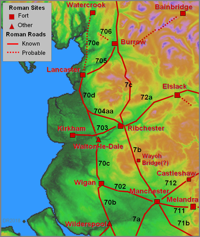
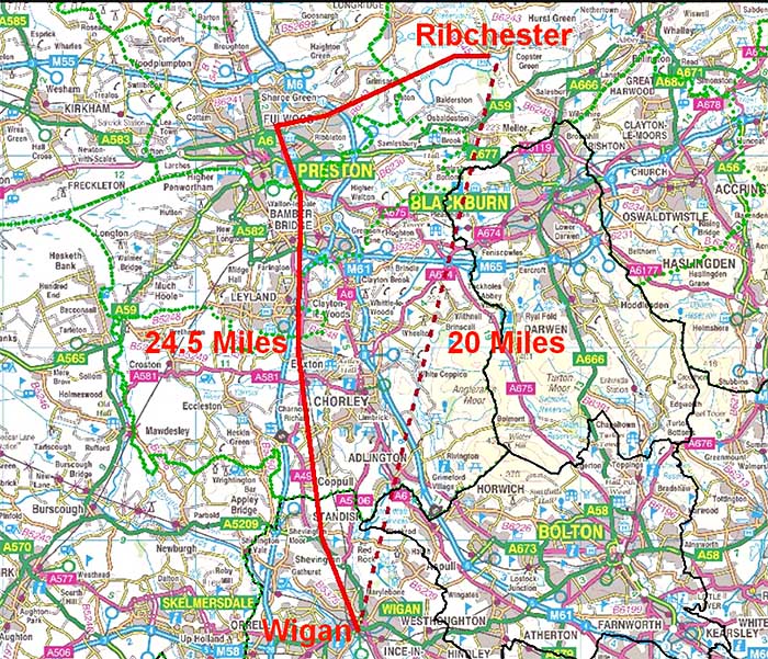
Ribchester to Wigan(?) (20.5 miles)A few clues point to the possible existence of this road. The Antonine Itinerary gives a distance from Ribchester to Wigan of 20 miles, which fits a direct route rather than the dog-leg via Walton-le-Dale. However, the Itineraries are notoriously full of copying errors. This is assuming Coccium is Wigan, which is more likely now with the discovery of the remains of a substantial bathhouse with hypocaust, in the town centre 2005 redevelopment (ref. Ian Miller & Bill Aldridge). But the discovery of the Wayoh Bridge fort adds a touch of confusion to this too. On the direct route there are 4 occurrences of street or causeway names. As yet most are best regarded as possible rather than likely indicators. If there were a road it would have branched off the Ribchester to Manchester road after crossing the Ribble. There are some very faint traces visible in the Lidar data and again ascending obliquely up the north side of Mellor Hill but all really of low confidence. |
Click for larger view |
 |
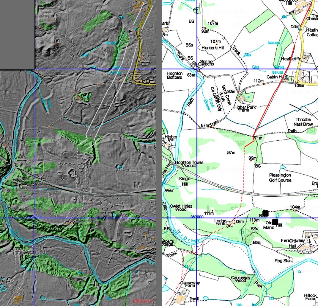
Lidar Image and Map - Pleasington At Causeway Farm, near Riley Green, the ford across the River Darwen below Lodge Farm was apparently known as the "Roman Ford". Any trace of a road seems lost across the golf course but perhaps appears further north across Long Lane at Cabin Hill/Woodcock Hill (Ref: Dixon - Journeys through Brigantia - Book 11). There are some Lidar indications but not overwhelming ones. Note the Causeway Wood and Causeway Farm names at the bottom of the map. |
Click for larger view |
 |
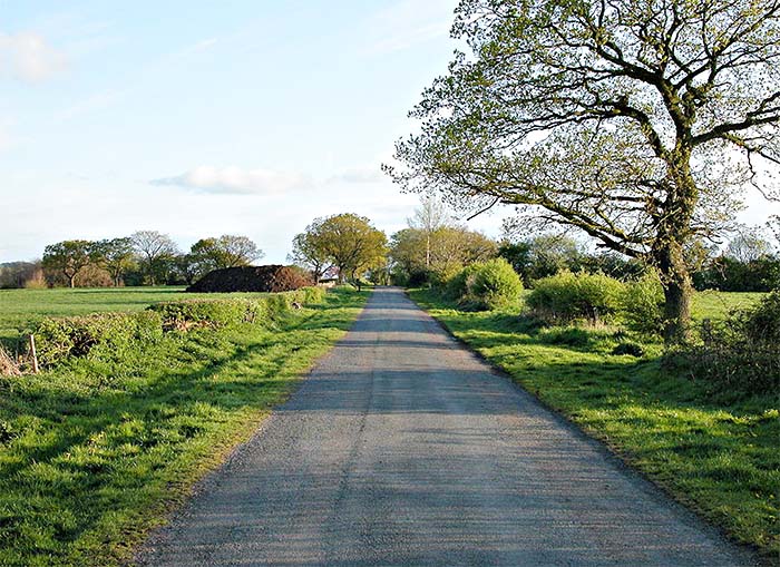
The Common, Adlington Getting nearer to Wigan then another possible candidate is the Common, Adlington, which comprises a large agger with ditches and a relatively narrow modern road. It is straight and its alignment fits with a destination of Wigan. |
Click for larger view |
 |
Lidar Image and Map - Haigh This was the only possible trace I could spot in the Lidar data approaching Wigan just west of the footpath known as Wash Pit Lane. Its direction would not fit with the Common, Adlington (above) as it is pointing more towards Blackrod. Wigan Archaeological Society have excavated about one kilometre north of here on Toddington Lane looking for evidence of the road but without success. Conclusion: on the available evidence it does not look likely that there was a direct road from Ribchester to Wigan. |
Click for larger view |
 |
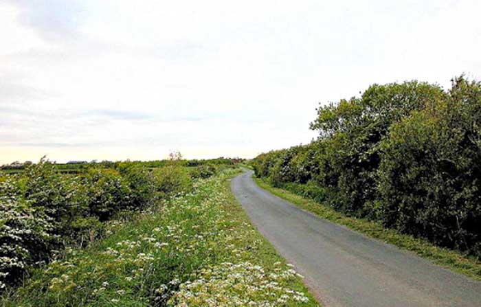
Wyre to Lancaster(?) - High Gate LaneOver Wyre has produced many Roman finds and coins. Mary Higham has suggested that High Gate Lane, west of Stalmine, could well be Roman on the basis of medieval references she found to a regiam viam and magnum stratum regiam called Alsergate - its former name. This would imply that it was a King's Highway of some status and therefore perhaps derived from a Roman road. High Gate Lane (itself a clue) is unlike other roads in the area being wider and built on top of a substantial agger. The modern road is also smaller than the agger on which it sits (see below) and there are prominent ditches on both sides. It is also reasonably straight. Appearance wise it is convincing but real evidence was needed.
|
Click for larger view |
 |
High Gate Lane It was formerly know as Alsergate and is wide and on a very prominent agger, unlike other roads in the area. Further north salt workings/mines have much disturbed the ground so tracing it towards Knott End is now difficult. A Lancaster connection is supported by coin hoards found at Preesall and Hackensall plus field names of Street Field, Street Meadow, Street Croft near the latter. This may seem a strange route but if a road from a site on the Wyre to Lancaster was the aim then then this makes sense as a direct line across Pilling Moss was impracticable before it was drained. Over-sands routes have been advocated again by Higham and the over-sands route from Knott End along Pilling Sands to Cockerham was still in use around 1700. At Cockerham it could have met up with the newly discovered route of the Walton-le-Dale to Lancaster road around Broadgate..
|
Click for larger view |
 |
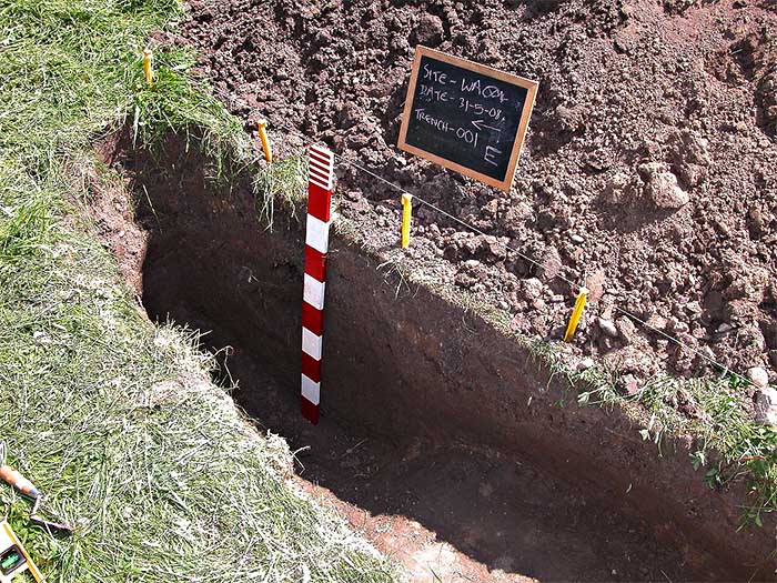
Excavation 2008, The Willows, High Gate Lane Where the modern road wobbles off to one side near the Willows, an excavation on the line was carried out by Wyre Archaeology in 2008. A clay agger and side ditch was found but there was only time to excavate half way across. A clay agger was to be expected on the Wyre where there is a shortage of stone. On seeing the size of the trench the land owner declined further excavation. Although a cambered clay agger (?) was found there was little in the way of a stone-based road surface.
|
Click for larger view |
 |
|
|
|
Last update: April 2018 |
© David Ratledge |