Roman Roads in Lancashire - Milestones |

|
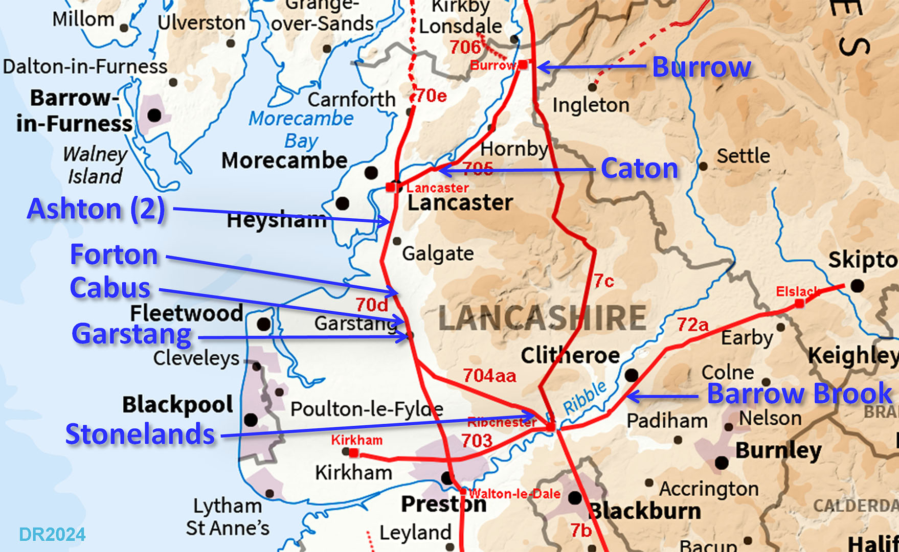
Roman Milestones of LancashireLancashire currently has 9 known milestones with no less than 6 on the route from Ribchester to Lancaster - this was probably Lancashire's most important road linking two major Roman centres so not a surprise. The Lancashire milestones were stone pillars usually cylindrical but not always (Ashton). Some have/had Latin inscriptions and again not always (Cabus). Several are no longer full height but are now just stumps - to be expected after nearly 2000 years. Generally erected when a road was first constructed but we do have at least one example (Stonelands) where the milestone was erected after a road upgrade - see later. A feature of Lancashire milestones is that many of them are not stuffed away in museums but out in the countryside - usually close to their original position and nearby to their Roman road.. The Big Question - were they every mile? The established opinion is no but in Lancashire, with plenty of stone quarries, it would have been perfectly feasible. Taking the Ribchester to Lancaster road with its 6 milestones this represents a 25% survival rate. If 25% are still here 2000 years later how many were there originally? Certainly many more and perhaps all 23 (24 miles needs 23 milestones). Over 100 inscribed Roman milestones have been recorded in Britain. The current Ordnance Survey Roman Britain map shows just one for Lancashire.
Note - The location mapping for each milestone is from Lancashire County Council’s Mario website under an Open Government Licence. For those milestones held in Lancaster Museum then the locations shown are where they were (probably) found. For the remainder then the locations shown are where they are to be found now.
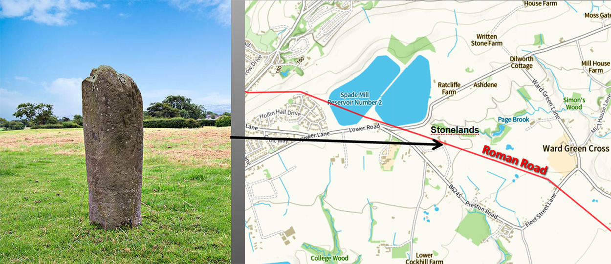
Ribchester to LancasterStonelands, near Longridge - 2 miles from RibchesterDedicated to Emperor Maximian c. 300 AD. The inscription now is barely discernable but was recorded by David Shotter & Patrick Tostevin. It has been re-erected in the garden of Stonelands - apparently upside down but in reality this may well be how it was in later Roman times - see below. No distance is recorded or has survived but it would fit with 2 miles (to Ribchester). The authors did not know of this road and reported it as being from the road to Burrow. This would represent a move of 2 miles and obviously it is from this road - a move of metres rather than miles. My thanks are due to Margaret Edwards for providing me a copy of the above report, which set in motion a train of events that lead me to the tracing of the full course of this road. The date on the milestone of around 300AD implies it was not erected for the original construction of the road, rather an upgrade. That is exactly what appears to be the case. At Stonelands there are two aggers side by side with the western one appearing in by far the best condition and therefore a replacement for the eastern one which had suffered erosion. Note: this milestone has all the appearance of an "inverted" milestone. The current top is decidedly squarish as is more normal for the base. The inscription is on the square end and In all likelihood it would have been the other way up originally with probably an inscription for an earlier Emperor. So rather than obtaining another stone it was easier to turn it upside down and re-carve a new inscription on the new top. Thanks to Bryn Gethin for explaining "inverted" milestones and therefore the odd appearance of this one. The milestone reads: MAXIMI ANO AVG In the year of Maximian Augustus Date: c. 300 Ref: Shotter, David and Tostevin, Patrick, A Newly-reported Milestone from Ribchester, LCAS TRANS VOL 107 2011 117-11 Image: DR
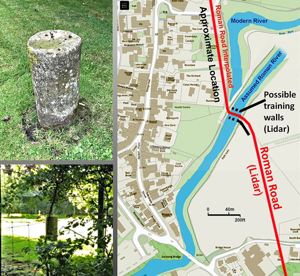
Garstang, discovered 2024 - 12 miles from LancasterThe route of the Roman road at Garstang I only found in the last 10 years. Lidar shows a very prominent agger approaching the River Wyre at Garstang. Also visible is what looks like bridge training or wing walls on the eastern bank (shown in black). We, Wyre Archaeology, has tried several times to gain permission to investigate what has survived there - a lot appears to have. However, permission has always been refused. Undaunted, my long time collaborator Andy Jackson decided to inspect the western side of the river to see if anything had survived there. What he spotted came as a great surprise. In a garden (exact location cannot be divulged) was the stump of what looked like a Roman milestone - very similar to the others known in the vicinity. It had been found by the garden owner and re-erected in a central position as a garden feature. His recollection was that the stone was found nearer the bottom of the garden and therefore very close to the (interpolated) position of the Roman road ie only metres away from it. Given its typical form and find spot there can be little doubt that it is indeed a Roman milestone. Well done Andy. Images: Andy Jackson
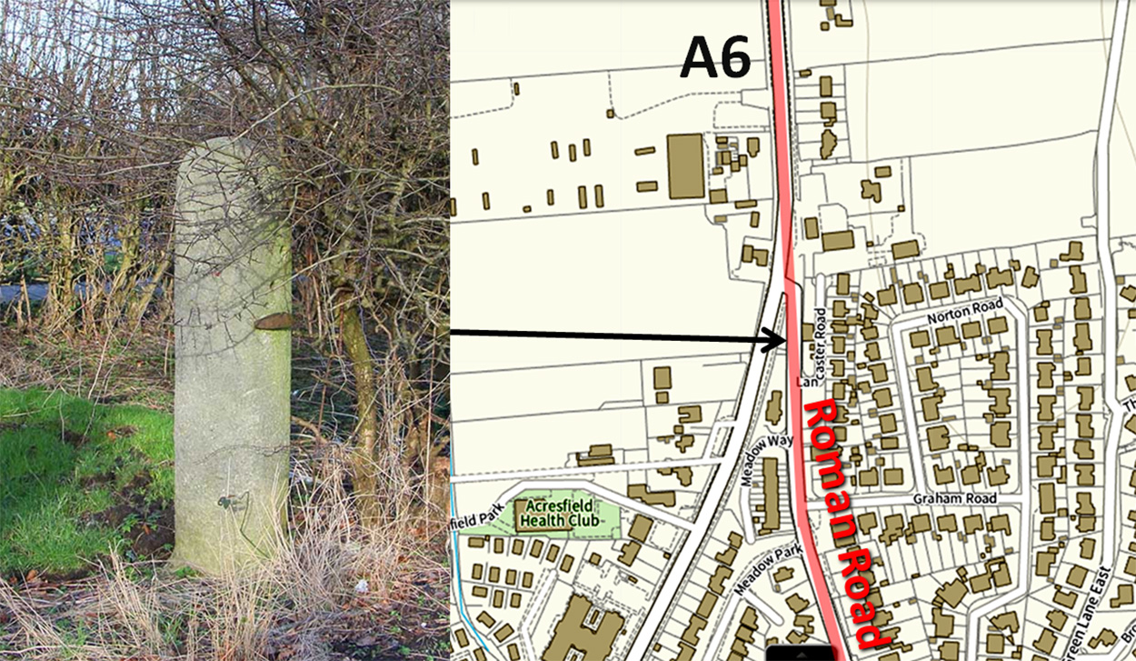
Cabus, Toll House - 11 miles from LancasterWhen I had worked out the route of the road across Garstang the penny suddenly dropped as to the nature of the west gate post of the Turnpike Cottage at Cabus. Hiding is full view was a Roman Milestone! It is so typically Roman with a square base and round top. The east gatepost here is totally different and appears banded. It looks like the turnpike trust simply commandeered the Roman milestone for use as a gate post - all they had to do was add a gate stop, visible in the picture. Because of its proximity to the hedge it very difficult to see in summer. Image: DR
Forton Crossroads, Forton - 8 miles from LancasterThis milestone adjacent to Forton Hall was re-erected at Forton Crossroads next to a cross base. Its position now is 200 metres from the Roman road and if originally from Forton Hall then this is a relatively easy move to make in order to place it somewhere where it is clearly visible. Obviously now a stump but is very similar to the Cabus milestone, at least in diameter. Its current location is at the crossroads but actually just on Stony Lane, which led for many years the belief that Stony Lane was the Roman road to Lancaster. Thanks to Lidar we now know better - the road went via Cockerham. Image: DR 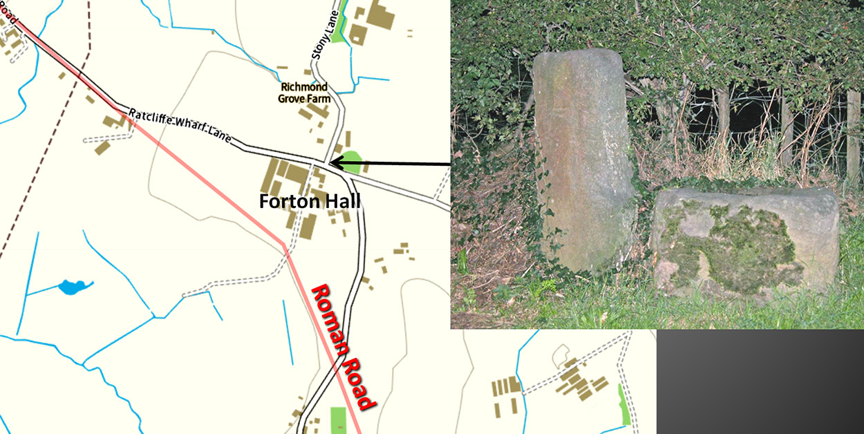
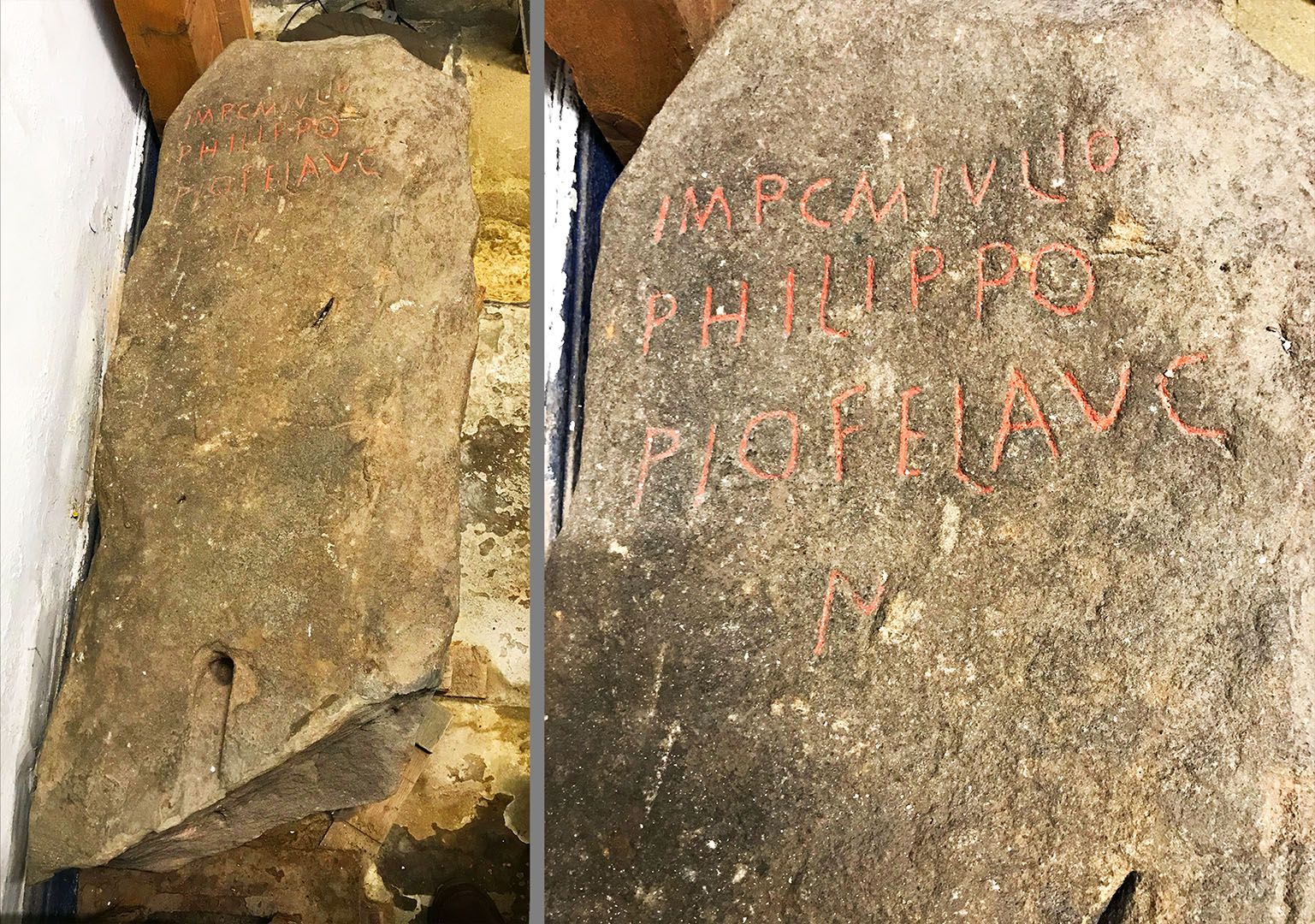
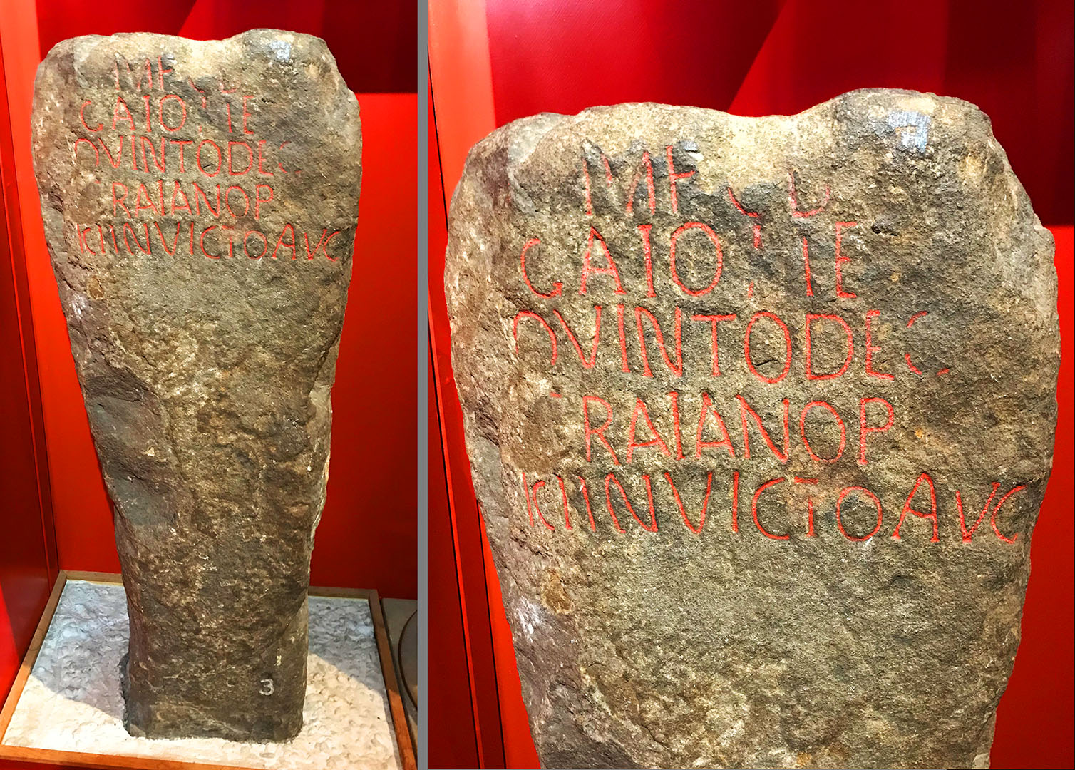
Ashton, Near Lancaster (2 milestones) - 3 miles from LancasterThis pair of milestones appear to have been found in the same field in Ashton, one in 1811 (left below) and another in 1834 (right below). We are indebted to W.T. Watkin for recording this and publishing drawings/engravings. The findspot was described as being ploughed up in a field in Ashton near the canal - that would fit well with a 3 mile distance along the road from Lancaster which is the inscription on the earlier stone. The second stone was recorded as being from the same field. The explanation of two in the same spot is probably one replaced the other. The first one (dedicated to Philip) is crude and is dated to 244-249AD. The second (dedicated to Decius) is grander and dated to 249-251AD. The stones now reside in Lancaster Museum but only the Decius one is on display. Reference: Roman Lancashire by W.T. Watkin. 1883. 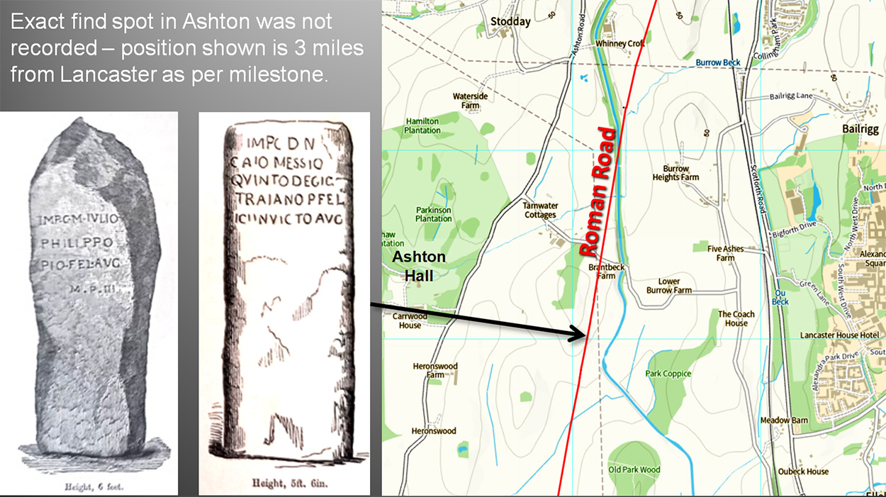
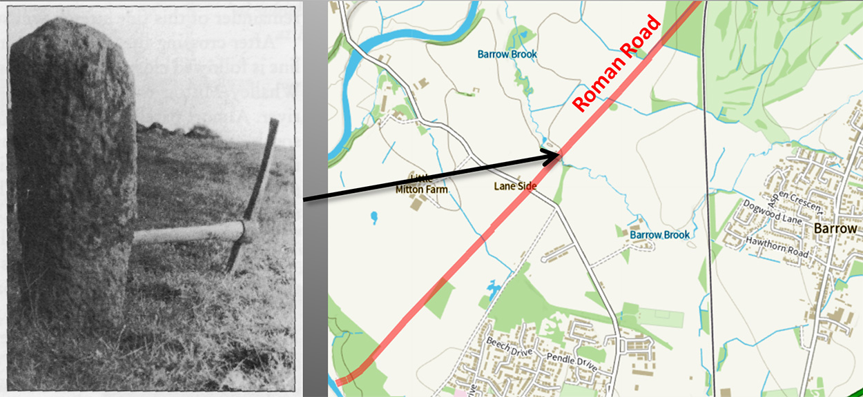
Thanks to Andy Jackson we now have photographs of these milestones following his visit to Lancaster Museum accompanied by museum staff including the head of the department. The Philippo stone (RIB2270) had wrongly been catalogued as from Ashton, Greater Manchester. We were able to put this right. Shotter recorded it as from Burrow Heights (above Burrow Heights Farm on the map) ,which was also incorrect. Watkin believed he could make out (faintly) that the last line read MPIII. Today that is not possible to verify. But Watkin was looking at the stone on the 1880s when it was outside in the garden of Stodday Hall. Watkins engraving shows the stone not broken which it now clearly is so in the intervening period was not very well looked after. One can only assume being in a garden it has suffered more damage and the last line in now illegible. Shotter, obviously looking at the milestone a century later than Watkin, interpreted the 4th line as N for N(ostro). The M or N is not another line of text lined up with the first three lines which are all left justified but located in the middle of the stone. Two other milestones in Lancashire have the dedication ending in AVG (Augustus) and this could well do the same making three. Having a disconnected "N" seems very unlikely. I would go with Watkin's interpretation - and the 3 miles fits the position. The milestone is currently not on display. Images Andy Jackson. The milestone reads: IMP C M IVLIO | PHILIPPO | PIO FEL AVG | N (Shotter) or MP III (Watkin). This translates to: For the Emperor Caesar Marcus Julius Philippus Pius Felis, (our) Augustus. This assumes the N ("our") rather than 4 milia passum (4 miles). Andy also photographed the Decius milestone (RIB2271) which is on display. This was found in the same spot but does not record the distance. Interesting the last text is AVG which would tend to confirm the interpretation that the N or M on the Phiippo milestone was not part of the dedication. The milestone reads: IMP C D N | GAIO MES | QVINTO DECIO TRAIANO PIO FEL | ICI INVICTO AVG THis translates to: For the Emperor Caesar, Our Lord, Gauis Messius Quintus Decius Traianus Pius Felix Invictus Augustus. Dated: AD249-251 Ribchester to ElslackBarrow Brook, Barrow - 8 miles from RibchesterDiscovered in the mid-1950s by Philip Graystone, author of the Walking Roman Roads series of books. He forwarded details to Ivan Margary who confirmed the likelihood of it being a Roman milestone. Cannot get better provenance than that. Graystone was excavating the road there at two sections with schoolboys from Blackburn, where he was a head teacher. The stone was found near Barrow Brook and "half-buried". Its condition was "mutilated" but was clearly cylindrical with a diameter of around 12 inches. It was presumably re-erected by Graystone with a suspicion it is upside down. Reference CNWRS, 1996 Image: Philip Graystone
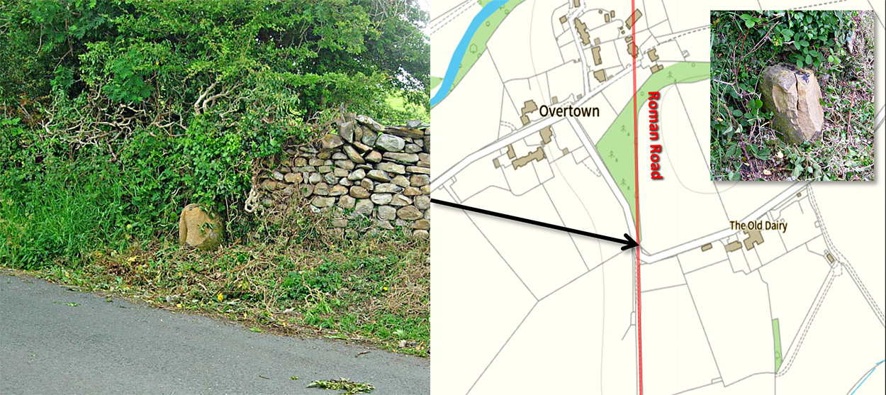
Ribchester to BurrowBurrow, Overtown - 1 mile from Burrow(?)Just before the road from Ribchester reaches Leck Beck then alongside it is the stump of a Roman Milestone. It on the boundary of Burrow and Leck Parishes. The location is shown incorrectly (at the time of writing) in Historic England's entry. The milestone is scheduled as ancient monument no. 1003131. In 2020 the milestone was badly damaged by verge clearing machinery(?). presumably because the worker did not realise the correct position. A few pieces were knocked off and the stump split in two. it is understood discussions have taken place regarding repairs, which I assume have now been carried out. Thanks to Graham Ransom for bringing this to my attention. Images: Graham Ransom
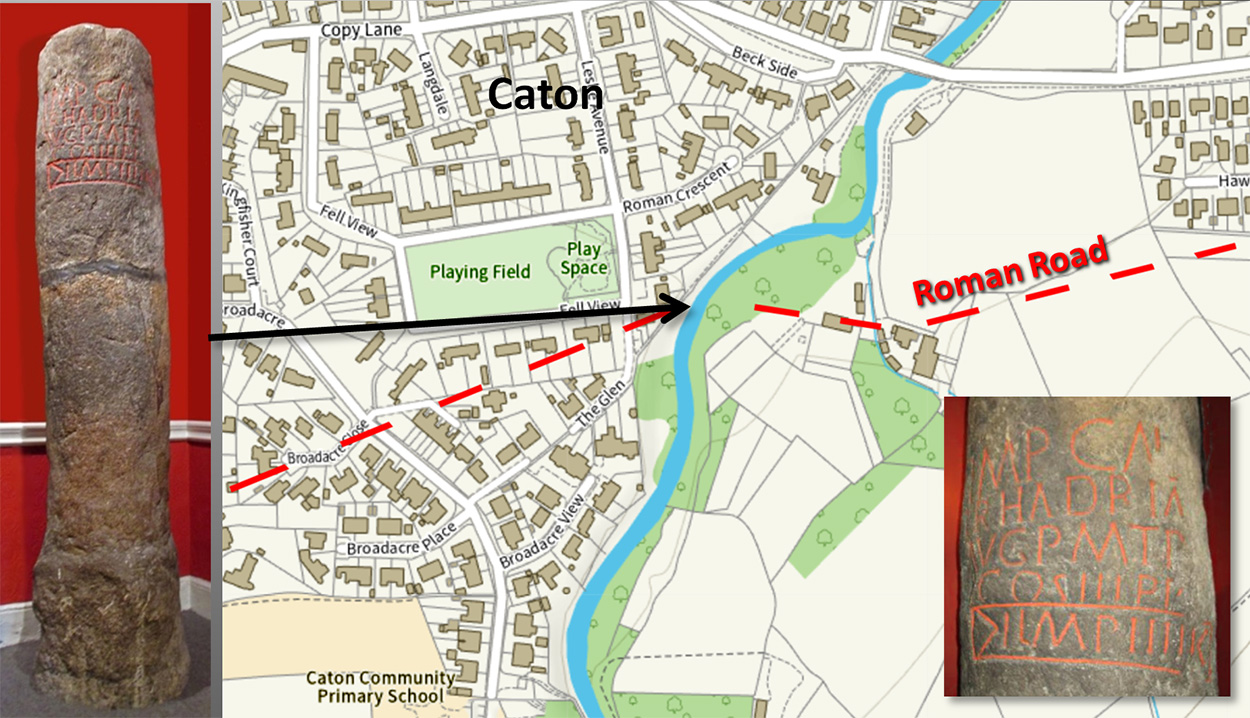
Lancaster to BurrowCaton, Artle Beck Milestone - 4 miles from LancasterThe find spot was in the vicinity of Milestone Place, Caton. However, historical research by Andrew White recorded that it was found 245 yards upstream of bridge (Contrebis 1992). This has now been confirmed by finding the Roman road on either side of Artle Beck by Andy Jackson and Phillip Crawshaw - see Lancaster to Burrow Roman Road Examining the Inscription (RIB 2272) we get the distance of 4 miles from "L", obviously Lancaster. The distance was initially a problem as the long-held traditional route was an indirect 5 miles from Lancaster. Finding the direct route as a result of Lidar resolved the distance issue but left unresolved as to what was the Roman name for Lancaster beginning with L. It is amazing how many suggestions over the years for its name do not begin with L. Antonine Itinerary X would seem to indicate Lancaster was called ALONE - is the A at the beginning an error? The LON bit would fit perfectly with Lonsdale and the River Lune derived from it and of course modern Lancaster. The milestone is kept in Lancaster Museum and appears to have had two halves re-joined together. It is on display. The milestone reads as: IMP CAES TR HADRIANO | AVG P M T P | CO S III P P | L MP IIII This translates to: For the Emperor Caesar Traianus Hadrianus Augustus, Chief Priest, Holder of Tribunician Power, Consul for the third time, father of his Coutry, (Lancaster) 4 miles. Dated to Hadrian: AD127-138
|
|
|
Last update: September 2024 |
© David Ratledge |
