
|
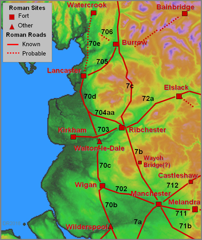
Possible Roman Road on the North Bank of the River LuneMargary Number: NADistance: unknownThe Lancashire Historic Environment Record has for many years recorded a possible Roman Road south-west of Oaken Head on the north bank of the River Lune. Whilst it is perfectly logical that the Roman's would have needed a road on the north bank of the Lune this is the only evidence so far that one could have existed. |
Historic County: Lancashire Current County: Lancashire HER: Lancashire
|
|
Click for full size map
|
|

|
|
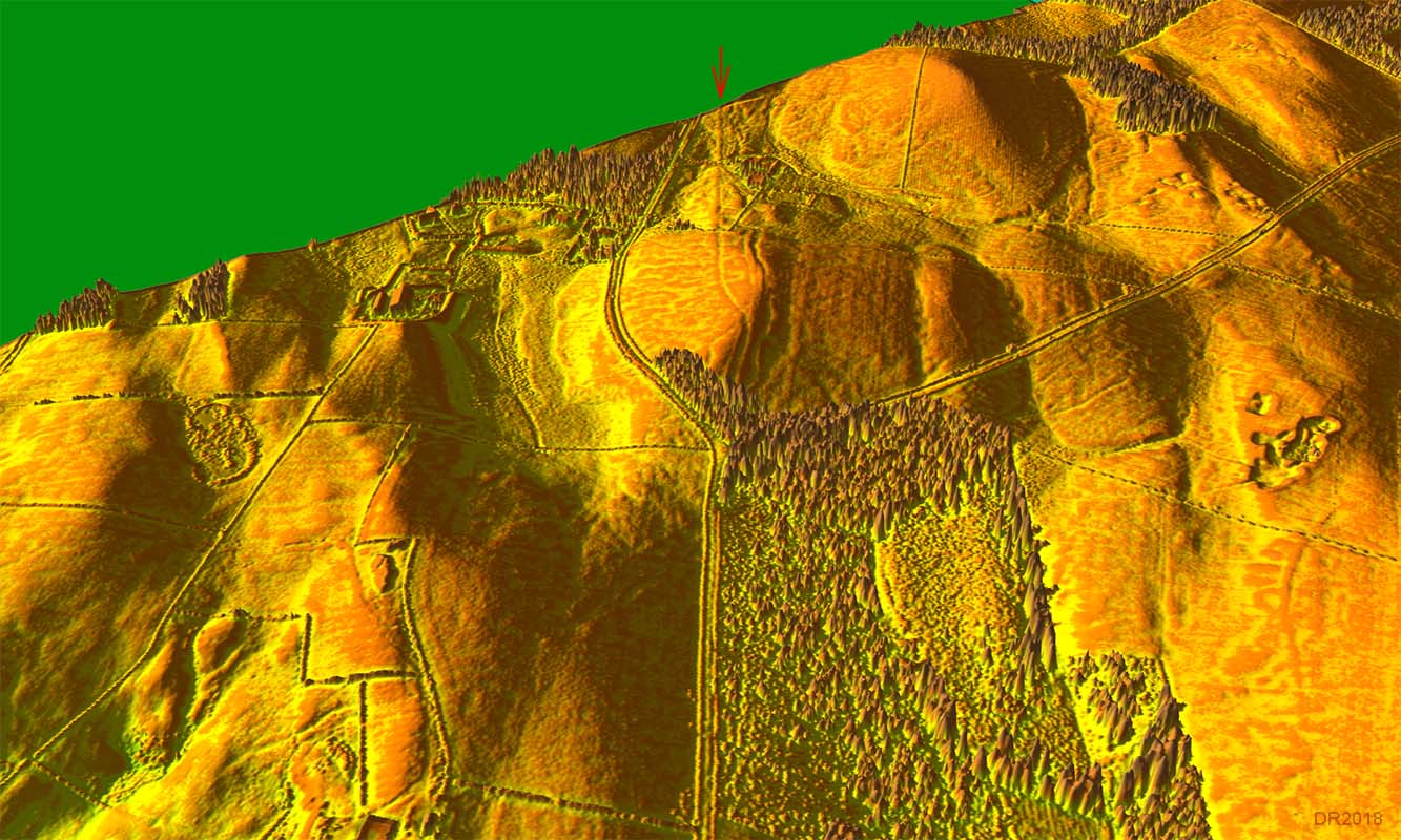
Lidar and Aerial Composite Image - Oaken Head Lidar coverage is currently patchy but fortunately the Oaken Head stretch is clear and quite convincing. Unfortunately it is a very short and single piece of evidence. Heading north-east then nothing further on is visible that could connect with it and extend the route towards Burrow. |
Click for larger view |
 |
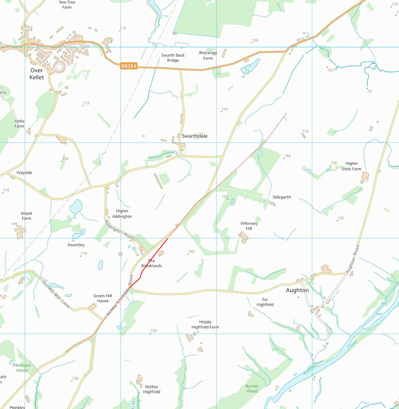
Route Map - Oaken Head I have shown extension dotted north and south. Towards Lancaster the modern road (Kirkby Lonsdale Road) would overlie its route to Lancaster so proof is all but impossible. In the other direction up the valley then a parish boundary perhaps extends the route passing Sidegarth Gate but this peters out. |
Click for larger view |
 |
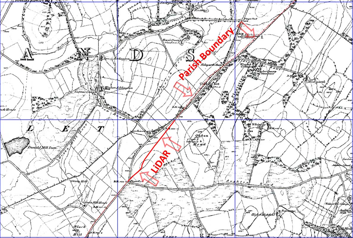
Oaken Head- First Edition Map This is the total amount of evidence for this road - the Lidar stretch at Oaken Head and the straight parish boundary passing Sidegarth Gate. |
Click for larger view |
 |
3D Oblique Lidar Image - Oaken Head It does look convincing in this view - shame there are no other traces visible towards Burrow.
Conclusion On balance there should be a road but currently there is probably not enough concrete proof to make it a definite. |
Click for larger view |
 |
|
|
|
Last update: April 2018 |
© David Ratledge |