|
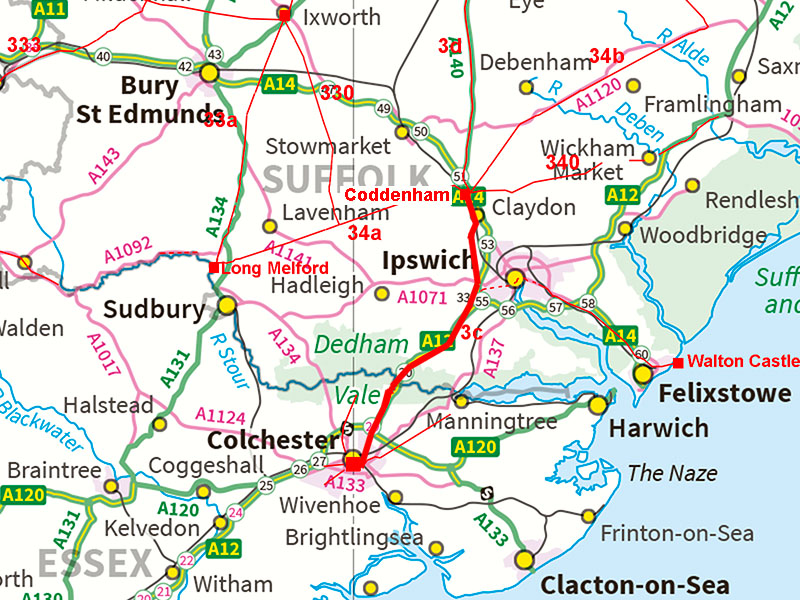
The Roman Road from Coddenham to ColchesterMargary Number: 3cDistance: 20 milesAn important road linking Coddenham (Combretovium) to the regional capital of Colchester (Camulodunum). It features in two itineraries, V and IX. The route initially follows the west bank of the River Gipping before heading south-west towards what was probably the lowest practical bridging point of the River Stour at Stratford St Mary. There appears to have been two routes into the city of Colchester, the primary(?) to the east gate and possibly a later one to the north gate. |
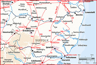
Historic Counties: Suffolk & Essex Current Counties: Suffolk & Essex HER: Suffolk, Essex & Colchester
|
|
|
|
|
|
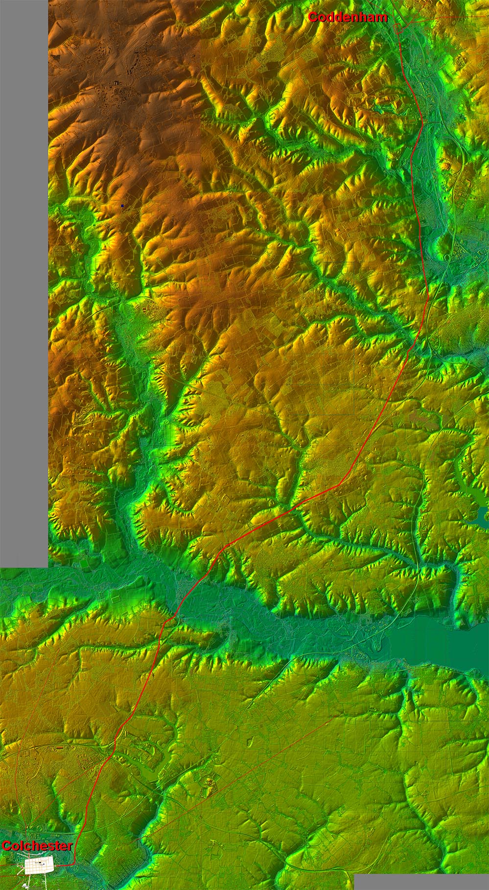
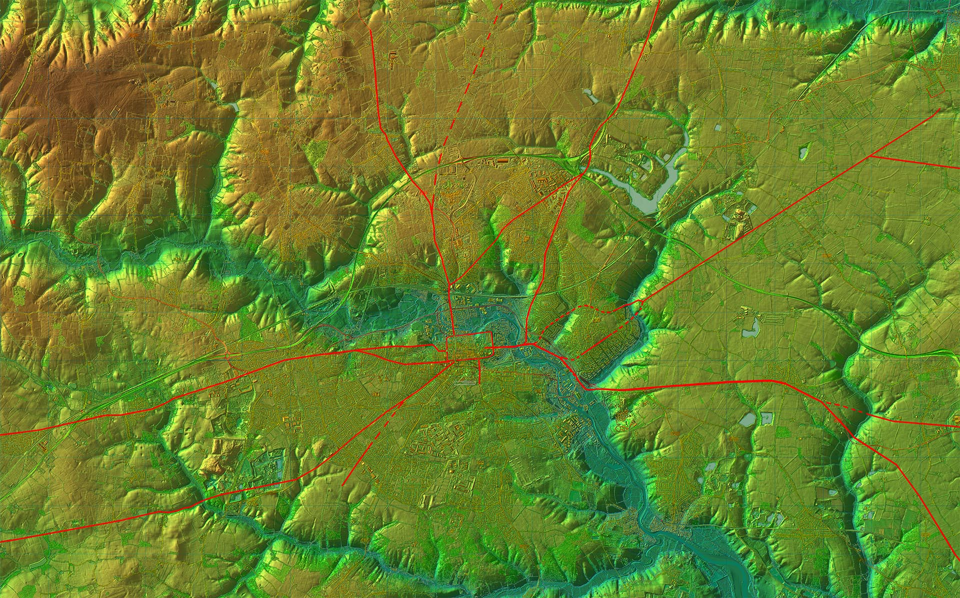
Lidar Image - Full Route The big obstacle was obviously the Stour valley/estuary. The route chosen was via the lowest bridging point of the River Stour in Roman times. There are two alternative routes into Colchester (if heading south) or two routes out of Colchester if heading north - see later. We will follow the road north to south. |
Click for larger view
|
 |
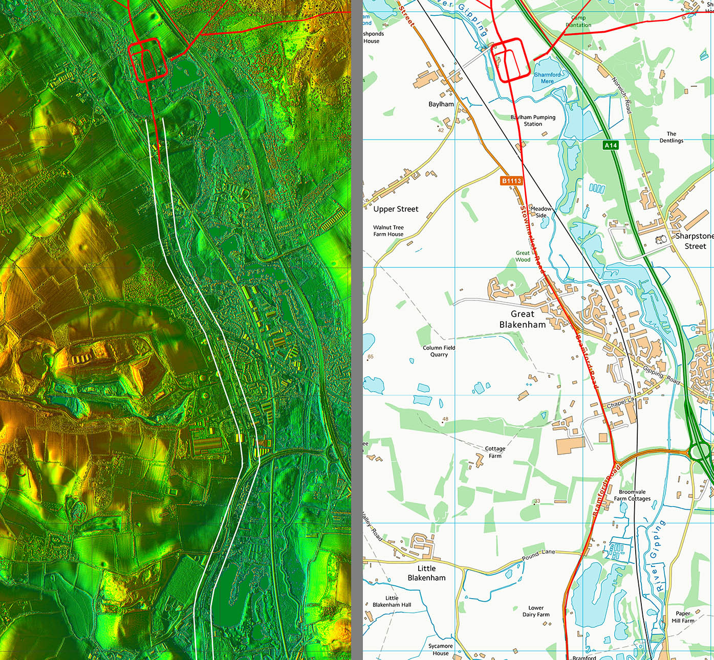
Coddenham - Google Earth We are looking south from over the Coddenham Roman site. The initial route is faintly visible in this aerial photo (more obvious in Lidar) before following the B1113 passing Great Blakenham. |
Click for larger view |
 |
Lidar Image and Route Map 1 The route passing Great Blakenham is somewhat inferred. A more direct route was possible and would shorten the distance but industrial developments and quarrying has made this difficult to assess. There is a faint feature on the Lidar perhaps on a direct line but not one I was convinced by. The modern road is therefore in all likelihood the Roman line. |
Click for larger view |
 |
Lidar Image and Route Map 2 We can be more certain of the route on this section. Just before the main change of direction near the Beagle, then the modern B1113 swerves off line but the Roman road is evident as a small cutting continuing straight on across the bend south of the car park for Landbridge. |
Click for larger view |
 |
Lidar Image and Route Map 3 Virtually straight apart from a wobble in Washbrook. On the north side of Washbrook the Roman line straight lines the modern bend - see below. |
Click for larger view |
 |
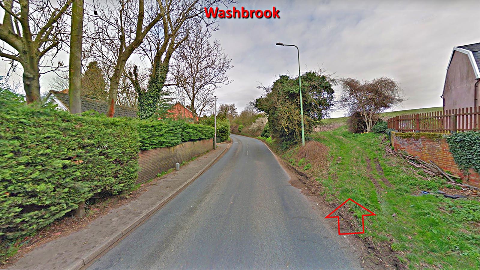
Washbrook - Roman Line On the northern approach to Washbrook, the Roman line cuts the modern corner and there is a faint cutting across the field indicating its course in the direction of the arrow. We are looking north here. |
Click for larger view |
 |
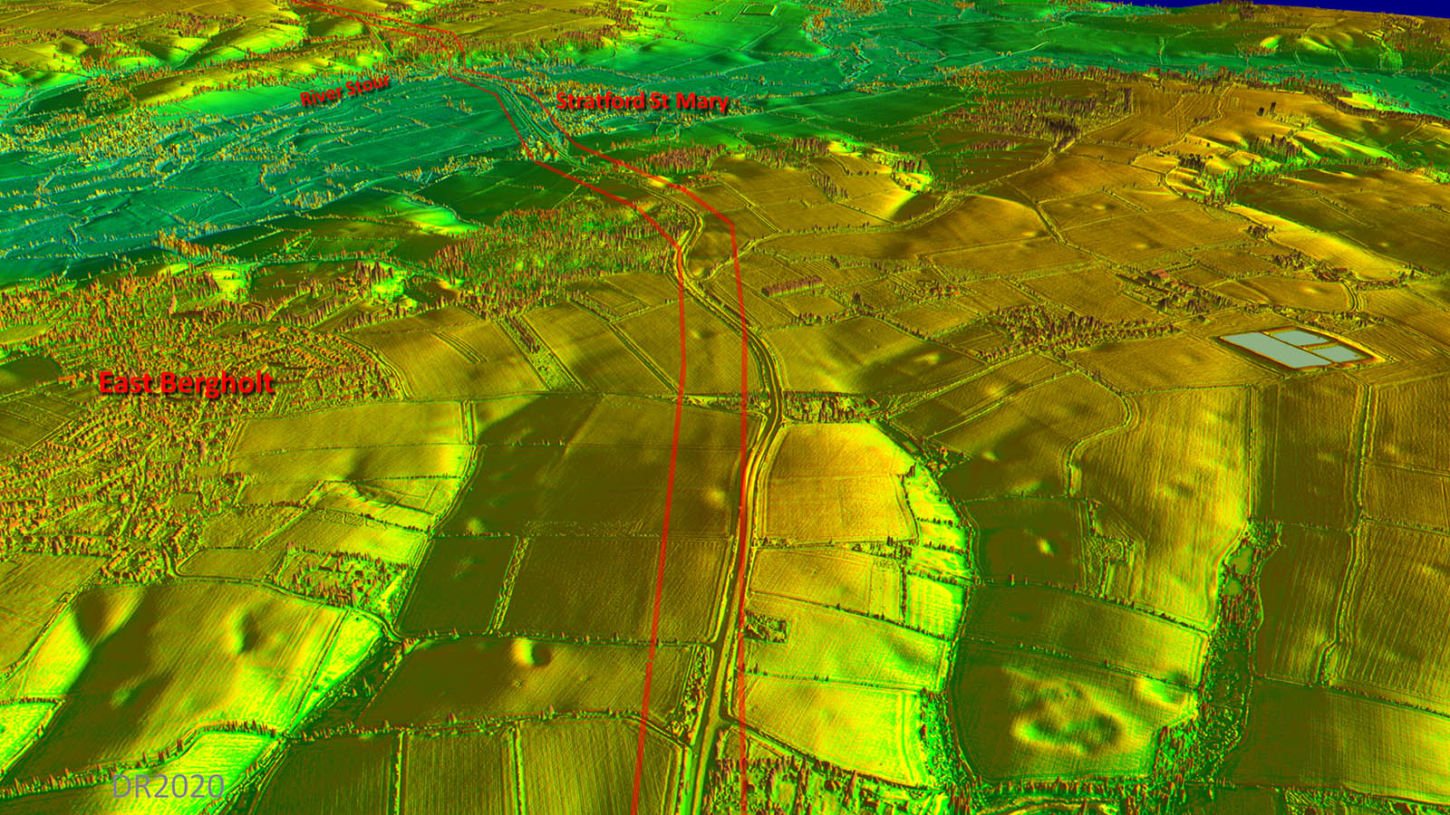
Oblique 3D Lidar Image - passing East Bergholt Passing East Bergholt the A12 drifts off the Roman line. The latter is clear in the fields first south of the the A12 then north before it turns for Stratford St Mary and the crossing of the River Stour. |
Click for larger view |
 |
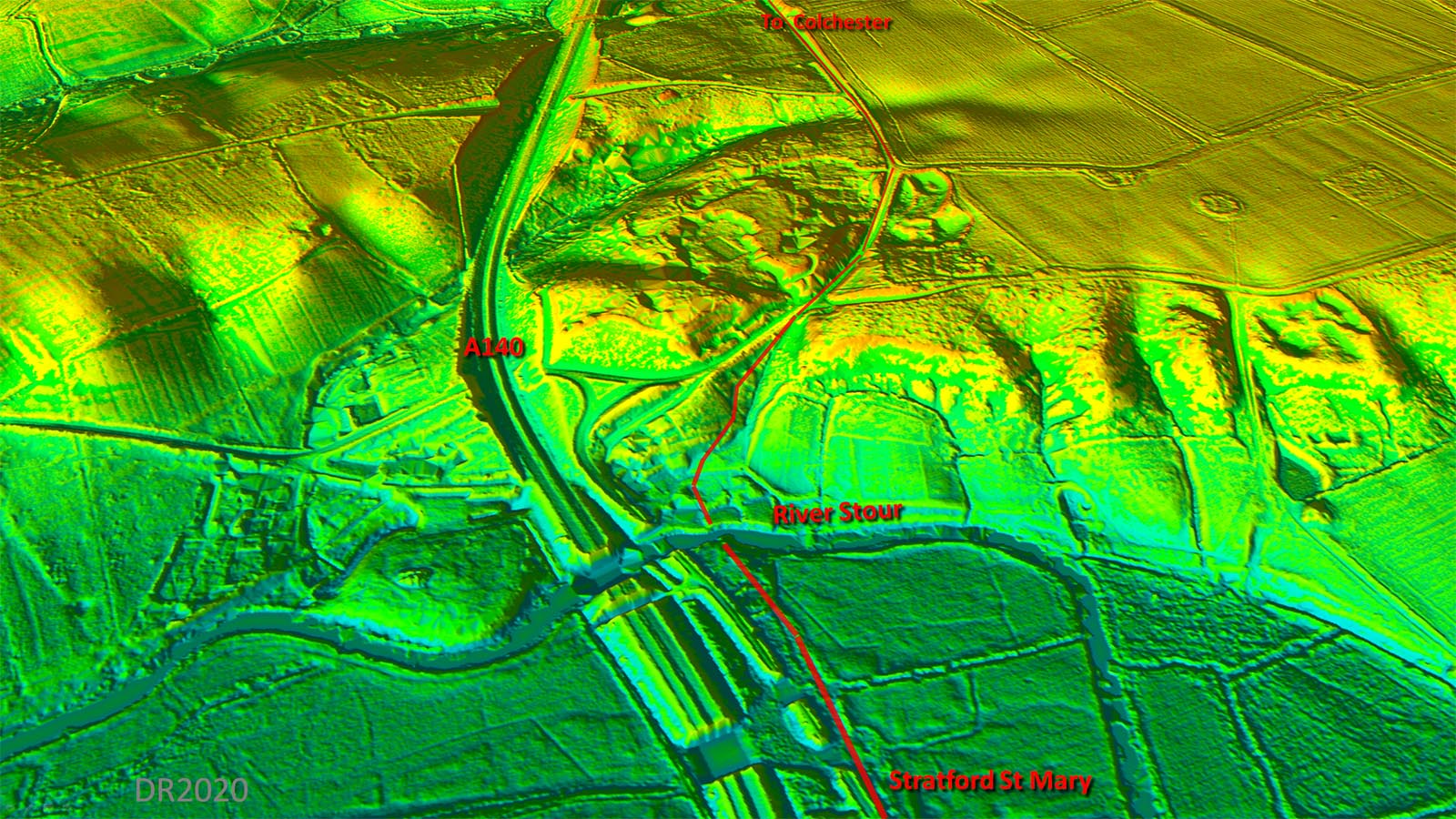
Lidar Image and Route Map 4 The Roman line was previously assumed to be under the A12 but Lidar clearly shows it south of the modern road after Lattinford Hill and then north of the modern road approaching Stratford Hills Farm. |
Click for larger view |
 |
Oblique 3D Lidar Image (DTM), Stratford St Mary In the DTM Lidar image all surface features, trees and buildings, are stripped off leaving bare earth. The ascent of Gun Hill was difficult to spot using DSM Lidar but I think using DTM then the route can be plotted with reasonable confidence. Stratford St Mary is Constable country and is well worth a visit. Its name is obviously derived from Street Ford but the Romans would almost certainly have bridged the River Stour here. Ford would refer to a time when the Roman bridge was no more. |
Click for larger view |
 |
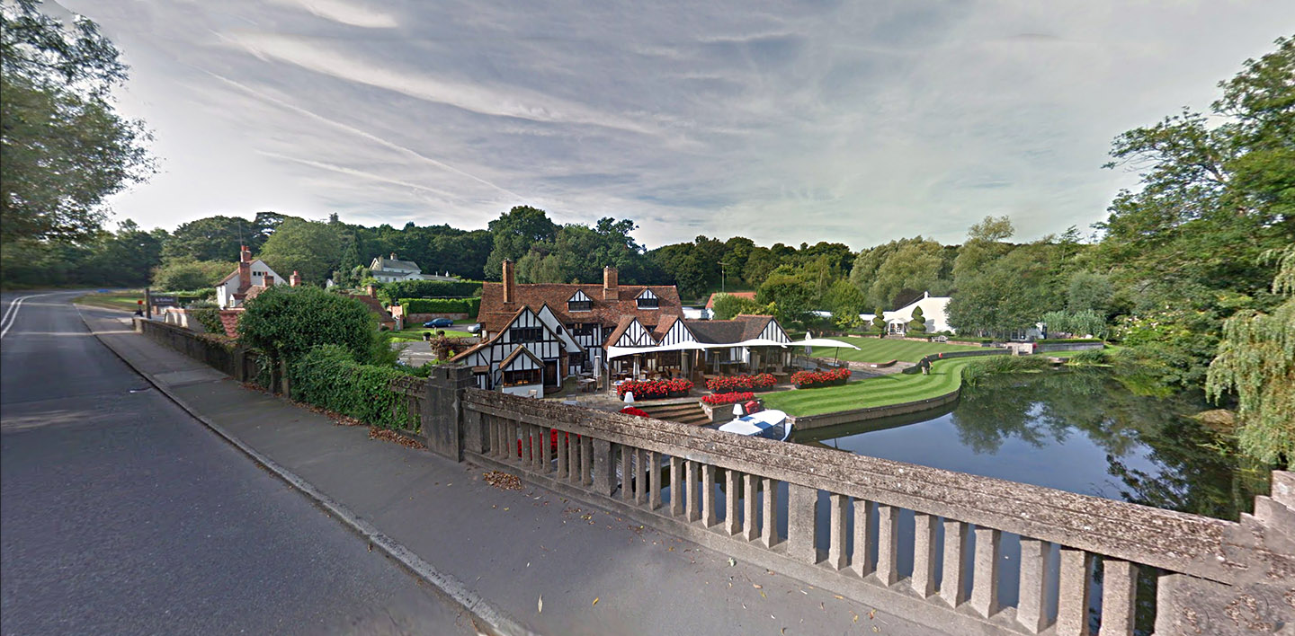
Stour Bridge, Stratford St Mary Lidar would indicate that the Roman bridge was upstream of the modern one, perhaps where that big marquee is. The road here is now bypassed and that it why it is so quiet. The Suffolk HER gives some support to this:- SHER Number: SSM 008 Name: Wooden piles (possibly Rom bridge). Type of Record: Monument Grid Reference: TM 042 334 Parish: STRATFORD ST MARY, BABERGH, SUFFOLK |
Click for larger view |
 |
Lidar Image and Route Map 5 - Gun Hill Lidar does indicate some traces for the route up from the river crossing via Gun Hill so what is shown is probably close to the truth. The parish boundary goes that way too. Crossing the River Stour we enter Essex. |
Click for larger view |
 |
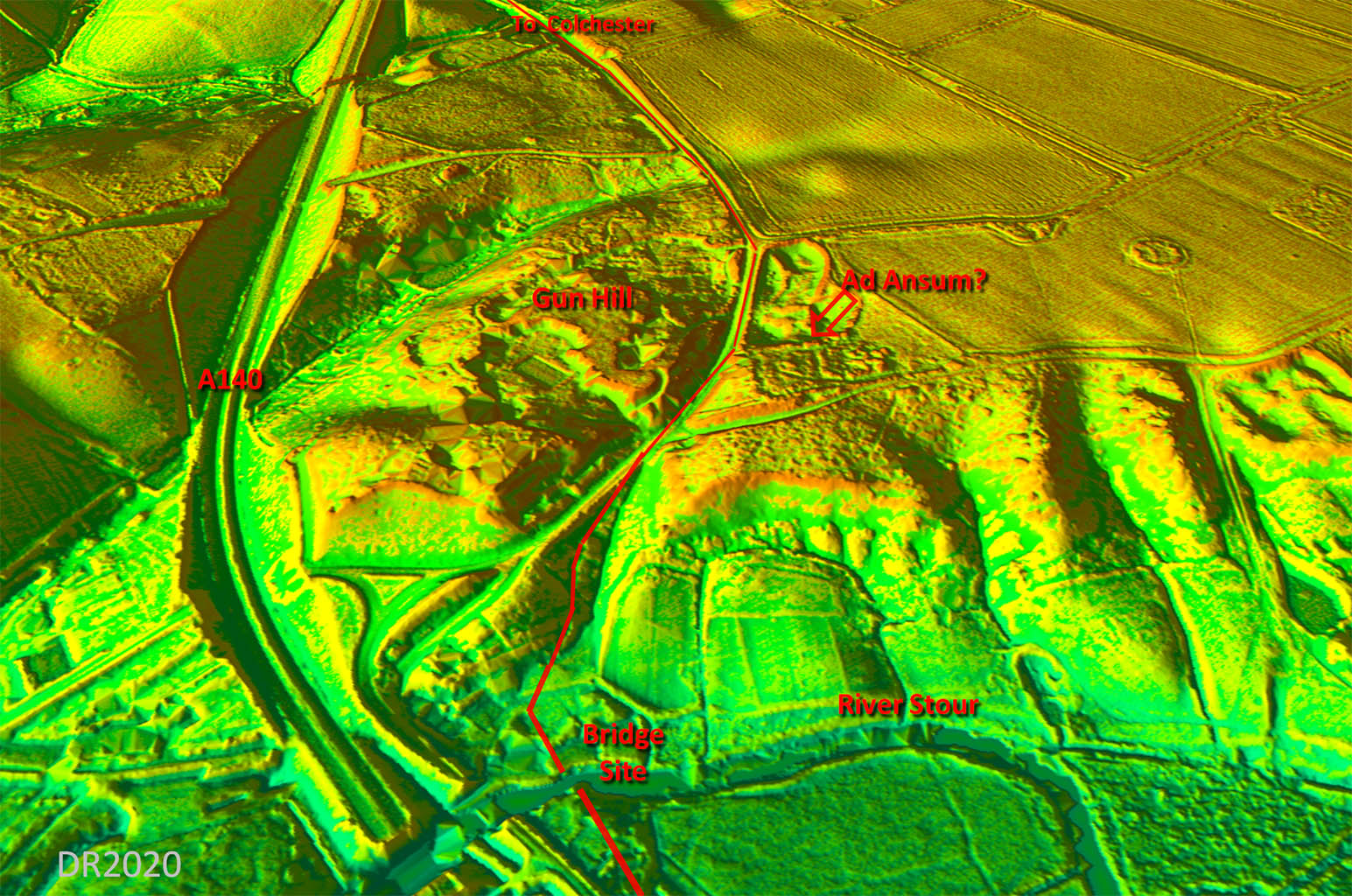
Oblique Lidar Image - Ad Ansum? This is a closer view than the Lidar image shown above but does perhaps indicate a possible site for Ad Ansum Itinerary V records a location of Ad Ansum on this road. The distances quoted would place it near Arley Grange, south of Gun Hill. However, the name means "at the bend of" ... usually of a river. That would tend to suggest Gun Hill itself overlooking the river. For some reason Higham is generally suggested as the location for Ad Ansum following Rivet and Smith placing it there. However, Higham is not on the Roman road - it is a mile away. Gun Hill would be a much more logical and likely suggestion. |
Click for larger view |
 |
Lidar Image and Route Map 6 This is the conventional route into Colchester bridging the River Colne east of the city and heading in via the east gate. |
Click for larger view |
 |
Colchester East Gate The site of the east gate is marked by a plaque on the right side white wall (not the fire alarm!). It would probably have had twin entrances although perhaps not as majestic as the Balkerne Gate on the London road. |
Click for larger view |
 |
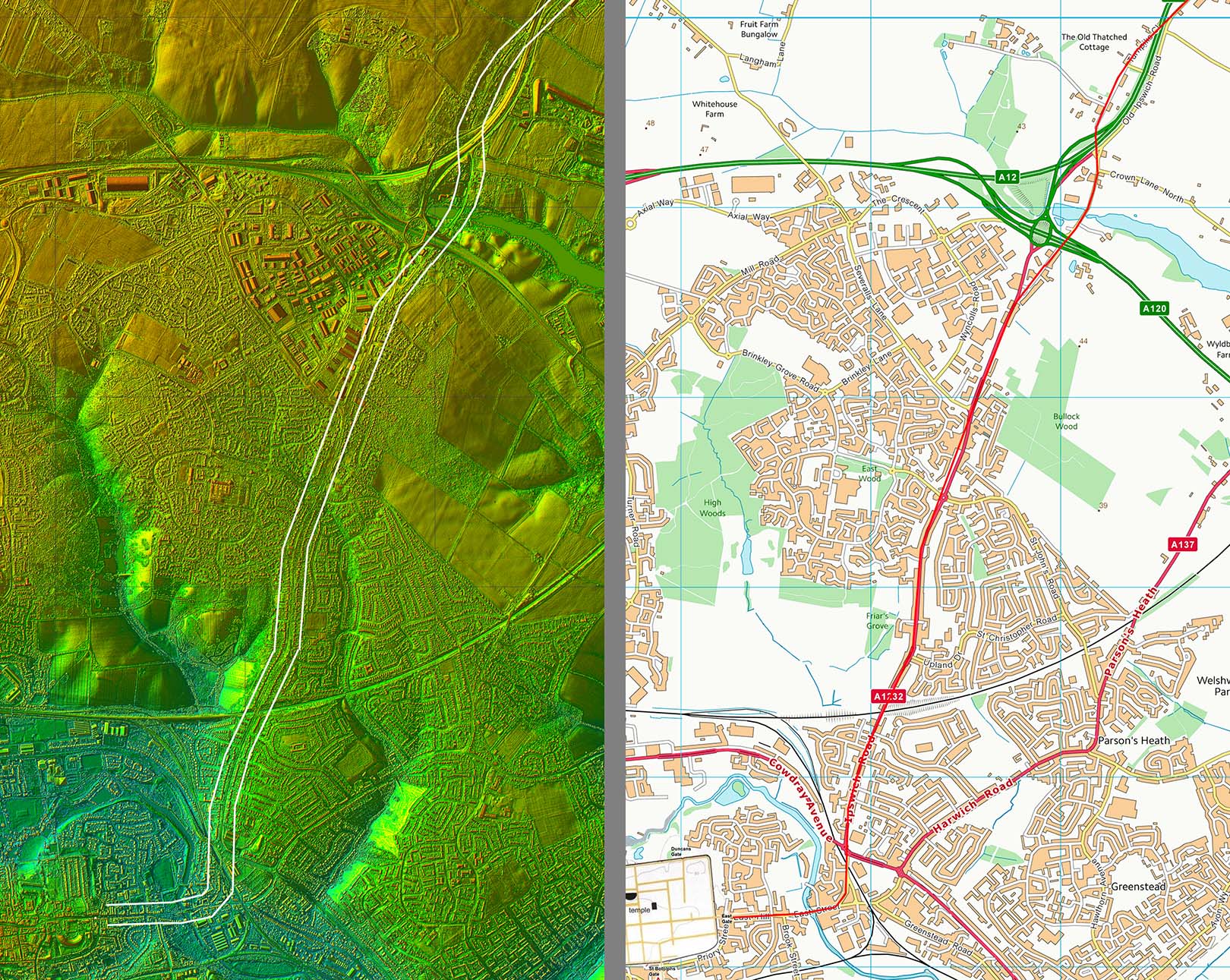
Lidar Image & Route Map - North Gate Route This appears to be a branch off the Coddenham to Colchester road (Maragary3c) heading to Colchester’s north gate rather than its east gate. I am a bit worried about this road. It is so obvious but why has it not been suggested before? It would provide an approach to Colchester using a different bridge over the River Colne. |
Click for larger view |
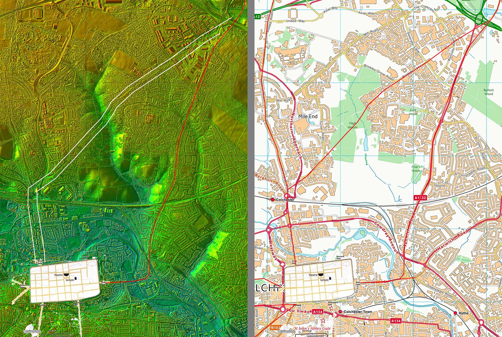 |
Lidar Image - High Woods The road is most obvious across High Woods Country Park – in fact the cuttings are so massive I wonder if this is the original Margary 3c? Old roads on the OS first edition maps line up with the High Woods stretch. |
Click for larger view |
 |
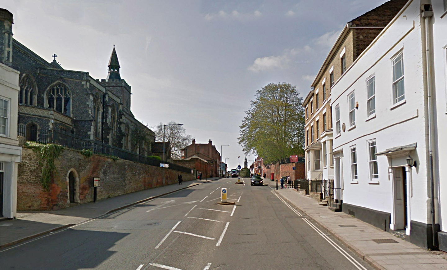
Colchester North Gate - Site Of Not the most attractive of entrances but remains of the city walls survive to the right in this image. Amazingly a small fragment of the walls survives on the left too - squeezed beyond the kebab shop and the next building. |
Click for larger view |
 |
Lidar Image - Colchester Roman Roads I know Colchester is not in Suffolk but for completeness the roads around Colchester shown- see the Essex web pages for more details. |
Click for larger view |
 |
|
|
|
Last update: August 2020 |
© David Ratledge |