|
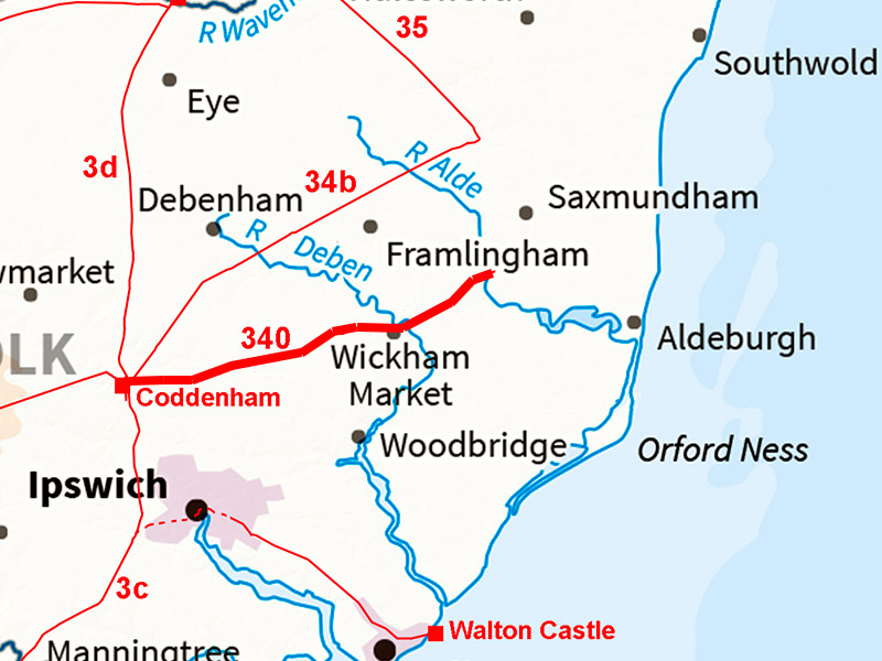
The Roman Road from Coddenham to Aldeburgh(?)Margary Number: 340Distance: 17 milesAnother certain road although its destination was unknown but we can now probably decide that destination. We do know it was not heading for site called Sitomagus! Rather Aldeburgh seems the likely destination. Our road runs to the south of Margary 34b but logically it should have a different destination otherwise why build two roads? The route is pretty secure to Stratford St Andrew - this name also is a quite convincing clue to presence of a Roman road. Beyond here though there the evidence is intemittent but what evidence there is then points to Aldeburgh. |
Historic Counties: Suffolk Current Counties: Suffolk HER: Suffolk
|
|
|
|
|
|
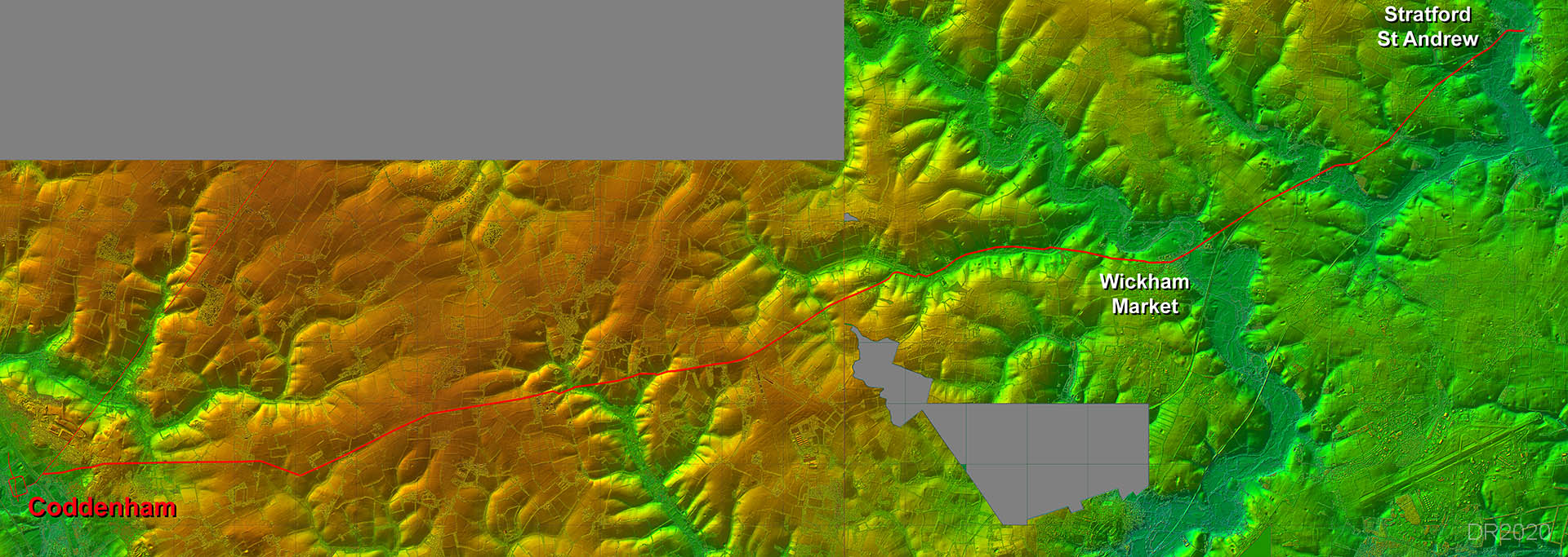
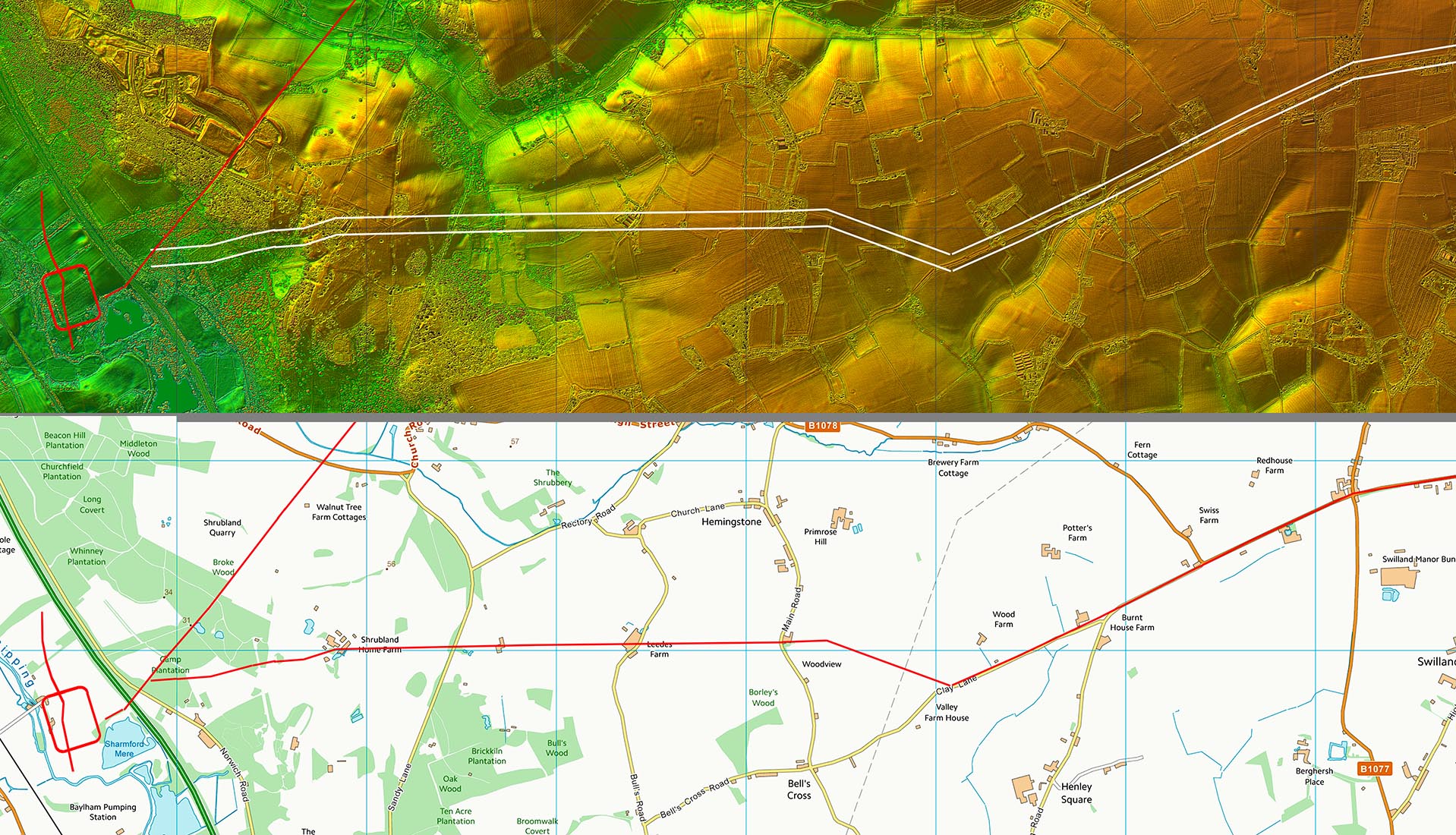
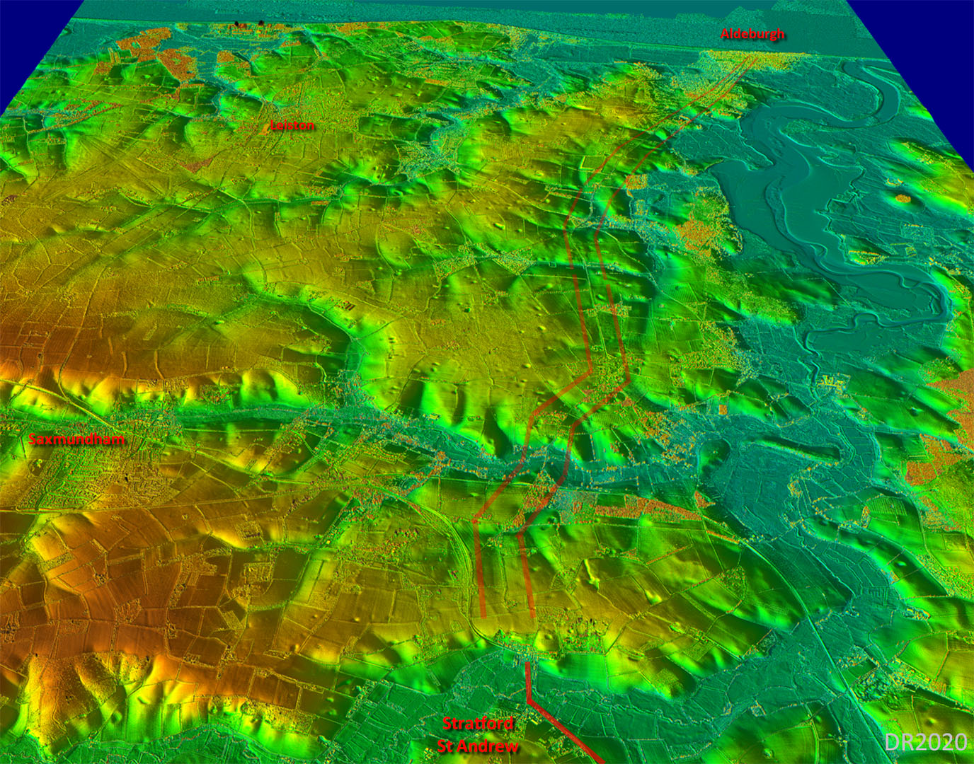
Lidar Image - Full Route The initial alignment from Coddenham to Clay Lane was unknown. However with the advent of Lidar we can now fill in this gap. The explanation was it changed direction there so searching on the line of the known length did not locate the road.
|
Click for larger view
|
 |
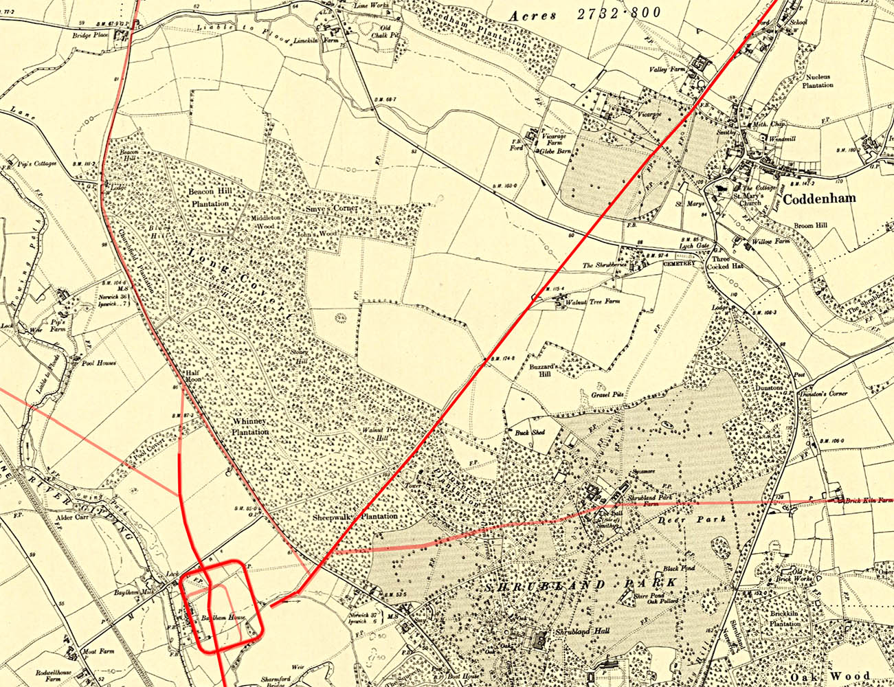
Coddenham - OS First Edition Map The Roman road branched off the road to Peasenhall east of the fort and headed through Shrubland Park to Clay Lane. This link to Clay Lane was previously unknown. |
Click for larger view |
 |
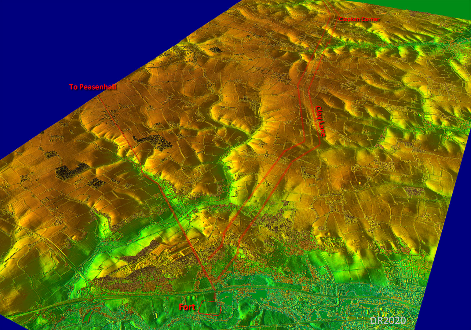
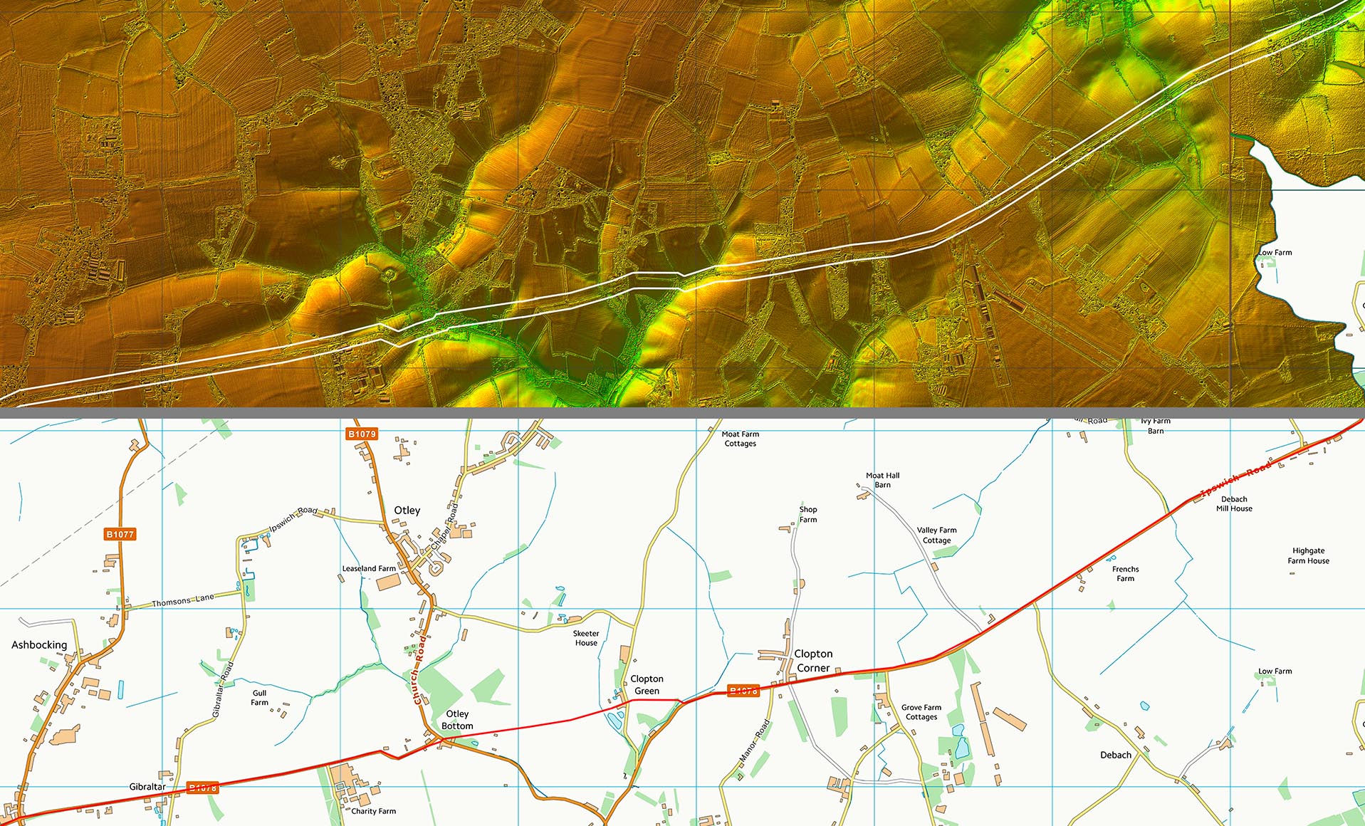
Oblique 3D Lidar Image - Coddenham to Clopton Corner The route is very clear all the way to beyond the appropriately named Clopton Corner. |
Click for larger view |
 |
Lidar Image and Route Map 1 The alignment of Clay Lane is well to the south of Coddenham site which was probably the reason that the course of the road from the fort was lost. It is quite a big dog-leg there leading many to guess the road carried straight on rather than turning to the fort. |
Click for larger view |
 |
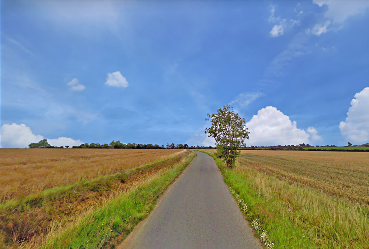
Clay Lane The big ditch on the left hand side (north) looks a modern re-cut. The Roman agger would have been much wider - around 8 metres. Image: Google |
Click for larger view |
 |
Lidar Image and Route Map 2 A little deviation to negotiate Otley Bottom. It was here that Elizabeth Owles proved the road in 1967 - see below. Her excavation spot is just about visible still in the Lidar imagery. |
Click for larger view |
 |
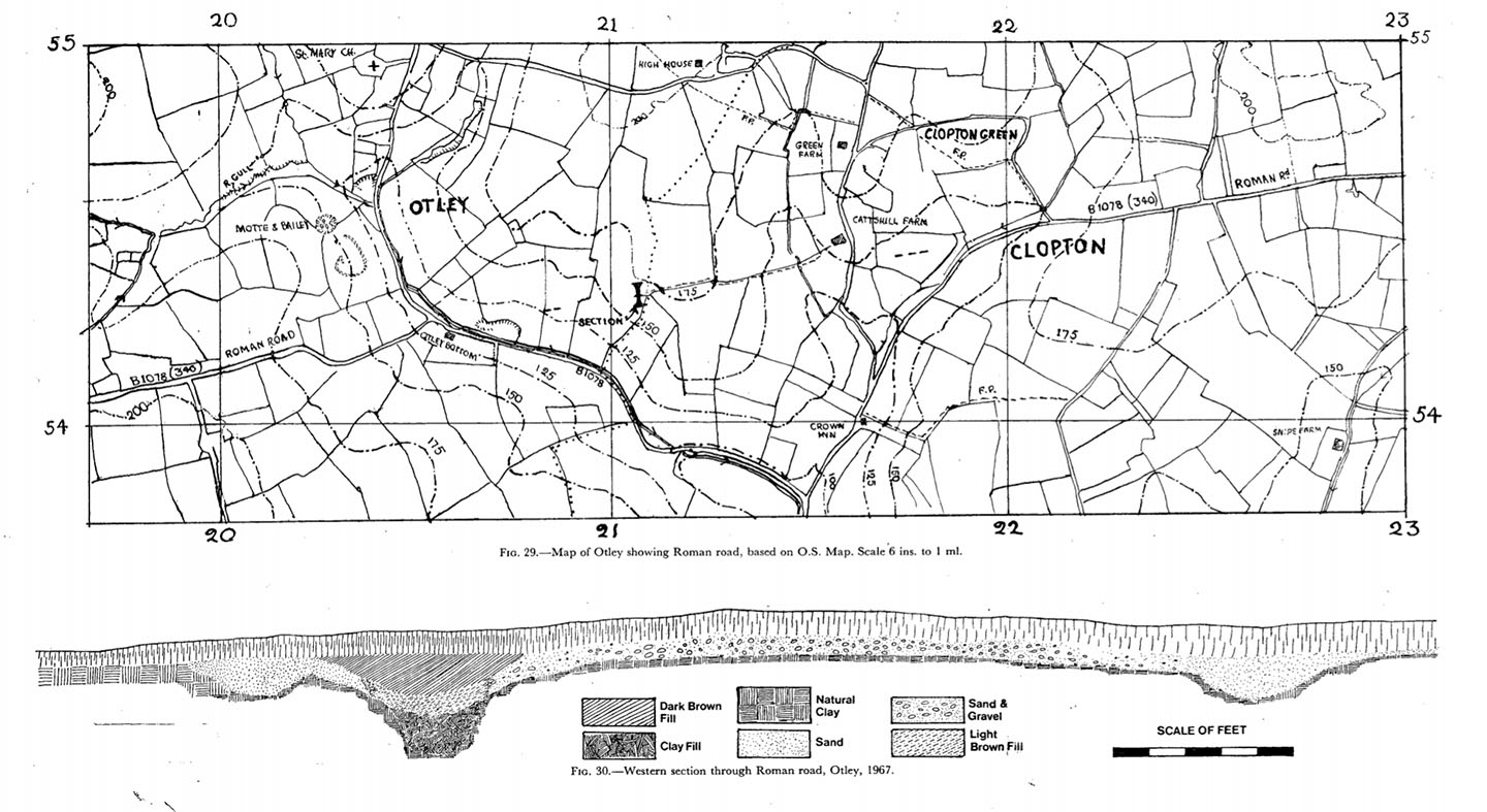
Otley Bottom Excavation 1967 The road was excavated at Otley Bottom by Elisabeth Owles in 1967. Her findings:-. A trench four feet wide sevenyards from the west end of the track revealed the road and its flanking ditches (TM/21085433). The ditcheswere four feet wide and two feet deep from the present ground surface; the distance between them was twenty-five feet (Fig. 30). The road was made up of rammed gravel eight inches thick in the centre; it was not possible to estimate the original thickness because evidently considerable damage had been caused by the plough. The gravel was thinner and less dense near the north ditch. The southern edge of the road had been destroyed when a hedge, which followed its course, was grubbed up a few years ago. The soil here is heavy clay, but a fifth of a mile away, opposite the Crown Inn, is a gravel pit which may have been worked since Roman times. The only finds made were two minute fragments of Roman pottery from the north ditch. |
Click for larger view |
 |
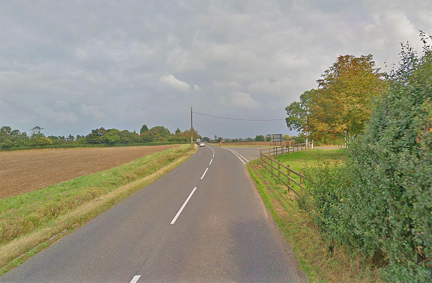
B1078 - Clopton Corner Just beyond Clopton Corner the road changes alignment. Is this the source of the name Clopton Corner? Image: Google |
Click for larger view |
 |
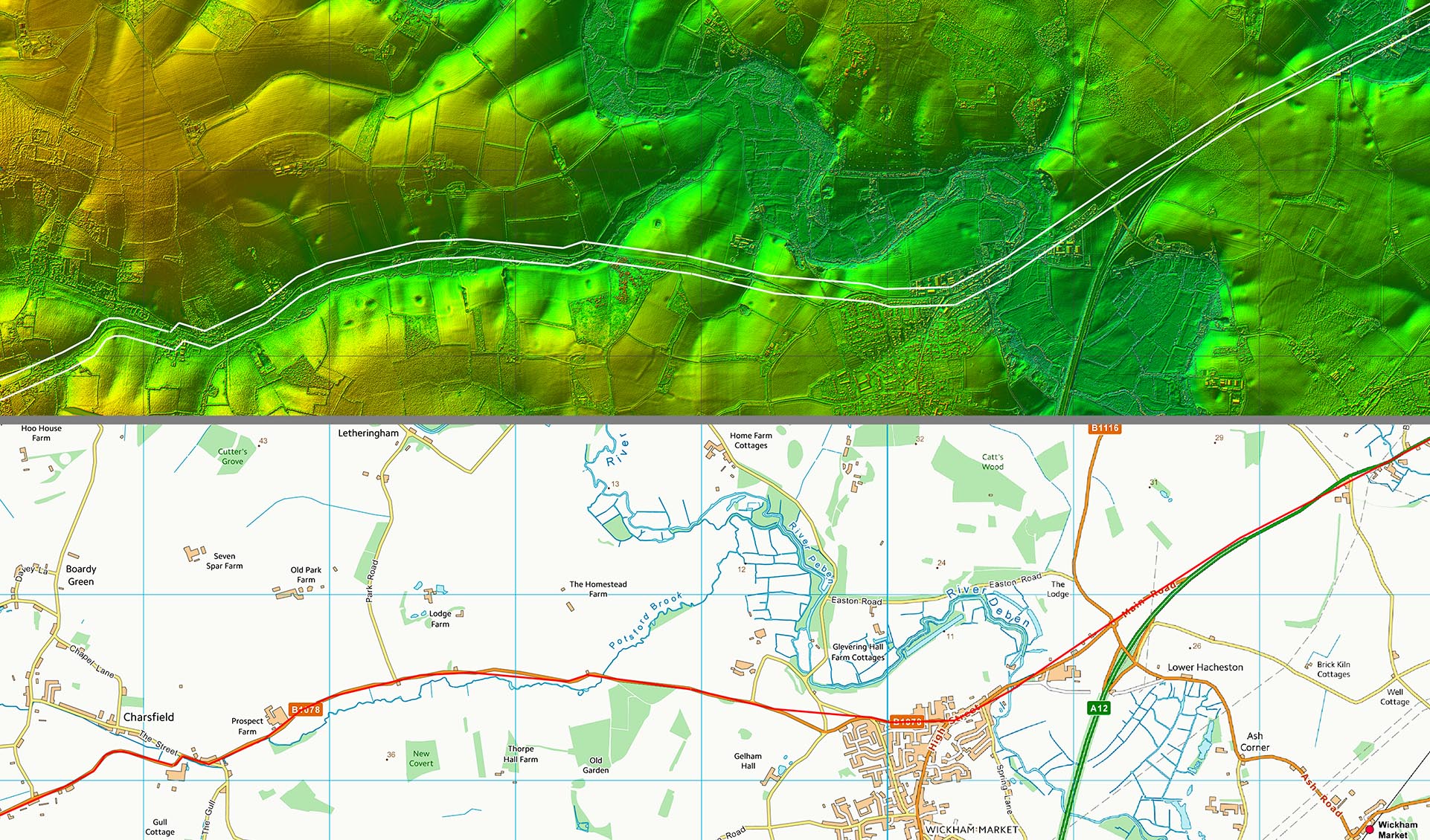
Lidar Image and Route Map 3 For this section there is little evidence apart from the modern road. It is likely therefore that the B1078 into Wickham Market overlies the Roman road. Elizabeth Owles also investigated what she described as a Roman Settlement at Lower Hacheston just beyond Wickham Market. This could have been the destination for our road but the existence of Knodishall Villa perhaps supports the fact that our road would have continued further east. Villas would not be in the middle of nowhere. |
Click for larger view |
 |
Lidar Image and Route Map 4 Across that big bend in the modern road at Glemham Park then there are clear traces in the Lidar of the possible route of our road. In fact there looks to be two parallel options - another one around 250 metres to the south-east of the one I have shown. It is not unusual for Roman roads to have two course - it usually means an upgrade or improvement occurred during the Roman era. The one I have depicted is probably favourite. |
Click for larger view |
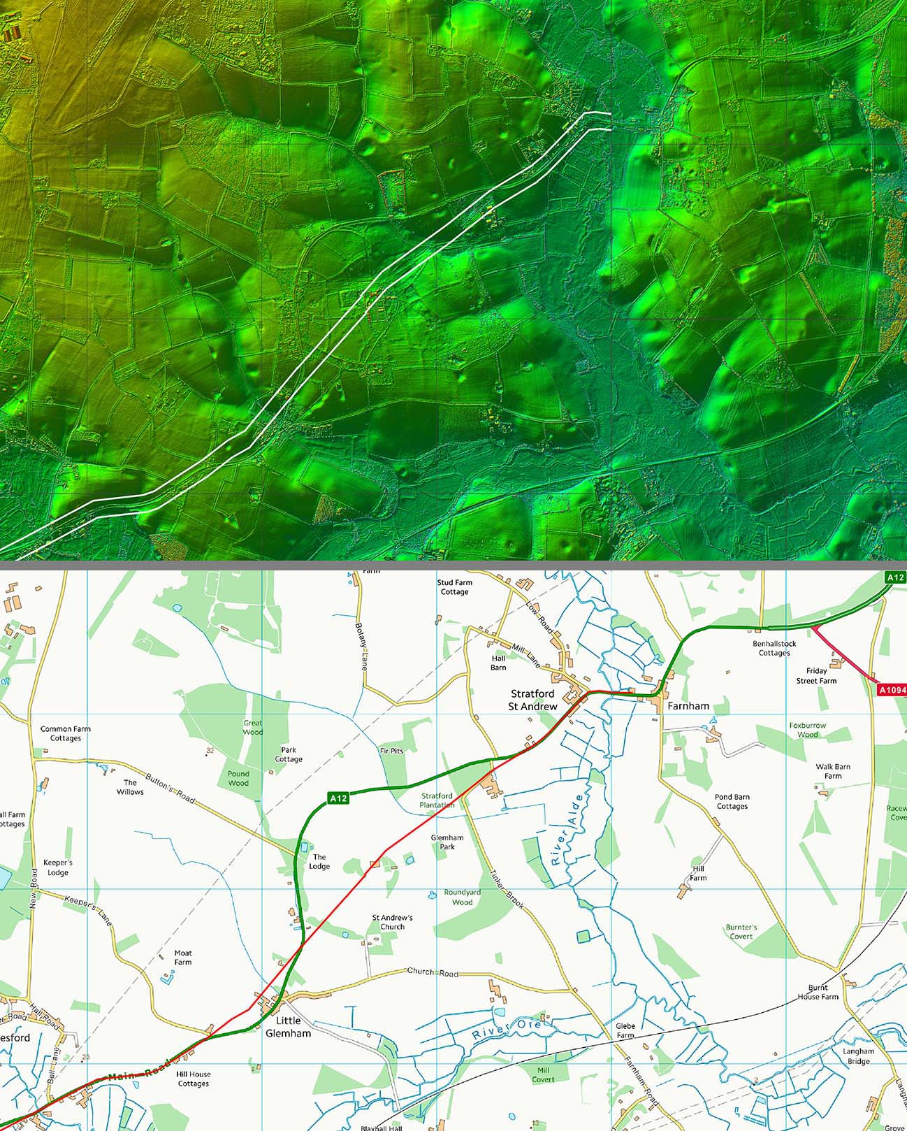 |
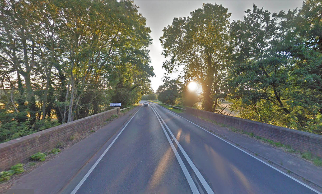
River Alde Bridge - Stratford St Andrew The name Stratford is a big clue that our Roman road ran through here. If correct then the modern bridge over the River Alde could well have been where the Roman crossed too. We are looking back to Stratford St Andrew in this view. Image: Google |
Click for larger view |
 |
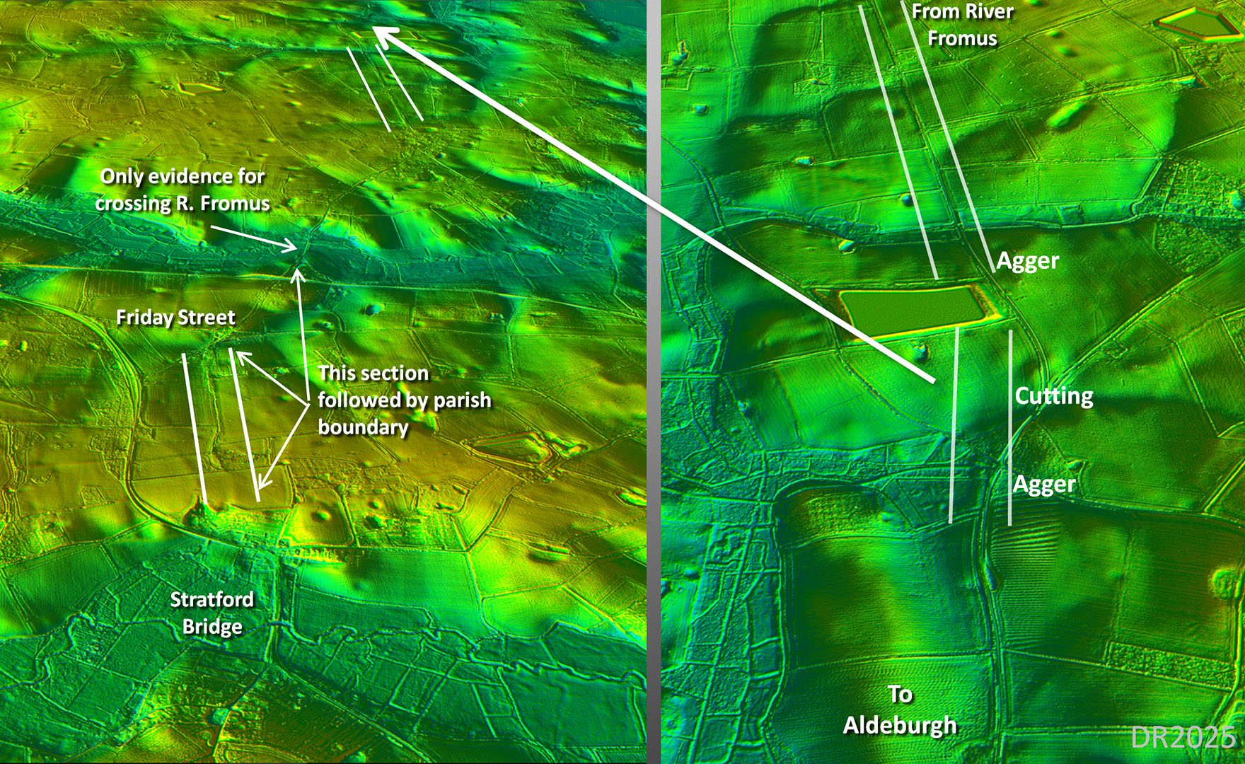
3D Lidar Images - The Evidence beyond Stratford Bridge Once across Stratford Bridge the next big obstacle was the valley of the River Fromus. There is only one built-up causeway visible so must represent the course of our road. Supporting this are clear traces heading via Friday Street and then angling to that crossing of the Fromus valley. All this section is followed by the parish boundary, often a good clues to a Roman road. Beyond the Fromus then the modern road almost certainly represents the road's course. This is confirmed just beyond a reservoir where the modern road no longer is straight but swings off. Here are the signs of the Roman road carrying across the bend - just what we would expect. |
Click for larger view |
 |
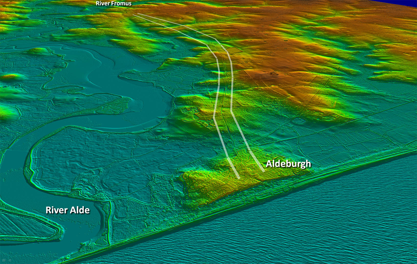
Oblique 3D Lidar Image - Stratford Bridge to Aldeburgh Logically a destination on the Aldeburgh penisular would to be expected at the (then) mouth of the Alde River.. The modern road which runs very directly to there, most likely indicates the Roman alignment. An old name giving us a clue perhaps is Hazlewood Street. |
Click for larger view |
 |
Oblique 3D Lidar Image - Aldeburgh The modern road has all the characteristics of being derived from the Roman road - a series of straight alignments. Also clear is how truncated Aldeburgh is with obviously much land lost to coastal erosion. The Alde no longer reaches the sea here but is diverted south by a long shingle spit. The "burgh" name is probably the only clue we have as to what used to be here... |
Click for larger view |
 |
|
|
|
Last update: June 2025 |
© David Ratledge |