|
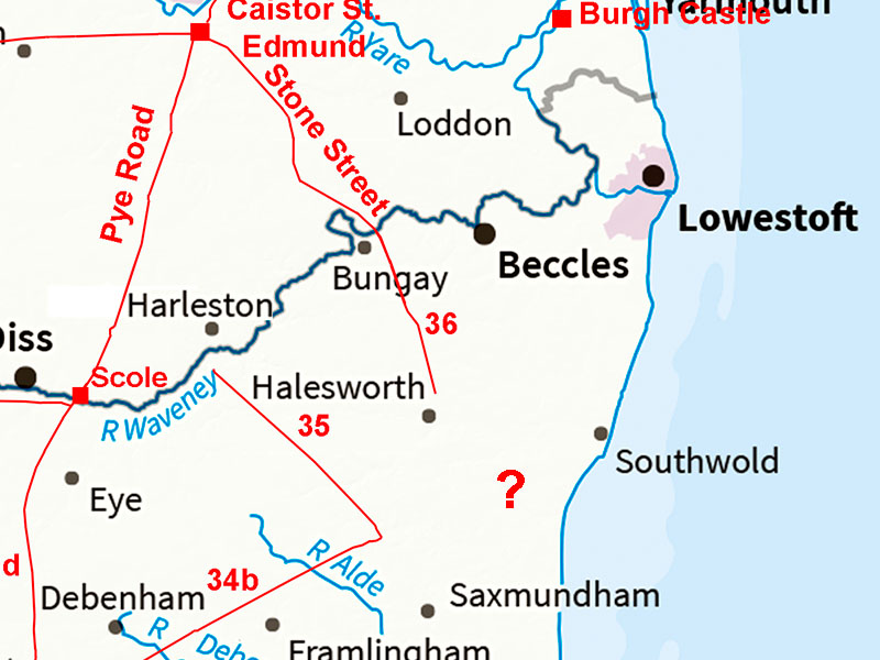
East Suffolk - Where are Margary 34, 35 & 36 Heading?Margary Number: 34b, 35, 36Distance: ?At least 3 Roman roads head for East Suffolk with no known destination. There have been many suggestions over the years but what has not helped is that although various site indicate a Roman presence no major town has turned up. Of course what has changed since Roman times is the coastline - there has been much land lost to the sea. A Roman town at Dunwich long lost to the sea is perhaps the most logical suggestion. At the time of the Domesday Book, Dunwich was one of 10 biggest cities in the country. Medieval writers referred to Dunwich as Dumnocaister which certainly has Roman connotations (ref. Chant). Margary 340 also heads for the Suffolk coast but as it is from Coddenham just like 34b, I have assumed it must have a different destination to 34b - otherwise why build it? Perhaps around Aldeburgh? Reference: The History of Dunwich by Katherine Chant, Dunwich Museum. |
Historic Counties: Suffolk Current Counties: Suffolk HER: Suffolk
|
|
|
|
|
|
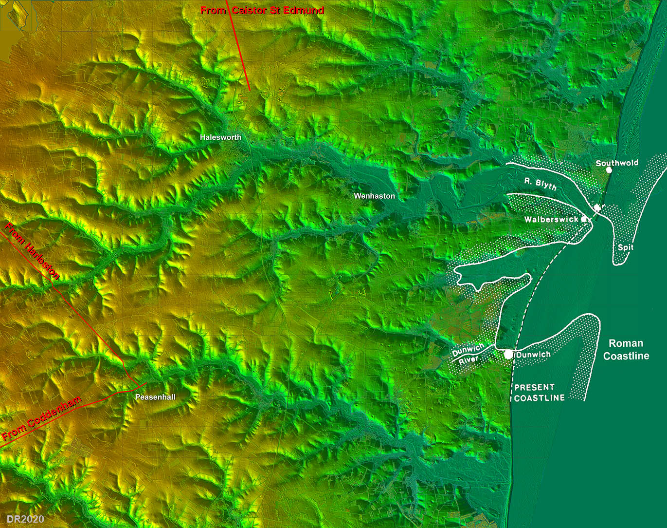
Lidar Image - East Suffolk with certain Roman roads A study of the topography showing those river estuaries indicates that the 3 Roman roads must surely have had the Dunwich peninsular as their destination. They all head for a destination on that peninsular. The probable Roman coastline is shown in white and indicates what a good harbour Dunwich would have been back then and also how much land has gone - probably over 1 mile. The Roman era coastline is derived from fig2, History of Dunwich (Chant). |
Click for larger view
|
 |
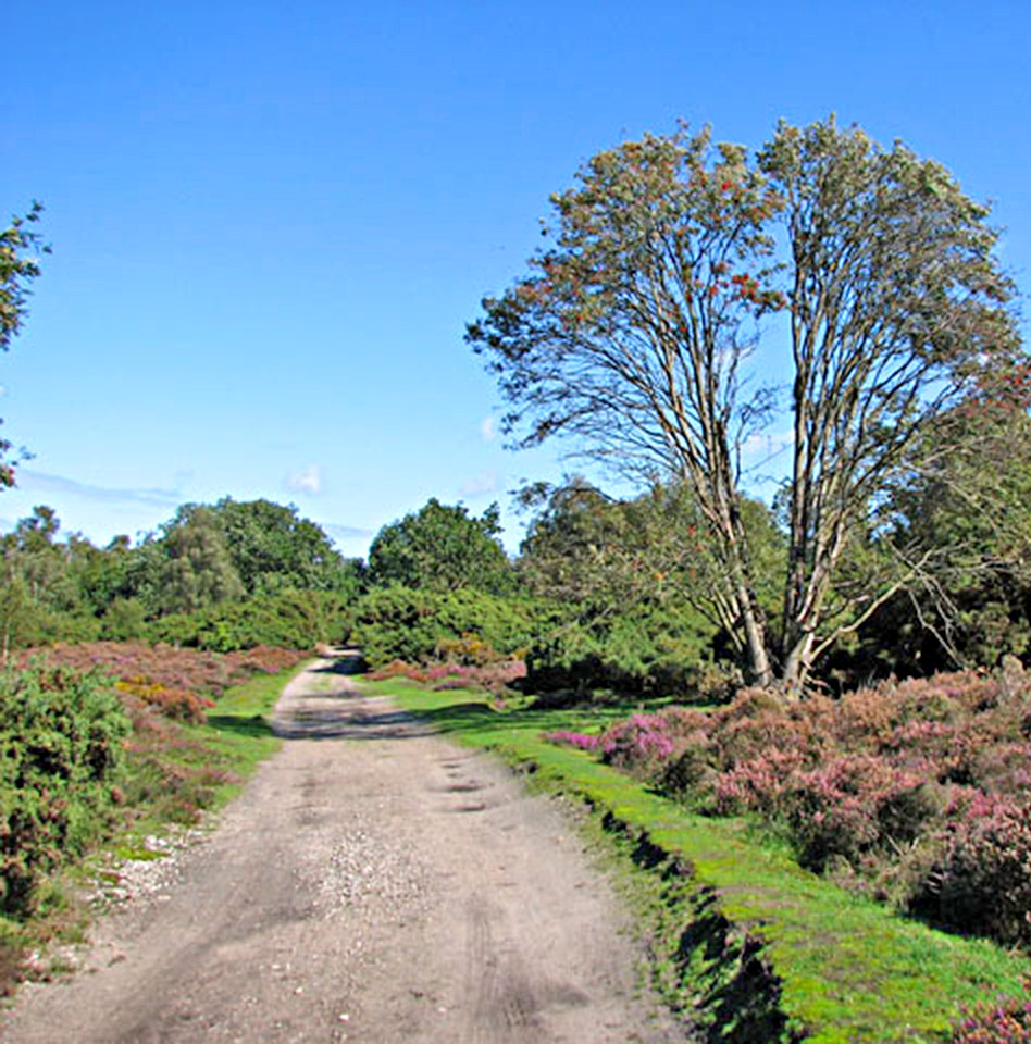
Roman Carriageway, Westleton heath - looking towards Dunwich (TM459698) This is probably the best candidate for a link from Peasenhall to Dunwich. This is based not just on its local name of Roman carriageway but its appearance. I visited it several year ago ingtrigued by its name. It is clearly worn down, even away in places, but does show it was once a major highway. Its considerable original width with ditches both sides does make a Roman origin very possible. Photo © Evelyn Simak (cc-by-sa/2.0) |
Click for larger view |
 |
Lidar Image - Possible Roman roads There are of course sevral traces of roads to Dunwich visible in the lidar imagery. It was an important Medieval city so that was to be expected. Are these Roman in origin? I have shown the traces I have spotted including ones at the north end of the peninsular towards Wenhaston and Woodbastwick. Ther are even signs of more old tracks but the ones shown perhaps are the most obvious. |
Click for larger view |
 |
Bing Mapping - Possible Roman roads The roads are overlaid on modern Bing mapping. With the possible location of a Roman site at Dunwich perhaps as far as one mile out to sea then proving it was the destination for our roads is not going to be easy. |
Click for larger view |
 |
|
|
|
Last update: September 2022 |
© David Ratledge |