|
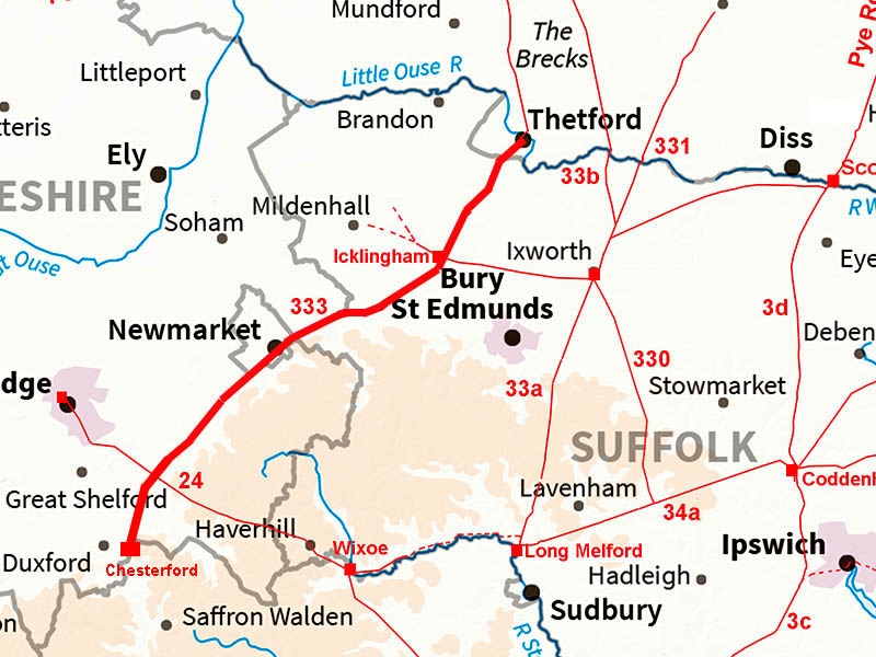
The Icknield Way - Thetford to Worsted LodgeMargary Number: 333Distance: 30 miles (Thetford - Worsted Lodge)Believed to be an Iron Age trackway predating the Roman period but adopted and improved by the Romans where they deemed necessary. That's the theory but is it really that old? Doubts have been cast on its authenticity. Much of its route is down to W.G. Clarke (EDP Oct 1923). Certainly in Suffolk much of the Icknield Way comprises long straight alignments.This would tend to support that it was a Roman road whether an upgrade or replacement. Generally is seems these days to be accepted as Roman. Note the mapping for this road is reproduced here at half the scale normally adopted on our Suffolk web pages. The actual route depicted in based on OS Mapping with gaps filled in by interpolation. |
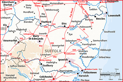
Historic Counties: Suffolk, Norfolk, Cambridgeshire Current Counties: Suffolk, Norfolk, Cambridgeshire HER: Suffolk, Norfolk, Cambridgeshire
|
|
|
|
|
|
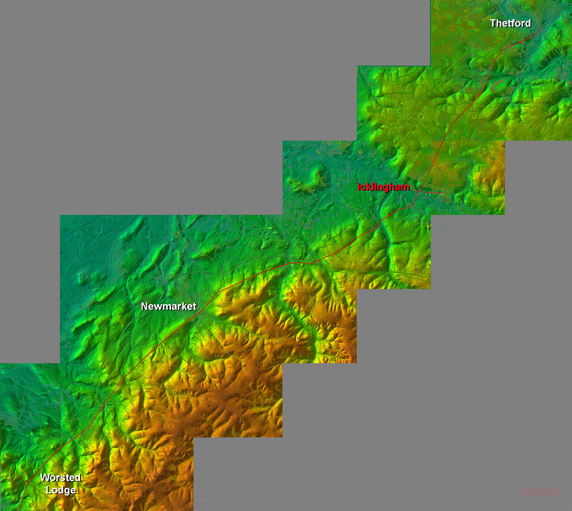
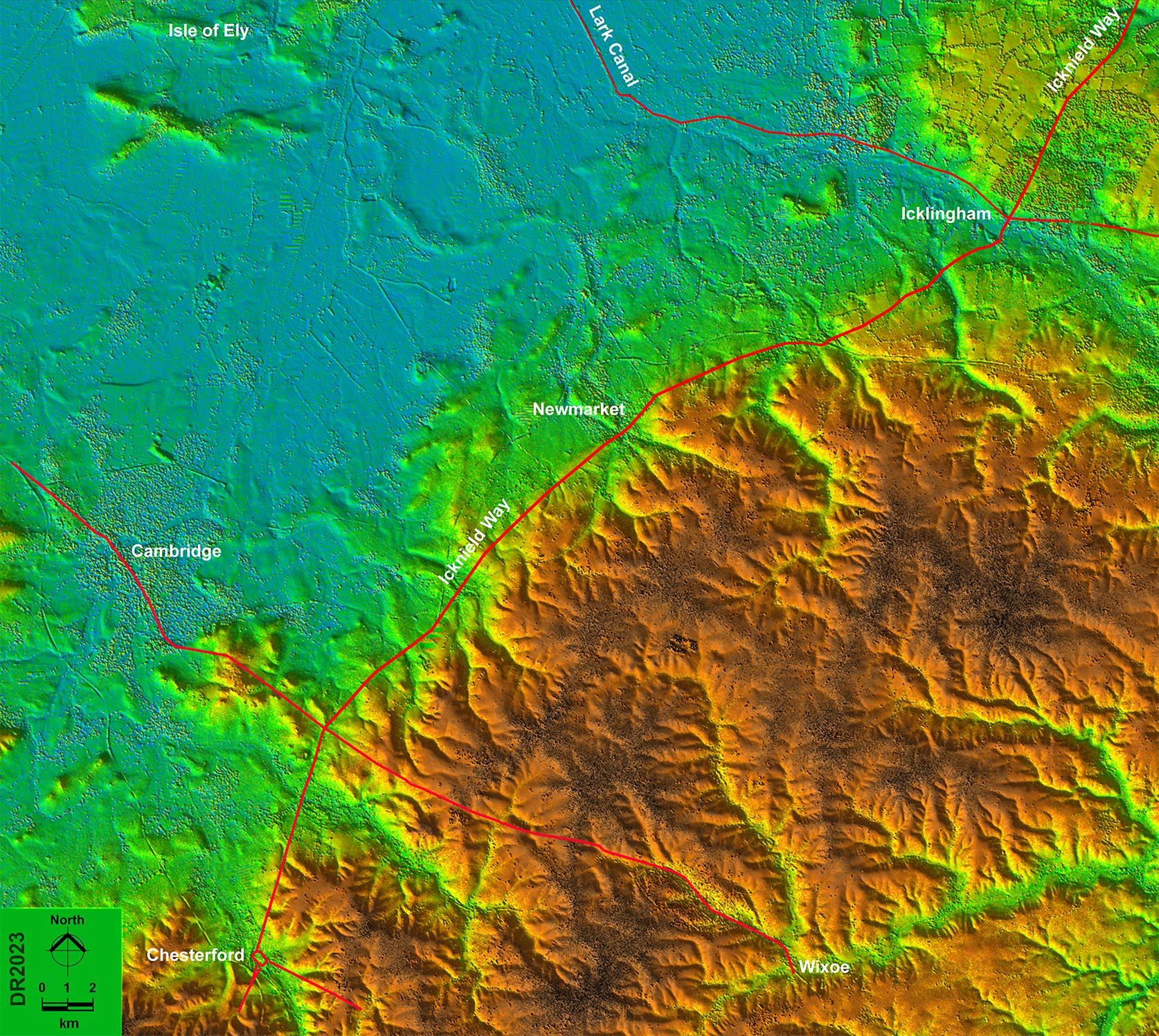
Full Route - Lidar Image The lidar imagery shows clearly how the Icknield Way sticks to the edge of the fens. |
Click for larger view
|
 |
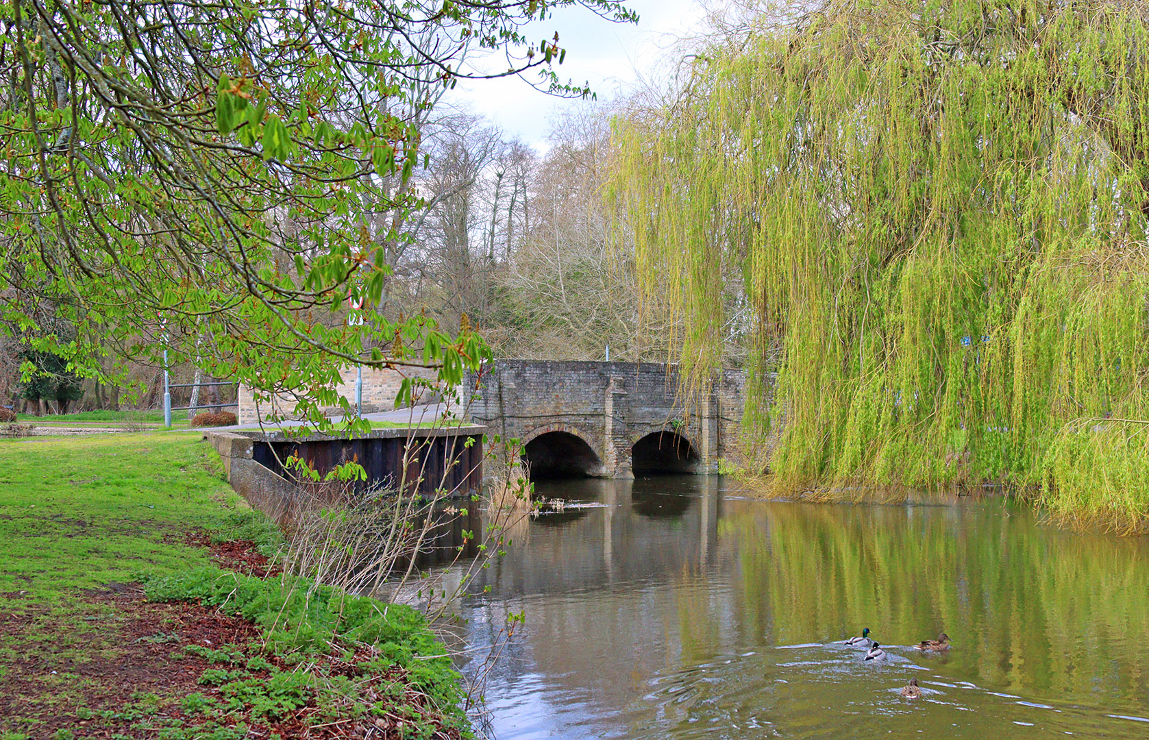
Icknield Way - Nuns Bridges, Thetford We start in Thetford at Nuns Bridges. Here, in close proximity, the Rivers Thet and Little Ouse are crossed at a truly delightful spot. The bridges are relatively modern and presumably replaced the ford of Thetford.. |
Click for larger view |
 |
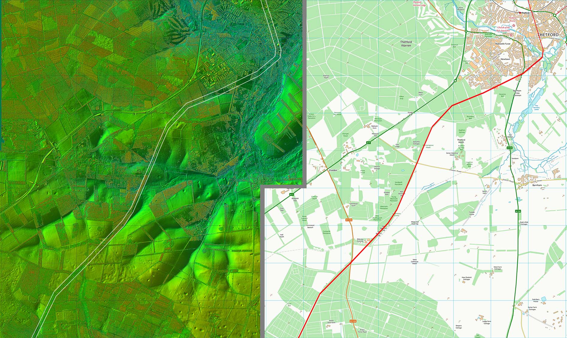
Lidar Image & Route Map 1 From Nuns Bridges to Thetford Heath then the course is uncertain so I have straight-lined it. From there onwards its course is shown on modern mapping. This first stretch goes by various names, Barnham Slip, Angles Way and St Edmund Way as well of course as Icknield Way. |
Click for larger view |
 |
Icknield Way - Icklingham The Roman settlement of Icklingham was just west of the Icknield Way where it crosses the Roman road from Ixworth. Icknield Way crosses from right to left in this view. Icklingham was probably Camborico of Antonine Itinerary V. The mileages are a couple of miles adrift (36.5 from Caistor & 27.5 from Cambridge) but it is the closest match available. Image: Google |
Click for larger view |
 |
Lidar Image - Icklingham to Chesterford The route of the Icknield Way around the dry edge of the Fens makes perfect sense in this widefield view of the area. |
Click for larger view |
 |
Lidar Image & Route Map 2 The road passels through the King's Forest to Icklingham and then crosses the River Lark, The Roman bridge appears to have been downstream (east) of the modern bridge. It then heads from Lackford to Cavenham. |
Click for larger view |
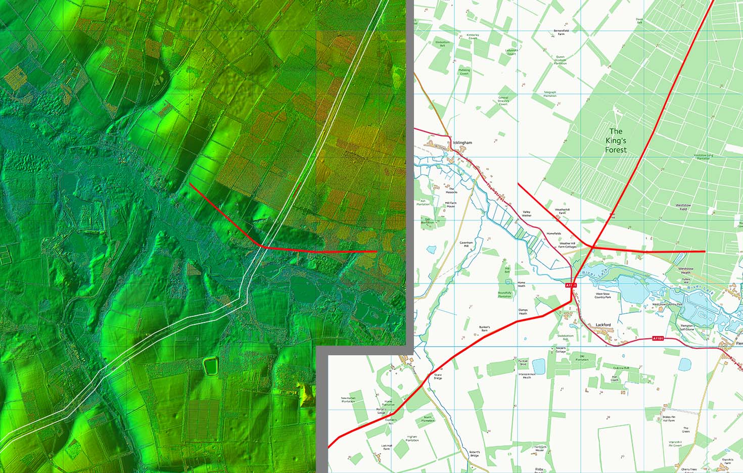 |
Icknield Way - Stone Bridge, Cavenham The Stone Bridge is a listed ancient monument and is visible to the right of the modern bridge in this image. Old but not Roman - see Historic England Listing below:- CAVENHAM LACKFORD ROAD Packhorse Bridge, known as Stone Bridge II Remains of Packhorse Bridge, probably C16. Disused and without parapets; it formerly carried the Icknield Way over a small tributary of the River Lark. Single segmental arch of red brick with gauged voussoirs and flint rubble core, about 2 metres wide and spanning about 3 metres. NGR: TL7661969560 Image: Google |
Click for larger view |
 |
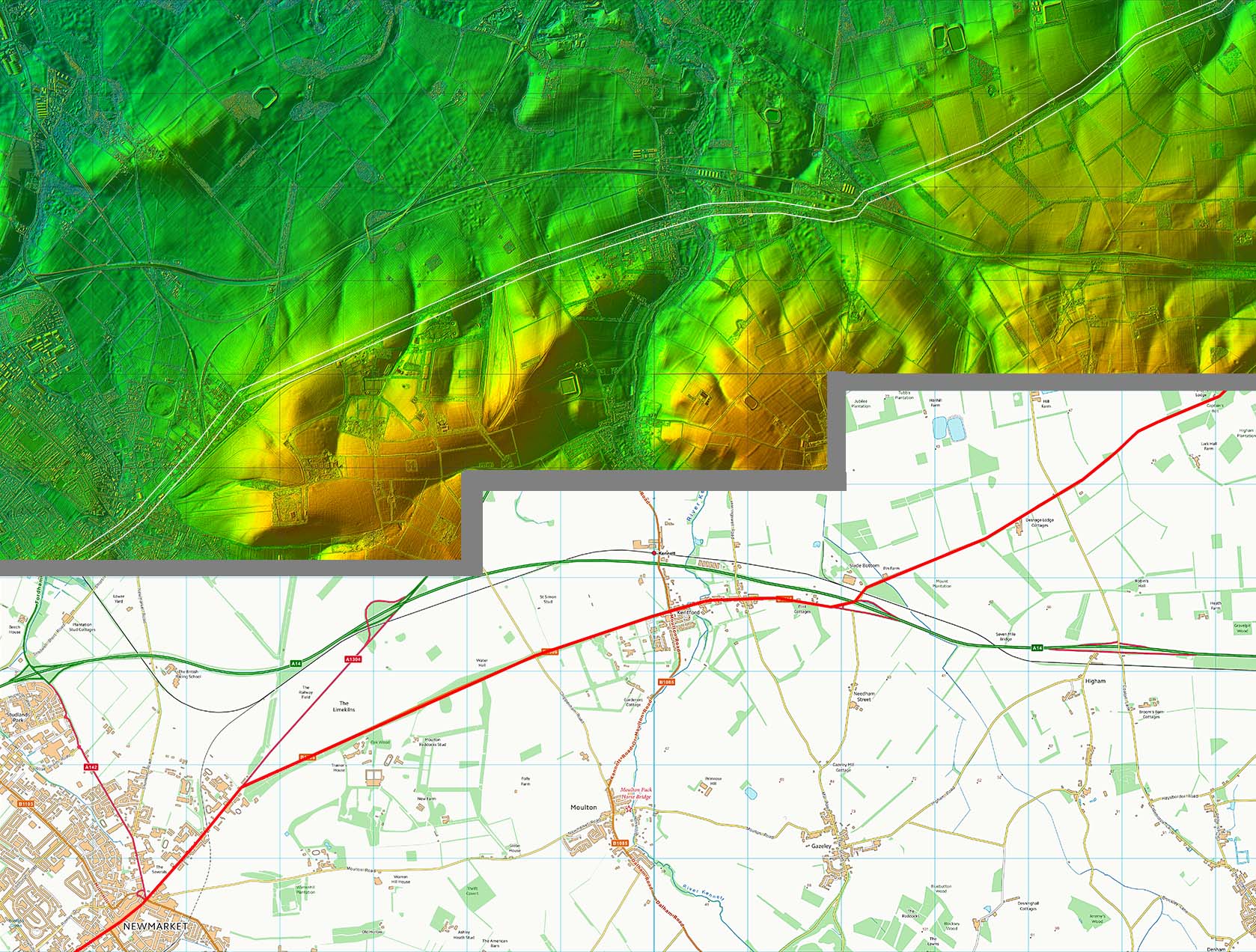
Lidar Image & Route Map 3 Our route now passes through Kentford and this point on follows main roads through Newmarket. |
Click for larger view |
 |
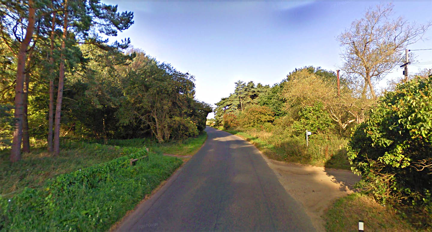
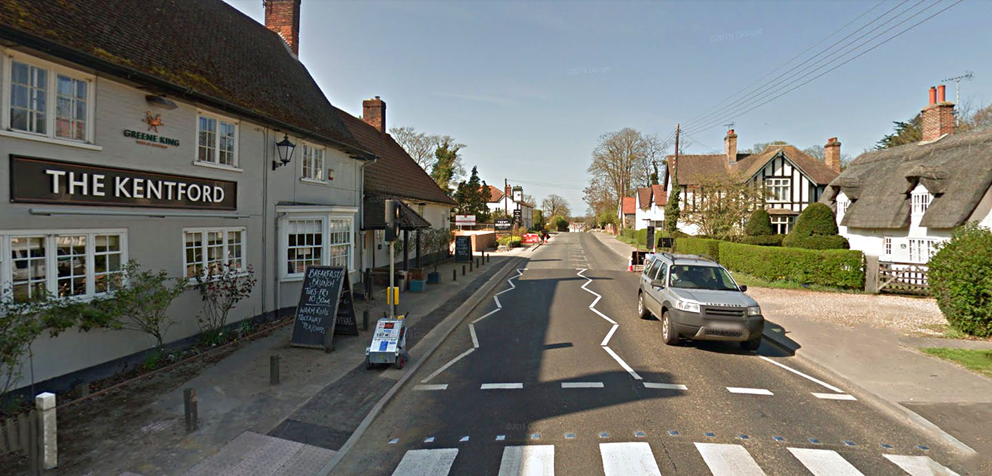
Icknield Way - Kentford The actual ford of Kentford is further on in this view and is where the Icknield Way crossed the River Kennett. Image: Google |
Click for larger view |
 |
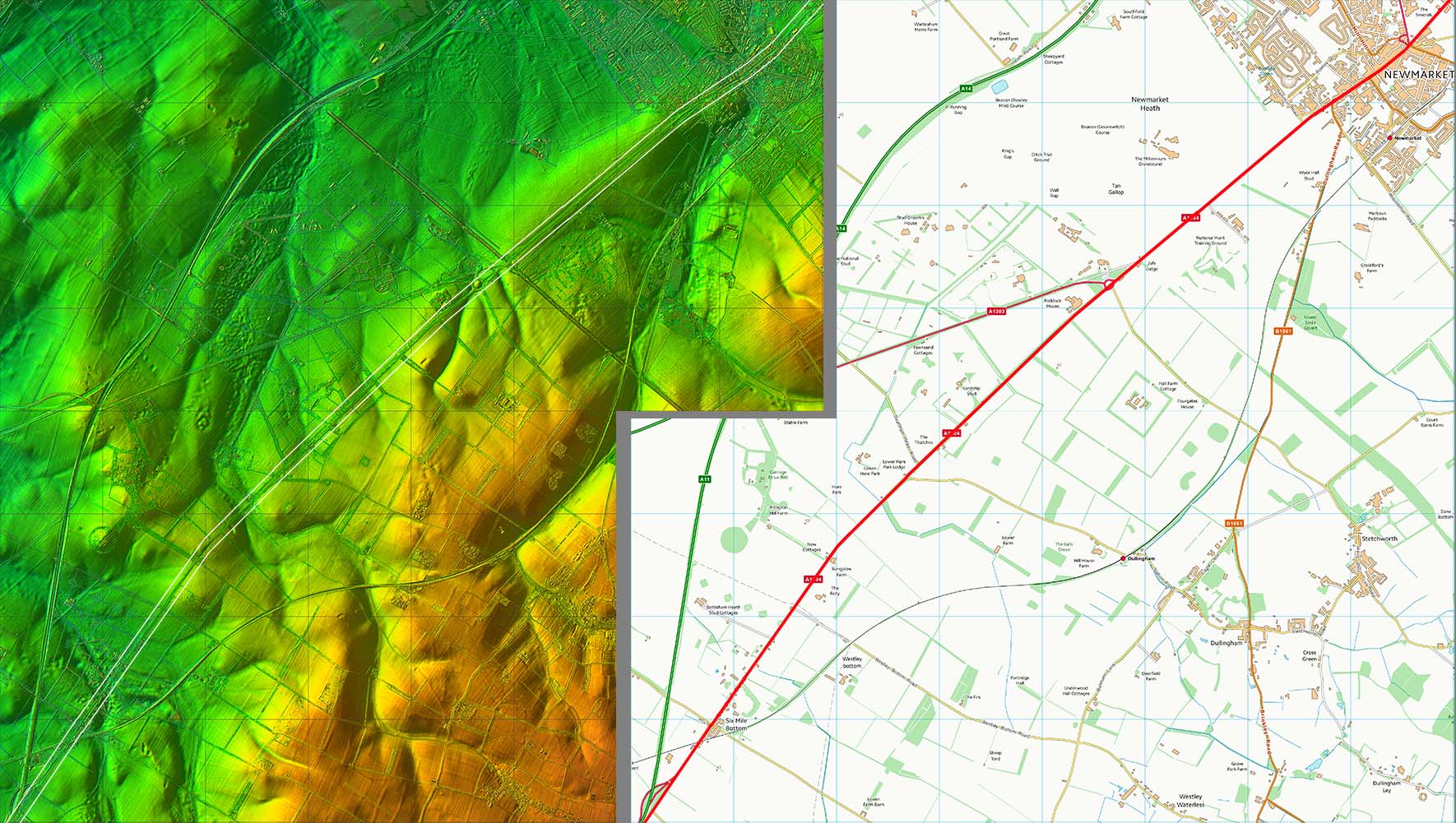
Lidar Image & Route Map 4 Its main roads all the way now. The straightness gives us the only real clue we are on Roman alignments. |
Click for larger view |
 |
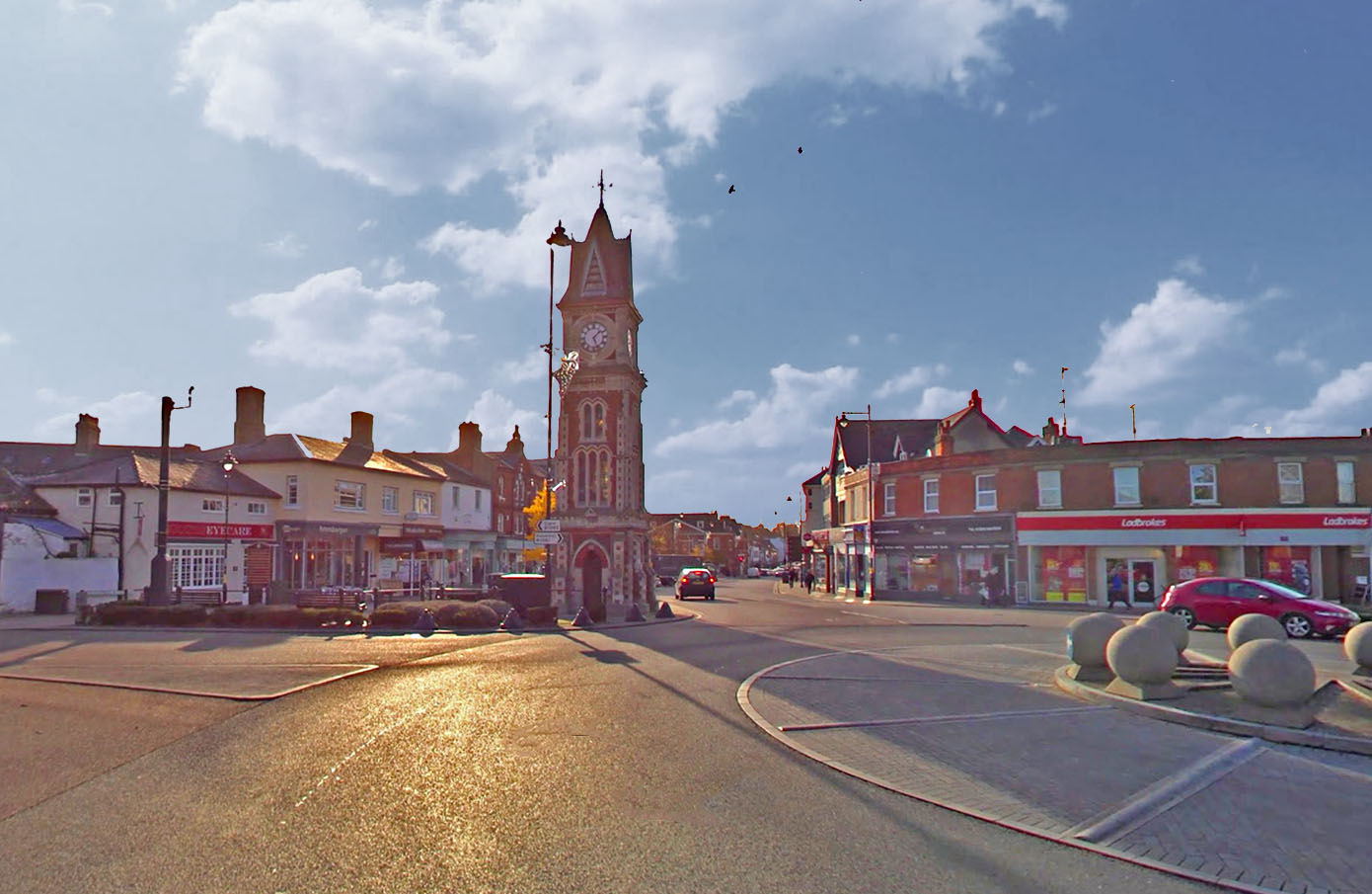
Icknield Way - Newmarket Our road passes right through the middle of Newmarket, just to the right of the famous Clock Tower. Image: Google |
Click for larger view |
 |
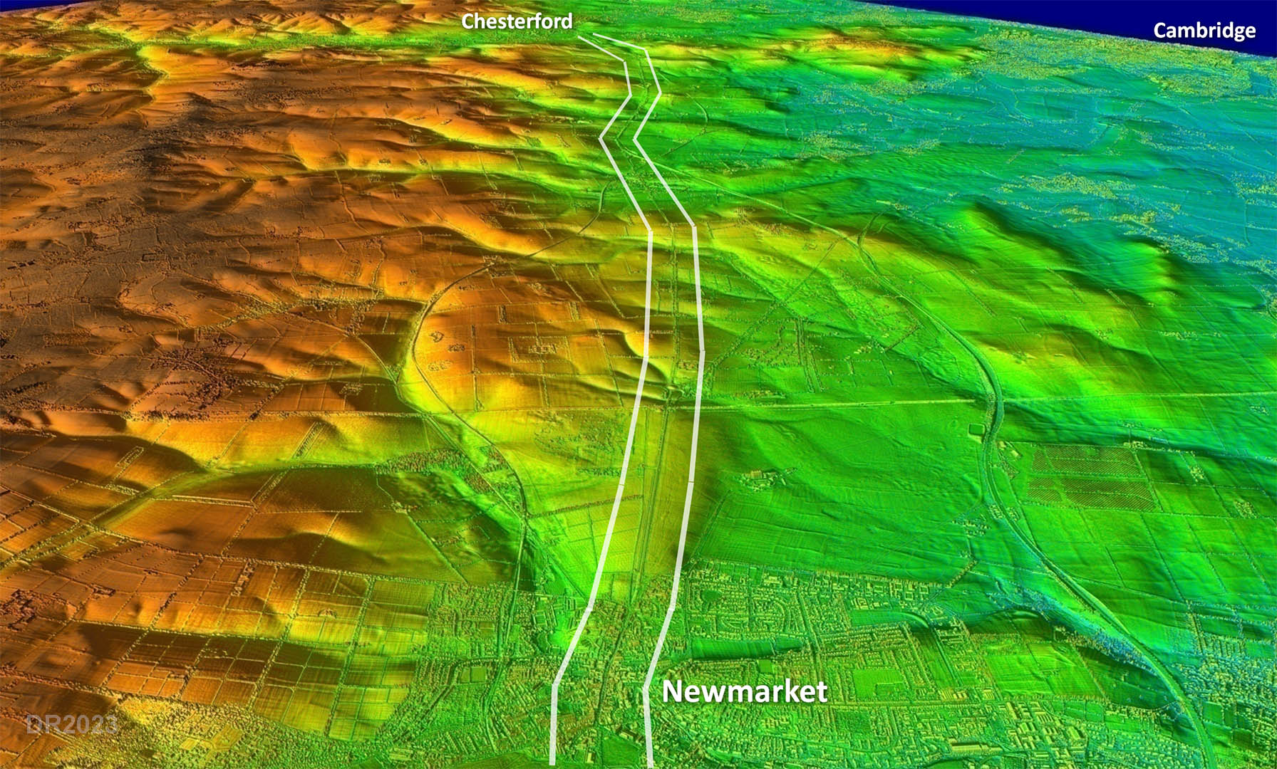
Oblique 3D Lidar Image - Newmarket to Chesterford Classical Roman road surveying - a series of straights from high point to high point. Absolutely certain this is Roman. The route keeps inland of the Fens and the connection to Cambridge had to wait till Worsted Lodge to turn right.
|
Click for larger view |
 |
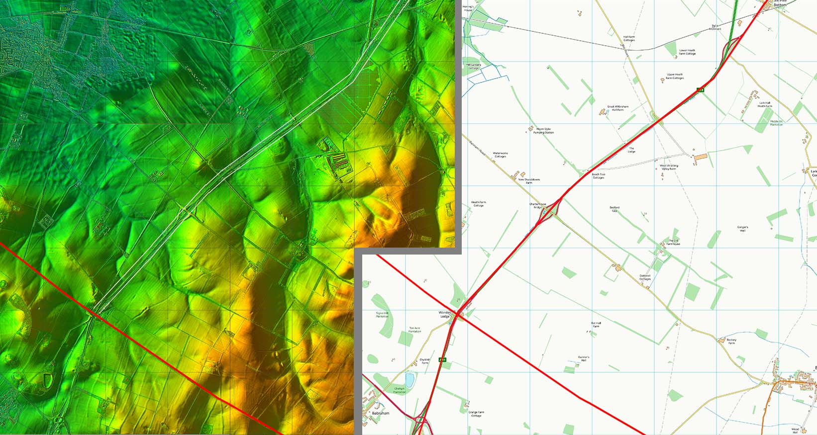
Lidar Image & Route Map 5 Our road continues its course to where it crosses the Wixoe to Cambridge Roman Road (Worsted Street) at Worsted Lodge. Road upgrades have all but obliterated any trace of the original Icknield Way.
|
Click for larger view |
 |
Lidar Image - Cambridge Link For traffic heading down the Icknield Way to Cambridge then there appears to have been a short-cut cutting off the corner at Worsted Lodge. There is clearly an old road there and it would make a lot of sense if it were Roman. |
Click for larger view |
 |
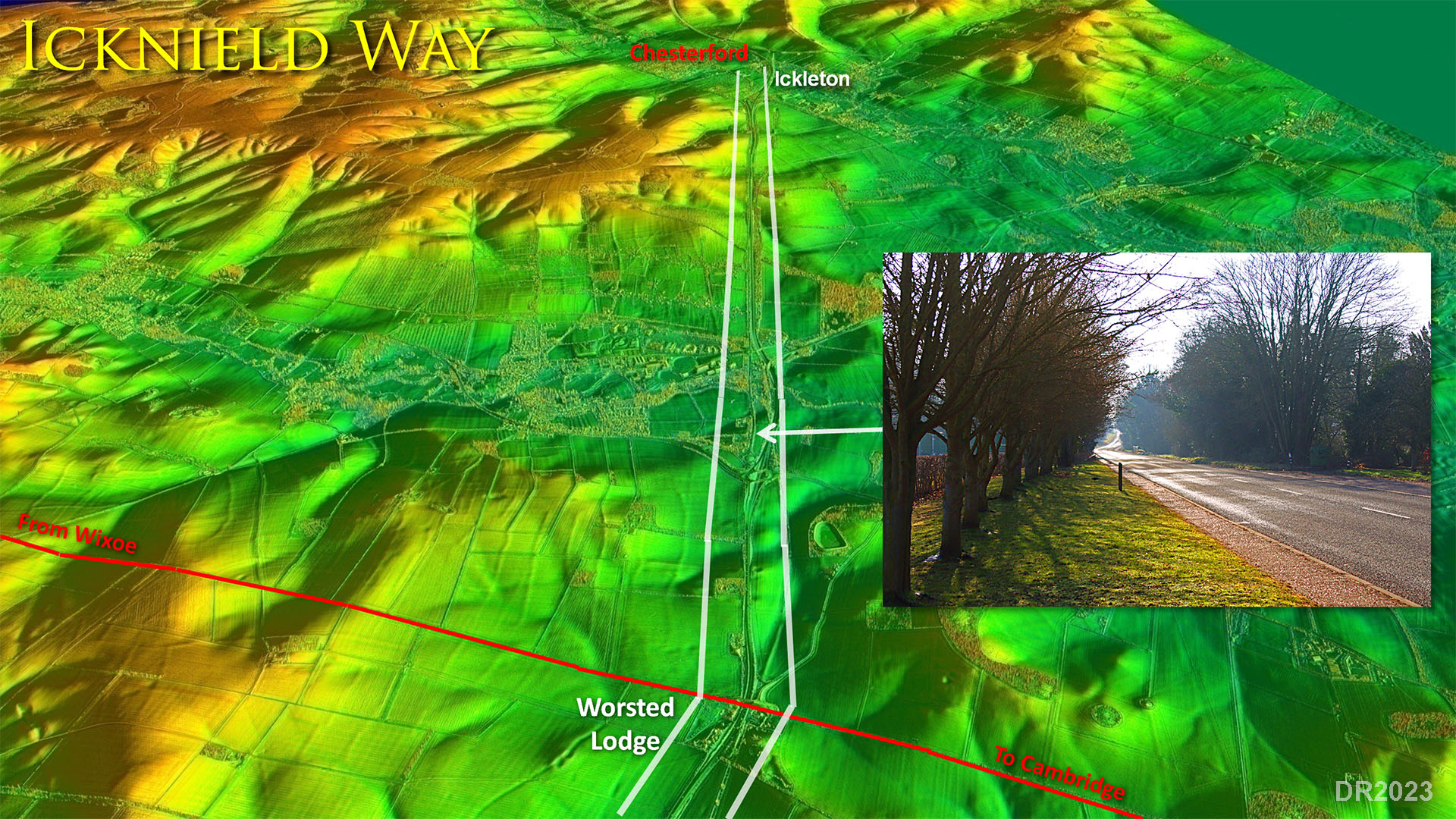
Oblique Lidar Image - Worsted Lodge to Chestertford Pretty simple alignment to the Roman fort and later town at Great Chesterford. Inset: Old road now bypassed heading down to Bourn Bridge. Does that line of trees preserve the original Roman ditch line? |
Click for larger view |
 |
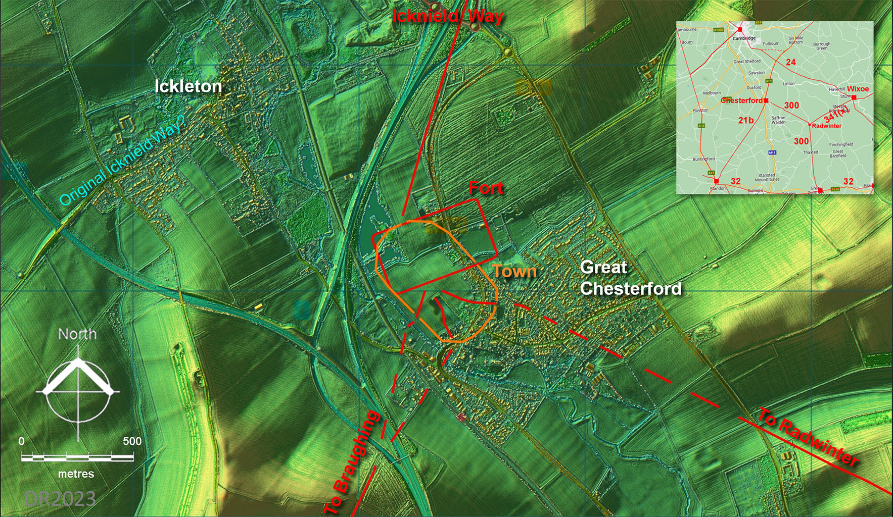
Lidar Image - Great Chesterford Site Plan The Roman upgrade to the Icknield Way probably ended at Great Chesterford. The pre-Roman(?) trackway most likely went via Ickleton - quite a clue that name. The early fort and later town extents are from Maria Medlycott, EAA Report 137, 2011. |
Click for larger view |
 |
|
|
|
Last update: January 2024 |
© David Ratledge |