|
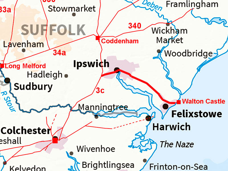
The Roman Road from Ipswich to FelixstoweMargary Number: NoneDistance: 15 miles There was a Roman settlement and almost certainly port at Felixstowe. Many finds over the years attest to this. The Lost Roman Saxon Shore fort at Walton Castle would have dated to around 300AD so would have been constructed well after the road system was established. It is assumed an extension off the road to Felixstowe would have been all that was necessary. It has also been suggested that a road down from Coddenham would have joined this road towards Felixstowe This could well be true but difficult to prove. There is a Roman villa on Castle Hill, Ipswich, where this suggested road could have run but villas were generally not built alongside roads. |
Historic Counties: Suffolk Current Counties: Suffolk HER: Suffolk
|
|
|
|
|
|
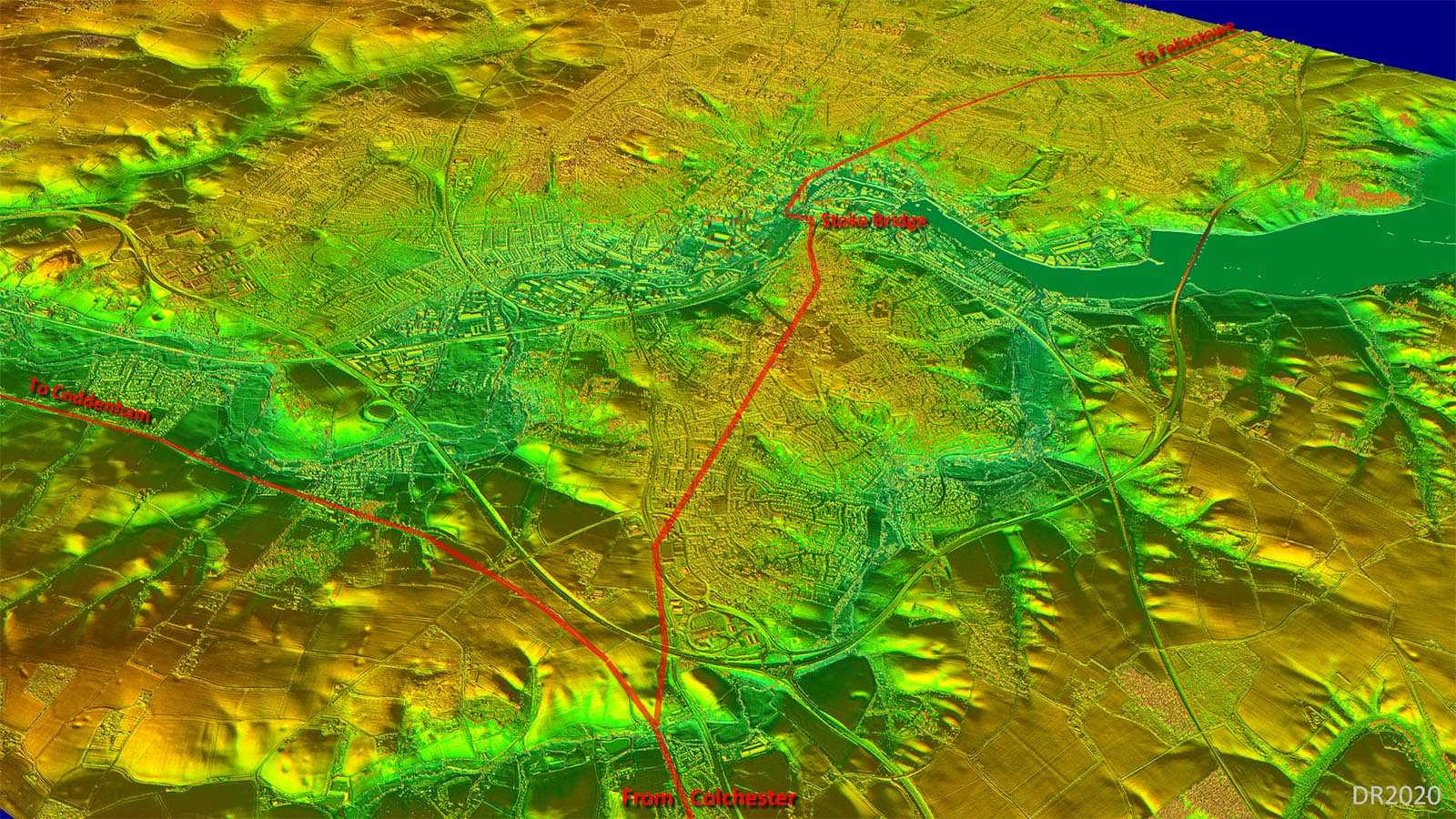
Lidar Image - Full Route The topography shows just why the road would have taken the course show. It is by far the best high ground route to Felixstowe. Typical Roman engineering. The current gap in the Lidar has been filled with Bing aerial photography. |
Click for larger view
|
 |
Oblique 3D Lidar Image - The route to Stoke Bridge is best regarded as indicative of the route rather than a precise position. The one shown follows high ground which Roman engineers certainly favoured. |
Click for larger view |
 |
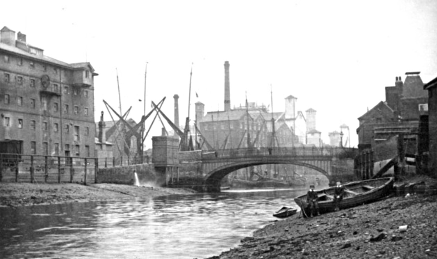
Stoke Bridge, Ipswich Stoke Bridge was until recently the lowest crossing point of the River Gipping/Orwell. A crossing here can be dated back to at least the Domesday Book and there are records of a bridge in the late 13th Century (wiki). The bridge in the picture is a cast iron arch structure from the 1800s which was replaced in 1924/5. Spanning a river this wide was well within the capabilities of the Roman engineers. There can be little doubt the Roman bridge would have been here. Note the bridge denotes where the River Gipping changes name to the River Orwell. It remained the southernmost crossing of the river until the construction of Orwell Bridge in the 1980s. The view in the image is looking downstream - the tall masted ships are on the sea side of the bridge.. Image: Ipswich Star |
Click for larger view |
 |
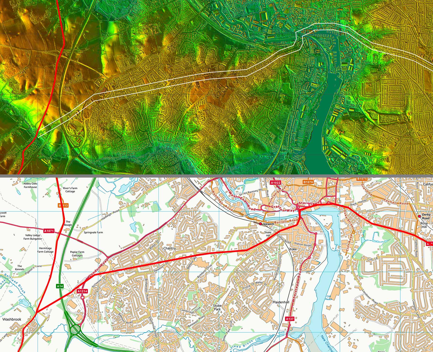
Lidar Image and Route Map 1 The line shown would have branched off the Colchester to Coddenham Roman road after crossing the Belstead Brook and then followed the high ground to cross the River Gipping at Stoke Bridge. This would have been the most logical course and these are old roads based on first edition mapping. Through Ipswich not a lot of clues so again the first edition mapping has been utilised. Felixstowe Road, Ipswich is probably the Roman line. |
Click for larger view |
 |
Lidar Image and Route Map 2
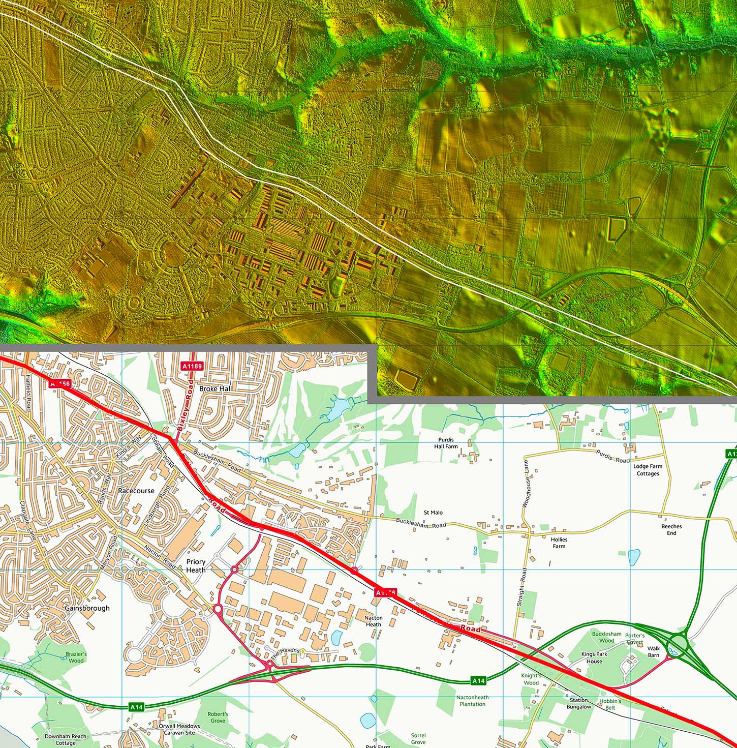
The dog-leg at the end of Felixstowe Road is to get around the low land of Bixley Heath. The route would then have used Seven Hills as a sighting/ setting out point. I have used the OS first edition map to work out its probable route here. There are some straight old parish boundaries which I suspect would have followed the Roman agger. |
Click for larger view |
 |
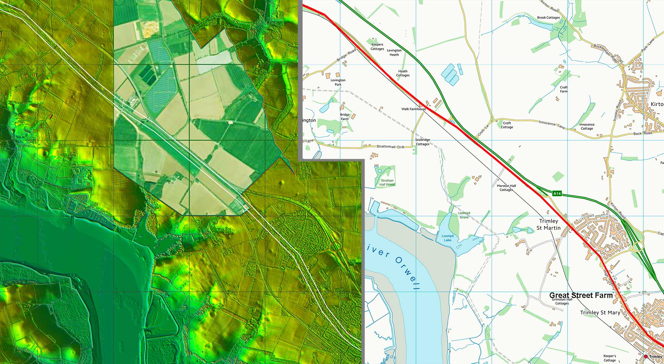
Lidar Image and Route Map 3 On this section is probably the biggest clue to this road - namely Great Street Farm. Stratton Hall is another significant name but Great Street Farm alongside our road fixes its position pretty securely. |
Click for larger view |
 |
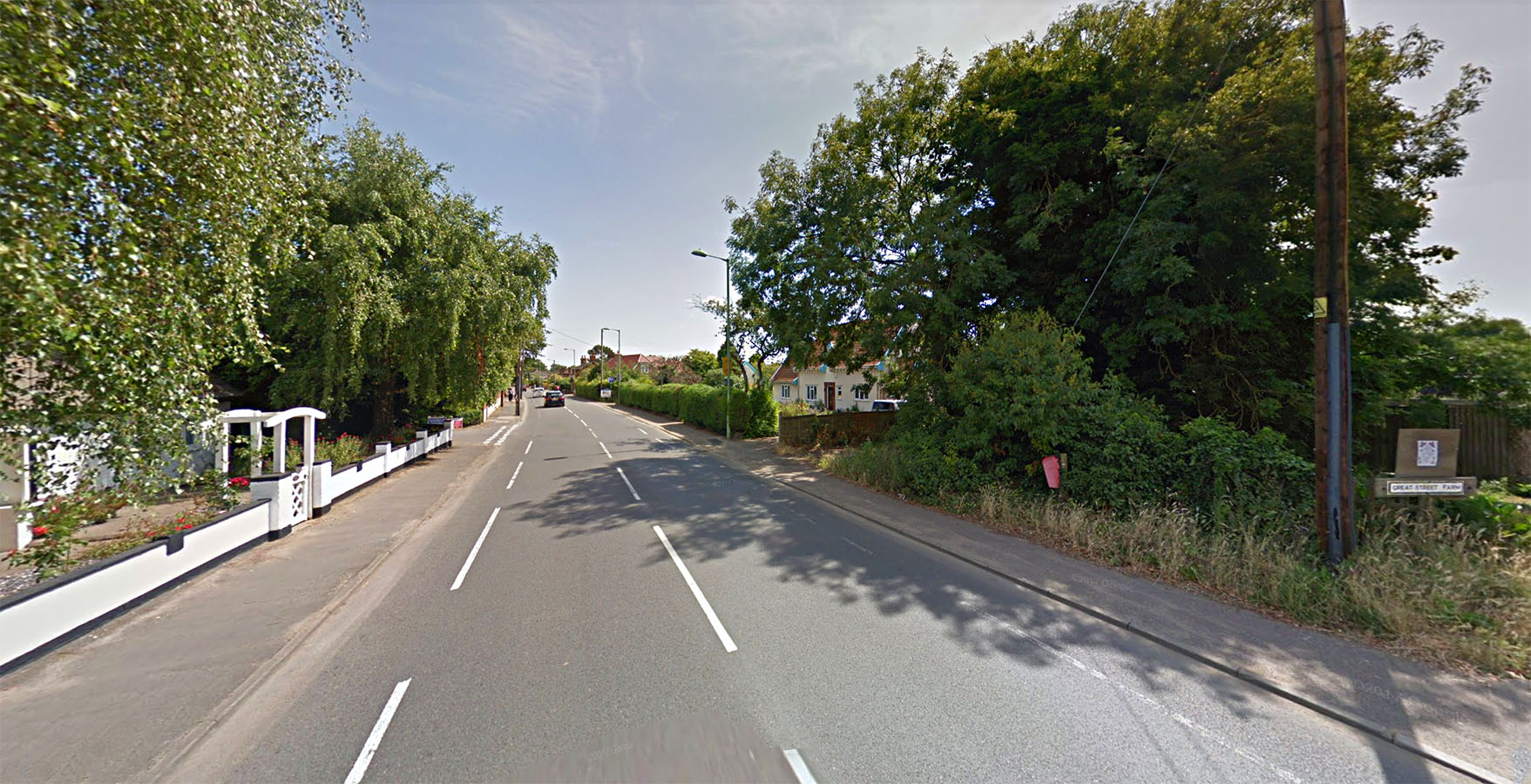
High Road, Trimley - Great Street Farm What better evidence could there be - a straight road passing a name such as Great Street Farm! Image: Google Earth |
Click for larger view |
 |
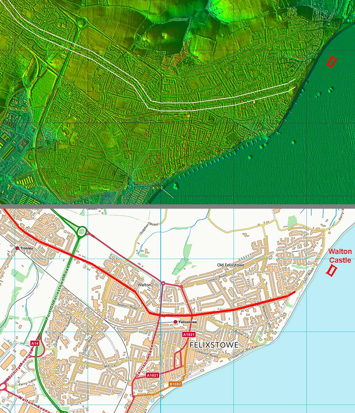
Lidar Image and Route Map 4 A little bit subjective in Felixstowe and again the OS First Edition maps have had to be consulted. The road would probably have been aligned on the Roman settlement/port at Felixstowe and later extended to Walton Castle fort. Coastal erosion has destroyed Walton Castle but its existence is not in doubt. |
Click for larger view |
 |
|
|
|
Last update: March 2020 |
© David Ratledge |