
|
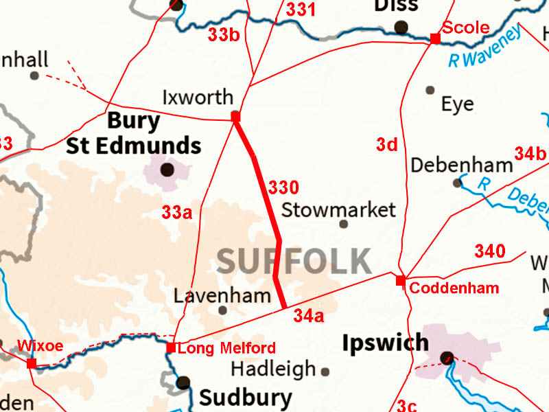
Ixworth to BildestonMargary Number: 330Distance: 13.5 milesIxworth and Coddenham were early fort sites and a direct connection would have been expected. However, for some reason the connection was via Bildeston and then across on Margary 34a. It is a very strange arrangement as Long Melford did have its own direct route from Ixworth
|
Historic Counties: Suffolk Current Counties: Suffolk HER: Suffolk
|
|
|
|
|
|
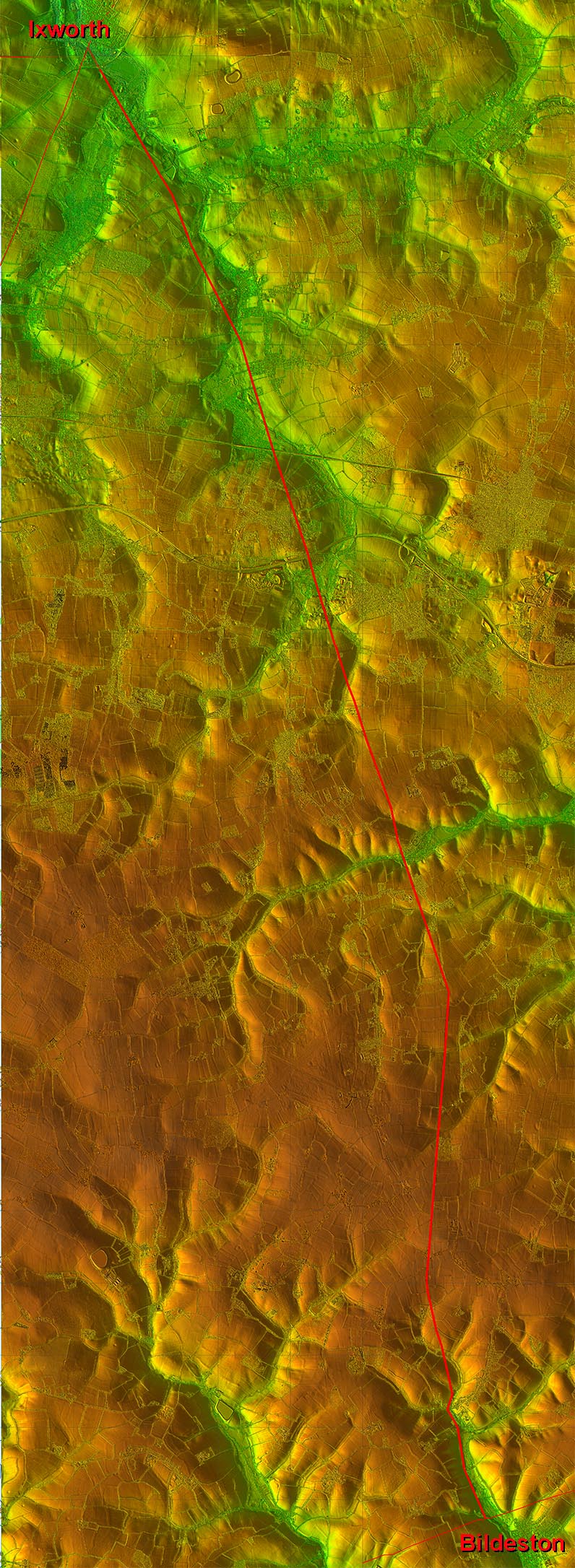
Full Route - Lidar and Aerial Image A very direct road to join Roman Road Margary 34a. Initially it follows the Black Bourn valley then keeps to mainly high ground. Whether it continued further south beyond Bildeston is open to debate. I could see nothing obvious that it did. |
Click for larger view |
 |
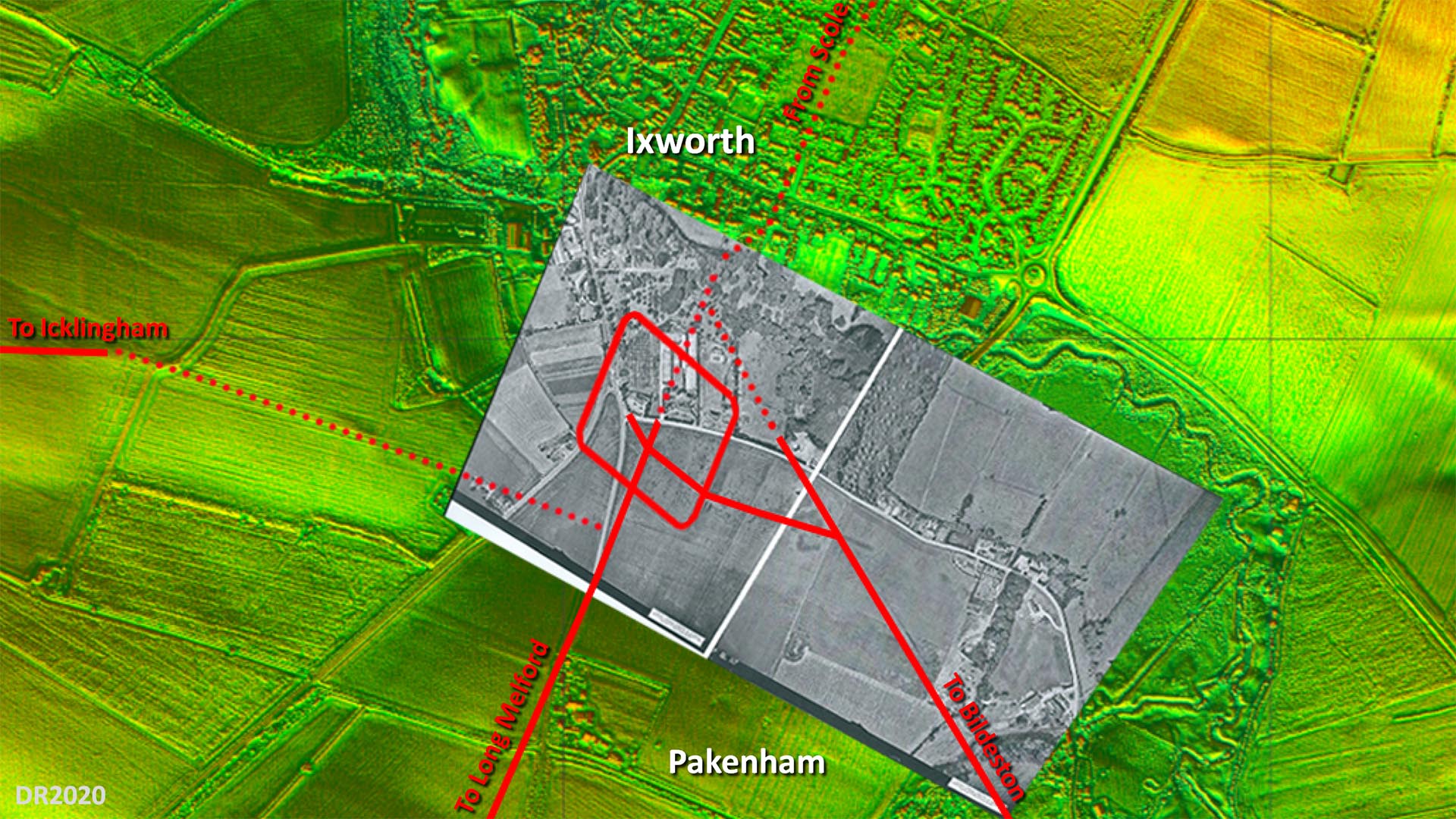
Site Plan - Lidar and Aerial Image The overlaid aerial is believed to have been taken shortly after WW2 and the fort and road system shows up very clearly. Obviously long before the bypass destroyed a large part of it. The only puzzle is the connection to the road to Icklingham. Where I have shown then there is some evidence but not totally certain. The main road alignment appears to have been set out on the fort's north west gate but no trace on that course is evident so what I have shown is my best guess. The rest of the roads are more definite although across Ixworth it is a projected line. Image: The aerial photograph overlaid on the background Lidar imagery is by the Air Photography Unit, University of Cambridge (assumed out of copyright - apologies if not).
|
Click for larger view
|
 |
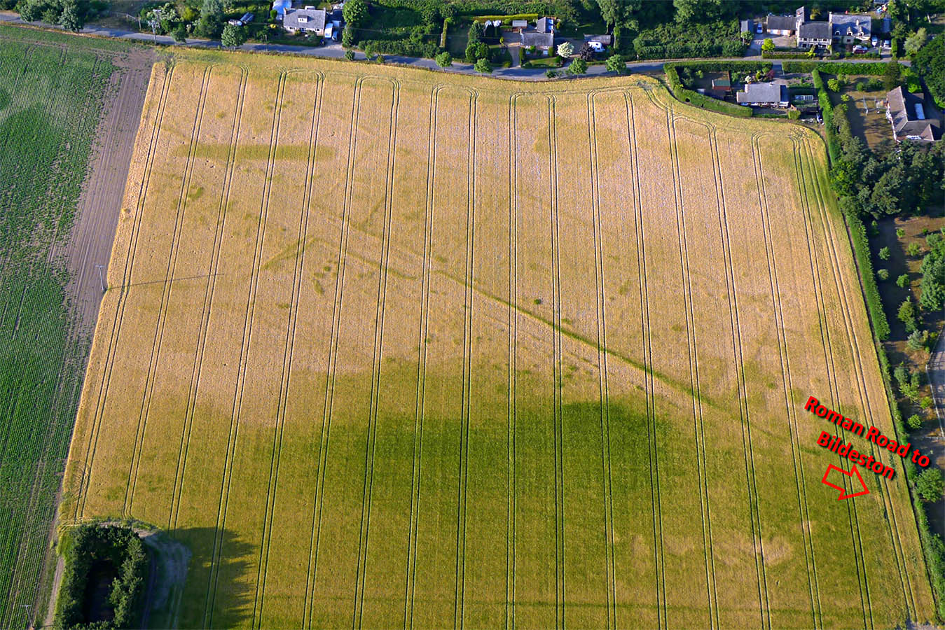
Ixworth/Pakenham Fort - Roadside Enclosures Alongside the road to Bildeston are visible Roman enclosures. The word enclosure is a catch-all term so quite what their precise function was is debatable but possibly fields? The HER describes it as a roadside settlement. Image: Steve Wilson |
Click for larger view |
 |
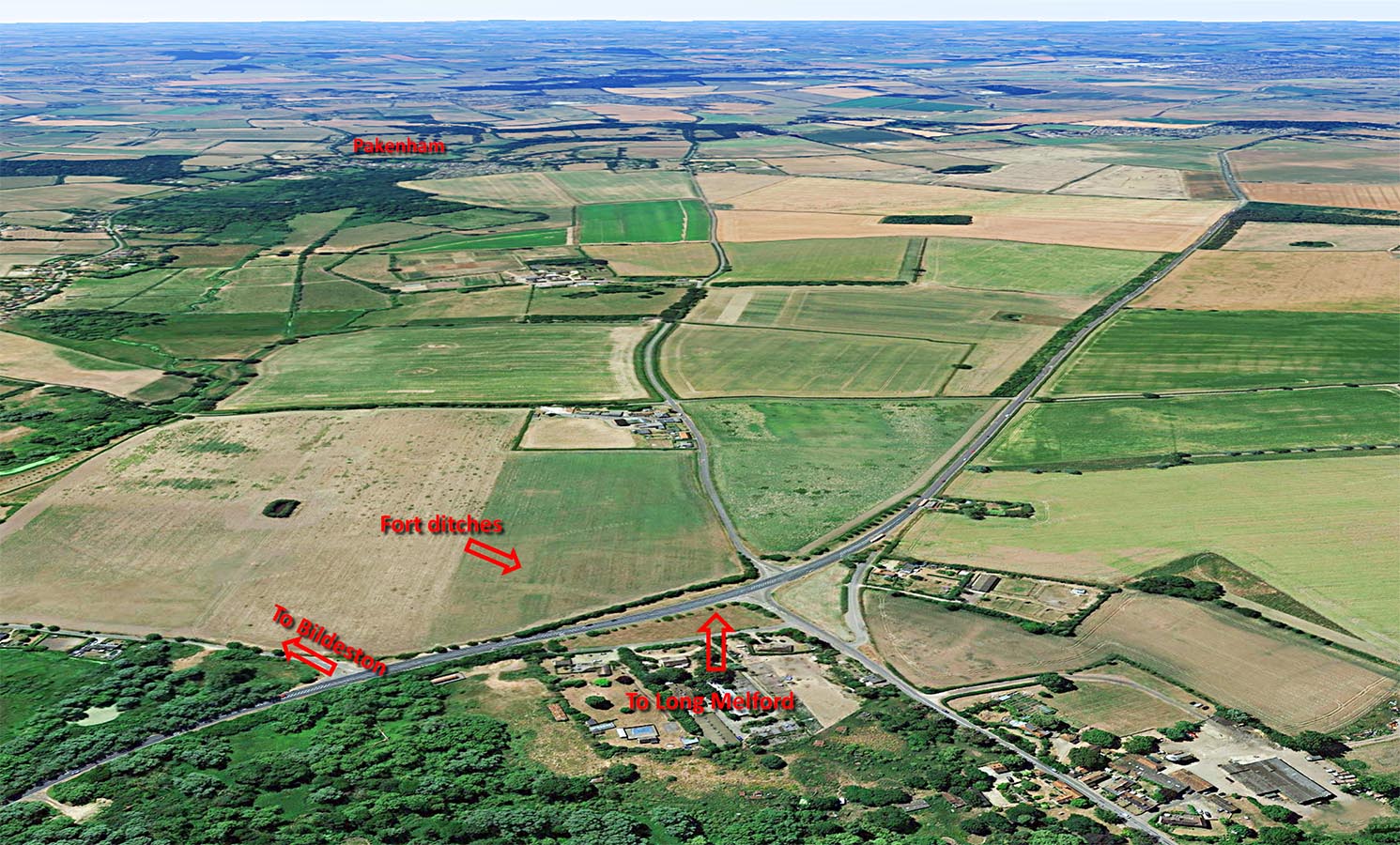
Ixworth Looking South - Google Earth In this oblique Google Earth image we are looking south from over the fort site at Ixworth. The fort ditches and our road to Bildeston are both clear. The fort didn't last long and would have been totally dismantled leaving just the outline of the ditches visible today. Accurately the fort site is in Pakenham Parish but as can be seen Pakenham, the village, is 1.5 miles away whereas Ixworth is adjacent.
|
Click for larger view |
 |
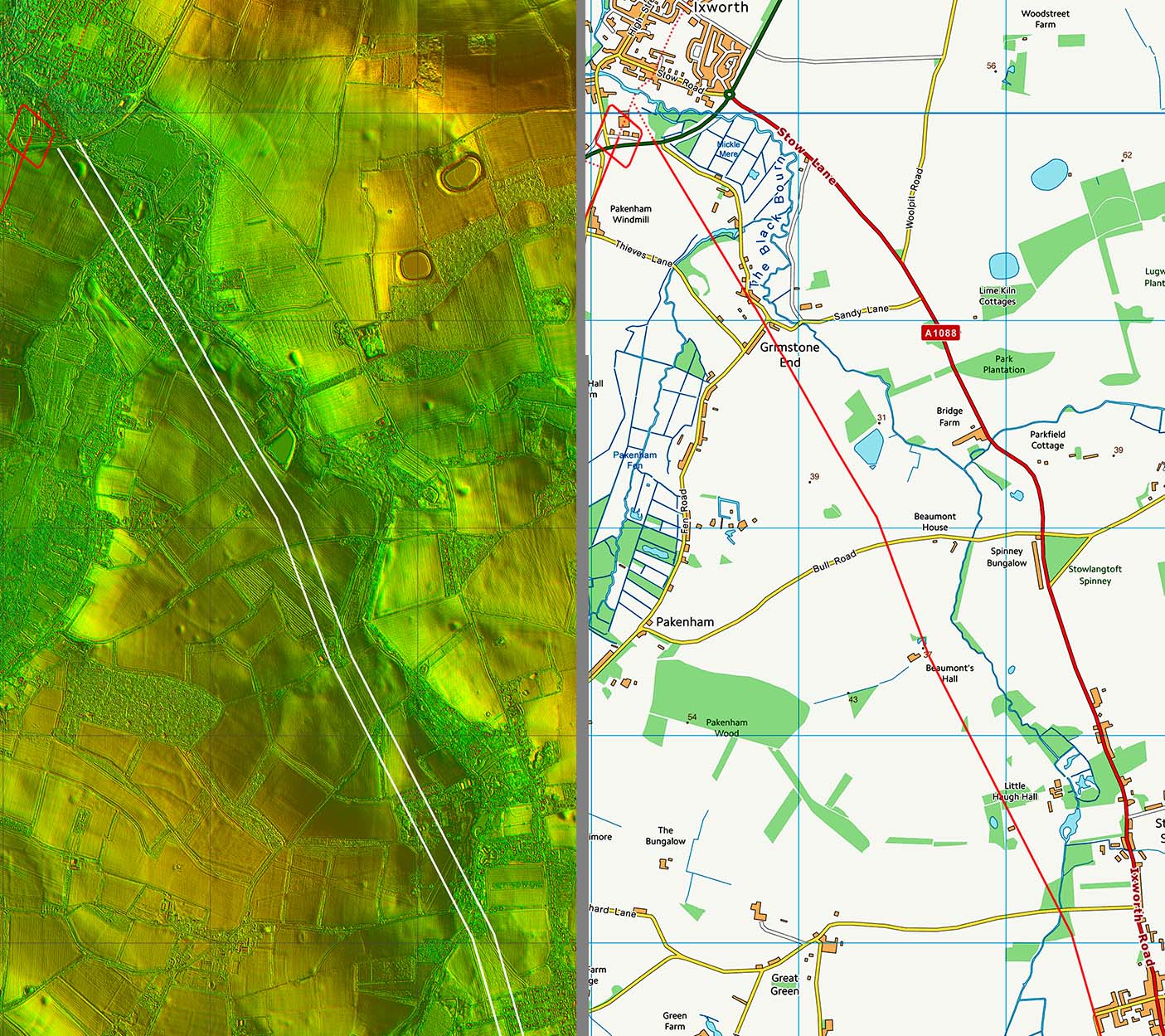
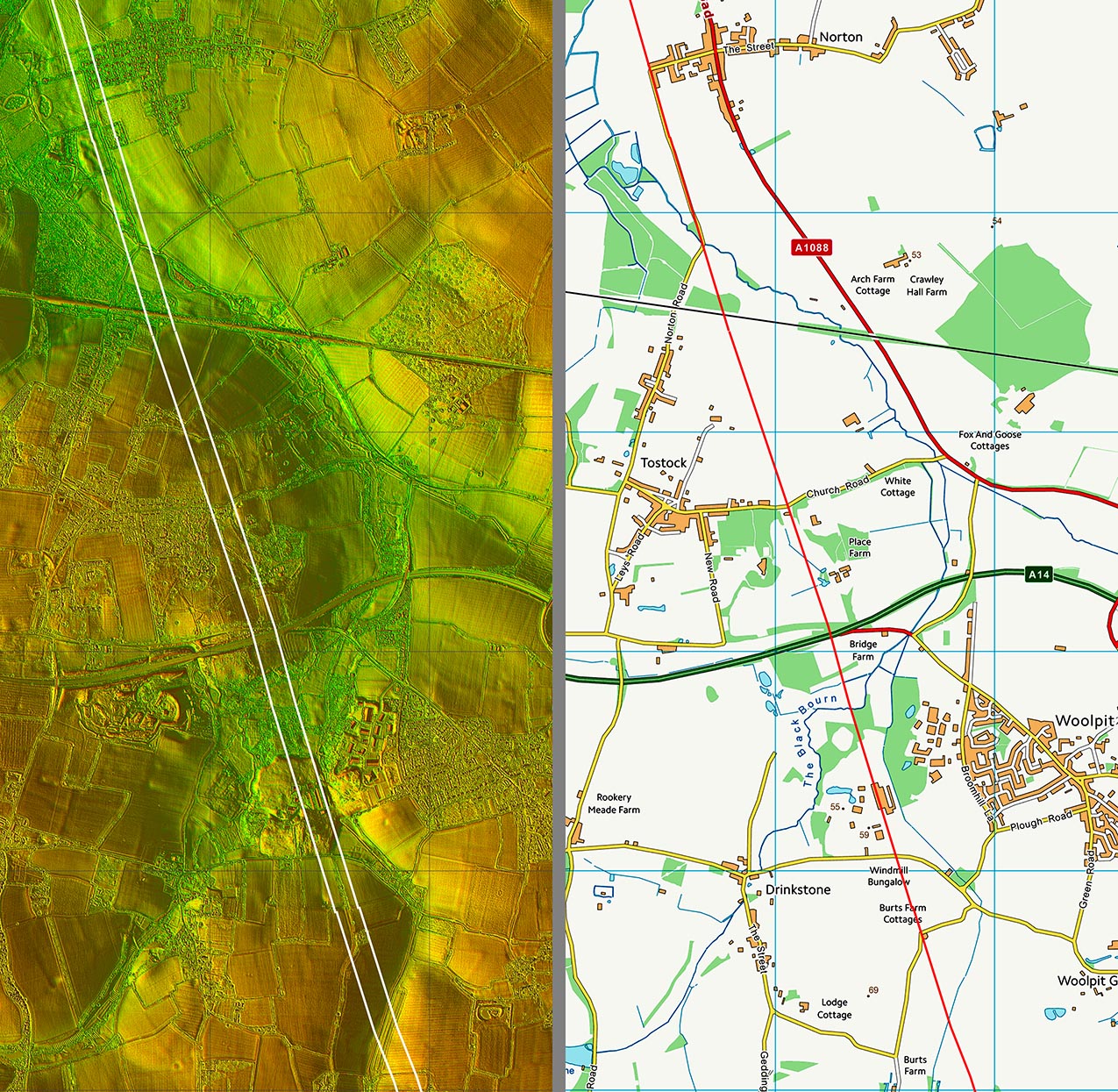
Lidar Image & Route Map 1 The initial route is almost straight and passes through the grounds of Little Haugh Hall. In then crosses the the Black Bourn (stream) north of Norton at Bridgeclose Plantation, just were a modern road now also crosses the stream. |
Click for larger view |
 |
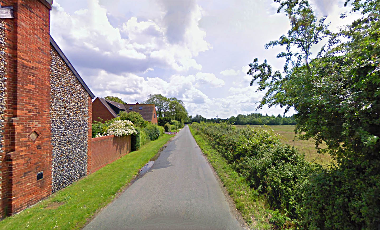
Heath Road, Norton The first real visible trace of our road is at Norton, where Heath Road marks its course. It does look Roman. Image: Google |
Click for larger view |
 |
Lidar Image & Route Map 2 Very straight alignment with enough traces in the Lidar to confirm the route. The line is west of Woolpit here. Fairclough thought there was second Roman road through Woolpit connecting directly to Peddars Way. Lidar doesn't support this - well at least to my eyes. |
Click for larger view |
 |
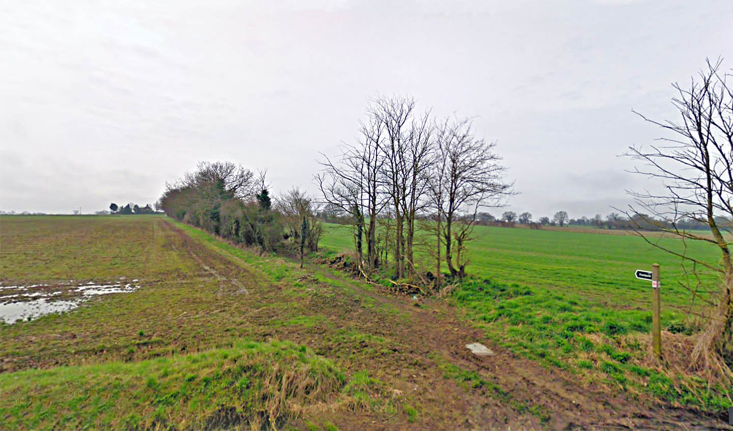
Deadman's Lane, Woolpit Wow - what a name for a Roman road! Now marked by just a footpath and a hollow-way - the Roman agger long worn away Image: Google |
Click for larger view |
 |
Lidar Image & Route Map 3 School Road, Rattlesden, is the line of the road - see next image. Beyond Rattlesden is the hamlet of Poy Street - obviously named after the road but the village is slightly off line with the Roman road a couple of hundred metres to its west.. |
Click for larger view |
 |
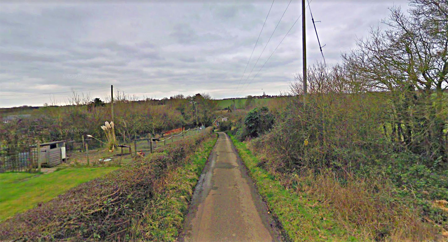
School Road, Rattlesden At first glance it doesn't look Roman but closer inspection shows a wide distance between hedges. The hedge on the right (west) is well back from the modern road. The road was clearly much wider in the past. Image: Google |
Click for larger view |
 |
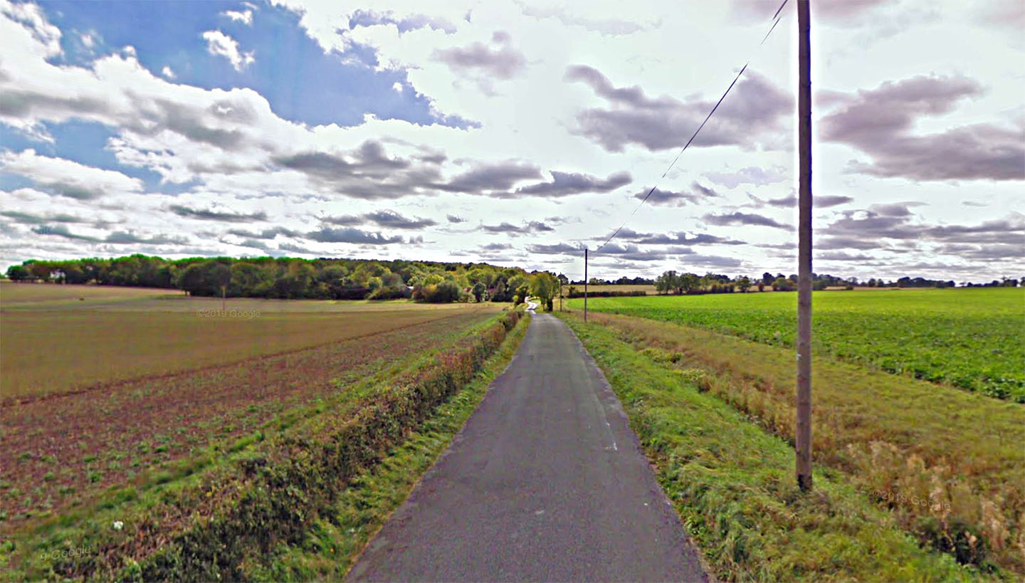
Brettenham Road This is heading south down the most obvious of Roman roads stretches. The name Brettenham, village of the Britains, is an interesting name. We are looking towards Pie Hatch Farm here. Parish boundaries follow the road for around 3 km. Image: Google |
Click for larger view |
 |
Lidar Image & Route Map 4 The best surviving section of the whole road with a modern lane following the Roman line passing Pie Hatch Farm. |
Click for larger view |
 |
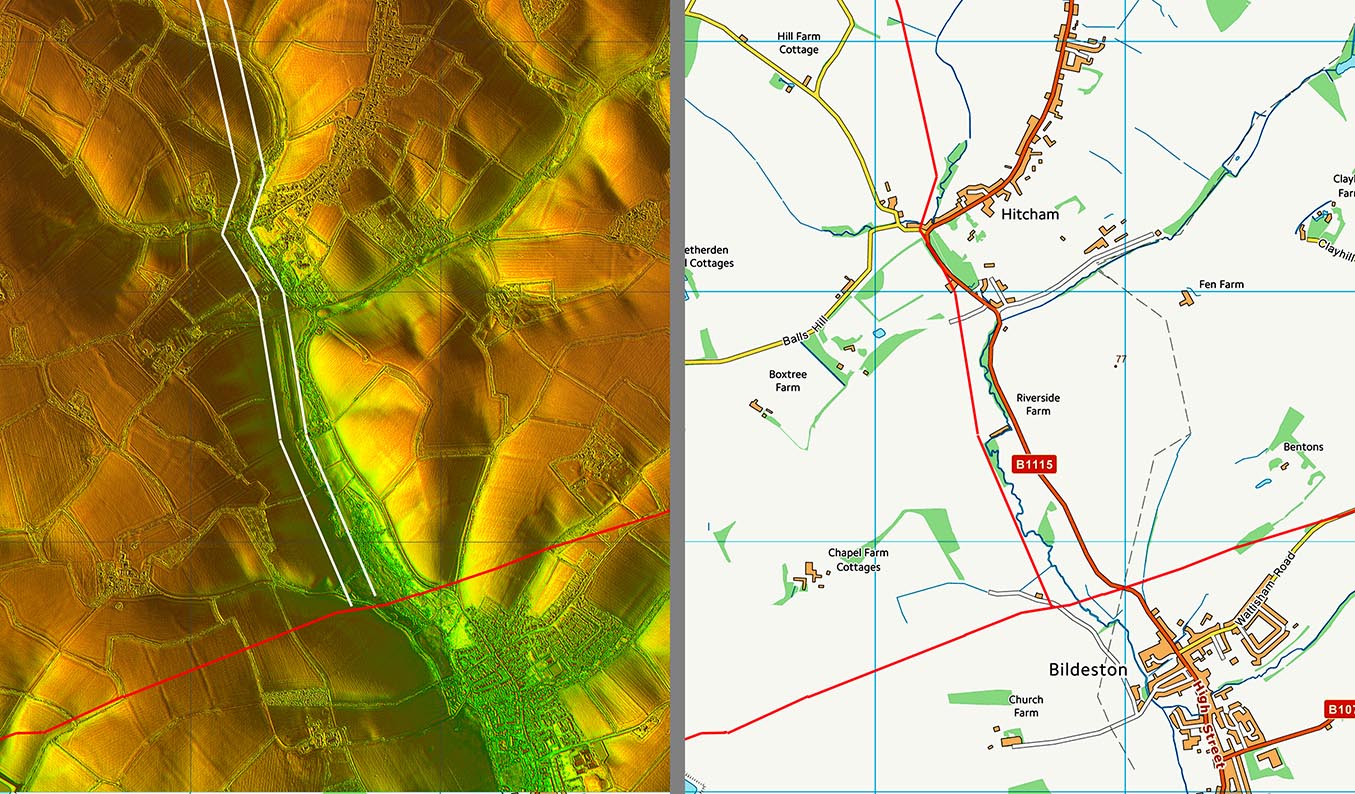
Lidar Image & Route Map 5 Final length to join up with Margary 34a at Bildeston. I am confident of the route to Hitcham but somewhat less so south of it - see 3D lidar below. |
Click for larger view |
 |
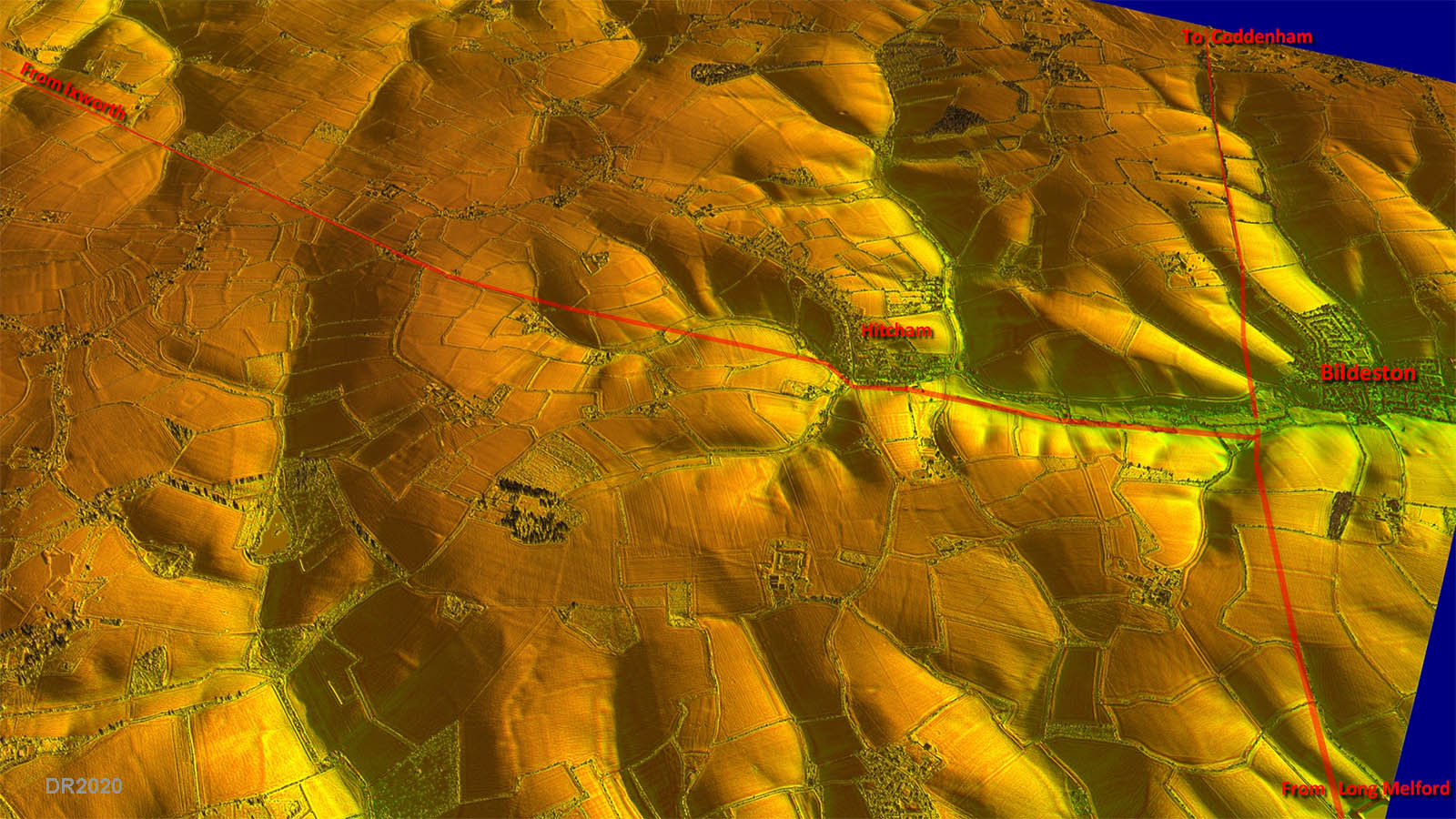
Oblique 3D Lidar Image - Bildeston The route to Hitcham is beyond dispute but the actual course the road took down to the junction at Bildeston is not so certain. I have shown it west of the stream as there appears to be a large agger there but it could have followed more on the line of the modern road. |
Click for larger view |
 |
|
|
|
Last update: May 2020 |
© David Ratledge |