
|
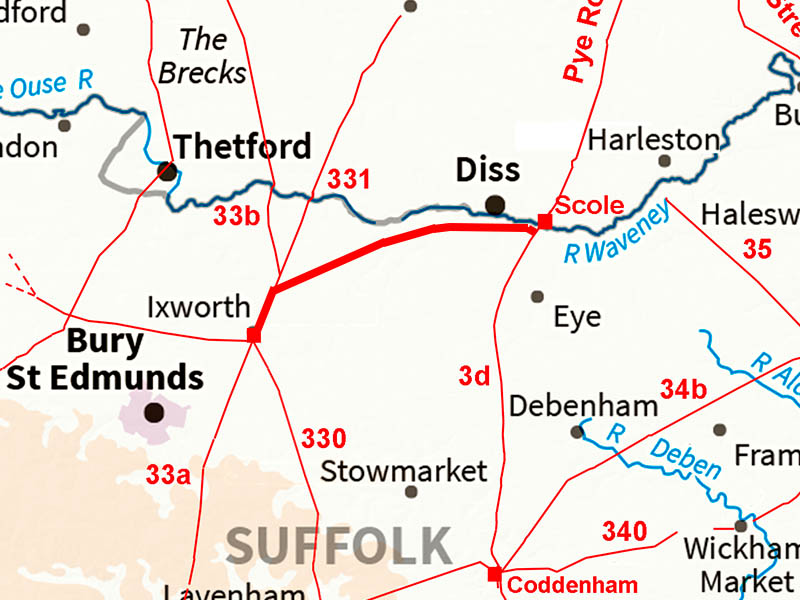
Ixworth to ScoleMargary Number: NoneDistance: 15.75 miles (Ixworth to Scole)Ixworth and Scole were substantial Roman settlements or small towns so a link between them was to be expected. This previously unknown road was to play a big part in solving the location of the lost Roman town of Sitomagus -its existence solved the puzzle. See separate section on Iter IX. This road shares the route out of Ixworth with Peddars Way and Margary 331. In reality it begins at Bardwell where it branches off and heads for Scole or rather just south of Scole on the Pye (Roman) Road. NEW 3D Lidar video from Ixworth to Scole - see link at the bottom |
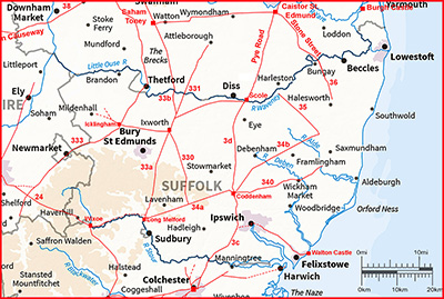
Historic Counties: Suffolk Current Counties: Suffolk HER: Suffolk
|
|
|
|
|
|
Full Route - Lidar and Aerial Image Very simple solution to get between the two Roman settlements. Use part of the existing Peddars Way then head off to just south of the bridge over the Waveney at Scole. |
Click for larger view |
 |
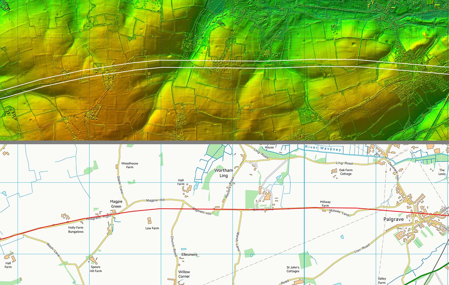
Lidar Image & Route Map 1 The initial route is shared with Peddars Way and Margary 331. It really begins at Bardwell. For the common section see either Peddars Way or Margary 331. |
Click for larger view |
 |
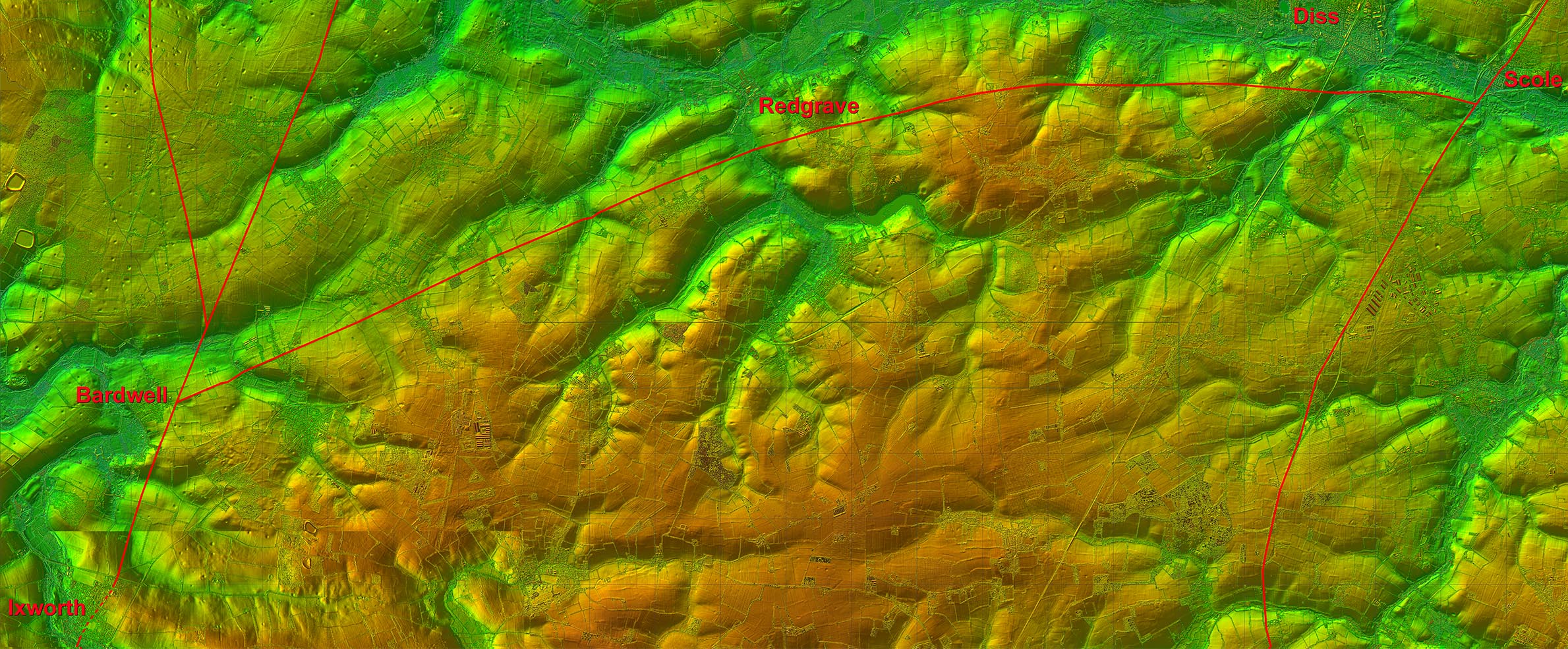
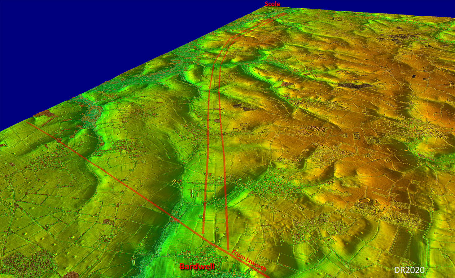
Oblique 3D Lidar Image - Bardwell to Scole Not the straightest of routes but in this 3D view you can see why they took the course they did. Dead straight would have ended up fighting the contours of those valleys so they kept to the north (left) of them. This was the view where I first spotted this road. |
Click for larger view |
 |
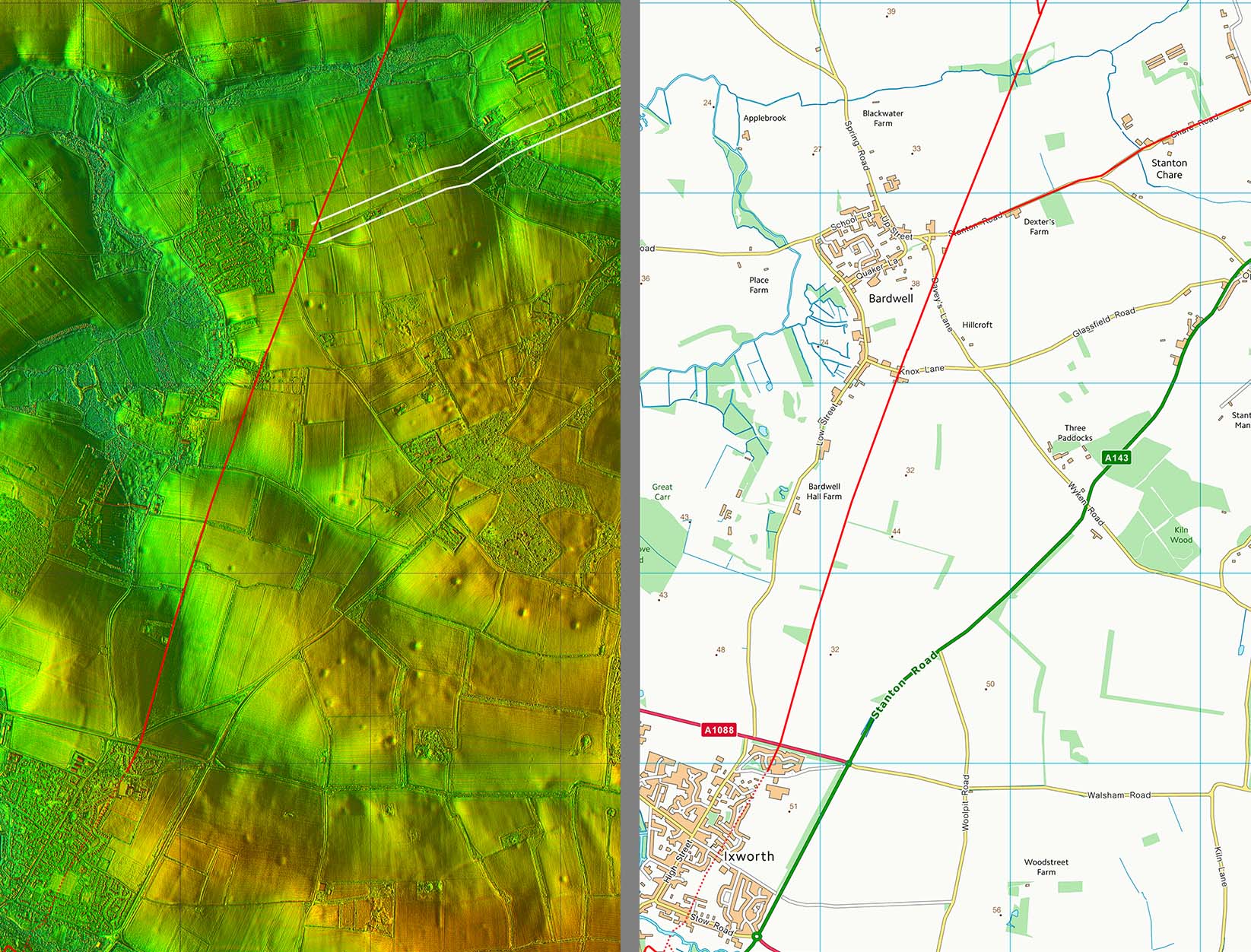
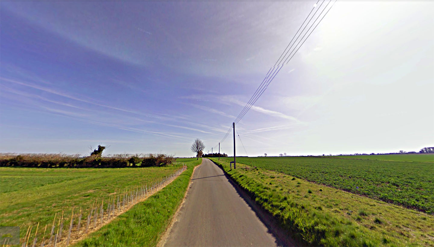
The Start of the Roman Road - Stanton Road, Bardwell Peddars Way & Margary 331 passes diagonally across the modern road here and our road to Scole begins at this spot. It does look Roman doesn't it! We are looking towards Scole with Bardwell Village behind us. Image: Google |
Click for larger view |
 |
Lidar Image & Route Map 2 Probably the best surviving stretch of this road. Further on it suffers from more modern disturbance. |
Click for larger view |
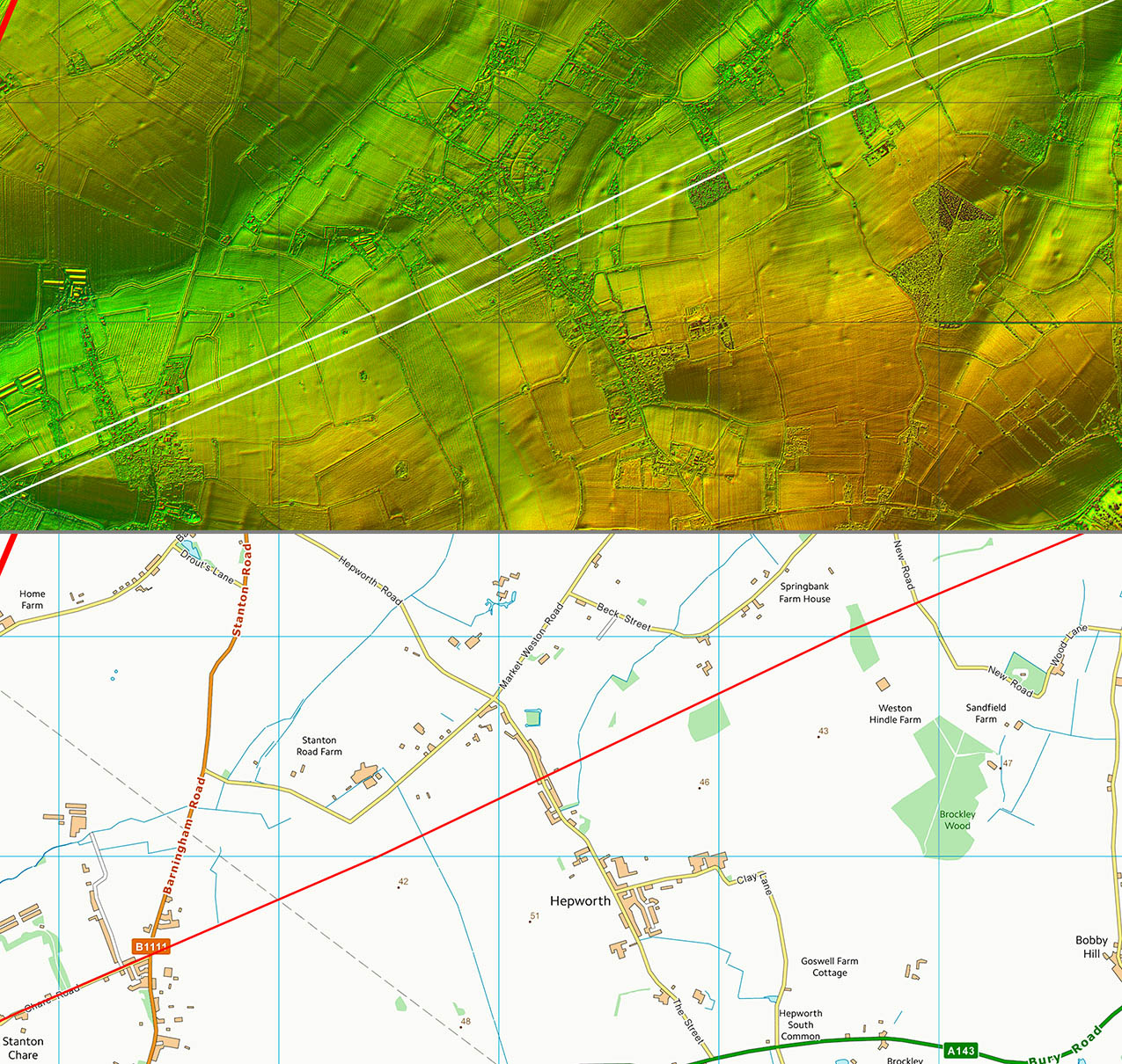 |
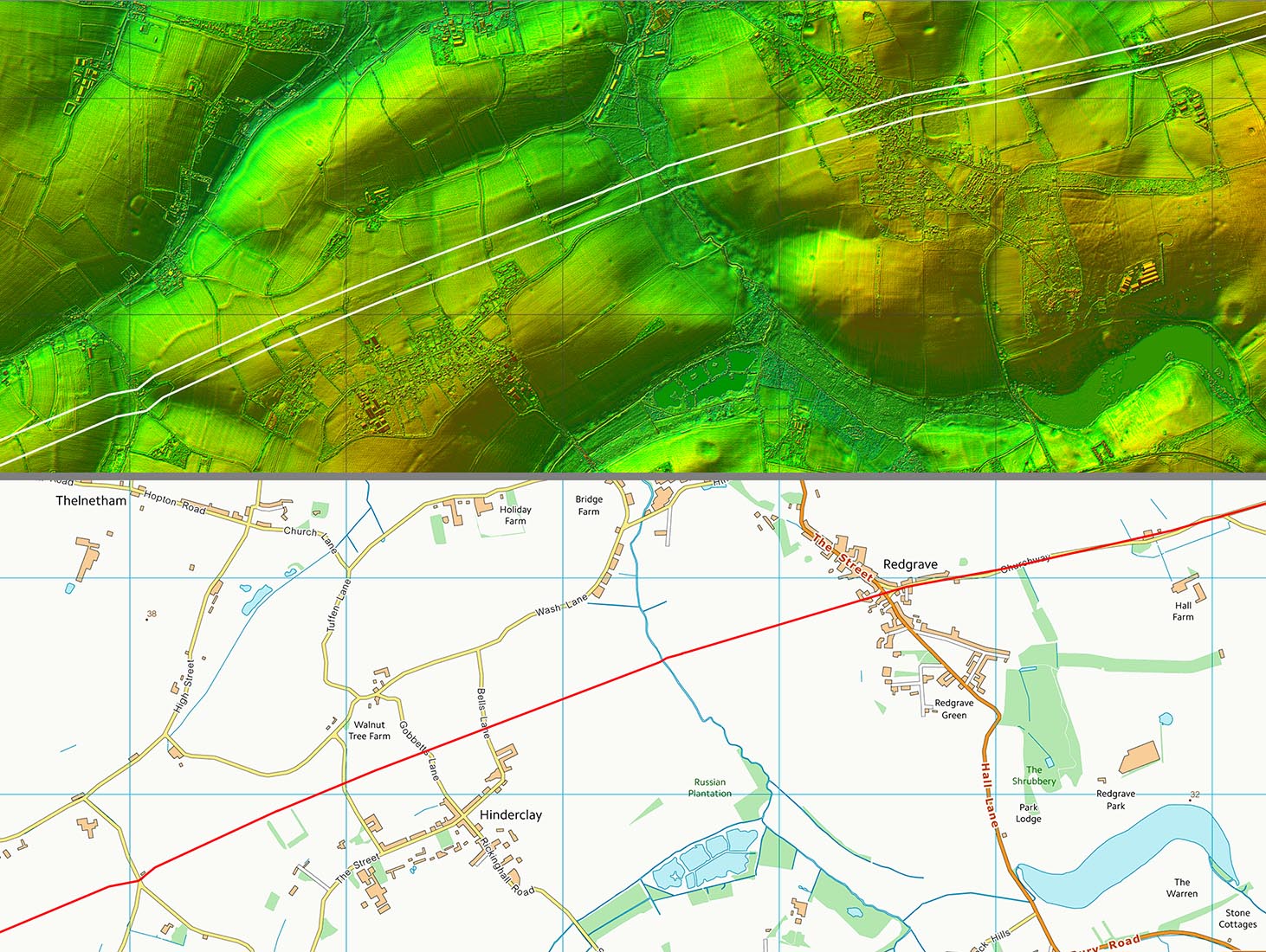
Lidar Image & Route Map 3 The Roman line bypasses Hinderclay to its north but goes straight through Redgrave's village green |
Click for larger view |
 |
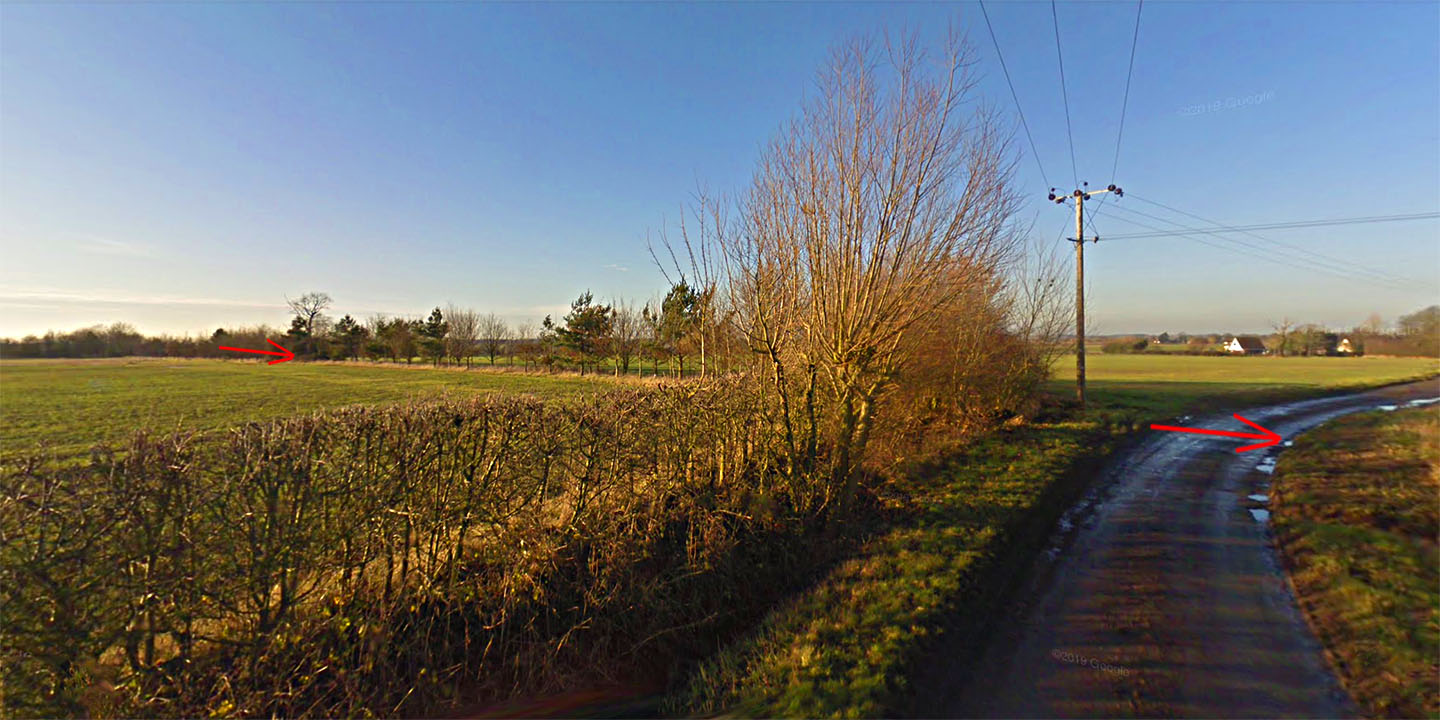
Chapel Road, Hinderclay The hedgeline to the left (west) of Chapel Road marks the line. A modern footpath follows the Roman road on the other side of the hedge. Image: Google |
Click for larger view |
 |
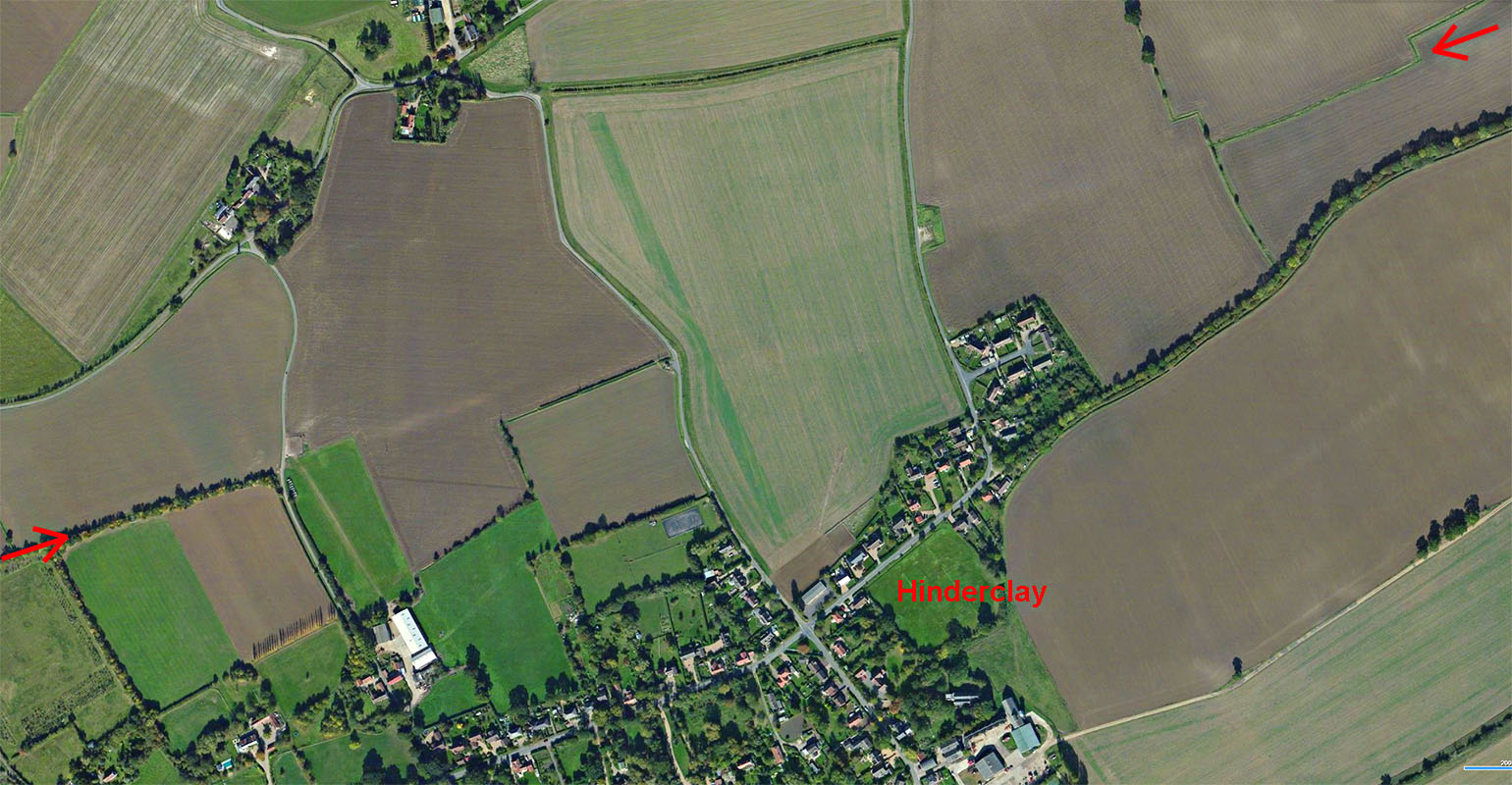
Google Earth - Hinderclay The route is obvious in this Google Earth aerial passing to the north of Hinderclay. The modern road through Hinderclay is called The Street but is not the Roman line. Image: Google |
Click for larger view |
 |
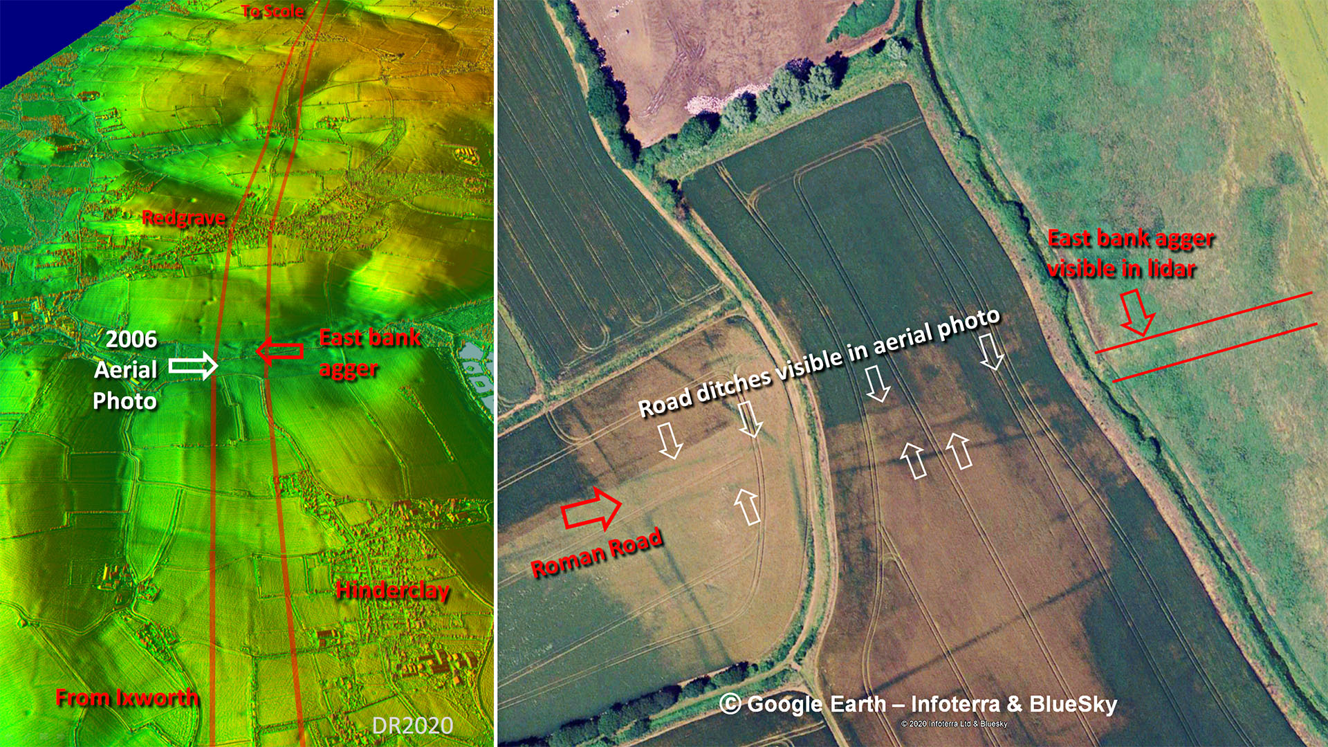
Stream Crossing between Hinderclay & Redgrave - 3D Lidar & Google Earth Aerial Between Hinderclay and Redgrave the road crosses a stream (Crackthorn Stream?). On the east bank Lidar shows a very clear and pronounced agger. On the west bank however there is little trace - the road presumably ploughed away. However, whilst it is easy to remove a built up agger it is harder to remove the ditches, which appear to have survived. They match the road alignment exactly so there can be little doubt they are Roman. |
Click for larger view |
 |
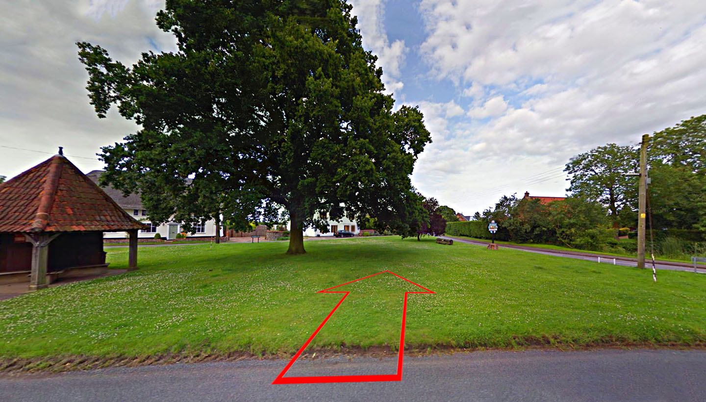
Redgrave Village Green The Roman road crosses Redgrave village green and heads on down the lane passing the Church. Image: Google |
Click for larger view |
 |
Lidar Image & Route Map 4 The road starts to subtly change direction to head for the Pye Roman road and its bridge over the River Waveney. |
Click for larger view |
 |
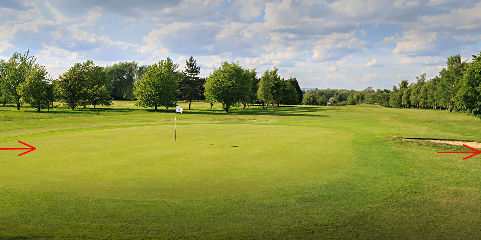
Diss Golf Course The route crosses the second fairway and the first green - shown right. It looks to have survived best on the second fairway beyond the tee but I couldn't find a picture of that spot. Any golfers like to oblige? Image: Diss Golf Course
|
Click for larger view |
 |
Lidar Image & Route Map 5 Our road must have joined the Pye Road somewhere near the modern roundabout but roadworks look to have removed all trace. It was then a short journey north to Scole over the River Waveney. |
Click for larger view |
 |
NEW 3D Lidar video from Ixworth to Scole
|
|
|
|
Last update: June 2020 |
© David Ratledge |