|
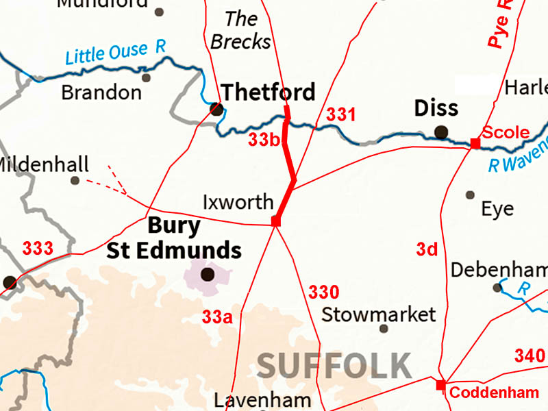
Peddars Way, Rushford Heath to IxworthMargary Number: 33bDistance: 7.5 milesMargary regarded the south to north road through Ixworth and then branching to the Wash as being all Peddars Way. In reality it looks like Peddars Way branches off road no. 331 but we will go along with his system. The north end of Peddars Way is regarded as a ferry point for crossing to Lincolnshire at Holme. We will follow the road north to south in Suffolk as that continues the route begun in Norfolk. For the rest of Peddars Way see our Norfolk section.
|
Historic Counties: Suffolk Current Counties: Suffolk HER: Suffolk
|
|
|
|
|
|
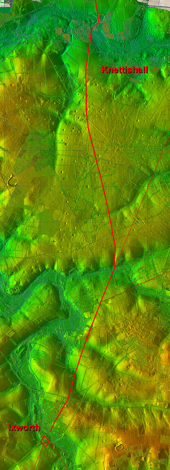
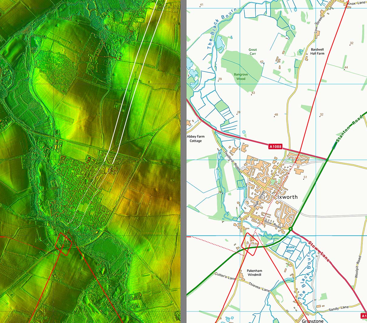
Full Route - Lidar and Aerial Image Peddars Way enters Suffolk after crossing the Little Ouse River at Rushford Heath, near Knettishall. After about 1 mile in Suffolk Peddars Way footpath leaves the Roman line. Our road then aims to join Margary 331, which surely must have been there first? There is then a common route into Ixworth. Note: some authors show Peddars Way continuing on across Margary 331 but there is no lidar evidence to support this. |
Click for larger view
|
 |
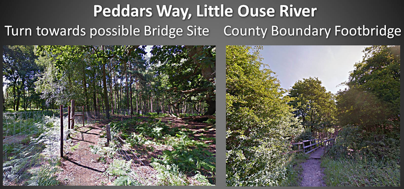
Peddars Way - Little Ouse River The left image is the end of the long alignment in Norfolk and we swing to the right for presumably the best bridging point in Roman times. In the right hand image we are on the Suffolk bank looking back towards Norfolk. Images: Google |
Click for larger view |
 |
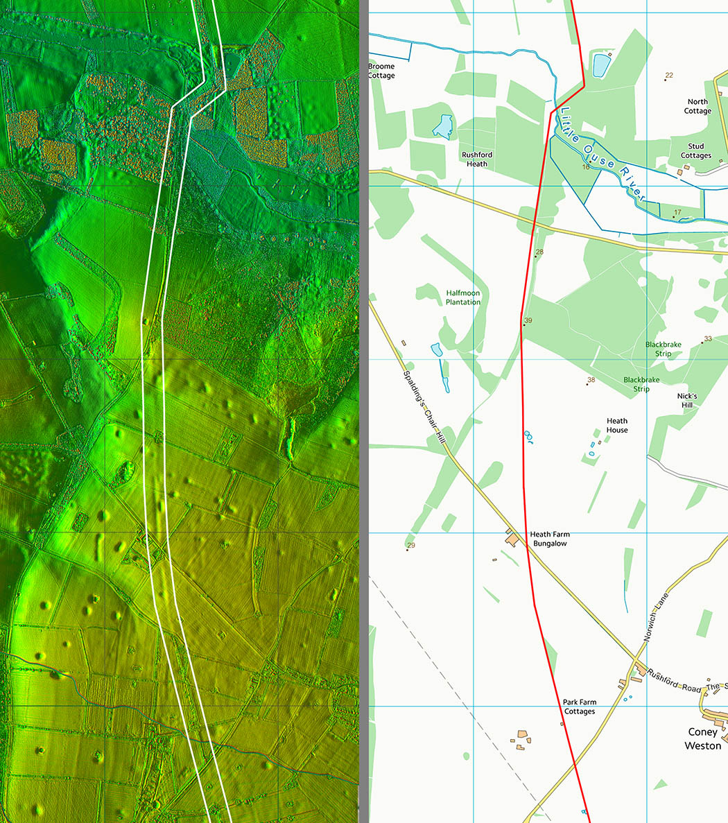
Lidar Image & Route Map 1 The stretch is clear in Lidar imagery and in aerial photographs but much harder to spot on the ground. |
Click for larger view |
 |
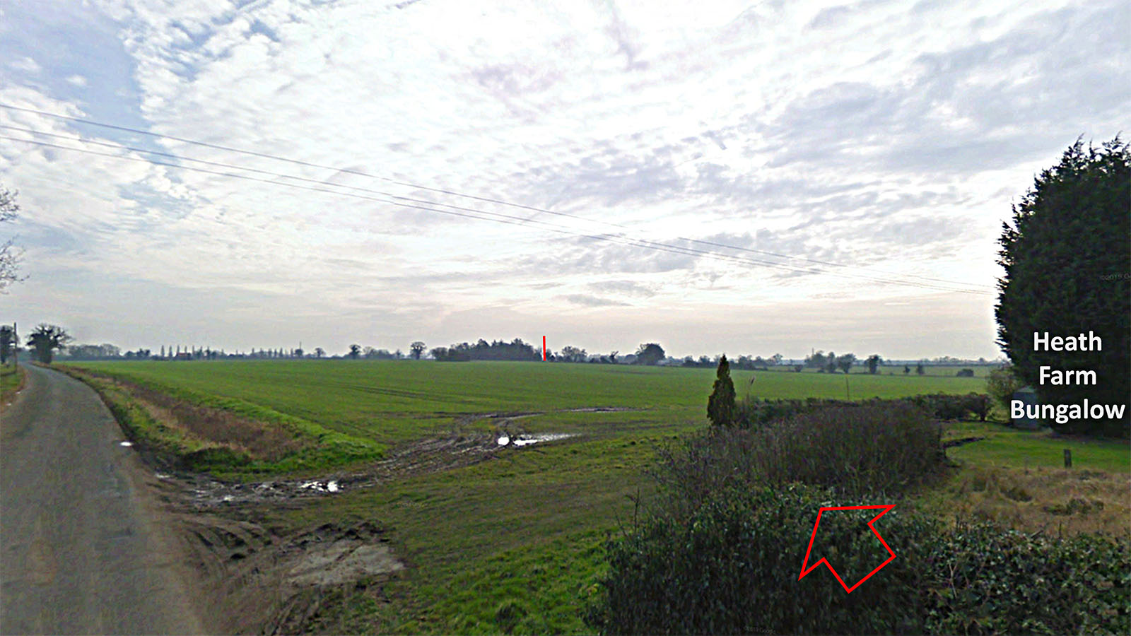
Peddars Way - Heath Farm Bungalow We are looking south down Peddars Way which passes just about through the conifer and towards the red line at the trees. Images: Google |
Click for larger view |
 |
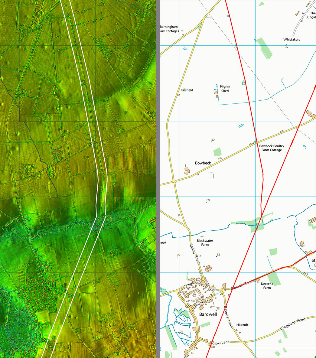
Lidar Image & Route Map 2 The junction with Margary 331 is just north of the river/stream so they would share a bridge. The Six Bells Inn in Bardwell seems in a very out of the way spot - virtually in the middle of a field. Well that is until you realise that it is alongside Peddars Way. |
Click for larger view |
 |
Lidar Image & Route Map 3 The approach to river crossing and the fort is lost in the housing of Ixworth. I have shown it carrying straight on as this aligns best with the roads on the south side of Ixworth. The fort had a short life and was replaced by a small town. The fort was a little out of square - not uncommon but hard to explain - see below. |
Click for larger view |
 |
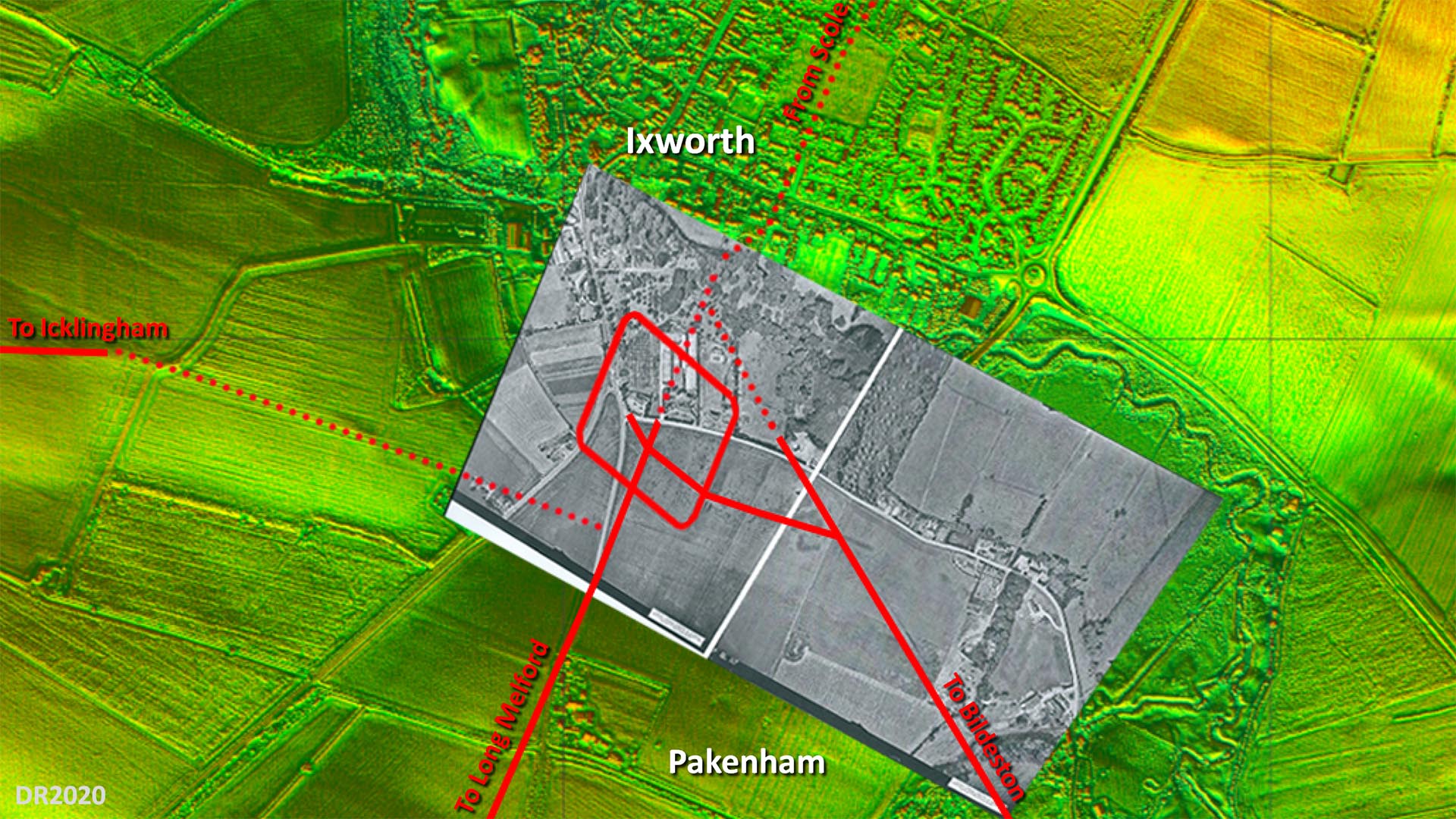
Site Plan - Lidar and Aerial Image The overlaid aerial is believed to have been taken shortly after WW2 and the fort and road system shows up very clearly. Obviously long before the bypass destroyed a large part of it. The only puzzle is the connection to the road to Icklingham. Where I have shown then there is some evidence but not totally certain. The main road alignment appears to have been set out on the fort's north west gate but no trace on that course is evident so what I have shown is my best guess. The rest of the roads are more definite although across Ixworth it is a projected line. Image: The aerial photograph overlaid on the background Lidar imagery is by the Air Photography Unit, University of Cambridge (assumed out of copyright - apologies if not). |
Click for larger view
|
 |
|
|
|
Last update: June 2020 |
© David Ratledge |