|
The Roman Road from Scole to Coddenham - The Pye RoadMargary Number: 3dDistance: 16.75 milesThis was possibly East Anglia's most important route linking Caistor St Edmund to Colchester and London. Caistor, Venta Icenorum, was the regional capital of the Iceni Tribe. Coddenham was a major road hub and the settlement there derived from early forts - 2 overlying each other. Today this road is mostly overlain by the Norwich to Ipswich main road, A140 except in a few instances such as at Yaxley, which is now bypassed. The name Pye road appears to derive from the Magpie or Pie Inn in Stonham, which was depicted on Ogilby’s 1675 road map for Ipswich to Norwich. Ogilby uses the name Pye (with a "y") in his text and this seems to have stuck.
|
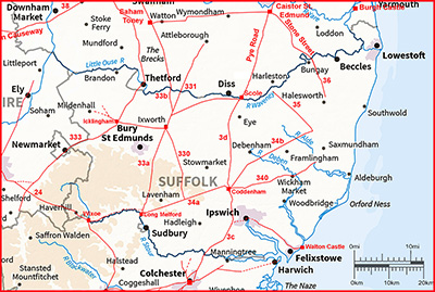
Historic Counties: Suffolk Current Counties: Suffolk HER: Suffolk
|
|
|
|
|
|
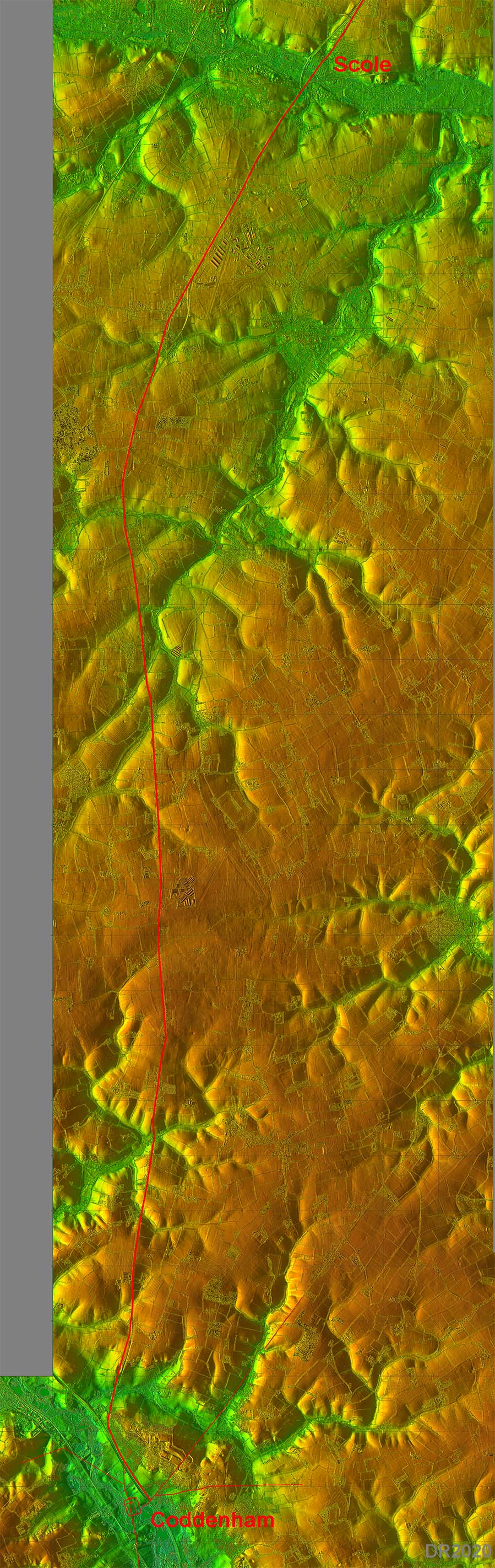
Lidar Image - Full Route From this Lidar image it is clear what a skillfully chosen route this was.It is the most practical route that keeps to high ground and avoids valley bottoms. |
Click for larger view
|
 |
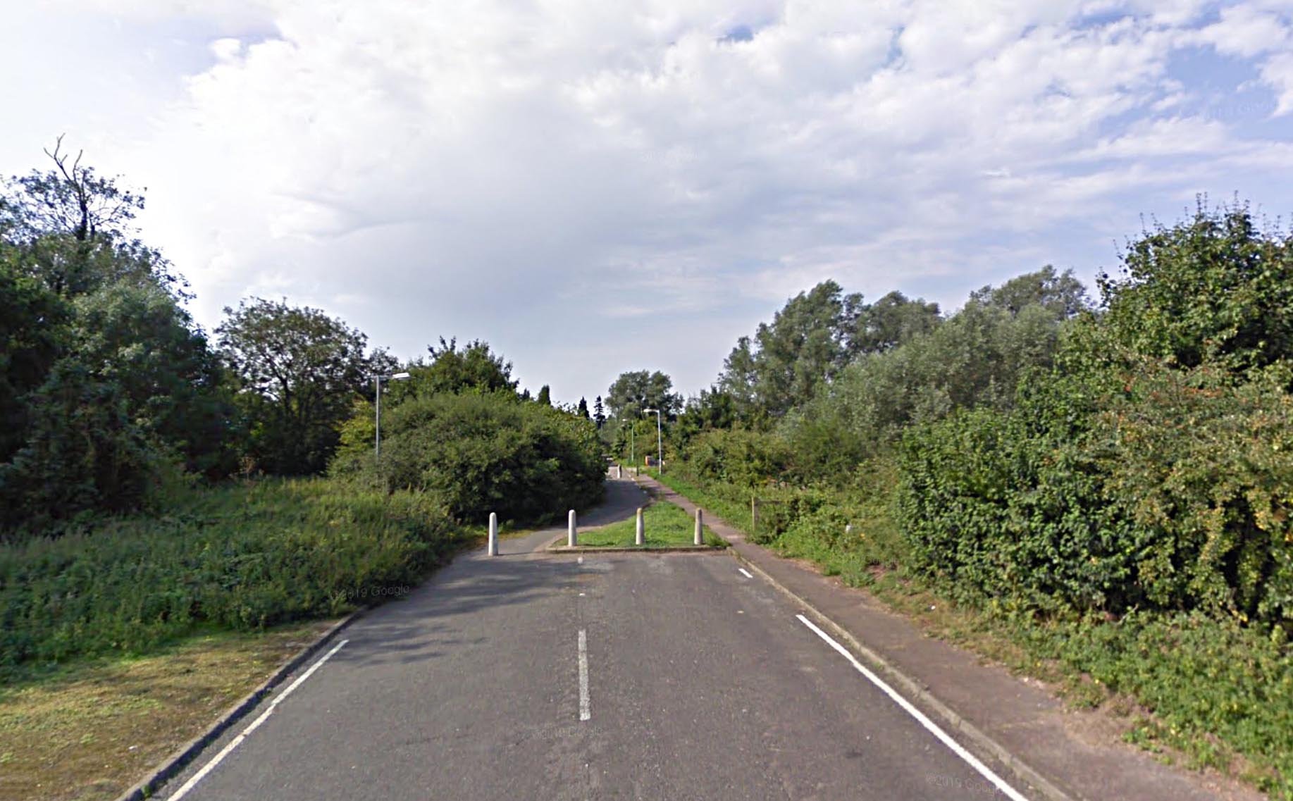
Old Road, Scole The old road, on or close to the Roman line, heading towards the Waveney Bridge, is now bypassed. The bridge is just beyond the bushes but is a modern concrete construction. |
Click for larger view |
 |
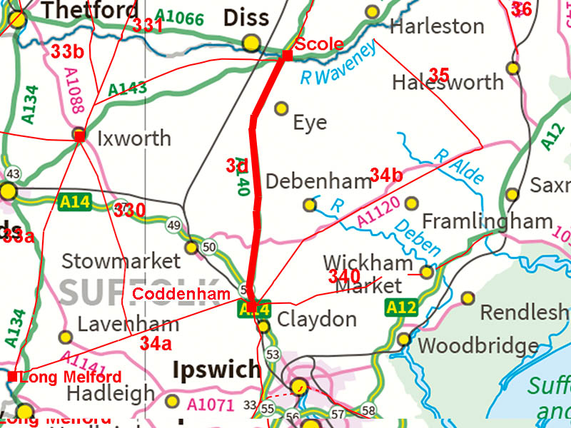
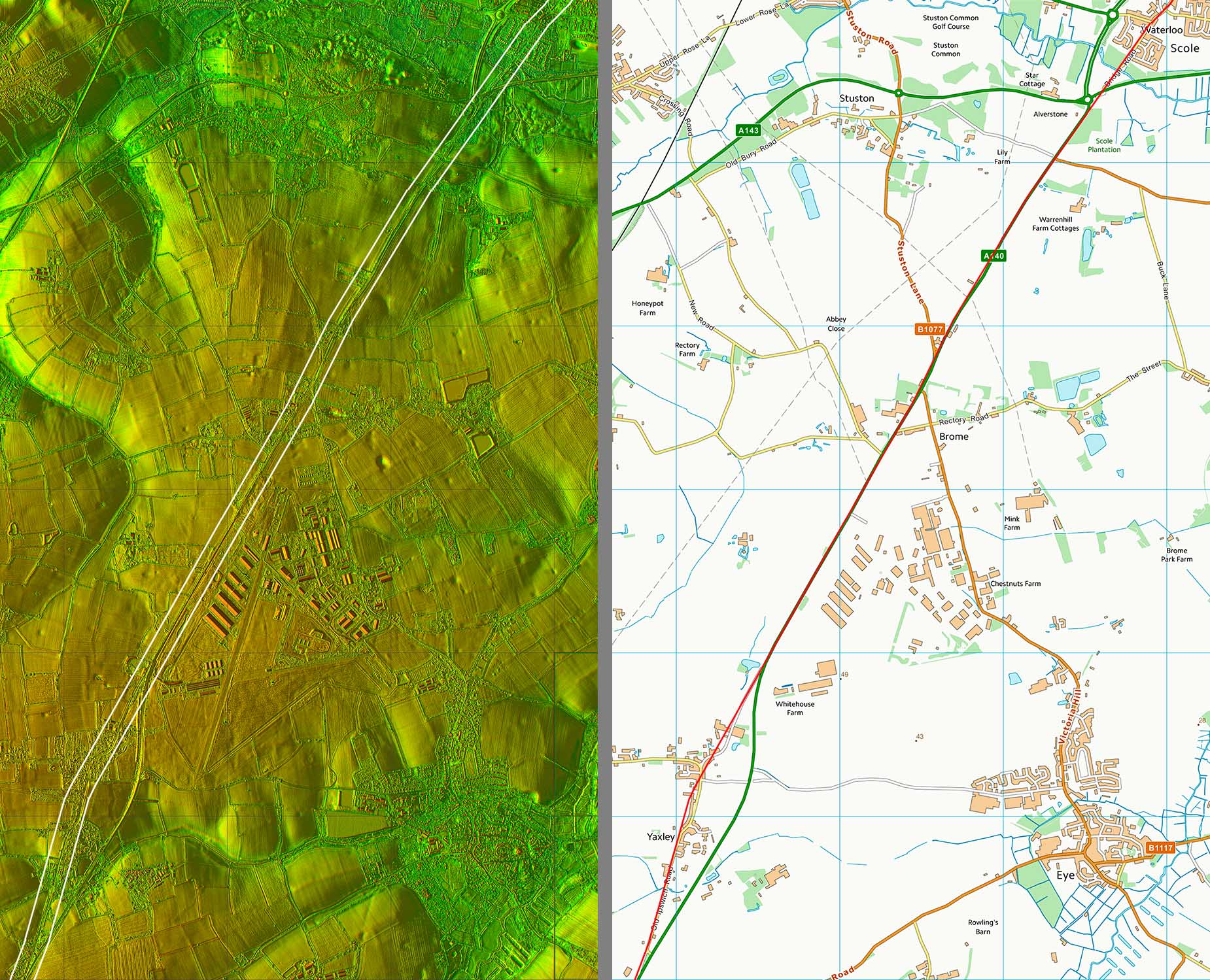
Lidar Image & Route Map 1 The road enters Suffolk at the bridge over the River Waveney at Scole. The Roman line and modern A140 coincide beyond the end of Scole Bypass until Yaxley where again a modern bypass leave the Roman route. Somewhere on the this road is Villa Faustini. This is referred to in Antonine Itinerary V as 35 miles from Colchester and 18 miles from Caistor. The total distance is correct but neither Scole or Stoke Ash (see later) match these distance. Distance errors in the Itineraries are not uncommon but with the total distance Caistor to Colchester being correct then this would be hard to explain. Measuring the distances then Brome is at the correct position - just above middle on this map..See next image. |
Click for larger view |
 |
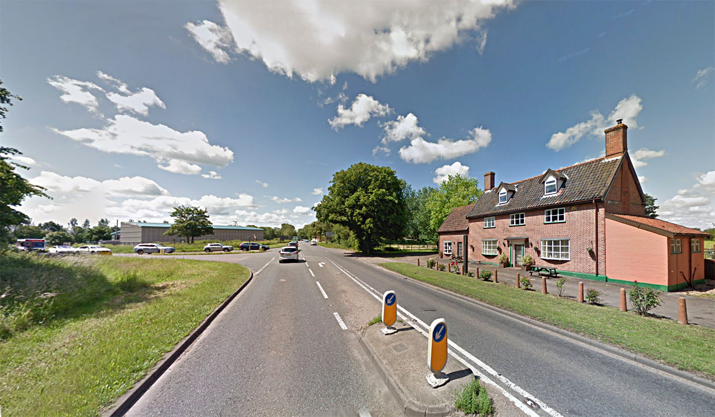
Former Swan Inn, Brome - Villa Faustini? Alongside the A140 at Brome is the former Swan Inn. This location matches the distances for that that given for Villa Faustini of Itinerary V. Doesn't look Roman but it does make a grand modern villa! The inclusion of a villa name in the itineraries is not unique but rare. Roman villas were generally in a country estate rather than roadside so still a bit of a puzzle. |
Click for larger view |
 |
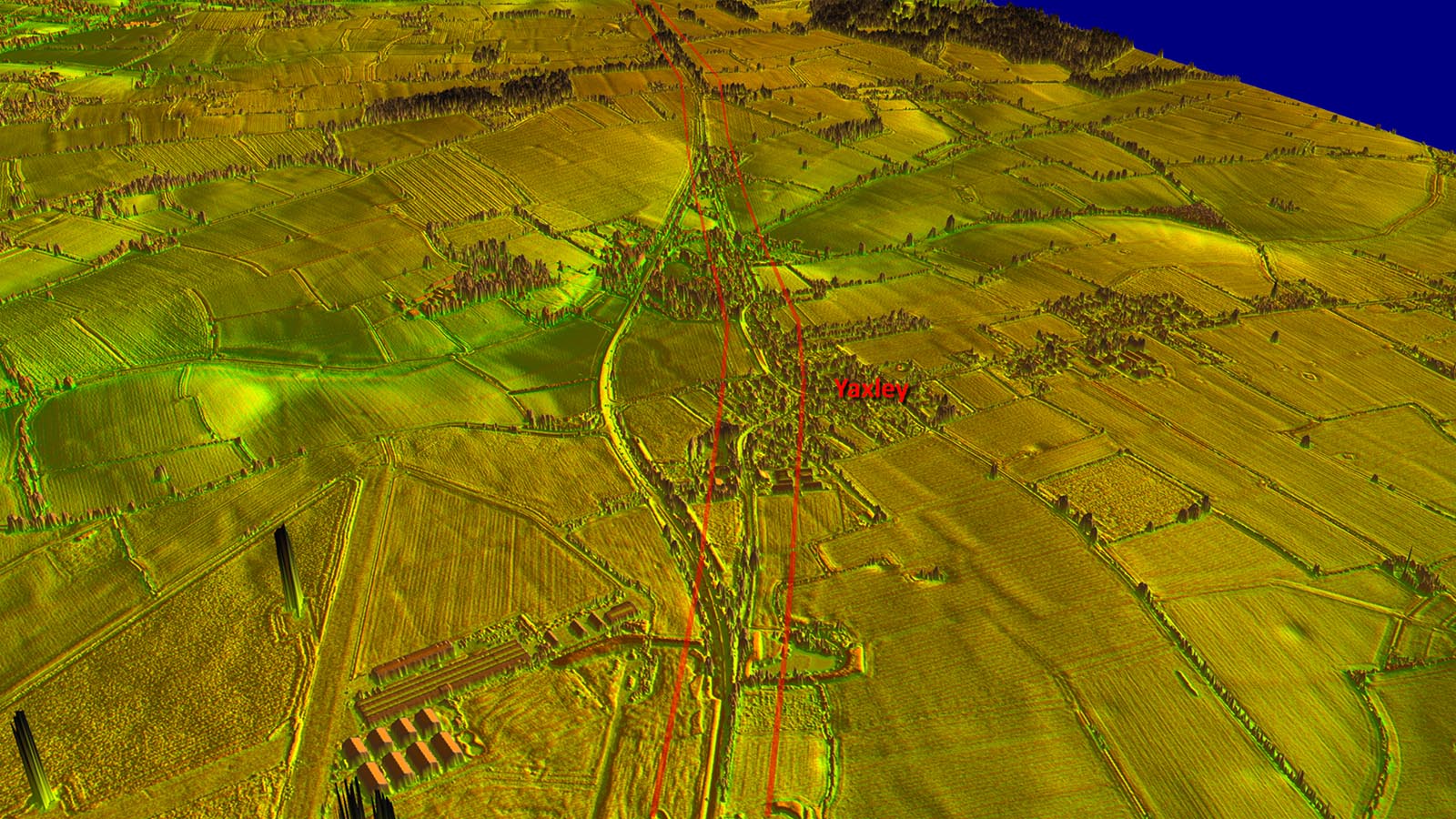
Oblique 3D Lidar Image - Yaxley The old road through Yaxley although clearly derived from the Roman alignment is far from straight. We can be reasonably certain that the actual Roman road would have straight-lined the modern bends. |
Click for larger view |
 |
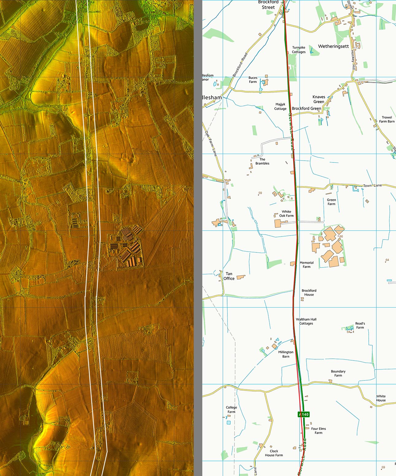
Lidar Image & Route Map 2 This is the main change of direction in this road but as can be seen it is a series of several adjustments rather than one big one. Towards the middle of this stretch is Stoke Ash. This has been suggested as one of the possible locations for Villa Faustini. A Roman roadside settlement is recorded at TM 113 709. At the bottom of this map is Brockford Street - clearly the brook ford on the street i.e. Roman road. |
Click for larger view |
 |
Lidar Image & Route Map 3 This stretch is through Stonham - another name derived from the Roman road i.e. stone ham. In Little Stonham is the famous Magpie Inn that gives this road its name - the Pye Road. |
Click for larger view |
 |
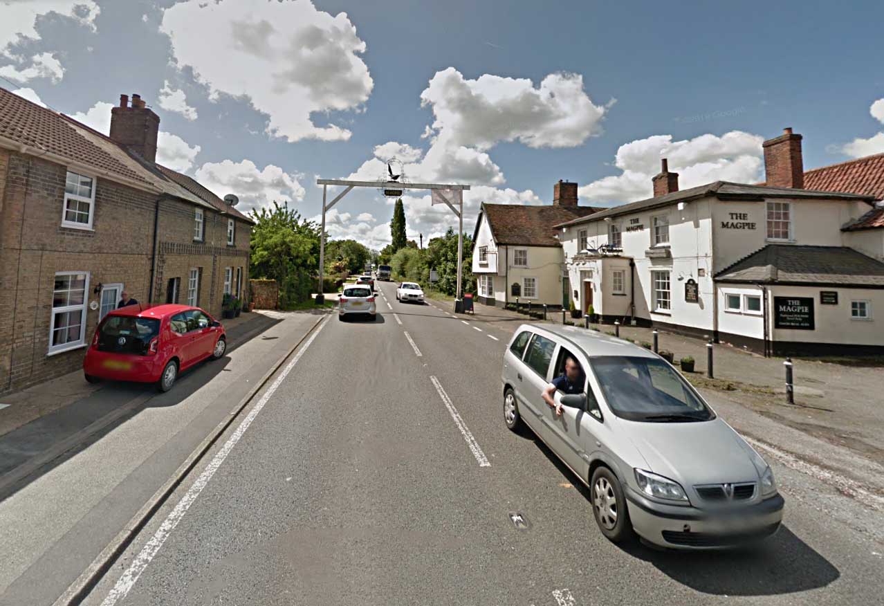
The Magpie Inn, Little Stonham Quite a unique feature advertising the Magpie Inn. You probably wouldn't be able to get away with it today but this one predates modern bureaucracy. |
Click for larger view |
 |
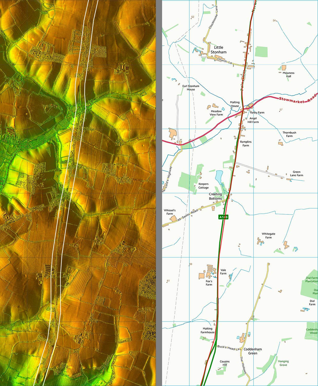
Lidar Image & Route Map 4 Generally this road has avoided valleys but at this stretch we cross a couple at Valley Farm/Angel Hill and the aptly named Creeting Bottoms. |
Click for larger view |
 |
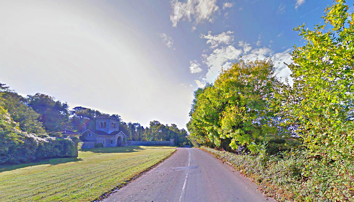
Norwich (Old) Road, Coddenham The old road is bypassed now approaching Coddenham - and much the pleasanter for it. This was almost certainly the Roman line passing Needham Lodge. Image: Google |
Click for larger view |
 |
Lidar Image & Route Map 5 The route into the fort I have shown as two roads. The one to the original forts seems to branch off a straight road that would have bypassed them. It was generally (but not always) the case that main road didn't go through the centre of forts. |
Click for larger view |
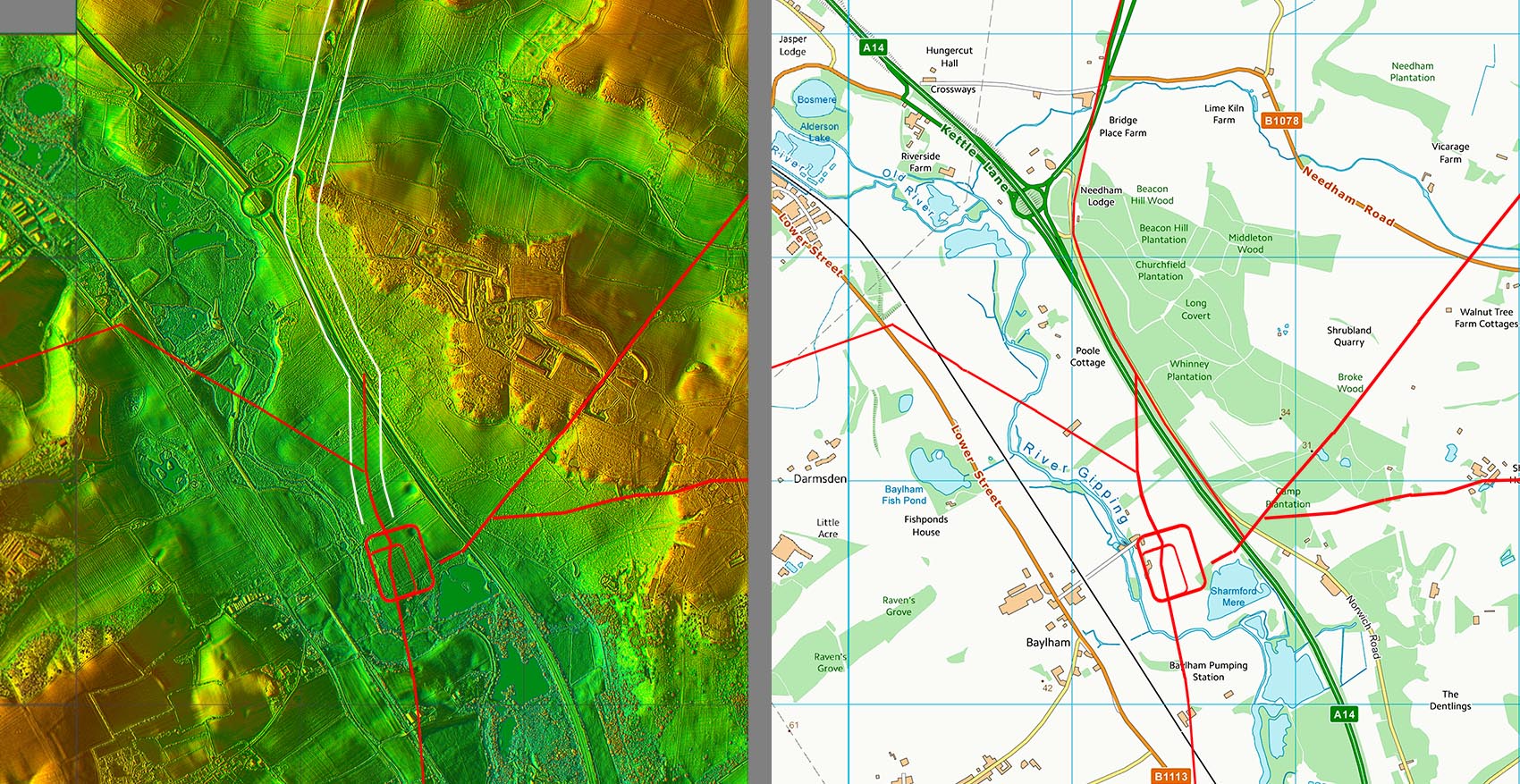 |
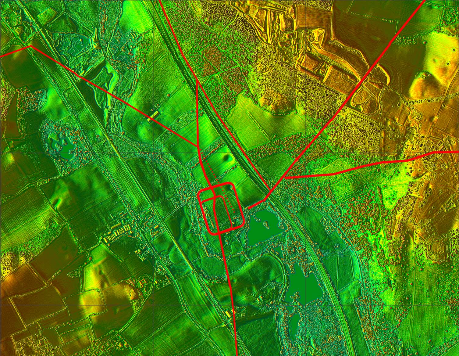
Combretovium, Coddenham - Detailed Lidar Image Combretovium was a Roman town derived from early Roman Forts. It is believed the first fort was from the invasion period and the second after the Boudiccan revolt (60/61AD). Which of the forts was the earlier is uncertain. Normally forts tended to be reduced in size over time but in this case perhaps the revolt necessitated a larger fort. The forts were very short lived and replaced as a settlement or small town as was generally the case away from the northern frontier. Combretovium means confluence - usually with regard to rivers but this is not the case here. Perhaps it refers to a confluence of roads? It certainly was an important road hub. It is suggested (ref. John Fairclough) that small boats would have been able to navigate up the Gipping to this site from Ipswich and the River Orwell. |
Click for larger view |
 |
|
|
|
Last update: June 2020 |
© David Ratledge |