|
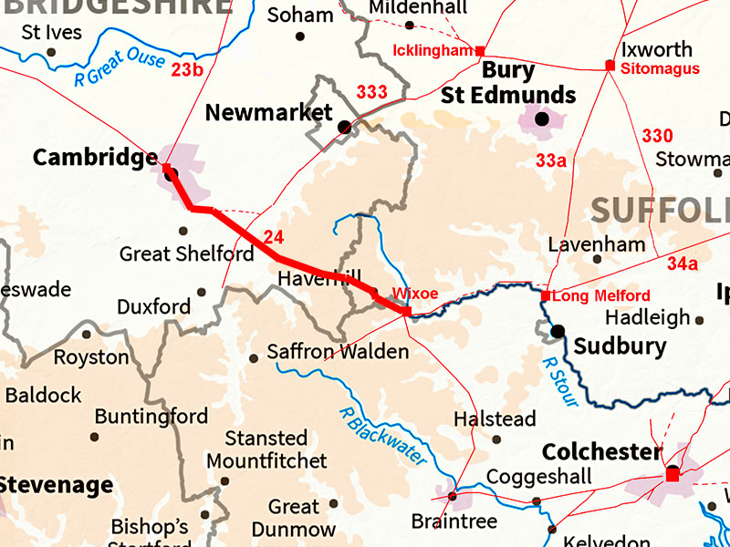
The Roman Road from Wixoe to CambridgeMargary Number: 24Distance: 20 milesThis road has several names but Worsted Street is probably the correct one. It is sometimes referred to as Via Devana but this has these days fallen out of favour. Worsted Lodge is where our road crosses the Icknield Way - or rather that route (there seem to have been at least 3) of the Icknield Way that was upgraded by the Romans. Excavations in Haverhill have revealed Romano-British activity although in Suffolk, Wixoe appears to have been the more major settlement or small town. It does also sit at the junction of at least 3 roads. Note the boundaries between Suffolk, Essex and Cambridge are complex here! |
Historic Counties: Suffolk, Essex & Cambridgeshire Current Counties: Suffolk, Essex & Cambridgeshire HER: Suffolk, Essex & Cambridgeshire
|
|
|
|
|
|
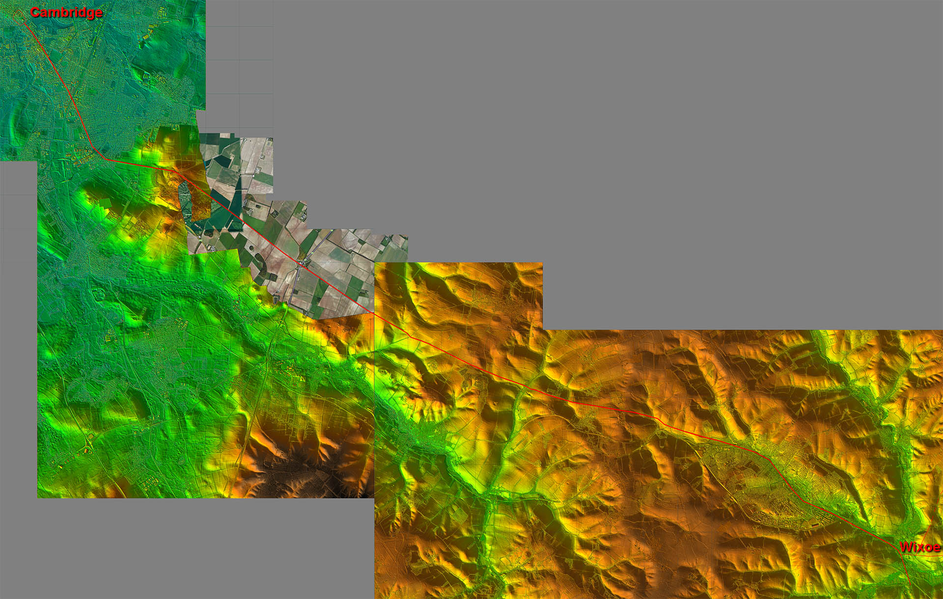
Lidar Image - Full Route The route takes a very logical course between Wixoe and Cambridge. There are a couple of deviations at Haverhill and at the Gog Magog Hills but these are logical adaptations to the topology. The Cambridge one clearly avoids low (marshy?) ground.
|
Click for larger view
|
 |
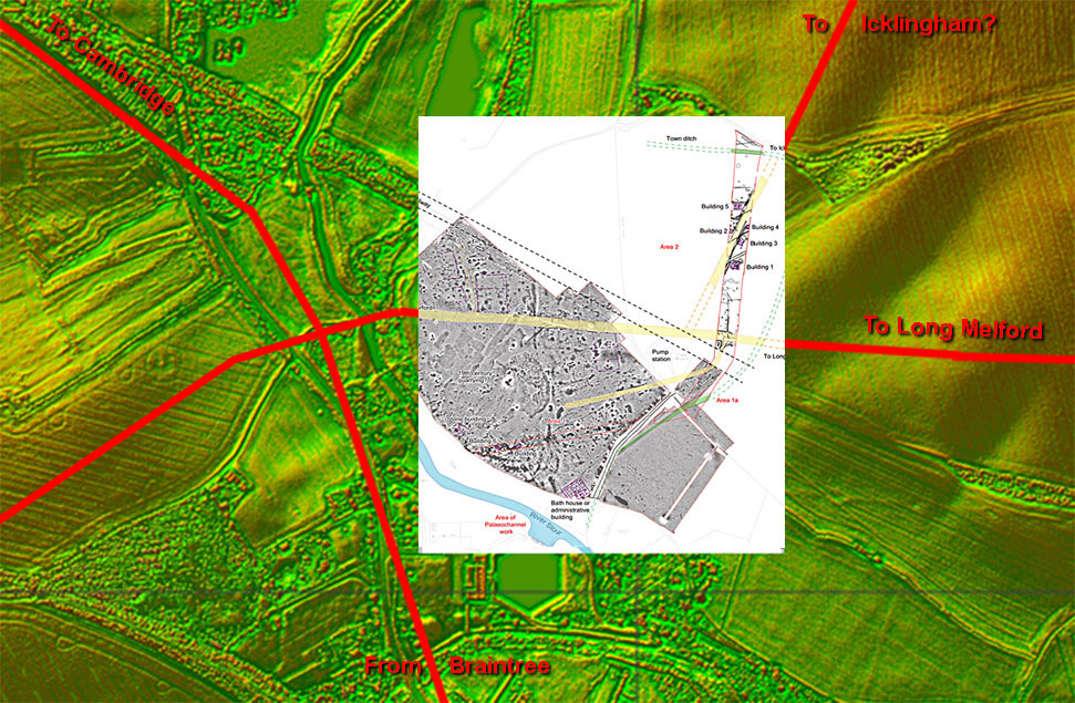
Wixoe Roman Site - Lidar Image & Oxford Archaeology Site Plan Thanks to a pipeline being laid across Wixoe we have an excellent site map of this small town. At least one high status building was recorded together with the road system (shown in yellow). These tie in with what is visible in the Lidar imagery. Ref: Excavations at Wixoe Roman Town, Rob Atkins, Oxford Archaeology, 2012 |
Click for larger view |
 |
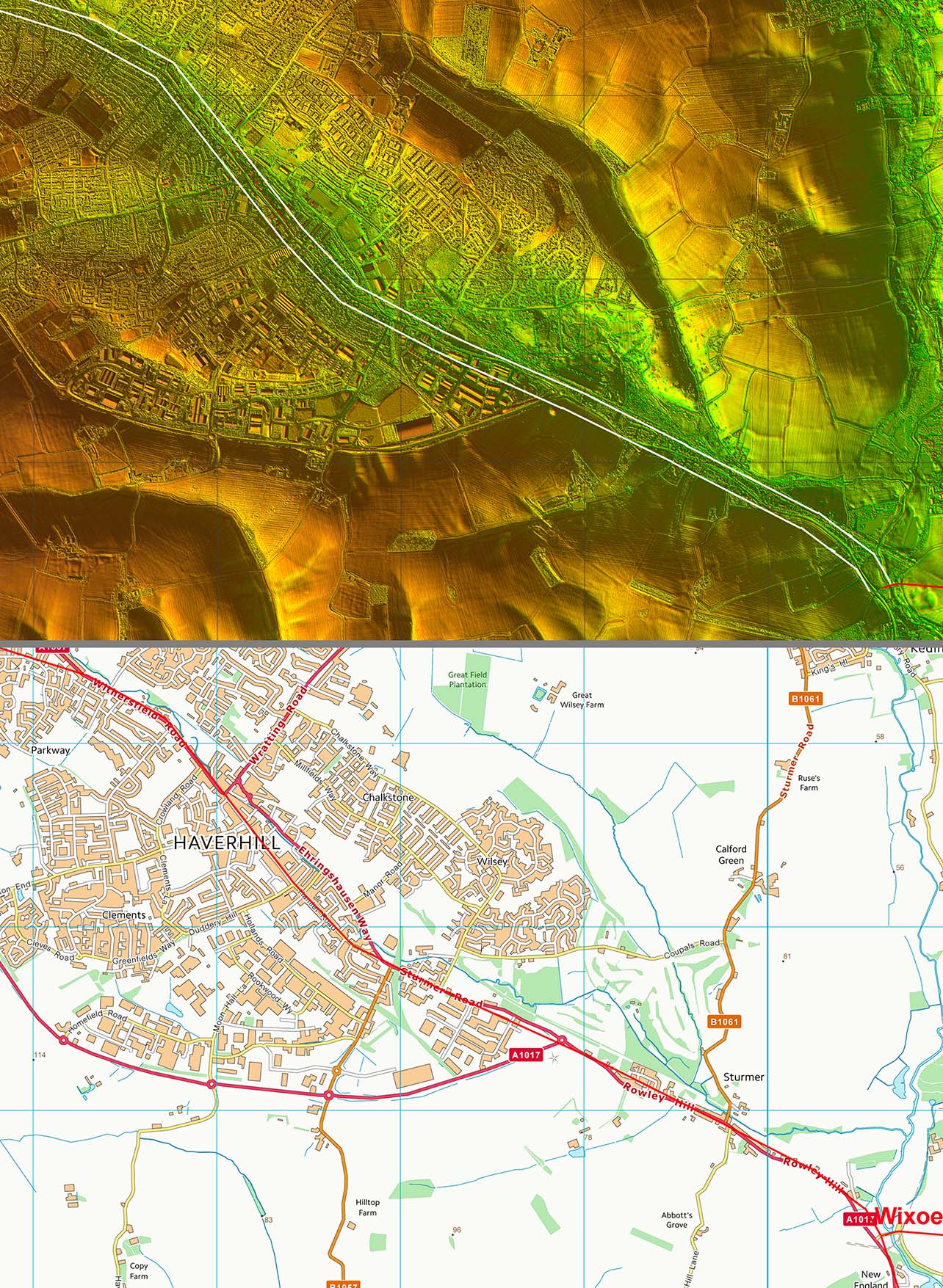
Lidar Image and Route Map 1 The road through Haverhill almost certainly marks our Roman road. The modern road wobbles a little here and there but the Roman alignment would have been much straighter. |
Click for larger view |
 |
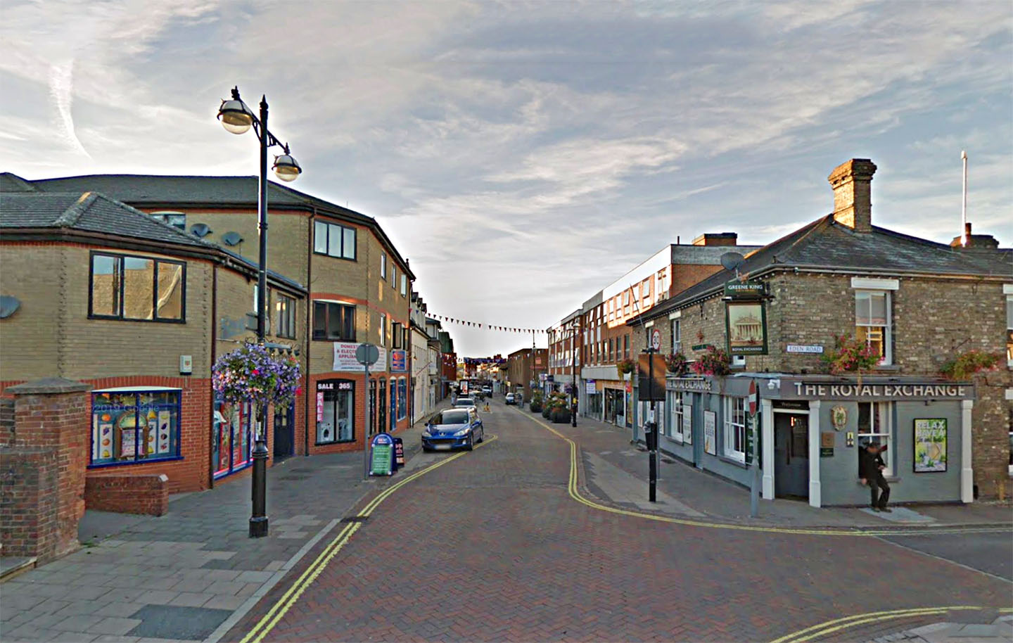
High Street, Haverhill Our road almost certainly passed down Haverhill High Street. It is straight and aligns well with the known alignments either side of the town. Image; Google |
Click for larger view |
 |
Lidar Image and Route Map 2 a little dog-leg was necessary to negotiate the valley north-west of Haverhill otherwise long straight alignments were achieved. |
Click for larger view |
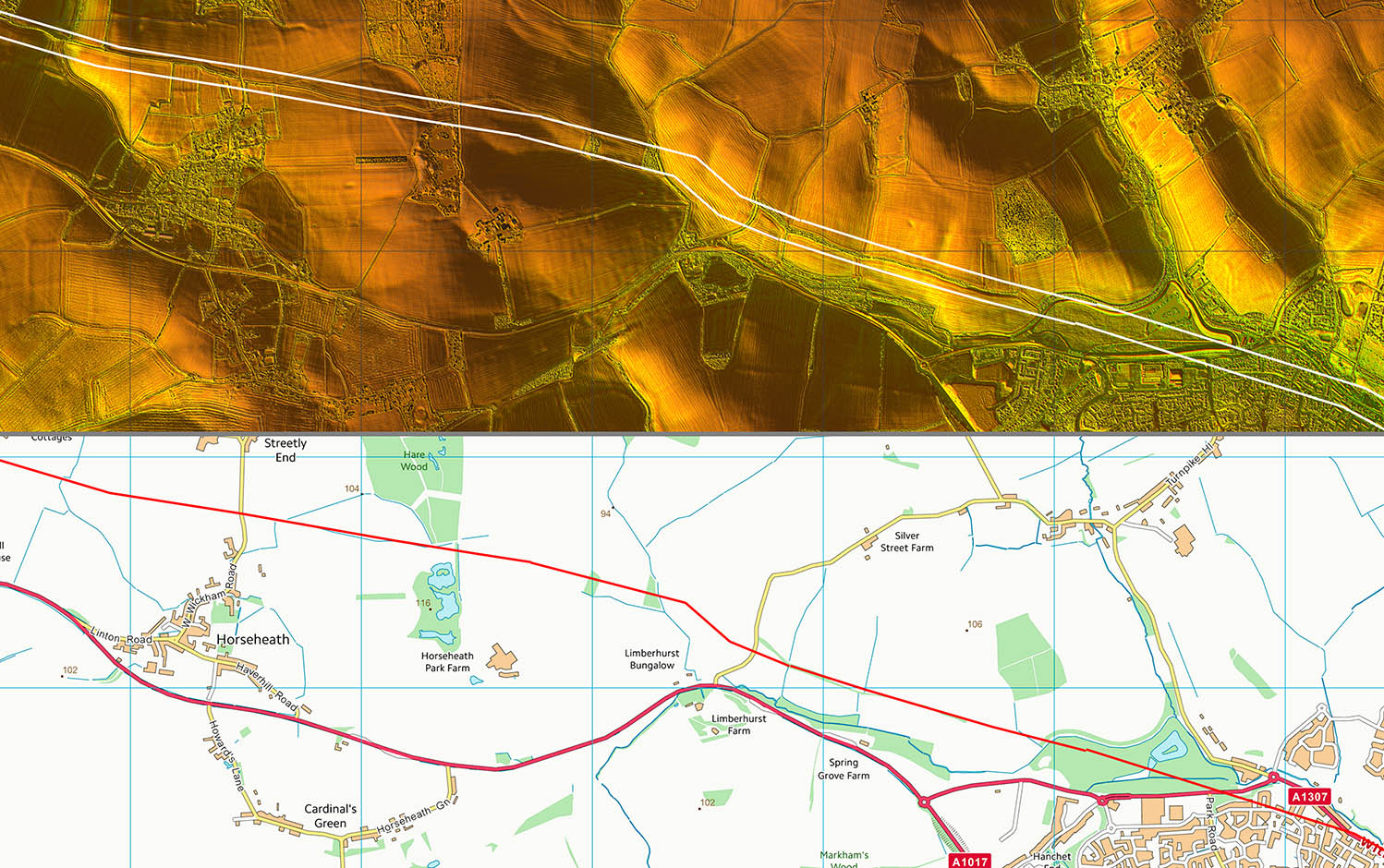 |
Lidar Image and Route Map 3 After passing the aptly named Streetley Hall our road crosses the Harcamlow Way - a modern long distance footpath. |
Click for larger view |
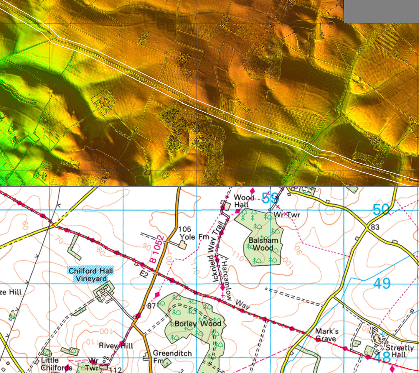 |
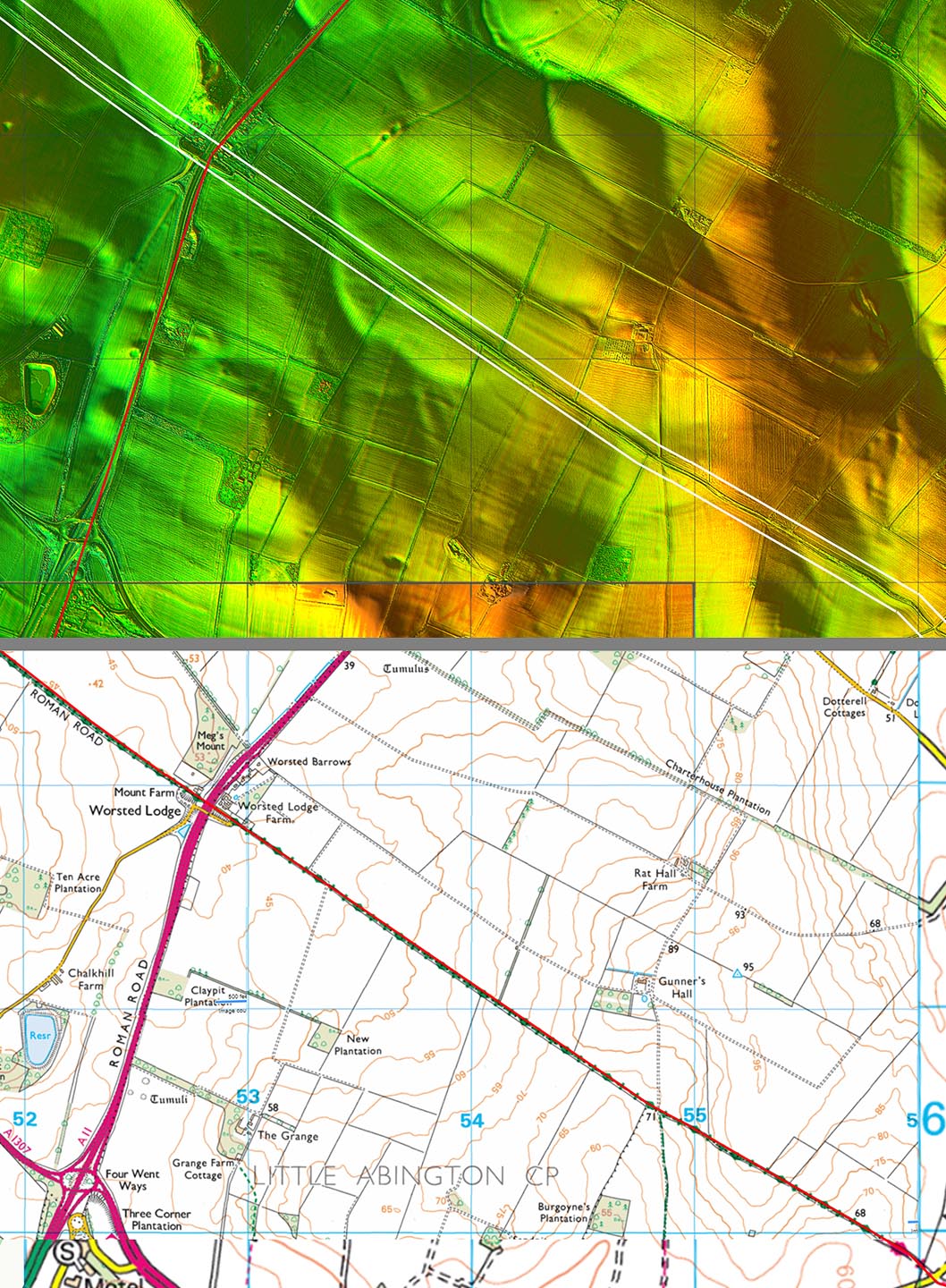
Lidar Image and Route Map41 Here we cross the Icknield Way Roman Road at Worsted Lodge. Excavations east of Icknield Way revealed a road somewhat less than 5 metres wide - a little narrow by Roman standards. This perhaps indicates that east of Icknield Way then our road was possibly of lower importance. |
Click for larger view |
 |
Lidar Image and Route Map 5 The Gog Magog Hills were obviously a setting out point for the road. The change of direction can be explained by heading for a dry route to the Roman town - see later. |
Click for larger view |
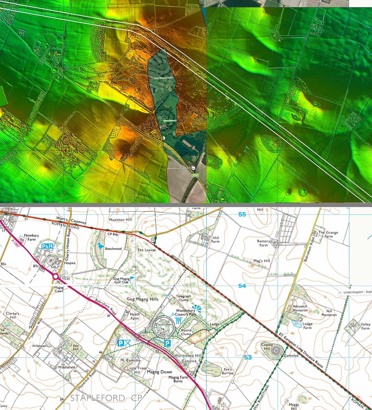 |
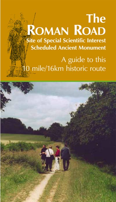
Friends of the Roman Road The Roman road in Cambridge has a group to look after it - click the image right to download their guide to it. Their map is not quite right - it suggests the our road could have carried straight on into Cambridge but it actually dog-legs at the Gog Madog Hills - see later. |
Click to follow link |
 |
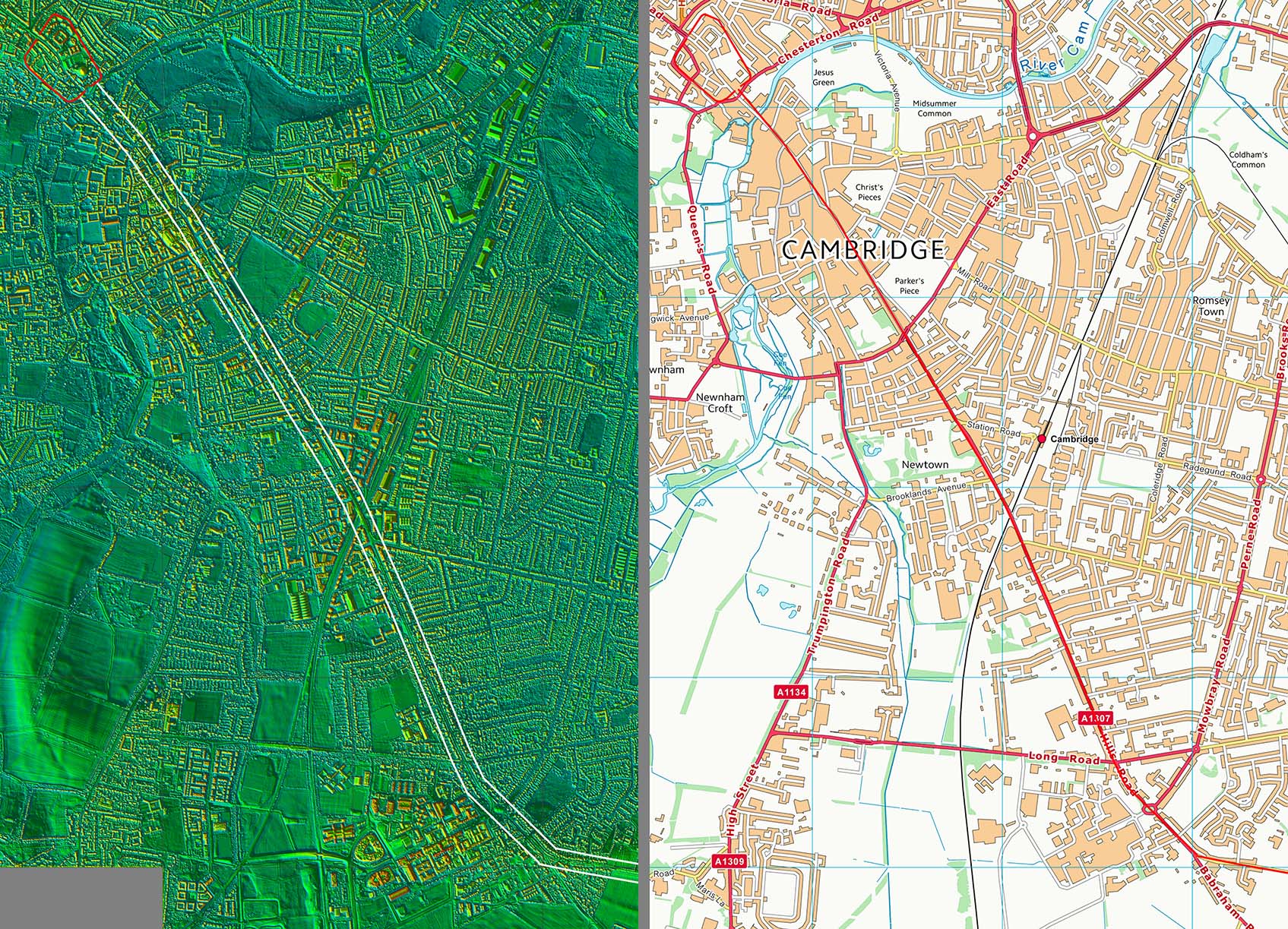
Lidar Image and Route Map 6 The route follows Babramham Road and Hills Road through the city. Hills Road presumably derives from it being the road to the Gog Magog Hills. The Roman road possible crossed the River Cam downstream of the modern Magdalene Bridge. |
Click for larger view |
 |
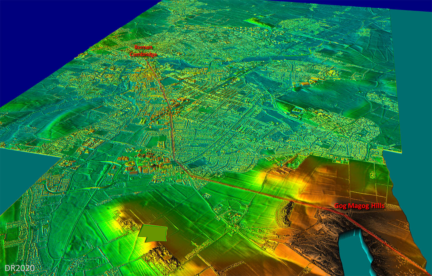
Oblique 3D Lidar Image - Cambridge The road clearly used the Gog Magog Hills as a sighting or setting out point. It did not proceed directly to the Roman Town but dog-legged appreciable. This 3D lidar image explains why. a straight ahead course would have had to pass over low probably marshy ground. The actual route chooses runs along a finger of higher and presumably drier ground. The Roman town was situated north of the river at Castle Hill. |
Click for larger view |
 |
|
|
|
Last update: April 2020 |
© David Ratledge |