
|
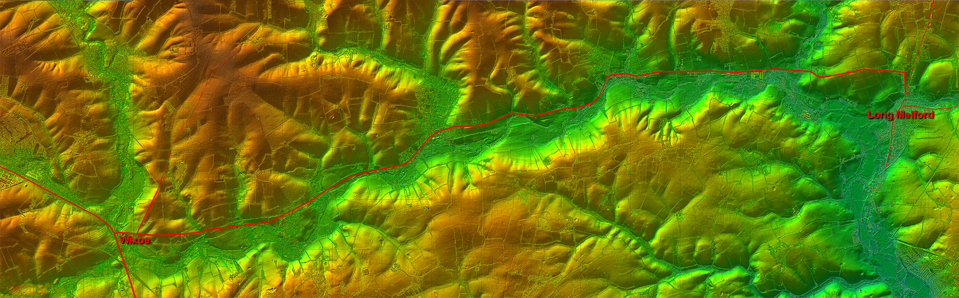
The Roman Road from Wixoe to Long MelfordMargary Number: 34aDistance: 11 milesThe evidence for this road is not overly strong or at least not for its course. The Ordnance Survey mark a section at the Long Melford end as Roman and the recent excavations at Long Melford (see ref) show the start of a road heading east. The latter is confirmed by lidar and takes the road further east. Putting these 2 clues together then a route can be postulated largely following the modern A1092 via Clare. Really a bit more evidence is required. |
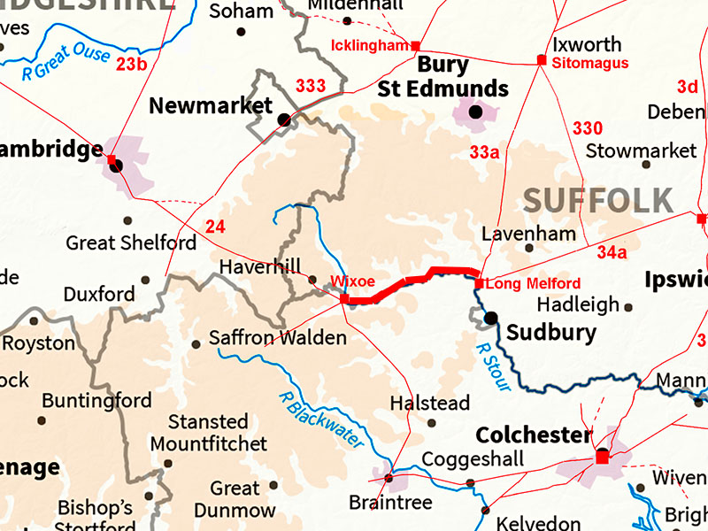
Historic Counties: Suffolk Current Counties: Suffolk HER: Suffolk
|
|
|
|
|
|
Lidar Image - Full Route IThe route follows the north side of the river valley.
|
Click for larger view
|
 |
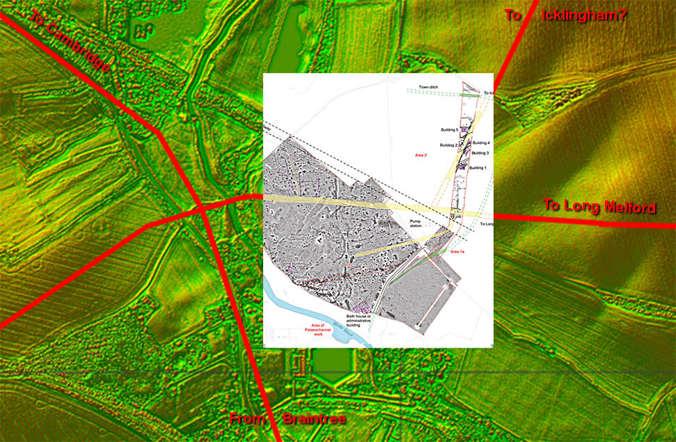
Wixoe Roman Site - Lidar Image & Oxford Archaeology Site Plan Thanks to a pipeline being laid across Wixoe we have an excellent site map of this small town. At least one high status building was recorded together with the road system (shown in yellow). These tie in with what is visible in the Lidar imagery. Ref: Excavations at Wixoe Roman Town, Rob Atkins, Oxford Archaeology, 2012 |
Click for larger view |
 |
Oblique 3D Lidar Image - Wixoe Roman Town This is by far the best evidence that this road exists. The agger is clear heading away from the town in the direction of Long Melford. So the road found in the excavation was not just a local road it went further, much further, and surely Long Melford can only have been its destination. |
Click for larger view |
 |
Lidar Image and Route Map 1 There are a couple of options for the route between Stoke-by-Clare and Clare. |
Click for larger view |
 |
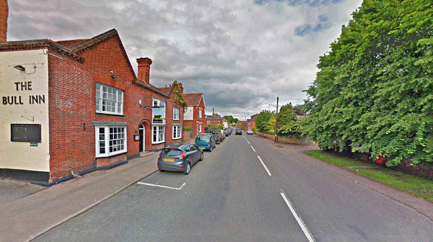
Cavendish Road, Clare Looks a little Roman like so it could well be the line of our road. Big ditch on the left (north) side. Image; Google |
Click for larger view |
 |
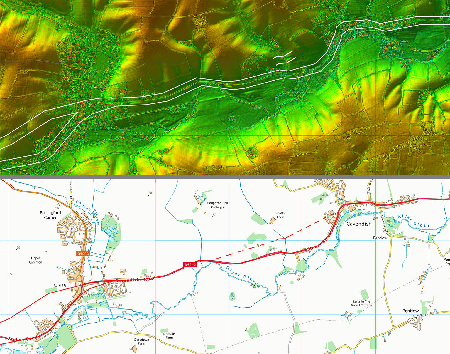
Lidar Image and Route Map 2 Again not a lot of evidence on the ground so we are forced to assume the modern road through Clare and Cavendish overlie the Roman road. There is a short cut option shown dotted. This based on a cutting for a stream crossing which does look man-made and therefore possibly Roman. |
Click for larger view |
 |
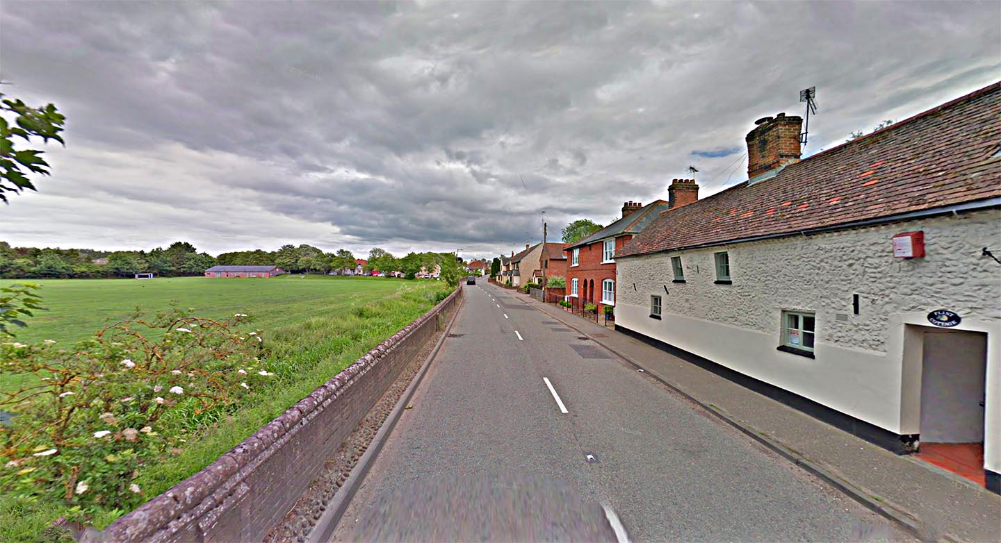
High Street, Cavendish This is the start of the generally straight length of the A1092 that the OS label as "Roman Road". The Suffolk HER does not! Image; Google |
Click for larger view |
 |
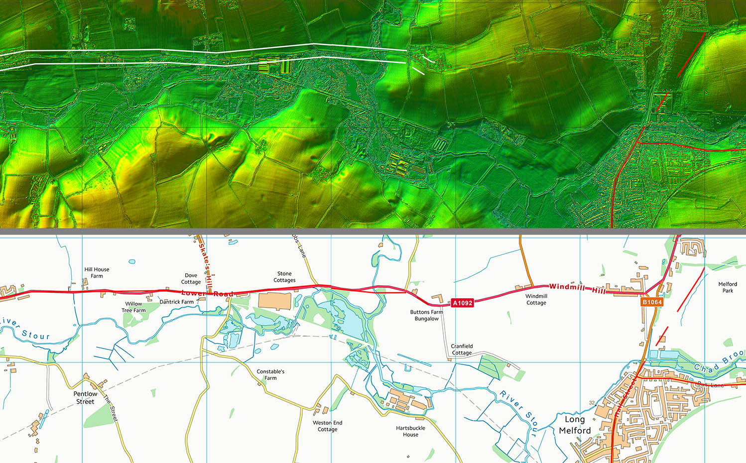
Lidar Image and Route Map 3 The approach to Long Melford is a bit of a puzzle. Did it continue roughly on the the line of the A1092 or did it short cut the corner? The old railway could have destroyed some of the evidence. |
Click for larger view |
 |
|
|
|
Last update: January 2023 |
© David Ratledge |