|
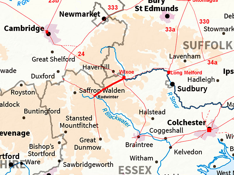
The Roman Road from Wixoe to Radwinter (Essex)Margary Number: noneDistance: 7.5 milesOnly the first 100 metres or so is in Suffolk but from then on it is Essex all the way. It meets up with the Chesterford to Dunmow Roman road in Radwinter Village. Recent excavations in Radwinter (Pat Moan, Oxford Archaeology, 2017) has revealed that Radwinter was a sizeable Roman Settlement of around 15 Ha. Moan comments :"... the site established itself quickly following the development of the road system in the 1st century AD, and was of a substantial size by the end of the 1st and into the early 2nd century AD." |
Historic Counties: Suffolk & Essex Current Counties: Suffolk & Essex HER: Suffolk and Essex
|
|
|
|
|
|
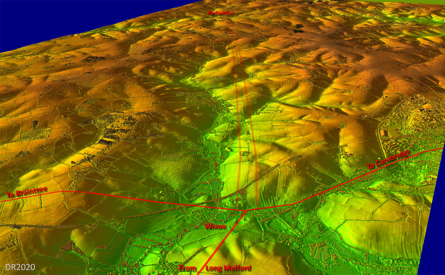
Lidar Image - Full Route Couldn't really be much straighter - typical Roman engineering.
|
Click for larger view
|
 |
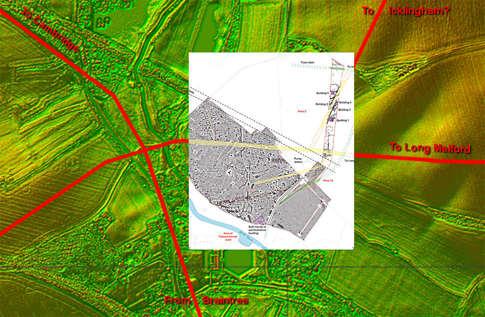
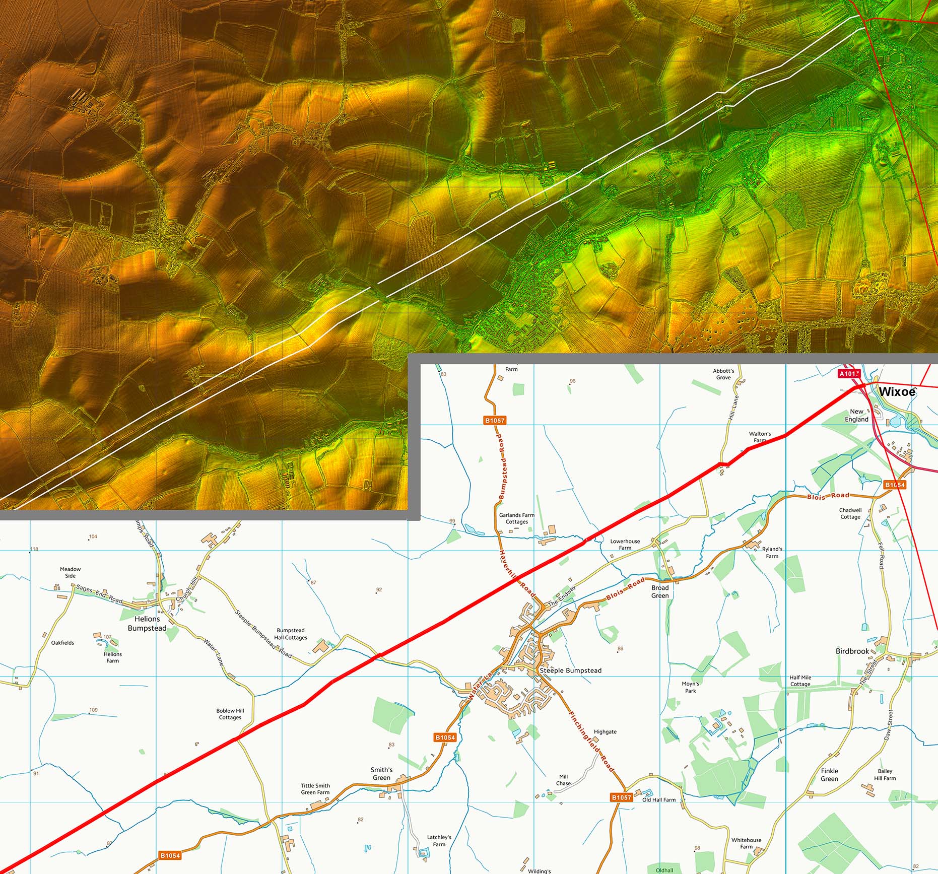
Wixoe Roman Site - Lidar Image & Oxford Archaeology Site Plan Thanks to a pipeline being laid across Wixoe we have an excellent site map of this small town. At least one high status building was recorded together with the road system (shown in yellow). These tie in with what is visible in the Lidar imagery. Ref: Excavations at Wixoe Roman Town, Rob Atkins, Oxford Archaeology, 2012 |
Click for larger view |
 |
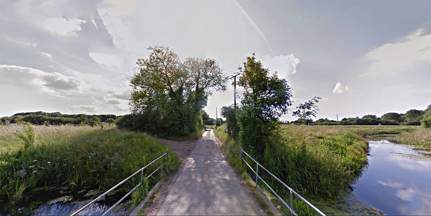
River Stour Bridge, Wixoe The modern bridge and the Roman bridge almost certainly crossed the River Stour at the same place as the road visible in the geophys is aiming for here. Today it is the county boundary between Suffolk and Essex and it is a delightful spot. Image: Google |
Click for larger view |
 |
Oblique 3D Lidar Image - Wixoe looking South Sensible alignment keeping out of the valley bottom and running on its north side. |
Click for larger view |
 |
Lidar Image and Route Map 1 The first mile or so is walkable from the Wixoe site. Very direct alignment with just very minor adaptations to negotiate the valleys and hills. |
Click for larger view |
 |
Hill Lane We are about 1 km from the Stour Bridge near Upper House Farm in this view looking west. The agger is broad as would be expected whereas the modern lane is relatively narrow. Image: Google |
Click for larger view |
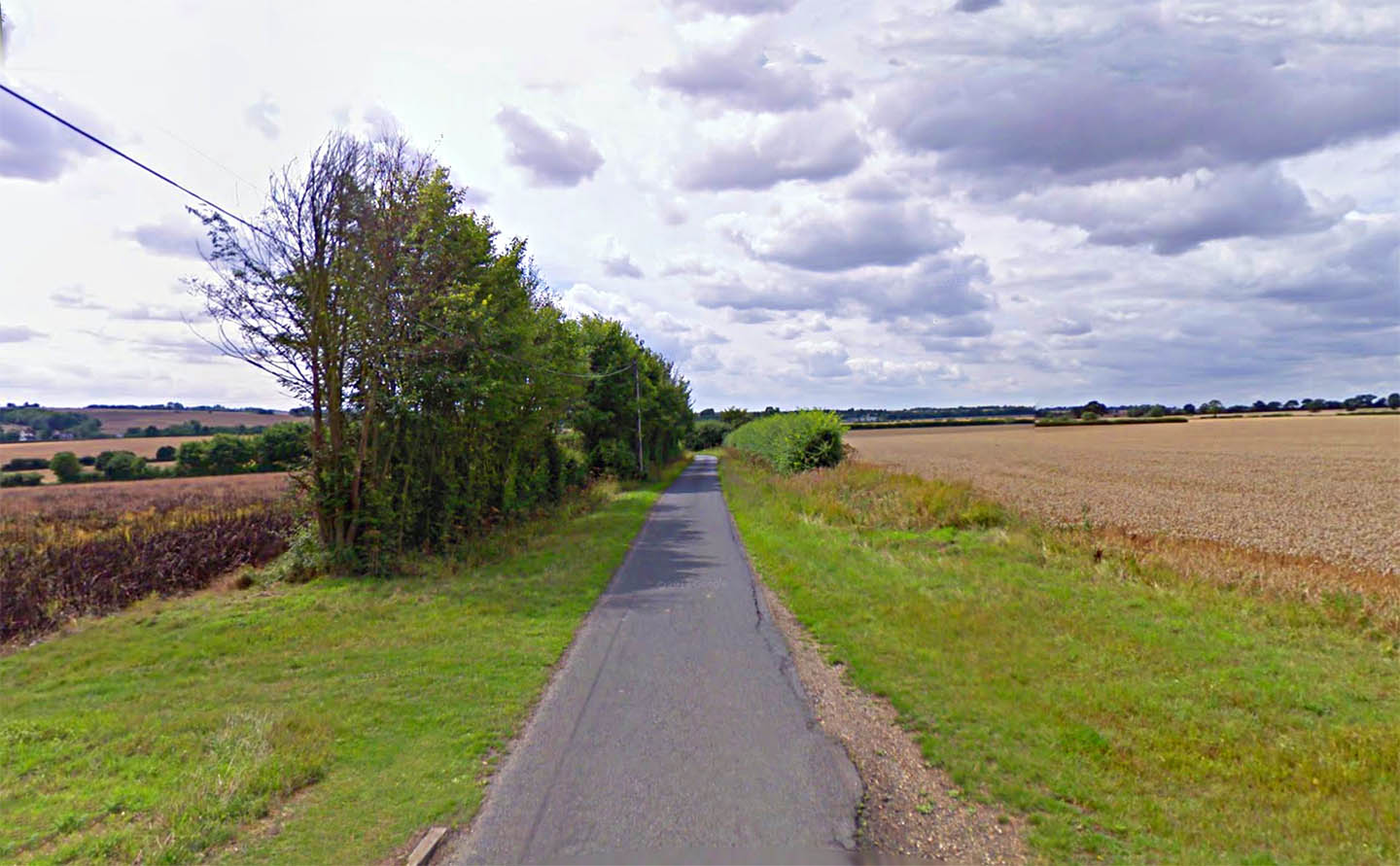 |
Water Lane, Near Boblow The Roman line is followed by a public footpath for around 1 mile from Boblow westwards. Image: Google |
Click for larger view |
 |
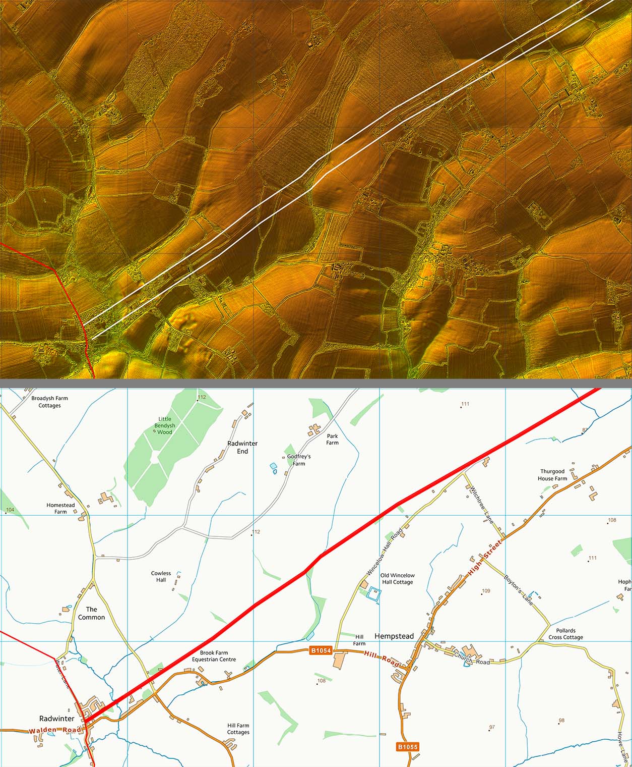
Lidar Image and Route Map 2 The alignment of the road would imply that it formed a junction with the Chesterford to Dunmow Roman road perhaps just north of the present day cross roads in the village. As we are extrapolating into the village this is not exactly certain. |
Click for larger view |
 |
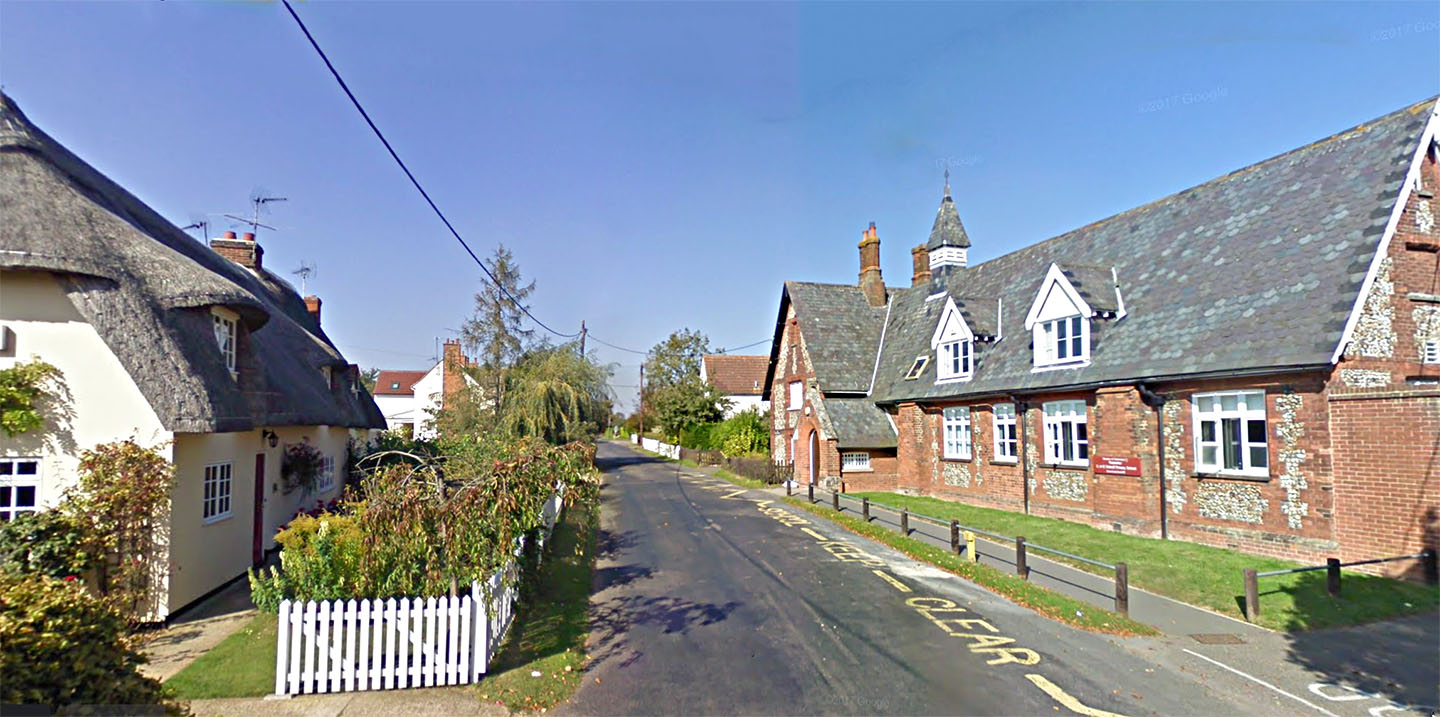
Radwinter Village We are stood on the line of the Chesterford to Dunmow Roman road probably where our road from Wixoe came in from the right. The local school could well be sat on the Roman road although I think it is just along the south boundary of the School Image: Google |
Click for larger view |
 |
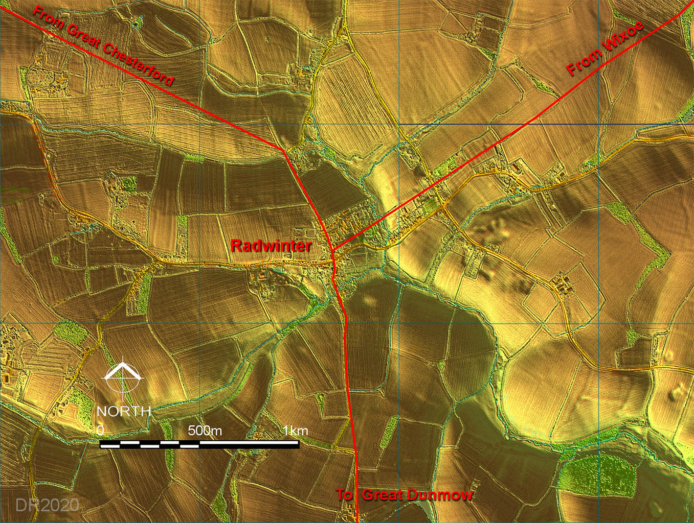
Radwinter Roman Road Map - Lidar Three Roman roads met at Radwinter including our road from Wixoe. The other two were from Great Chesterford and south to Great Dunmow. Image: Google |
Click for larger view |
 |
|
|
|
Last update: April 2020 |
© David Ratledge |