title

Roman Road from Godmanchester to Great Staughton

Margary Number: None

Distance: 9.5 miles

When the Roman road was found from Sandy to Thrapston it was obvious there must be a settlement at Great Staughton. It was the only explanation for the route of the road there. It was picking its way through a settlement. This was confirmed in September 2024 when geophys by AOC Archaeology Group was published showing what a large Roman site it was - described as a "town".

This road was to be expected being an easy less than 10 mile link to Godmanchester and Ermine Street - the Roman's main road north.

Note: This road is not to be confused with road 173d proposed by the Viatores, which as far as I can see does not exist.


Historic Counties: Cambridgeshire

Current Counties:Cambridgeshire

HER: Cambridgeshire


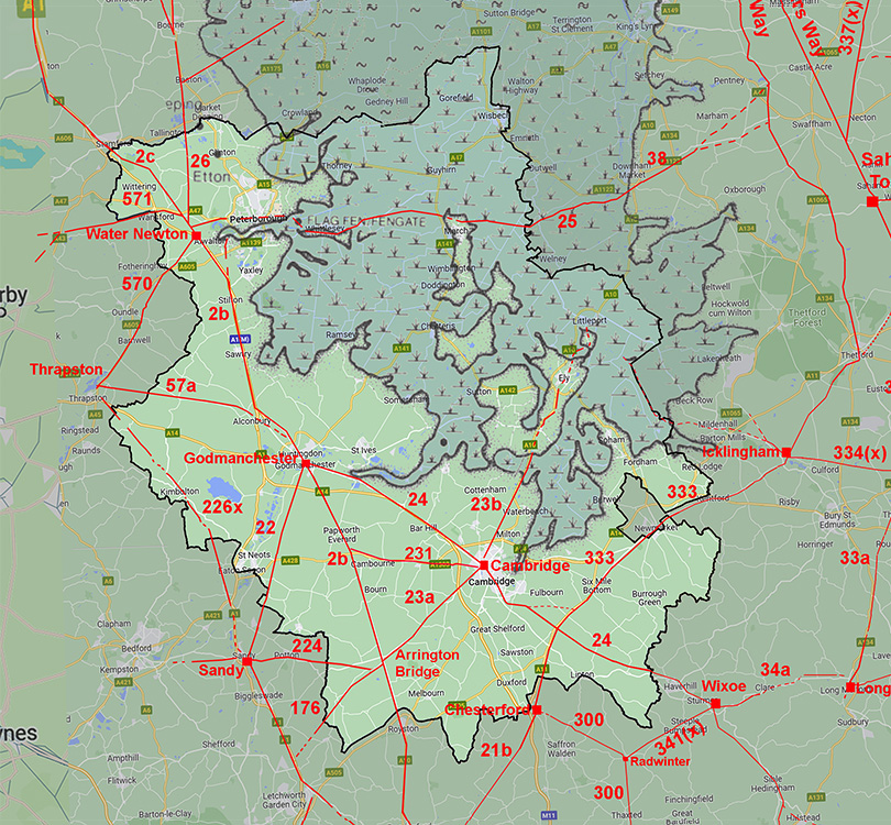
location

mini map


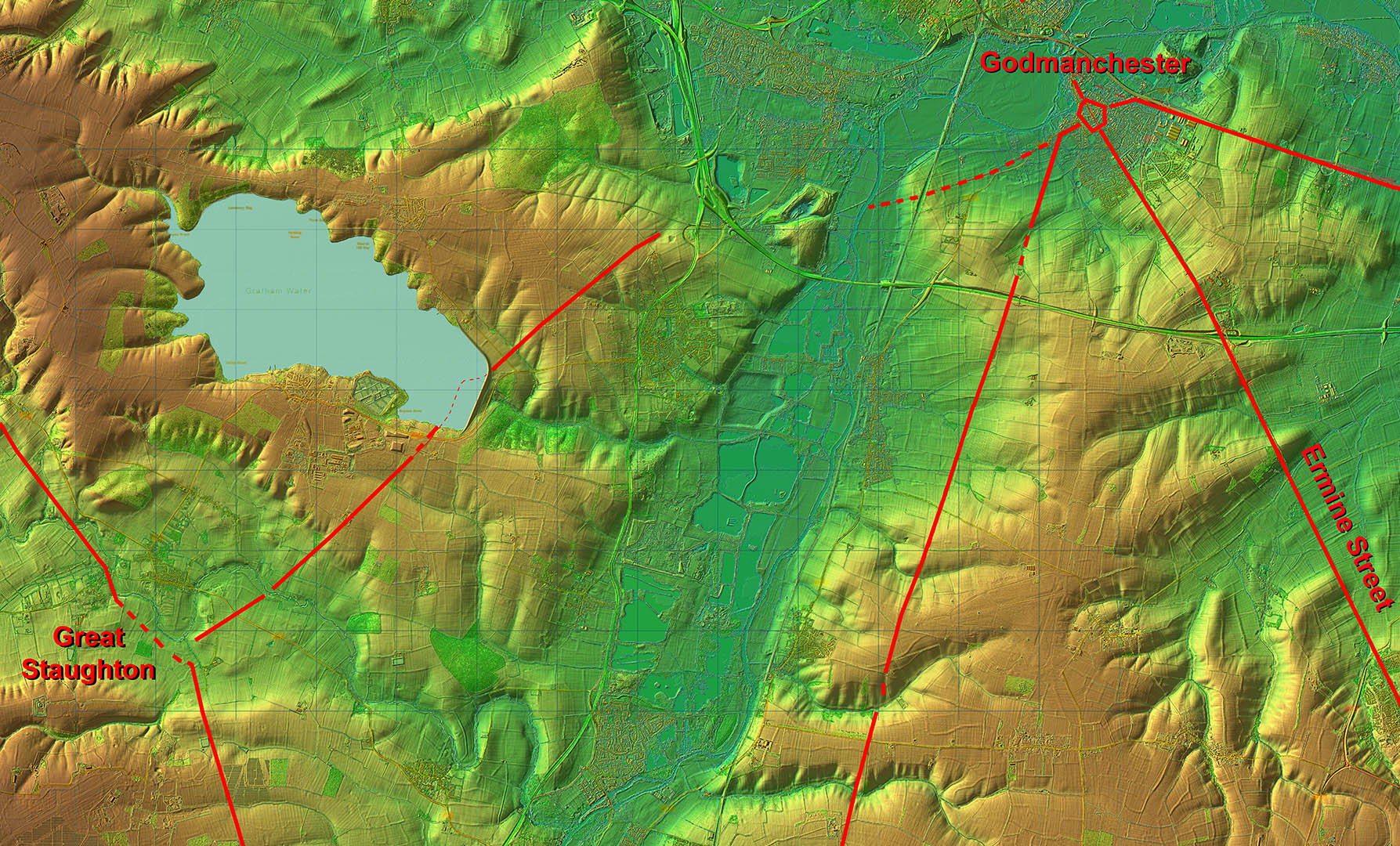
Lidar Image - Full Route

Not dead straight but I would guess the Great Ouse valley was to be avoided so the course does make sense. The agger is clearest either side of Grafham Water, which looks to have swamped a surviving section.

Click for larger view

full route lidar

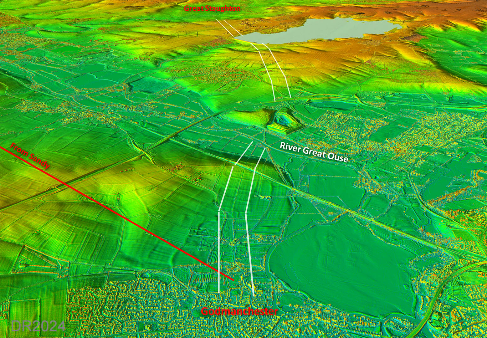
Oblique 3D Lidar Image - Full Route

In 3D the route looks very logical preferring high ground as is the usual Roman tactic.

Click for larger view
£D full route

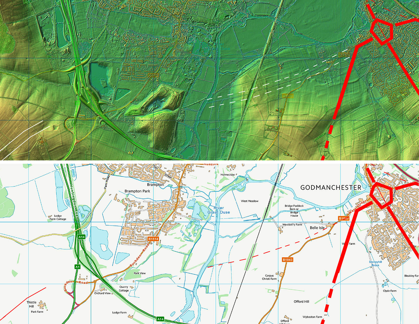
Lidar Image and Route Map 1

The initial course is probably shared with the Godmanchester to Sandy Roman road before it branches off to the south. I have shown the route dashed here as the clues are not the strongest but are most likely indicate the course to the river. Across the river is a what looks like a quarry and spoil heaps.

Click for larger view
routemap1

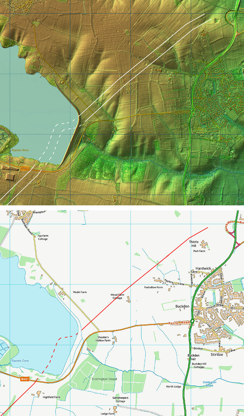
Lidar Image and Route Map 2

The agger is clear either side of Grafham Reservoir. The suggested connection now well under water is based on the First Edition OS map which shows typical zig-zags to a river crossing.

Click for larger view
routemap2

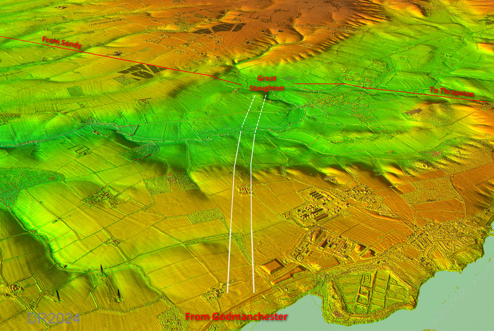
Oblique 3D Lidar Image

The approach to the settlement at Great Staughton is very very faint. I have shown it dashed but it is probably correct - see below.

Click for larger view
3D gt staughton

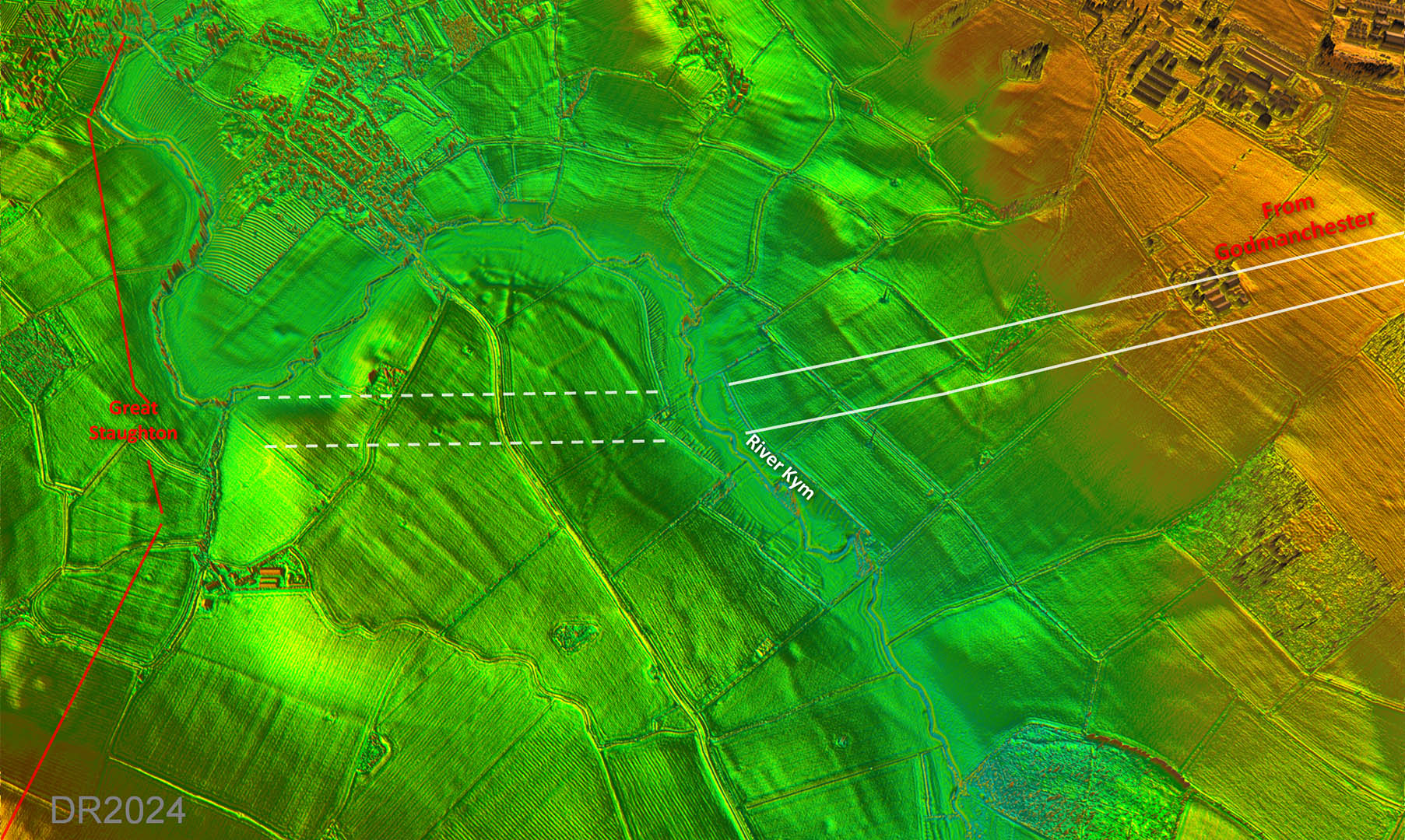
Lidar Image - Great Staughton Approach

This slightly oblique lidar view of the approach to Great Staughton has been processed to reveal the probable course of the road. Yes it is faint, yes it is subtle but I believe this is probably the line of the road.

Note: either side of the river then different illumination angles have been used to optimise visibility so shadow directions are opposite.

Click for larger view
gt-staughton

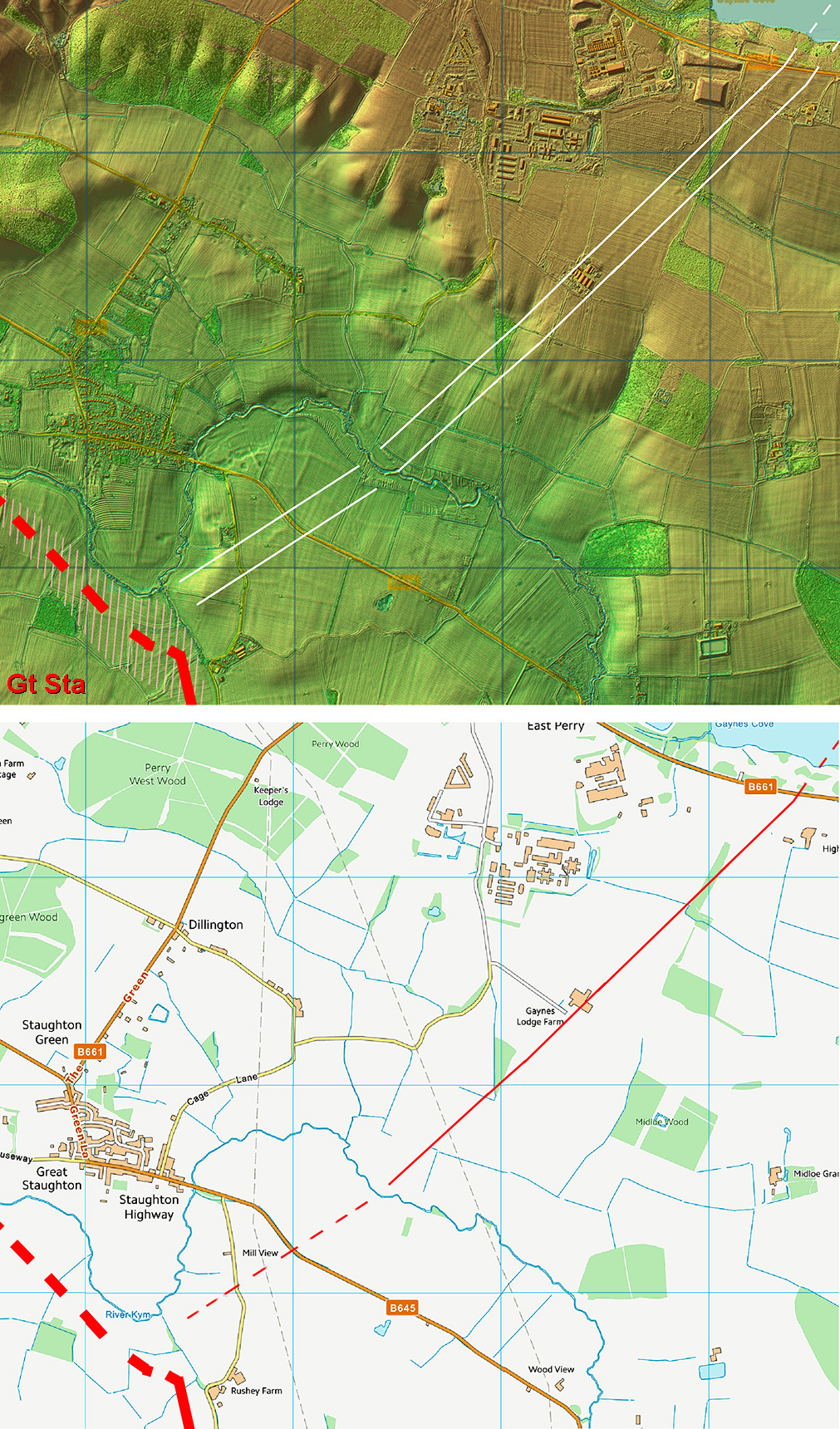
Lidar Image and Route Map 3

The extent of the settlement (shaded in the lidar plot) is taken from the recent geophys by AOC Archaeology Group. The press release for the geophys and the scheduling of the site called Great Staughton a "town". It is extensive but there are no signs of town walls so I will go with settlement.

Click for larger view
routemap3

Back to Cambridge homepage

Last update: September 2024

© David Ratledge