 |
Possible Roman RoadsVery limited evidence for these roads and probably insufficient as yet to include them in Cumbria's Roman road map.
|
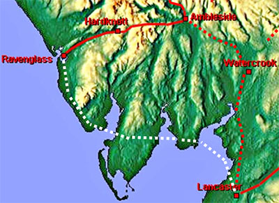
Lancaster to Ravenglass - across the sands of Morecambe Bay The south of the County is notably lacking in Roman roads. One candidate frequently suggested is that the Romans used the sands route across Morecambe Bay. So far the Lidar evidence for this road in the Furness peninsular is not overly convincing. To Ferguson (see below) this road was certain. R.S. Ferguson , CW1 3 1877 (64-94) From strategic and historical reasons we should expect to find another great road through Cumberland, older than, and more or less superseded by those we have just mentioned. Agricola, in A.D. 79, advanced from the Isle of Anglesey into Scotland by the western coast, crossing the estuaries, and, Roman-like, securing his retreat by the formation of a good road, guarded at frequent intervals by fortified posts. During this advance he kept close to the sea, partly we suppose that he might be supported by his fleet, partly to avoid the trackless woods, and wild mountains of the interior. This Roman road starts from Lancaster, crosses the Lancaster branch of the Morecambe estuary to Pigeon Cote Lane, near Wyke in Cartmel; passes, Flookburgh, where part of this Roman road still remains; thence crosses the Ulverston estuary and goes by Mount- barrow and Lindal to Dalton, near to the second of which places its pavement was long ago discovered, (vide Stockdale’s ’Annales Caermoelenses” p. 241; also West’s “Furness” p.8 Hutchinson’s “Cumberland,” Vol. I., p. 533, for the Roman road, leading through Furness to Duddon Sands). Thence the road would cross the Duddon Sands and enter Cumberland somewhere near Millom. From Millom it would run by Bootle and Ravenglass to the great camp at Moresby. It could be that this was an invasion route as Ferguson suggested. Tacitus refers to the conquest crossing estuaries but perhaps the invasion route did not get converted into a fully built road?
|
 |
|
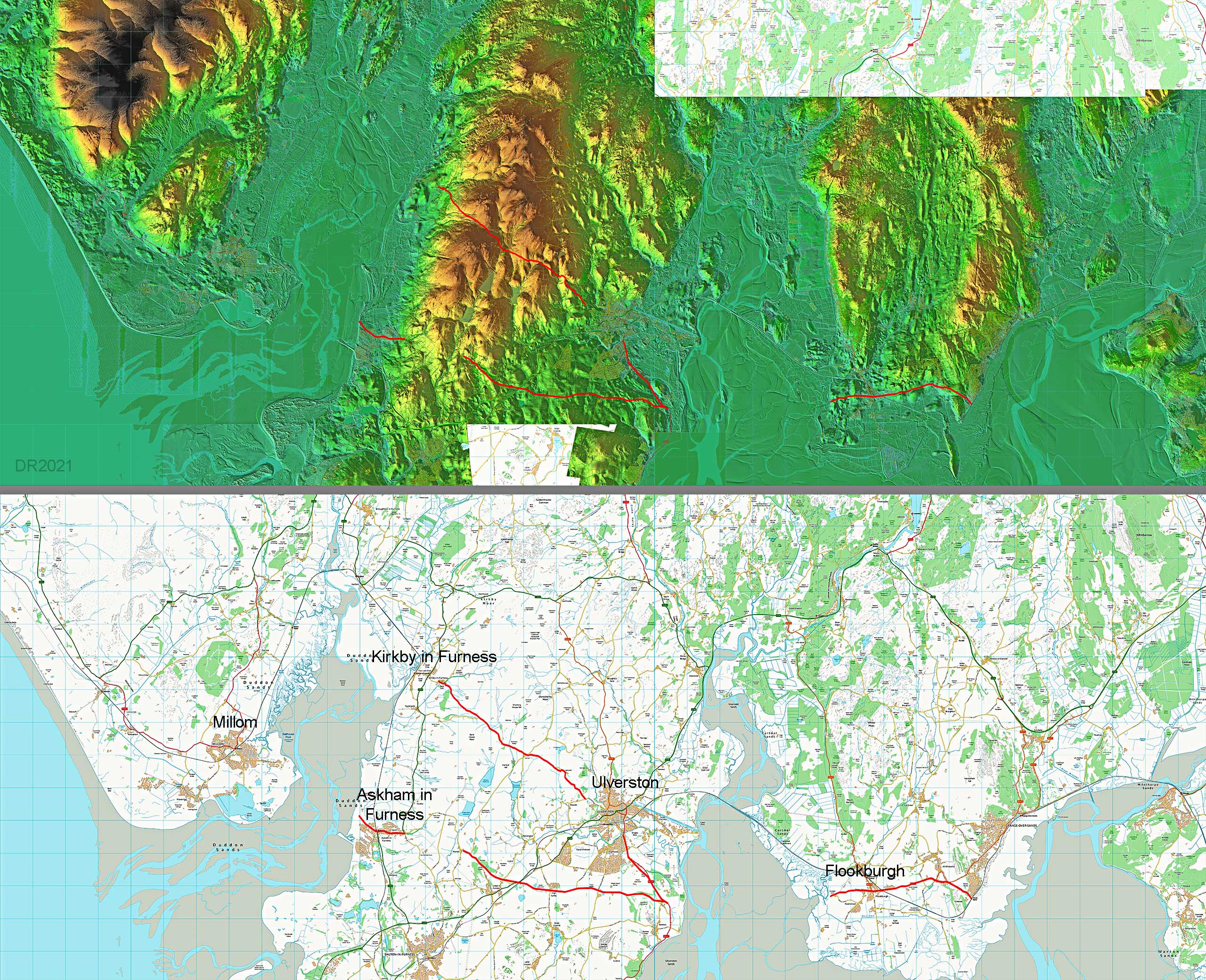
Furness - Lidar Image and Possible Routes Shown are the possible routes across the Furness peninsulars. These are largely existing routes. Lidar does not show any real convincing evidence that they are Roman. They are old routes - see CWAAS 2012 & 2018, author Bill Shannon. There is also the likelihood that these routes are pre-Roman. When a modern road follows an old Roman route the hope is that evidence for the original Roman line will be visible where the modern road has wandered off line over time. With these routes are a some of these but, in my opinion, not enough of them to be convincing evidence that these are Roman..
|
 |
|
|
| ||
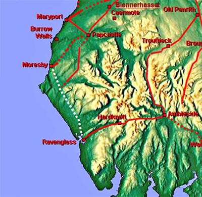
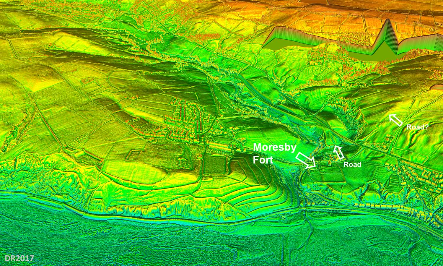
Moresby to Ravenglass - RRX12 Various suugestions for this road in the past and the RRX 12 number denotes the Ordnance Survey took an interest in it too. RRX numbers are used by OS for Roman roads - they don't use Margary numbers. The existence of this road would explain why the road from Papcastle to Ravenglass doesn't take a short cut to Ravenglass but heads in the direction of Cleator - perhaps it was limking to an already existing road from Moresby? This is perhaps the best supporting evidence that this could actually be a Roman road.
|
 |
|
3D-Lidar Image - Moresby Fort The (possible) road we are looking for is towards the right handside and marked with a "?". Could this be the start of a road towards Egremont? I am not sure. Apart from this (shred) of evidence I have so far failed to find any more clues. |
Click for larger view |
 |
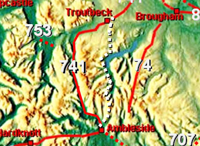
Ambleside to Troutbeck via Kirkstone Pass Suggested by Allan and Richardson in C&WAAS 1990. Unfortunately there is only intermittent Lidar data for their route. However, the Lidar data that is available then I couldn't find anything convincing that supported their route. That is apart from where they follow modern roads. The route they propose is also puzzling. They show it joining the Ambleside to Old Penrith road east of Troutbeck so that road must be earlier. So if that road existed why build this one? Well it could be to connect to the proposed fort of theirs at Glencoyne Park but Lidar shows nothing there either (see below). Kirkstone Pass is over 200 metres higher than Dunmail Raise so again it would be a much more severe route but admittedly a bit shorter. The climb from Ambleside to Kirkstone is not called the Struggle for nothing. The lack of Lidar evidence is the main worry.
|
 |
|
3D-Lidar Image - Ambleside to Kirkstone The route is based on the modern road up to Kirkstone Pass - known fondly as The Struggle. Allan and Richardson show the Roman line sometimes alongside the current road but Lidar doesn't seem to confirm this.
|
Click for larger view |
 |
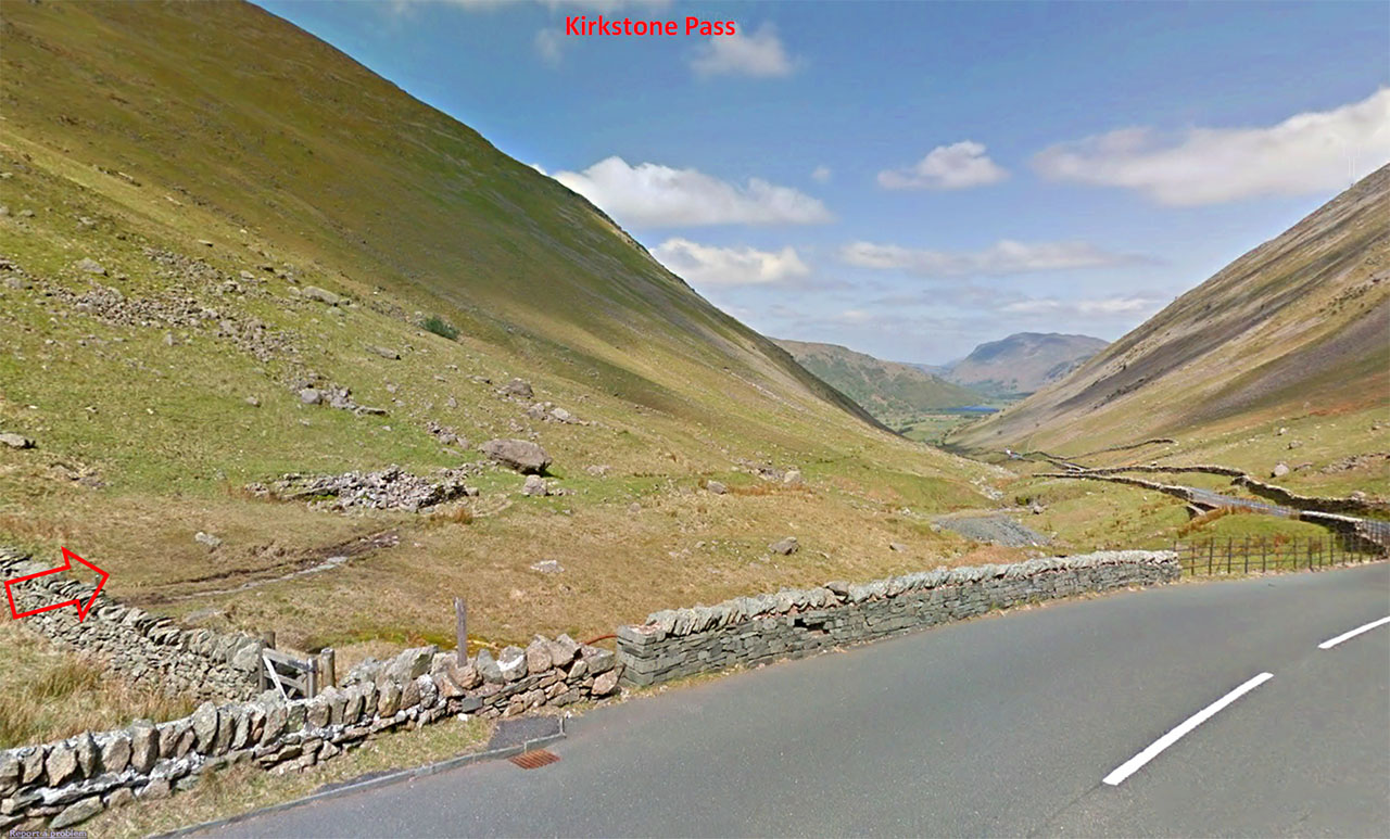
Kirkstone Pass - descent 1 Over the summit and on the descent there are signs of an older road alongside the current one - could this be old enough to be Roman? It doesn't look anything like substantial enough to be a Roman road.
Image: Google |
Click for larger view |
 |
Kirkstone Pass - descent 2 This is about half way down. The track is clear but again it is more like a pack-horse track than a Roman highway. Image: DR |
Click for larger view |
 |
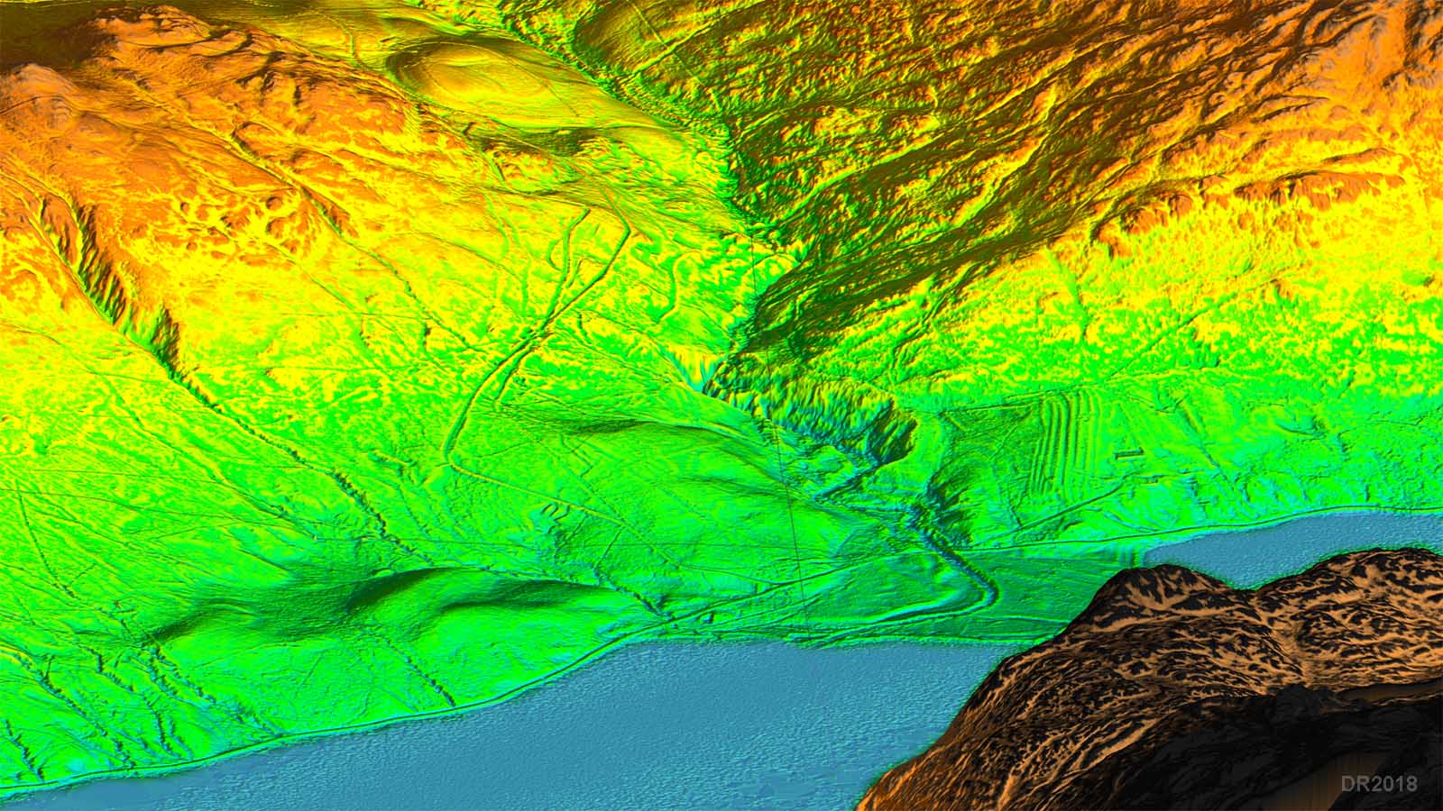
3D-Lidar Image - Ullswater to Matterdale The big problem here is that into Matterdale the modern road looks Roman and the old road one (now abandoned) looks anything but! Hard to reconcile this one. Also there is no evidence for a possible fort at Glencoyne Park as suggested by Allan and Richardson. A route to Brougham rather than one through Matterdale would have made more sense - a lower level alternative to High Street. There are some lidar signs for this but not really enough to confirm it. Perhaps the forthcoming full Lidar survey will help but currently I am not sure we have enough evidence to consider this road valid either to Troutbeck or Brougham. |
Click for larger view |
 |
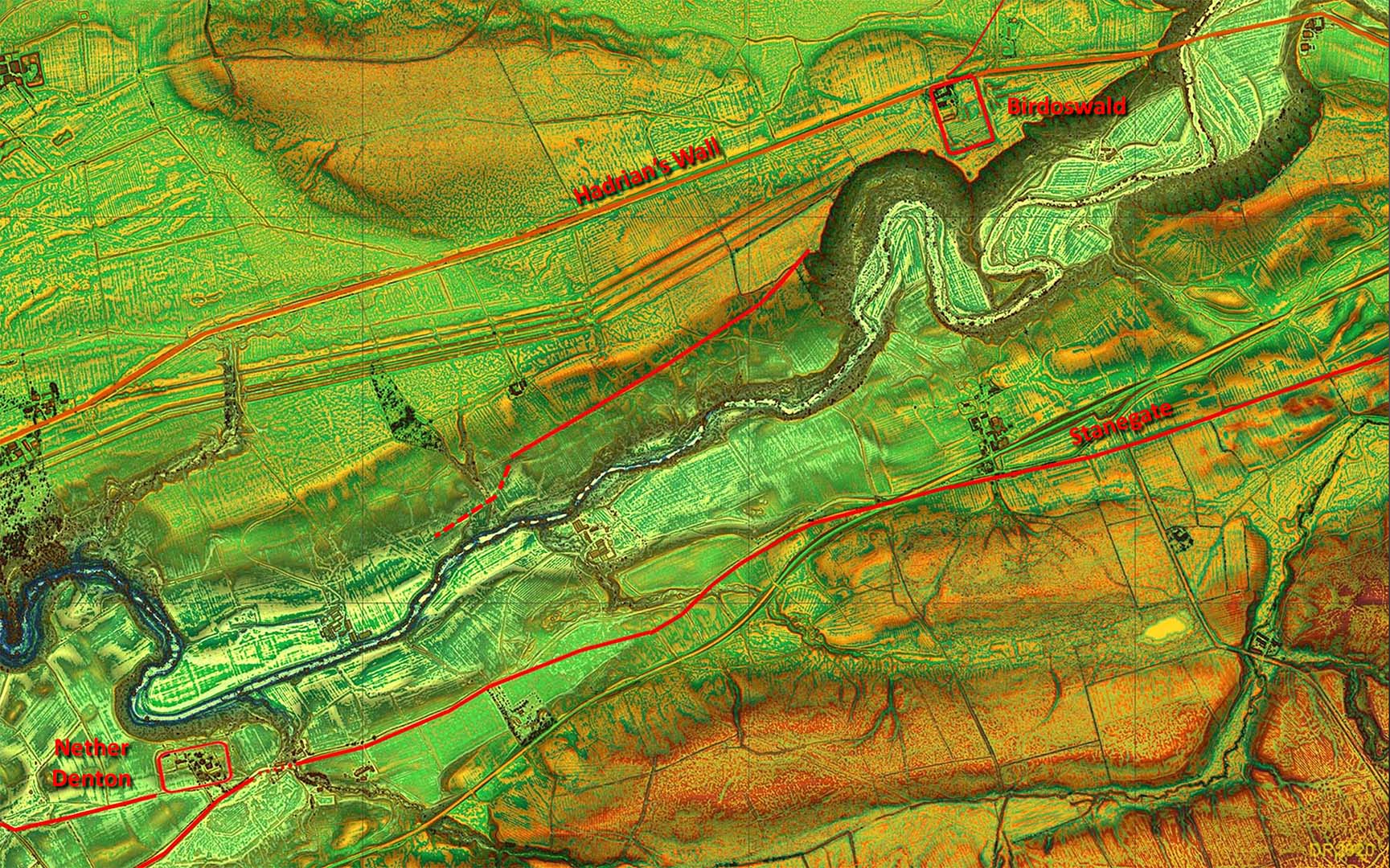
Birdoswald to Nether Denton There does seem to be the beginnings of a road heading from Birdoswald in the direction of Nether Denton. Little is known about Nether Denton but a connection between the two would seem logical.
|
 |
|
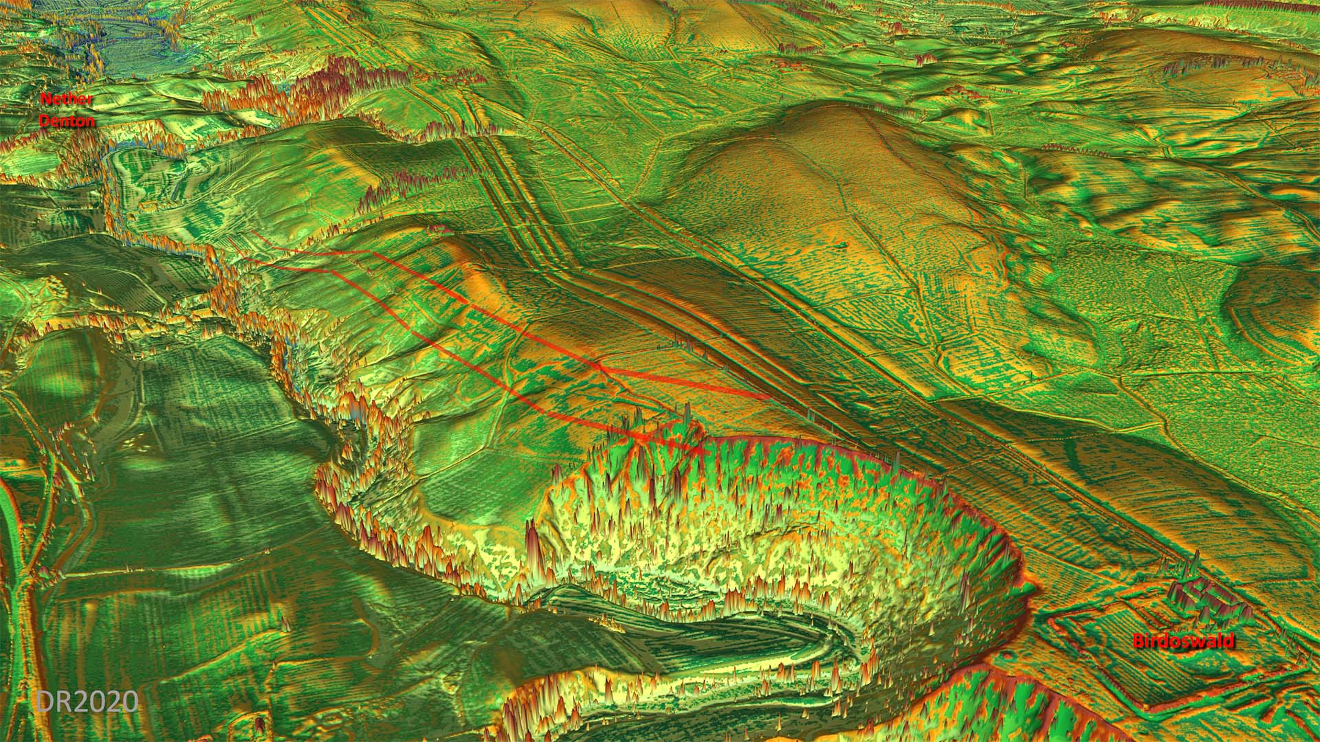
3D-Lidar Image - Birdoswald to Nether Denton The initial stretch has been lost to erosion but it then becomes very obvious angling diagonally down the slope. This would be a typical strategy used by the Romans for easing gradients. The only worry is then clues run out. It would have needed a bridge over the Irthing but a fairly simple task for the Romans. |
Click for larger view |
 |
|
|
|
Return to Cumbria Roman Roads homepage Last update July 2021 |
© David Ratledge |