 |
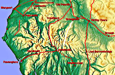
High Street Roman Road, Margary 74Tirril to Troutbeck (Nr. Windermere)Certainly the most famous Roman road in Cumbria rising to almost 2700 feet. We shall follow it north to south. Tirril, west of Brougham, is where the Ordnance Survey first mark the course of this road. The last point they mark is the descent to the Troutbeck valley, that's the Troutbeck north of Windermere. The assumption has always been that it connected the forts at Brougham to probably that at Ambleside or least to the road between Watercrook (Kendal) and Ambleside. But is it really Roman? Popular folklore would say yes and no doubt the Lake District Tourist Board would like it to be Roman too. We shall look at the evidence and I will leave up to you to judge for yourself as to whether it really is Roman.
Thanks are due to John Poulter for sharing his excellent Powerpoint presentation that was given to the Roman Roads Research Association's 2016 Conference in York. Many of the images here were taken by John in the 1960s - that is before thousands of Wainwright followers wore away old paths and blazed new ones over the tops of these fells. Many of the features spotted are also down to John. I am ashamed to say my pictures (film days) have not survived Needless to say the comments and opinions here are mine alone. UPDATE 2022 & 2023 1. At the 2021 Lake District Annual Archaeology Conference Dave Knight, Historic England, gave a presentation on their ongoing work on High Street using photogrammetry - 3D modelling from 2D photographs of the full route. Whilst sitting on the fence as to its Roman origin the talk did reveal they found no Roman agger over the full length. 2. Defra recently released series 2 LiDAR for virtually the full length. From my searches using 3D models I too found no Roman agger - only holloways often meandering and braided. In several places straight alignments were perfectly feasible but instead we have wandering trackways and no aggers. Some of the views from my model have now been included below. 3.The Lake District National Park commissioned Eden Heritage to carry out excavations on Bampton Common in August 2022 across the supposed line of the road. Nothing resembling a “classic” Roman road was found - just some narrow tracks and side banks - see report . It is now hard to reconcile this road as being Roman in origin but watch the video flyover and decide for yourself!.
|
|
|
|
3D Lidar Image - Brougham fort looking west There is the faintest of traces of a road leading out of the fort's east gate but then........nothing. |
Click for larger view |
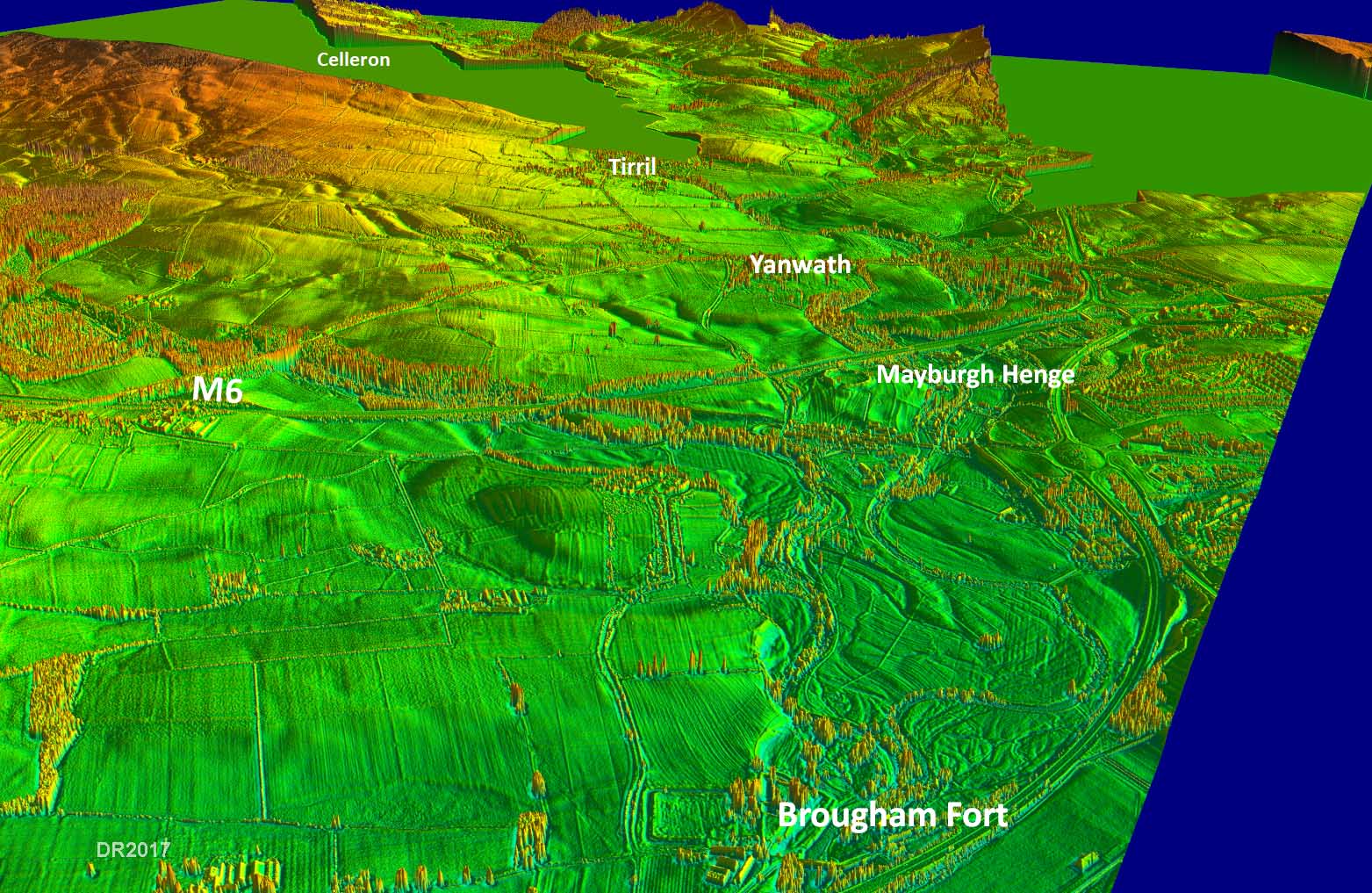 |
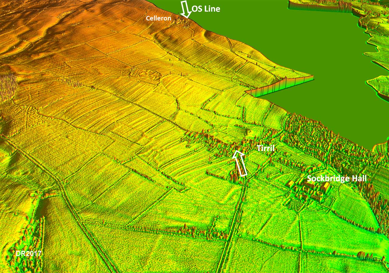
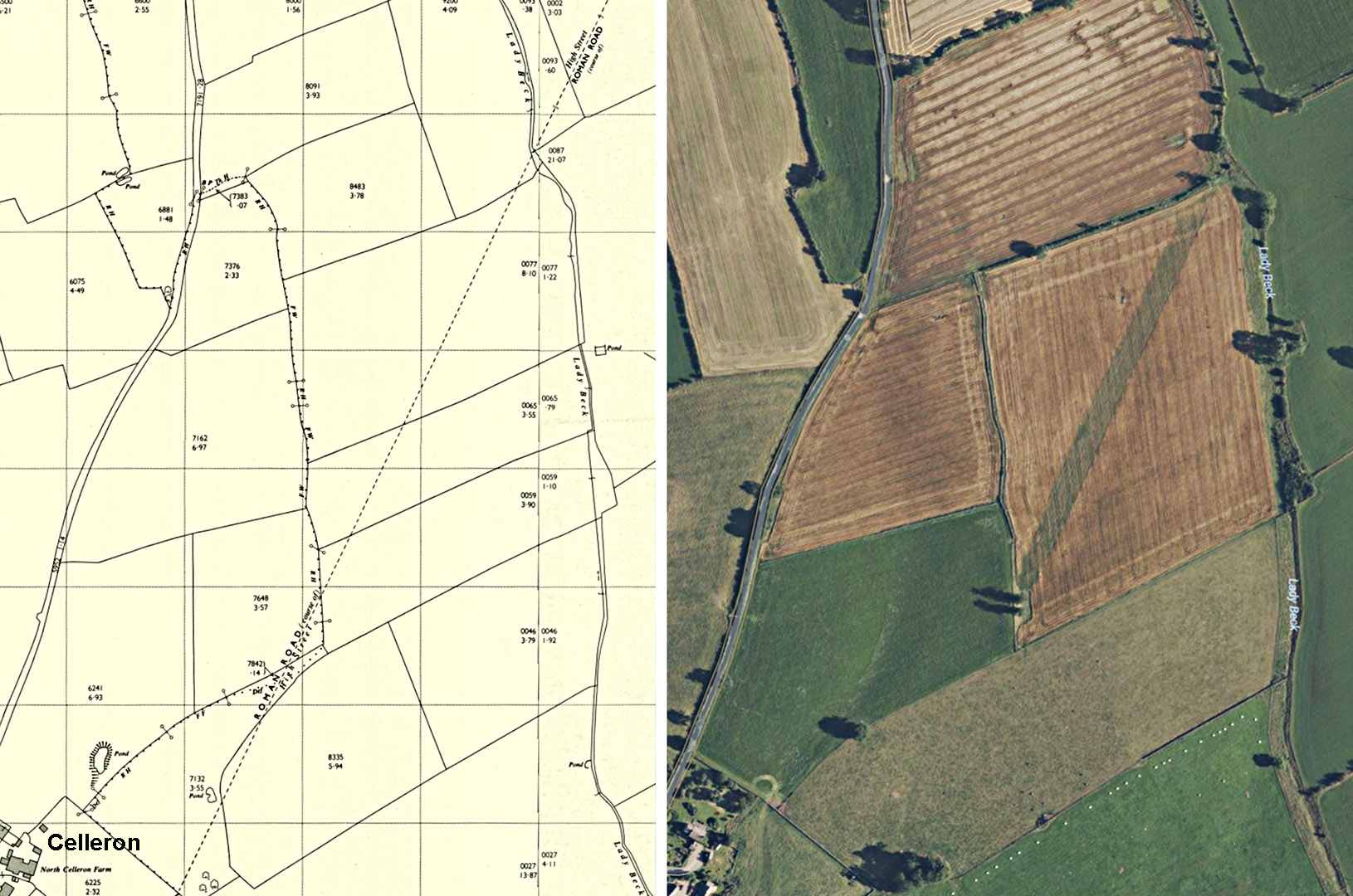
3D Lidar Image - Tirril to Celleron This is the first length shown on Modern OS maps as "Roman Road". Lidar fails to show anything supporting this line between the arrows. |
Click for larger view |
 |
2024 Update - Evidence suddenly appears - or does it? After 2000 years of no evidence for High Street emerging then miraculously it has suddenly appeared on both Bing and Google recent aerial photos (right). This is exactly on the line shown (confidently) on Ordnance Survey maps old and new (left). Of course this is a recent feature - nothing to do with a genuine Roman road. In 2022 a treeplanting scheme was proposed. A field-walking survey and a desktop study was undertaken - it found nothing so it was recommended either further research was carried out or the line of the "road" left unplanted. So the best of intentions means we have ended up with a prominent false-clue and one that will mislead researchers for years to come, especially as the trees either side mature. Oh dear! |
Click for larger view |
 |
Lidar Image - Brougham to Celleron I have shown a hypothetical route - the likely course if there were a Roman road to Brougham - but nothing is visible.There's no road here. |
Click for larger view |
 |
Route Map - Brougham to Celleron The lack of any evidence has resulted in some authors suggesting alternative routes to Brougham - but again nothing I can see in the Lidar data supports these.
|
Click for larger view |
 |
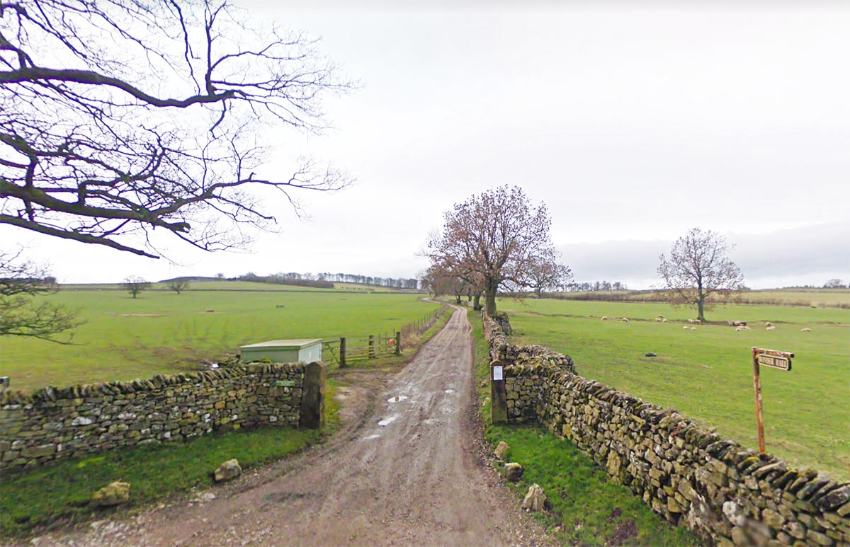
Track to Winder Hall This where High Street really begins along this track to Winder Hall. The public highway ends here. |
Click for larger view |
 |
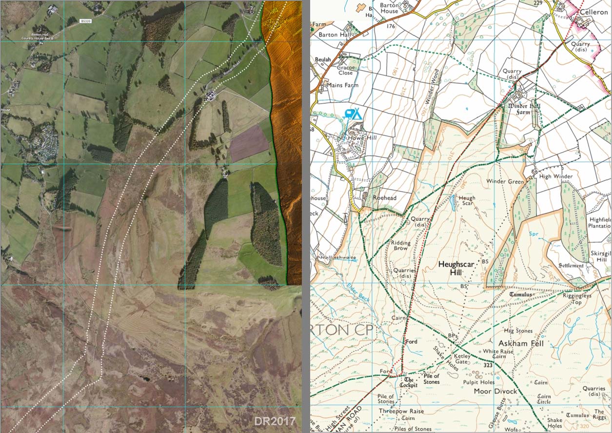
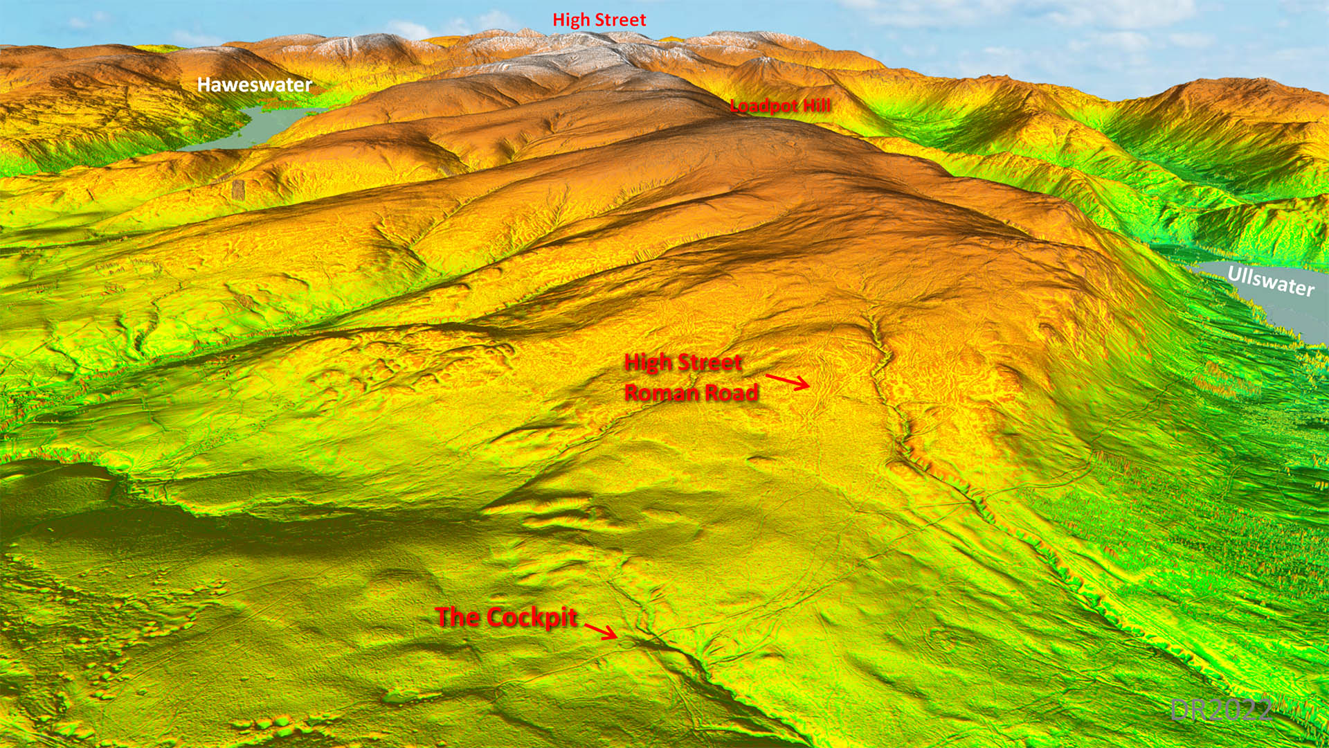
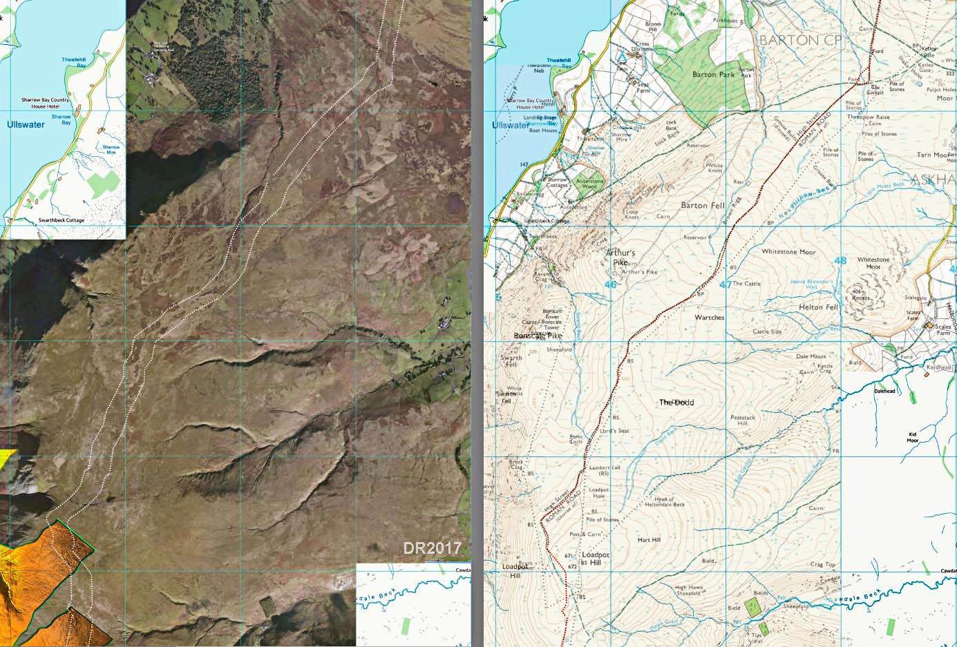
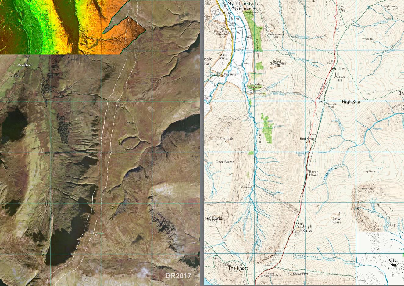
Aerial Image and Route Map - Celleron to Cockpit The road up to Winder Hall is called Roman Road - is this a clue or optimism? On the open fell we now have visible tracks. The track marked as Roman leads to the Cockpit on Moor Divock. The latter is covered with signs of pre-Roman activity and the Cockpit shows there was a lot going on up here long after the Romans as well. Peat cutting is also supposed to have been extensive. Today all is quiet here but don't be fooled - this spot was a hive of activity in the past. At the Cockpit we are 1000 feet up. |
Click for larger view |
 |
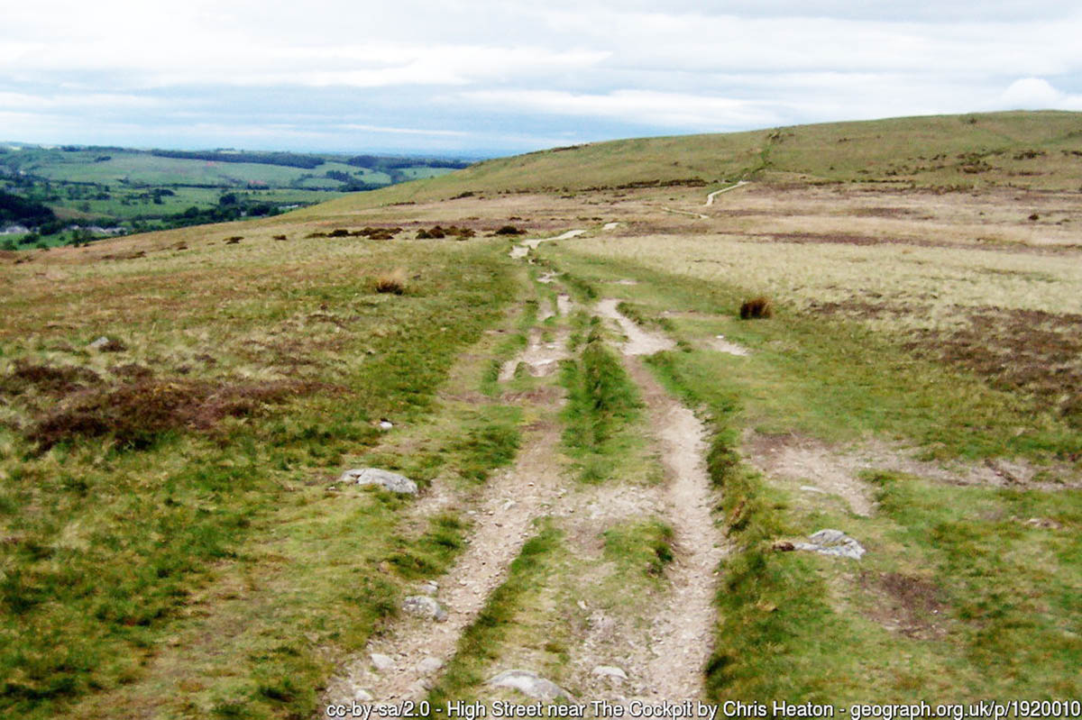
The Cockpit - looking north (NY483222) Looking back to Tirril from near to the Cockpit. The road is seen coming up across the north slope of Heughscar Hill. Photo: Chris Heaton |
Click for larger view |
 |
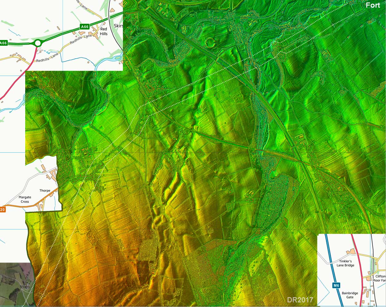
Oblique 3D Lidar - The Cockpit to High Street In this widefield Lidar view we get the full extent of the climb from the Cockpit crossing over Loadpot Hill and on to High Street. |
Click for larger view |
 |
Lidar + Aerial Image and Route Map - Cockpit to Loadpot Hill To negotiate Loadpot Hill the road skirts around its western slopes.
|
Click for larger view |
 |
Warches - Road looking north-east from NY465203 We are looking back towards the Cockpit and Heughscar Hill. Cross Fell is in the far background. The road is clear and straight here but very narrow. The track to the right heads for Helton Fell/Knotts.
Photo: David Purchase |
Click for larger view |
 |
Lidar + Aerial Image and Route Map - Wether Hill to Knott The route now is reasonably direct before it reaches Riggindale and has to swing westwards. |
Click for larger view |
 |
Wether Hill - looking back to Loadpot Hill Both Wether Hill and Loadpot Hill are over 2000 feet. Only a meandering track (Packhorse trail?) is visible here. Photo: John Poulter |
Click for larger view |
 |
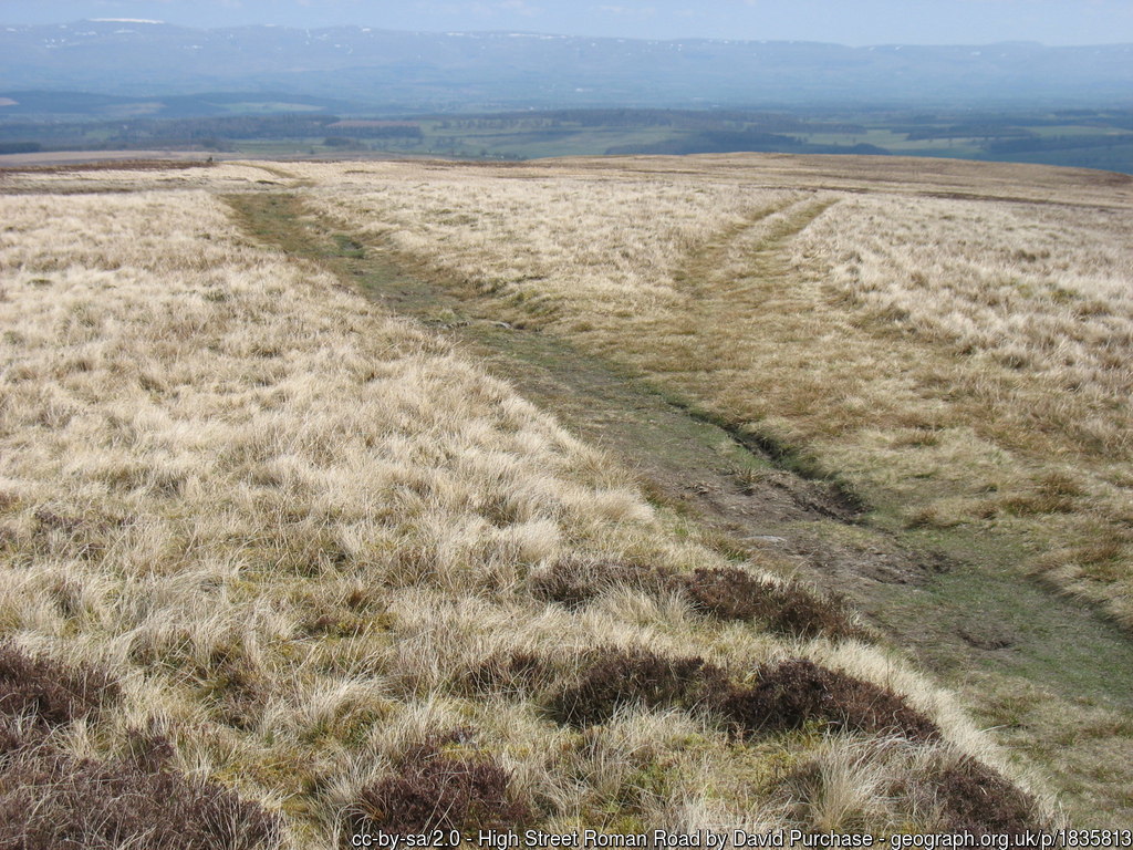
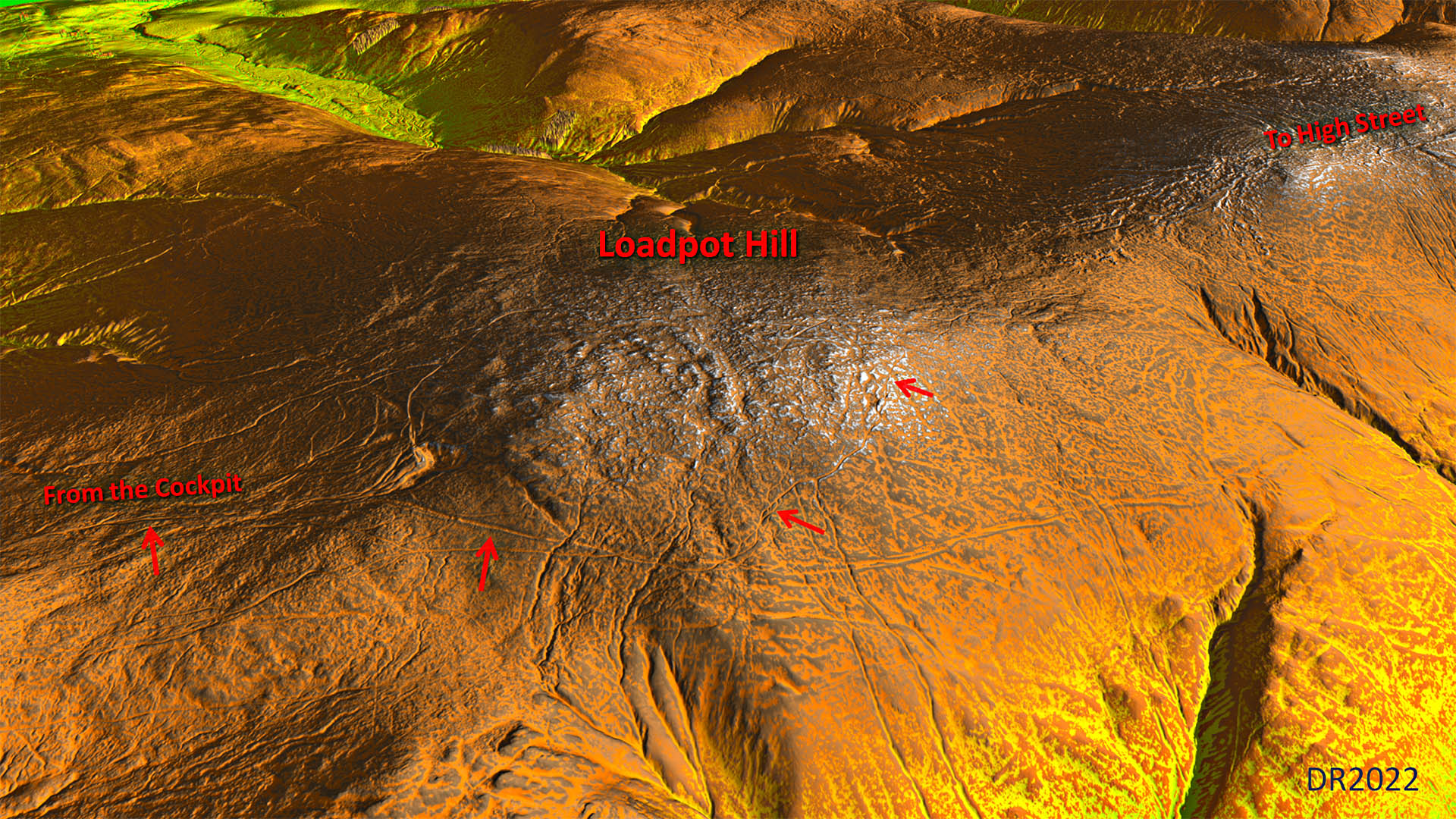
Oblique Lidar Image - Loadpot Hill The road skirts around the west side of Loadpot Hill. The first section (left two arrows) is marked up on OS Maps as High Street signifying it is clear there. The second part - well - if that is a Roman road then something went wrong! It is an insignificant meandering track. The official supposed Roman raod appears not to head towards High Street but carries straight on down i towards a side valley ravine (right edge of this view). What did the famous hillwalket Wainwright have to say about Loadpot Hill back in the 1950s? High Street he refers to as ”a line of ruts in the grass” and on the side of Loadpot Hill as a “grooved path”. |
Click for larger view |
 |
Raven Howe - looking north to Red Crag There does seem at last to be traces of a curving road (hollow-way again) under the wall. However, this is not what the OS record as High Street - they mark the faint track to its left passing closer to Red Crag.
Photo: John Poulter |
Click for larger view |
 |
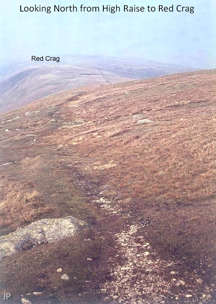
High Raise - looking north to Red Crag Just a track here - nothing significant visible but there is a shallow cutting north of this spot, just over the crest. The wall in the previous picture can be seen in the distance.
Photo: John Poulter |
Click for larger view |
 |
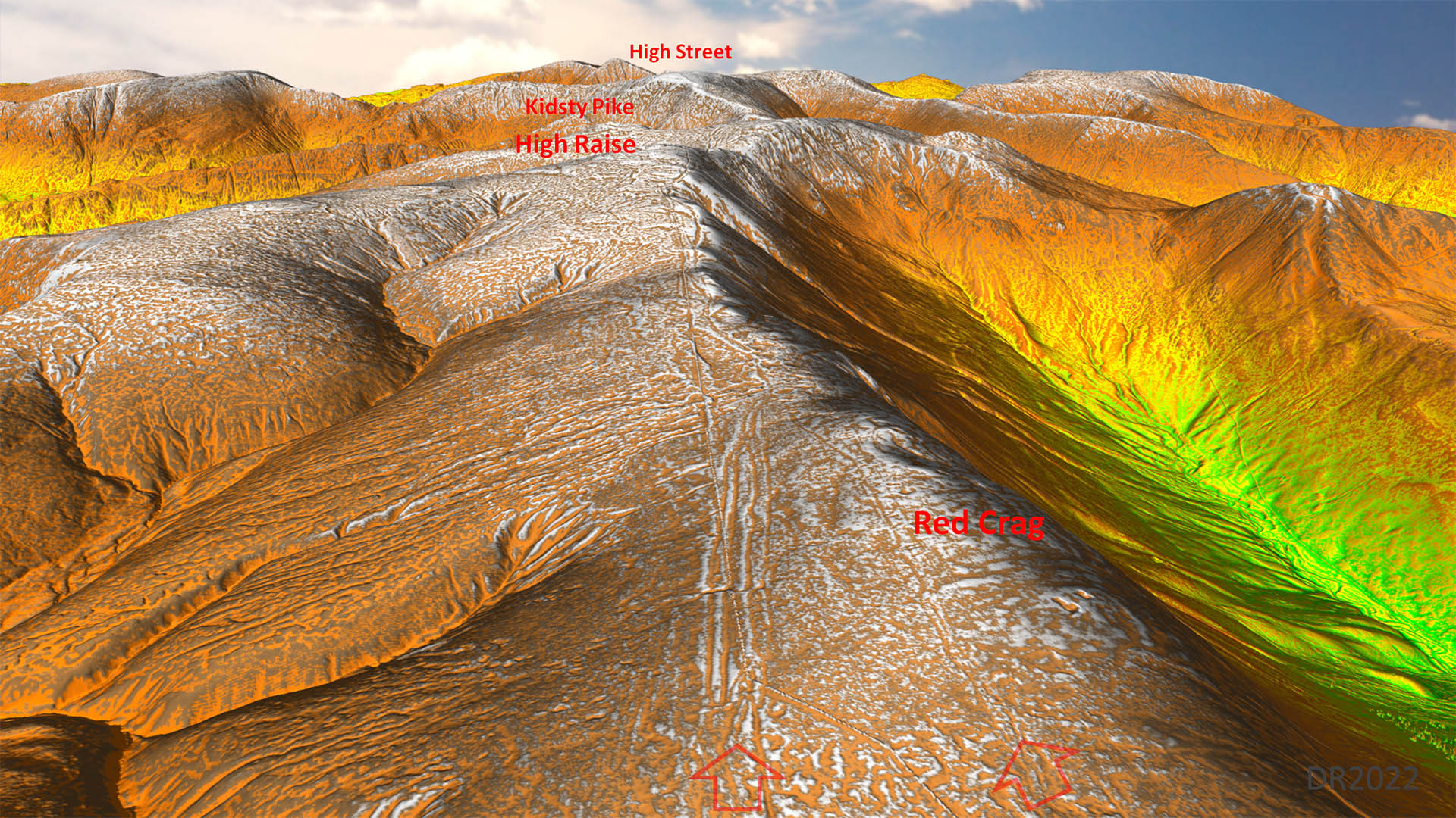
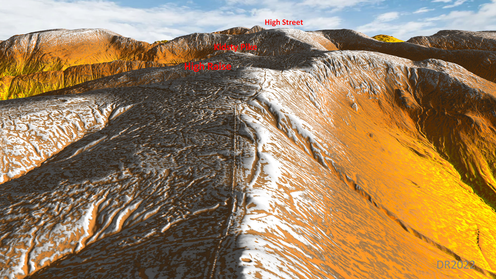
Oblique 3D Lidar - Red Crag looking south to High Raise & Kidsty Pike The Ordnance Survey indicate the right arrow is the Roman road. Neither look typically Roman. Note how the old boundary wall was able to take a very straight line. So a straight alignment was perfectly feabible here but instead we have a wandering trackway. |
Click for larger view |
 |
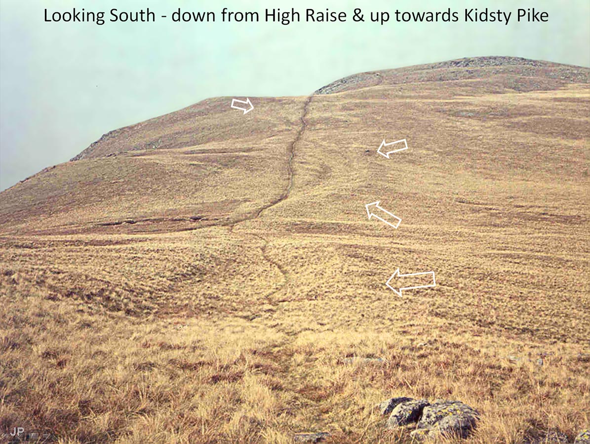
High Raise - looking south to Kidsty Pike Clearly a man made road zig-zagging up towards Kidsty Pike. On close inspection the raised bank arrowed is not the agger of a road but the west (right) side bank to a hollow-way. Photo: John Poulter |
Click for larger view |
 |
Oblique 3D Lidar - Looking south to Kidsty Pike The euivalent Lidar view to John' Poulter's image above. Worryingly the road is clearly a hollow-way between raised banks. |
Click for larger view |
 |
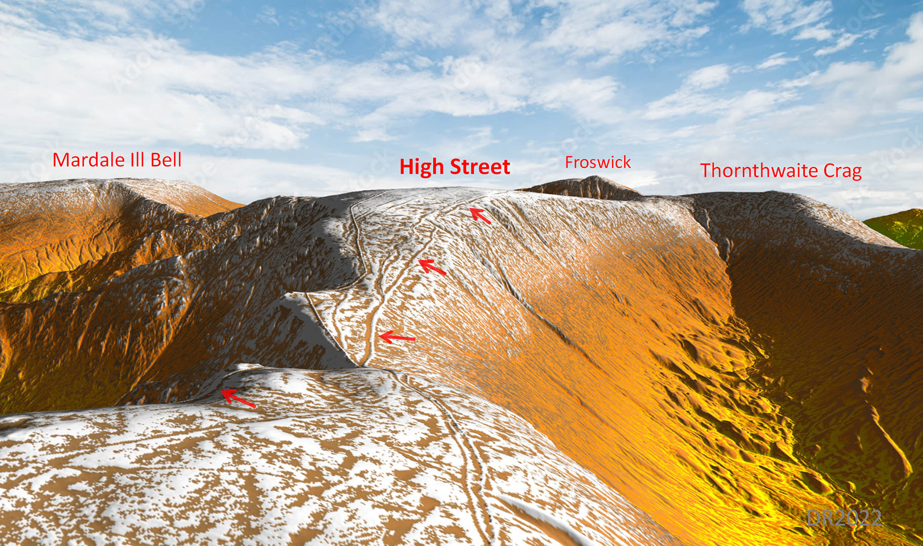
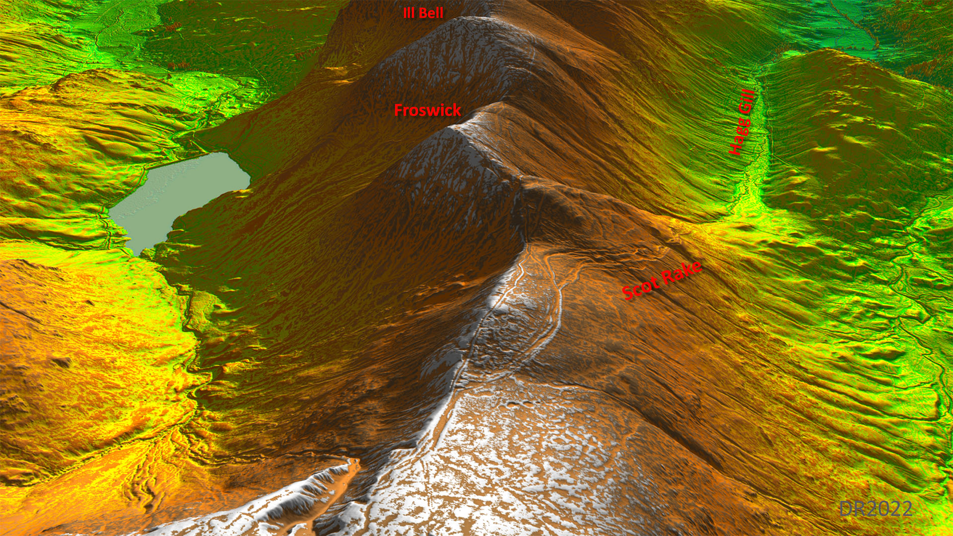
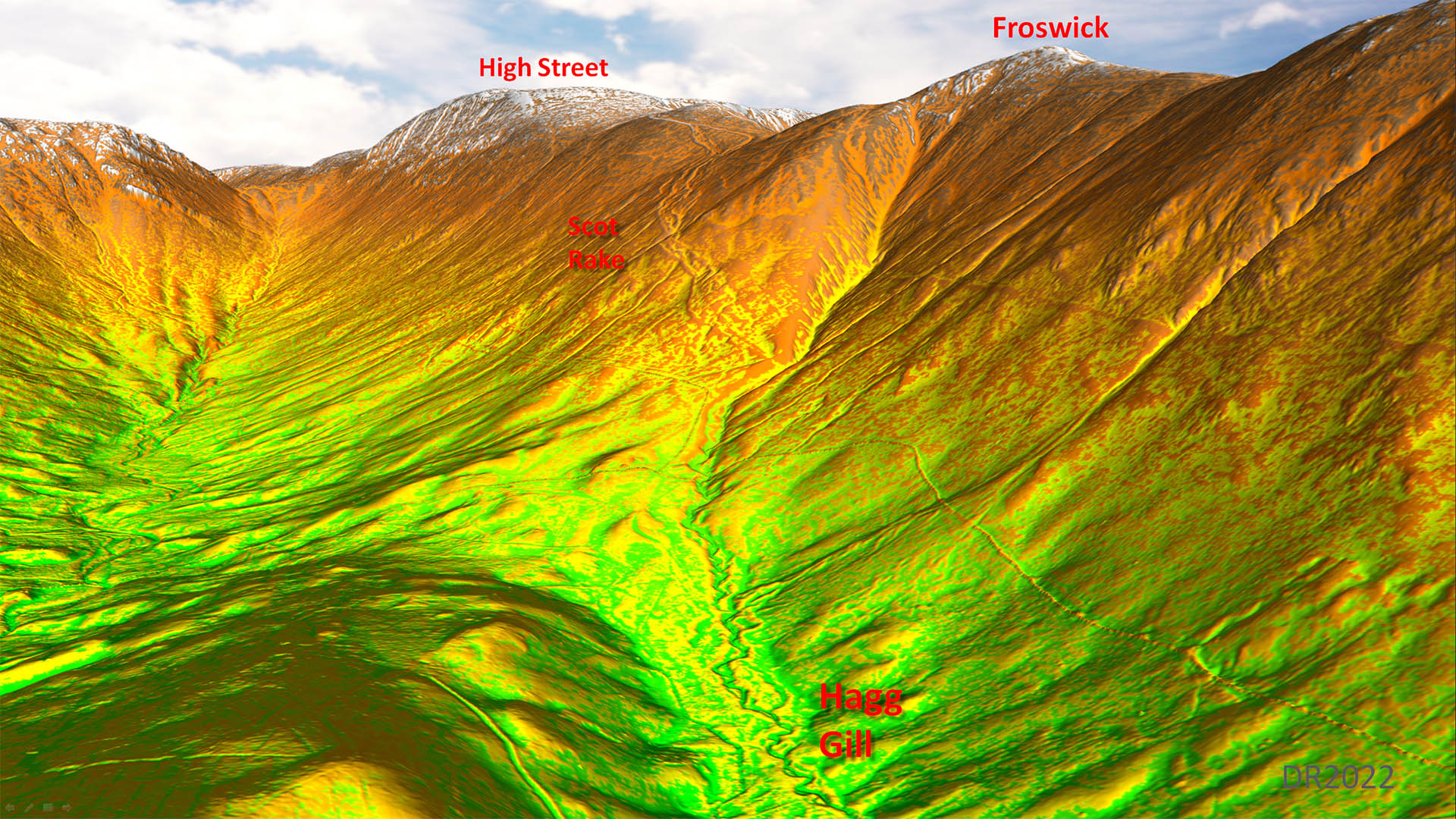
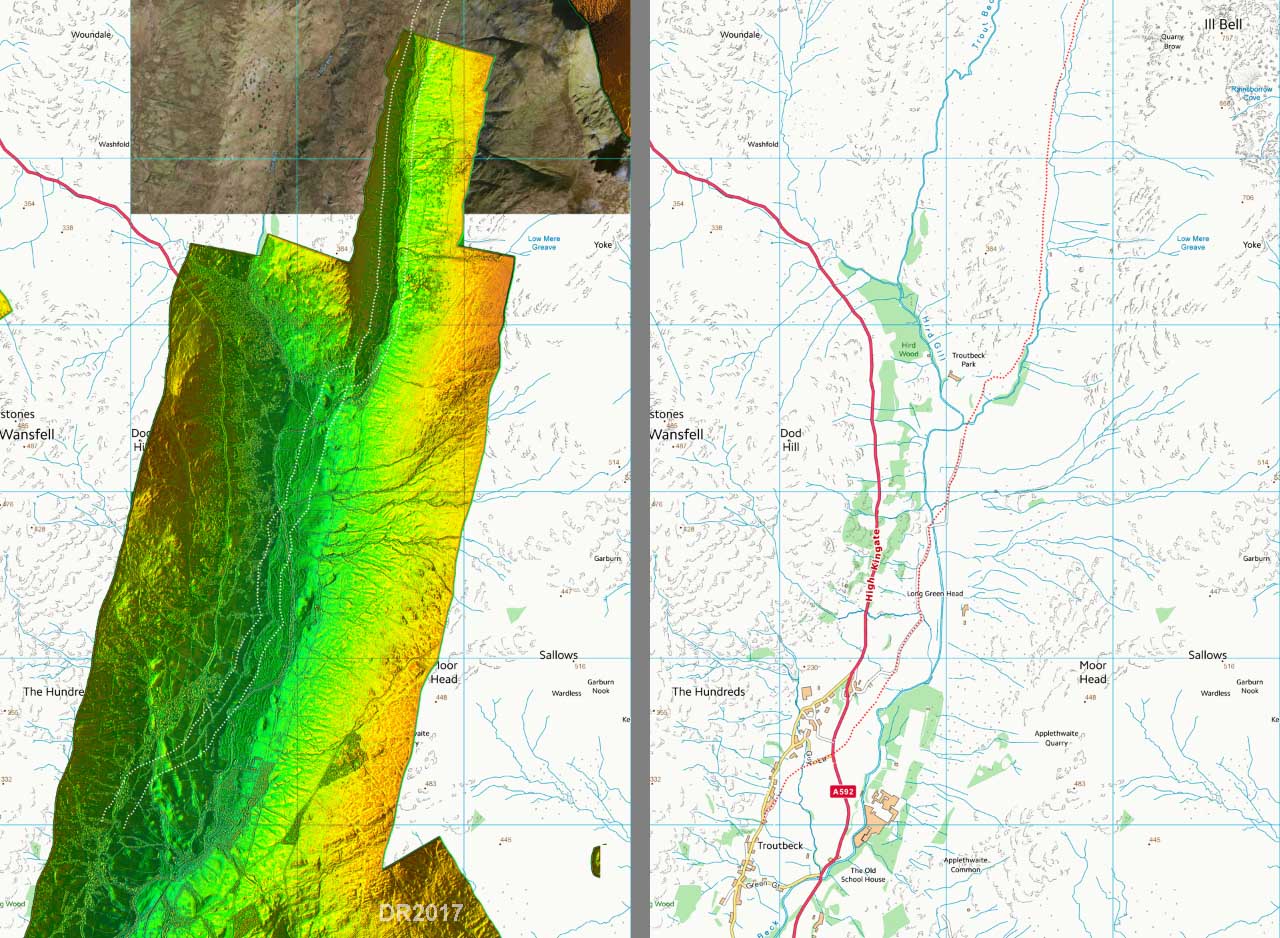
Lidar + Aerial Image and Route Map - The Knott across High Street to Hagg Gill/Troutbeck Valley The highest point of the road reaches is around 817 metres or 2680 feet. After High Street then the descent to the Troutbeck Valley valley begins - this is via the very steep Scot Rake. So steep some, including Hindle (1984), have suggested it could have kept to the tops via Froswick, Ill Bell and Yoke heading to the Garburn Pass. |
Click for larger view |
 |
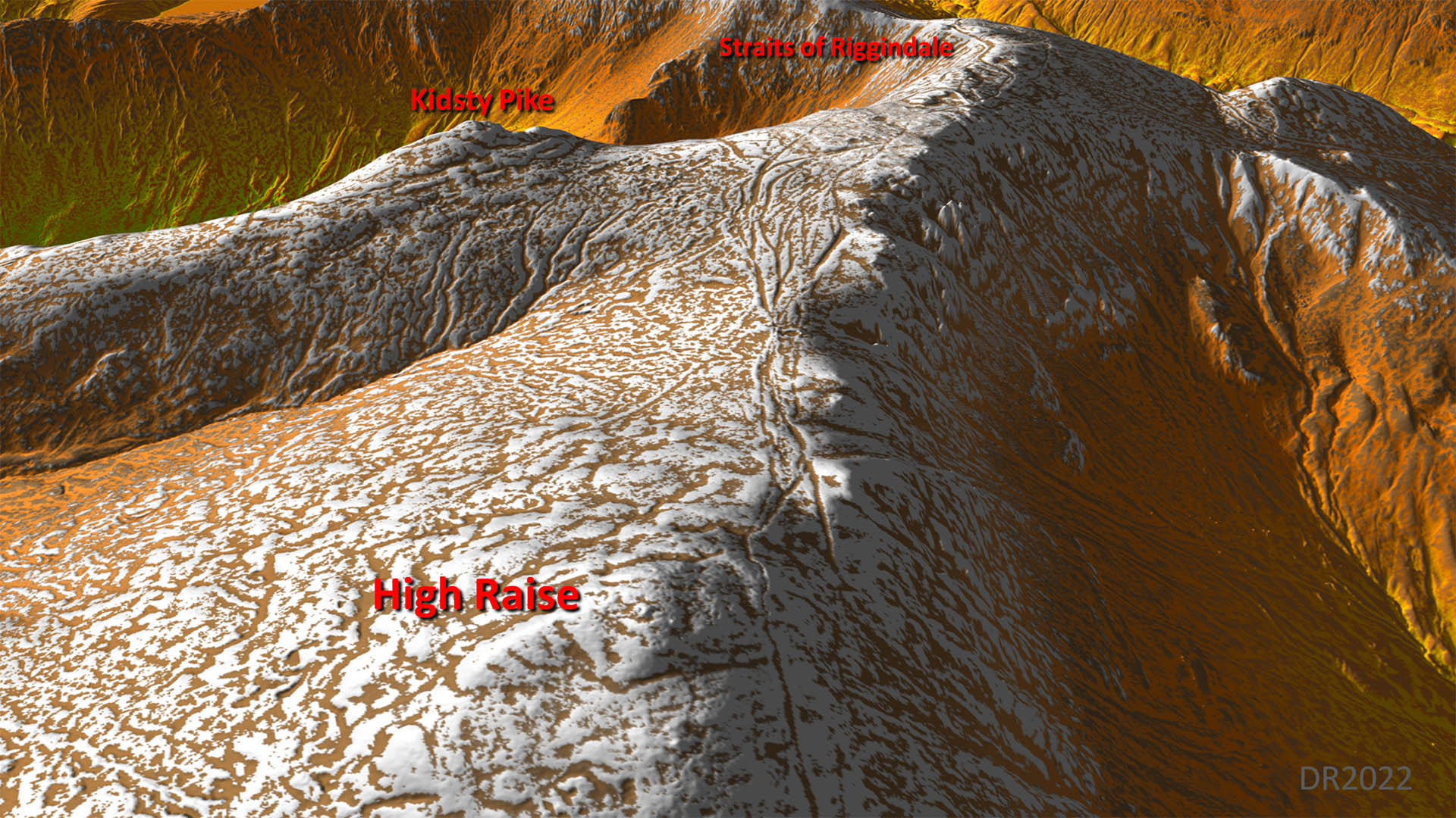
Oblique 3D Lidar - High Raise to Staits of Riggindale More braided tracks rather than a distinct Roman style agger |
Click for larger view |
 |
From The Knott across the Straits of Riggindale looking towards High Street Probably the most famous and most photographed section of the road where it climbs up from Riggindale towards High Street, the mountain. Normally the road is quite subtle but in snow it is remarkably evident. The alignment of three straights is typical of Roman engineering. What is also clear in snow is that the road is sunken i.e. a hollow-way with higher side banks. This is not typical of Roman engineering. Other high Roman roads in Cumbria i.e. Maiden Way and north-south road over Crosby Ravensworth Fell have distinct built up aggers with side ditches. Photo: Simon Connell |
Click for larger view |
 |
Oblique 3D Lidar - Straits of Riggindale looking towards High Street A similar Lidar view to that above. |
Click for larger view |
 |
Across the slopes of High Street The road is at is highest across the west side of High Street, just below the summit. No one would doubt that it is man-made and that it is indeed a road. But it is quite clearly a hollow-way not a built up agger. High Street was formerly known as Racecourse Hill and fairs were held up there. Photo: John Poulter |
Click for larger view |
 |
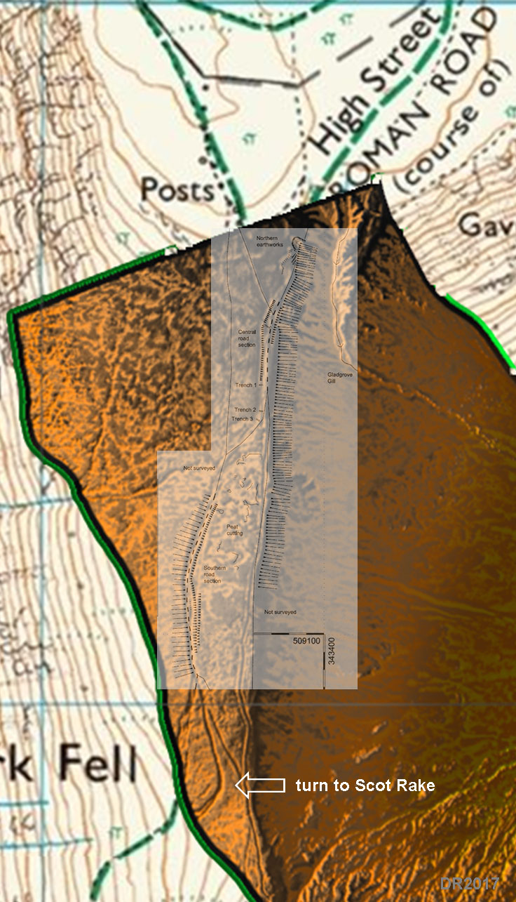
Lidar + Overlay of Greenlane Archaeology Investigation 2006 Greenlane Archaeology (Samuel Whitehead & Daniel Elsworth) carried out an investigation/excavation in 2006. It was commissioned by Lake District National Park before repairs to the footpaths were carried out - those Wainwright walkers have a lot to answer for. This is the first excavation of the road in modern times. For a full description of what was found see CWAAS 2008. In summary, they found was "not what might be described as typical for the Roman period". What they did find was a road surface, once with a (gravel filled) ditch but more generally with large side banks. But because Haverfield (1898) had reported (he didn't do the excavation) finding the road with side banks at the northern end, they concluded it was therefore like a known Roman period road. It does seem a circular argument to infer that what they found could be Roman because it matched another Roman road - unfortunately the same road. They also were very doubtful of the Scot Lane descent being Roman preferring the Froswick/Ill bell route suggested by Hindle. They did mention that south of their investigation area the road feature they examined continued on supporting that hypothesis. What is visible in the Lidar data is that the feature does indeed continue on beyond the modern path down for a short length but it then clearly makes a turn to the west to descend to the Troutbeck valley. A modern path is also visible heading off in the direction of Froswick but the feature - Roman or otherwise - didn't head that way. So what do we get from all this? Well, the road appears to be typically sunken with large side banks. The road almost certainly turns for a steep descent via Scot Rake.
|
Click for larger view |
 |
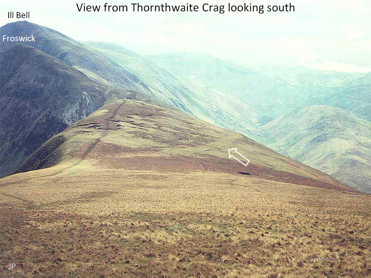
View from Thornthwaite Crag looking South This is the spot (arrow) investigated and excavated by Greenlane Archaeology - taken long before this area had become so damaged by walkers that it needed repair. The road they examined is clear and it is this feature, according to the Lidar, that finally turns for a descent down Scot Rake. T Photo: John Poulter |
Click for larger view |
 |
Oblique 3D Lidar - looking down Scot Rake Would you take a road down there? Packhore yes but a road! he suggested alternative high level route via Froswick and Ill Bell doesn't look too inviting but It does now have a brand new path courtesy of the LDNP. The story is they even had a mechanical digger up here to construct it. |
Click for larger view |
 |
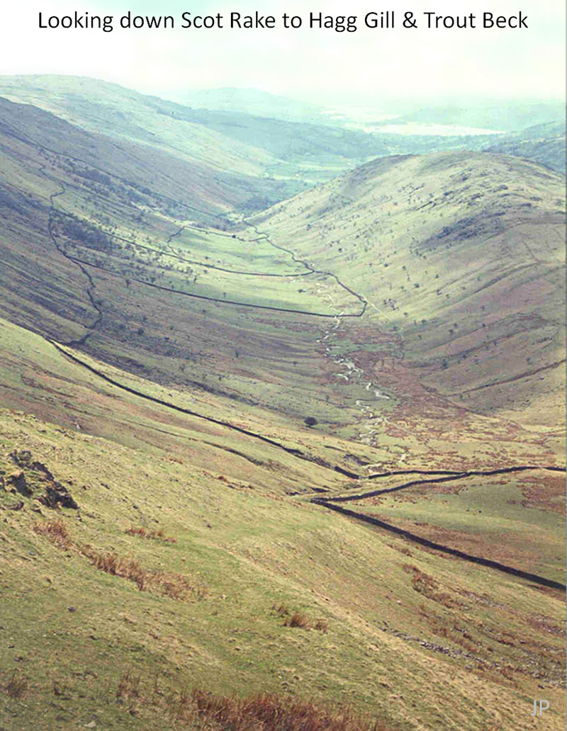
Looking down Scot Rake to Hagg Gill and Trout Beck There was grass on the descent in the 1960s! It is extremely steep - the gradients are 1 in 3 or 4. No wonder Paul Hindle and Greenlane Archaeology had their doubts and I would agree with them. Does it really look like a Roman road? Photo: John Poulter |
Click for larger view |
 |
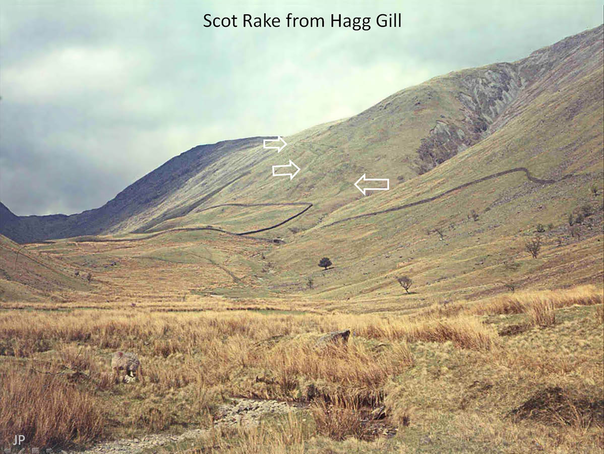
Scot Rake from Hagg Gill - looking north The zig-zags were very clear in the 1960s but they are fainter nowadays. Thousands of hill walkers have straight-lined the route and bypassed them, as has occurred elsewhere in the Lakes. Zig-zags like these were very typical of the Lakeland passes - usually dating from the packhorse era. Photo: John Poulter |
Click for larger view |
 |
Oblique 3D Lidar - looking up Scot Rake A similar Lidar view to John's picture above. |
Click for larger view |
 |
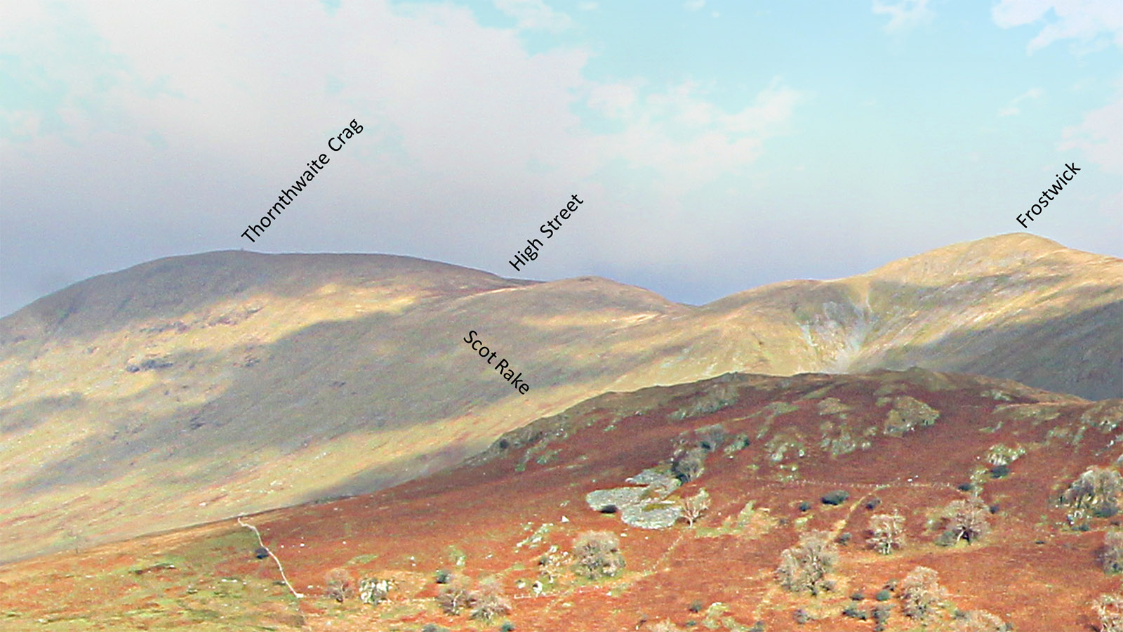
Scot Rake from the Kirkstone Pass Road The Scot Rake route looks unlikely but so does the suggestion by Paul Hindle for it heading across Frostwick. In reality there is no easy way off High Street. Photo: DR |
Click for larger view |
 |
Lidar Image and Route Map - Hagg Gill & Troutbeck Valley Modern farm tracks can complete the route down to join the Kirkstone Pass main road (A592). If Ambleside were the destination this route on the west bank of Hagg Gill would make most sense. Others have suggested a possible route on the east bank of Hagg Gill & Trout Beck which would better suit Watercrook. The Scot Rake - Troutbeck valley descent was apparently the route used by packhorses bringing peat down to the Windermere area. |
Click for larger view |
 |
DiscussionWe have now completed our journey along the most famous Roman road in the north-west. But is it Roman? Arguments for it:
Arguments against it:
Following several recent attampts to find/excavate High Street, which have all failed to provide any evidence of a Roman road, I think we can finally confidently discount this road of being of Roman construction.
|
|
|
|
Return to Cumbria Roman Roads homepage Last update August 2024 |
© David Ratledge |