 |
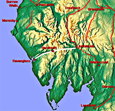
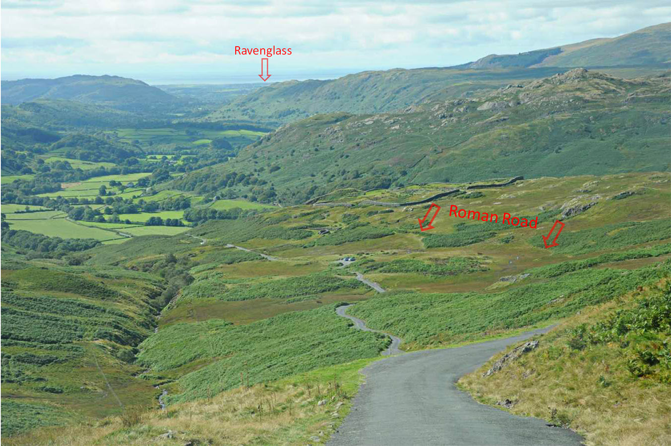
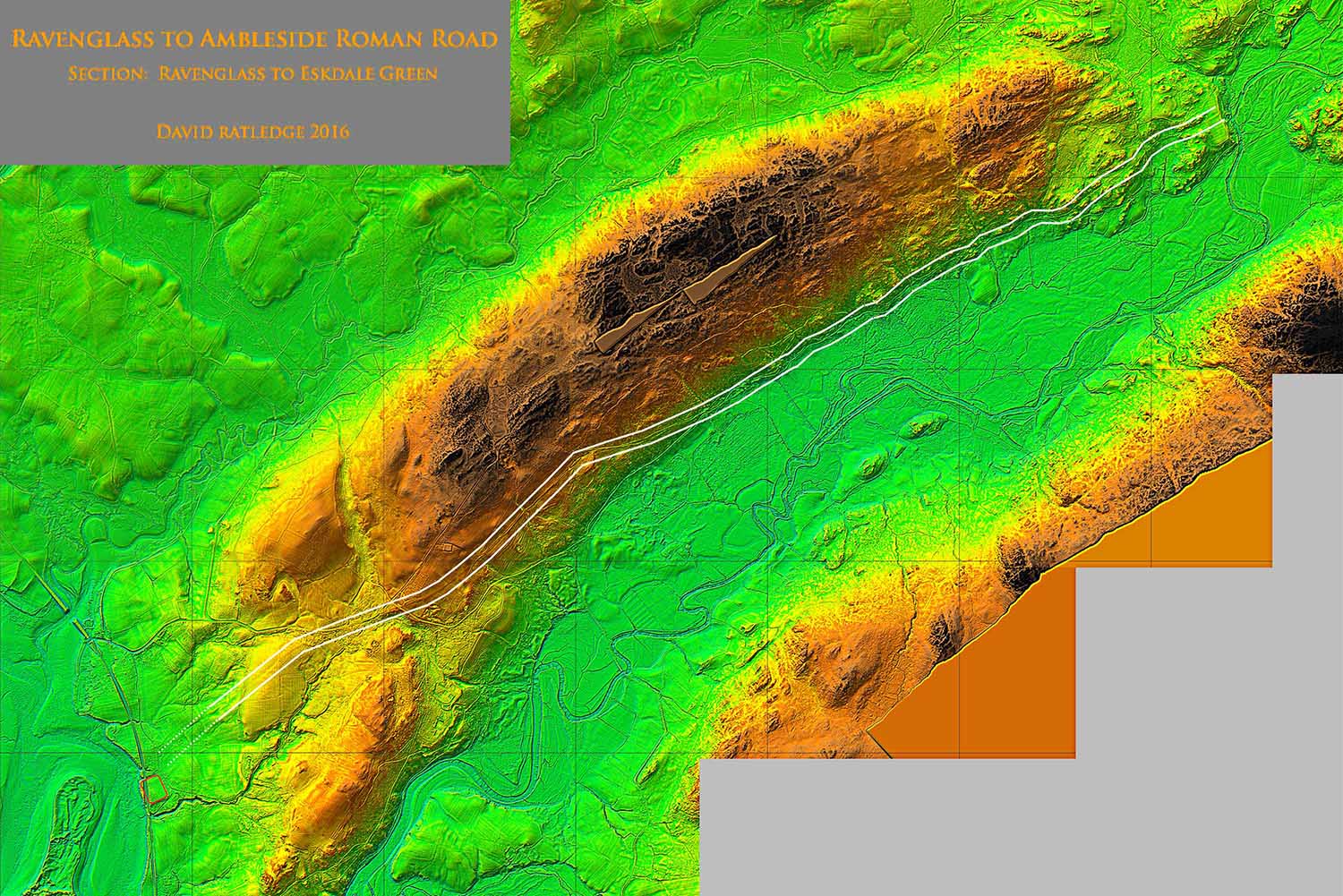
The Roman Road from Ambleside to Ravenglass, Margary 740The definitive work on the course of this Roman road was carried out by Professor Ian Richmond over 70 years ago. His findings still stand today but the two extremities of the road, west from Ambleside and east from Ravenglass could only be surmised in his day. Lidar has enabled progress to be made at the Ravenglass end but the eastern end (Ambleside to Wrynose) is still very much "work in progress". This a spectacular road and travelling it today is still an adventure with Wrynose and Harknott passes to be overcome.
|
Lidar Image - Route(s) to Little Langdale There is very little positive evidence to Little Langdale. South of the River Brathay is probably favourite to Skelwith but a northern bank route is also possible |
Click for larger view |
|
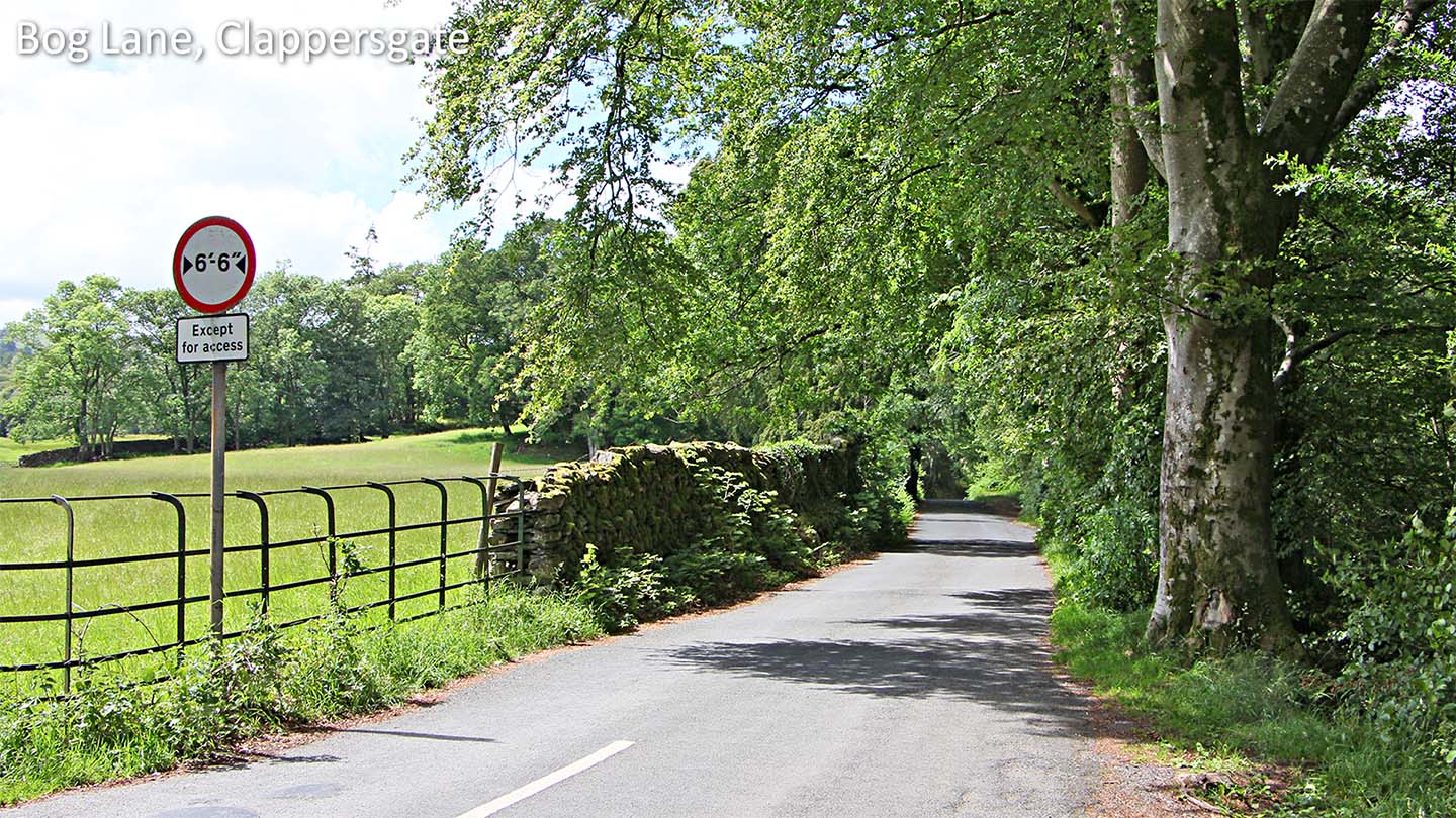
Bog Lane, Clappersgate The start of Bog Lane and the first really definite part of the route on the south route option. |
Click for larger view |
|
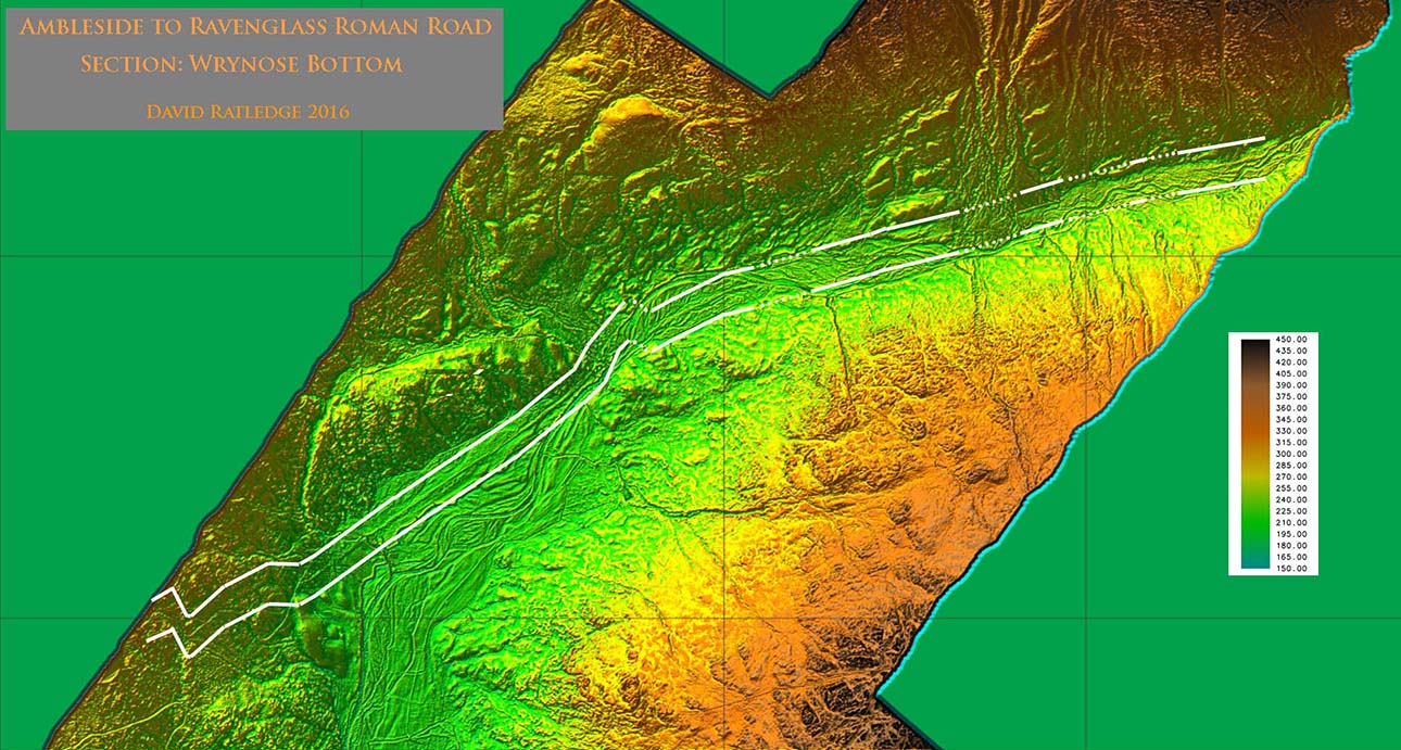
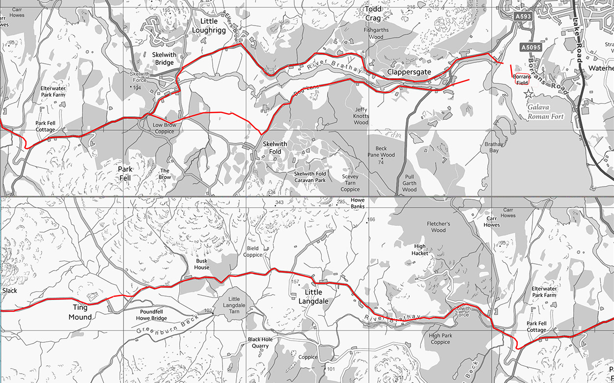
Routemap to Little Langdale Both options to Skelwith are shown. West of there, although evidence is somewhat lacking, the route shown is most likely correct. |
Click for larger view |
|
Lidar Image - Colwith to Little Langdale The Roman line coincides with the A583 for a while until the descent to Colwith Bridge is where it separates. The Roman descent is clear on the Lidar and is north-east of the modern road.
|
Click for larger view |
 |
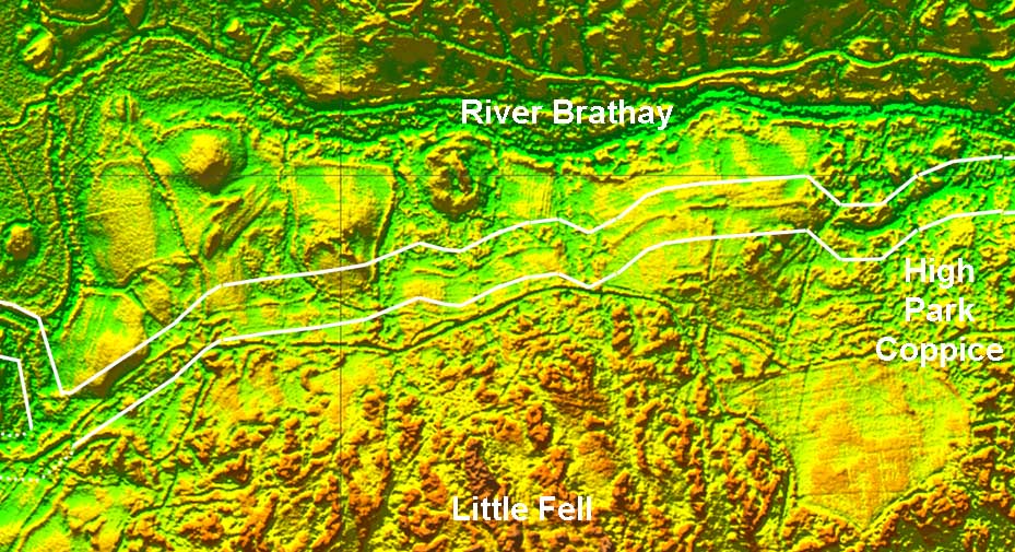
Lidar Image - Little Fell West of High Park Coppice, across the north side of Little Fell, there are clear traces of the probable Roman agger visible. |
Click for larger view |
 |
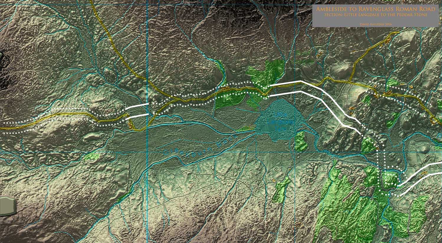
Lidar Image - Little Langdale The obvious route would appear to be south of Little Langdale Tarn marked on modern maps by a footpath. However, this shows no Roman characteristics and has been discounted by previous researchers. On balance therefore is believed the road headed north of the tarn and there is some Lidar evidence for this route. There is also a possibility that the road kept north of the Brathay from Colwith (dotted). |
Click for larger view |
 |
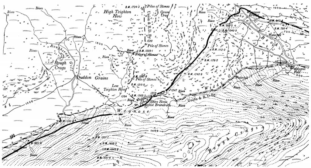
Wrynose Pass Roman Road - Richmond 1947 Richmond's map of 1947 was the definitive route here. Surprisingly little of the modern road follows it. |
Click for larger view |
|
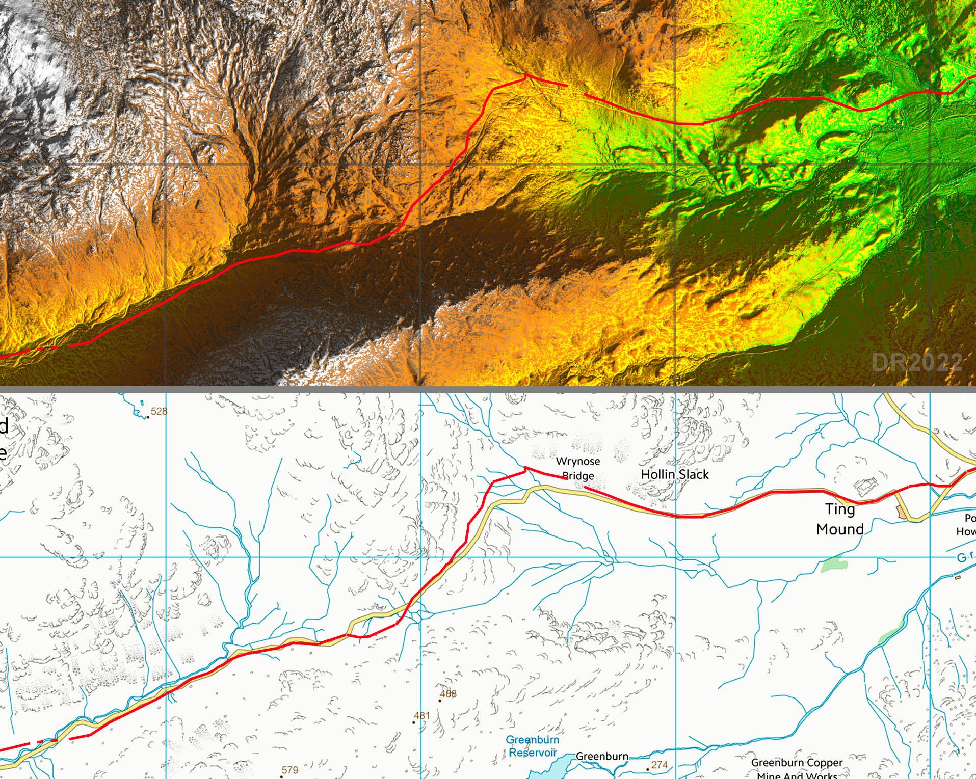
Lidar Image & Route Map - Wrynose Pass With the release os series 2 Lidar early in 2022 we can now plot the route over the summit. How did Richmond fare? Well it would seem he was very much on the money! |
Click for larger view |
|
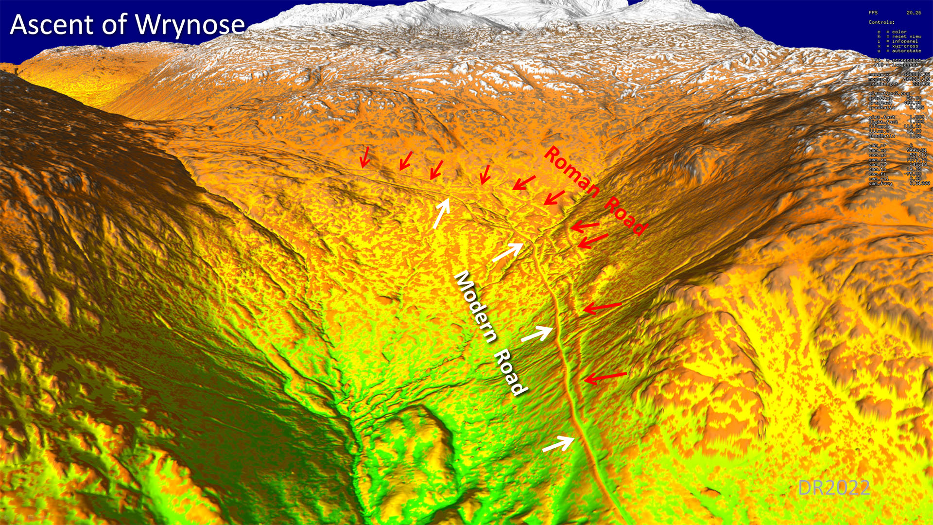
Oblique 3D Lidar - Wrynose ascent I have marked the Roman and modern roads with arrows as in this case corridor lines would have covered relevant details. As we now can confirm, Richmond's route is supported by the lidar data. |
Click for larger view |
|
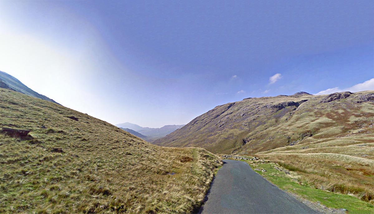
Wrynose Summit Pass The Roman road is the faint flattish feature on the left side of the modern road. We are looking west towards Hardknott and Ravenglass. |
Click for larger view |
|
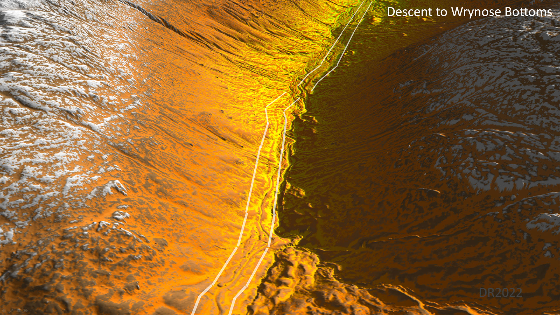
Oblique 3D Lidar - Descent to Wrynose Bottoms Initially on the left side of the river and modern road, but the Roman road eventually crosses over to the north side in the valley bottom.. |
Click for larger view |
|
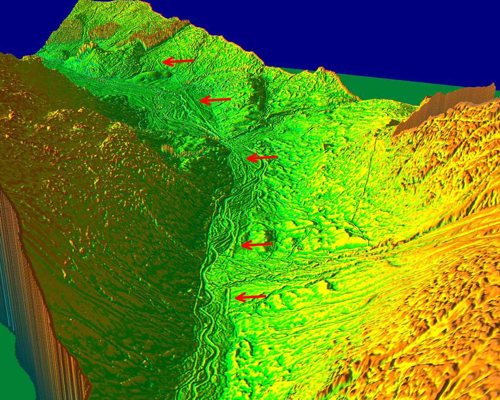
Oblique 3D Lidar Image - Wrynose Bottoms, looking west. One of the best surviving stretches on the whole route. Just where you would expect it have been washed away, it is still remarkably clear and visible from the modern road. No ploughing here of course so the agger is still prominent. |
Click for larger view |
 |
Lidar Image - Route Wrynose Bottoms The road oddly kept to Wrynose Bottoms as long as it could before its ascent to Hardknott pass. The modern road is actually more direct. |
Click for larger view |
 |
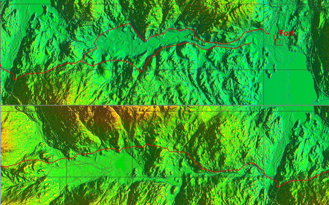
Oblique 3D Lidar Image - Hardknott Fort. With the release of series 2 lidar we now have the route passing the Fort. The parade ground is also evident and does look like it could have been made from an earlier fort?
|
Click for larger view |
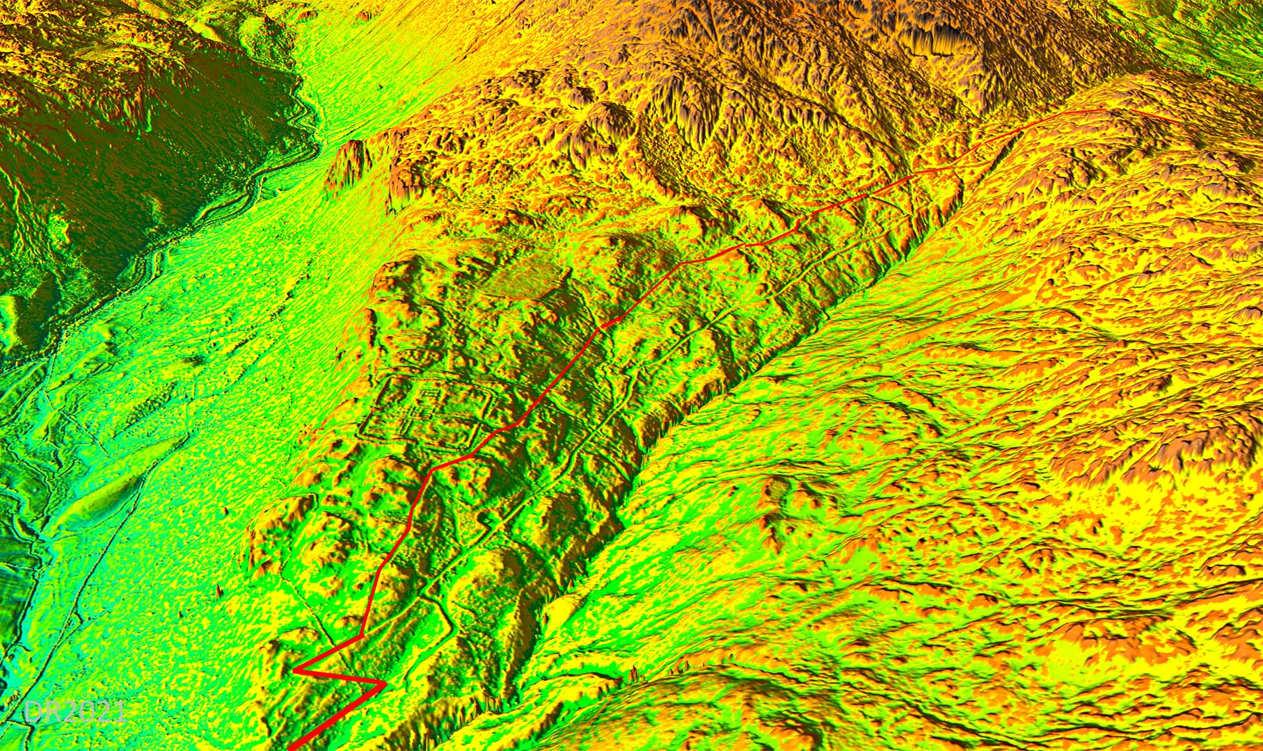 |
Lidar Image - Route over Hardknott Pass and passing the Fort They chose an easier ascent to Hardknott Pass than the modern road at the expense of a less direct and longer route. The ascent via the Roman route averages around 1 in 7.5 although like the modern road the ends of the zig-zags can be steeper.
|
Click for larger view |
 |
View from Hardknott Pass - looking west From the top of the pass the modern and Roman lines coincide but at the end of the hairpin bend that swings to right in the picture, the Roman road diverges and takes a higher line to the fort. |
Click for larger view |
 |
|
NEW - 3D Lidar video flyover from Wyrnose Bottoms to Hardnott Fort |
Western Route MapThe situation from Eskdale Green to Ravenglass has now become much clearer with the route of the road determined with high confidence.
|
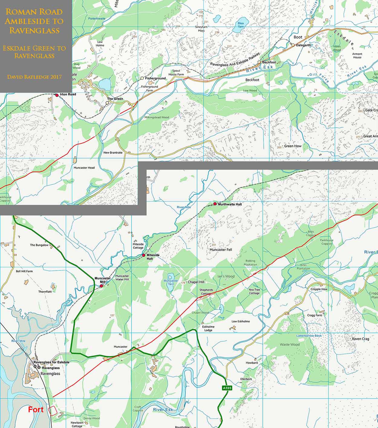
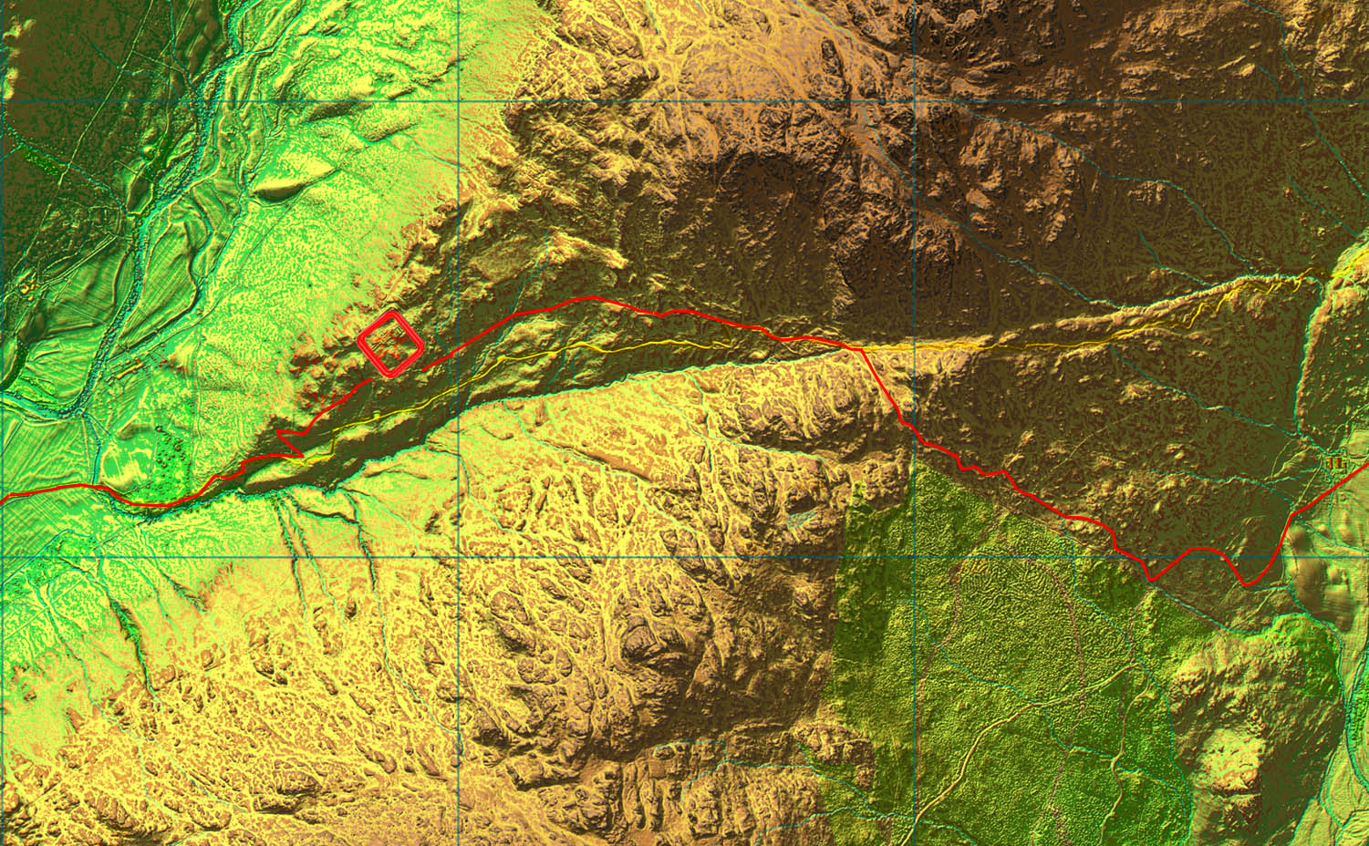
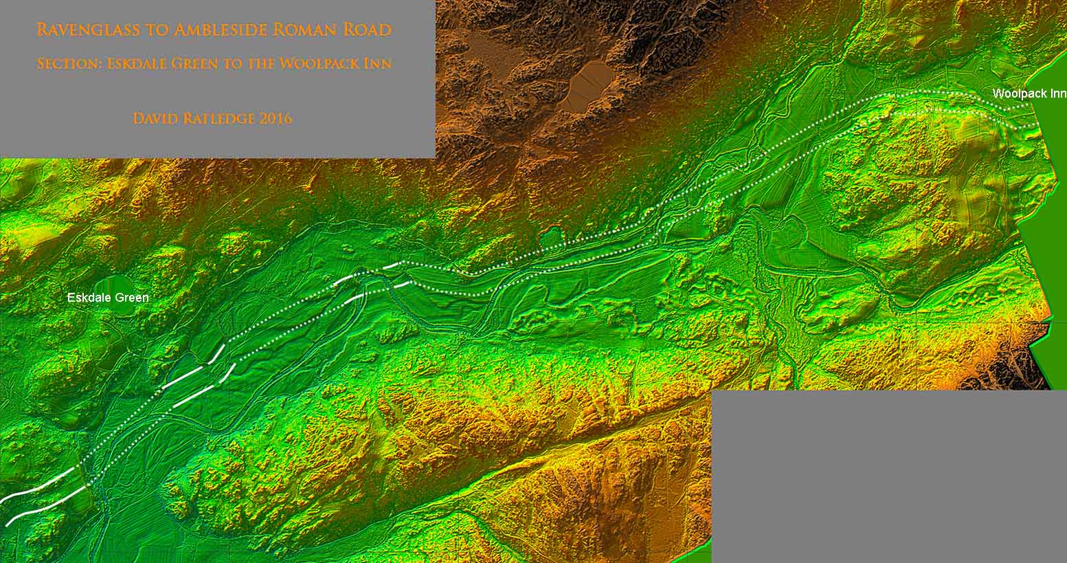
Lidar Image - Woolpack Inn to Eskdale Green From the foot of Hardknott Pass to Eskdale Green the Roman and modern roads coincide. There are one or two deviations such as Spout House Farm/Hillin Head (see next image) but generally there is nothing now visible. The modern and Roman road finally separate at Eskdale Green. It would appear that later movement of the River Esk has destroyed the Roman line and the modern road has had to divert further south. |
Click for larger view |
 |
Agger - Hollin Head Cottage Hollin Head Cottage is on the modern road near Spout House Farm. Here the modern road and the Roman road diverge for a short section. The Roman agger is pronounced and clear but has been washed away beyond the trees by movements of the river.
|
Click for larger view |
 |
Agger - approaching The Green Again the modern road and the Roman road diverge approaching The Green. The Roman agger is pronounced and is now heading for Forge Hills but the river has destroyed a long section.
|
Click for larger view |
 |
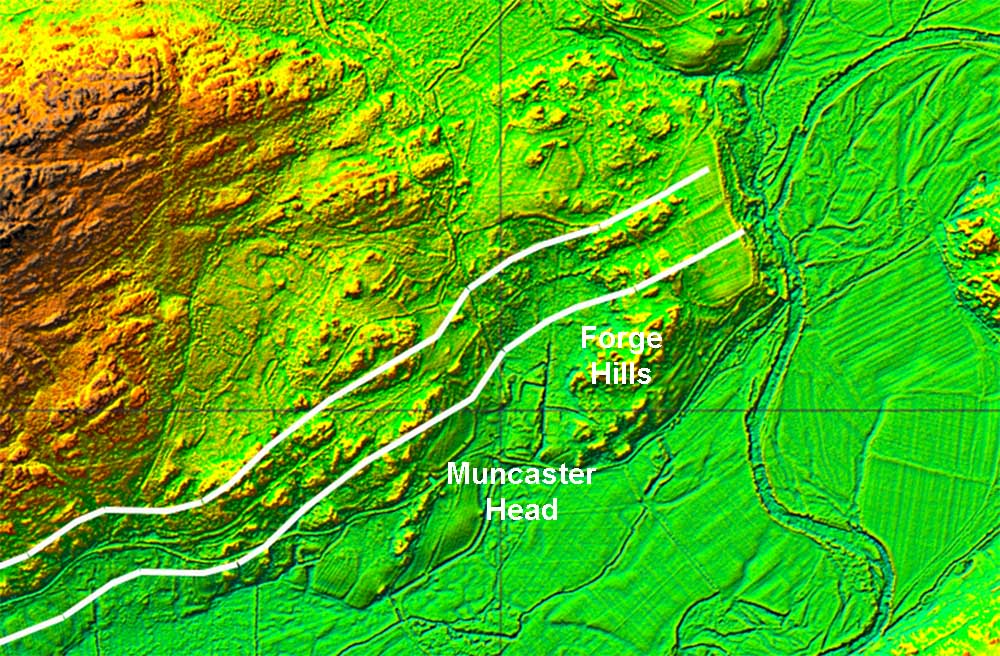
Lidar Image - Forge Hills West of Eskdale Green the agger resumes. It is clear where It crosses Forge Hills (SD1432 9931) and passes north of Muncaster Head.
|
Click for larger view |
 |
Lidar Image - Eskdale Green to Ravenglass Alongside Muncaster Fell, the Roman line mostly coincides with a modern track, but again several deviations occur here and there such as at Birks Coppice. This stretch passes close to the Muncaster Roman kilns. The final run in to Ravenglass is very clear on the Lidar (see next image).
|
Click for larger view |
 |
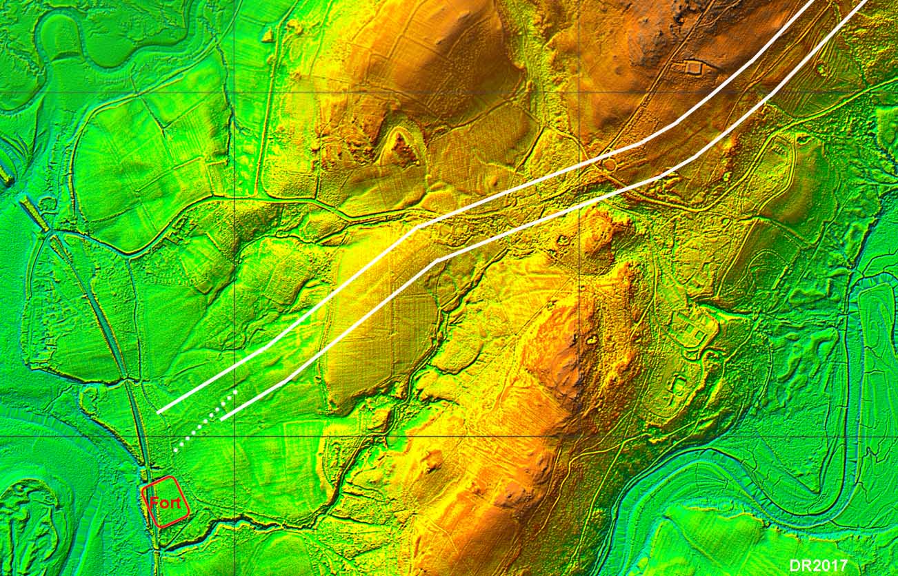
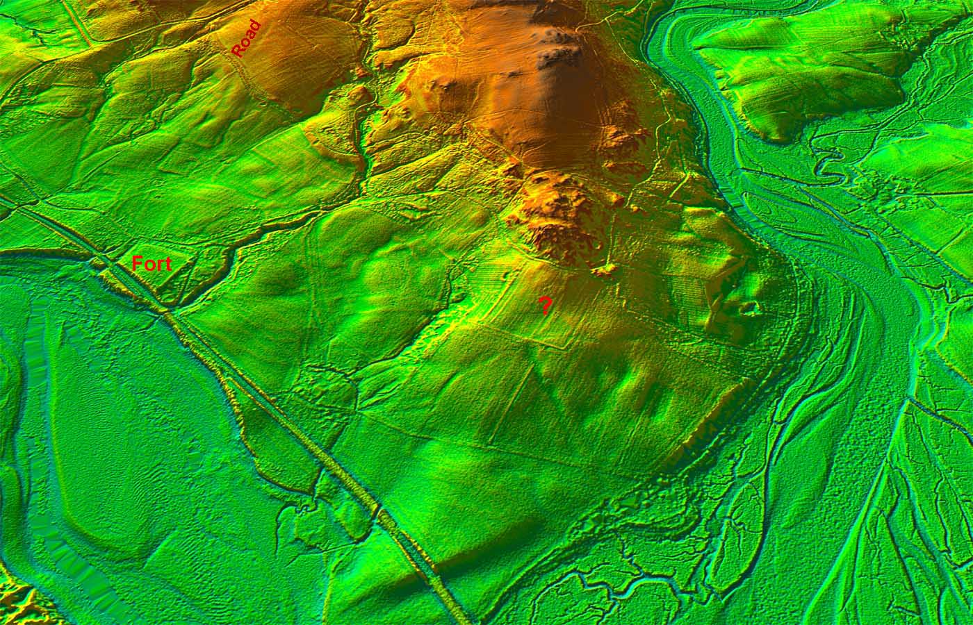
Lidar Image - Ravenglass Recently, as part of the Romans in Ravenglass Community Archaeology Project, the road in the vicinity of Ravenglass fort was found. Lidar also shows this clearly and has extended the line into Eskdale. Until the Romans in Ravenglass project, it was generally believed that this road emanated from the fort's east gate. The project found that it actually lay around 150 metres north of the fort. In addition, Lidar indicates that there was possibly another road branching from this one towards the bath-house and fort (dotted). The main route from the fort environs is very clear and again across Muncaster Chase (SD1030 9685). Quite why the alignment of the road is so obviously north of the fort remains a puzzle.
|
Click for larger view |
 |
3D Lidar Image - Ravenglass Fort setting. View is from the south-west.
|
Click for larger view |
 |
|
NEW - 3D Lidar video from Ravenglass Roman Fort following the Roman road up Eskdale |
|
|
|
|
|
Return to Cumbria Roman Roads homepage Last update: December 2023 |
© David Ratledge |