 |
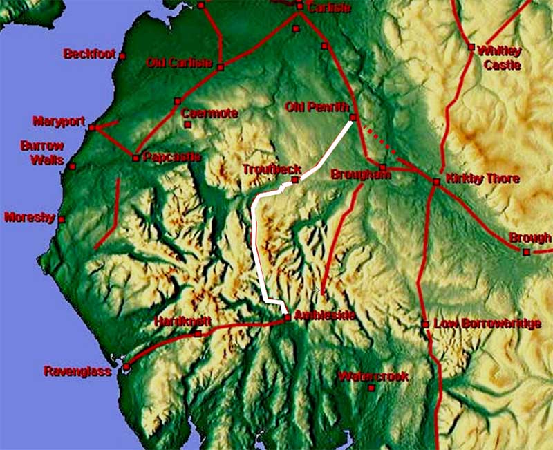
The Roman Road from Ambleside to Old Penrith, Margary 741In reality a "new" road through the centre of the Lake District. Margary actually only numbered the Troutbeck to Old Penrith section as 741 but we now know that this length was just part of a road from Ambleside.
The existence of a road south-west from Old Penrith has been known since West (1778) but its destination had never been satisfactorily explained despite the best efforts of Richard Bellhouse and Martin Allan. The former was convinced it must head for Keswick but could find no evidence on the ground ( C&WAAS 1955) west of Troutbeck. Allan on the other hand believed he had found evidence for "The Roman Route Across the Northern Lake District" (1994) with an east-west route from Brougham to Moresby on the coast, This would have connected to the road from Old Penrith. It would take the advent of Lidar to at last solve the mystery of where Roman road Margary 741 was really heading - it was Ambleside. Probably the first to realise the the true nature of this road was Hugh Toller. The clues were very much teamwork and thanks are due to Hugh Toller, Martin Pugmire and Bryn Gethin for sharing their discoveries. Individually the clues/evidence is sporadic but put together then the complete road becomes definite. The Romans were never going to miss the opportunity for using Dunmail Raise as the easiest pass through the Lakes and so it proved.
NEW - Video flyover from Ambleside to Troutbeck (in Winter)
|
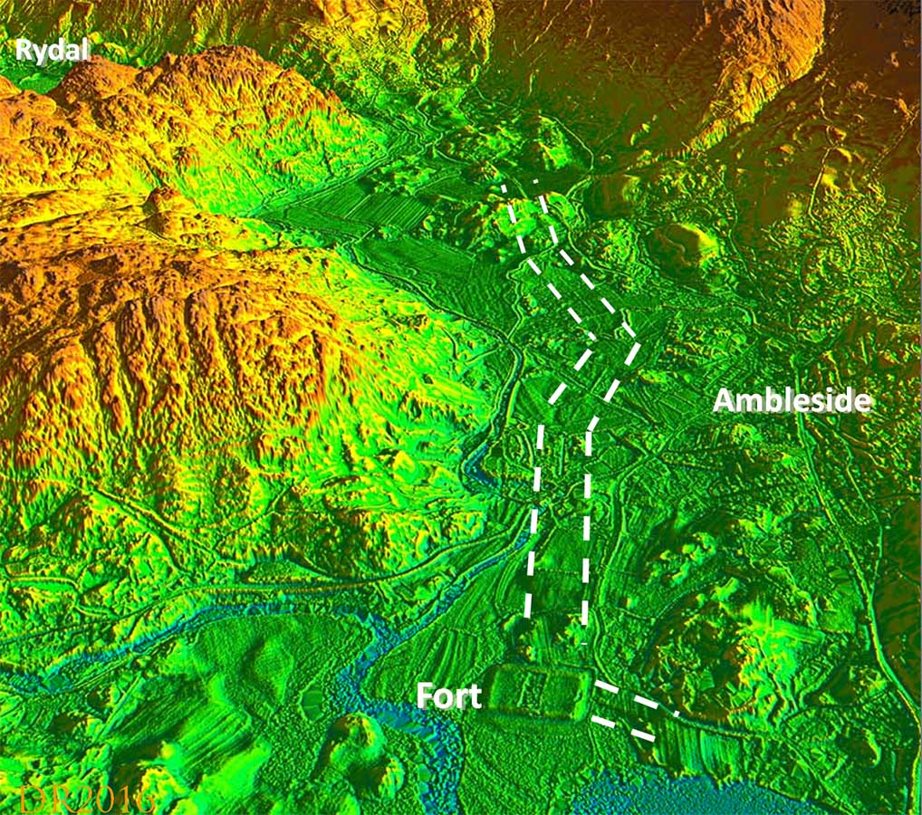
3D Lidar Image - Ambleside looking north The first real indication in the Lidar data of an agger heading north from the Ambleside fort is across Rothay Park, west of the Church heading NNE (NY3728 0434). South of this there is a boundary and ditch that could also indicate the course of the road back towards the fort. The road changed direction slightly at the crossing of Stock Ghyll and beyond the ghyll there is a second length of about 400 metres where a straight agger shows a little faintly heading this time NNW (NY3724 0470). There are perhaps a few indications further north and the road probably coincides with the modern road at NY3719 0533. These clues were independently spotted by both Hugh Toller and myself, which gave us confidence they were real. Also visible is the start of another road heading for Watercrook leading out of the east gate of the fort. The start of the branch road to Ravenglass shows no signs near the fort. |
Click for larger view |
 |
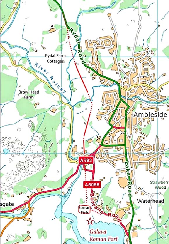
Ambleside - Routemap North of the two visible lengths of agger then the A591 and the Roman line follow the same course around to Rydal and alongside the lake. There isn't really much scope for variation. |
Click for larger view |
 |
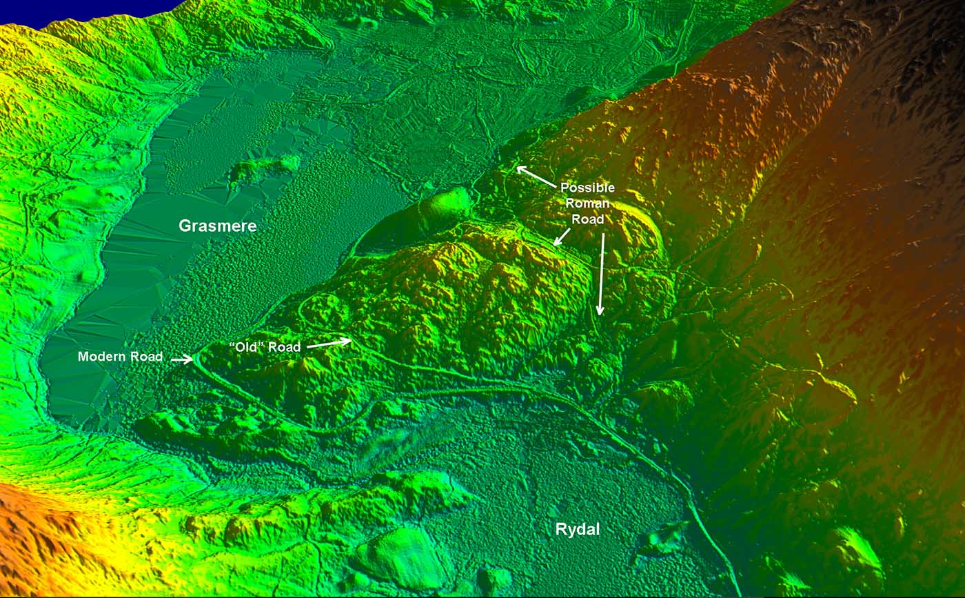
3D Lidar image - Rydal and Grasmere At the head of Rydal there are two options for the Roman line. The modern road is almost certainly not the course and is derived from the turnpike. Over the headland are two roads/tracks - one the old road and one now just a track. Either could be the Roman line. |
Click for larger view |
 |
Oblique 3D Lidar Image - Dunmail Raise looking North This stretch was first spotted by Martin Pugmire in 2004 (C&WAAS) in pre-Lidar days. Lidar has extended it further north where again it returns to the line of the A591.
|
Click for larger view |
 |
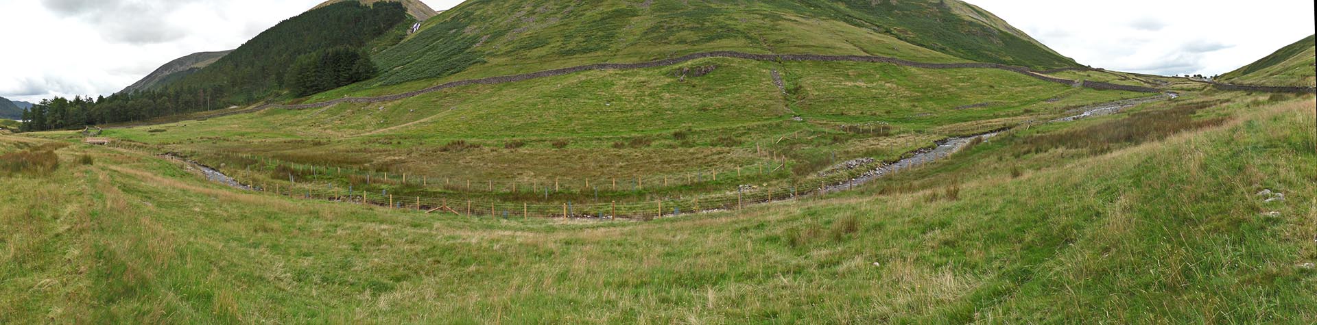
Panorama - north side of Dunmail Raise The Roman agger is clear and walkable on the east side of the modern A591. This image was taken prior to Storm Desmond and this area did suffer badly. |
Click for larger view |
 |
North side of Dunmail Raise - looking south The A591 is off to the right in this view. You can just make out the "Lion and the Lamb" in the distance. |
Click for larger view |
 |
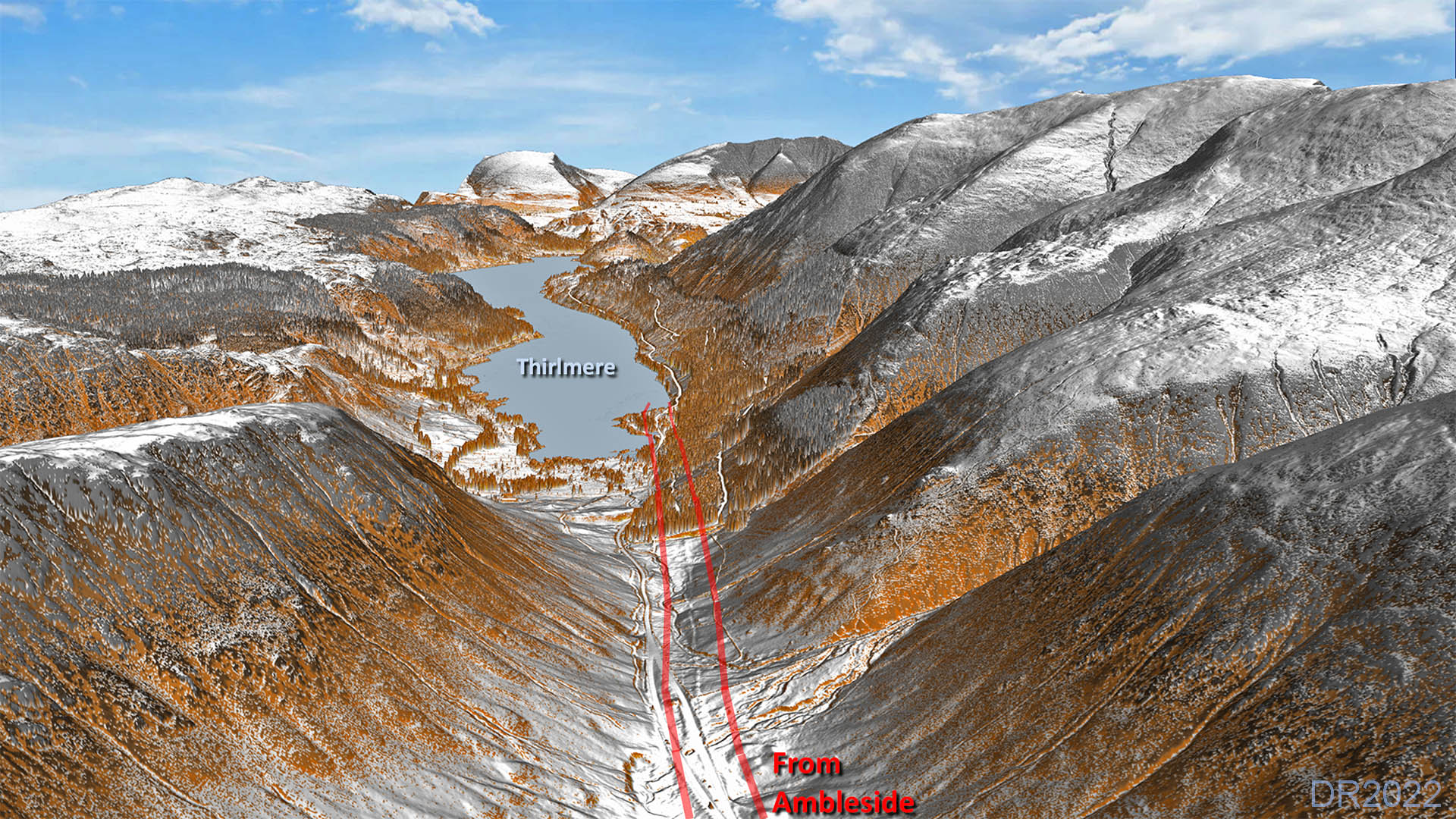
North side of Dunmail Raise - looking North towards Wythburn Agger clear heading for the woodland near Wythburn. Thirlmere is the lake ahead. |
Click for larger view |
 |
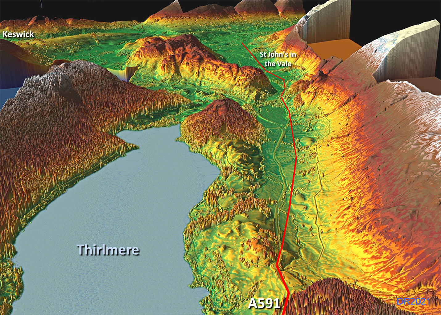
Oblique 3D Lidar Iamge - Thirlspot The next feature visible in the Lidar data is near Thirlspot Farm and was originally spotted by Bryn Gethin. What shows up is 600 to 700 metres of a typical straight alignment of a Roman road agger (NY3176 1803). Projecting this alignment south then it would merge with the A591 back to Thirlspot. However, projecting its line northwards then it is undoubtedly aligned on St John's in the Vale. If its destination was Keswick then it surely would not have crossed to the east side of the valley. |
Click for larger view |
 |
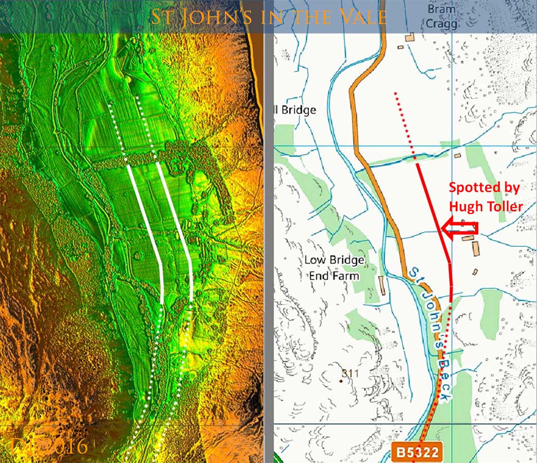
St John's in the Vale - Lidar and Map Sure enough there was an indication of an agger into St John's in the Vale. Within the confines of the Vale there is not much scope for variation between the Roman line and the modern B5322 but near Fornside (the farm under the arrow (right) there is a short length of agger.. |
Click for larger view |
 |
Roman Agger Surviving Near the north end of the Vale, where the B54322 comprises two straight stretches, on the southern of these stretches the modern road wobbles off line near Mire House. Here the Roman agger is clear alongside the modern road on its western side. See also next Lidar image. |
Click for larger view |
 |
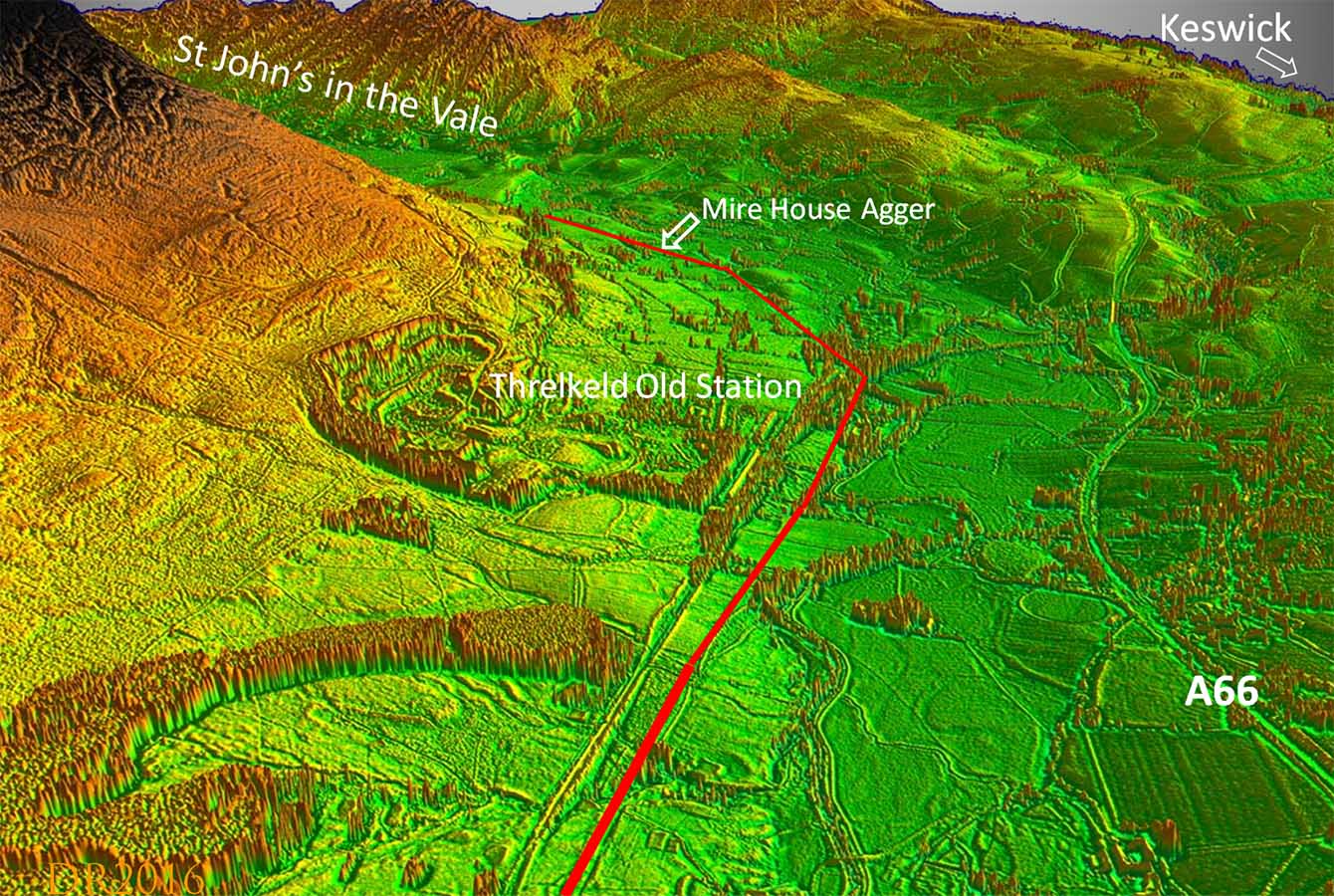
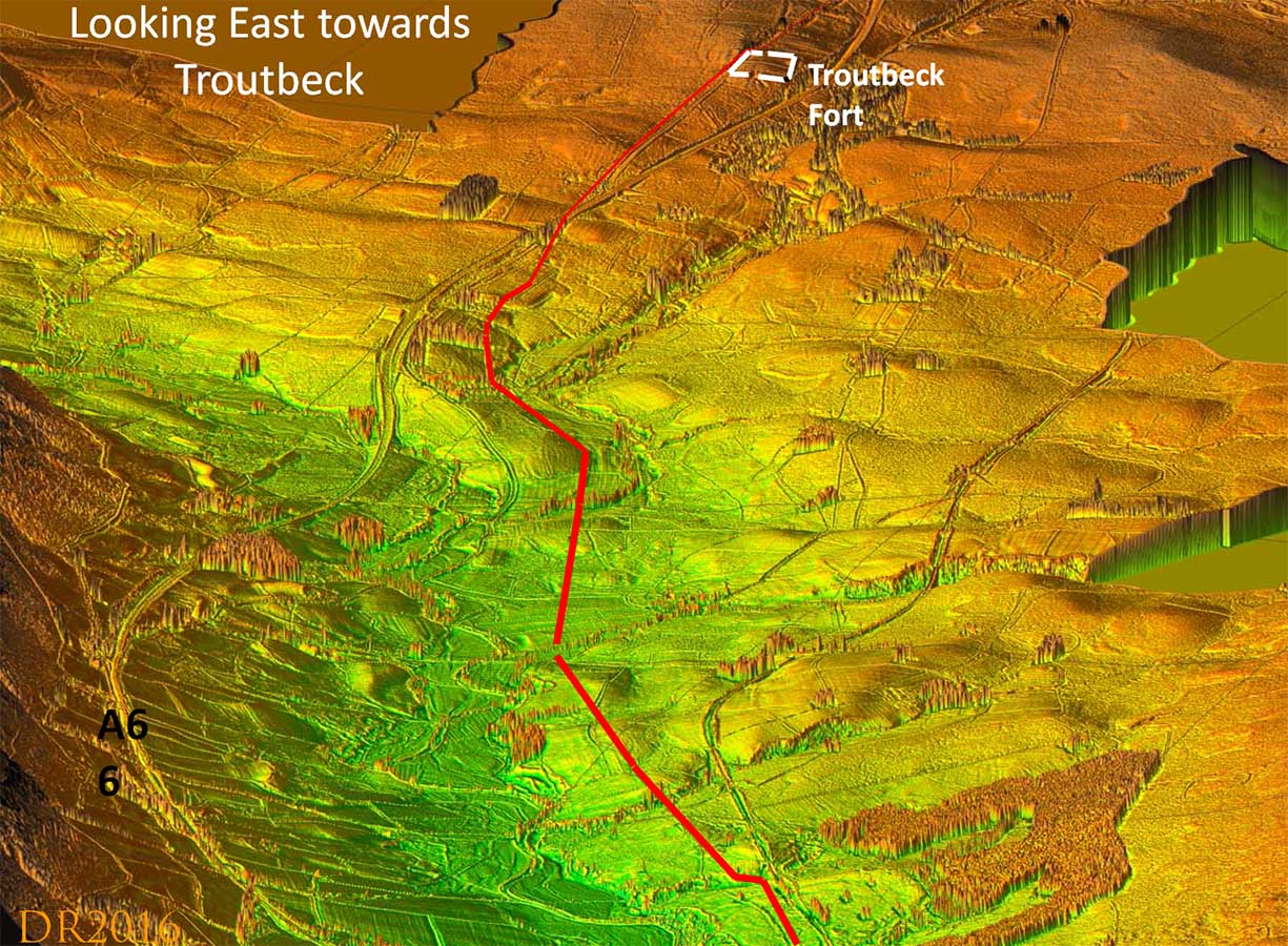
Oblique 3D Lidar Iamge - Looking West As mentioned in the introduction, an east-west road at Troutbeck fort was postulated by Martin Allan in his book The Roman Road across the Lake District, Brougham to Moresby. On the face of it that title would not indicate a likely connection with this road but it warranted further research. In short, using Lidar, I could find nothing convincing connecting Brougham to Troutbeck and nothing west of Threlkeld either, both suggested as part of Allan's route. However, what did show was a Roman road between Troutbeck and Threlkeld - about as obvious and clear as it can get with Lidar! If a road this prominent disappeared west of Threlkeld there had to be a reason. In this 3D Lidar image we are looking west over the site of the old station at Threlkeld with the line of the Roman road from Troutbeck marked in red. The reason the Roman road disappears at Threlkeld is because it turned into St John's in the Vale. |
Click for larger view |
 |
Tracing the road from Troutbeck to Threlkeld, Lidar has confirmed that Allan was very successful in deducing its course over this section. Lidar has also filled in the missing gaps and added a few minor corrections. There is no Lidar support for extending this length to Brougham or west to Keswick. Allan projected on the last alignment from the east of Threlkeld (confirmed correct by the Lidar data) further westwards, passing Naddle Farm, Castlerigg Stone Circle and on across Keswick. However, if so one of the most obvious of roads had become invisible - at least in the Lidar data and to my eyes. Examining the evidence around Threlkeld old station then the more obvious explanation became apparent. The last alignment would take the road as far as Station Road and would fit perfectly with a turn to the SSW here, on a course coinciding with the modern road (B5322) to St John's in the Vale and our Roman road from Ambleside. The connection had been made!. |
Click for larger view |
 |
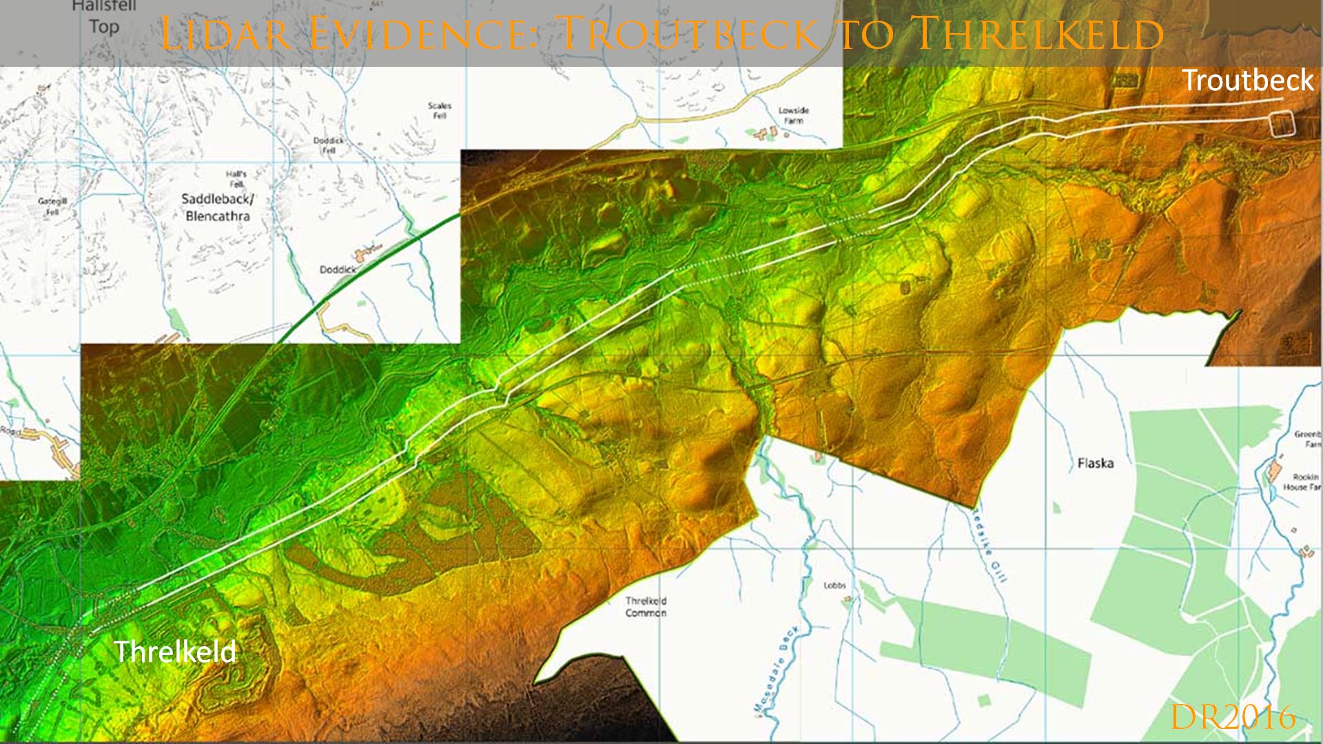
Lidar plan view of the Roman road between Troutbeck and Threlkeld. The agger has survived virtually over the entire length as it has almost all the way to Old Penrith. It was the fact that a road so obvious appeared to end at Threlkeld old station that convinced me it had turned into St John's in the Vale. |
Click for larger view |
 |
3D Lidar image looking east towards Troutbeck fort/camps. This is the length first discovered by Allan. He was pretty accurate in locating this road but there is no Lidar evidence to connect it Brougham or Keswick for Moresby as he postulated. |
Click for larger view |
 |
Lidar image of the route north-east from Troutbeck. There is a gap in the Lidar coverage but aerial photography enables the route to be plotted with confidence. This is the start of the length recorded by West in 1778 |
Click for larger view |
 |
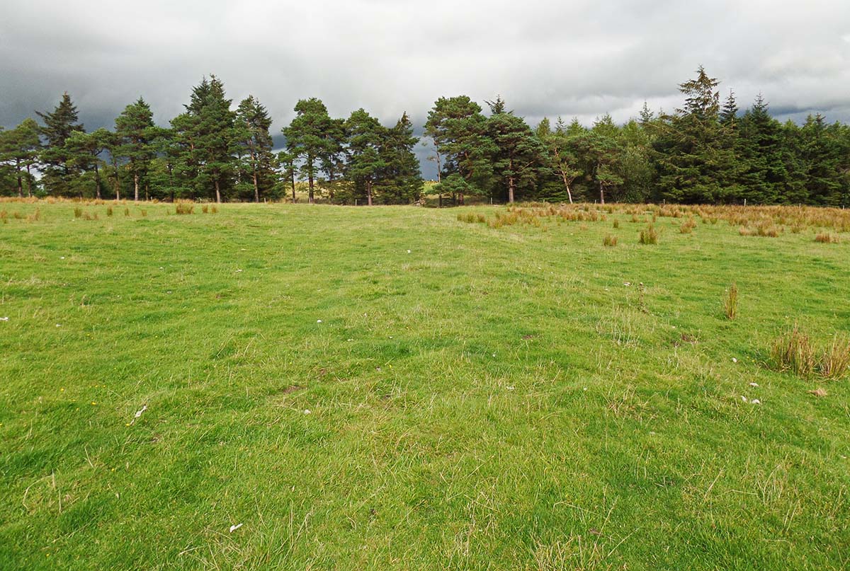
Agger at Lofshaw Hill - NY391274 Just west of Troutbeck Fort and just north of Troutbeck village is this fine stretch of agger. This is looking east. |
Click for larger view |
 |
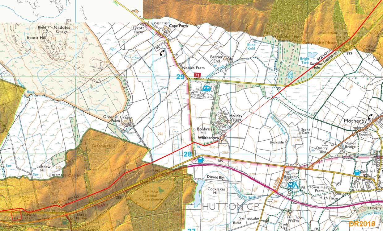
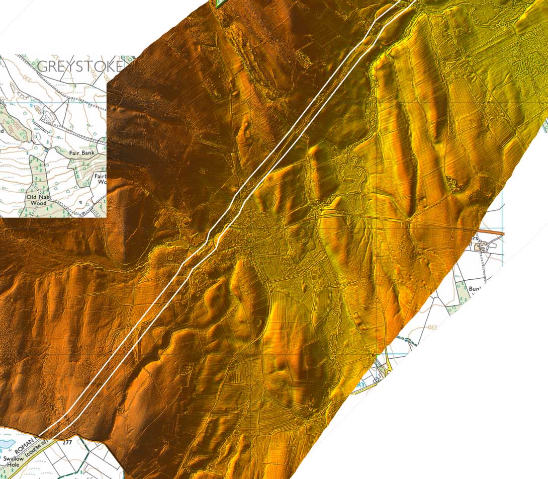
Route Map - Greystoke to Old Penrith. This was determined from the Lidar images below and has completed the route first reported by West all those years ago. Most of the route was known already if not in precise detail. For example, the dog-leg at Fairbank Wood appears to be a new discovery. |
Click for larger view |
 |
Lidar Image - Greystoke to Old Penrith, Section 1 |
Click for larger view |
 |
| Lidar Image - Greystoke to Old Penrith, Section 2 | Click for larger view |
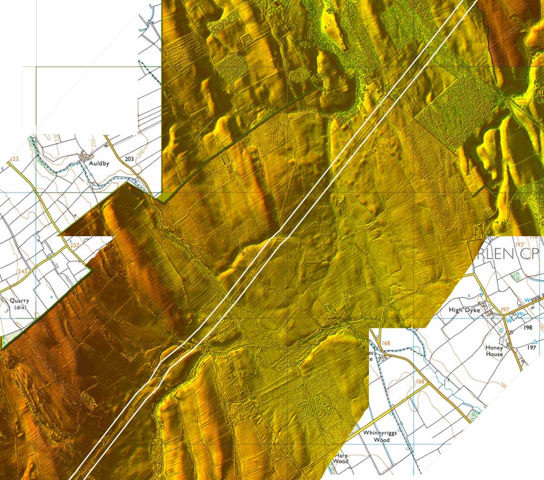 |
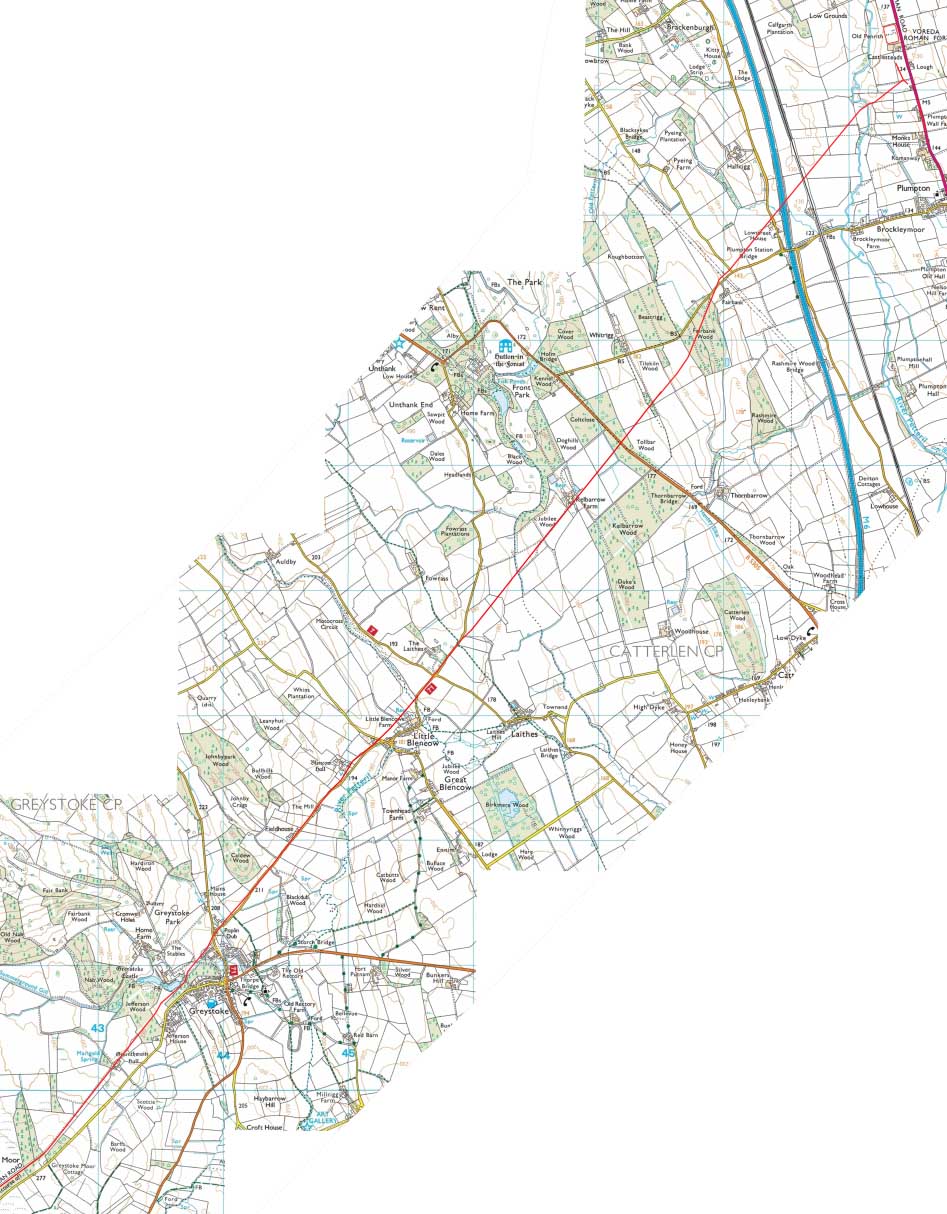
Lidar Image - Greystoke to Old Penrith, Section 3 Because of the name Low Street, the location of the road here was always suspected. |
Click for larger view |
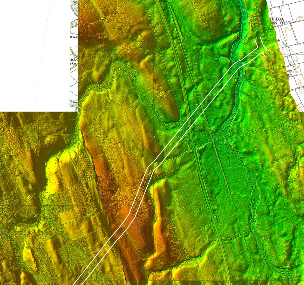 |
3D Lidar image of the road approaching Old Penrith Fort, looking south-west. The alignment is south of the fort and joins up with the road from Brougham. |
Click for larger view |
 |
Thanks to Lidar and teamwork inspired by the late Hugh Toller, we now have a new strategic route from Ambleside through the very centre of the Lake District, heading via Dunmail Raise, St John's in the Vale and Troutbeck to Old Penrith. The initial section as far as Threlkeld is mostly masked by modern roads and is only provable at sporadic but crucial points. Beyond Threlkeld then circumstances change and the Roman road is very clear and is easy to trace virtually all the way to Old Penrith.
|
|
|
|
Return to Cumbrian Roman Roads homepage Last update: Decmber 2022 |
© David Ratledge |