 |
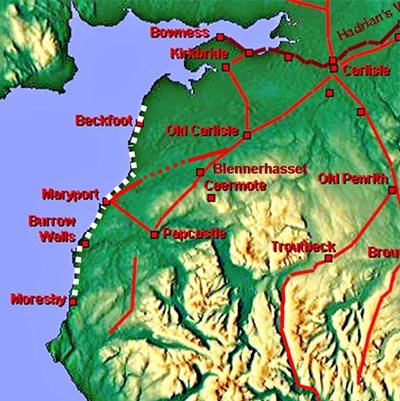
The Coastal Roman Road, Margary 750A road that must have existed but is almost impossible to track down! Logic suggests that a road down the coast would have been needed to support the Cumbrian Coastal Defences and onwards to the forts of Burrow Walls and Moresby. Having said that, the evidence is very very sparse and I have only included images of 4 locations.
|
3D Lidar Image - Beckfoot looking north towards Silloth The only trace of road I have spotted. And it is a trace - just the faintest of indications of a road from the south gate of Beckfoot Fort. This agrees with the location on aerial photographs taken by Barri Jones. The suspicion is that it is a local link road rather than the actual main road. The inference from here and the other locations is that the modern coast road (B5300 and A596 further south) overly the Roman line.
|
Click for larger view |
 |
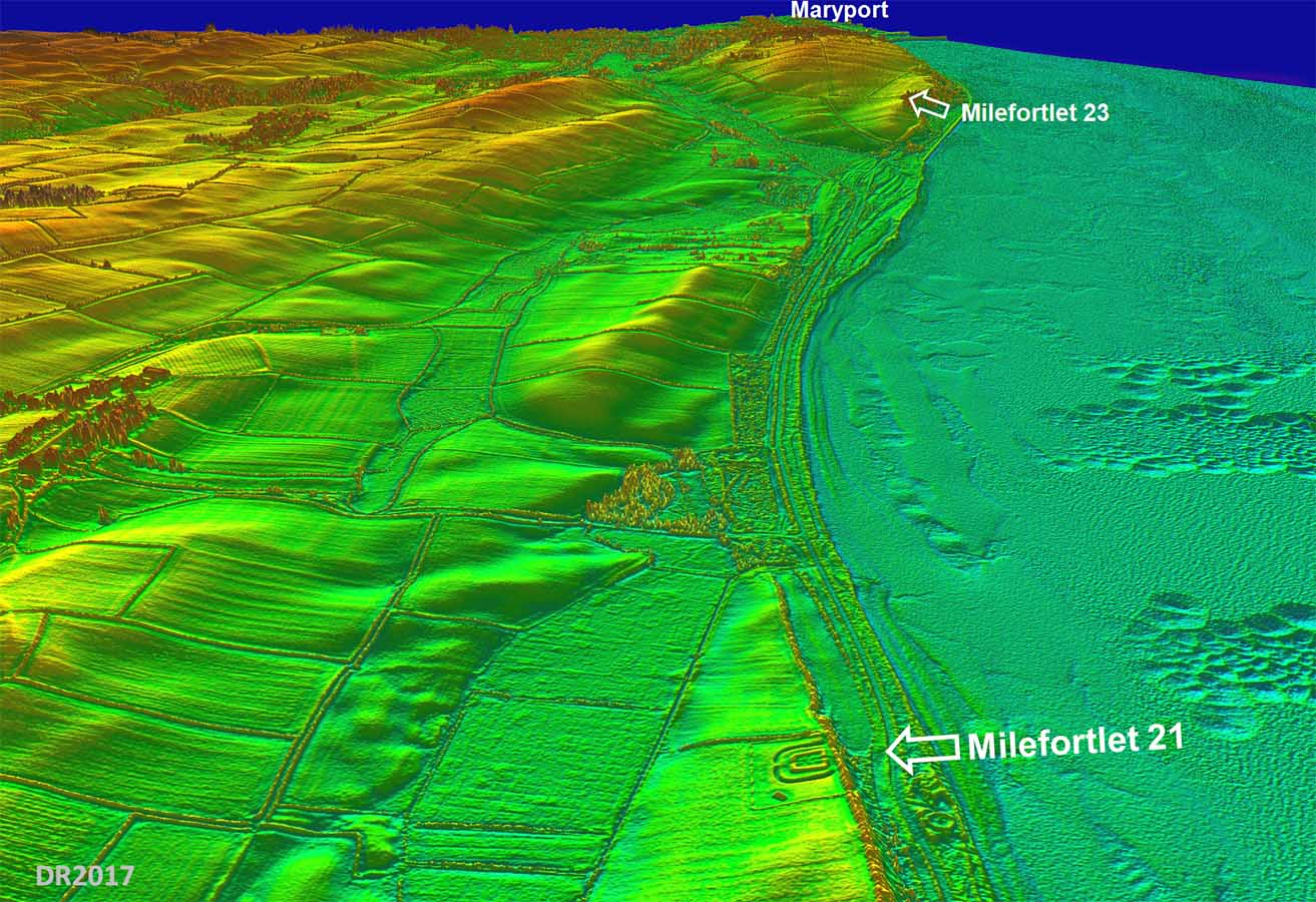
3D Lidar Image - Milefortlet 21 looking south towards Maryport The Milefortlets are located on top of the old cliff edge and the Roman road must have run along the bottom of the cliffs, much where the modern road is now, as there is nothing visible on the cliff tops. The Roman road shown on modern OS maps leaving Maryport and heading to the coast appears to be an error. There is nothing in the Lidar data to support it. |
Click for larger view |
 |
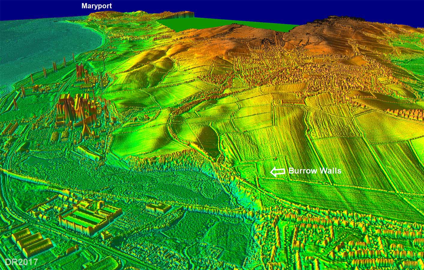
3D Lidar Image - Burrow Walls looking north towards Maryport There is an alternative route to get from Maryport to Burrow Walls. The straight modern road over Broughton Moor and Seaton could be a link but the coast road via Flimby (A596) is probably more likely. Note: the fort is clearly much smaller than originally suggested by Bellhouse, who excavated it. Both Lidar and geophys by Derventio show it more the size of a fortlet. Is this the terminal Milefortlet of the Cumbrian Coastal Defences? Its position would match Milefortlet 29. Dating evidence it must be said doesn't support this. |
Click for larger view |
 |
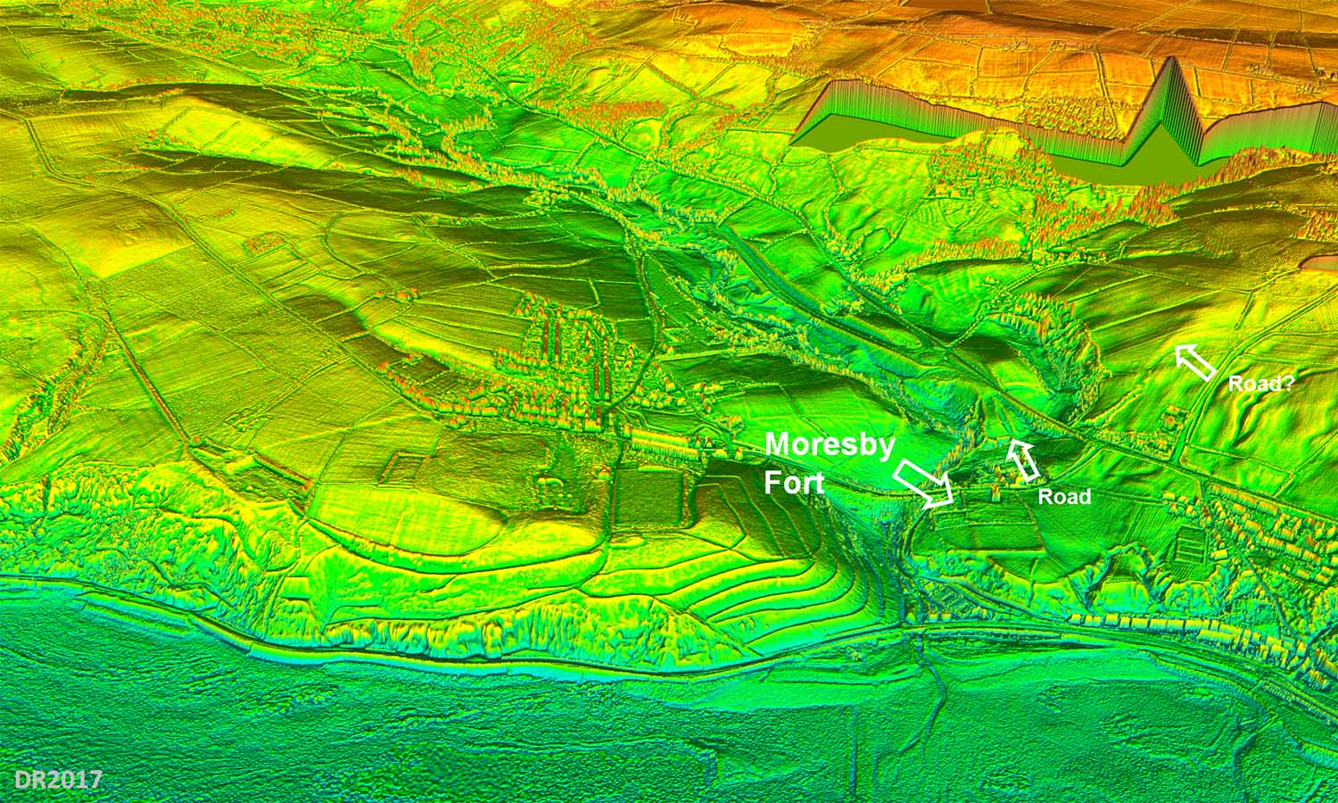
3D Lidar Image - Moresby Fort looking east We have now left the Coastal Defences so a route along the coast edge would not have been essential - it could come inland a bit to find an easier route. The railway managed a route along the cliff bottoms but they had modern machinery. However, my guess is that Margary 750 finished at Burrow Walls and Moresby was reached from Papcastle by Margary 752. |
Click for larger view |
 |
|
|
|
Return to Cumbria Roman Roads homepage Last update January 2018 |
© David Ratledge |