 |
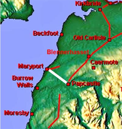
The Roman Road from Papcastle to Maryport, Margary 751A short 6 mile road of basically a single alignment that is shown on modern Ordnance Survey mapping.
|
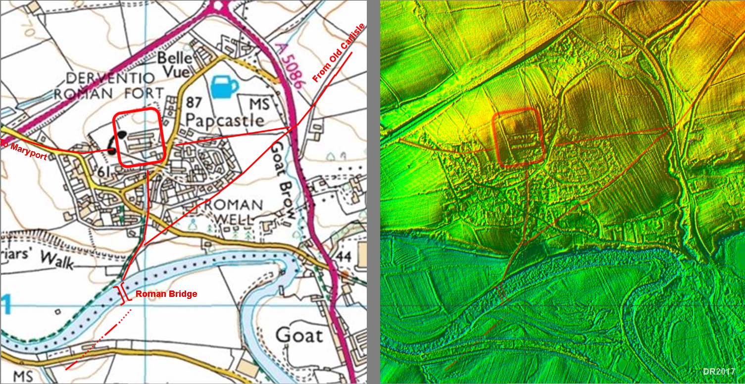
Papcastle - Road Map and Lidar Image The Roman road map is derived from Roman Papcastle by Eric Apperley, modified slightly in accordance with what is visible on the Lidar image. Our road leaves the west gateway of the fort. |
Click for larger view |
 |
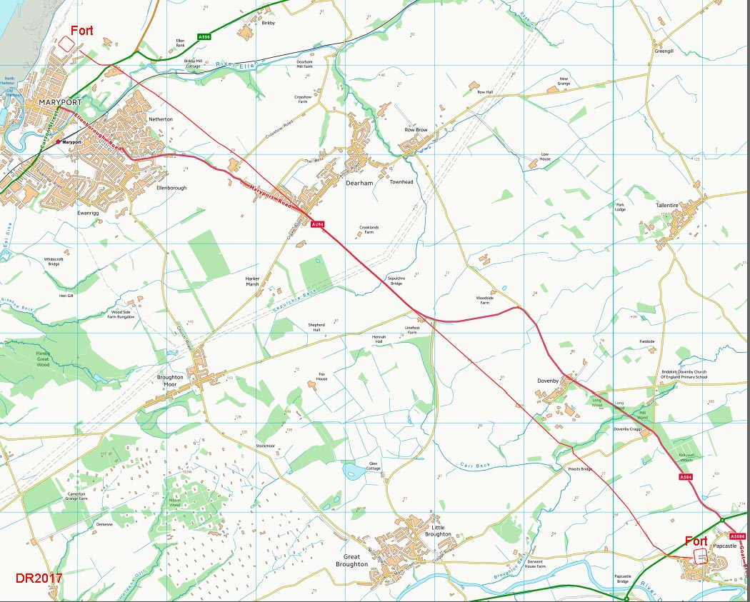
Full Route map Not dead straight - there is subtle change of direction at Crosshow Road, Dearham. |
Click for larger view |
 |
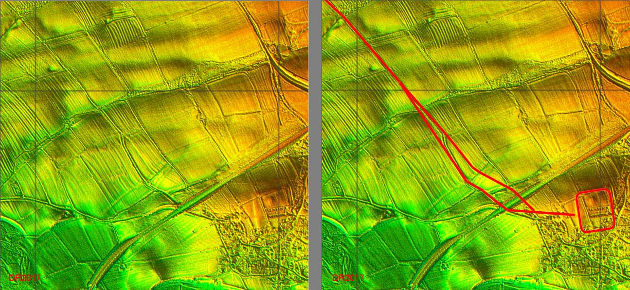
Lidar Images - alternative routes at Papcastle The route shown above is the "conventional" one from Papcastle. However, in the Lidar data there is an alternative route, which is actually more direct. On the basis of the Lidar data either could be correct. |
Click for larger view |
 |
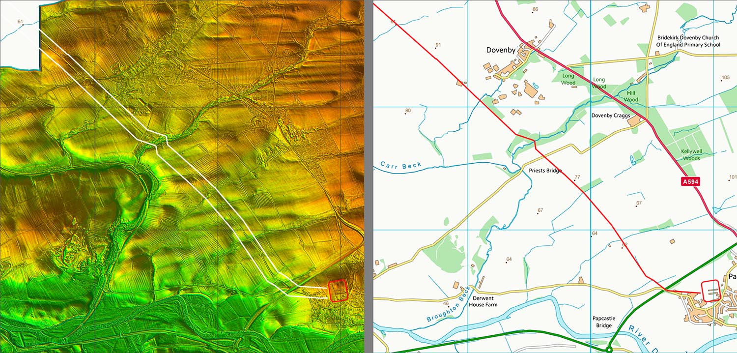
Lidar Image and Route map - Papcastle to Dovenby The Lidar runs out at Dovenby but by then the Roman road is masked by modern roads. Note I have not shown the alternative route (see above) on this map. |
Click for larger view |
 |
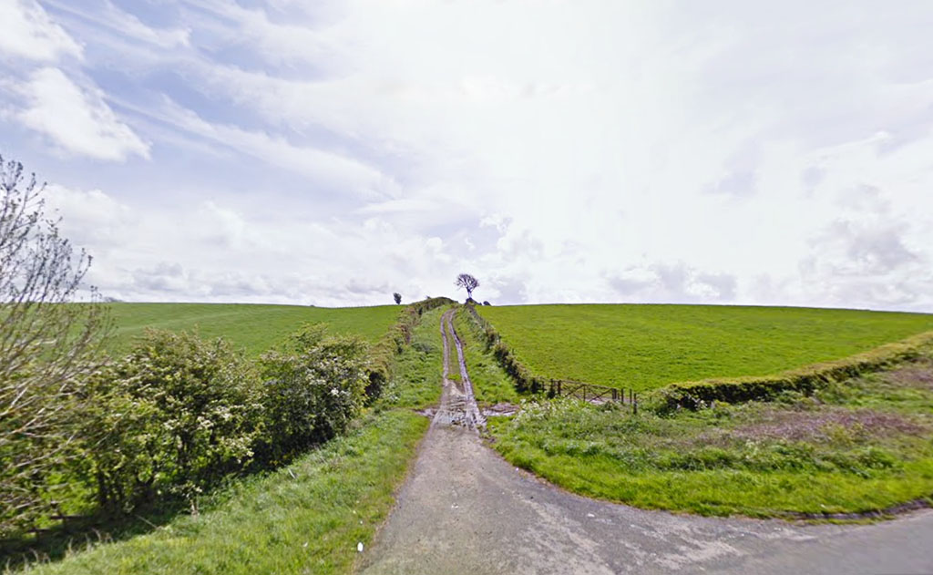
Near Linefoot Farm- looking east After Dovenby a farm track follows the Roman line down to Folly Bridge, near Linefoot Farm. This track is under the red arrow in the next image.
|
Click for larger view |
 |
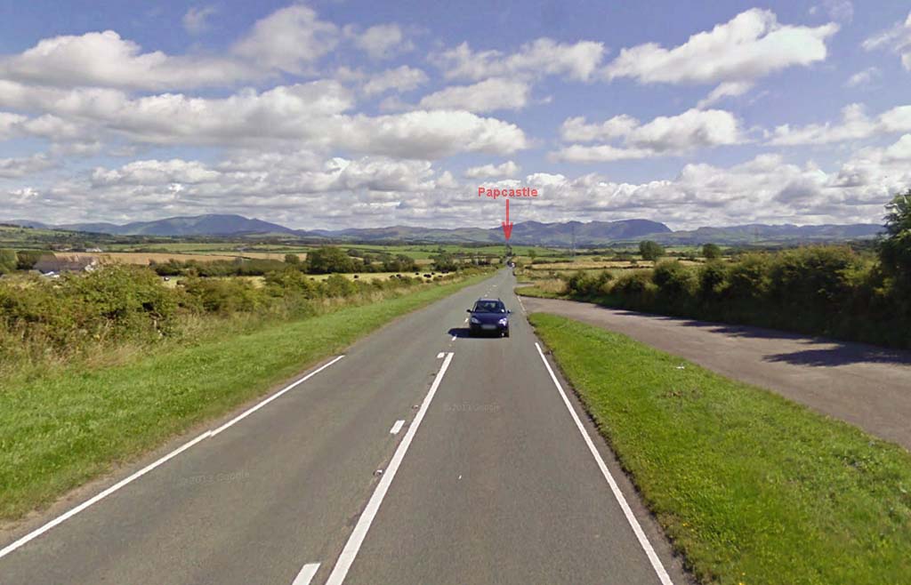
A594 - looking East The A594 overlies the Roman Road for about 1 mile approaching Dearham. We are looking back towards Papcastle here.
|
Click for larger view |
 |
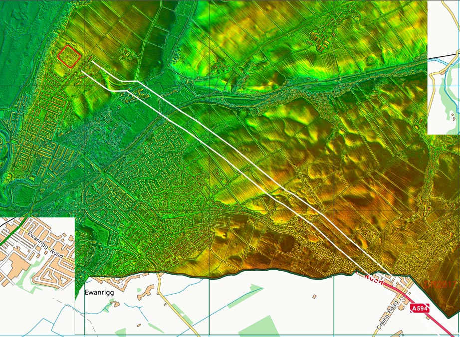
Lidar Image - Dearham to Maryport The odd chicane approaching Maryport is actually a cutting to ease the gradient up to the fort (see later). |
Click for larger view |
 |
Route Map - Dearham to Maryport |
Click for larger view |
 |
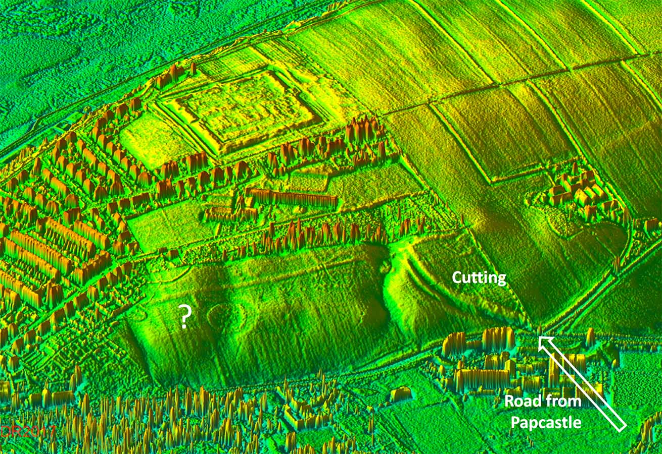
3D Lidar Image - Maryport approach The road climbs up to the fort by means of a very impressive curving cutting. But what is the strange amphitheatre shaped feature? According to Pete Wilson it has been interpreted as "iron-age" on the basis of finds but It does look very similar to the one at Newstead. |
Click for larger view |
 |
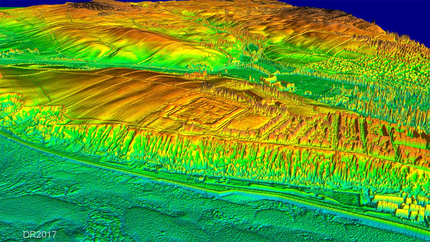
3D Lidar Image - Maryport Fort The view from over the sea gives an impression of how good the location for Maryport fort was. It is virtually on an island of high ground and there has been discussion in the past as to whether it was, at one time, a real island.. |
Click for larger view |
 |
|
|
|
Return to Cumbria Roman Roads homepage Last update January 2018 |
© David Ratledge |