 |
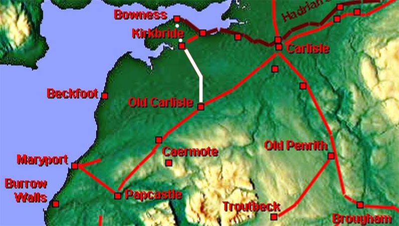
The Roman Road from Old Carlisle to Kirkbride and Bowness, Margary 755A totally "new" road to which I have allocated (unofficially) the next available Margary number i.e. 755.
Margary postulated that the very direct modern road via Oulton could represent its course i.e. a route on the west side of the River Wampool. However, Lidar revealed that there was indeed a Roman road linking these two forts but it actually crosses onto the east side of the river. There is also some evidence for it having been extended on to Bowness which is of course highly likely once Hadrian's Wall was constructed. The assumption is that Kirkbride fort pre-dated the wall. It was in trying to locate Kirkbride fort using Lidar imagery that I noticed the very clear agger of an unknown Roman road coming in from the Old Carlisle direction. Once this was spotted tracing it back to Old Carlisle was relatively straight forward although in the vicinity of Wigton its course is somewhat subjective due to modern development there.
|
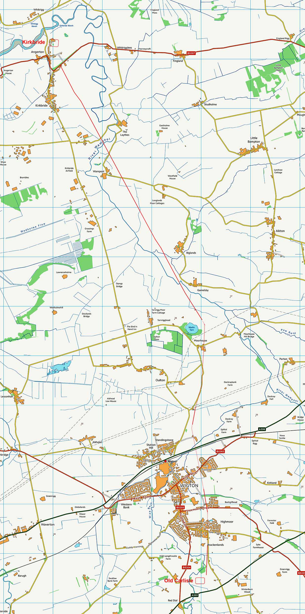
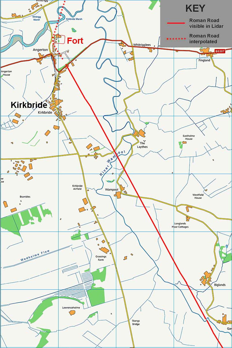
Route Map - full route from Old Carlisle to Kirkbride The route is ostensibly in two alignments with a change of direction around the halfway point just north of Moorside, in the vicinity of NY261517. |
Click for larger view |
 |
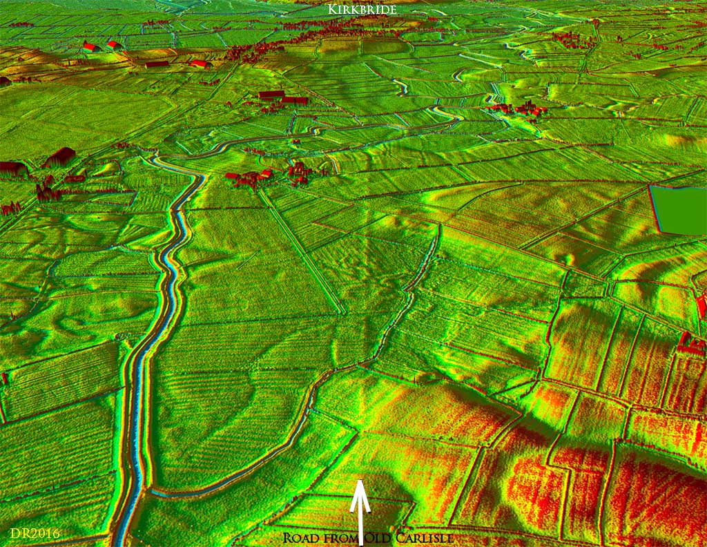
3D Lidar Image - view of the Old Carlisle fort site looking north-east. The "new" road to Kirkbride heads off towards the top left and, as can be seen, there are clear traces of the agger. In fact this stretch was spotted many years ago on Cambridge University aerial photos. Strange no one thought to project this line onwards. That modern straight road through Oulton must have been too tempting to ignore. Also clear is the square Mansio building outside the fort. |
Click for larger view |
 |
Route Map - southern alignment The first (southern) alignment begins outside the east gate of the Old Carlisle fort and heads over Highmoor in a northerly direction. The Lidar evidence is then somewhat fragmentary passing Wigton and its course here has had to be interpolated in several sections. This alignment plotted therefore represents a "best guess" and Stony Banks could be an alternative. What can be said is that it is certainly not a single straight line but is made up of slight alignment changes adapting its course to the terrain which is much hillier than that of the second alignment. |
Click for larger view |
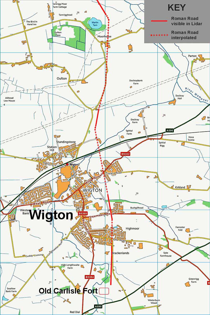 |
Lidar Image - southern alignment Beyond Wigton, on the north side of a sewage farm, there is a particularly prominent agger visible in the Lidar data (NY2587 4983) heading towards Moorside and parts of the modern road to Moorside probably overlie it here. |
Click for larger view |
 |
Route Map After the crest at Moorside the second (northern) alignment begins. By contrast this stretch is remarkably clear and certain. It is almost a single alignment all the way to the fort with only the slightest of deviations just to the west of Biglands. This shows up especially clearly in the oblique Lidar image and was perhaps to negotiate the small hill there. |
Click for larger view |
 |
Lidar Image - northern alignment Amazingly direct and very very obvious. |
Click for larger view |
 |
3D Lidar Image - view from the first River Wampool crossing looking towards Kirkbride fort. There looks to have been a slight dog-leg to the left up the ridge of higher ground. |
Click for larger view |
 |
3D Lidar Image - view towards Kikbride from beyond Biglands. The agger is still very clear but does become fainter at the Kirkbride end. |
Click for larger view |
 |
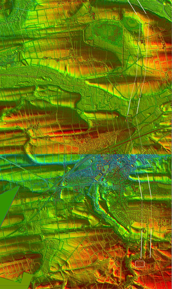
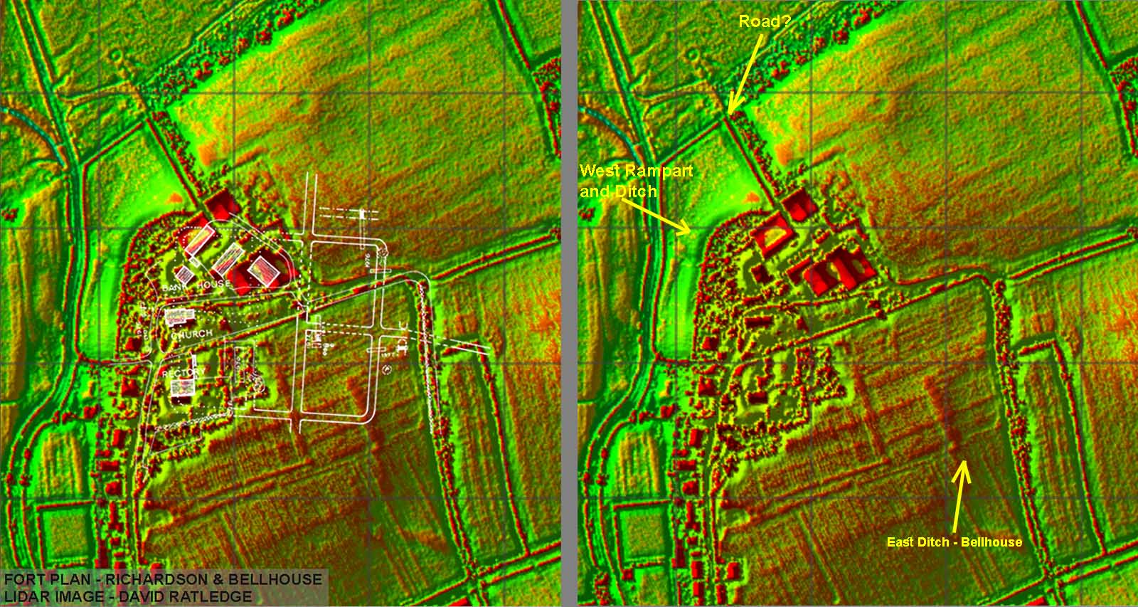
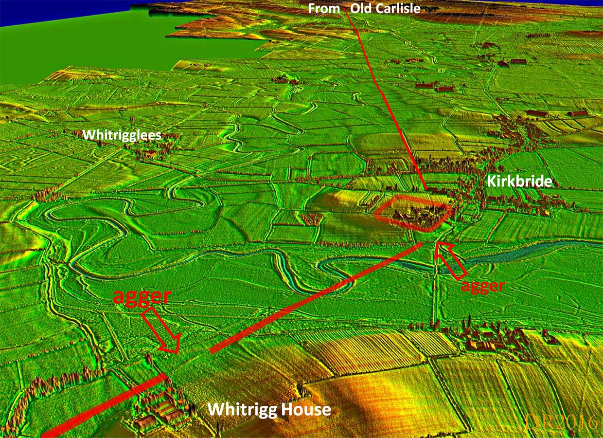
Kirkbride Fort - Lidar image. As well as revealing the road to Kikbride, Lidar also indicated what is almost certainly the north-east corner of the fort. This is further west than Richard Bellhouse had thought and makes the fort larger (at least wider) than previously assumed. Also visible is what appears to be the agger of our road passing the north-west corner of the fort and heading the direction of Bowness. |
Click for larger view |
 |
Oblique 3D Lidar Image The road could well have continued on to Bowness and really this was to be expected even though the road as far as kirkbride pre-dated the Roman Wall and Bowness fort. There are indications of a road passing the north west corner of Kirkbride fort and again just to the east of Whitrigg House there are signs of an agger (NY2311 5829). |
Click for larger view |
 |
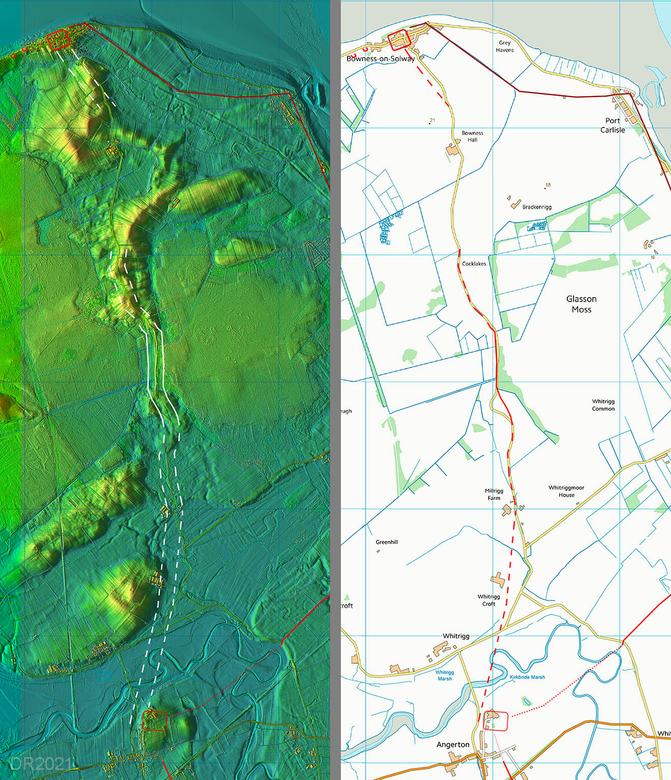
Lidar Image & Route Map - Kirkbride to Bowness From Whitrigg the modern road to Bowness overlies much of the Roman route. There is however, in the middle section, a stretch where the original Roman line becomes visible. There are a few clues approaching Bowness too. |
Click for larger view |
 |
|
NEW - 3D Lidar video fly-over of the road from Moorside to Kirkbride |
|
|
|
Return to Cumbria Roman Roads homepage Last update July 2021 |
© David Ratledge |