 |
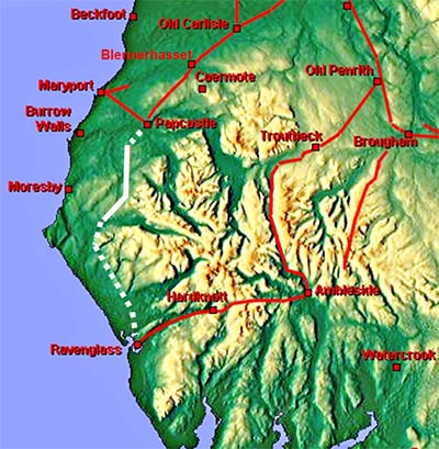
The Roman Road from Papcastle to Ravenglass, Margary 75A puzzling road with an uncertain southern section. Ravenglass surely must have been its destination but proving it is proving difficult. Thanks to series 2 Lidar we can be confident in the route now as far Cleator. Beyond there then it is still "work in progress".
There has been much speculation over the years as to where this road was heading - several suggestions for a lost Roman site at Beckermet. I could find nothing supporting this and in reality Ravenglass is the only logical destination.
|
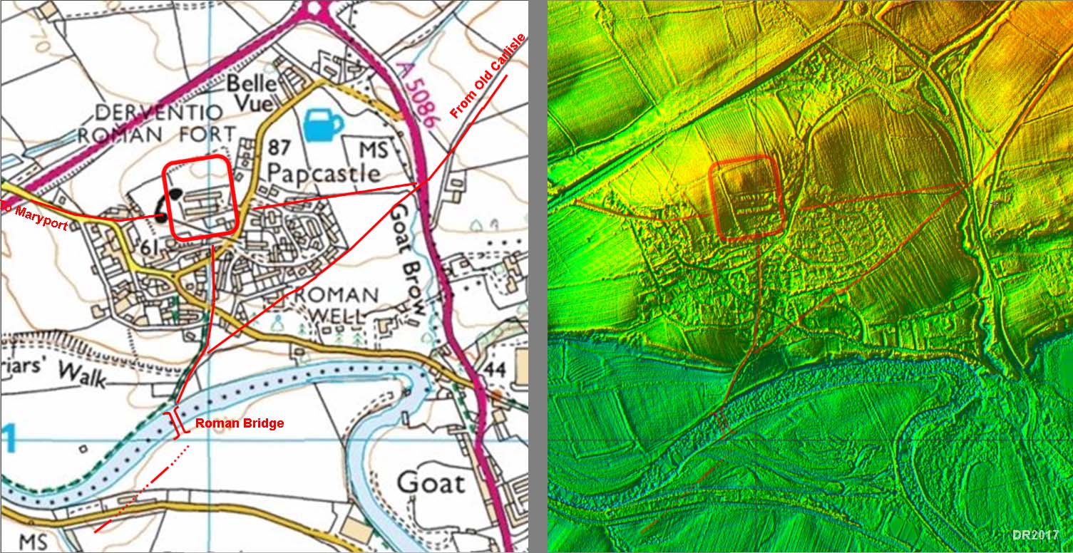
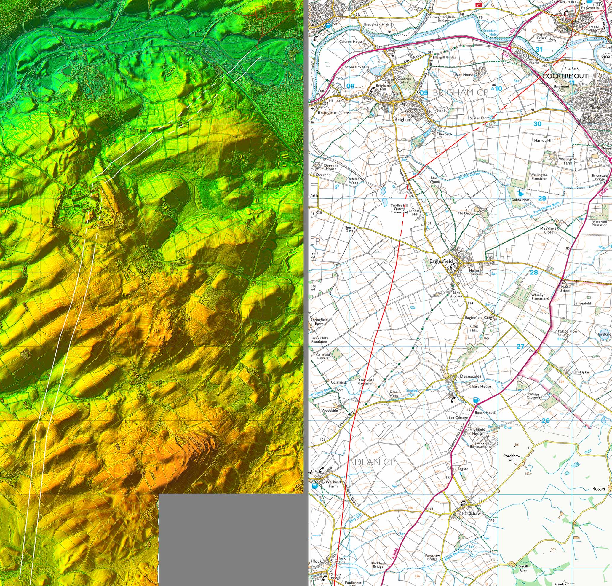
Papcastle - Road Map and Lidar Image The Roman road map is derived from Roman Papcastle by Eric Apperley, modified slightly in accordance with what is visible on the Lidar image. Our road leaves the south gateway of the fort but it appears that the road from Old Carlisle bypasses the fort and headed to join it for the bridge crossing too. South of the bridge there are two traces of the beginning of our road, which could also be shared with a road to Moresby. |
Click for larger view |
 |
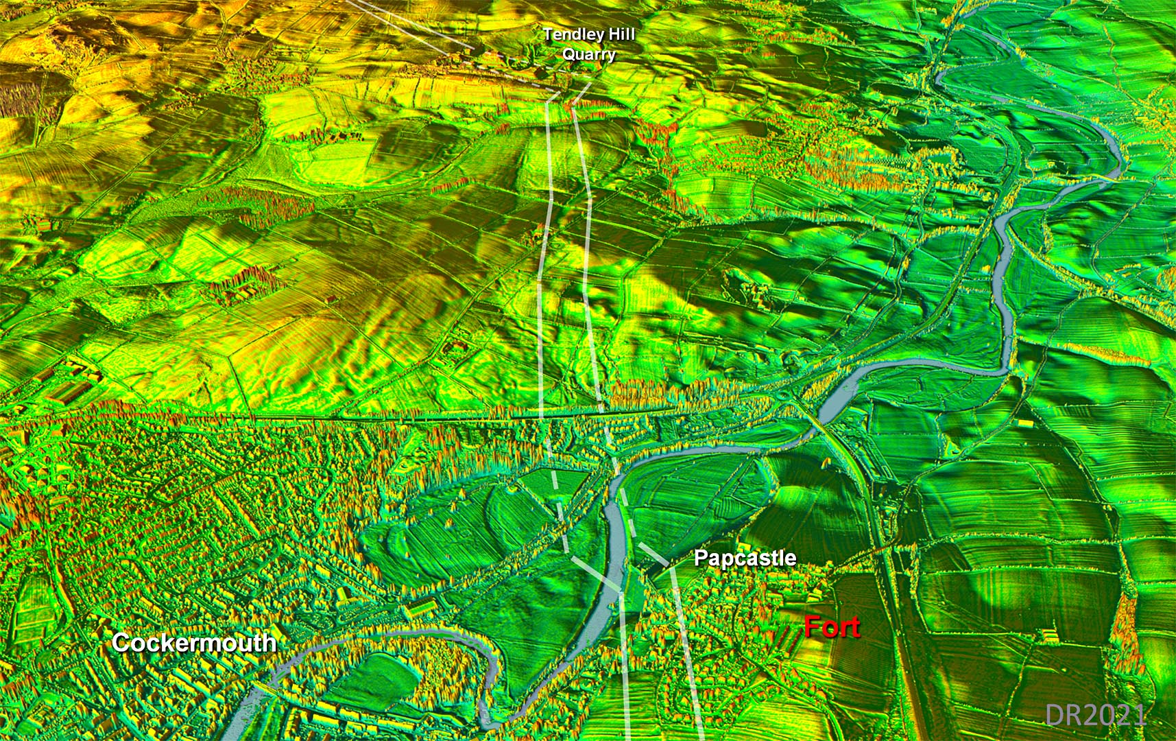
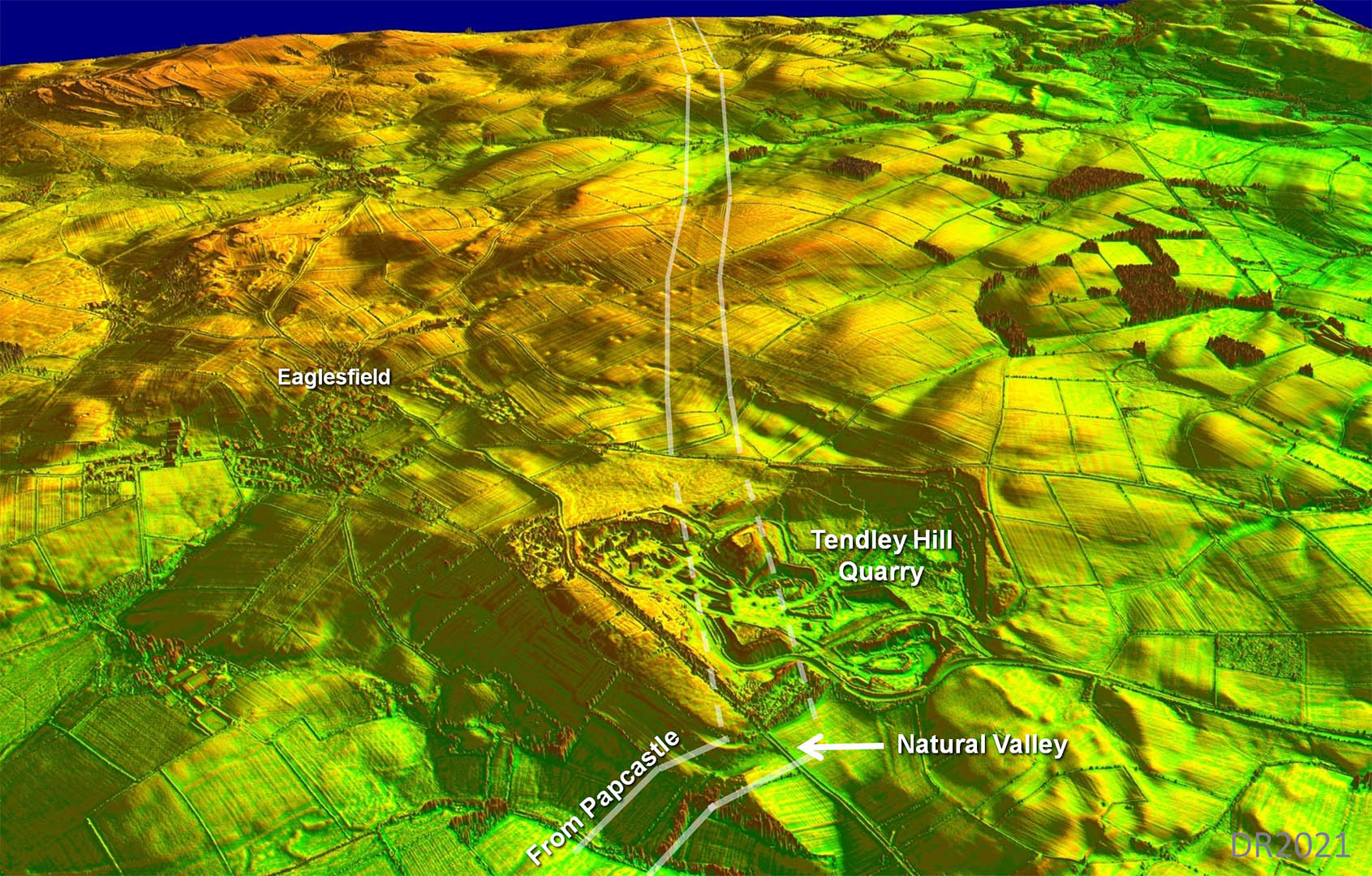
Obique 3D Lidar Image - Papcastle to Tendley Hill After the road crossed the bridge over the River Derwent, there are enough clues to plot the course to Tendley Hill. It aimed for a natural valley up the hill - typically clever Roman engineering.
|
Click for larger view |
 |
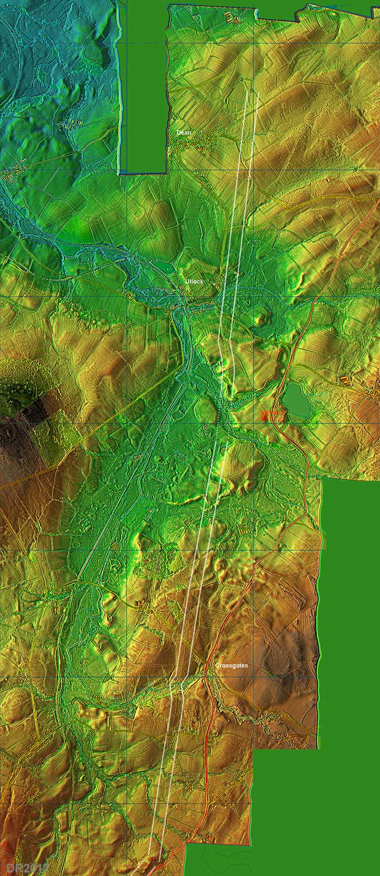
Route Map - Tendley Hill Thanks to the release of series 2 lidar we can now plot the route south from Papcastle with confidence. There are still a couple of interpolated stretches but these must surely be pretty close to reality. Tendley Hill would be used for setting out the road. Quarrying has destroyed the road on the hill top. The road cleverly made use of a natural valley on the north side of the hill before turning to begin its main alignment down to Scallow and Cleator.
|
Click for larger view |
 |
Obique 3D Lidar Image - Tendley Hill to Ullock That natural valley they used is visible near the bottom edge. The alignment turned on the hill - a typical scenario - and headed south to Ullock and ultimately Cleator. The quarry has obviously destroyed the road on the hill top but we can interpolate there with high confidence.
|
Click for larger view |
 |
Lidar Image - Ullock to Scallow Very clear in the Lidar data. |
Click for larger view |
 |
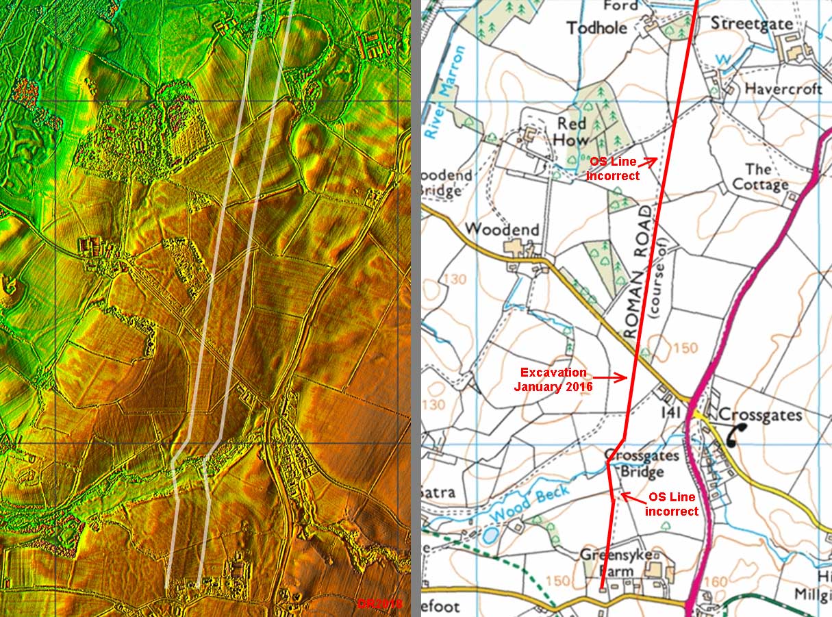
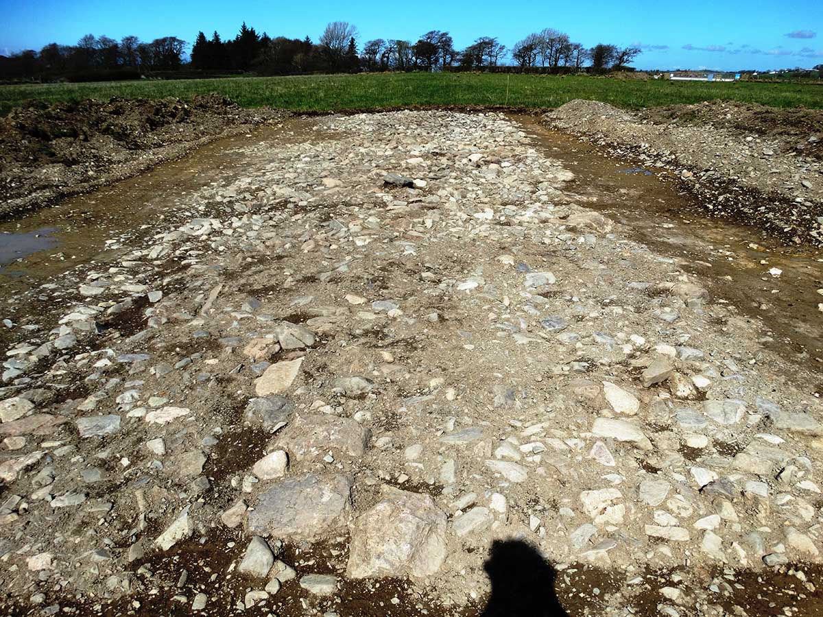
Crossgates - Excavation 2016 During pipeline laying in January 2016 the Roman road was excavated just south of the minor road from Crossgates to Woodend. Thanks are due to Bob Marshall for bringing this to my attention. Note also the Ordnance Survey recorded position for our road is incorrect both north and south of this spot.
|
Click for larger view |
 |
Crossgates - Excavation 2016 Wow! The road is in remarkable condition despite appearing very close to the surface. This must be looking north.. Image: Bob Marshall
|
Click for larger view |
 |
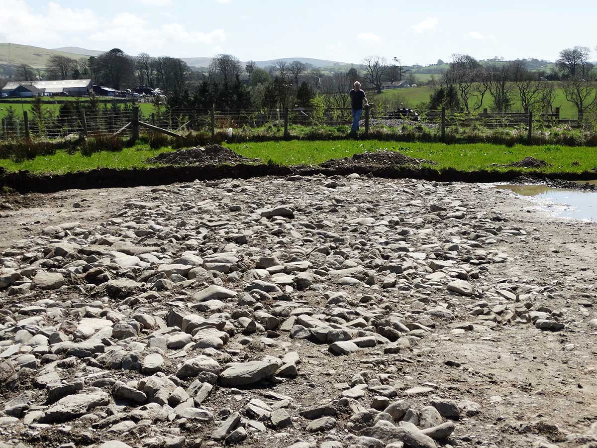
Crossgates - Excavation 2016 This must be looking south. Image: Bob Marshall
|
Click for larger view |
 |
Lidar Image - Scallow to Cleator Moor This is where we get a big turn towards Cleator and Egremont |
Click for larger view |
 |
3D Lidar Image - Scallow Corner The actual corner has been destroyed by quarrying. |
Click for larger view |
 |
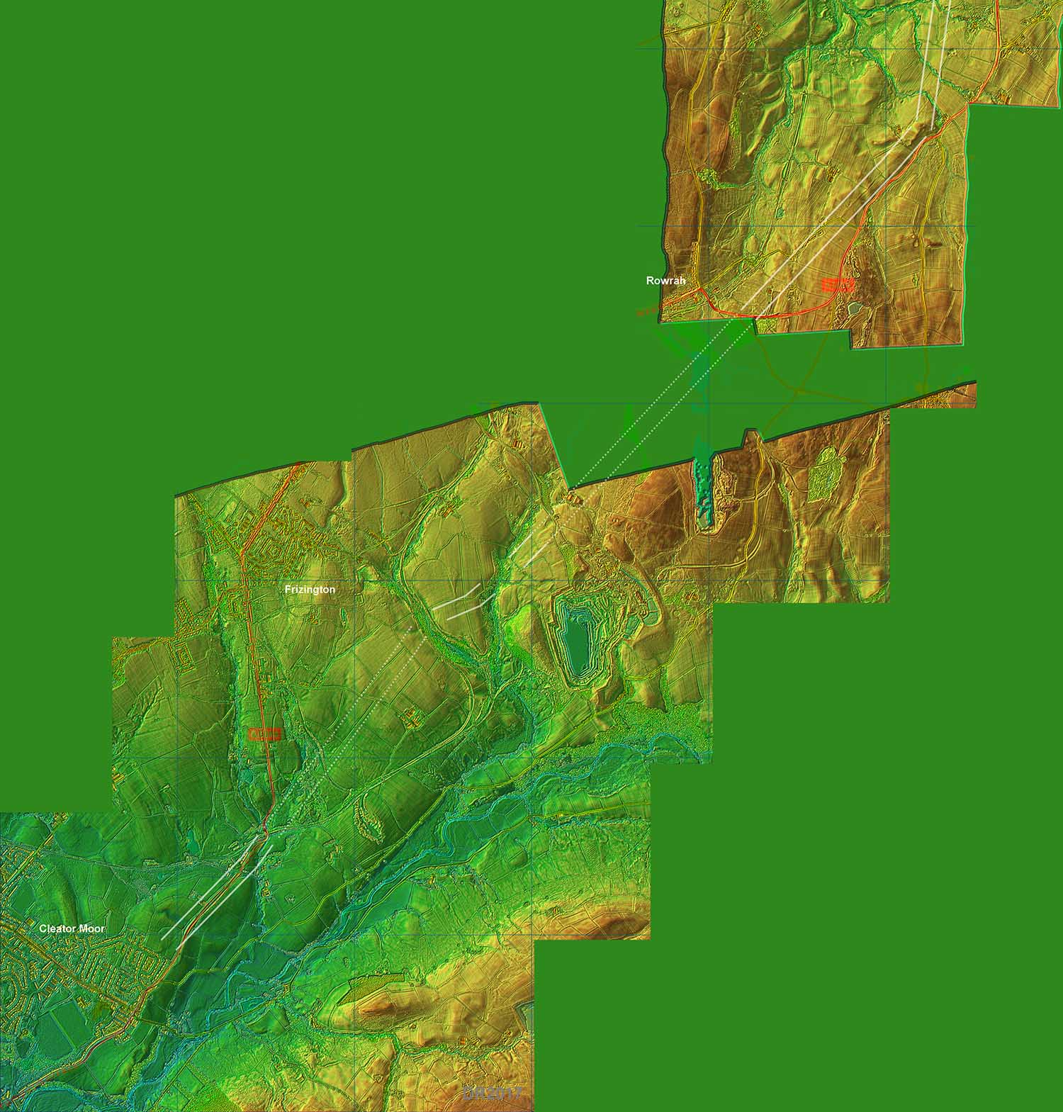
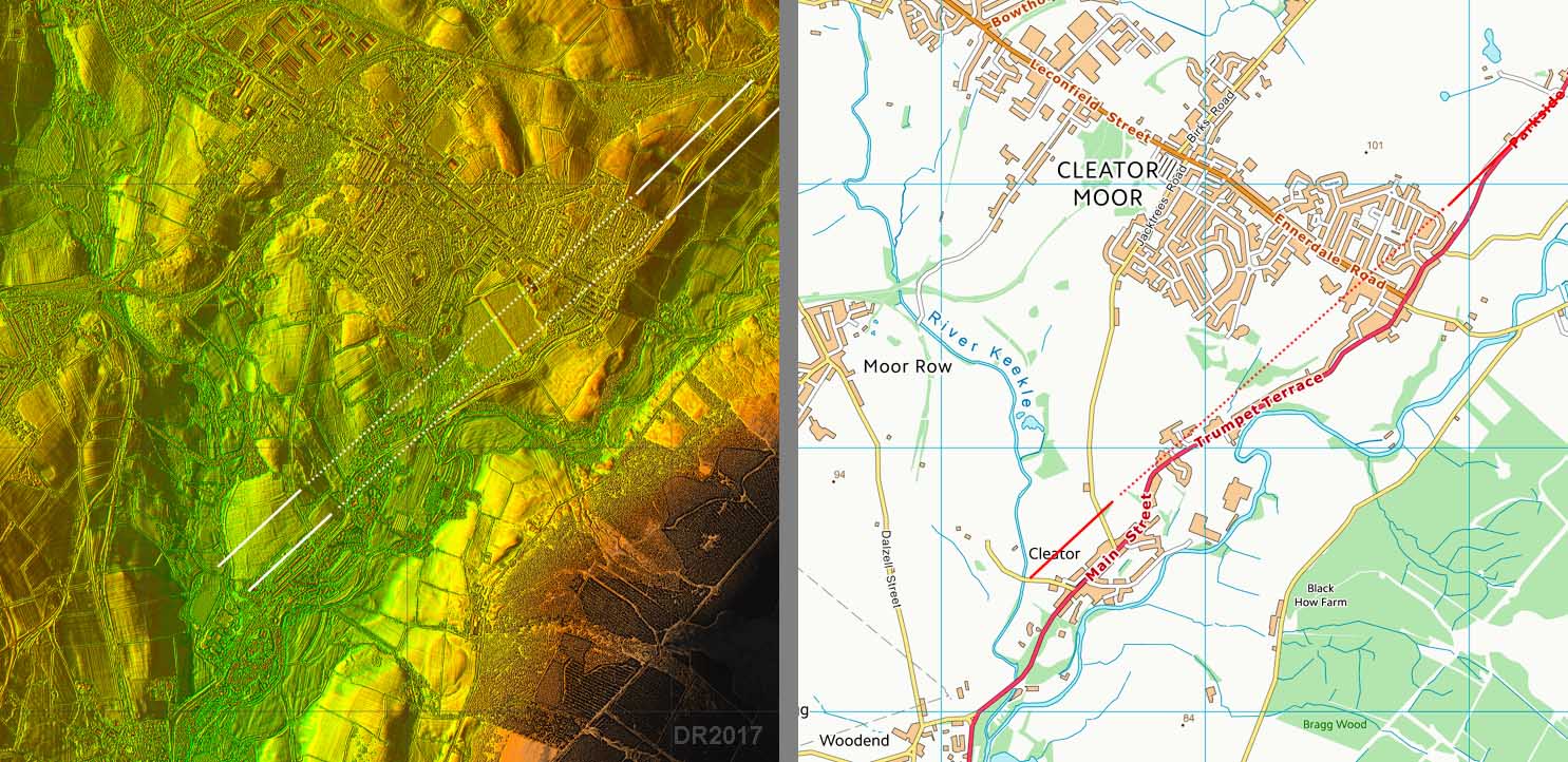
3D Lidar Image (DTM) - Approaching Cleator Moor Despite all the mining and quarrying there is just enough surviving to locate the route as far as Cleator Moor. From Cleator onwards it is a different story with the road proving extremely elusive. |
Click for larger view |
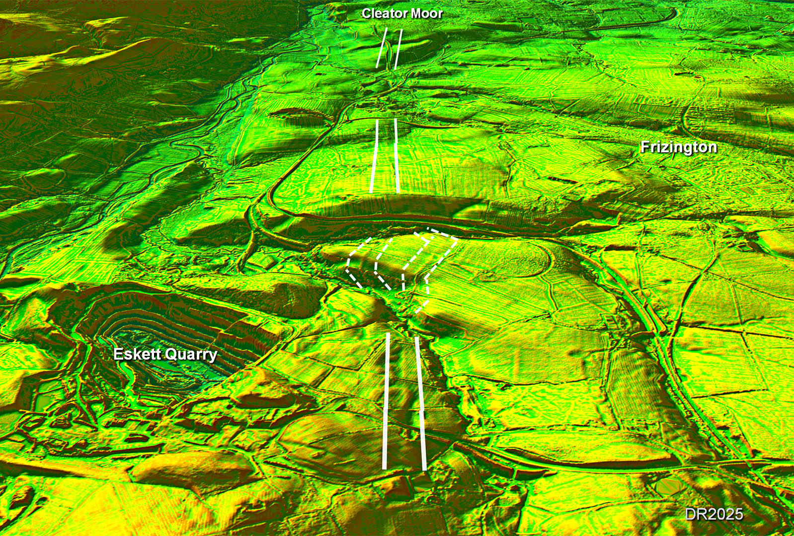 |
Route Map - Ullock to Cleator Moor This stretch has survived well and is clearly visible in the Lidar images. Why the road turned for Cleator is a bit of a puzzle - I would have expected it to carry straight on and gone via Ennerdale Bridge but it obviously did not. |
Click for larger view |
 |
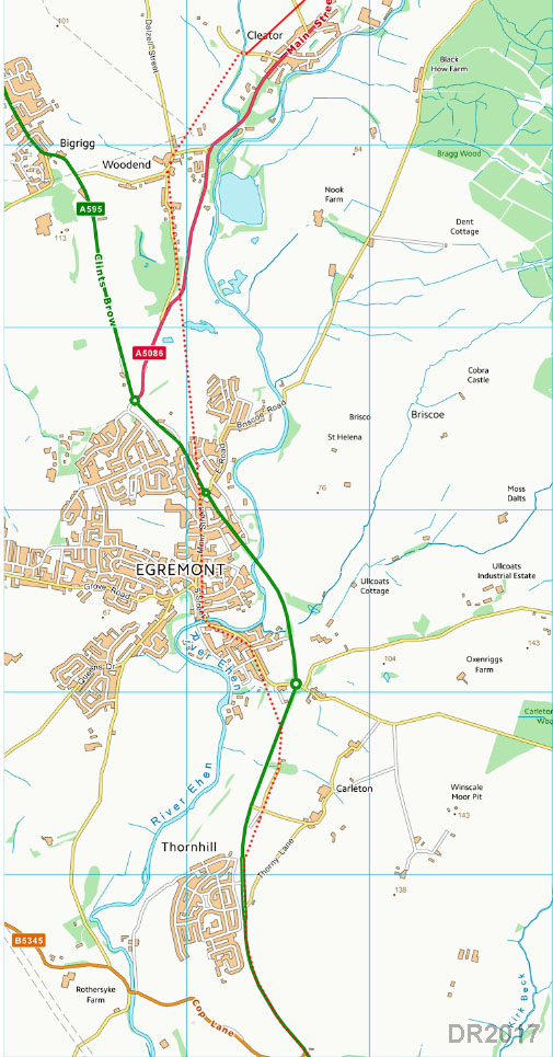
Lidar Image and Route Map - Cleator to Egremont This is last (possible) trace I could find in the Lidar data heading to the bridge at Dub Beck. The overall direction would seem to imply the Roman road would be crossing the River Ehen at or very near the current crossing in Egremont, which is presumably the best bridging point. |
Click for larger view |
 |
Route Map - Egremont Very much intelligent(?) guess work assuming that the crossing of Dub Beck and the River Ehen date back to Roman times. From Thornhill it is likely the modern road overlies the Roman road at least to Street Bridge (see below) and perhaps further. Note: a possible reason for this road heading south-west past Cleator, rather than taking a short cut via Ennerdale Bridge to Ravenglass, could be that it came down to Woodend to join a road from Moresby to Ravenglass. See the "possible" roads web page. |
Click for larger view |
 |
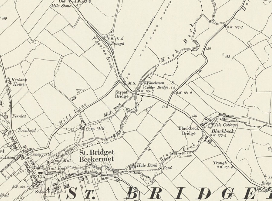
OS First Edition Map - Street Bridge The only real clue we have to go on for this stretch of the road. |
Click for larger view |
 |
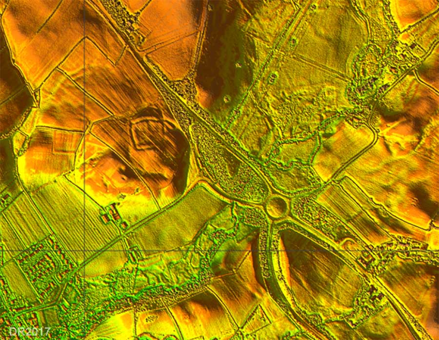
Lidar Image - Street Bridge There has long been speculation about a lost Roman site near Beckermet. Castle Earthworks visible in the Lidar image is certainly not it! However, locating a (medieval?) castle close to a Roman road could be a clue to our road being hereabouts. |
Click for larger view |
 |
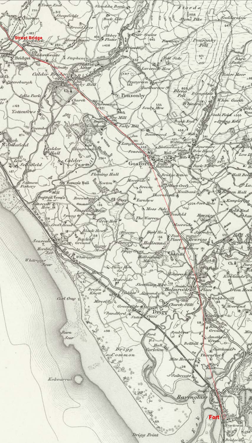
OS 1-inch First Edition Map - Possible Route Beyond Street Bridge Lidar does not offer much help so this is just really speculation! Where Lidar shows nothing then it can be a case that modern roads overlie the Roman line. I have therefore assumed it possibly went via Gosforth and what is now the A595 masks its course. |
Click for larger view |
 |
A "Road of two Halves!" From Papcastle to Cleator there is clear Lidar evidence for the route but south of Street Bridge then it is still "work in progress". |
|
|
|
Return to Cumbria Roman Roads homepage Last update: October 2025 |
© David Ratledge |