 |
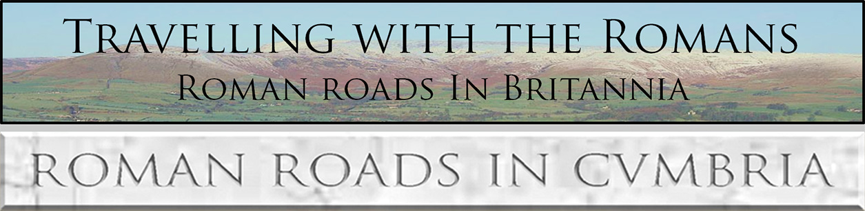
The Roman Road from Middleton to Low Borrowbridge, Margary 7caThis road came as quite a surprise. No one expected to find that, in addition to the known road on the east bank of the Lune, there was a second west bank route into the Lune Gorge. What triggered its discovery was John Scott spotting an agger on Firbank near Fox's Pulpit. I had followed the line of a Roman road south from Low Borrowbridge (Tebay) on the west side of the Lune but lost it thinking it must go to Watercrook, Kendal. The answer was now obvious - the road didn't go to Kendal but went via Firbank. The connection between John Scott's length and what I had been following was quickly spotted. Southwards of Firbank then Lidar indications are that it would appear to have crossed the Lune at Middleton Bridge and joined the known east bank road at Middleton. We therefore have an alternative route from Middleton to Low Borrowbridge Fort on the west bank of the Lune. NEW Video flyover along the full road - see below
|

Lidar Image - Full Route I have shown both the "new" west bank route and the well known east bank route. Quite why there are two is a puzzle. The west bank route is shorter at 8 miles as opposed to the east bank road at 8.5 miles. It it however much the hillier. |
Click for larger view |
 |
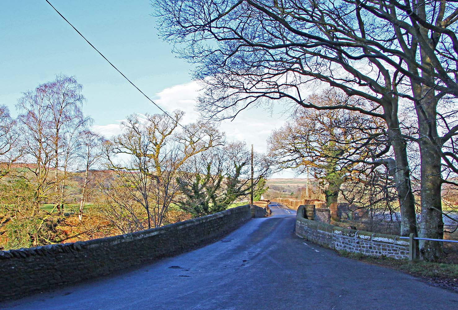
Roman Road Junction - Middleton Here the road from Burrow in Lancashire splits. Straight on up the narrow lane is the Roman Road on the East Bank of the River Lune. On the left, dropping down to the River Rawthey, is the "new" road on the Lune's west bank. Image: DR |
Click for larger view |
 |
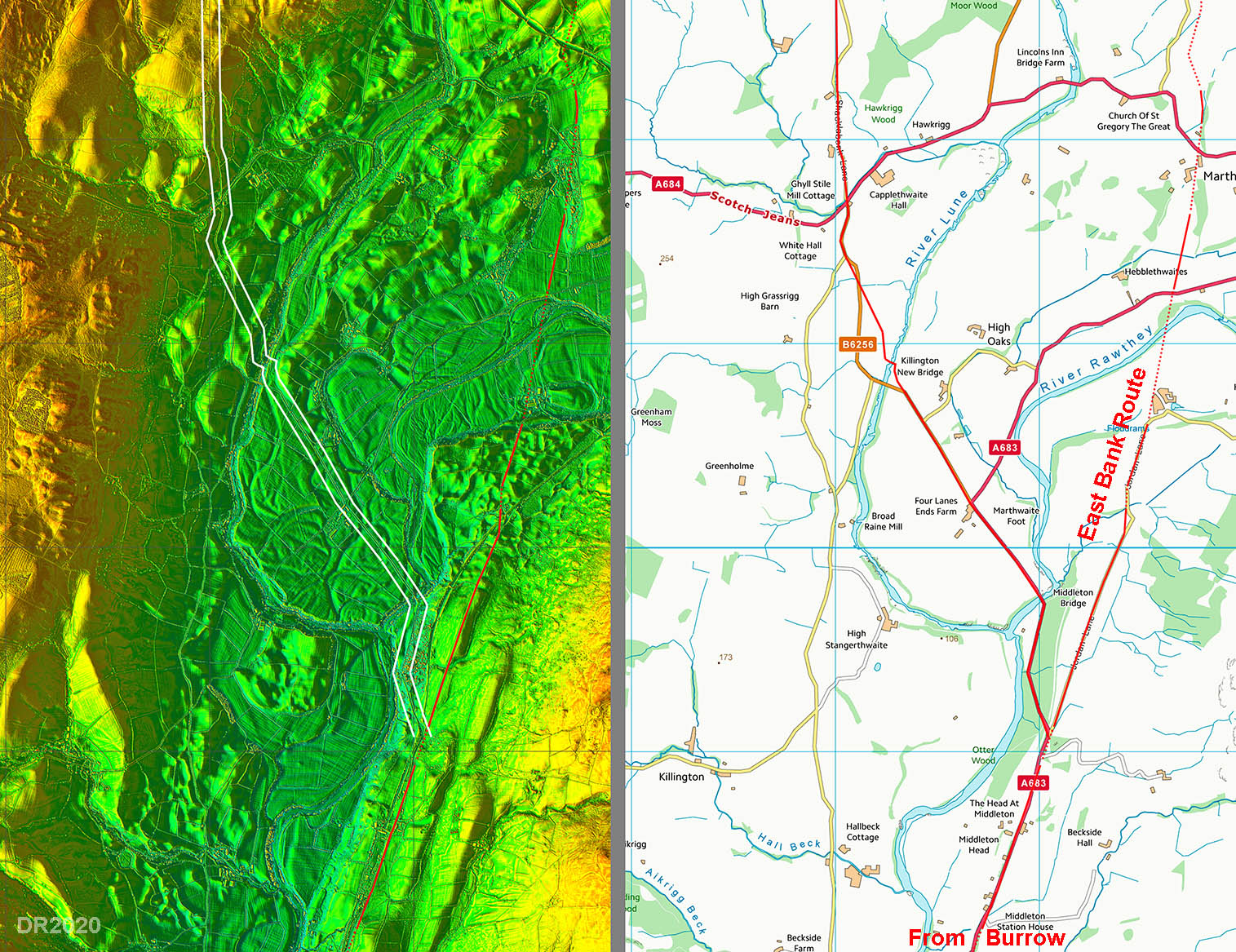
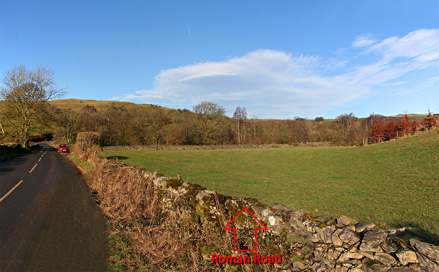
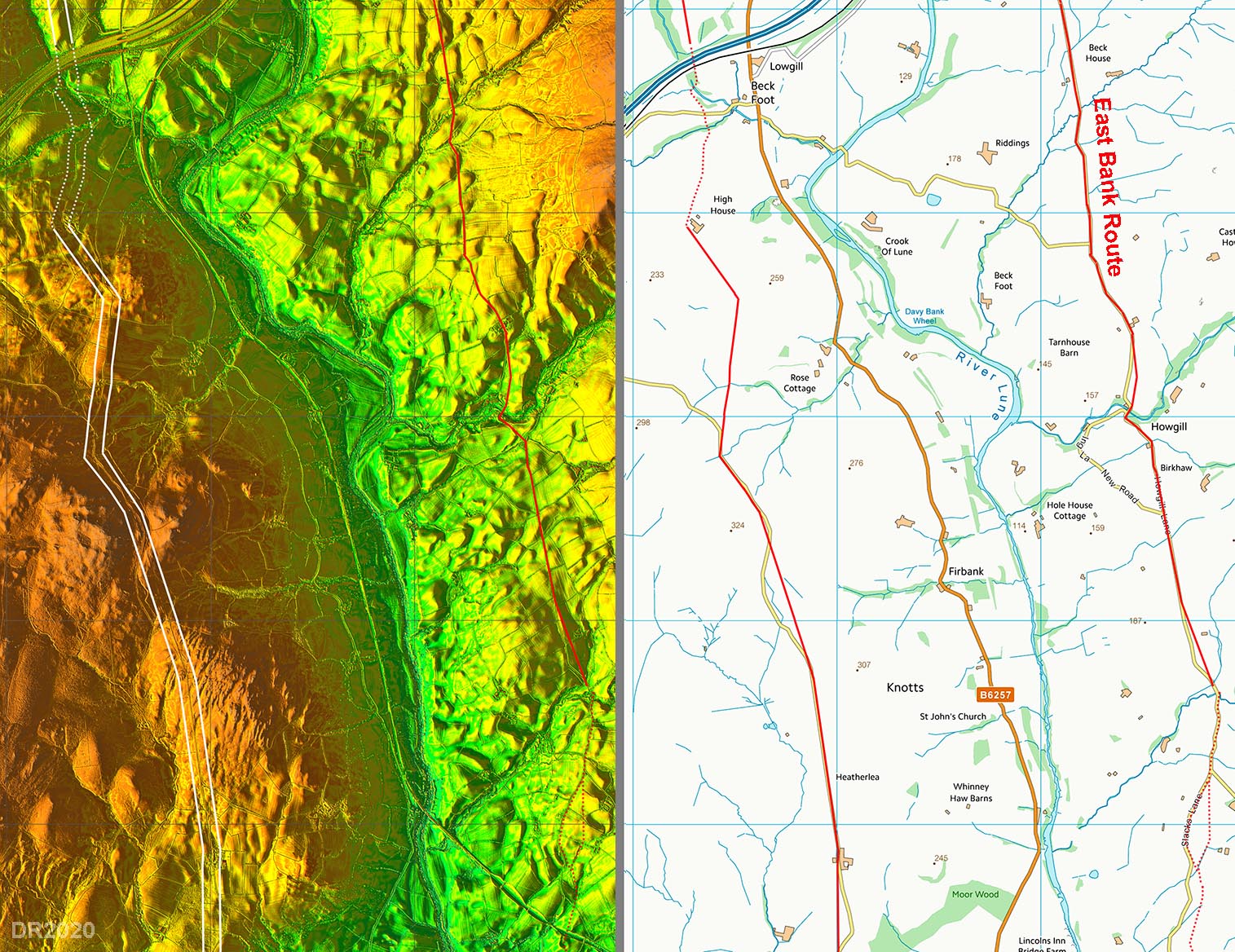
Lidar Image & Route Map 1 I have searched south of Middleton on the west bank for the road but all indications are that the Roman road crossed the River Lune at Middleton Bridge. West of the bridge the road is straight passing Four Lane Ends and is typically what would be expected if Roman. |
Click for larger view |
 |
Middleton Bridge Having dropped down from the junction our road turns and crosses the River Rawthey. Beyond the bridge, the road takes a typically straight alignment. This length of road was improved by Sedbergh Turnpike Trust but would have followed the Roman alignment. It may seem strange having two bridges close together but the east route also had to cross both rivers, although the bridges were much further apart. Both bridge sites for the west bank route are at solid rock outcrops so make ideal foundations. Image: DR |
Click for larger view |
 |
Killington Bridge This is the end of the straight alignment mentioned above. The modern Killington Bridge (the turnpike bridge but widened) is on the left. We are looking towards the Roman bridge site for crossing the River Lune. This was 100 metres north of Killington Bridge (SD62273 90903). Nothing much is visible on the ground but Lidar does reveal the 2 road ditches - see below. Image: DR |
Click for larger view |
 |
Oblique Lidar Image - Killington Bridge The site of the "old bridge" is marked on first edition Yorkshire maps. The Sedbergh Turnpike Trust decided on a new bridge site 100 metres south of the Roman original so the modern road turns off the Roman line. Killington modern bridge would have been narrower in Turnpike days but has since been obviously widened.
|
Click for larger view |
 |
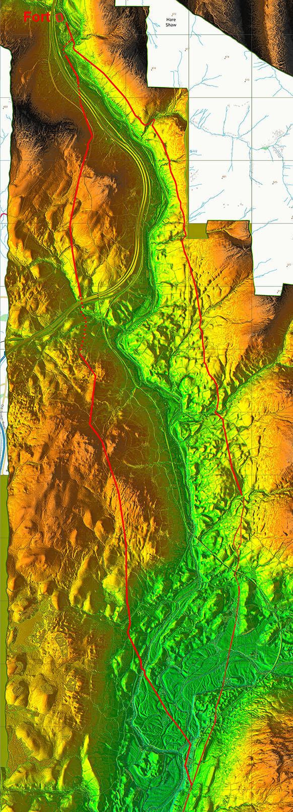
Black Horse Cross Roads The Roman road crosses the modern A684 road to Sedbergh at the (former) Black Horse pub. Here we are looking back from the Firbank side and into the Sun! Behind us there will be a steady climb up to Fox's Pulpit on Firbank. Note road to the Pulpit is nowadays very narrow and not in the best of condition. Image: DR |
Click for larger view |
 |
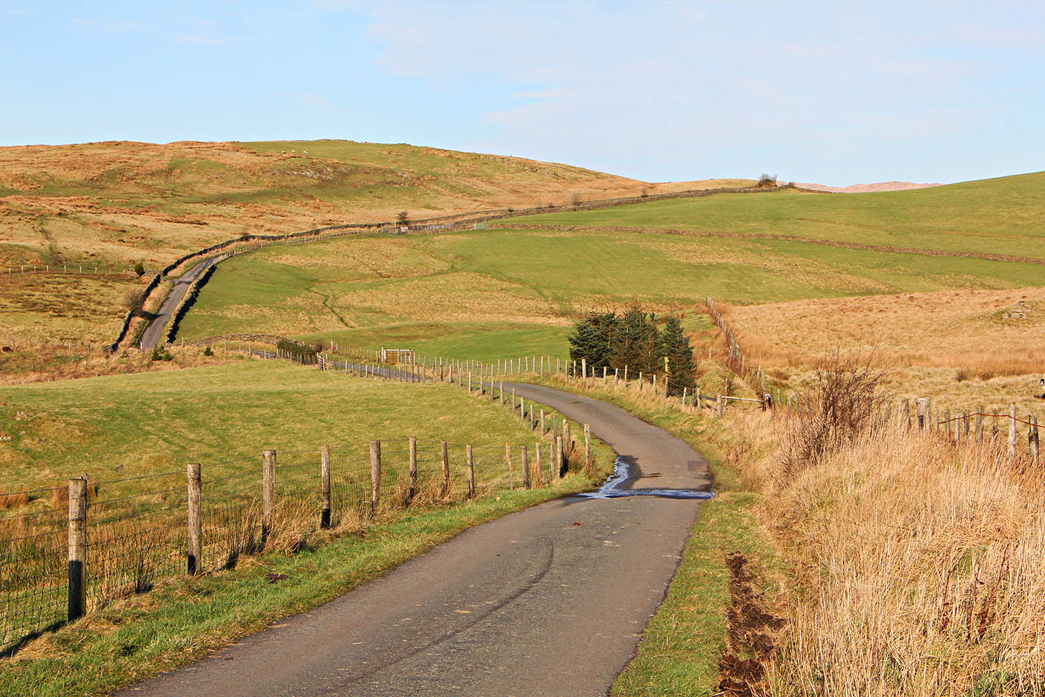
Approaching Fox's Pulpit, Firbank The country lane to Fox's Pulpit is today a bit narrow but this section is on a proper agger. Fox's Pulpit is on the skyline, right (east) of the road. Here, on 13 June 1652, George Fox, the founder of the Religious Society of Friends (Quakers), preached. I had always wondered why Fox chose this spot - today it is in the middle of nowhere, on a road to nowhere. We now know it was alongside the main Roman road to the north. So it was a very sensible spot where believers from north and south could attend. Image: DR |
Click for larger view |
 |
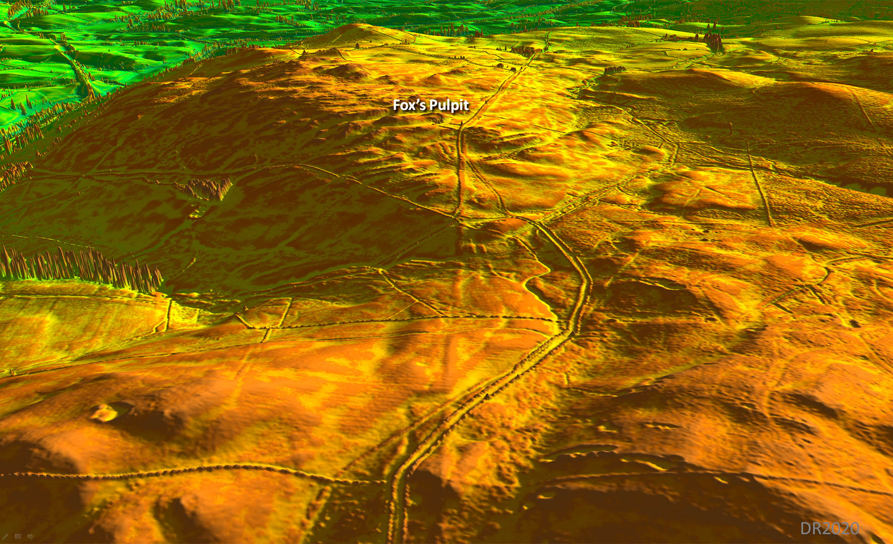
Oblique 3D Lidar Image - Firbank North This is the section near Fox's Pulpit on Firbank that John Scott spotted. This led to the penny dropping that there was a west bank Roman road to Low Borrowbridge fort. |
Click for larger view |
 |
Fox's Pulpit - looking back A plaque on the rock, visible on the left, commemorates Fox's preaching, which is sometimes considered the beginning of the Friends movement. Firbank Fell is therefore an important place in Quaker history. Why he preached here now makes perfect sense - it must still have been an important highway 370 years ago. Image: DR |
Click for larger view |
 |
Oblique 3D Lidar Image - Firbank South We are looking back to Firbank and Fox's Pulpit. Normally I place corridor lines either side of the agger to indicate its course. It is so obvious in this view that they are not needed. It also shows that the modern lane coming up to Fox's Pulpit is on a large agger. |
Click for larger view |
 |
North of Fox's Pulpit, Firbank The modern country lane now swings off to the left but the Roman line carries straight on. It follows a fence just to the right of those conifer trees and then can be seen as a lighter patch of grass beyond the end of the fence heading to cross over the modern lane on the skyline. Image: DR |
Click for larger view |
 |
Lidar Image & Route Map 2 Again the modern road approaching Fox's Pulpit is straight before it diverges off the stretch that John Scott found. |
Click for larger view |
 |
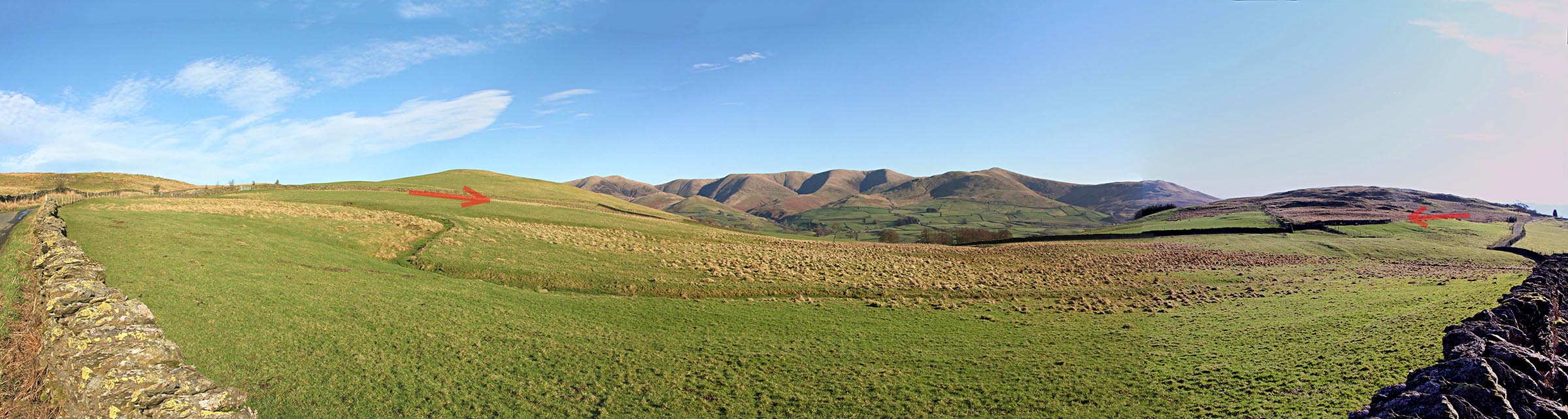
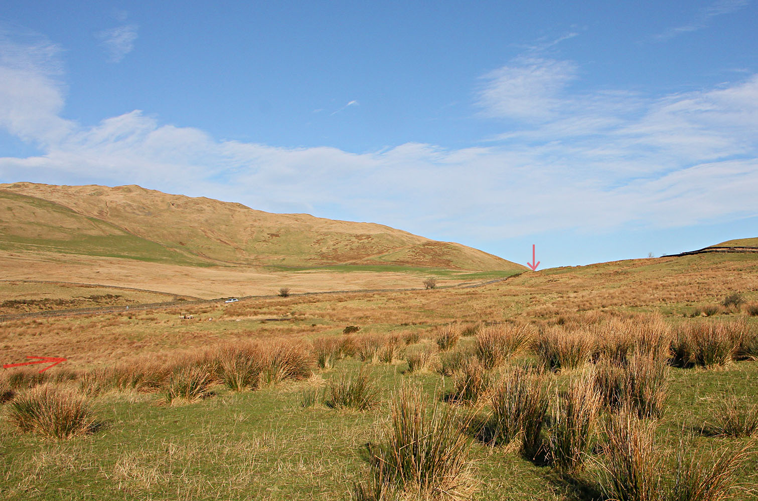
Firbank Panorama This is beyond Fox's Pulpit where the modern road temporarily leaves the Roman line. I have marked the Roman agger with two faint arrows - so as not to spoil the magnificent view of the Howgills. Image: DR |
Click for larger view |
 |
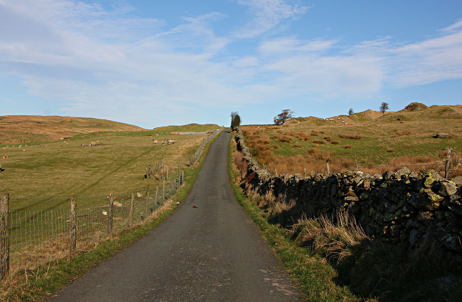
Towards High House Further along, the modern lane now swings completely off line and our Roman roads heads for High House. The first part of the track - a hollow-way - is not the line - it comes in from the right, hidden by the wall, and joins the track/footpath near the tree. Image: DR |
Click for larger view |
 |
Oblique Lidar Image - Graining Farm to Grayrigg This is the stretch I had previously located but had failed to find a route onwards to Watercrook, Kendal. It is obvious now with hindsight that this is an alternative west bank route from Middleton. |
Click for larger view |
 |
Graining Field Farm No access to this stretch but the Roman road passes under Graining Field Farm and heads up the hill to Grayrigg. Image: DR |
Click for larger view |
 |
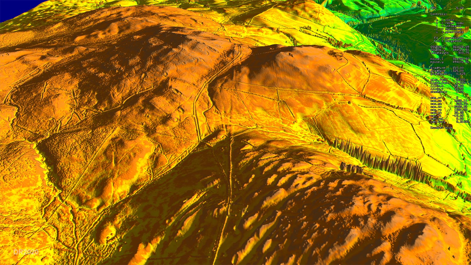
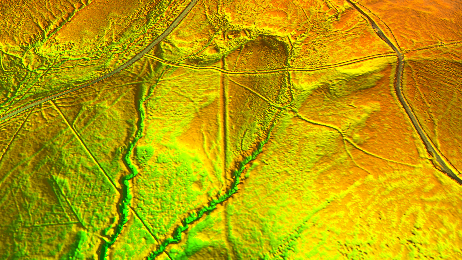
Oblique Lidar Image - Grayrigg Detail Possibly the best surviving stretch of agger on the road. Looks pristine. The width of the road over the ditches is 9 metres. It certainly is a proper Roman road, not a local supply road by any means. |
Click for larger view |
 |
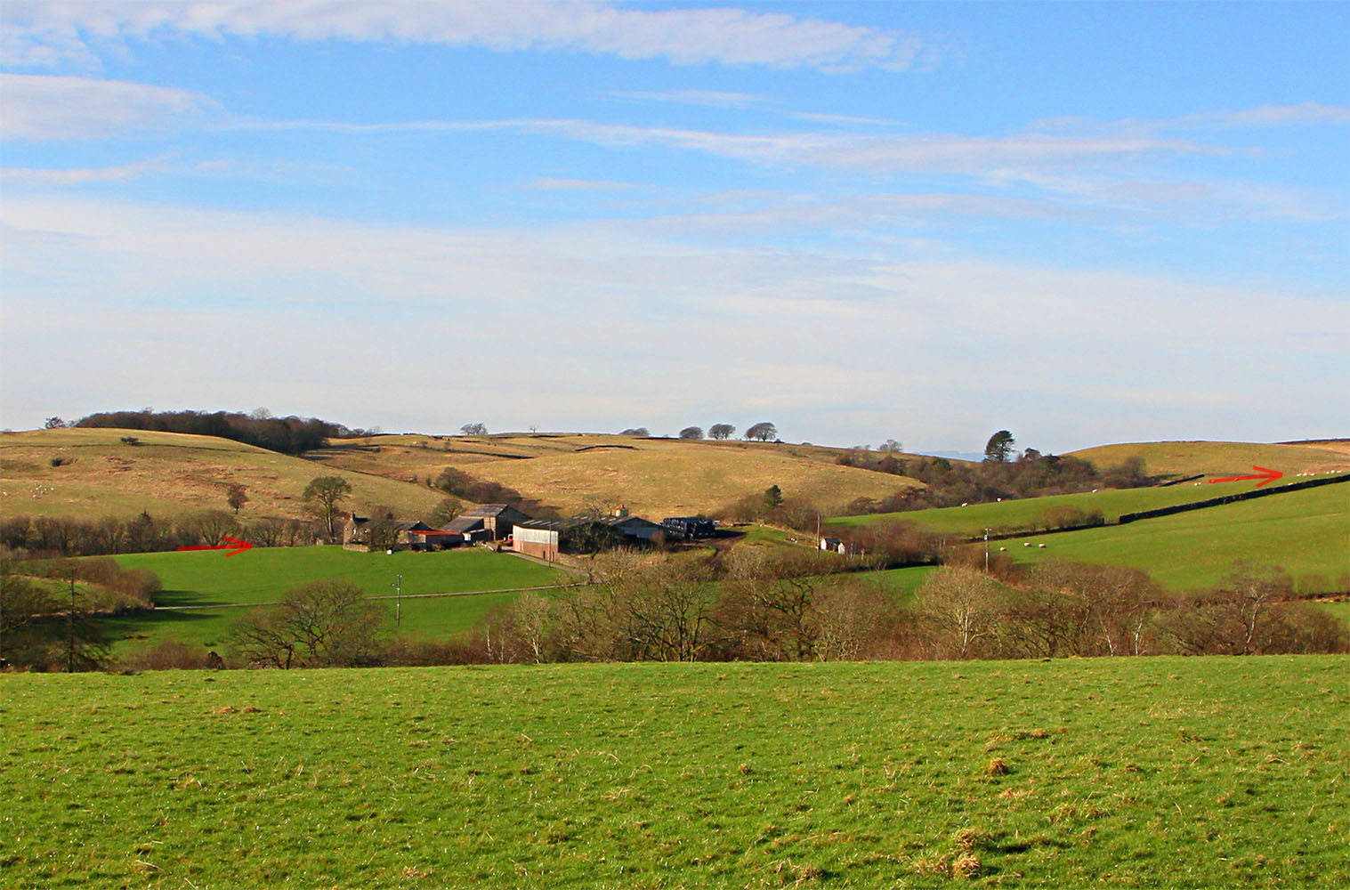
Grayrigg I didn't quite get on line for this image. Our road is just to the left heading towards the arrow on the skyline, where it will begin its descent into the Lune gorge. The A685 is the road on the left and the B6257 is just appears in the top right corner. Image: DR |
Click for larger view |
 |
Lidar Image & Route Map 3 The stretch over Grayrigg is very prominent and was the length I spotted several years ago but thought it must be a road to Watercrook. The final length to the fort is down by the river and the descent from Grayrigg is partly destroyed by the motorway and railway but sufficient survives to confirm this was the course.
|
Click for larger view |
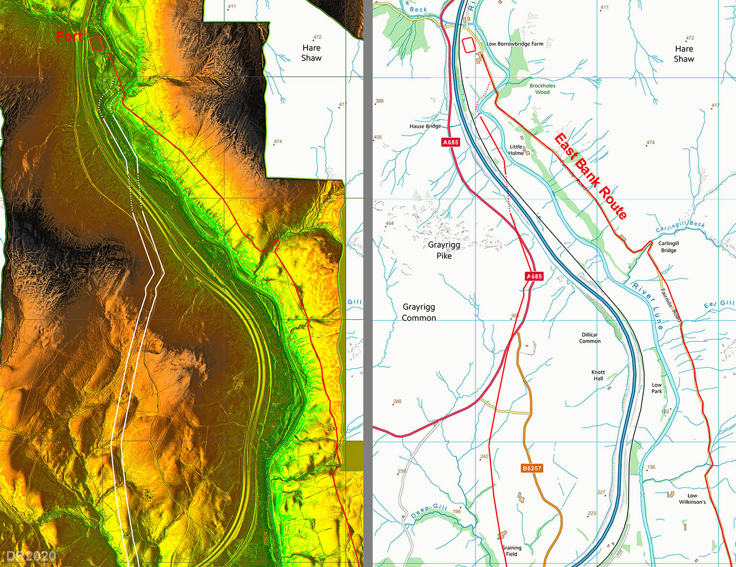 |
Why Two Roads? The western route appears to branch off the east bank road, which would suggest it was the later. However, this west bank route is hillier and not just slightly but dramatically so (see profiles on right). Admittedly it is a little bit shorter (0.5 miles) but it would have needed an important reason to build 8 miles of new road with two bridges. So can it be regarded as a later replacement of the east bank road? In its favour are the bridges. The west bank route bridges are where the rivers are constrained by rock and building bridges would be relatively easy. On the other hand, the River Rawthey crossing on the east bank route, west of Sedbergh, is where the river is unconstrained. A study of the LiDAR imagery reveals an active river with numerous old abandoned channels and meanders. Realistically it is only suitable for a fording point. It should also be noted that the west bank route turns off exactly where it would need to to bypass the Sedbergh flood plain - no sooner, no later. So my guess is that it was the bridges that clinched it for the west bank route and the east bank route, with almost certainly a ford, was abandoned.
|
Click for larger view
|
Road height profiles |
3D Lidar video flyover along the road.
|

|
|
|
Return to Cumbrian Roman Roads homepage Last update: February 2020 |
© David Ratledge |