 |
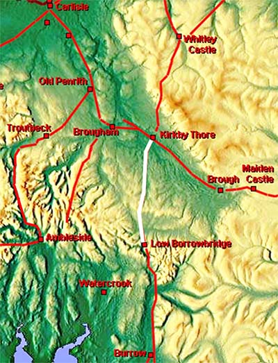
The Roman Road from Low Borrowbridge to Kirkby Thore, Margary 7dThis was the breakthrough road that began the Lidar revolution and changed the course of history - well the course of this road at least! It was the late Hugh Toller who discovered the true destination of this road was Kirkby Thore not Brougham using the first publicly available Lidar data. Until 1920 this road was lost beyond Crosby Ravensworth but assumed, on the basis of its general alignment, that Kirkby Thore was its likely destination but without any evidence to confirm it. However, when in 1920 Percival Ross also failed to find any evidence for this, he made the erroneous conclusion that it must have gone to Brougham. He was quite adamant saying there "never was a road to Kirkby Thore". Since then every book and map has shown the road going to Brougham. Hugh had a big job trying to overturn convention and his report on his discovery (C&WAAS 2014) had to include that the route to Brougham was also probable - i.e. two roads. Hugh never believed this (personal comments) and I agree with him. The Brougham route was a mistake - plain and simple.
Thanks to Hugh and Lidar we now have the full correct route - only the crossing of the River Eden has been eroded away and is not traceable. Because this route does not (yet) figure on modern mapping, maps for the full route have been provided below. Note: I have kept the Margary number 74 despite it not going to the destination assigned by Margary.
|
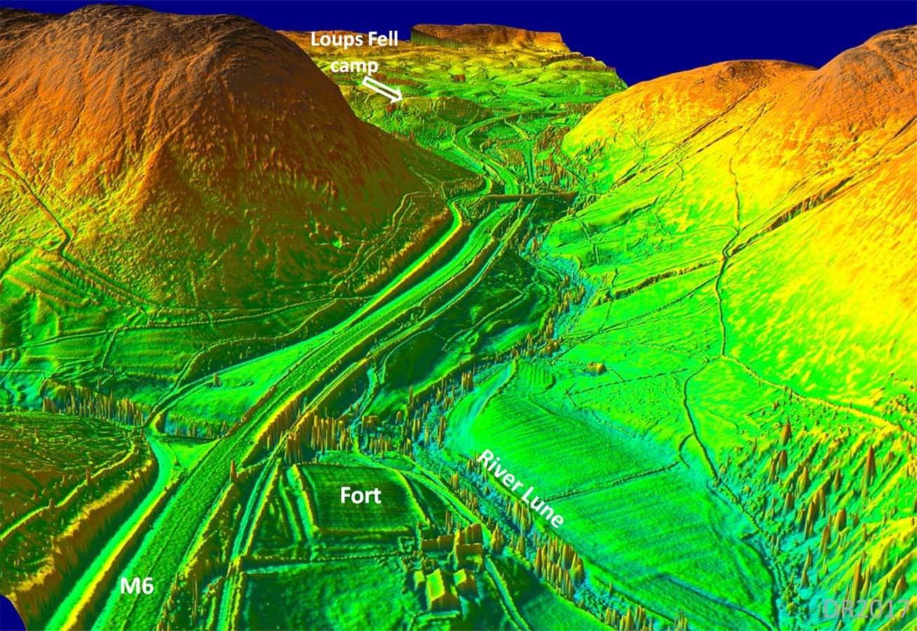
3D Lidar Image - looking north from Low Borrowbridge The fort platform is very obvious and Loups Fell marching Camp is just about visible at the top of the Lune Gorge. |
Click for larger view |
 |
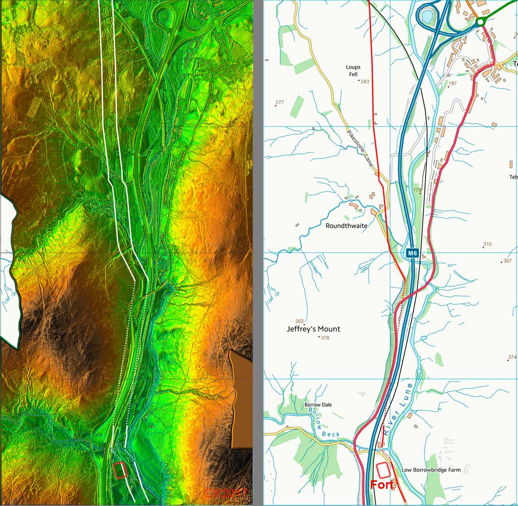
Lidar Image and Route map In the Lune Gorge, the Roman road has been obliterated by the railway and the M6. Only towards Loups Fell does it become traceable. |
Click for larger view |
 |
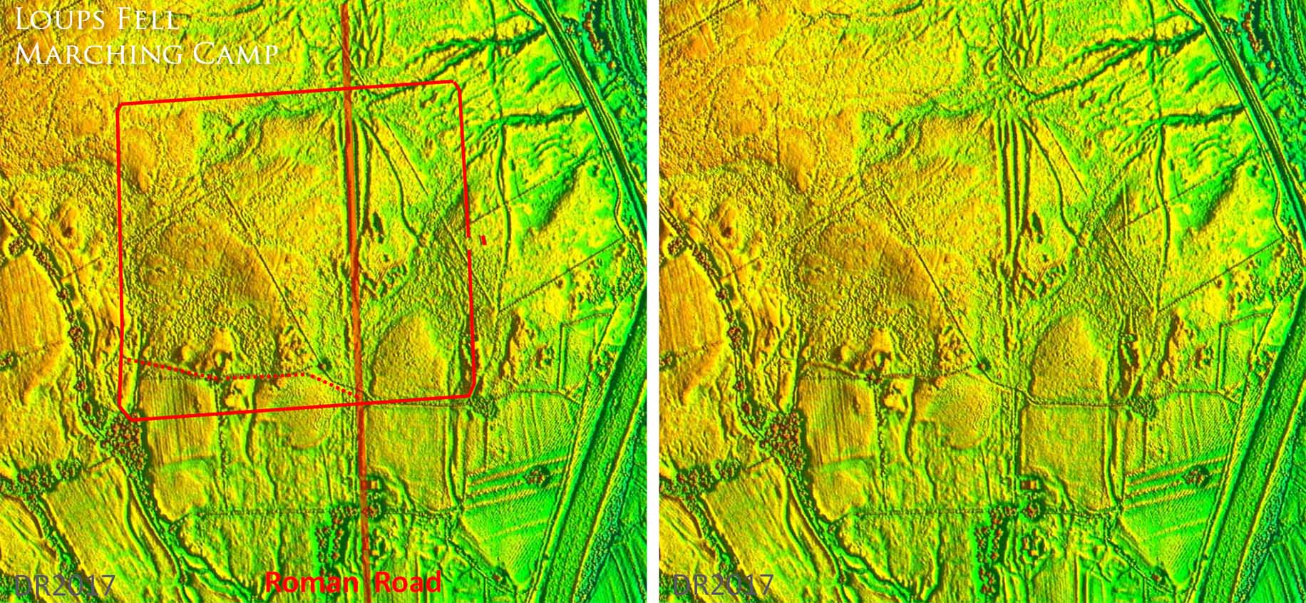
Lidar Images - Loups Fell Marching Camp Discovered by Bryn Gethin and Hugh Toller (Britannia 2014) this marching camp lies at the head of the Lune Gorge and sits astride the Roman road. The camp is badly eroded but appears to have an entrance on the east side protected by a traverse. The southern rampart - west end - is not visible. The red outline assumes a symmetrical layout but there is some evidence - dotted line - that the southern rampart may have been dog-legged. Interestingly the camp respects the Roman road alignment. |
Click for larger view |
 |
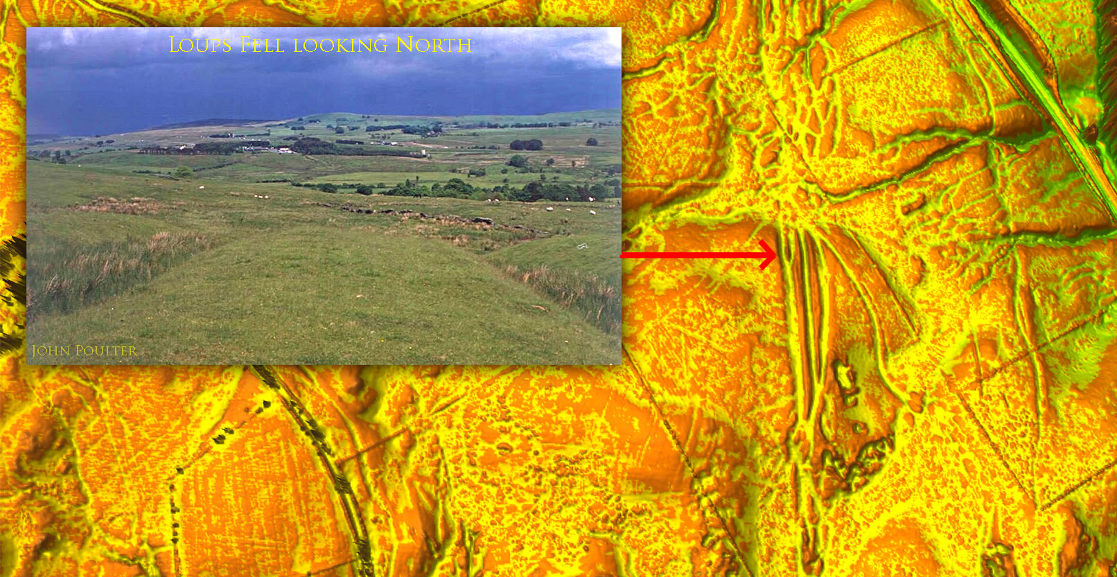
Agger on Loups Fell Most of Loups Fell is much disturbed but a very prominent section of agger has survived insdie the camp at its northern edge. The route of the road onwards through Tebay Motorway Services can be made out Inset image: John Poulter |
Click for larger view |
 |
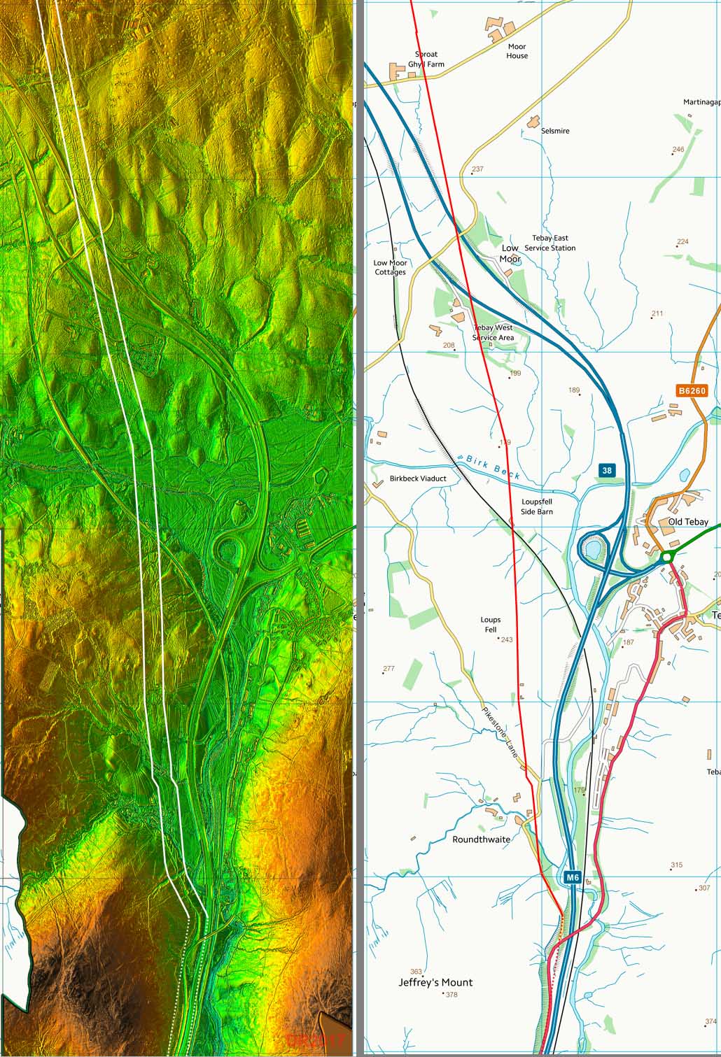
Lidar Image and Route map The road has survived well here and is easy to trace in the Lidar image. The Roman road passes through Tebay Services - probably the best service station in the country! North of the Service Station traces on the ground start to become obvious. |
Click for larger view |
 |
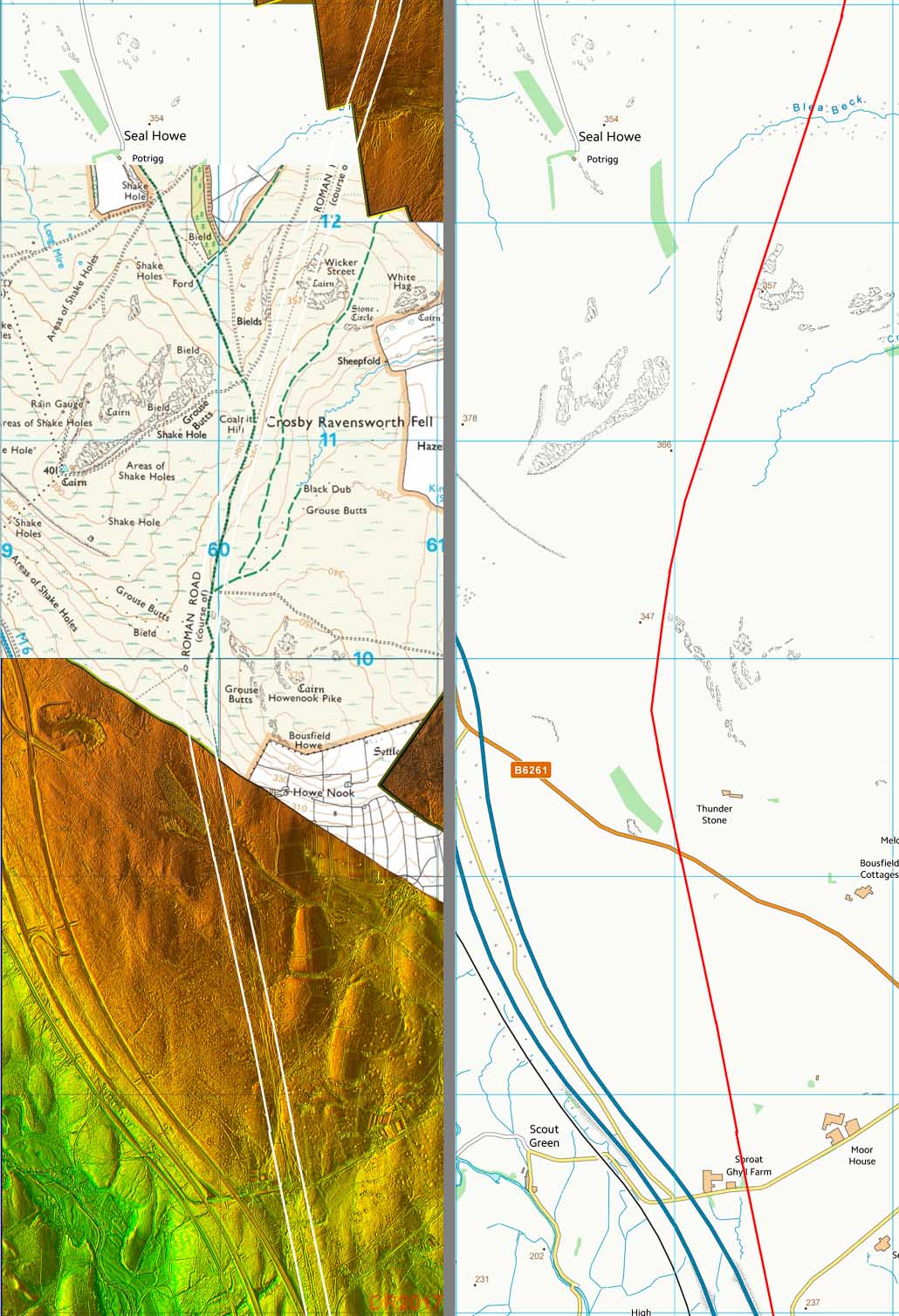
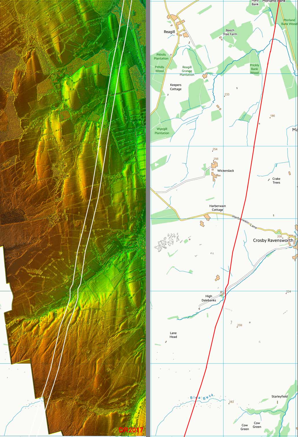
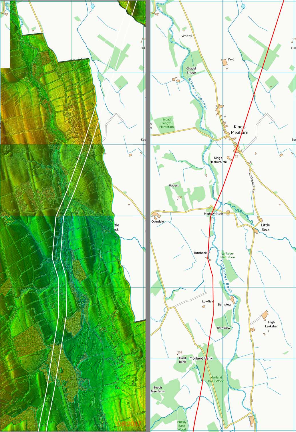
Lidar Image and Route map The route makes a turn on Crosby Ravensworth Fell and from now on is aligned on Kirkby Thore. It carries the name "Wicker Street" here. |
Click for larger view |
 |
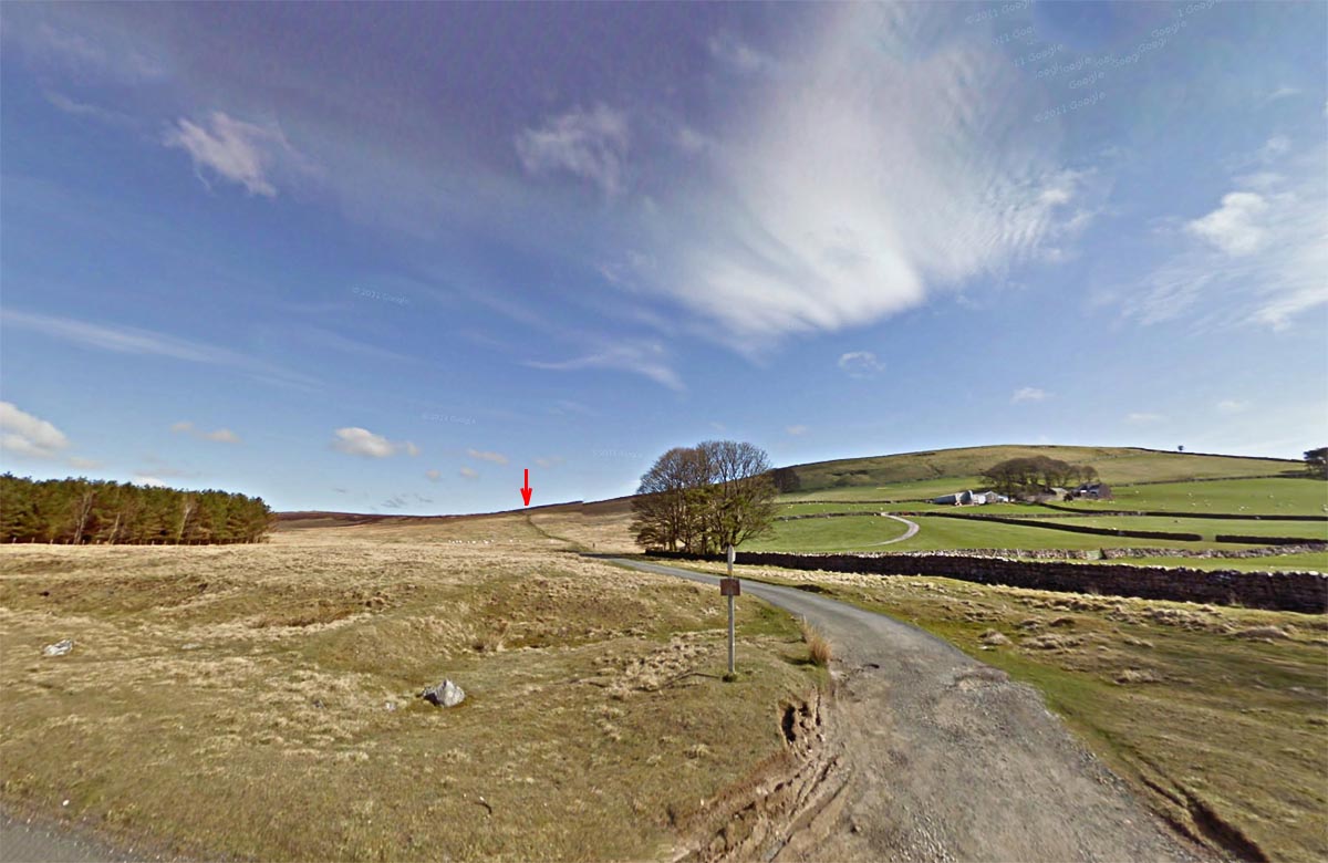
Crossing the B6261 - looking north The road is walkable north of the B6261 and there is easy parking. Image DR |
Click for larger view |
 |
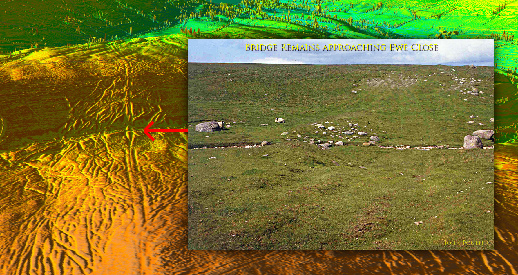
Remains of Bridge Ramps/Abutments - looking north Approaching Ewe Close the road has to cross a small stream and the ramps of the bridge approach are still clearly evident. The big boulders are interesting - almost as they have been placed to mark the extremity of the highway boundary. Inset image: John Poulter |
Click for larger view |
 |
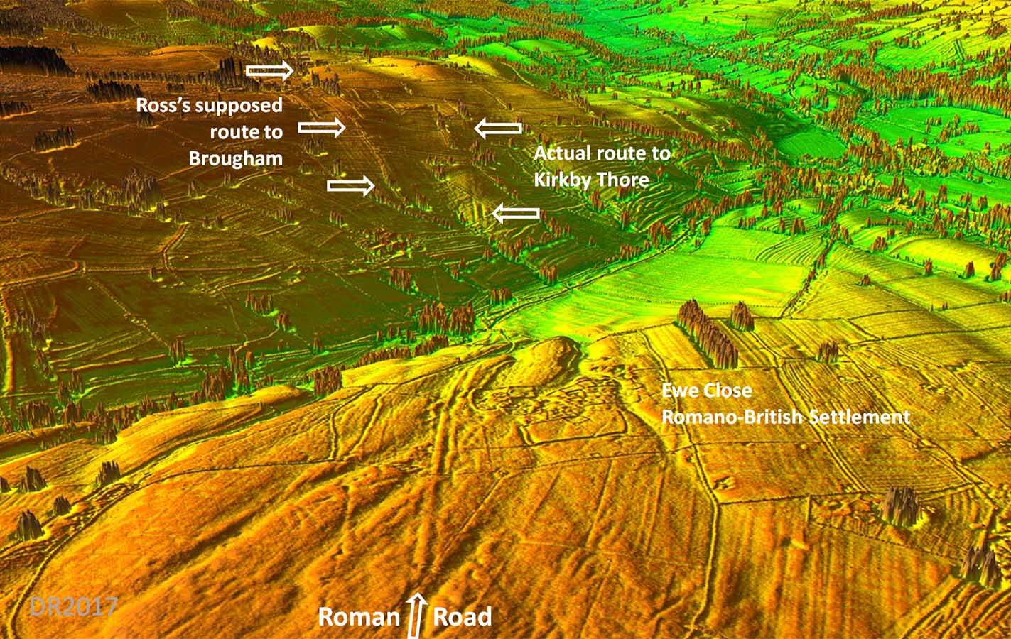
3D Lidar Image - passing Ewe Close Romano-British Settlement This is the crucial bit of evidence that the road continued on its alignment to Kirkby Thore. Ross's route to Brougham is little more than hedgerows and there is no supporting Lidar evidence for its existence. Interestingly, the Roman road actually bends around the Ewe Close settlement. Presumably this means they were contemporary and the Roman surveyor was respectful of the existing boundary.. |
Click for larger view |
 |
Lidar Image and Route map Heading for Kirkby Thore and it is easy to understand why Ross could not find it as the evidence is very intermittant.....but definite. |
Click for larger view |
 |
Oblique Lidar Image - Crossing the River Lyvennet 1 The course of the agger of the road is probably at its clearest since Ewe Close. It crosses the River Lyvennet just before King's Meaburn (see below). |
Click for larger view |
 |
Oblique Lidar Image - Crossing the River Lyvennet 2 Detail of the route passing Turnbank Farm. The road keeps to the west bank but has been partly washed away as it approaches the river crossing point. |
Click for larger view |
 |
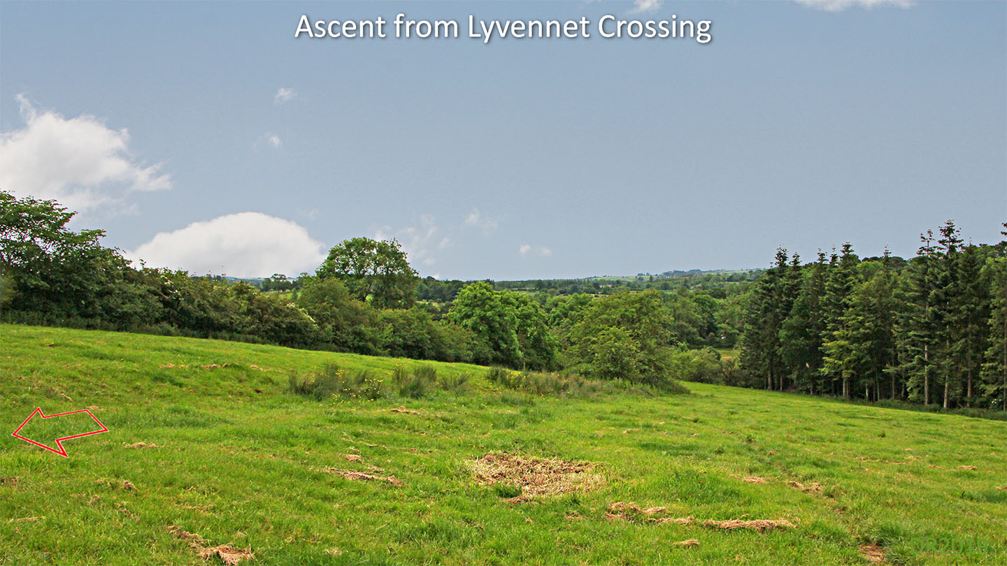
Ascent from the River Lyvennet The road has survived here as a slight cutting into the side sloping ground as it comes up from crossing the River Lyvennet down by the trees. Image: DR
|
Click for larger view |
 |
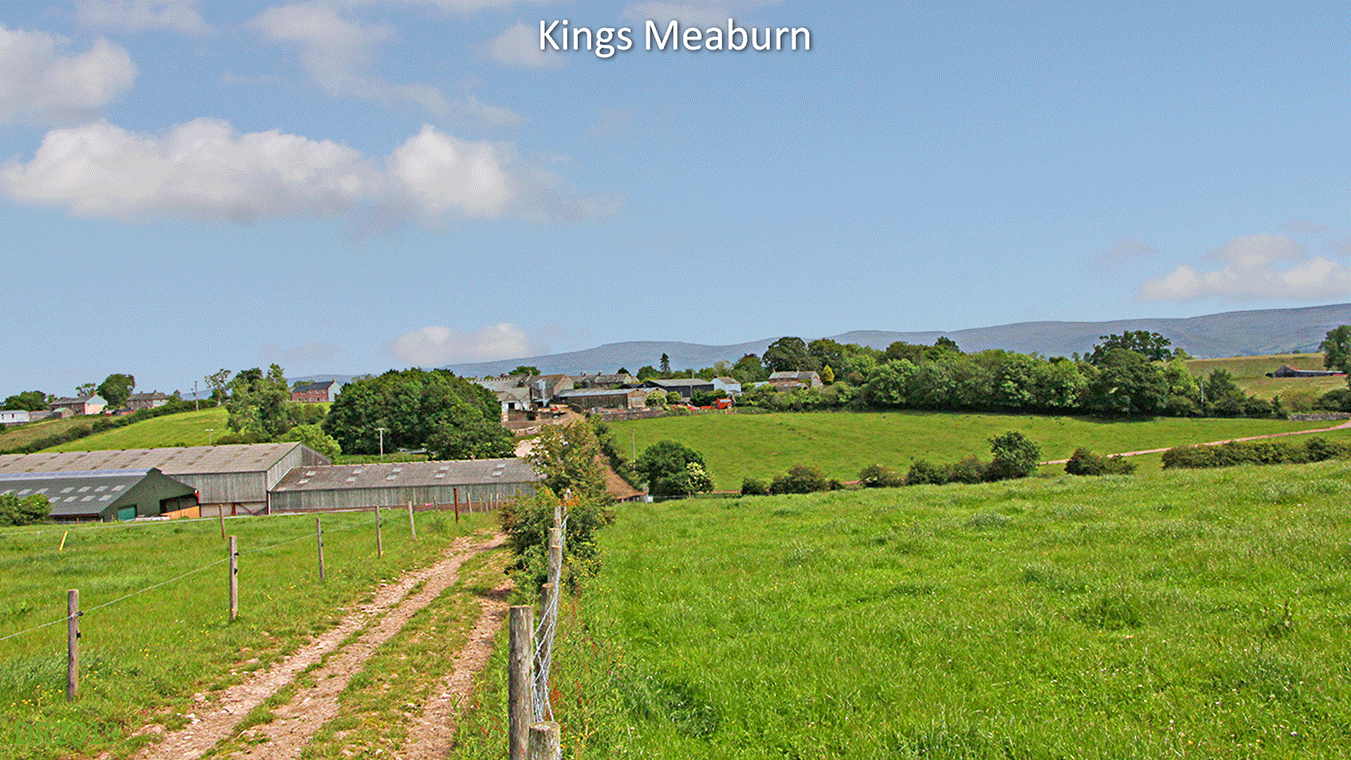
Approaching King's Meaburn The Roman road is to the right of the modern farm track here but merges at the bottom of the hill and follows the track to the farm. It is perhaps just visible in the colour of the grass. A Google Earth aerial image also shows it faintly here. Image DR |
Click for larger view |
 |
Lidar Image and Route map Makes a slight detour to negotiate the Lyvennet. The Lyvennet Valley is one of Cumbria's hidden gems. |
Click for larger view |
 |
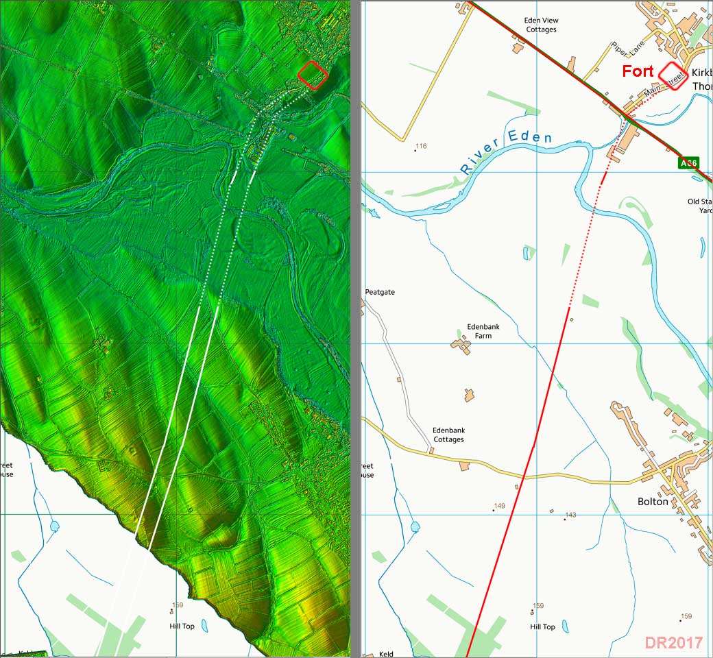
Oblique Lidar Image - Crossing the River Eden This is the last visible trace of the road. It is only a trace too being very faint but is certain as those features all line up and point directly to the fort.
|
Click for larger view |
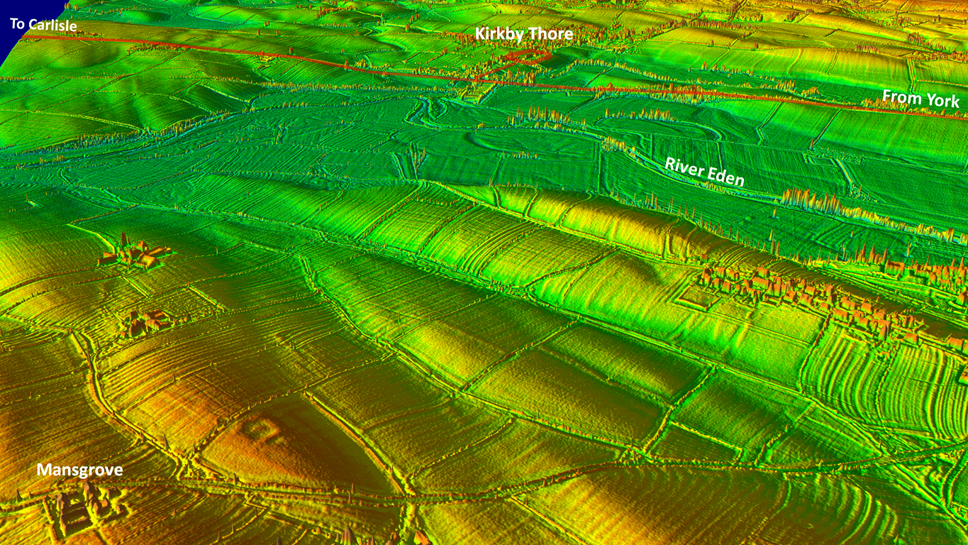 |
Lidar Image and Route map The Lidar coverage resumes approaching the fort but across the Eden flood plain all evidence has been washed away. We can be pretty confident though in joining up the clues and proposing a straight alignment. The Stainmore Roman road and this road would have shared a route into the fort, probably close to the modern village road. |
Click for larger view |
 |
The alignment of this road could imply that it was part of a through route continuing along the Maiden Way to Alston and Carvoran. |
|
|
|
Return to Cumbria Roman Roads homepage Last update June 2019 |
© David Ratledge |