 |
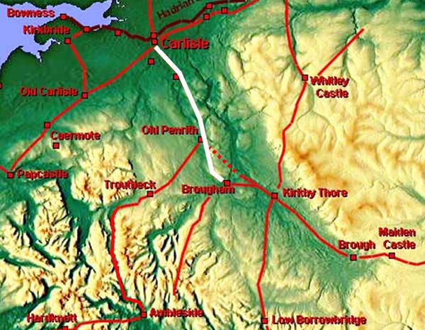
The Roman Road from Brougham via Old Penrith to Carlisle, Margary 7eA simple and fairly well known stretch of Roman road well recorded by the early Ordnance Survey surveyors. Across Penrith much of its route is now lost to housing and most of the remainder is covered by the modern A6.
This is the route of Antonine Itinerary V, which includes Brougham but not Old Penrith.
|
Map - Brougham to Penrith Composite old and new map. The Ordnance Survey first edition maps depict the road with double lines indicating it was clearly visible to them. |
Click for larger view |
 |
Lidar Image - Brougham to Penrith A little bit worrying as nothing is visible on the Ordnance Survey line. One can only assume it has been completely ploughed away. |
Click for larger view |
 |
Lidar Image - north Penrith No disputing this stretch of agger. Probably the best preserved piece of agger on the whole route. Unfortunately it too has now succumbed to housing but it was exposed and properly recorded - see below. |
Click for larger view |
 |
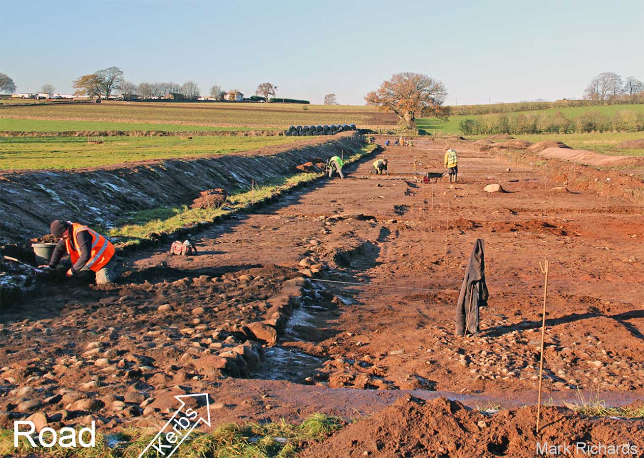
Exposed Roman Road off Salkeld Road, Penrith, 2017. Looking north. The road had large kerb stones or more accurately edging stones. These were to retain the road construction. There was also a scatter smaller stones off line - visible on the right in this picture. Possibly some of the surfacing stones ploughed off to the side? Image courtesy of Mark Richards |
Click for larger view |
 |
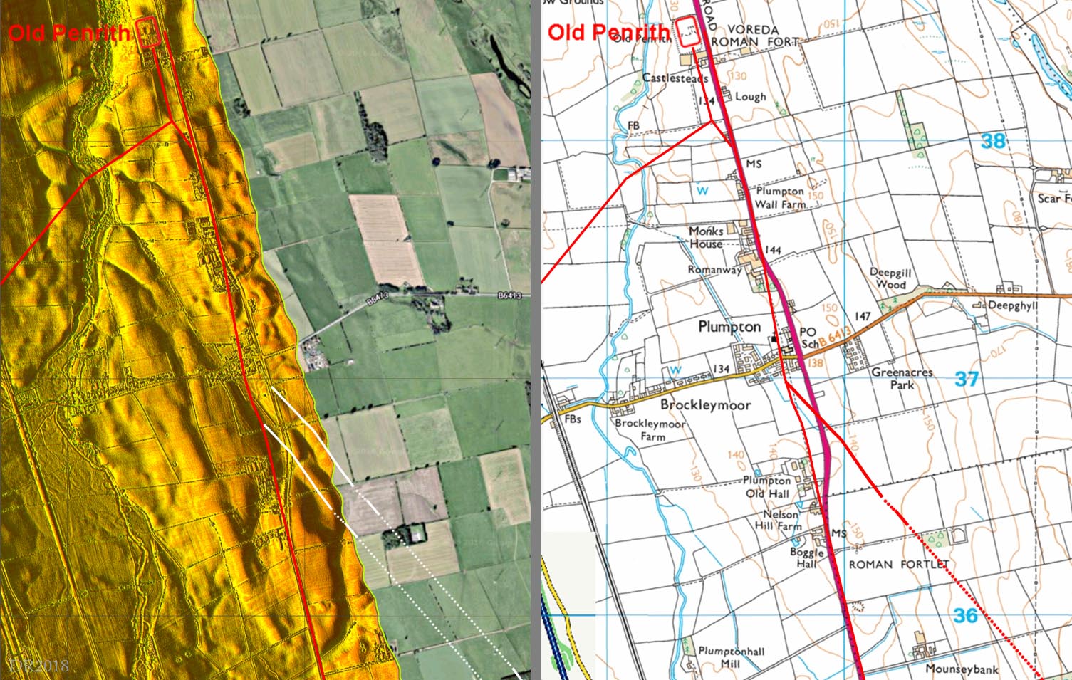
Lidar Image & Route Map - Plumpton The direct road from Kirkby Thore to Old Penrith joined that from Brougham at Plumpton.. The course of the roaf from Brougham is slighly wrong in the OS maps. The road from Brougham does a little kink to the west to avoid a stream and the Kikby Thore road joins up with it. |
Click for larger view |
 |
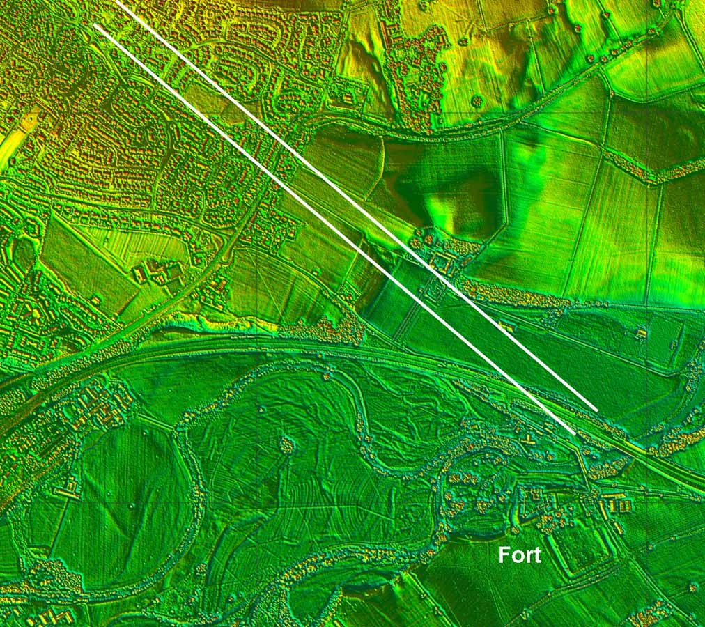
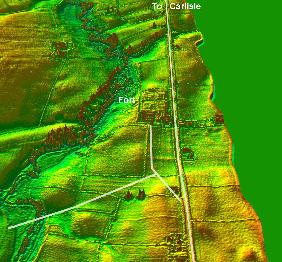
Lidar Image - passing Old Penrith Fort There appears to have been a branch road off the main road to Carlisle into the fort area. This was joined by the Roman road from Troutbeck/Ambleside. |
Click for larger view |
 |
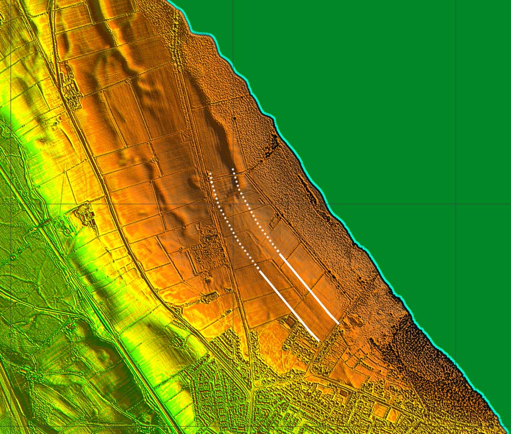
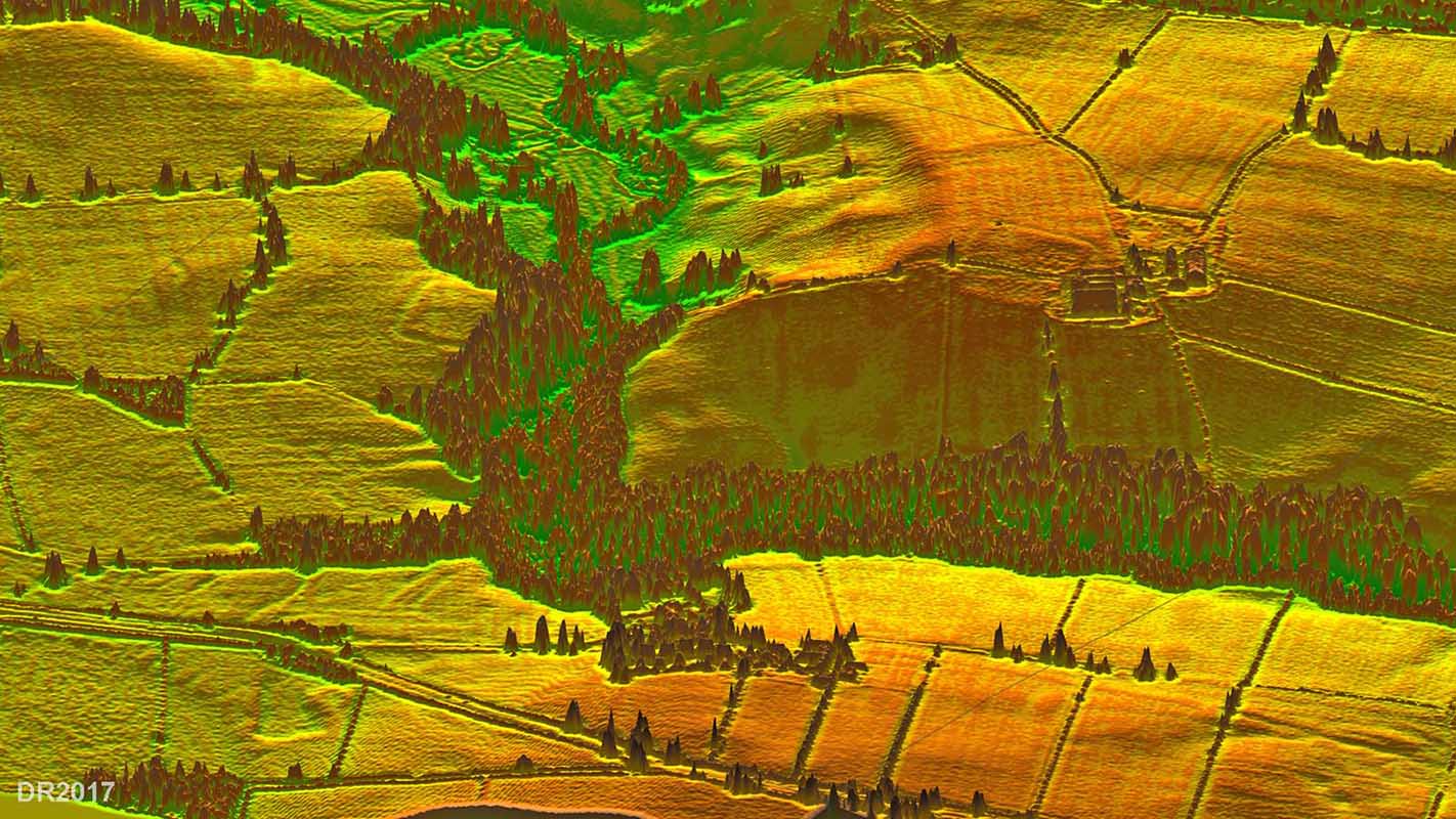
Roman Road at Wreay - Lidar + Map The Roman line and the modern A6 diverge at Wreay and the agger of the Roman road is visible in the Lidar data. However, this doesn't match the Ordnance Survey line which would appear to be possibly in error here. Also visible is the Park House Fort and also a previously unknown one south of the River Petteril, centred on 344480/549240. |
Click for larger view |
 |
3D Lidar Image - Wreay Forts Looking west from the Roman road towards the two forts. |
Click for larger view |
 |
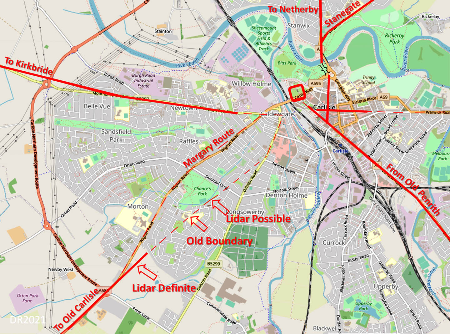
Carlisle Roman Road Map The road in from Old Penrith is perhaps surprisingly aligned on the fort. For some other Roman towns/forts in the north west then the road seems more often to be aligned on the bridge. Central Carlisle roads derived from Hogg, McCarthy and Breeze. Hogg researched where the bridge was likely to be, McCarthy produced the definitive text on Roman Carlisle and David Breeze produced a map!
|
Click for larger view |
 |
|
|
|
Return to Cumbria Roman Roads homepage Last update: June 2021 |
© David Ratledge |