 |
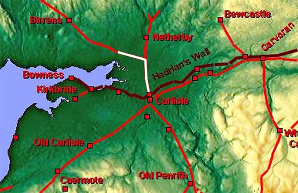
The Roman Road from Carlisle to Birrens, Margary 7fFormerly a little bit of doubt over the location of parts of this route but Lidar has confirmed that Margary correctly surmised that, after heading due north from Carlisle, the road crossed the Esk at the Roost ford.
This road is clearly linked with the road to Netherby (Margary 868) and it could be argued that this is actually a branch off that road.
We will trace this road as far as the Scottish Border at Springfield, Gretna.
|
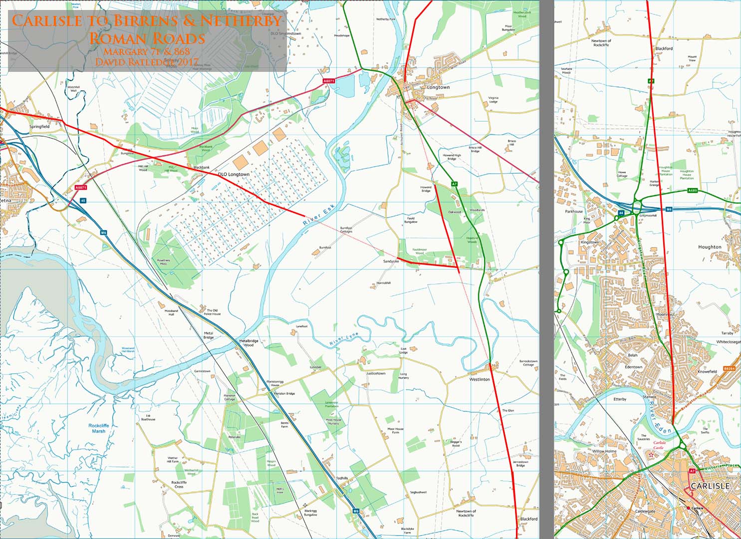
Carlisle Road Map Our road, after crossing the River Eden, heads almost due north initially along the A7, Scotland Road but where the latter swerves off to the west at Kingstown, the Roman road carries straight on. Central Carlisle roads derived from Hogg, McCarthy and Breeze. Hogg researched where the bridge was likely to be, McCarthy produced the definitive text on Roman Carlisle and David Breeze produced a map! |
Click for larger view |
 |
Lidar Image and Route Map The first evidence visible in the Lidar data is west of Houghton either side of the M6 where the housing development ends. The agger is particularly clear where the road merges into the A7, just south of Blackford. The Roman line crosses to the west side of the A7 just south of Blackford and rejoins it at The Glen. There was previously a gap in the Lidar coverage here and thanks are due to Mike Haken for bringing to my attention the correct line of the road between Blackford and the The Glen . Right features the latest Lidar.
|
Click for larger view |
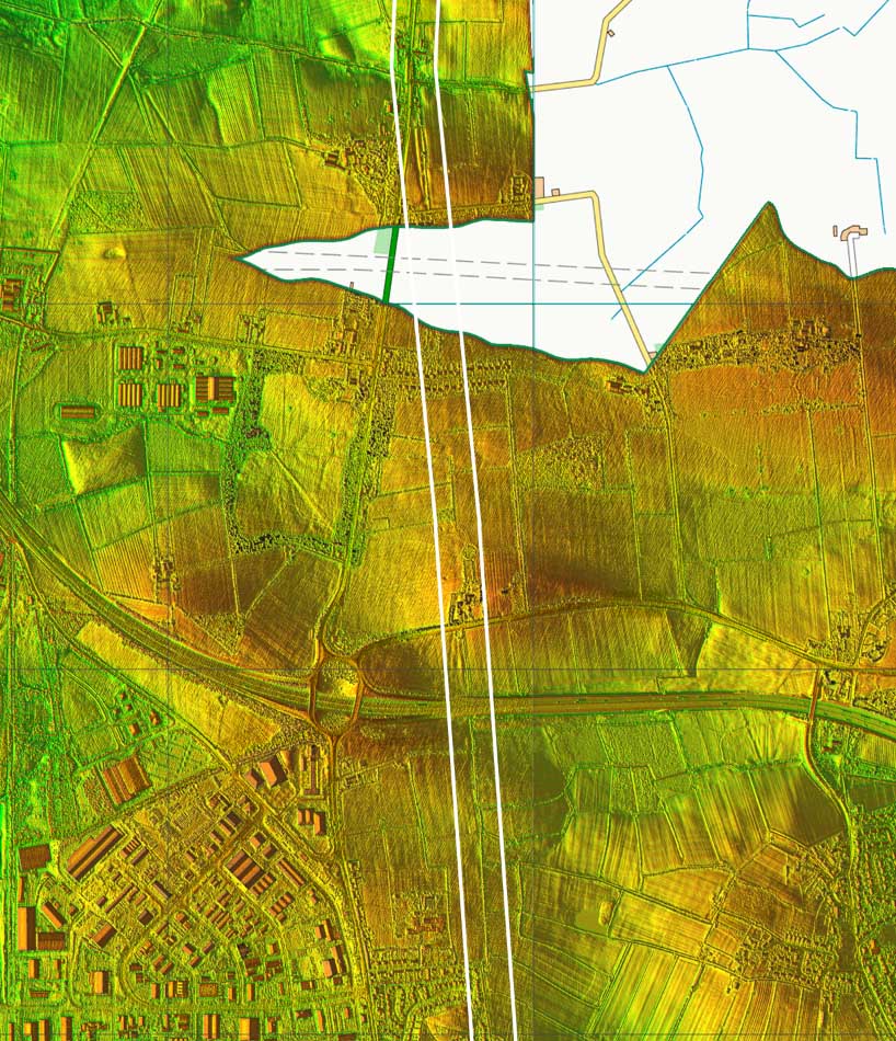 |
Lidar Image - Sandysike Junction Here the the road to Birrens probably leaves the road Netherby. Across the River Lyne, river movements over the years seem to have destroyed any remains so very much guesswork here. Sandysike Lane (assumed name) almost certainly marks the junction - see below. |
Click for larger view |
 |
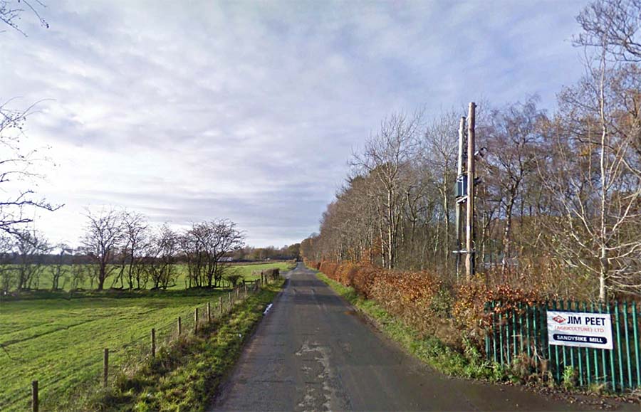
Lane at Sandysike Mill The lane is very straight but is not built up. It does however, align with the Roost Ford, so on balance it would seem to be the best candidate for the Roman road to the ford. Image: Google Streetview |
Click for larger view |
 |
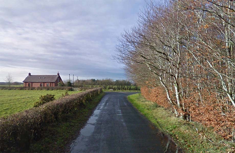
End of Sandysike Lane Here the modern road heads off to the right but the Roost ford is just over a kilometre straight on. Image: Google Streetview |
Click for larger view |
 |
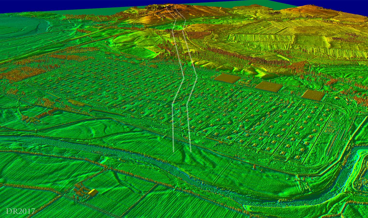
3d Lidar Image - Roost Ford The Roman agger has amazingly survived and is clearly visible across the munitions factory. Who would have though it could have survived here? Margary was sure it would have been destroyed. |
Click for larger view |
 |
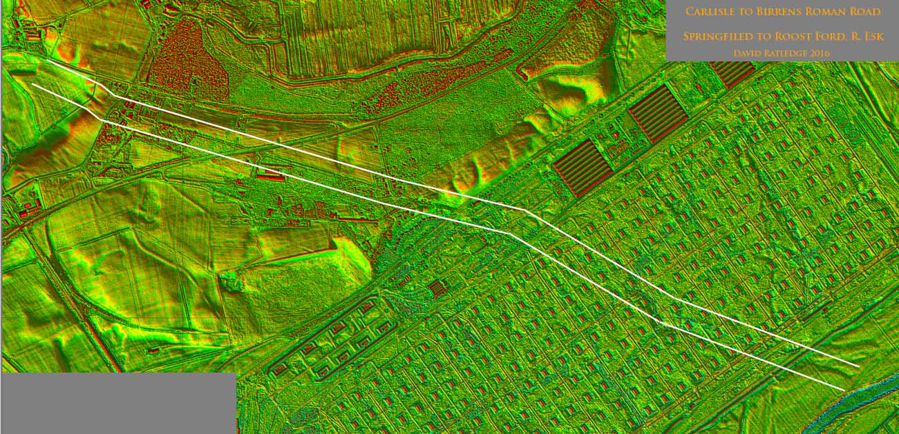
Lidar Image - Roost Ford to Springfield The Roman agger is visible just about all the way the way to Springfield. Beyond, Springfield (Gretna), the B7076 modern road marks the course onwards to Birrens. |
Click for larger view |
 |
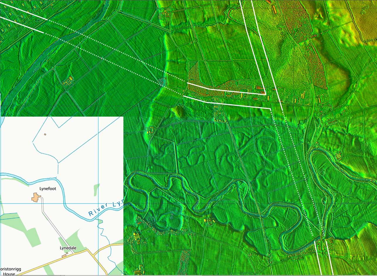
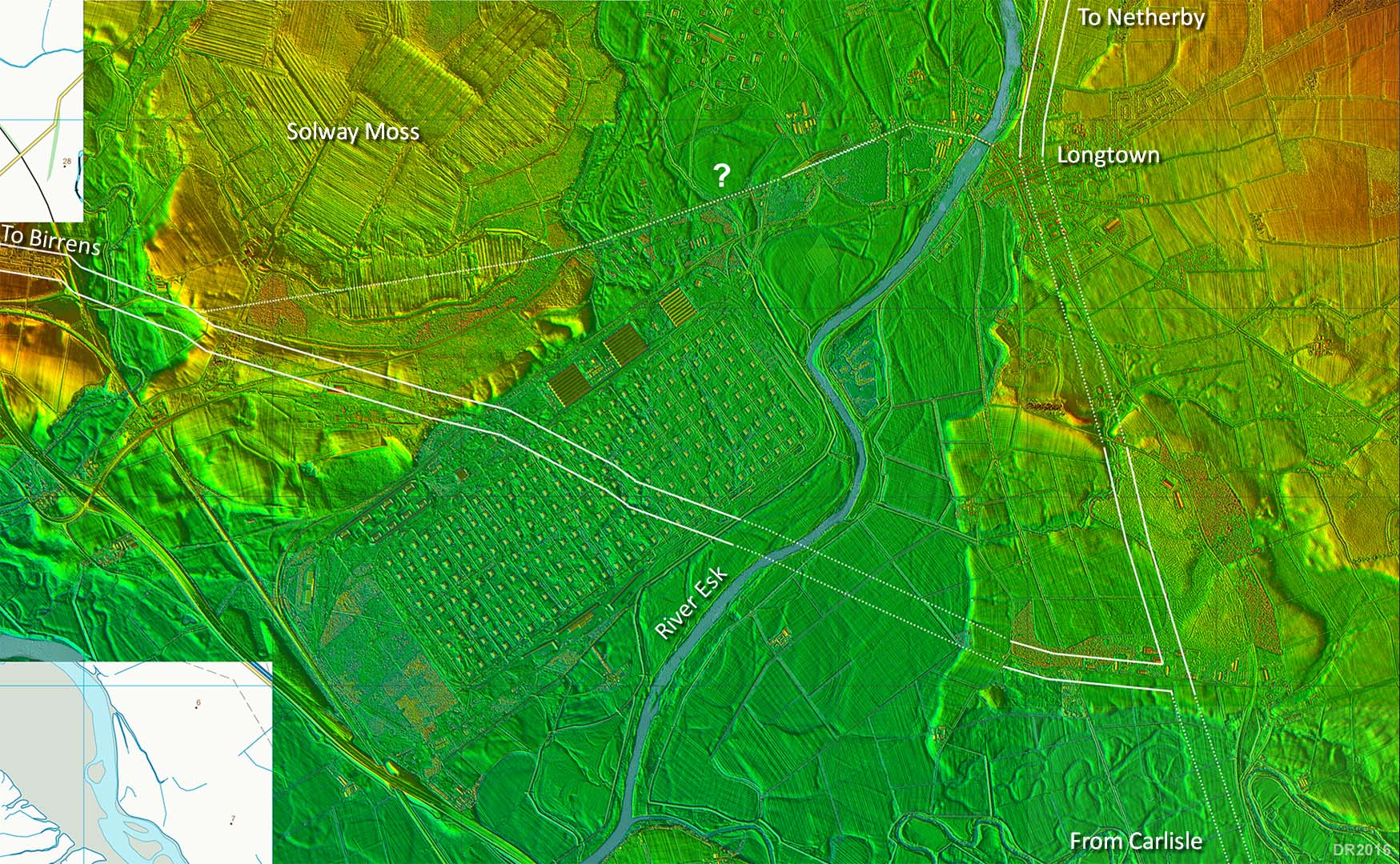
Lidar Image - Sandysike & Longtown Options The Roost ford is a bit odd - the Romans would surely have had a bridge for such an important route north. In which case the ford could have been superseded by a bridge and Longtown would seem to be the best candidate for a stable bridging point. It also fits well with the direction of the road from Carlisle which seems to be directed towards it. The roads are a bit interpolated here as evidence is patchy but I think must be reasonably close. There is an alternative route down to Roost ford north of Sandysike but I prefer the Sandysike Road option. The best candidate for a Netherby to Birrens link is the A6071. To me this could have replaced the Roost ford. |
Click for larger view |
 |
|
|
|
Return to Cumbria Roman Roads homepage Last update March 2025 |
© David Ratledge |