 |
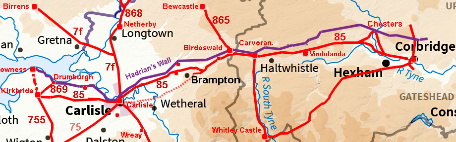
The Stanegate Roman Road, Throp to Carlisle, Margary 85This page describes the Cumbrian section of the Stanegate road. See also Stanegate in Northumberland The route no doubt began as a fast cross-country road linking the two strategic border sites of Corbridge and Carlisle, either side of the Pennines. Following the abandonment of the campaign to conquer what is now Scotland, it was adapted and probably the route adjusted here and there when it became a frontier. It was strengthened with a fort system that appears to repeat in a pattern of large - small - large - small etc.. Note that a small fort at Crosby would be expected but one has not been found (yet). Note the Stanegate preceded Hadrian's Wall by about 50 years.
The section of the Stanegate in Cumbria is somewhat unusual for the large cuttings used in constructing the road. These include the two famous ones at Potts Cleugh and Quarry Beck.
References The definitive work on this road in Cumbria is by Simpson, Richmond, Hodgson & St. Joseph - C&WAAS 1936. John Poulter in Archaeologia Aeliana (1998) described its problems and evaluated dating evidence. It was this paper that alerted me to the suggestion that there could be two Stanegate routes in Cumbria, one via Warwick Bridge and a later one via Crosby on Eden. Thanks are due to John for his help in assisting me in trying to make sense of what the Lidar was showing. Thanks are also due to Graeme Stobbs in freely sharing his doctoral thesis on the Stanegate - it too (independently) mentioned the Warwick Bridge possible original direct route
|
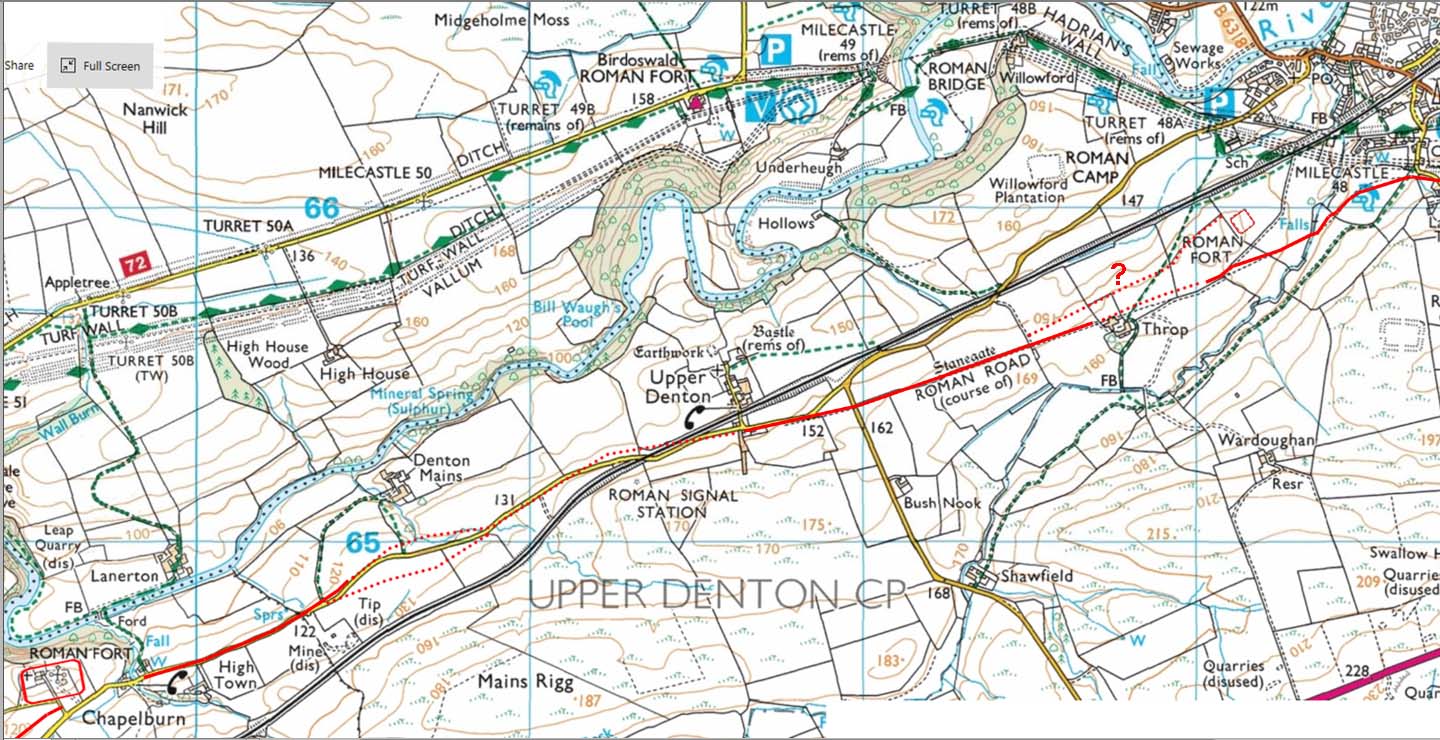
Lidar Image - Throp to Nether Denton This stretch of the Stanegate is pretty well documented and not disputed. There is, however, what looks like a possible linking road to Throp fort which I've marked with a "?" on the map below. Just a few lengths where there are a couple of options and that possible link road to Throp is also quite obvious. |
Click for larger view |
 |
Route Map - Throp to Nether Denton It is a shame the there is no public access to the Stanegate north of Bush Nook as it is a very impressive stretch - see below taken from a legal location!
|
Click for larger view |
 |
Agger - West of Throp Farm (NY622655) Despite running along a natural ridge here, the agger is hugely built up on its northern side - even visible at this distance from it. |
Click for larger view |
 |
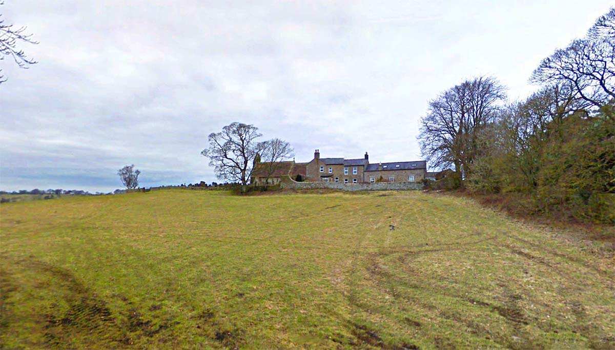
Denton Fort Site A relatively under investigated fort and even its name is unknown. Most of what is known is by Barri Jones interpreting his aerial photography. It is believed that it has a very early date. Regarding the Stanegate, west of Nether Denton then the problems begin! Despite the crossing of Carling Gill & Potts Cleugh being very well known, the rest of the route here has been notoriously difficult to locate. Searches over the years have failed to locate the road. At last with Lidar, we may have some answers. |
Click for larger view |
 |
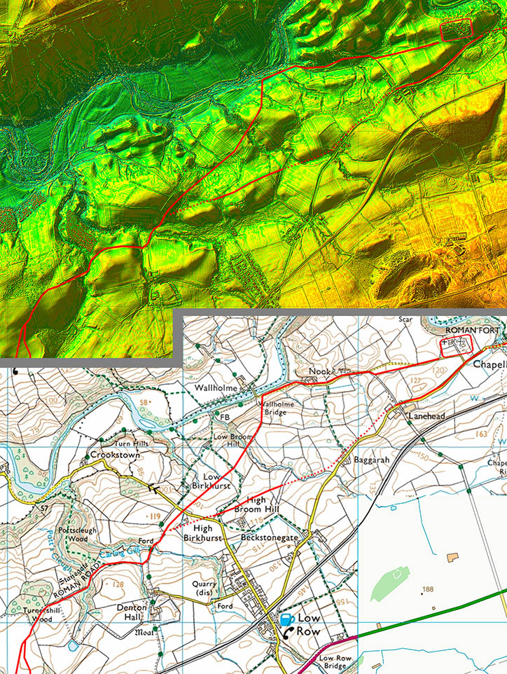
Route Map - Nether Denton to Potts Cleugh There are two options for the Stanegate west of Nether Denton Fort. I did wonder if the southern one was the original and the northern one perhaps constructed after the frontier moved up to Hadrian's Wall. It does drop down to where it would be easy to cross the River Irthing and link up to the wall zone.
|
Click for larger view |
 |
Carling Gill - East Descent This looking up the descent to Carling Gill. Beautiful curving cutting engineered to get the Stanegate down to presumably ford the gill. This stretch is still in relatively good condition |
Click for larger view |
 |
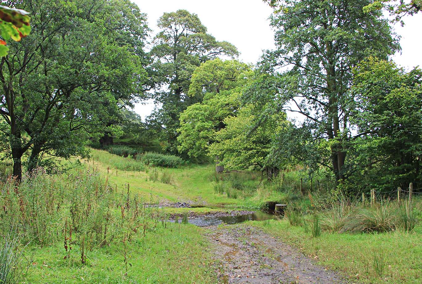
Carling Gill Ford The steam isn't huge so I assume the Roman's forded it too. It does usually need wellies though. |
Click for larger view |
 |
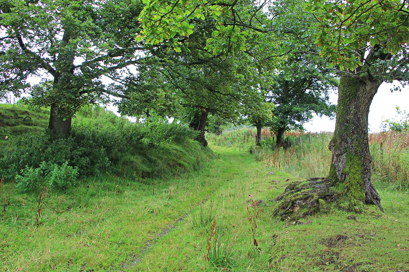
Carling Gill To Pott's Cleugh 1 The line of the road is marked by nettles so the footpath is now off the Stanegate proper. The length to Pott's Cleugh is around the side of a hill by the trees so the road has been cut into the hill on its left (south) side. |
Click for larger view |
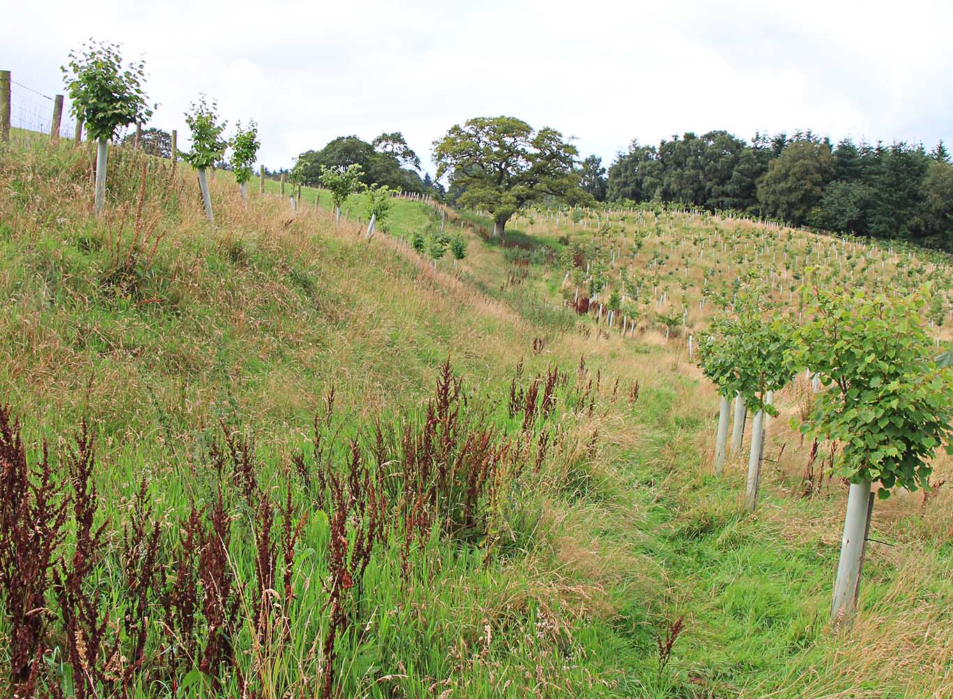 |
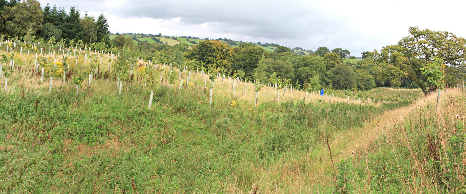
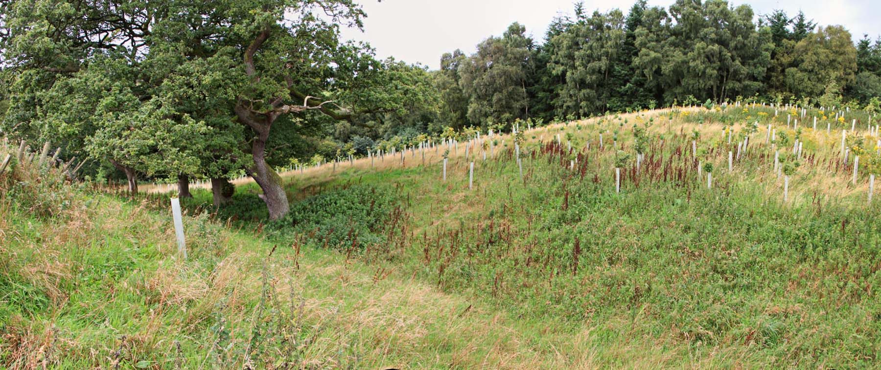
Carling Gill To Pott's Cleugh 2 The cutting of the left into the hillside is even higher here but it has obviously slumped over the centuries and I would guess slope slippage probably covers about half of the Roman road now. This is where a new woodland has been planted. As you can see the trees are right up to the road edge, even probably on top of it in places. They have also been planted in the left cutting too. It will not be long before the Stanegate here is a narrow path through dense woodland. Visit it before it is too late. Just beyond the big tree in the distance the Pott's Cleugh descent cutting begins. |
Click for larger view |
|
Potts Cleugh Cutting (panorama right) The big tree at the right edge is the same tree in the above image. This is the huge cutting excavated by the Romans to get the Stanegate down to cross Pottscleugh Gill. |
Click for larger view |
 |
Potts Cleugh Cutting (panorama left) This image is left of the above and is lower down the cutting. The gill is just off the left edge. You can seen the new plantation has reached both sides of the road here too. |
Click for larger view |
 |
Potts Cleugh - Pottscleugh Gill Even smaller stream than Carling Gill but following the road beyond here is almost impossible now. There is another cutting over the gill in the trees ahead by which the Stanegate climbs up out of the valley. It actually is much more overgrown than than this picture depicts. It might be possible to get through in winter but not in summer. This cutting was as far as the road had been traced. Beyond the top of the valley all attempts to locate the Stanegate had failed - presumably as all searches looked for a logically straight course to Quarry Beck at Boothby, the next known stretch. As we shall shall that wasn't what the Romans had in mind............. |
Click for larger view |
 |
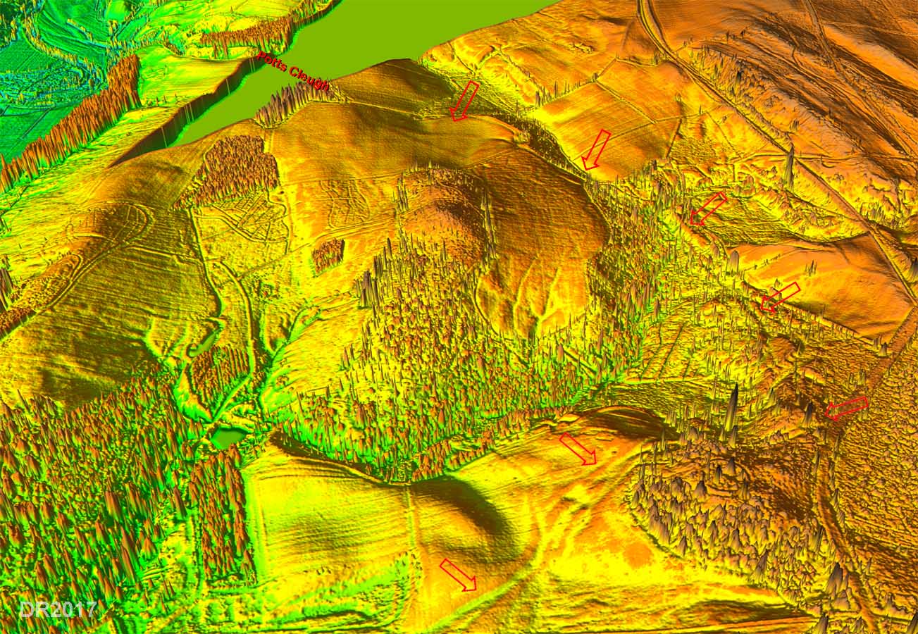
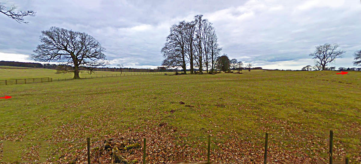
3D Lidar Image - descent from Potts Cleugh This is the key image in tracing the lost Stanegate and what it showed came as a great surprise. Connected to and descending from Potts Cleugh are two distinct parallel aggers. However, they are not descending in the direction expected, ie Boothby, but towards Brampton. Further along this "Brampton" road a second road branches off northwards towards Boothby - at the bottom of the image. This is aiming for the other famous cutting at Quarry Beck. Wow - what does it all mean? Note: Twin parallel aggers are not unusual for Roman roads - they just indicate a later change to the route - perhaps the first was too steep. |
Click for larger view |
 |
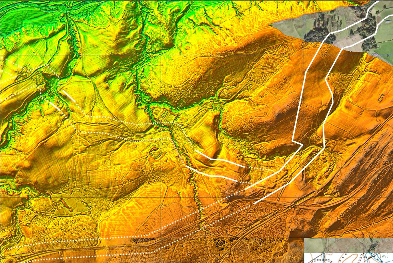
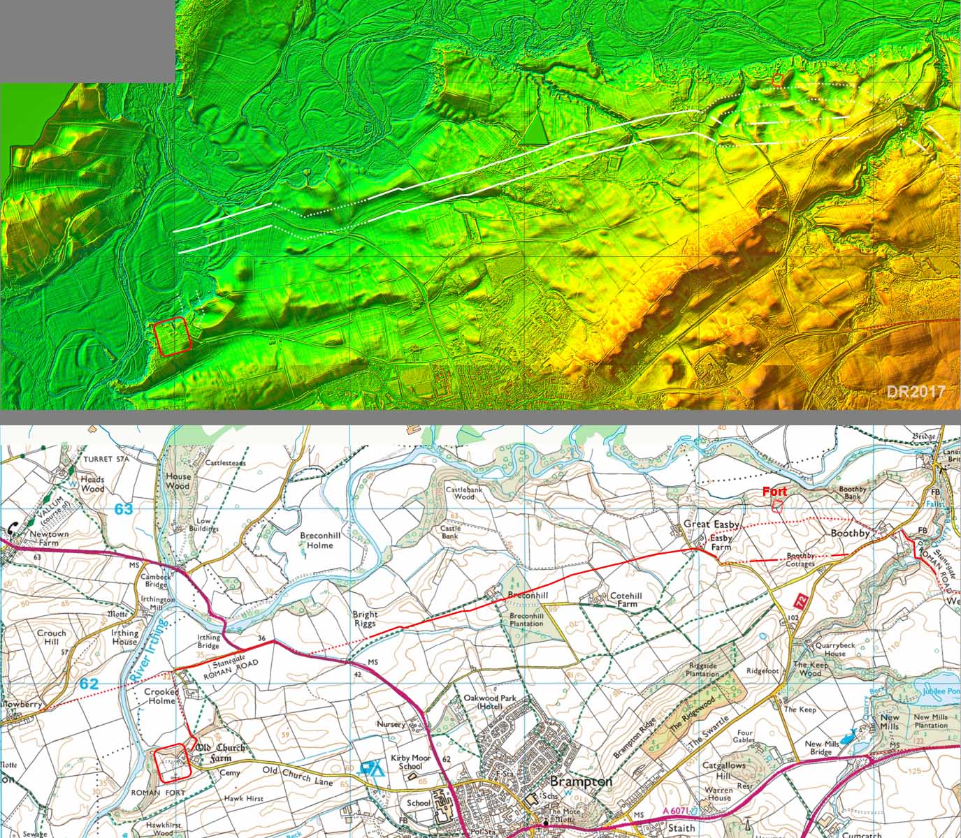
Lidar (DTM) Image - Potts Cleugh to Naworth This is the plan version of the above 3D image and has the trees/vegetation removed (DTM). This makes the route to Brampton clearer and shows it joining up to the A69. Much of the A69 is based on Wade's Military route but perhaps this was a case of him swinging his road onto a convenient existing road. The road to Boothby branches off and heads via Quarry Beck, shown as "Stanegate" on the map. The quarry Beck stretch runs virtually south to north which made little sense when it was believed the road was coming westwards direct from Pott's Cleugh but now makes total sense given the direction of the road branching off the Brampton road. |
Click for larger view |
 |
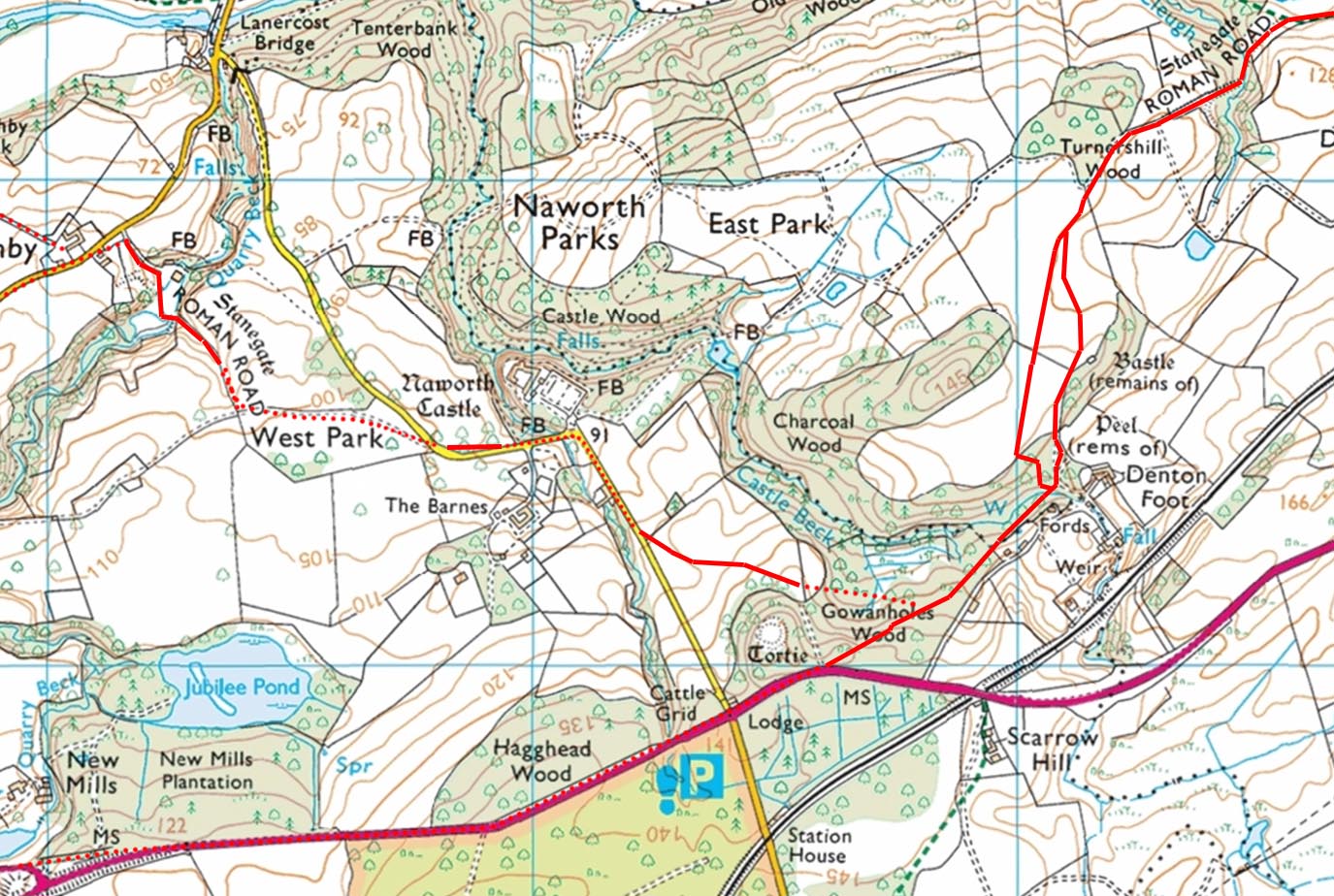
Route Map - Potts Cleugh to Naworth The direction of the road coming down from Potts Cleugh surely can only mean its initial destination must have been towards Brampton. It is a very circuitous route if Boothby was the primary destination. As mentioned in the introduction, there have been suggestions in the past as to the possibility of two Stanegate routes here - the first one via Warwick Bridge and a later one via Crosby on Eden. What is revealed here seems to support that hypothesis i.e. a direct Stanegate 1 and Stanegate 2 linking forts. For a possible extension of the Brampton route to Warwick Bridge see later.
|
Click for larger view |
 |
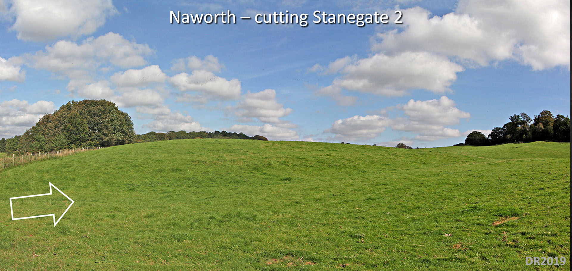
Naworth Cutting - Staingate 2 (NY5626 6226) Descending down from Staingate 1 (the Brampton Road) is this cutting on the branch (Staingate 2) towards Boothby. This is alongside the roiad to Naworth Castle, which is off to the left in this view.
|
Click for larger view |
 |
West Park, Naworth - Staingate 2 (NY557625) After the Castle, the road ascends through another cutting just to the north of the modern road. It then crosses several fields heading for Quarry Beck and the agger is clear across those fields in this view..
|
Click for larger view |
 |
Lidar Image and Route Map - Boothby to Old Church Returning to the traditional Stanegate route, the latest edition of Hadrian's Wall Map (2014) shows a small section of the road just west of Boothby aiming at the fort. Lidar doesn't lend any support for this and the southern option shown seems more logical. There is also an alternative route to Old Church Brampton from Boothby Cottages. It very direct and is marked by tracks and hedgerows. The only disadvantage to this route is that it doesn't pass as close to Boothby as the above options. This was the route shown on the OS first edition maps - see next image. Note: half of Boothby Fort has land-slipped away. |
Click for larger view |
 |
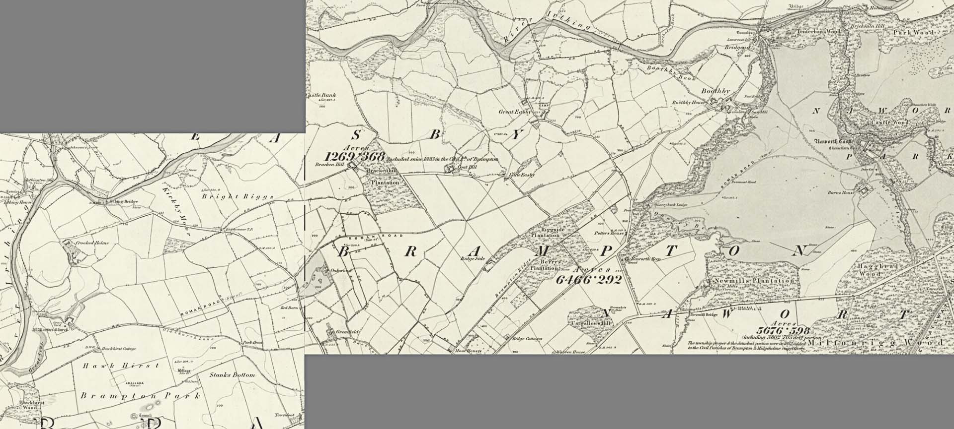
Ordnance Survey First Edition Map c.1867 The route from Naworth to Old Brampton fort is shown along the road/track via Boothby Cottages. This looks remarkably obvious and direct but for some reason the northern route seems to be in favour today for the Hadrian's Wall Map. The detached bit in Naworth West Park doesn't make much sense. Yes there is a track there but the route via Boothby/Quarry Beck is easier. |
Click for larger view |
 |
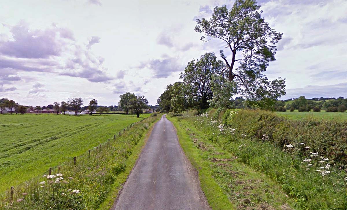
Country Lane to Crooked Holme - looking west The first stretch of the lane to Crooked Holme continues the line of part of the A6071 and is much wider than the modern track. It does narrow further along the lane but is generally taken to be the course of the Stanegate heading to a bridge over the River Irthing. Movements of the Irthing over the centuries make locating the crossing almost impossible today. |
Click for larger view |
 |
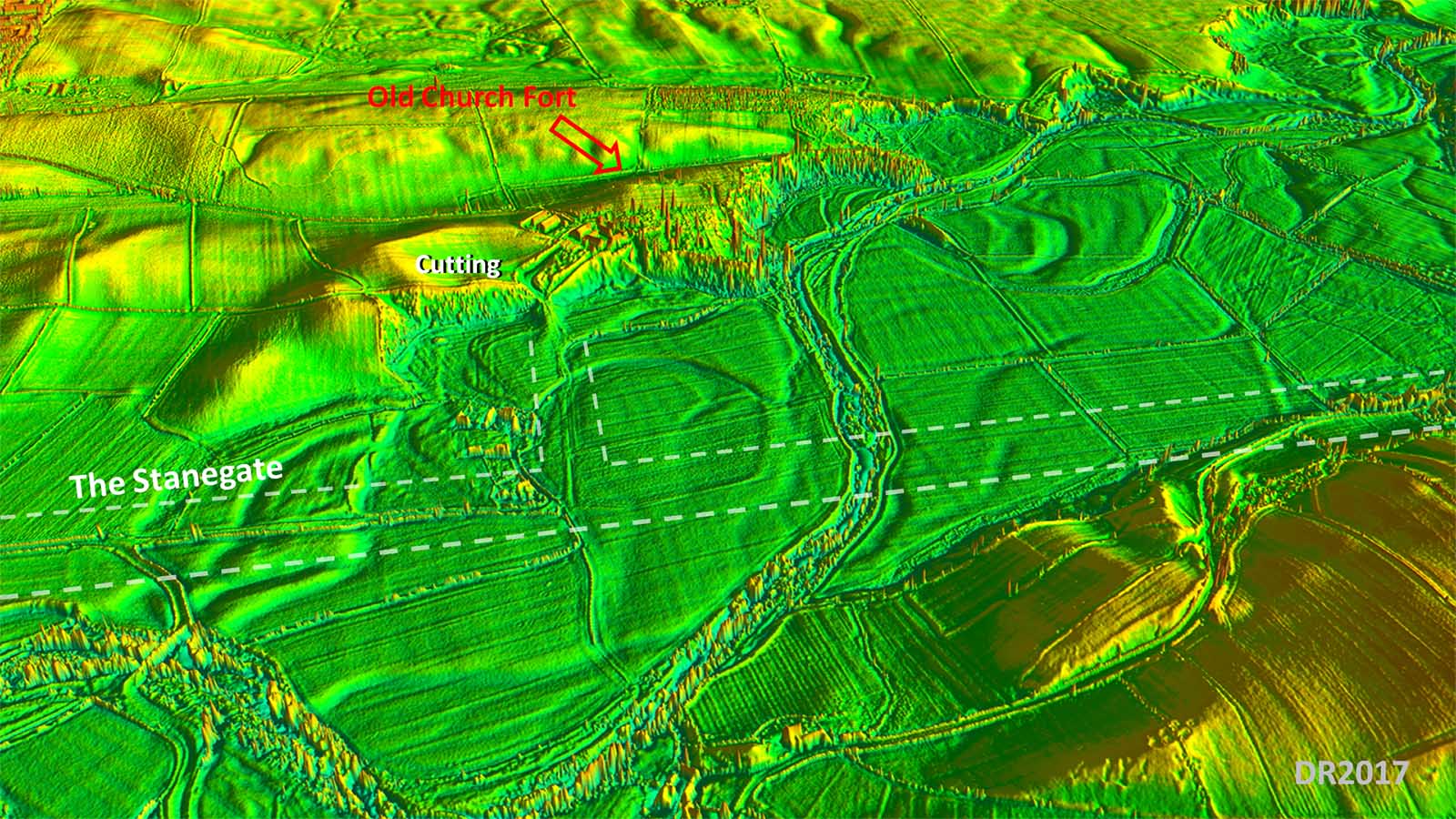
3D Lidar Image - Old Church, Brampton This view is looking south and shows the link road to the fort from the Stanegate. It also shows that the fort platform was well chosen on a high knoll, well above the flood plain, guarding the River Irthing crossing. Also visible is the impressive cutting leading down to the course of the Stanegate. |
Click for larger view |
 |
Lidar Image - Old Church to Carlisle Fairly logical route with several straight alignments as was to be expected. The long alignment through the airfield appears to be aimed at Brampton fort or just outside its northern gate. Was this on an original route with perhaps a ford of the Irthing? The road perhaps later diverted when a bridge was built? |
Click for larger view |
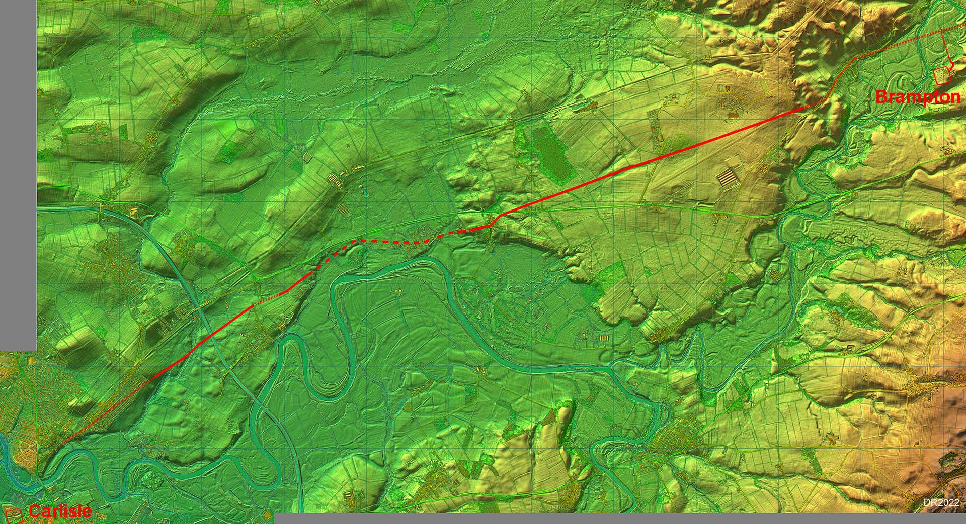 |
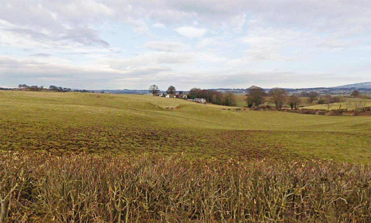
Backjumping - looking east towards the cutting, Red Hills & Brampton Fort The main alignment appears to be on the north entrance to Brampton Fort which resulted in the road being on a collision course with a small hill in the middle of the field beyond the end of the runway. Rather than going around it they went straight through it with a cutting about 6 metres deep! Note: on the latest Wall Map, a route to the north of the modern road and Red Hills is shown. This defies logic as it brings the road in a curve down to the Backjumping cutting. On that line it would have been shorter and easier to altogether avoid the hillock on its north side. So on the basis of common sense the southern route seems much more likely. |
Click for larger view |
 |
Lidar Image and Route Map - Old Church to Crosby-on-Eden The modern road through Irthington is taken to overlie the Roman road but see above about the two options for the route here. After Red Hills, Irthington, then begins a 2 mile straight alignment to Crosby-on-Eden. Much of this is lost under Carlisle Airport but just before the eastern extremity of the runway is another remarkable cutting. This is Backjumping - see image above. Beyond the airfield Lidar resumes and the straight alignment of the road is confirmed before a dog-leg into Crosby-on-Eden. The modern A689 bypasses this (thankfully) but alongside the old main road is perhaps the most extraordinary of Roman cuttings. |
Click for larger view |
 |
Crosby Lodge Cutting - looking east The cutting is in the grounds of Crosby Lodge but is visible on the southern side of the old road. It is around 200 metres long and marks the line of the Roman road. Here there was no hill to cut through and on the face of it no logical reason for a cutting at all. The road was proved here by Simpson et al. in 1936, complete with big ditches. It would need them to stop the cutting flooding. They also found Roman pottery. This could indicate a Roman building nearby - perhaps the missing Crosby fort? As to the reason for the cutting then possibly it served two purposes - one for the road and a second for a source of a large quantity of sand or sandstone. This would again fit with nearby building works. |
Click for larger view
|
 |
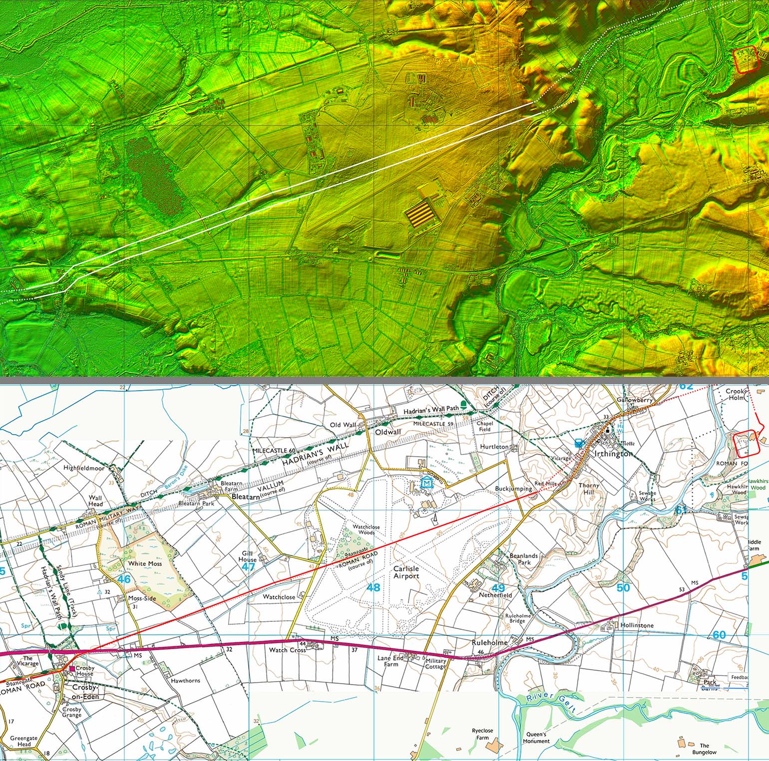
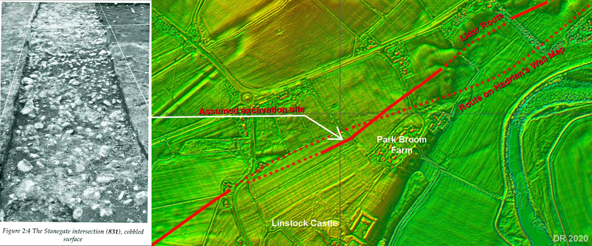
Stanegate Excavation Site 831 Thanks to John Poulter for bringing to my attention this excavation carried out in 1995. The report: Transect Through Time, published by Lancaster University Archaeological Unit reports the archaeological finds which were made during construction of the Shell North Western Ethylene Pipeline. This included an excavation of the Stanegate west of Park Broom Farm. Their photograph is shown alongside the Lidar plot of the area (right). They found the road south of the Hadrian's Wall Map position (based on their plan). It was 16.4 metres wide between ditches. This is considerably wider than all other excavations of the Stanegate. Note: the position where I have marked the excavation spot is from the map in Fig2:2 in the above report not its quoted grid reference - they don't agree! Grid refs are easy to get wrong but putting a spot on a map is perhaps more reliable. |
Click for larger view |
 |
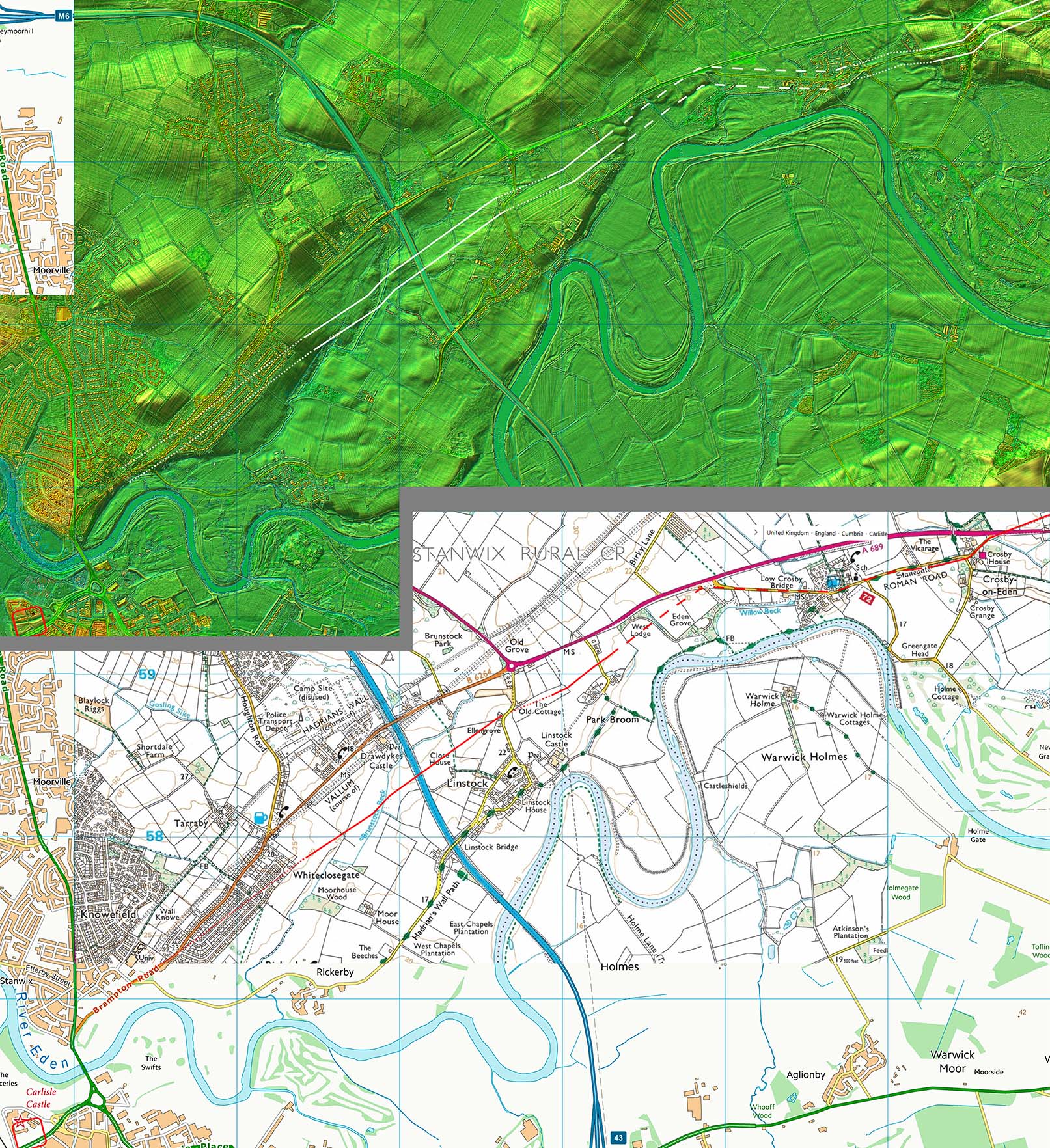
Lidar Image & Route Map - Crosby-on-Eden to Carlisle Thanks to Lidar we now have the route of the road virtually all the way into Carlisle. After the cutting at Crosby Lodge the road skirts around the high ground at the edge of the River Eden flood plain. Beyond the M6 motorway, Lidar has revealed the previously unknown course of the road heading towards Brampton Road, Stanwix - this was discovered by Bryn Gethin. Bear in mind the Stanegate precedes the Stanwix fort, the Wall and vallum too. East of the M6, the OS First Edition maps showed an "Ancient Road", which seems to have been adopted as the route of the Stanegate - it has on the OS Hadrian's Wall Map (2014). Lidar does not provide any supporting evidence for that line but does show traces of a road on a higher and more direct line. This is much more likely to be the true line of the Stanegate. It also fits better with the excavation at site 831 (see above) |
Click for larger view |
 |
3D Lidar Image This shows the last alignment heading for Carlisle and projecting the line onwards it would imply that Brampton Road overlies the Roman line - see map below also. |
Click for larger view |
 |
Road Map - Carlisle The Stanegate can be inferred to coincide with Brampton Road and would join the road from Netherby for the crossing of the River Eden into Carlisle itself. Note the road heading east in the direction of Warwick Bridge! Map derived from Hogg, McCarthy and Breeze. Hogg researched where the bridge was likely to have been, McCarthy produced the definitive text on Roman Carlisle and David Breeze produced a map! |
Click for larger view |
 |
Route Map - Warwick Bridge Although it is easy to postulate a route from Naworth via Brampton to Warwick Bridge, proof is almost impossible to establish today as modern roads overlie nearly all of it. Was this Stanegate 1? It makes sense that that the original Stanegate route was designed for fast communication between Carlisle and Corbridge. It it were later turned into a pre-Hadrianic frontier then its route could have been changed where necessary to visit the new forts.
|
Click for larger view |
 |
Western Stanegate - did the road continue to Kirkbride?See our separate section on the Western Stanegate. |
|
|
|
Return to Cumbria Roman Roads homepage Last update: June 2022 |
© David Ratledge |