 |
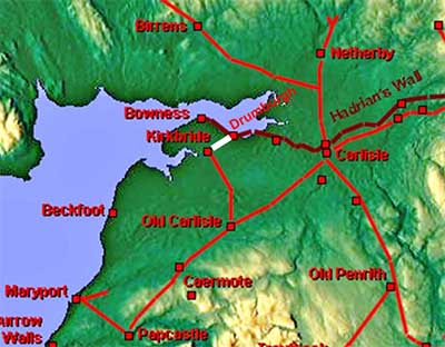
The Roman Road from Drumburgh to Kirkbride, Margary 869Discovered by Richard Bellhouse in the early 1950s, this very direct and short road linked the Hadrian's Wall fort of Drumburgh to Kirkbride. Lidar has proved the stretch Bellhouse found was correct and extended it all the way to Drumburgh. It has also provided some evidence to extend the route at the Kikbride end but not quite on Bellhouse's line. It is perhaps a puzzle as to why this road exists as conventional wisdom has Kirkbride fort as pre-Hadrianic only and Drumburgh post-Hadrianic.
|
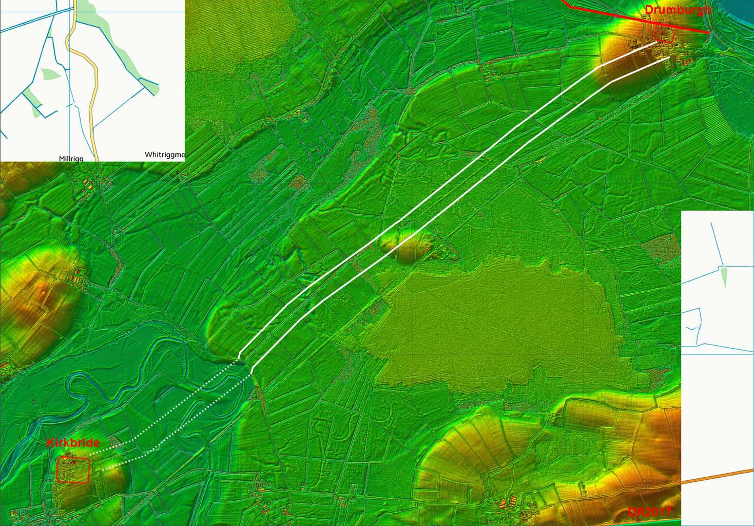
Lidar Image - route corridor Lidar provides very strong evidence all the way from Drumburgh to the drop down to the River Wampool flood plain. At Drumburgh, Lidar shows faint traces of the Vallum passing immediately to the south of the fort and the alignment fits with the road starting from a Vallum crossing there. At the Kirkbride end, meanders of the River Wampool over the years have removed all traces. Interestingly, the wider Lidar image gives an explanation for the large Moricambe Bay. There is clearly a glacial channel from the Riven Eden connecting down to Moricambe. The river's normal route to the sea must have been blocked during the ice age resulting in the Eden being diverted south forming Moricambe Bay. Part of the channel is visible at the top of this image. |
Click for larger view |
 |
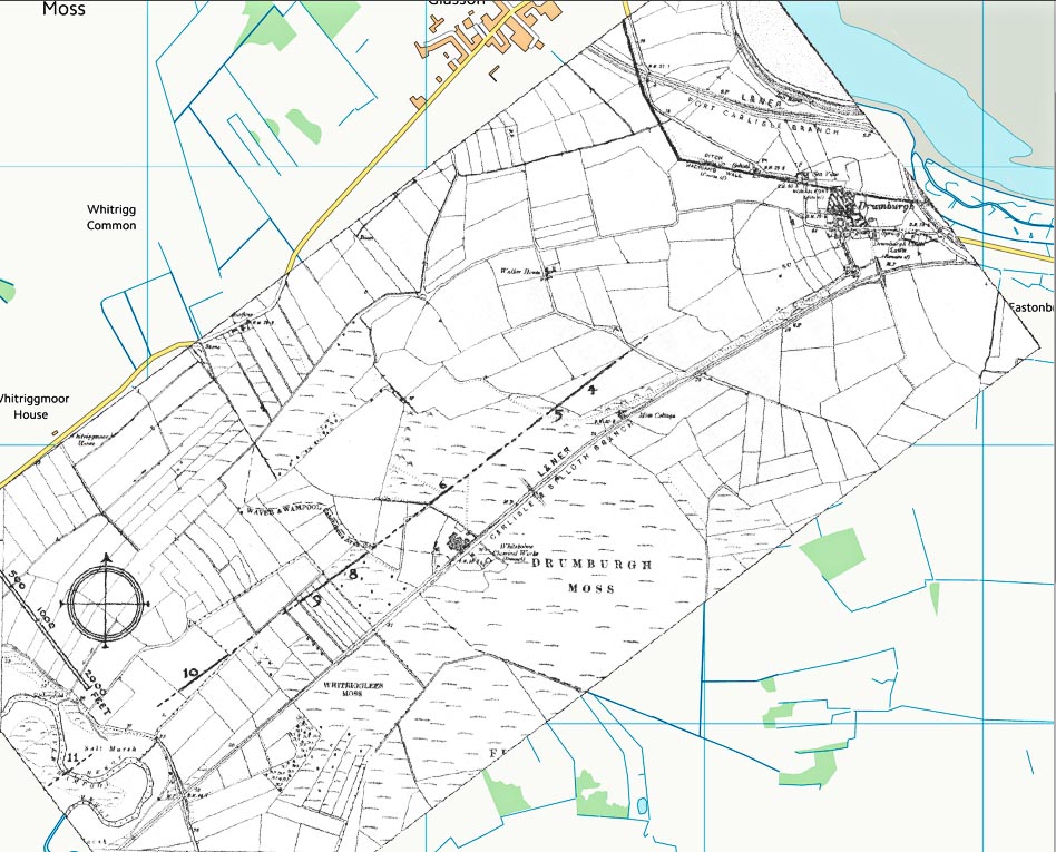
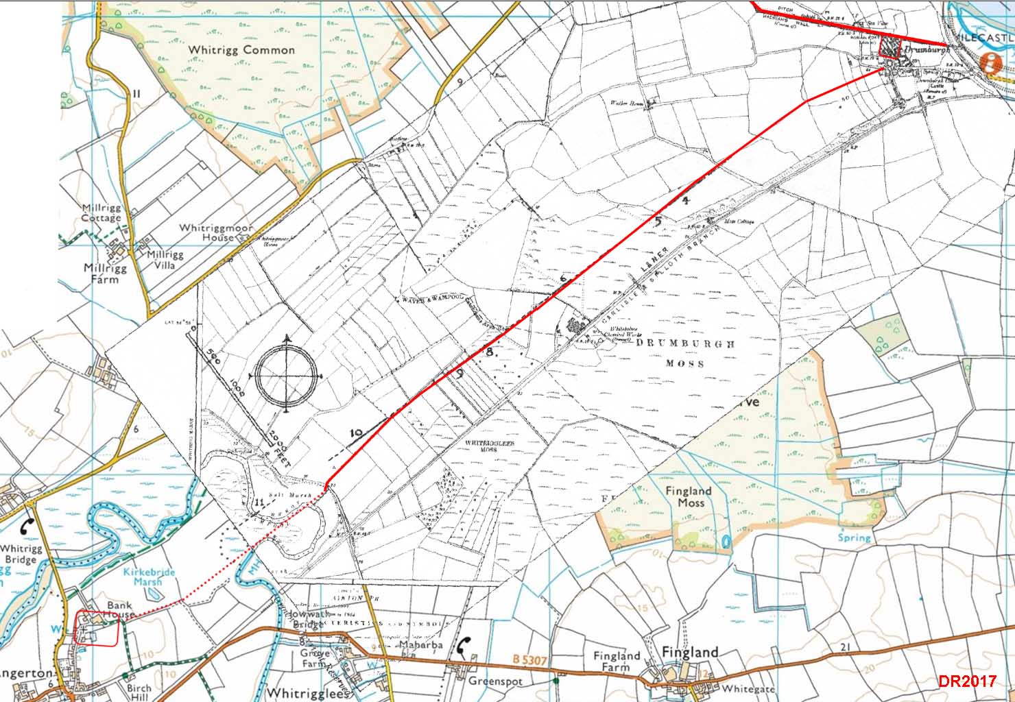
Bellhouse's Map - C&WAAS Transactions 1952 Bellhouse could find no trace of the road at Drumburgh and point 4 was his first visible detection. He was remarkably accurate from point 4 to 9. Lidar doesn't show anything supporting his points 10 and 11 so on balance the route via the modern track for the last stretch looks more convincing. |
Click for larger view |
 |
Route Map - route overlaid on Bellhouse's map Lidar has provided the route from Drumburgh to Bellhouse's point 4. As can be seen, his points 4 to 9 agree well with the Lidar - showing excellent work by Bellhouse. |
Click for larger view |
 |
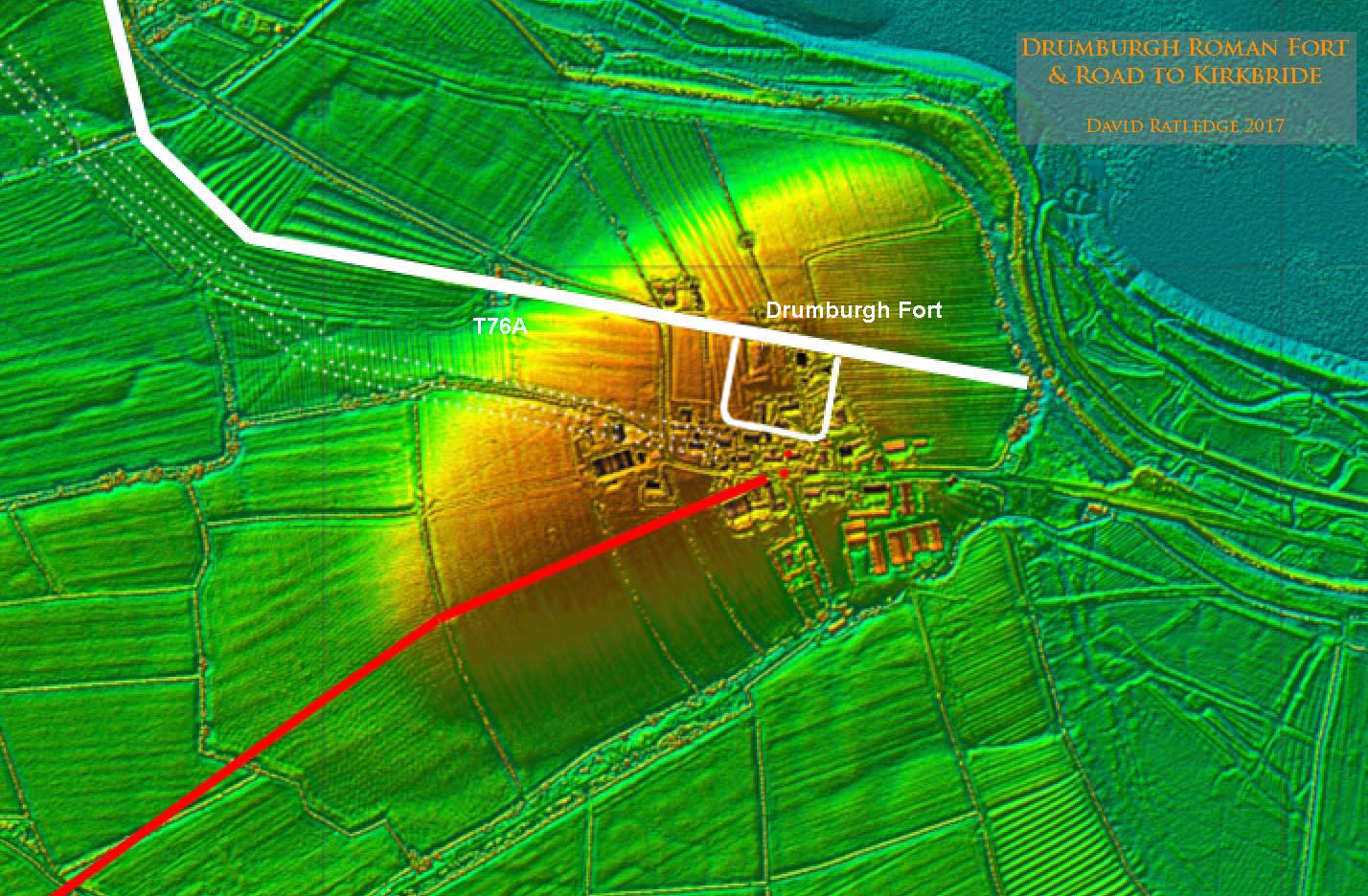
Lidar Image - Road alignment approaching Drumburgh Close up of the Drumburgh area showing the wall, vallum and fort location. The entrance to the fort was not in the middle of the south wall but offset to the east and the road alignment matches this. The Vallum is not recorded at Drumburgh but there is sufficient Lidar clues to suggest its course - marked with 3 dotted lines.
|
Click for larger view |
 |
Lidar Image - Road evidence approaching Drumburgh Clear evidence for the course of the road approaching Drumburgh. The vallum is not shown near Drumburgh on the Wall map but there is sufficient Lidar evidence to locate it with reasonable confidence - shown as 3 dotted lines. According to the Lidar data, the wall is not quite correctly located on the OS Hadrian's Wall map here. The angled corner of the wall west of Drumburgh seems to be incorrect - the dotted line is where the Wall Map shows it whereas on the basis of Lidar it is where I have shown it.
|
Click for larger view |
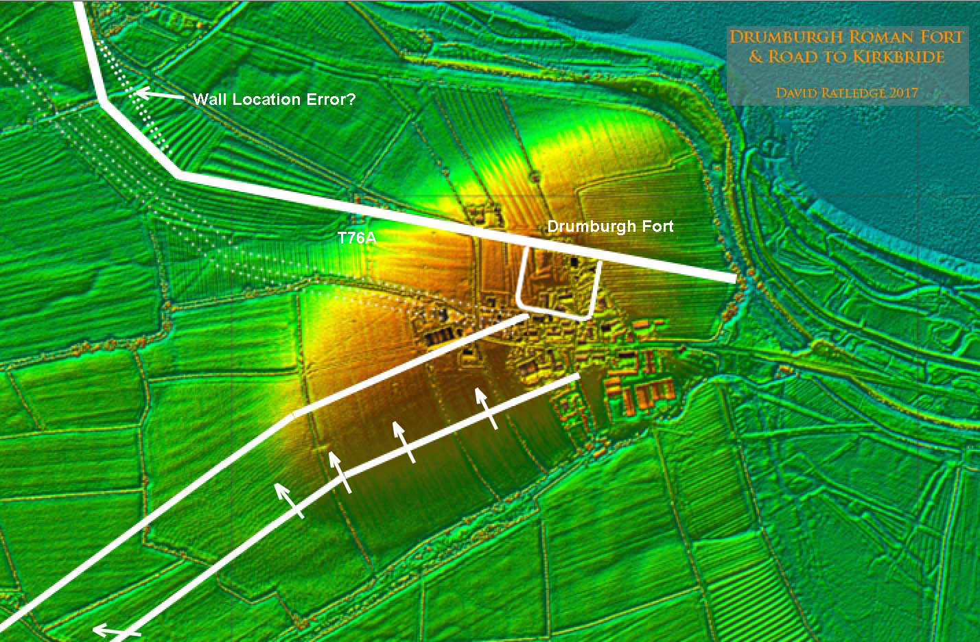 |
Photo - end of track at Wampool Here is where the modern track and the Roman line probably coincide. The track finally drops down to the Wampool flood plain and it seems sensible that this was also the Roman way down too. This is looking back towards Drumburgh. |
Click for larger view |
 |
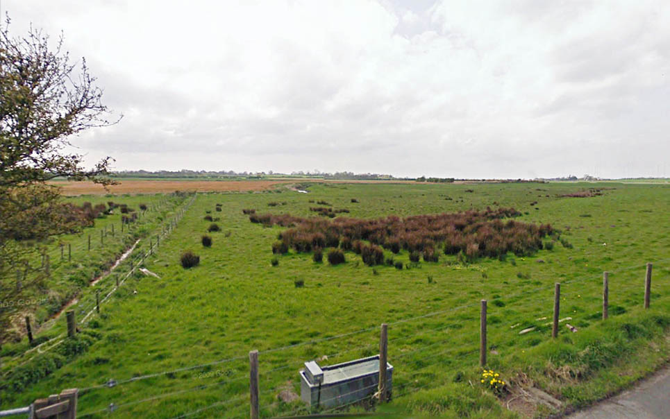
Photo - Wampool flood plain Kirkbride is on the high ground near the middle of this picture. This ditch could be the south ditch of the road but river meanders over the centuries make the route from here onwards very speculative. |
Click for larger view |
 |
|
|
|
Return to Cumbria Roman Roads homepage Last update January 2018 |
© David Ratledge |