
|
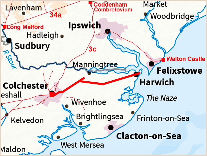
The Roman Road from Colchester to Lawford (Mistley?) & HarwichMargary Number: NoneDistance: ?? miles A road north-east from Colchester was missed by Margary but recorded by Fairclough (Ref: Boudica to Raedwald, East Anglia's Relations with Rome, John Fairclough, 2010) and is included on the 2016 OS Roman Britain Map. Lidar also revealed a branch of this road and there is good evidence to conclude it went all the way to Harwich. As well as an obvious port, Harwich is source of building stone, which is rare occurrence in in East Anglia. There is also a Roman Villa located at Little Oakley. A Roman road to Harwich therefore would to be expected.. Flyover Video - see at bottom |
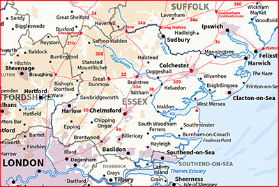
Historic Counties: Essex Current Counties: Essex HER: Essex
|
|
|
|
|
|
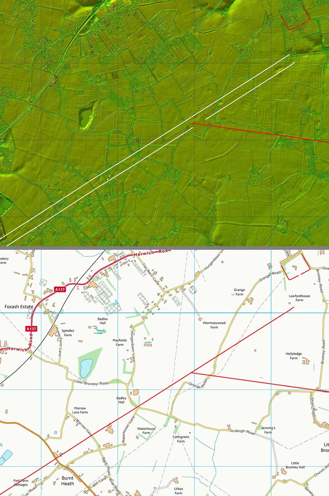
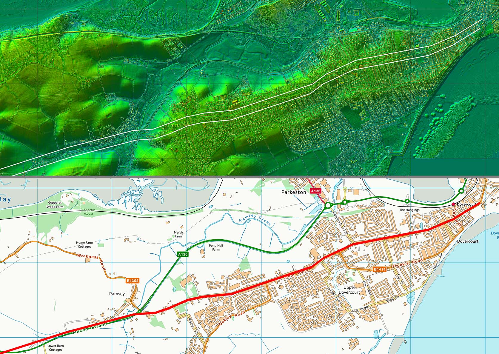
Lidar Image - Full Route Fairclough assumed the Roman road from Colchester would have crossed the River Stour estuary by a ford and headed further northwards in the general direction of modern day Ipswich. However, LiDAR shows the route clearly but only as far as Lawford House, where it appears to turn slightly towards the house and then stop. I could see no trace of an agger on Fairclough’s route onwards. Lidar also reveals a road to Harwich. |
Click for larger view
|
 |
Colchester - Site of the East Gate Our road(s) almost certainly emanated from Colchester's East Gate and headed straight down East Hill to for a bridge over the River Colne. Image: Google Earth |
Click for larger view |
 |
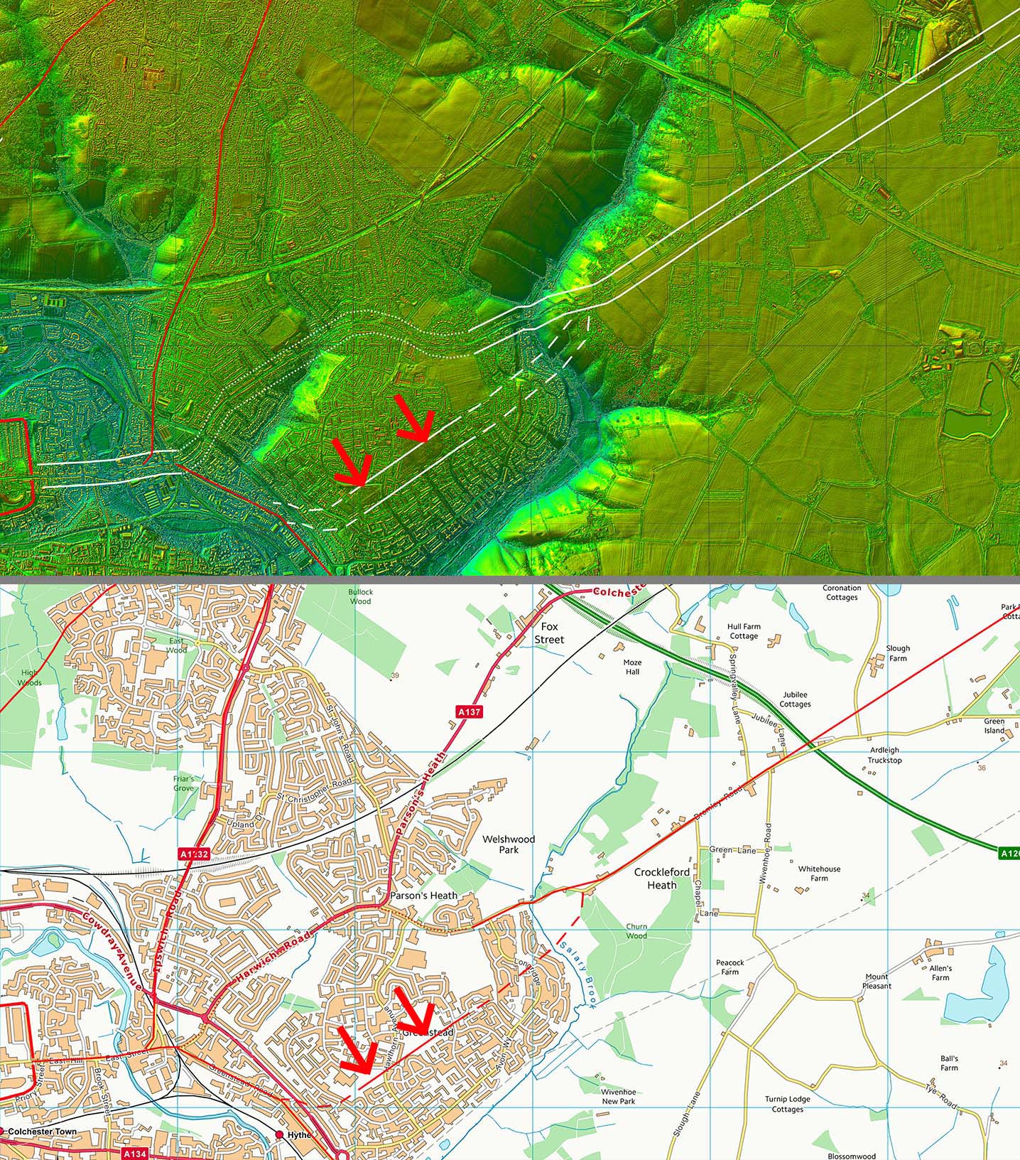
Oblique 3D Lidar Image - Colchester to the North-East After crossing the River Colne then the course is a bit subjective and I have shown 2 options. The left (northernmost) follows the modern road which is a bit circuitous until the main alignment begins. There is some sense to this route as it skirts around an intervening valley and it is the shorter of the 2. However, the Greenstead alternative is a distinct possibility - see below - and there is some clear evidence of a possible agger marked with the red arrow. |
Click for larger view |
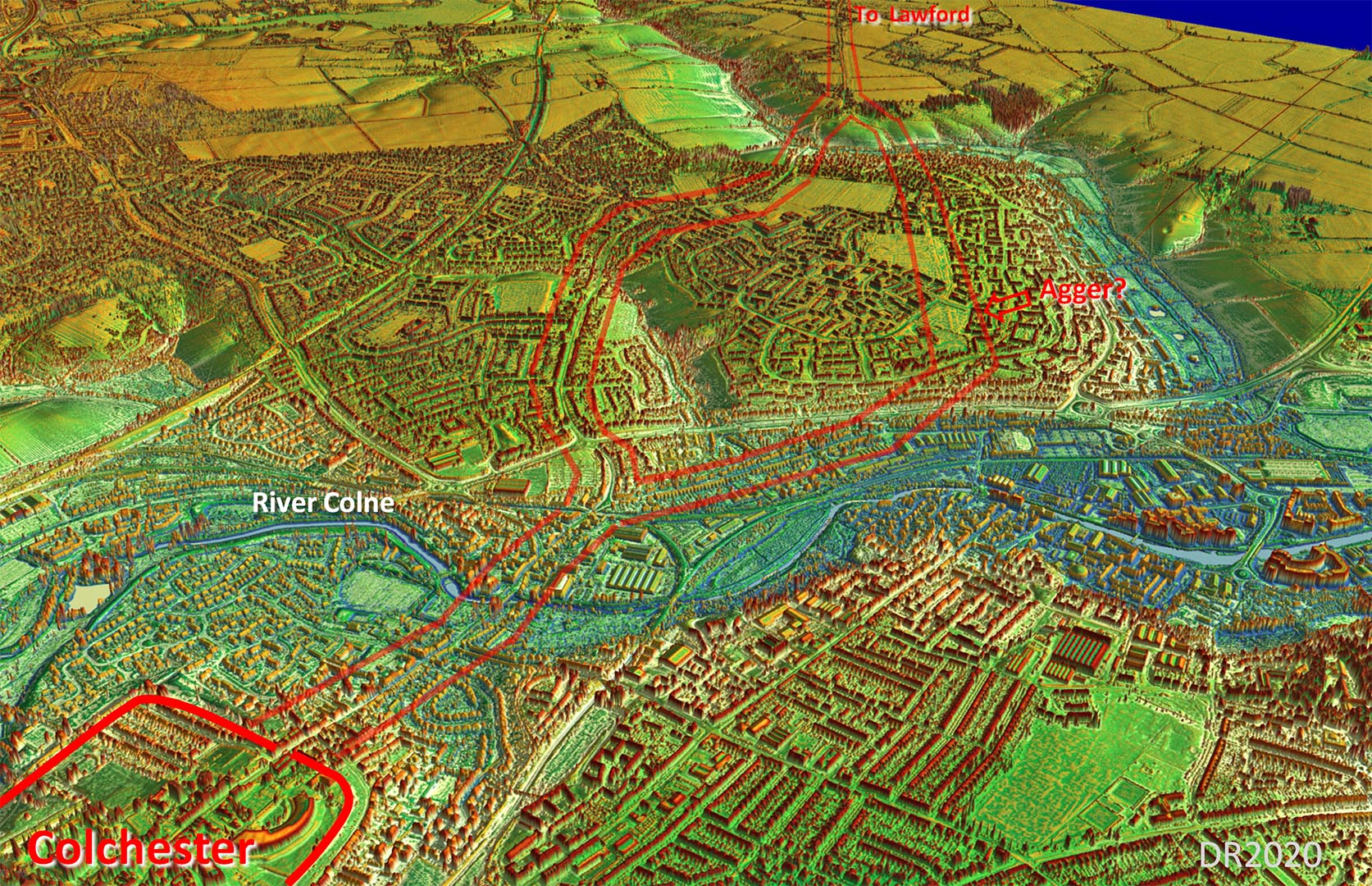 |
Lidar Image and Route Map 1 This is the plan view of the 3D view above. Both alternative routes up to Bromley Road are shown. |
Click for larger view |
 |
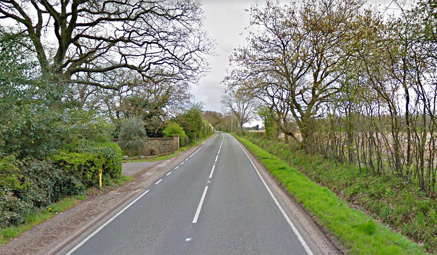
Bromley Road - looking towards Lawford The main alignment to Lawford begin with Bromley Road. There is a very Roman like ditch on the right but no doubt refurbished over the years. Image: Google |
Click for larger view |
 |
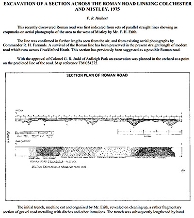
Excavation at Ardleigh Park by P R Holbert, 1975
The excavation was carried out in 1975 and is described in a Colchester Archaeological Group newsletter - follow link at right. Location is given as TM 054275. Thanks are due to Geoff Lunn for bringing this to my attention. |
Click to follow link |
 |
Lidar Image and Route Map 2
The main alignment is clear and obvious - well until it reaches Lawford House where it disappears. |
Click for larger view |
 |
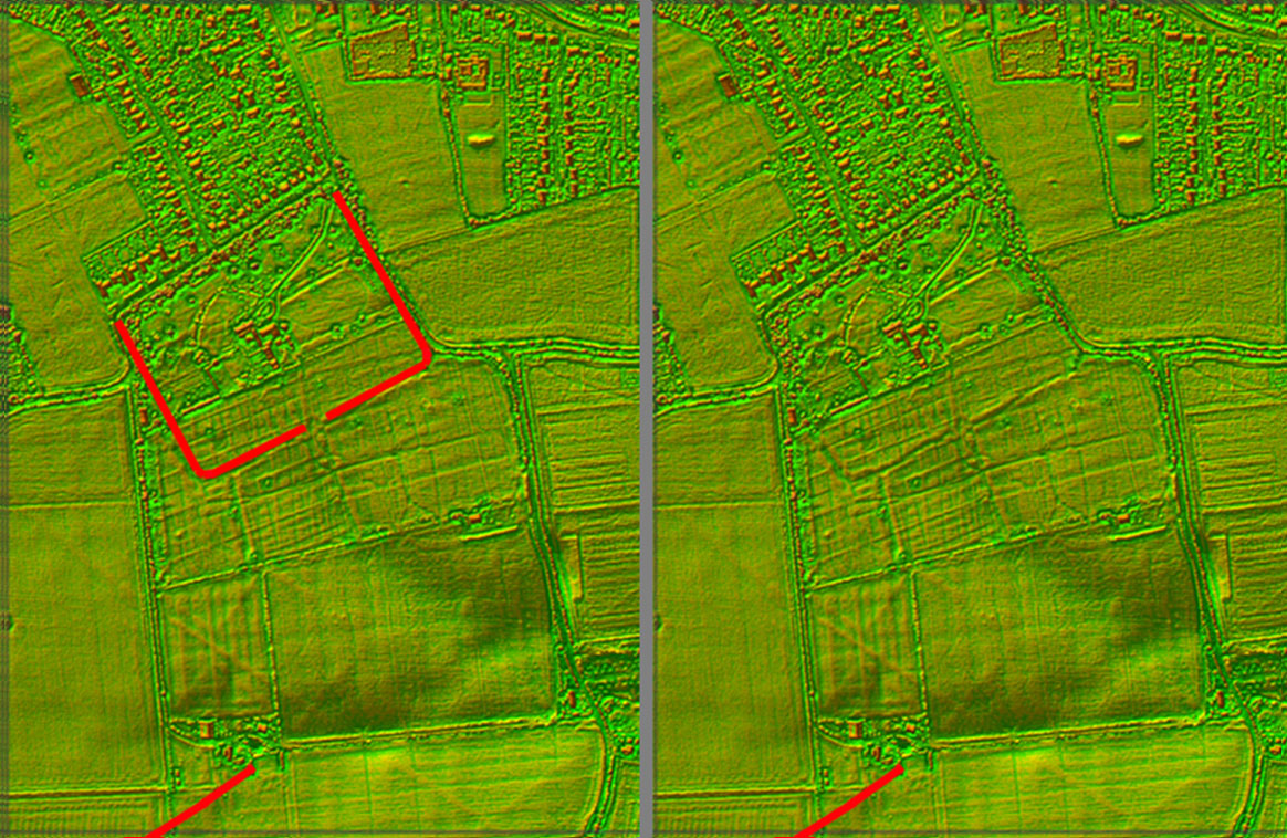
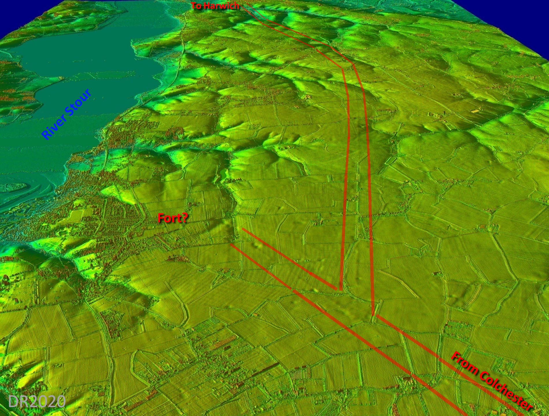
Lidar Image - Lawford House possible Fort? Where the Roman road to Lawford apparently comes to an abrupt end then there is what appears to be a possible unrecorded fort visible in the LiDAR imagery. These are the grounds of Lawford House and although there has been much disturbance here what appears to be a south-eastern rampart and ditch with curving corners has survived. |
Click for larger view |
 |
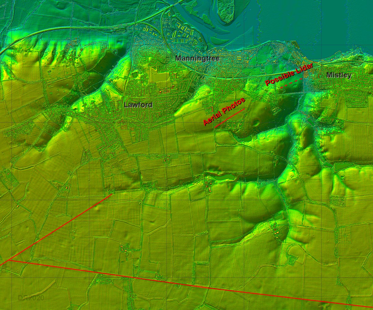
Lidar Image - Mistley Connection? The LiDAR traces run out at Lawford House. Logically it must have continued to the Stour Estuary. Mistley is often suggested and the Via Mistley Roman Road Group have some very persuasive aerial photographs of it continuing past Mistley Hall. Strangely LiDAR shows absolutely nothing for this but I have come across this before when a road has been ploughed out. There is perhaps a trace in the Lidar imagery where the road descends towards the estuary. So best guess is it probably headed for a port on the Stour near Mistley. |
Click for larger view |
 |
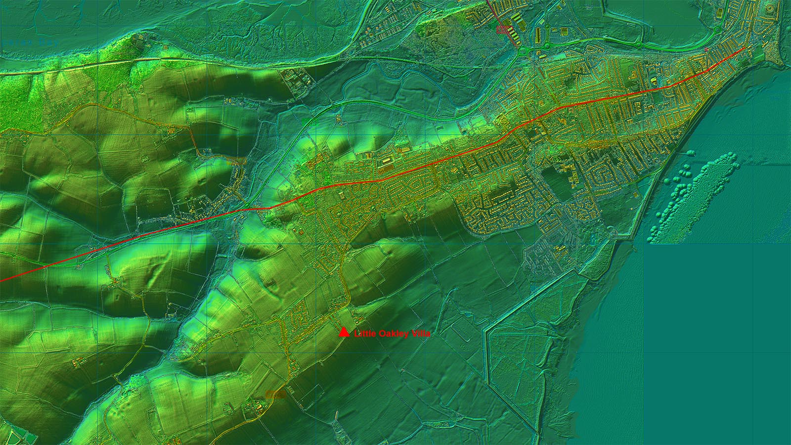
Oblique 3D Lidar Image - Roman Road to Harwich A branch off the road to Lawford was previously suspected from aerial photography but only for a short distance. We can now, with LiDAR, extend this all the way to Harwich with reasonably high confidence. Why Harwich? At Harwich then the “Harwich Stone Band” rock outcrops and is probably why this peninsular has survived coastal erosion. Stone outcropping here makes this part of the coast fairly unique being the only naturally occurring rocky shore from north of the Thames to the top of Norfolk. It is one of the few decorative stones native to Essex and was therefore a very important local resource. One of the Roman theatres in Colchester is believed to have used Harwich stone for its foundations. A Roman road to Harwich would therefore make perfect sense. |
Click for larger view |
 |
Lidar Image and Route Map 1 The first alignment to the solar farm (see below) is very obvious in the Lidar image. The name Horsleycross Street on the line of the road is another good clue. |
Click for larger view |
 |
Chequers Road - looking East I was this short length of road that led to the suspicion that there was Roman road here. Lidar has confirmed this and considerably extended it just about all the way to Harwich. The agger is obvious with the build up on the left side and further along a ditch on the right side appears. Image: Google |
Click for larger view |
 |
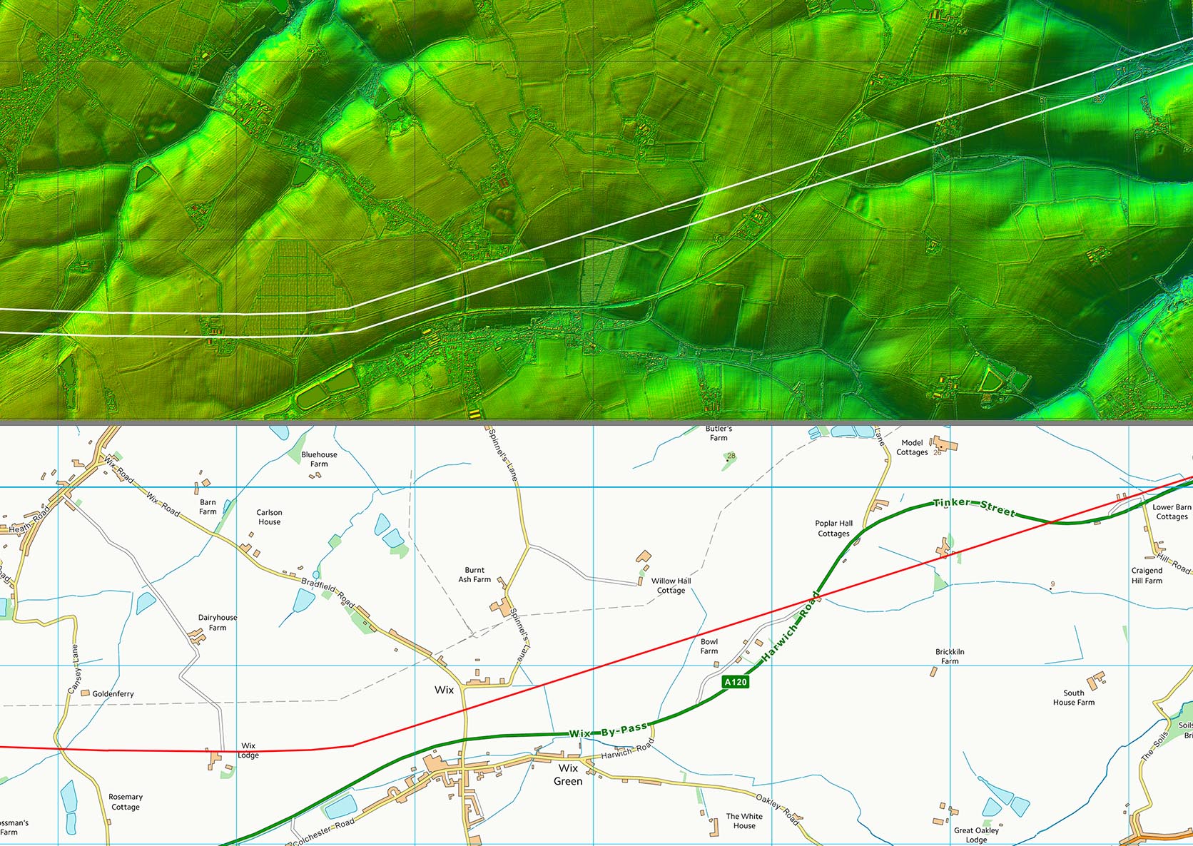
Lidar Image and Route Map 2 The turn is near or under a solar farm so Lidar is unable to pinpoint the exact spot but we can be reasonably confident by projecting the alignments either side. After the turn for Harwich clues are more subtle but sufficient I believe to fix the route. |
Click for larger view |
 |
Oblique 3D Lidar Image - Passing Ramsey Hall It was seeing this section that left me in no doubt that our road was heading into Harwich. A connection to the sea and the stone outcrops there made this a logical destination. Image: Google |
Click for larger view |
 |
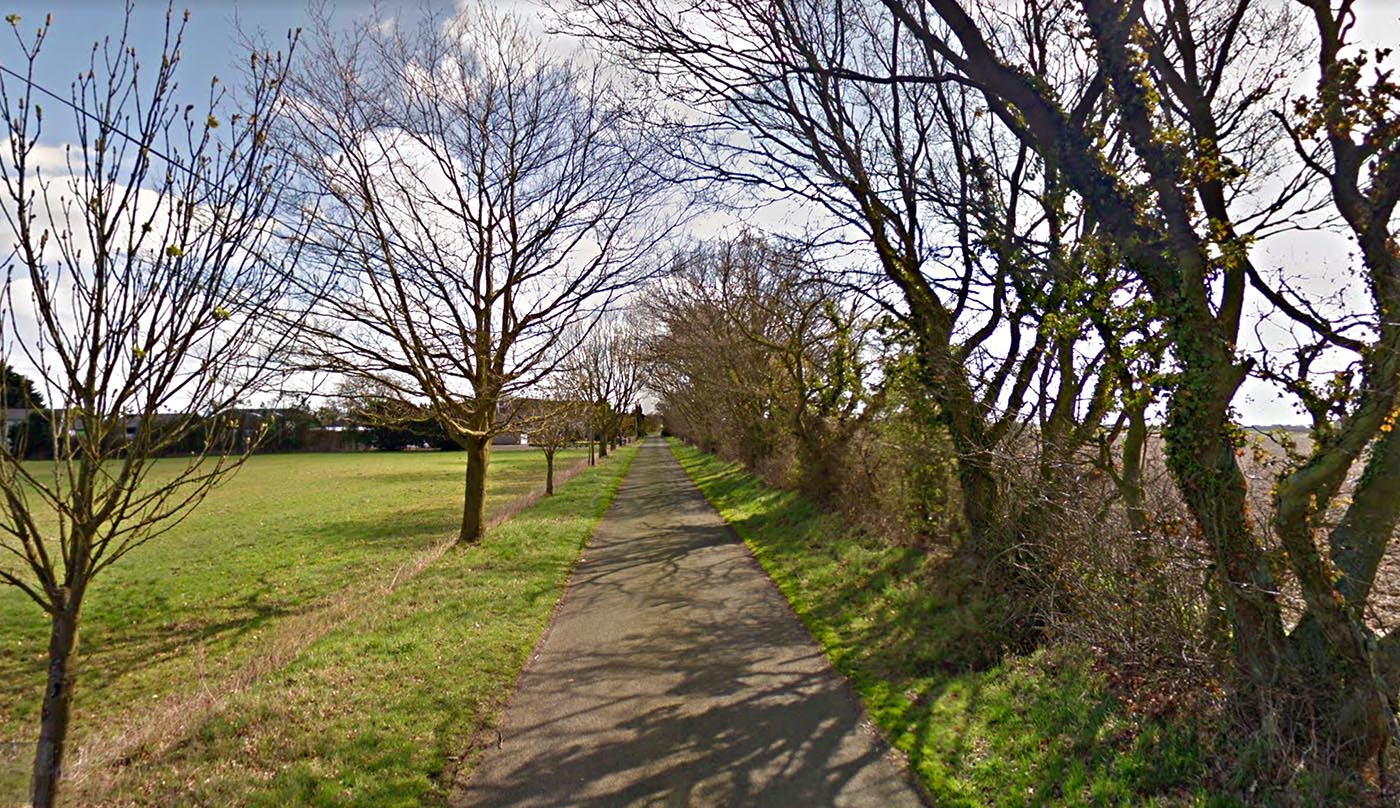
The Green, Harwich I suspect the Roman line is down the Green as we ahead into Harwich. It appears to be the original and much straighter alignment. It is bypassed now on its south (right) side here. Image: Google |
Click for larger view |
 |
Lidar Image and Route Map 3 Quite where the road ended is almost impossible to determine so I have not shown it actually reaching the coast but it surely would have somewhere in Harwich. As referred to above, the “Harwich Stone Band” rock outcrops would also presumably have been linked in to this road. |
Click for larger view |
 |
Location of Little Oakley Villa - Lidar Image The villa was located on an excellent high spot about 1 mile from the road. Villas located around a mile from the main Roman road is a very normal affair. Just like today, posh country houses are not located roadside. |
Click for larger view |
 |
Main Street, Harwich This is as far I have plotted the course of the Roman Road. It would have turned left or headed straight on - perhaps even both. Left for a port and straight on for the rock outcrops. Image: Google |
Click for larger view |
 |
NEW 3D Lidar flyover video from Colchester to Harwich
|
|
|
|
Last update: July 2020 |
© David Ratledge |