title

The Roman Road from Great Chesterford to Braughing

Margary Number: 21b

Distance: 14 miles

Great Chesterford was connected into the important Roman road of Ermine Street at Braughing in Herfordshire. An obvious and easy route to trace road with Lidar but the last section, the approach to Braughing Roman settlement, is somewhat vague through Braughing village itself.

Subsequent to this page going online a book by Christopher Hadley, The Road, has been publisheddescribing this route and its history.


Historic Counties: Essex & Herfordshire

Current Counties: Essex & Herfordshire

HER: Essex & Herfordshire


location

mini map


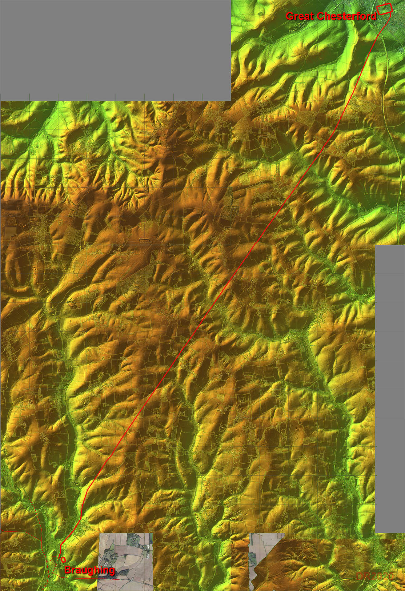
Lidar Image - Full Route

The usual Roman directness with this road. In reality whichever route they had chosen would have involved negotiating several valleys so the straight line was as good as any.

Click for larger view


fullroute

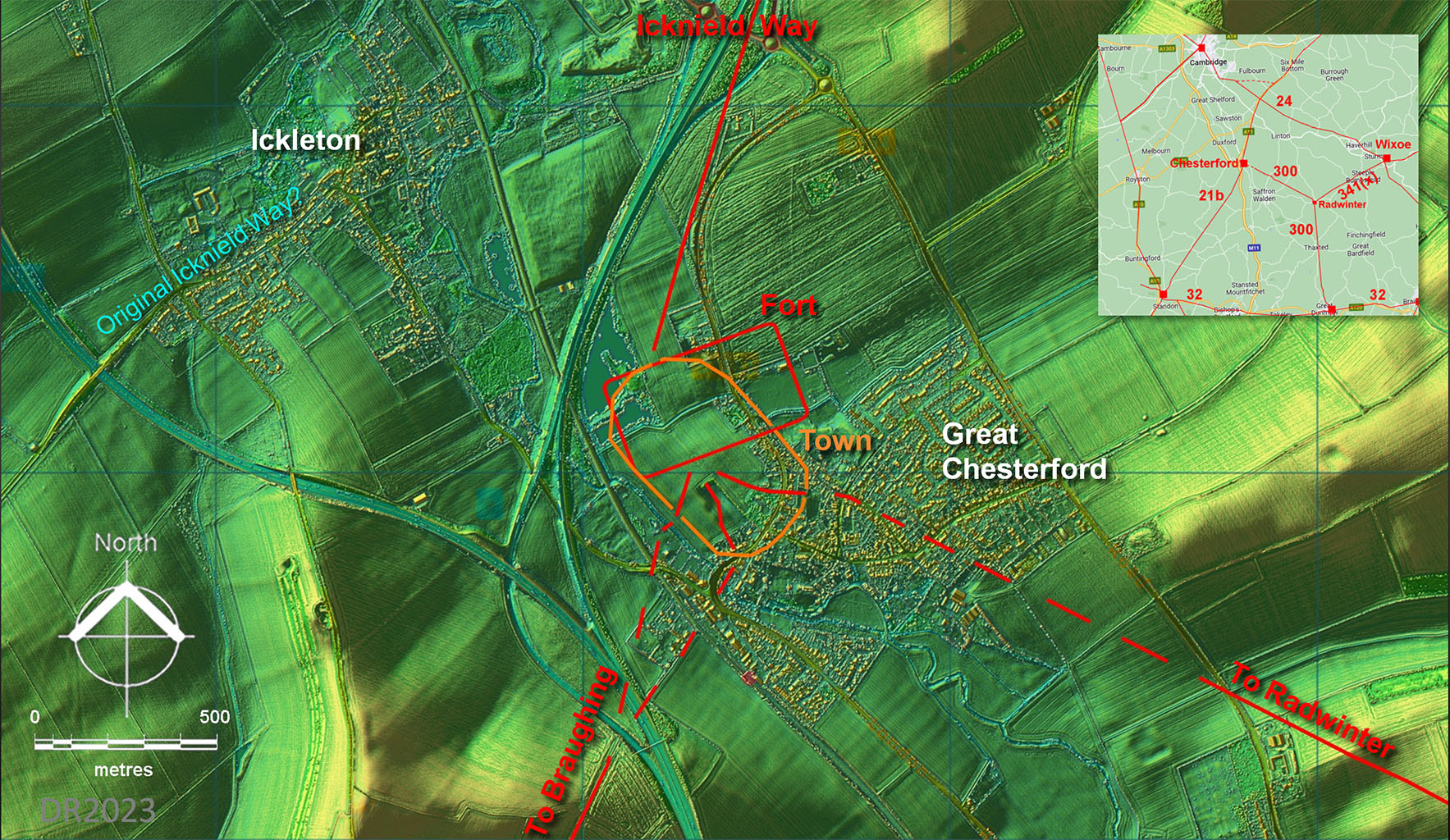
Lidar Image - Great Chesterford Site Plan

The Roman upgrade to the Icknield Way probably ended at Great Chesterford. The pre-Roman(?) trackway most likely went via Ickleton - quite a clue that name.

The early fort and later town extents are from Maria Medlycott, EAA Report 137, 2011.

Click for larger view
chesterford

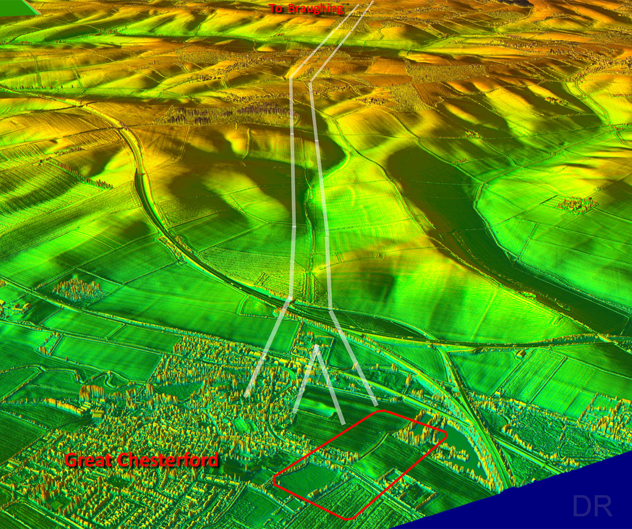
Oblique (3D) Lidar Image - Great Chesterford towards Braughing

The roads would most likely have been set out in the early days when Great Chesterford was a fort rather than the later town. There is evidence visible for a fork so perhaps this was needed when the town was constructed

Note: the route shown (page 226) in Christopher Hadley's book "The Road" is almost certainly incorrect for the approach to Great Chesterford.

Click for larger view
3D chesterfrod

Lidar Image and Route Map 1

Obvious in the Lidar passing Strethall - the latter's name obviously derived from Street Hall.

Click for larger view
map1

Beard's Lane - Littlebury Green

The lidar perhaps indicates the Roman agger is to the right of the modern track so the modern right ditch may be the left ditch of the Roman road.

Click for larger view
beards lane

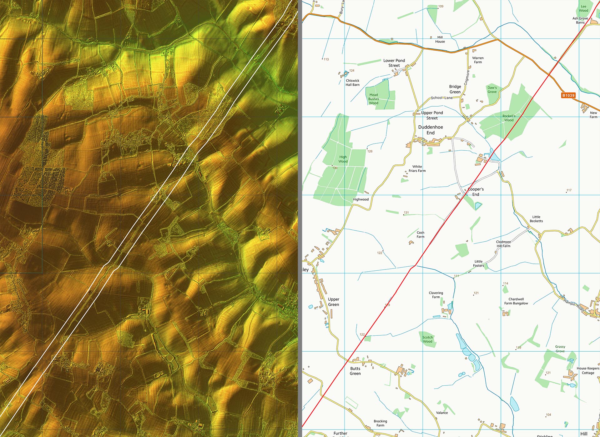
Lidar Image and Route Map 2

Obvious all the way with just a slight kink to cross a stream.

Click for larger view
map2

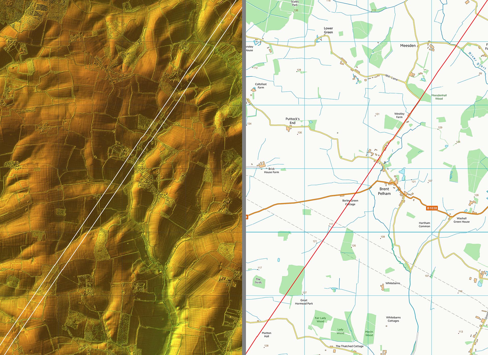
Lidar Image and Route Map 3

The alignment continues through Brent Pelham.

Click for larger view
map3

Brent Pelham

The Roman road runs from right to left here under the thatched cottage!

Click for larger view
brent pelham

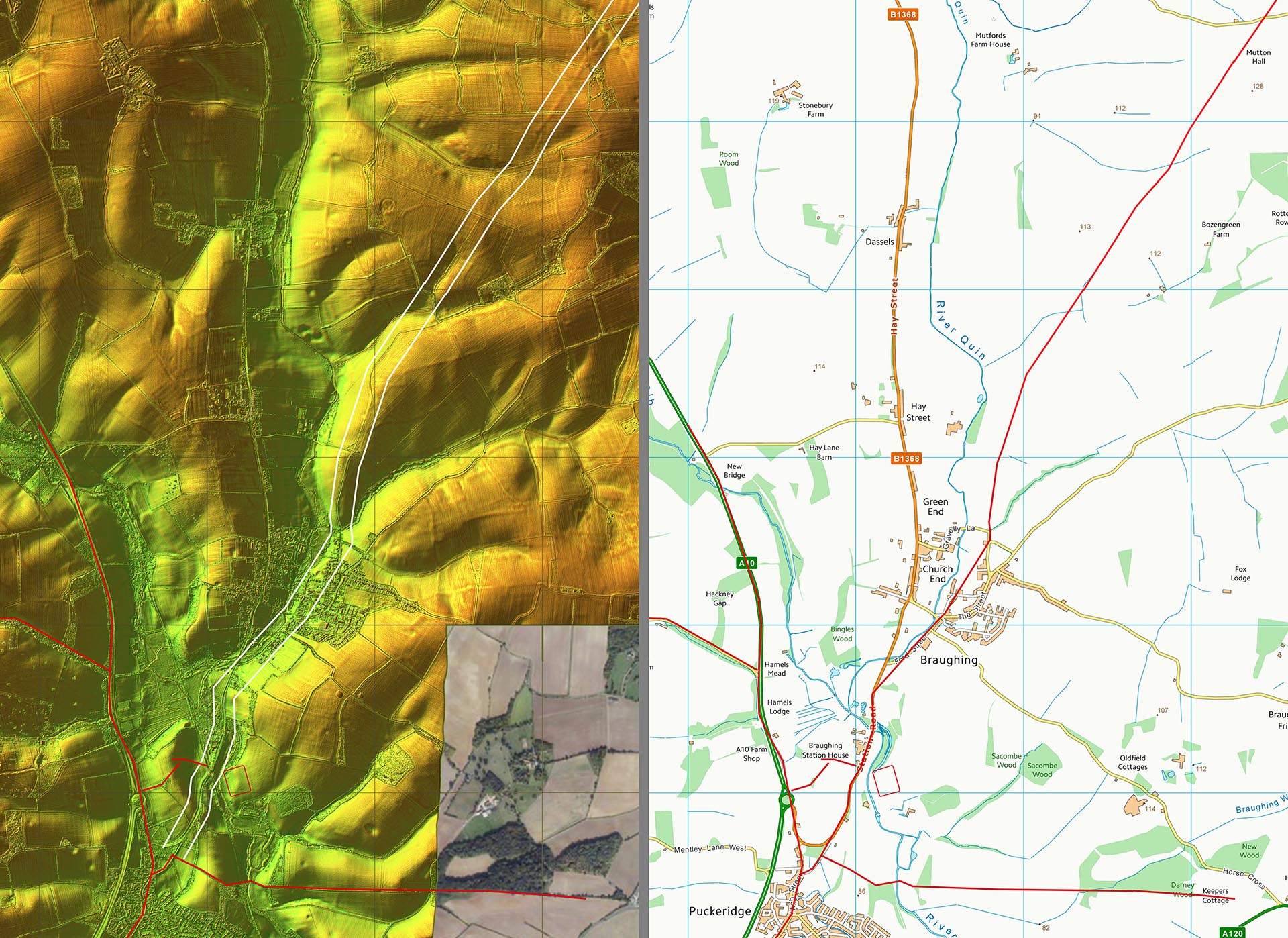
Lidar Image and Route Map 4

The actual road junction with Ermine Street and the Roman settlement are both actually in Puckeridge rather than Braughing, where the fort is located.

Click for larger view
map4

Back to Essex homepage

Last update: April 2024

© David Ratledge