
|
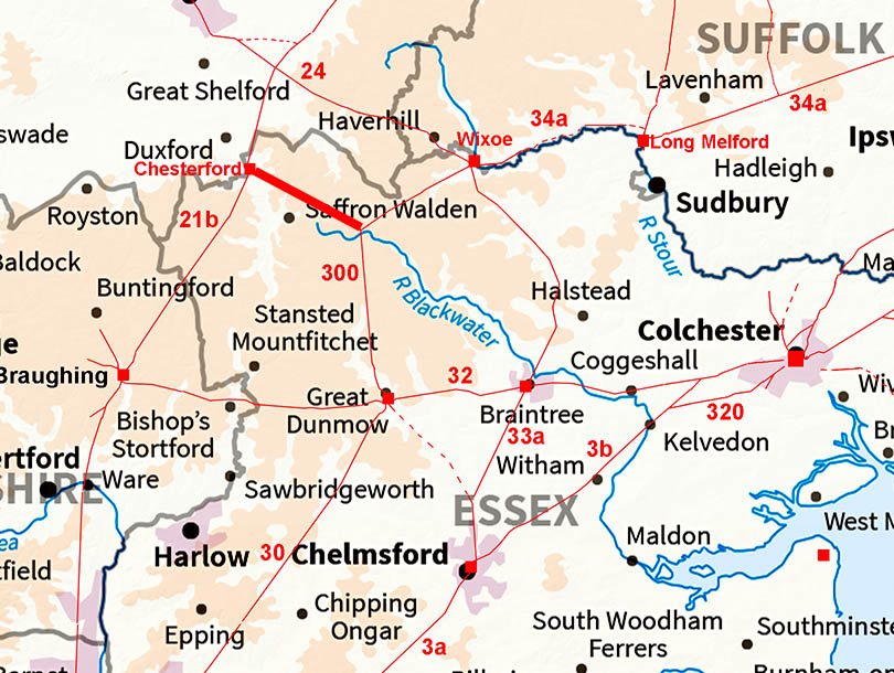
The Roman Road from Great Chesterford to RadwinterMargary Number: 300Distance: 7.25 miles The direction of this road towards Radwinter, where there does not seem to have been a Roman settlement is at first glance a little odd. However, it does connect Great Chesterford to both the known settlements at Wixoe and Great Dunmow. Two birds with one stone? Note: This road was covered in a presentation by John Peterson "How was the course of a Roman Road in Essex predicted by a land survey hypothesis?" given to the RRRA conference 4th Sepember 2016. However, this predated the use of Lidar and we are probably now able to plot the route of the road based on actual visible evidence i.e. lidar + aerials. He also examined the road layout at Radwinter and proposed the arms of the junction made specific angles (ratios). Unfortunately lidar has revealed the road junction was not where he had proposed and it was not a simple "Y" junction. |
Historic Counties: Essex Current Counties: Essex HER: Essex
|
|
|
|
|
|
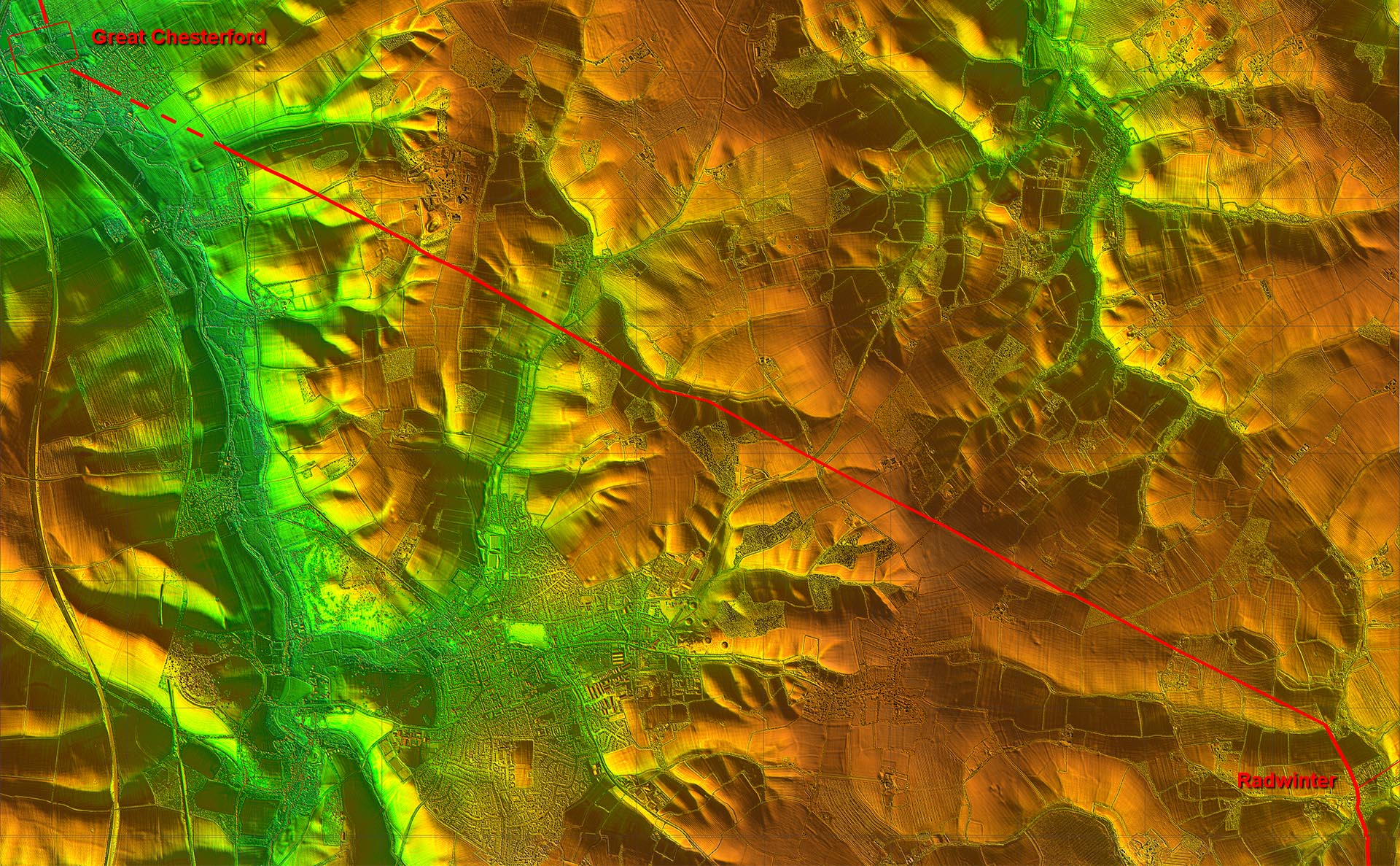
Lidar Image - Full Route The first kilometre is perhaps a bit subjective but from there on the route to Radwinter in not really in doubt. |
Click for larger view
|
 |
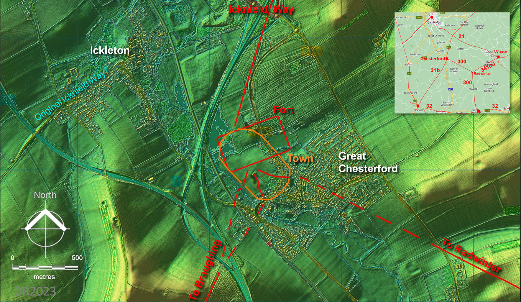
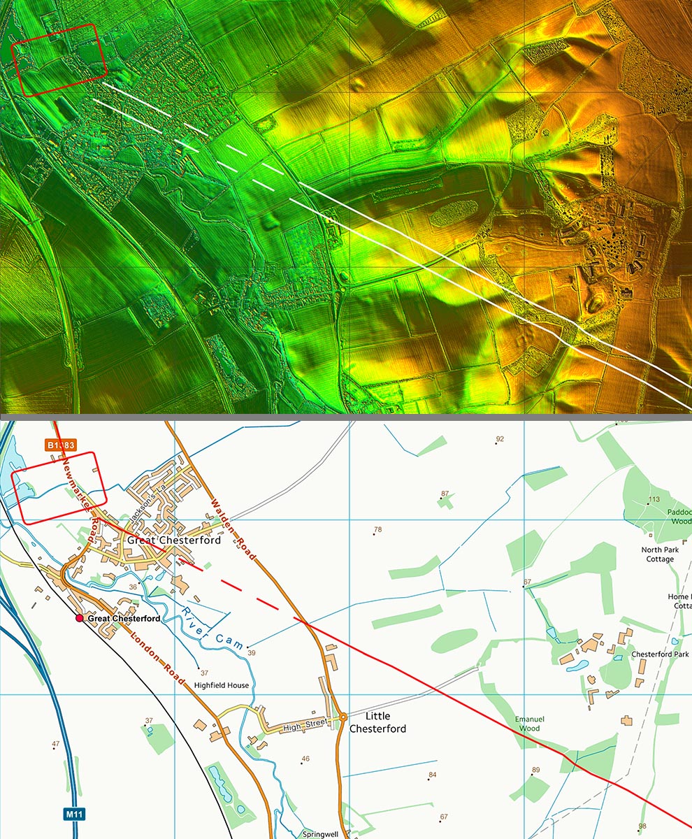
Lidar Image - Great Chesterford Site Plan The Roman upgrade to the Icknield Way probably ended at Great Chesterford. The pre-Roman(?) trackway most likely went via Ickleton - quite a clue that name. The early fort and later town extents are from Maria Medlycott, EAA Report 137, 2011. |
Click for larger view |
 |
Lidar Image and Route Map 1 There is nothing to suggest that the road would not have been straight over that gap. |
Click for larger view |
 |
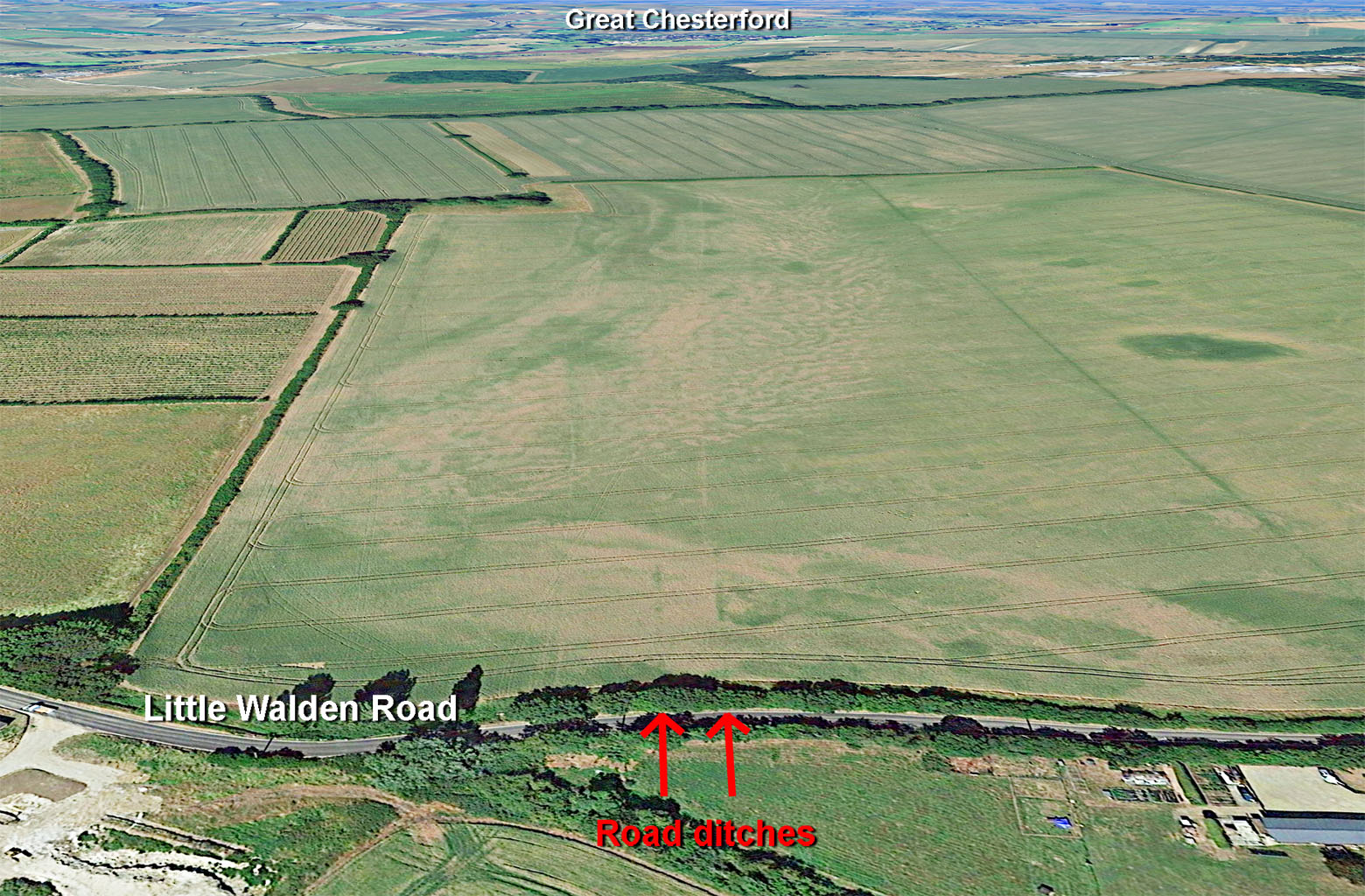
Little Walden Road - Google Earth For once an aerial photo shows the road - or least its ditches - better than lidar. The road must have been completely ploughed out here but the ditches remain as darker strips. |
Click for larger view |
 |
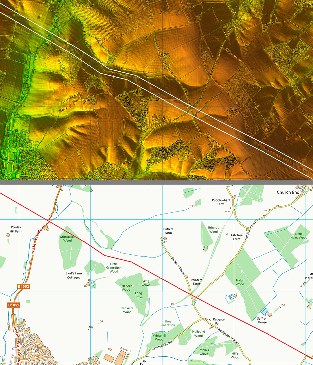
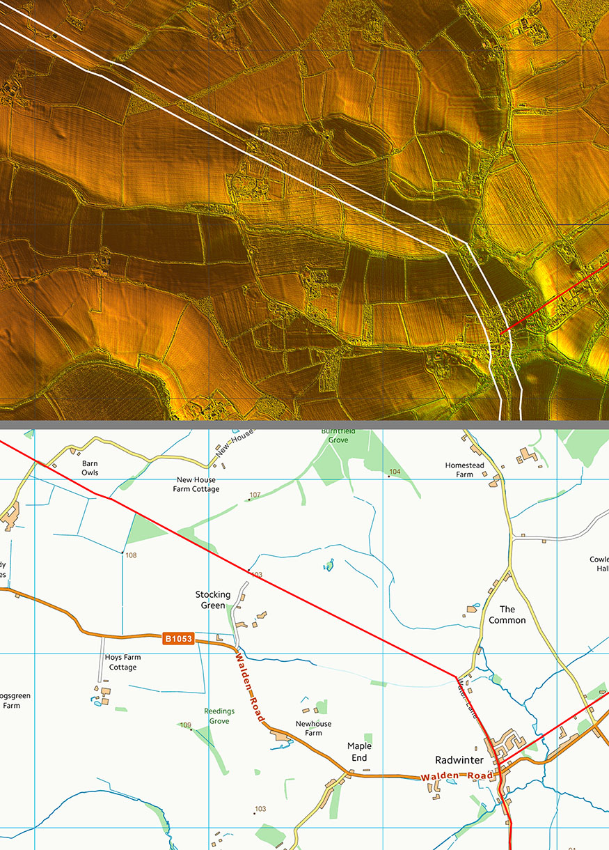
Lidar Image and Route Map 2 Adapts to the contours a little as would to be expected but then is very direct. |
Click for larger view |
 |
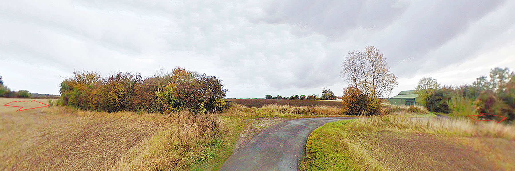
New House Lane Our road has "captured" New House Lane for a short length. This is a common occurence where a modern lane adopts the original Roman line for a short distance before resuming its intended direction. |
Click for larger view |
 |
Lidar Image and Route Map 3 That direct alignment continues to just north of radwinter where it turns to the south. It is joined by the Roman road in from Wixoe. Recent excavations in Radwinter (Pat Moan, Oxford Archaeology, 2017) has revealed that Radwinter was a sizeable Roman Settlement of around 15 Ha. Moan comments :"... the site established itself quickly following the development of the road system in the 1st century AD, and was of a substantial size by the end of the 1st and into the early 2nd century AD." |
Click for larger view |
 |
|
|
|
Last update: August 2023 |
© David Ratledge |