
|
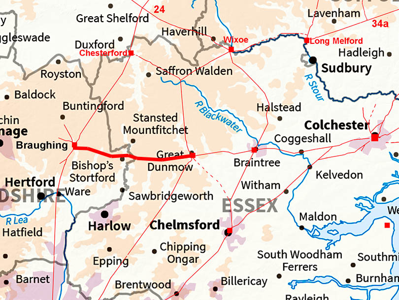
Stane Street - Great Dunmow to BraughingMargary Number: 32Distance: 15.5 miles This stretch of Stane Street is half in Essex and half in Herfordshire and connects Colchester to Ermine Street,.
|
Historic Counties: Essex & Herfordshire Current Counties: Essex & Herfordshire HER: Essex & Herfordshire
|
|
|
|
|
|
Lid ar Image - Full Route Some gaps in the Lidar at the Braughing end but these do no effect determining the route. The Braughing site would connect Stane Street directly to Ermine Street. |
Click for larger view
|
 |
Lidar Image - Great Dunmow Roman Settlement The Roman settlement area appears to have been mainly to the west of the road junction. It is likely that Stane Street predated the other later roads which then avoided the already settled area. Settlement area is shaded in yellow and is taken from Wickenden although the road to London I have shown in a different location based on Lidar and old mapping.. Ref: Excavations at Great Dunmow, Essex: a Romano-British small town in the Trinovantian Civitas, N.P. Wickenden, EAA 41 (1988)
|
Click for larger view |
 |
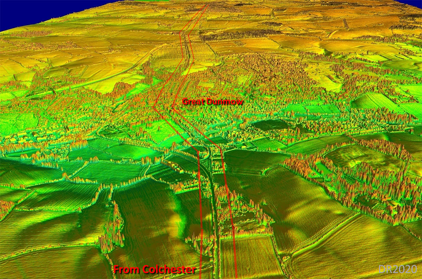
Oblique 3D Image - Great Dunmow The reason for the dog-leg at Great Dunmow is possibly because of the location of the Roman settlement that the road has to serve. |
Click for larger view |
 |
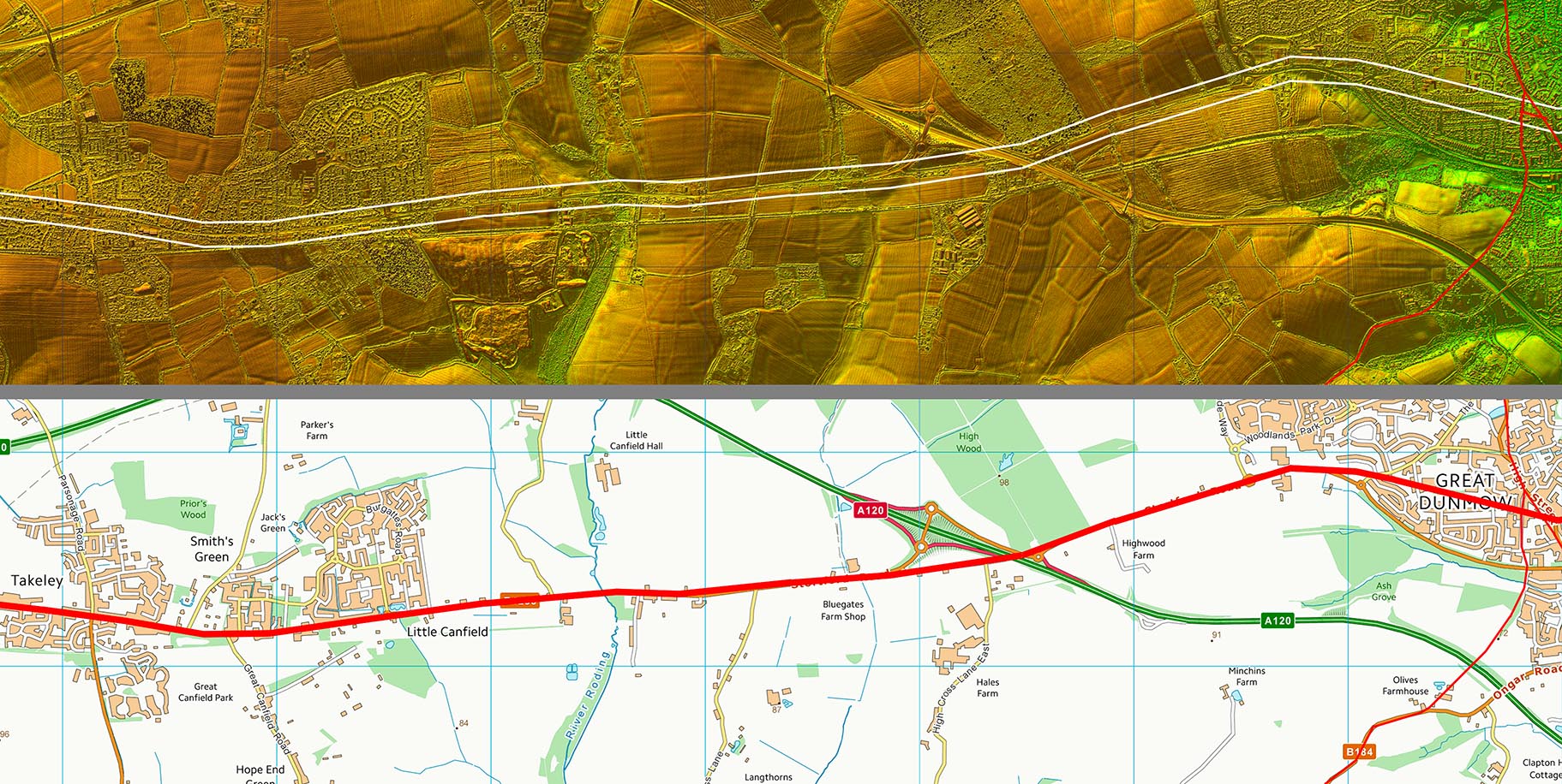
Lidar Image and Route Map 1 The Roman line is now bypassed and the old road through Little Canfield and Takeley (B1256) overlies the Roman road. |
Click for larger view |
 |
Lidar Image and Route Map 2 Takeley Street is a clue as we pass to the south of Stansted airport. The Roman line was not through the centre of Bishops Stortford but to its north. Stortford is probably name after the road however meaning Street Ford. |
Click for larger view |
 |
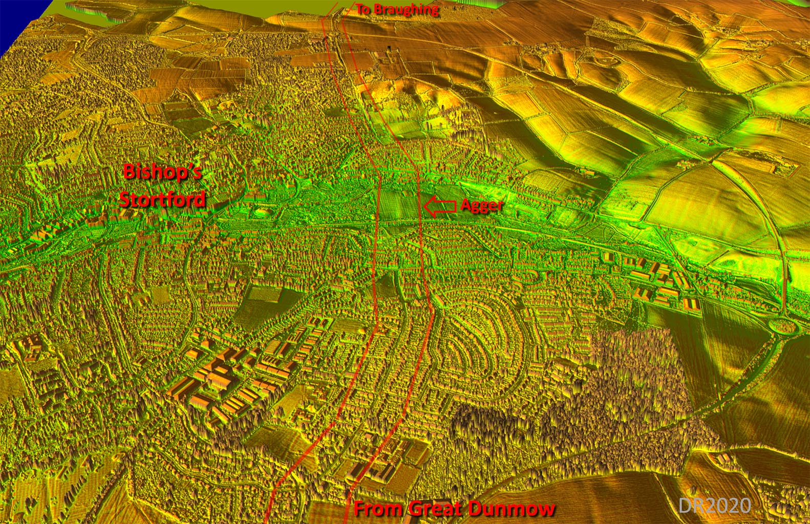
Oblique 3D Lidar Image - Bishop's Stortford The agger of the road has survived well approaching the River Stour crossing. |
Click for larger view |
 |
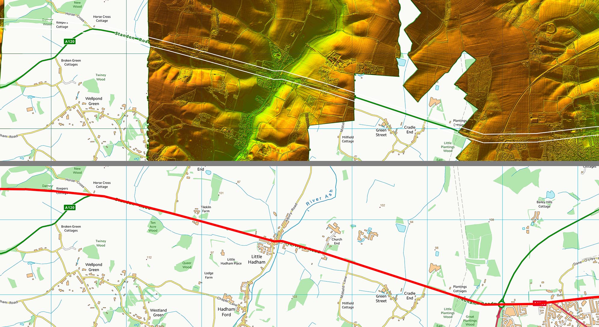
Lidar Image and Route Map 3 Those annoying gaps in the lidar data are of no consequence as the road alignment is not in doubt here. |
Click for larger view |
 |
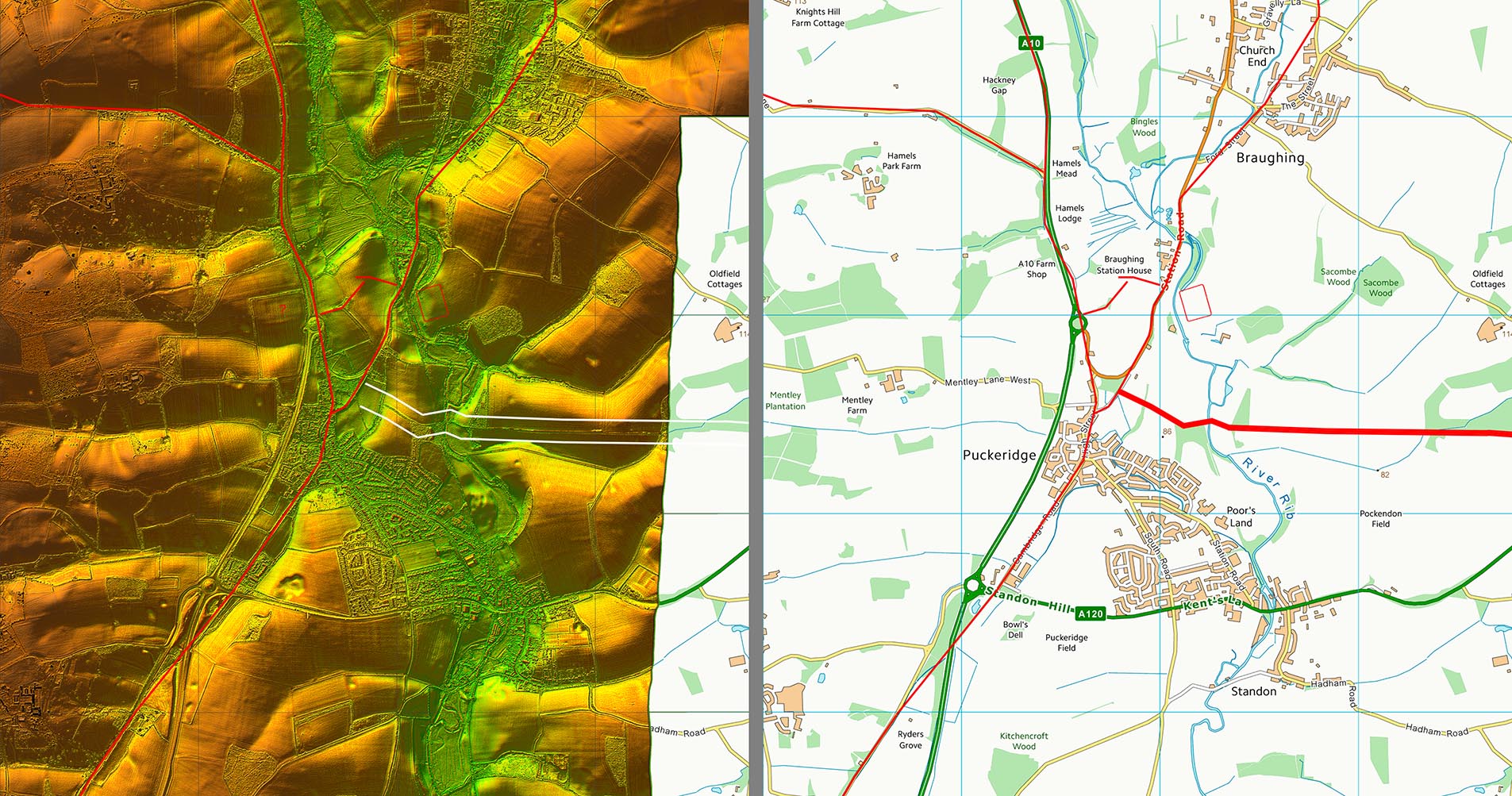
Lidar Image and Route Map 4 The final approach to Braughing is south of the fort site. There is nothing unusual in this and similar arrangements do occur elsewhere. The actual road junction with Ermine Street and the Roman settlement is actually in Puckeridge rather than Braughing, where the fort is located. |
Click for larger view |
 |
|
|
|
Last update: July 2020 |
© David Ratledge |