
|
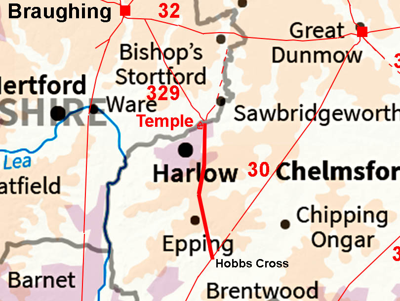
The Roman Road from Hobbs Cross to HarlowMargary Number: noneDistance: 8.5 miles With the known important Roman site at Harlow this was was an often suggested road. In addition, the roads named Foster Street and Latton Street were very suggestive of just such a road although it would appear they do not represent Roman roads. However, thanks to Lidar we do now have the route - well at least as far as Harlow, where suburbia hides the line. 2025 Update: Thanks to Andrew Johnson we now have almost cerainly the correct line across Harlow. You cannot beat local knowledge!
|
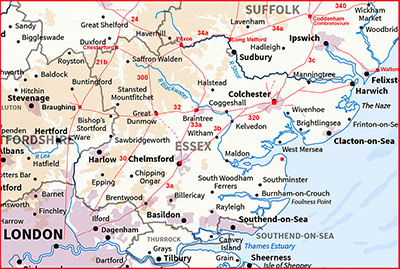
Historic Counties: Essex Current Counties: Essex HER: Essex
|
|
|
|
|
|
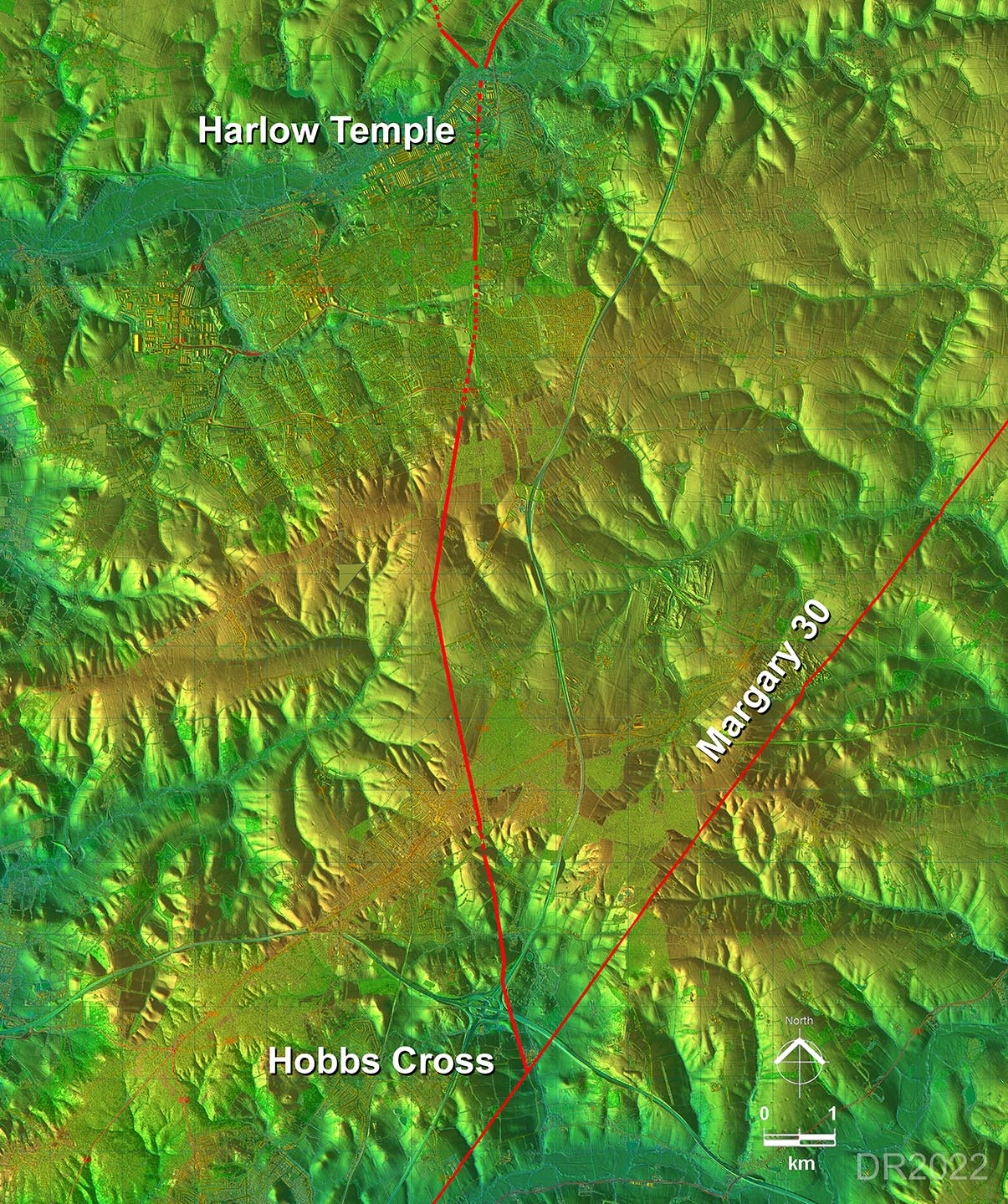
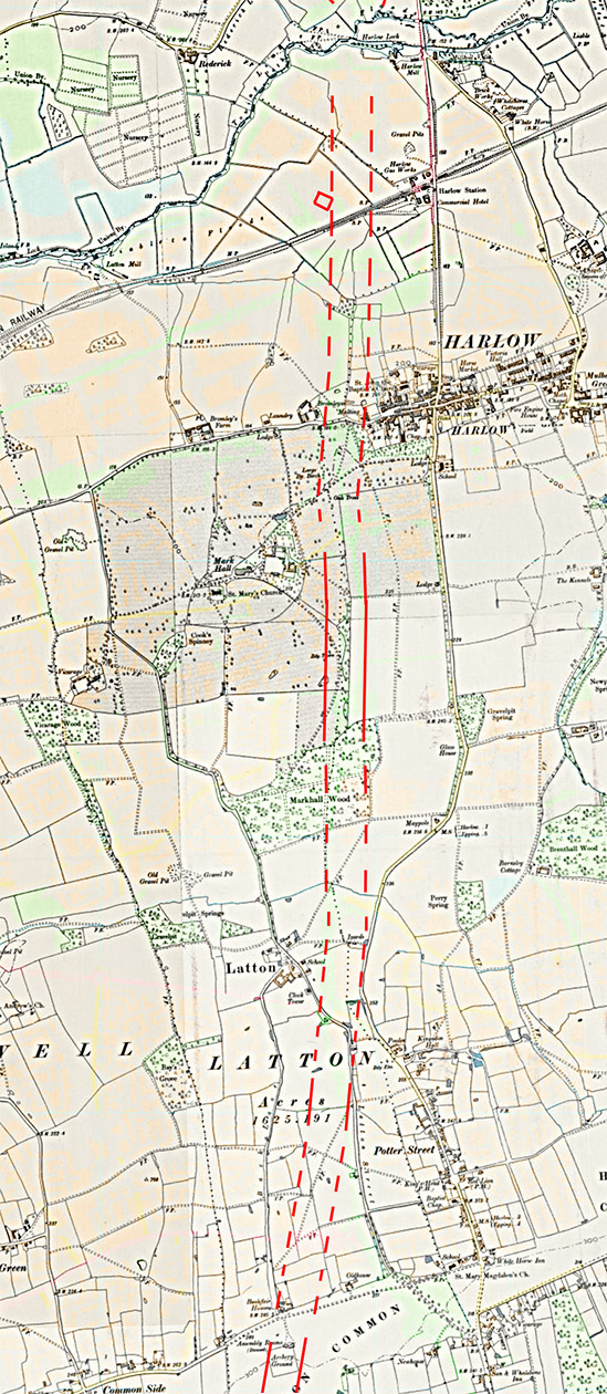
Lidar Image - Full Route The route is based on basically 2 main alignments with the major turn (and setting out point) on the high ground just north of Thornwood Common. There was also a slight change of direction in Harlow. |
Click for larger view
|
 |
Oblique 3D Lidar Image - Hobbs Cross After Hobbs Cross Road there are a few minor dog-legs to negotiate a couple of valleys but then the straight alignment to Thornwood begins. |
Click for larger view |
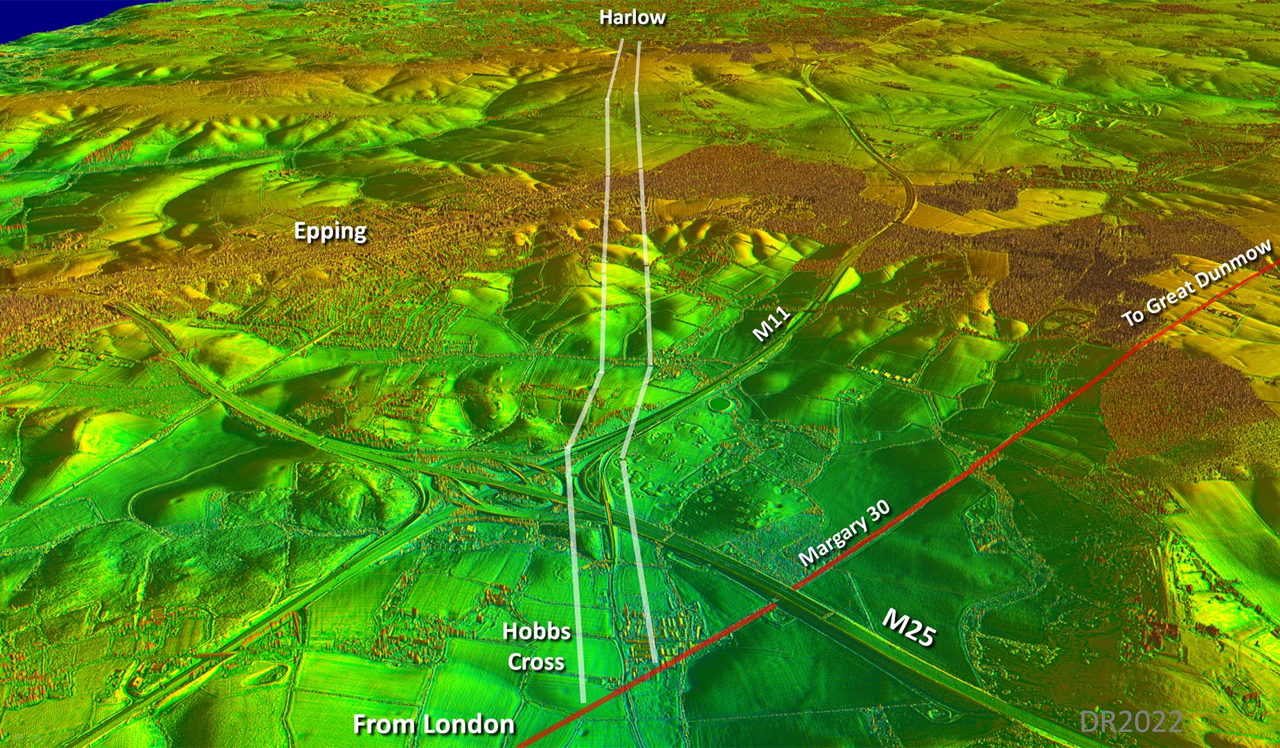 |
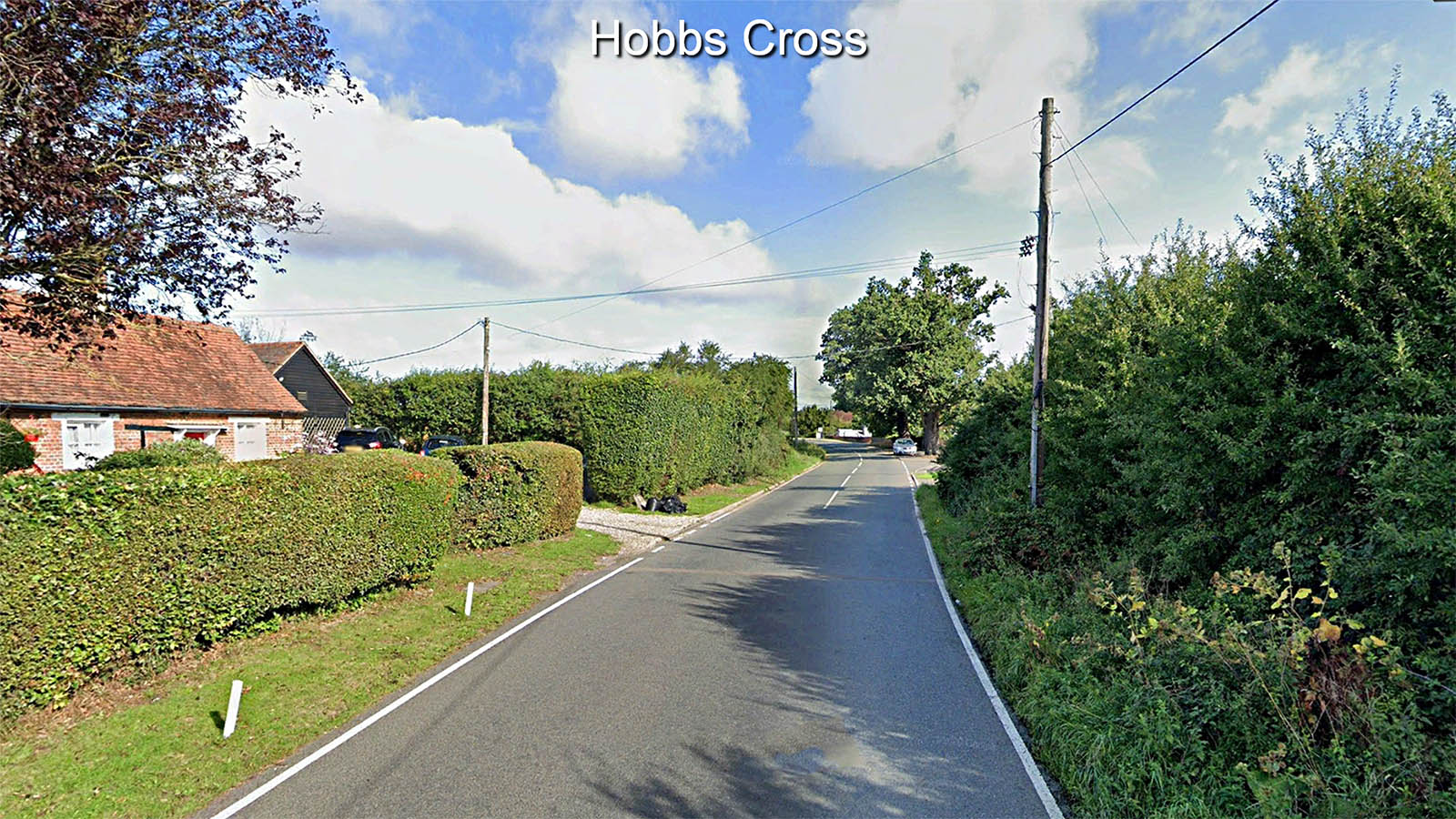
Hobbs Cross Road, Hobbs Cross This is the spot where the road to Harlow Temple branches off the Great Dunmow to London Roam Road. The latter crosses right to left and our route is marked initially by the modern road straight ahead (Hobbs Cross Road). |
Click for larger view |
 |
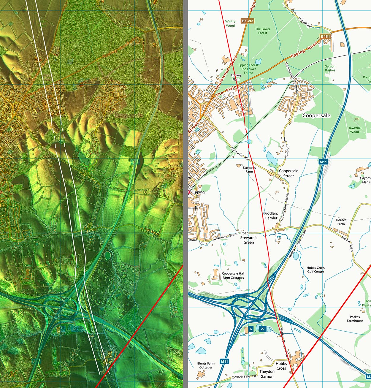
Lidar Image and Route Map 1 Enough clues to confirm the route although surprising in Epping Forest, where you would expect the agger to have survived well, there is virtually no trace. |
Click for larger view |
 |
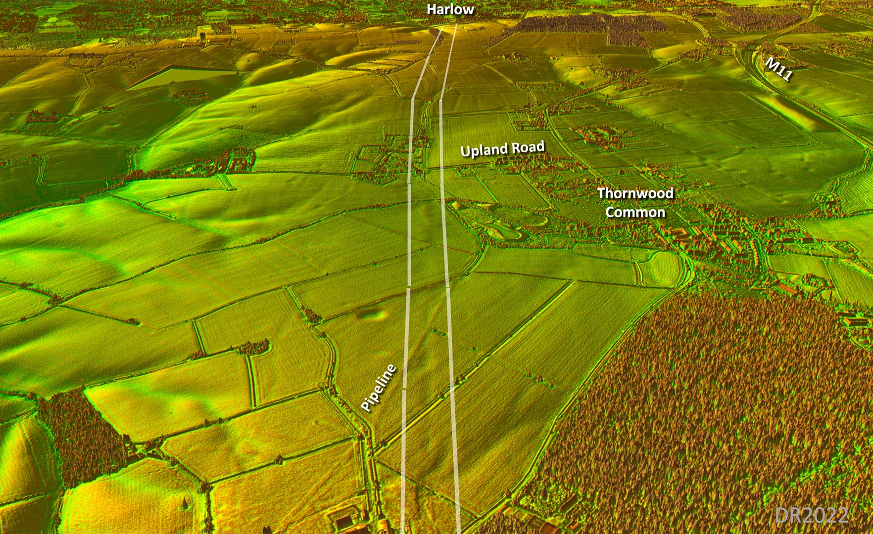
Oblique 3D Lidar Image - Epping Forest to Thornwood Common Beyond Epping Forest there is a continuing string of clues marking the Roman alignment. |
Click for larger view |
 |
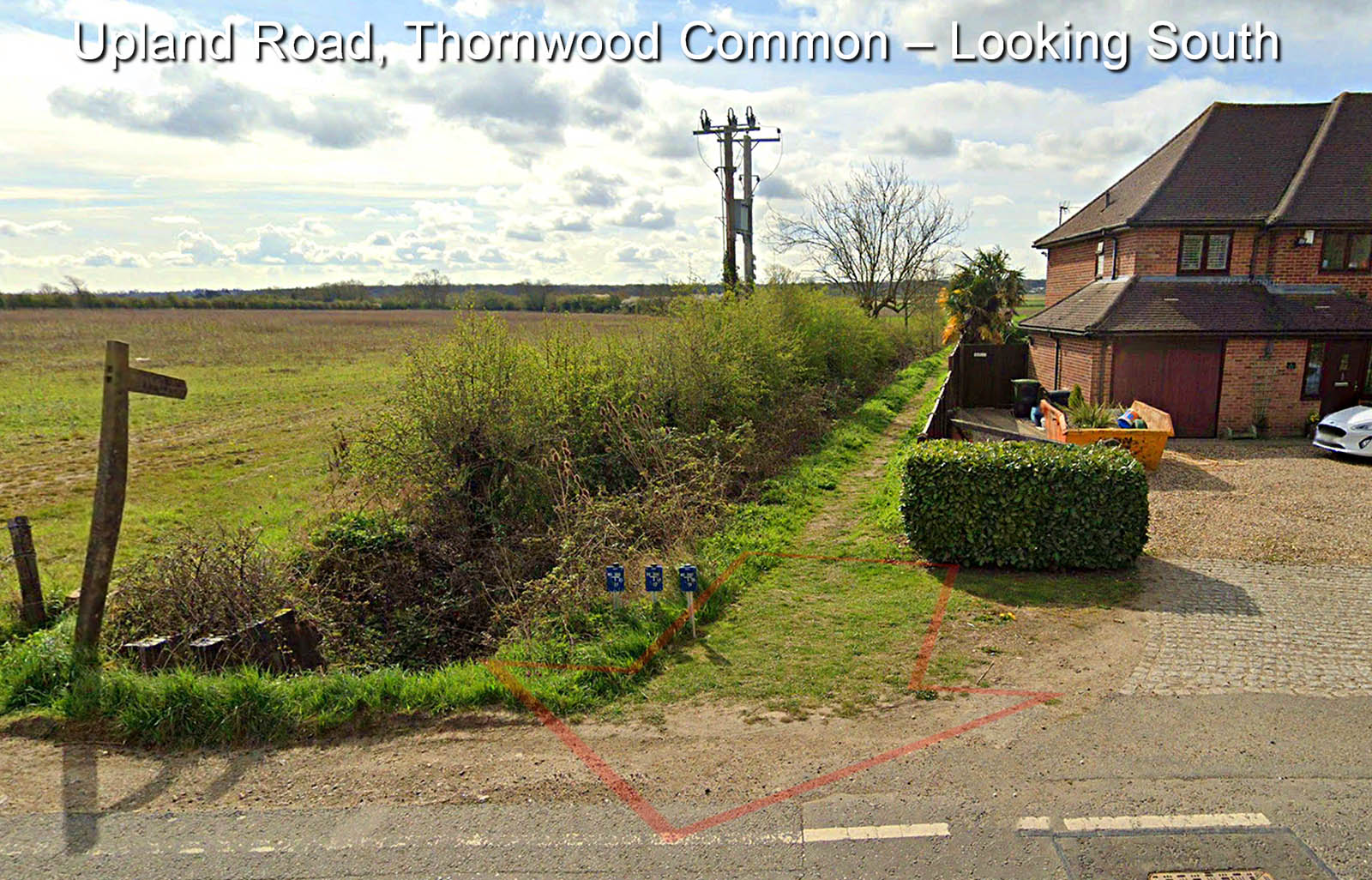
Upland Road, Thornwood Common We are looking south back to Hobbs Cross and the modern ditch to the left of the footpath is most likely derived from the eastern ditch of the Roman road. |
Click for larger view |
 |
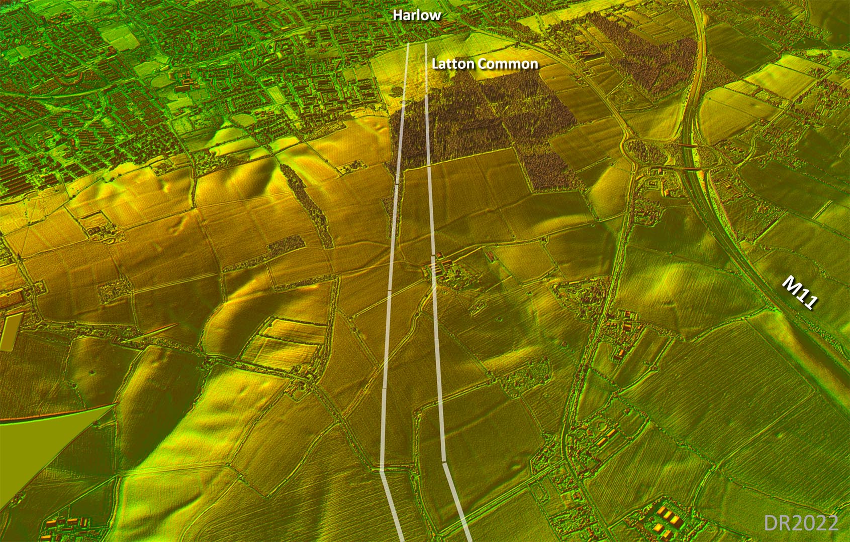
Oblique 3D Lidar Image - Latton Common Again continuing clues all the way into Harlow. |
Click for larger view |
 |
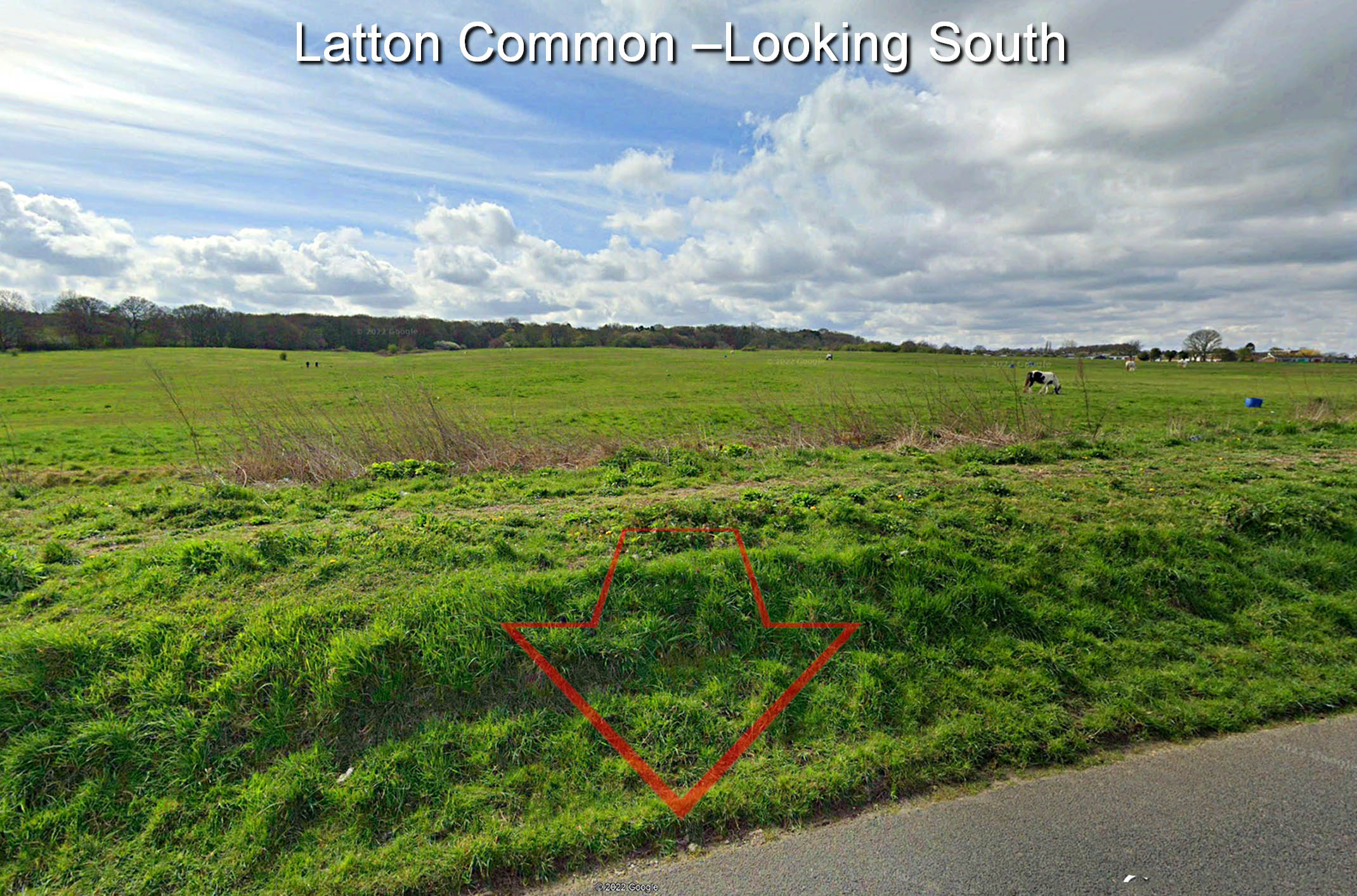
Latton Common The route across Latton Common is clear in Lidar but not so obvious on the ground. |
Click for larger view |
 |
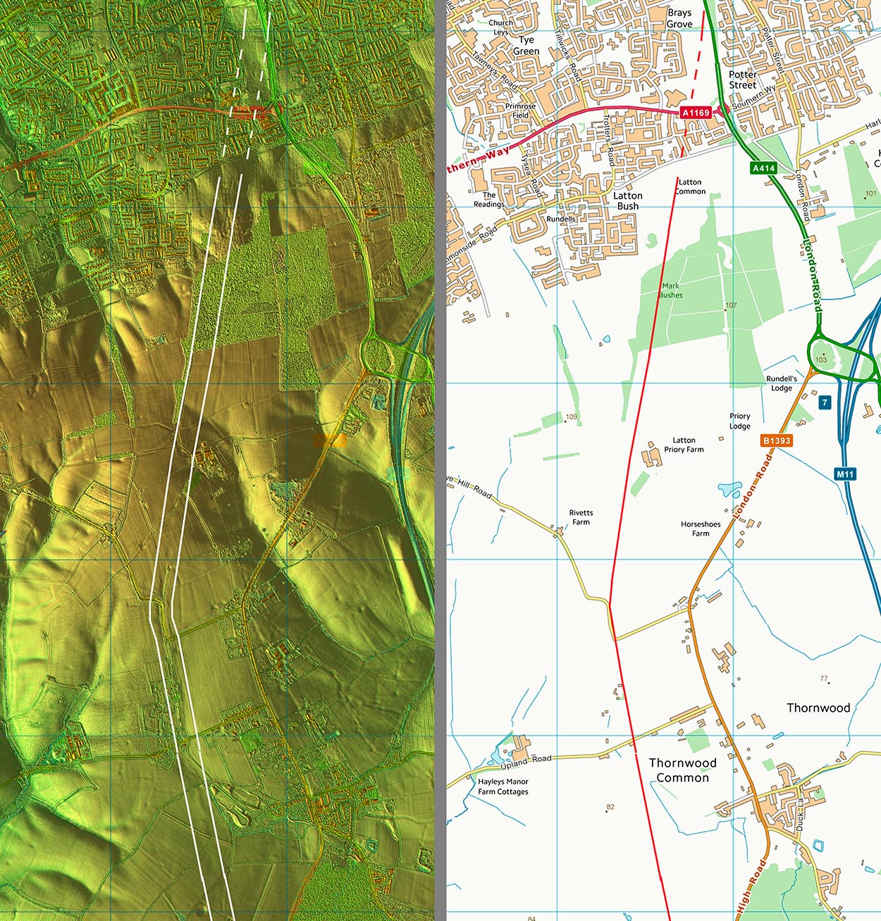
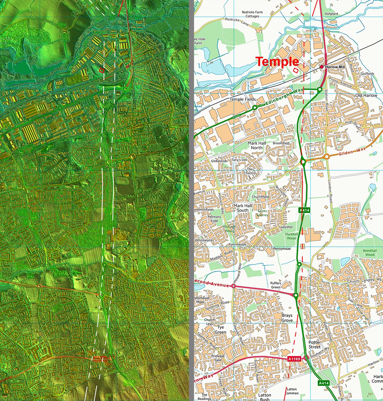
Lidar Image and Route Map 2 The line into Harlow is secure and its route onwards is reasonably certain due excavations by Kate Clover published in 2015/16 fo the London Road North Enterprise Zone - see below. |
Click for larger view |
 |
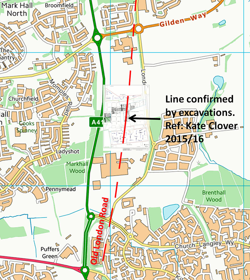
London Road North Enterpise Zone - Excavation Site The London Road North Enterprise Zone exacavtions by Kate Clover confirmed the line of the road.. It also indicates that the road aligned with part of old Latton Street. Ref: Kate Clover, Archaeological Evaluation Report Phase 2 London Road North Enterprise Zone LDO Harlow, Essex, Archaeology South-East, 2015 & 2016, |
Click for larger view |
 |
OS Map c.1900 - Harlow It all aligns through Harlow very well. The lidar on Latton Common - old Latton Street - London Road excavations - centre of old Harlow - Swallows Park.
|
Click for larger view |
 |
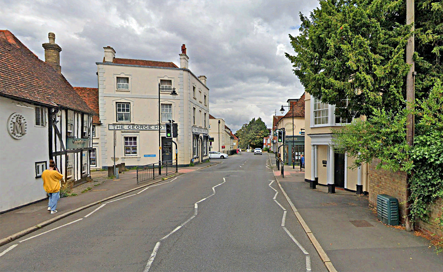
London Road, Old Harlow Continuing the interpolated alignment thet it fits perfectly with London Road in the centre of Old Harlow. Perhaps the name was always a clue. Image: Google |
Click for larger view |
 |
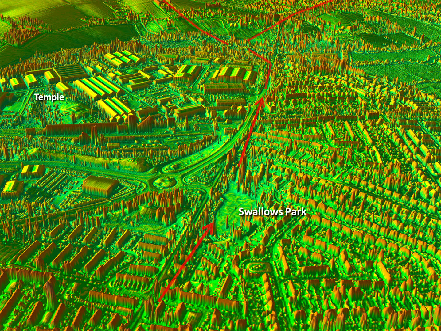
Oblique Lidar Image - Swallows Park In 1972 excavations at Stafford House, directed by Jan Sewter revealed "The main north to south Roman road was traced for 110 m, lying c.45m east of the old A11 (Station Road, Old Harlow). The road was made up of 0.35m of packed gravel and was defined by ditches 12m apart." Today this is Swallows Park. The exact spot does not seem to have been recorded but this is not an issue as Lidar shows the road reasonably clearly. Ref: The Romano-British small town and temple complex at Harlow, Essex: a liminal community on the Catuvellaunian-Trinovantian border, Stephen Rippon, Essex Archaeology and History, 2016. The reason for being 45 metres east of Station road would appear to be that the Roman roads descended and climbed a little valley there and an upgraded Station Road was built off-line on an embankment bypassing the Roman decent/ascent. A not uncommon occurence. My thanks are due to Andrew Johnson for bringing this to my attention. |
Click for larger view |
 |
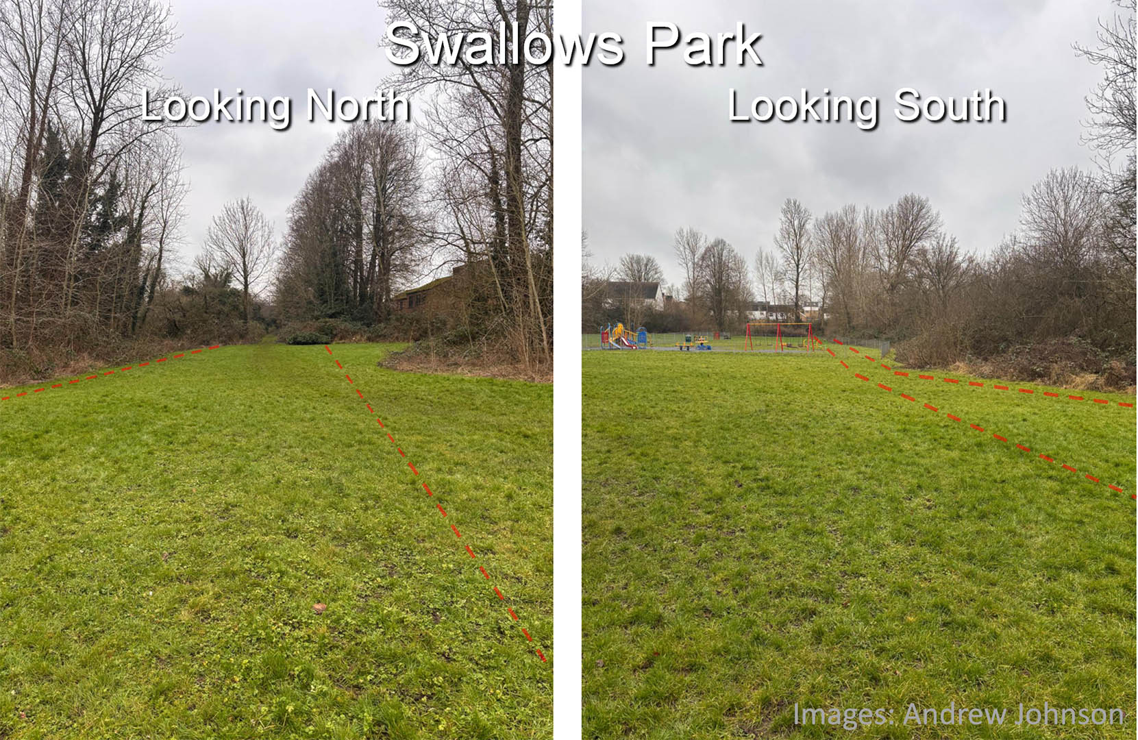
Swallows Park This is the location of the 1972 excavations at Stafford House, now Swallows Park. Only the slightest hint of an agger but this is our road. Images: Andrew Johnson |
Click for larger view |
 |
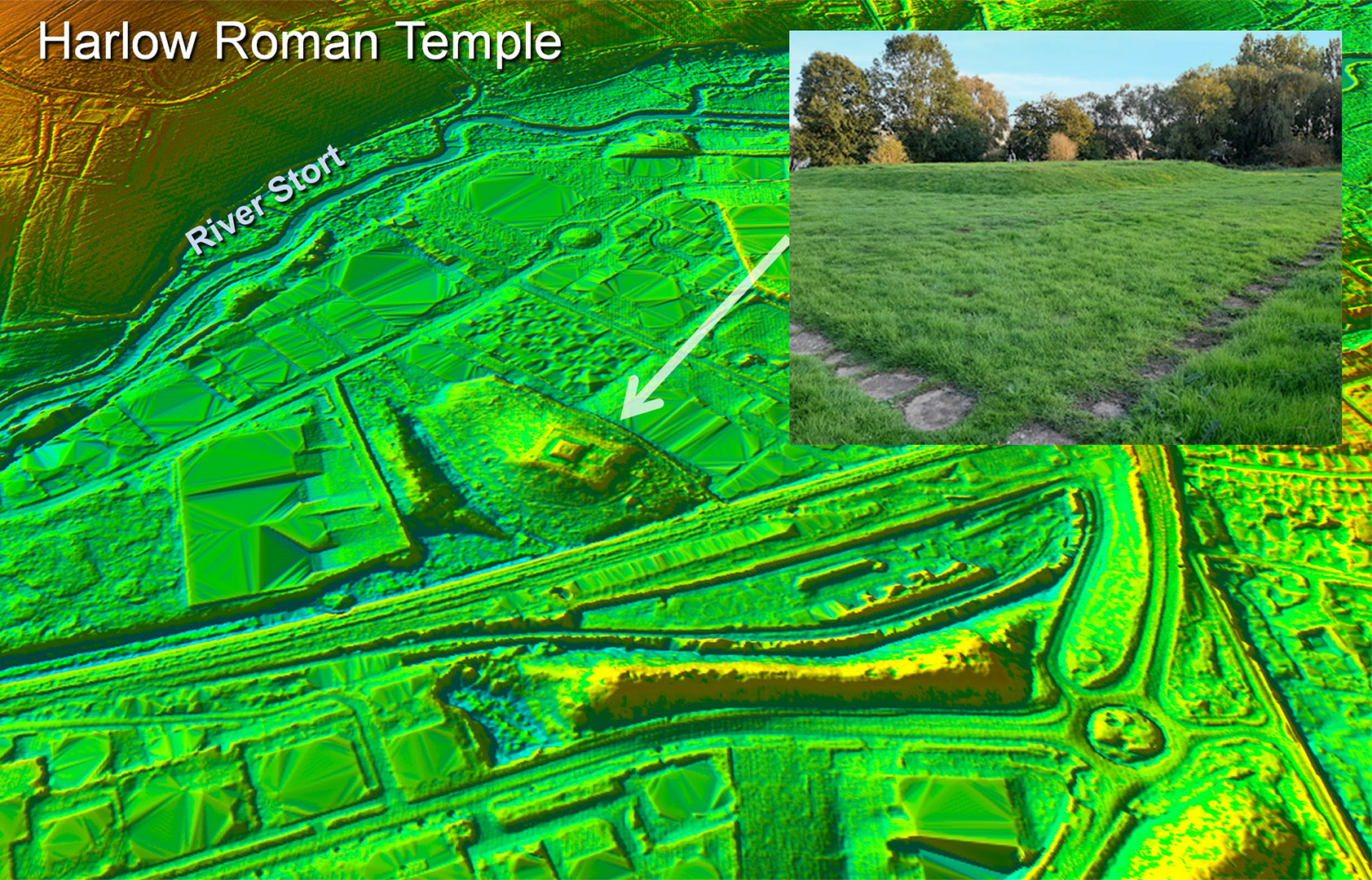
Harlow Roman Temple The Roman temple is located on top of a small hillock alongside the River Stort. The site appears to have been part of a large settlement both industrial and high status. Historic England Record: Grid Ref : TL4720012500 HE Summary : "Excavations uncovered the site of a late Iron Age settlement and Roman town; building remains including mosaics and hypocausts were found. Industrial activity included a bronze working site and a pottery kiln. Many votive objects were found, possibly associated with the nearby temple (TL 41 SE 6), though this site has been also been interpreted as a Roman temple complex with Iron Age origins" |
Click for larger view |
 |
Lidar Image and Route Map 3 There is a long straight interpolated section but this seems reasonable. The alignment continuing form Latton Common when projected would head through the cross roads at the middle of Old Harlow and join the known section at Swallows Park. There really was no reason to deviate from a straight course here so this line is probably very close to correct. |
Click for larger view |
 |
|
|
|
Last update: January 2025 |
© David Ratledge |