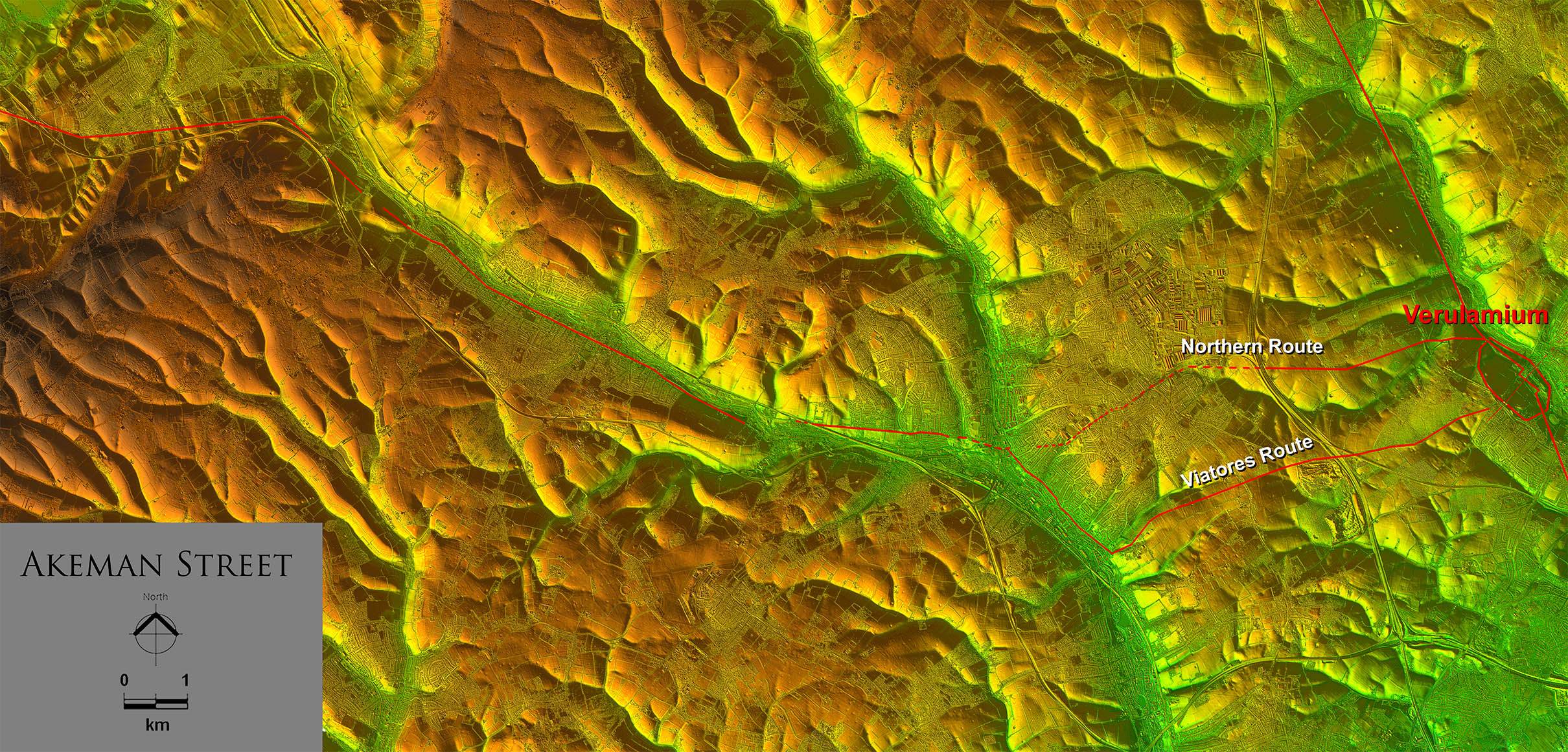
Lidar Image - Full Route from
From Berkhamstead very much a valley route but getting to Berkhamstead is the problem. In general Akeman Street is very direct with long straight alignments and you would therefore expect the same for Verulamium to Berkhamstead. It is for this reason I consider the northern route the more likely. |
|
 |
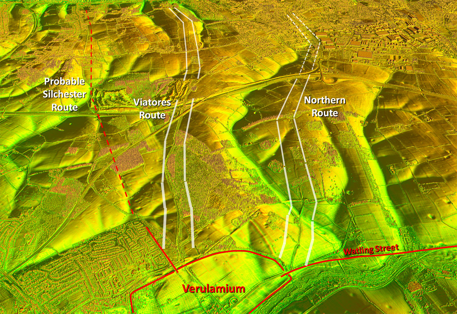
Oblique 3D Lidar Image - leaving Verulamium
The Silchester road and the Viatores route are very close. Would you build two roads so close together when one would serve both? There is Lidar evidence for both options including the Viatores one. |
Click for larger view |
 |
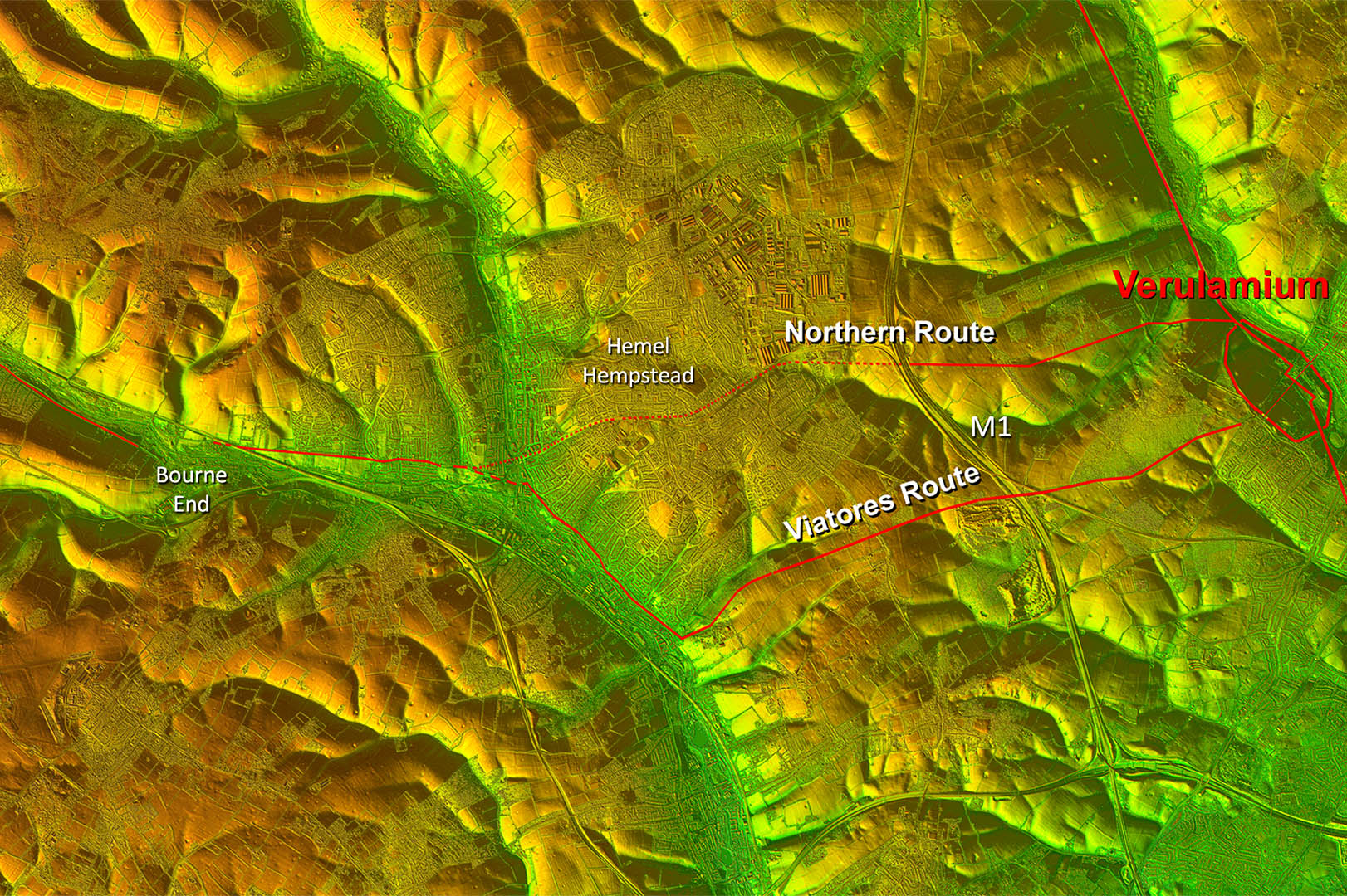
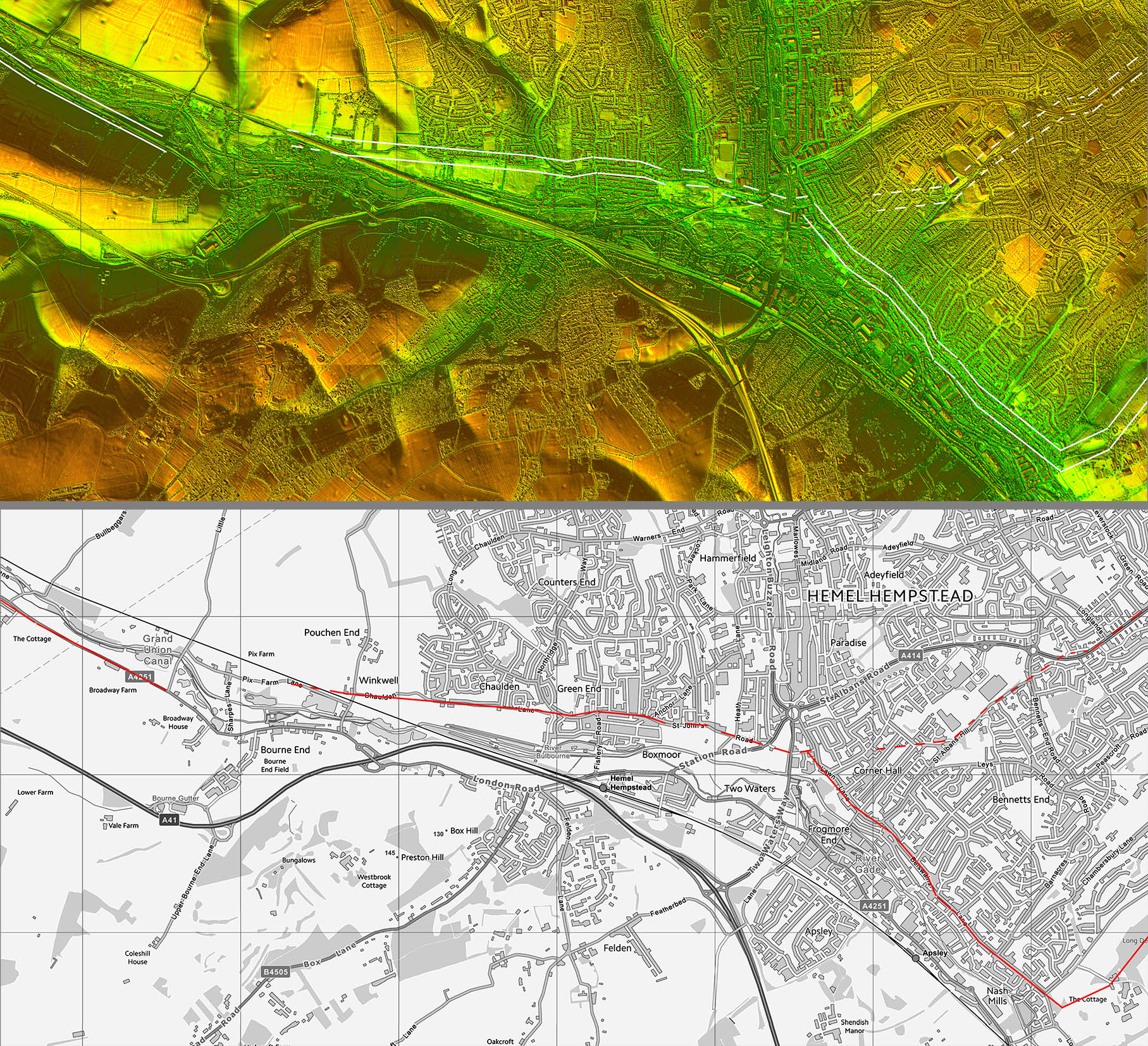
Lidar Image - Hemel Hempstead
The northern route is much more direct but evidence across Hemel Hempstead is non-existant. It does though follow natural valleys and would therefore have been a logical route for the Roman surveyor to have adopted.
The Viatores route seems odd with that right-angled bend. Would the Romans have veered so far off a direct line? |
Click for larger view |
 |
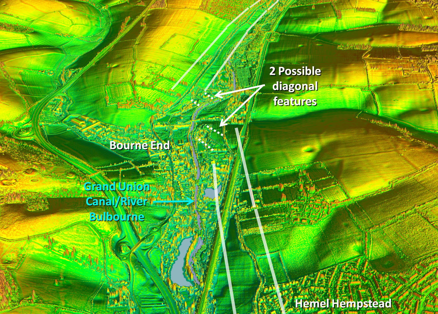
Oblique 3D Lidar Image - Bourne End
The road would have changed valley sides near Bourne End. There a couple of diagonal features that could indicate crossing options but there has been so much disturbance there it is difficult to form an opinion. |
Click for larger view |
 |
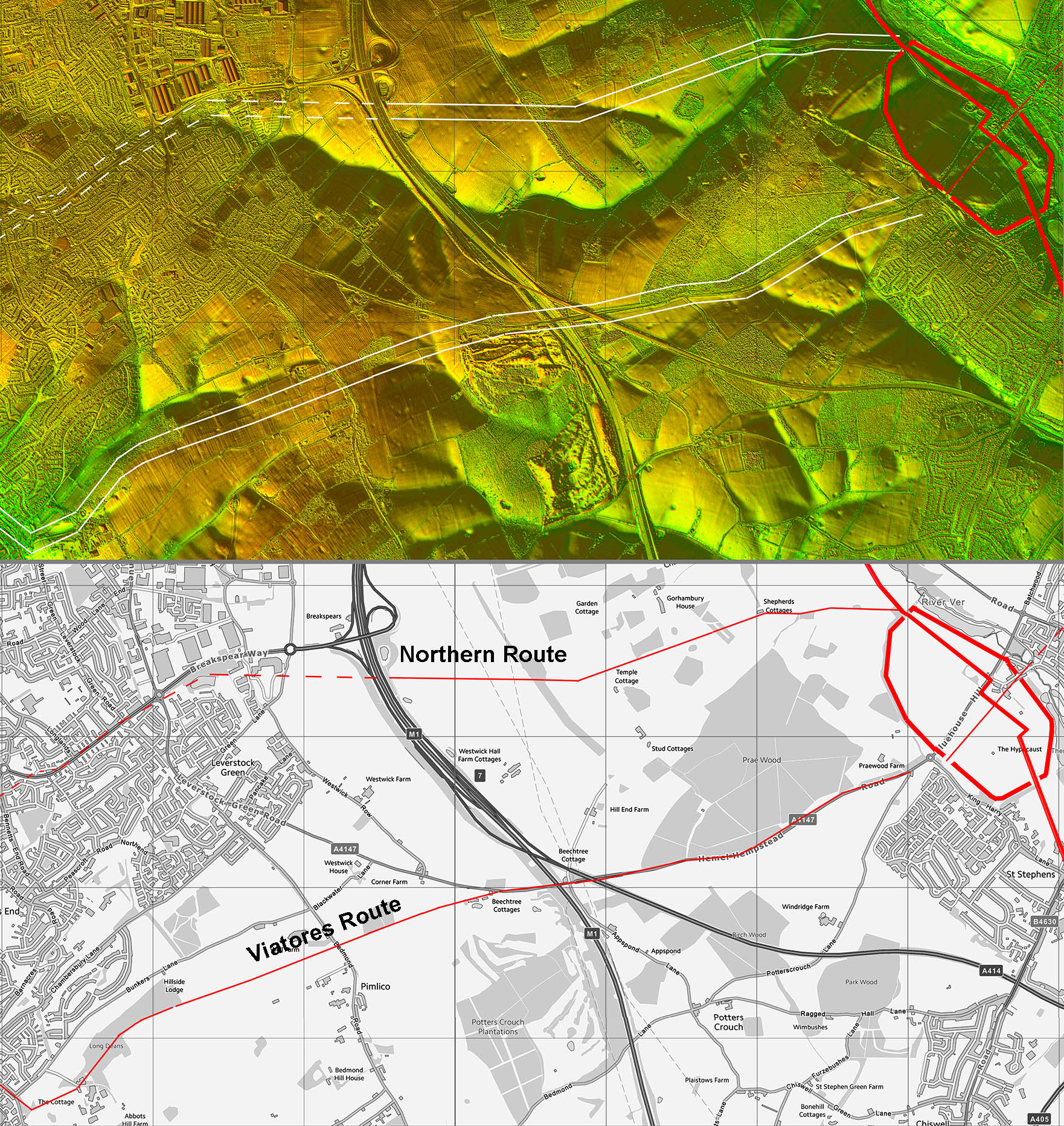
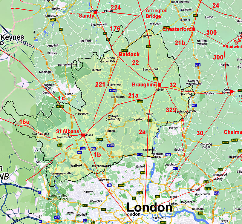
Lidar Image and Route Map 1
Both routes have visible features supporting them. |
Click for larger view |
 |
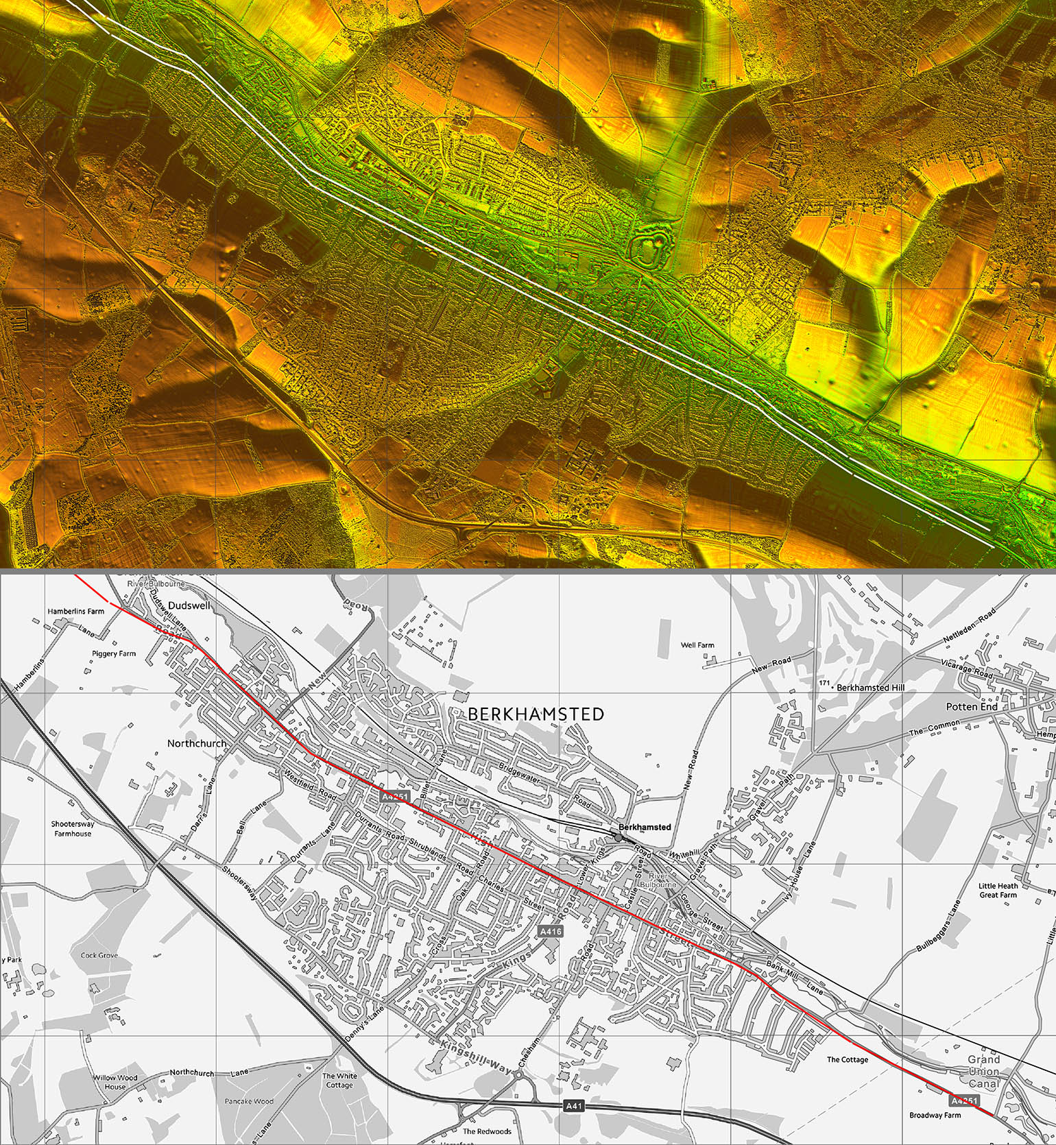
Lidar Image and Route Map 2
Berkhamsted options. The northern one uses a natural valley now occupied by the modern road called St Albans Road. A coincidence or a clue? |
Click for larger view |
 |
Lidar Image and Route Map 3
No doubts as to the route now with long straight alignments. |
Click for larger view |
 |
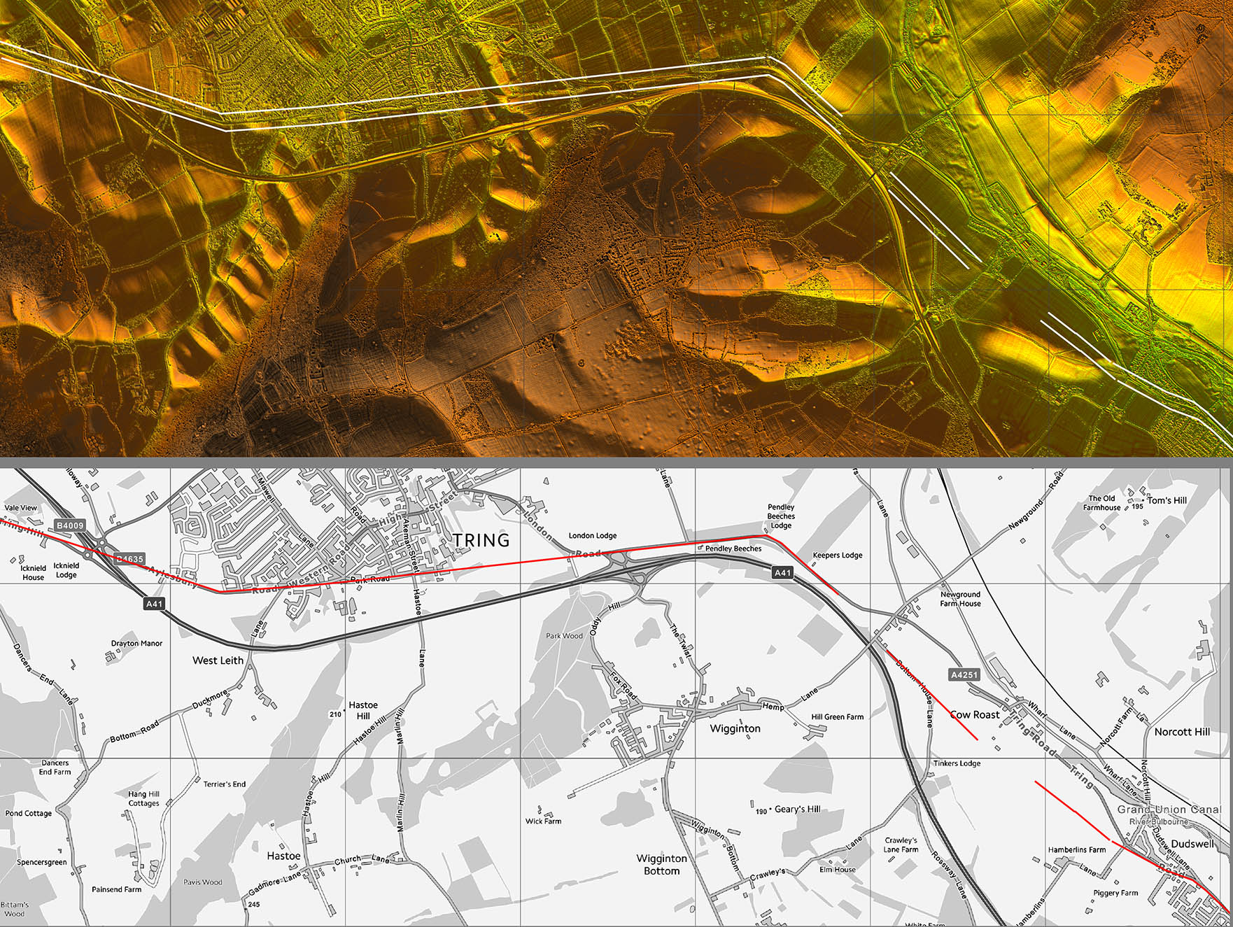
Lidar Image and Route Map 4
Cow Roast was an important Roman industrial site where iron ore was mined and processed.
The county boundary is at the Tring roundabout where we leave Akeman Street. |
Click for larger view |
 |