Lidar Image - Full Route
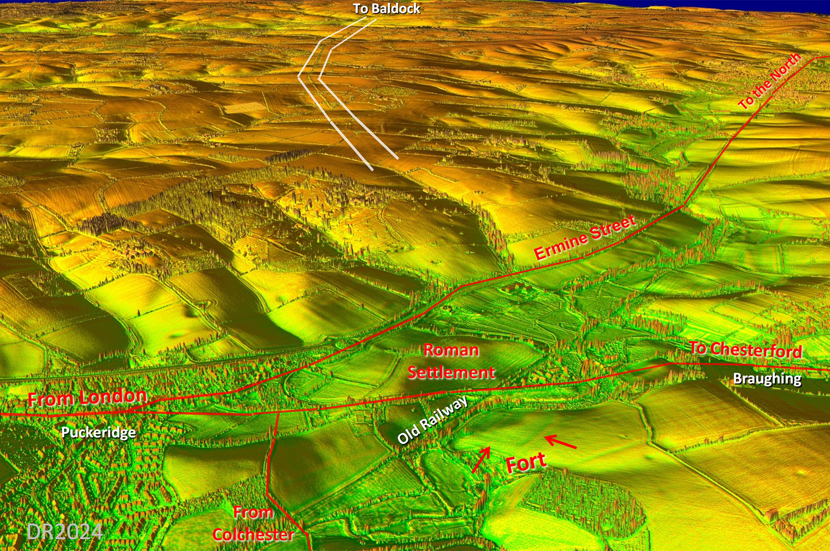
Very direct route but the surveyor decided to head up Ermine Street to a small side valley where the road to Baldock began. |
|
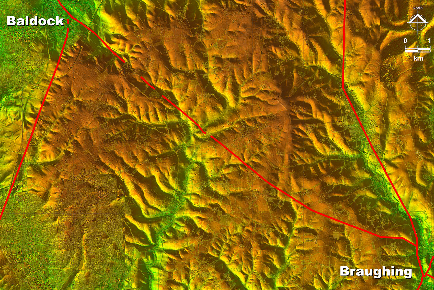 |
Oblique 3D Lidar Image - Braughing towards Baldock
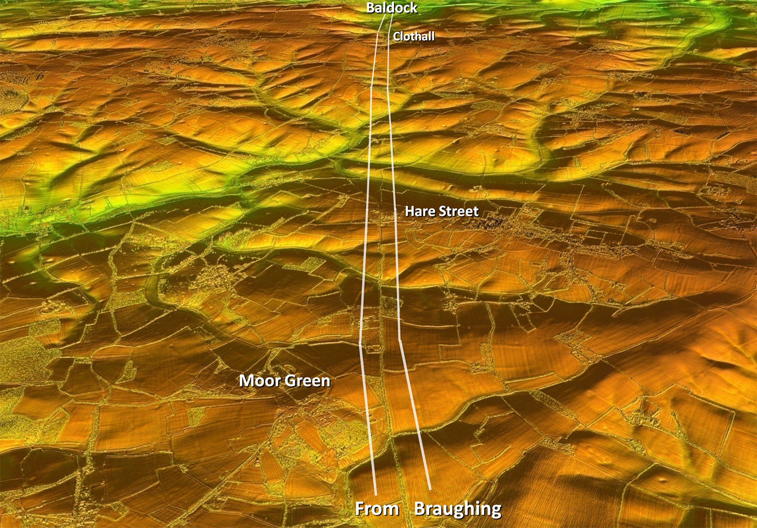
The road to Baldock clearly branched off Ermine Street but the first section was unknown. |
Click for larger view |
 |
High
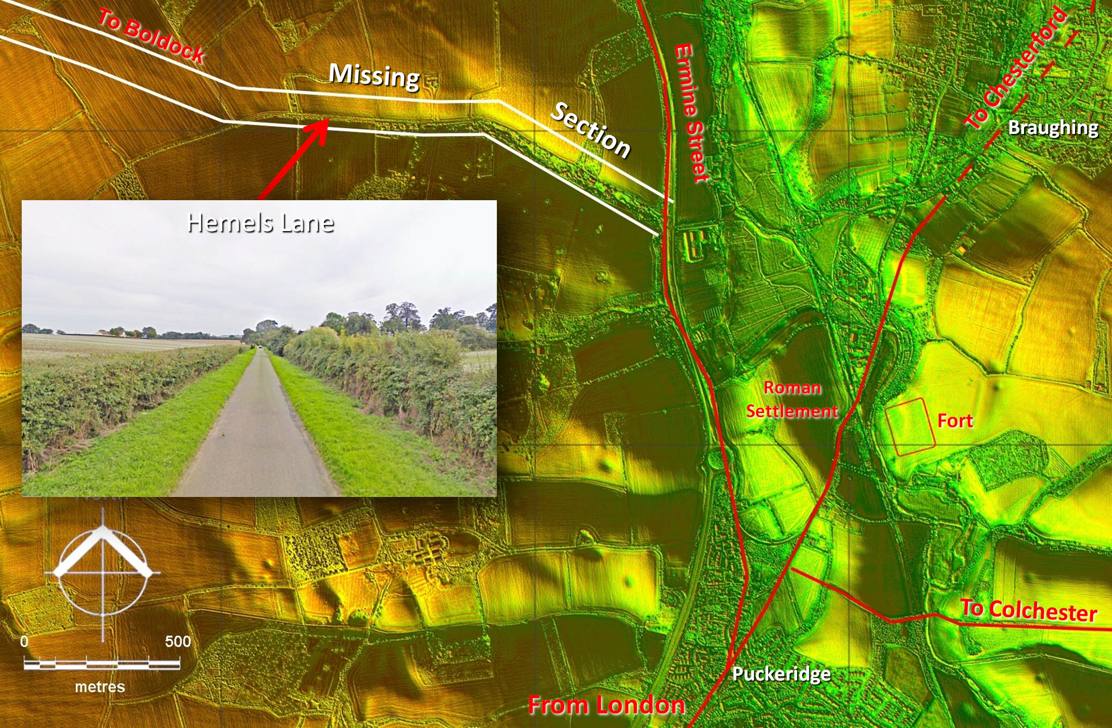
Quite why there was any doubt for the location of the connection between the road to Baldock and Ermine Street is a puzzle. The known section, confirmed by Lidar, clearly emanated from a natural valley making an easy link possible. In this valley is a typical Roman agger comprising two straight sections now overlain by a much narrower modern lane |
Click for larger view |
 |
High
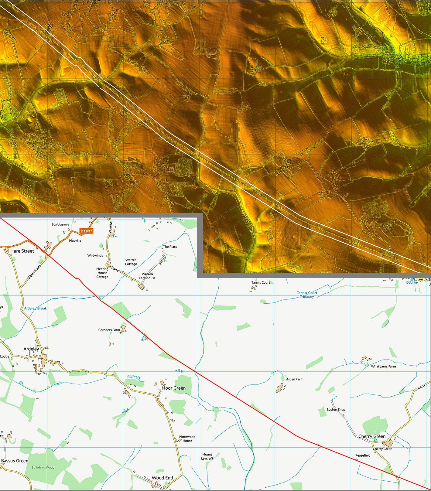
A bit of a clue in the name of Hare Street. Perhaps hares used the Roman agger for their high speed runs - quite an appealing thought |
Click for larger view |
 |
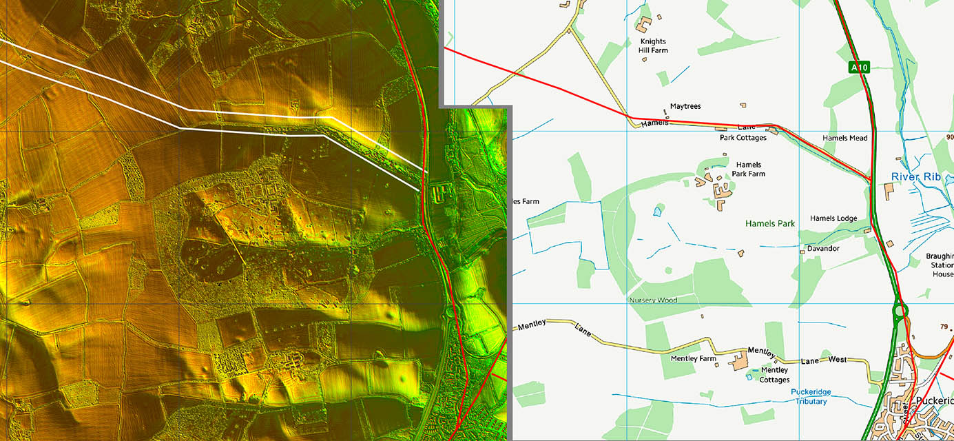
Hare Street
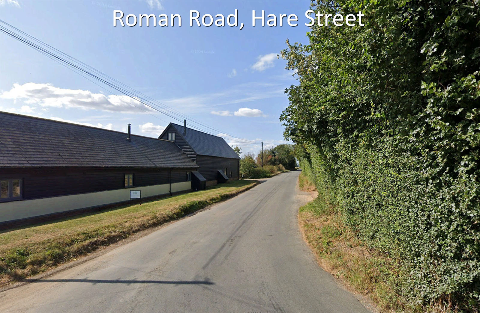
Passing Hare Street Farm Barns the B1037 follows the Roman road for a short length.
Image: Google |
Click for larger view |
 |
High
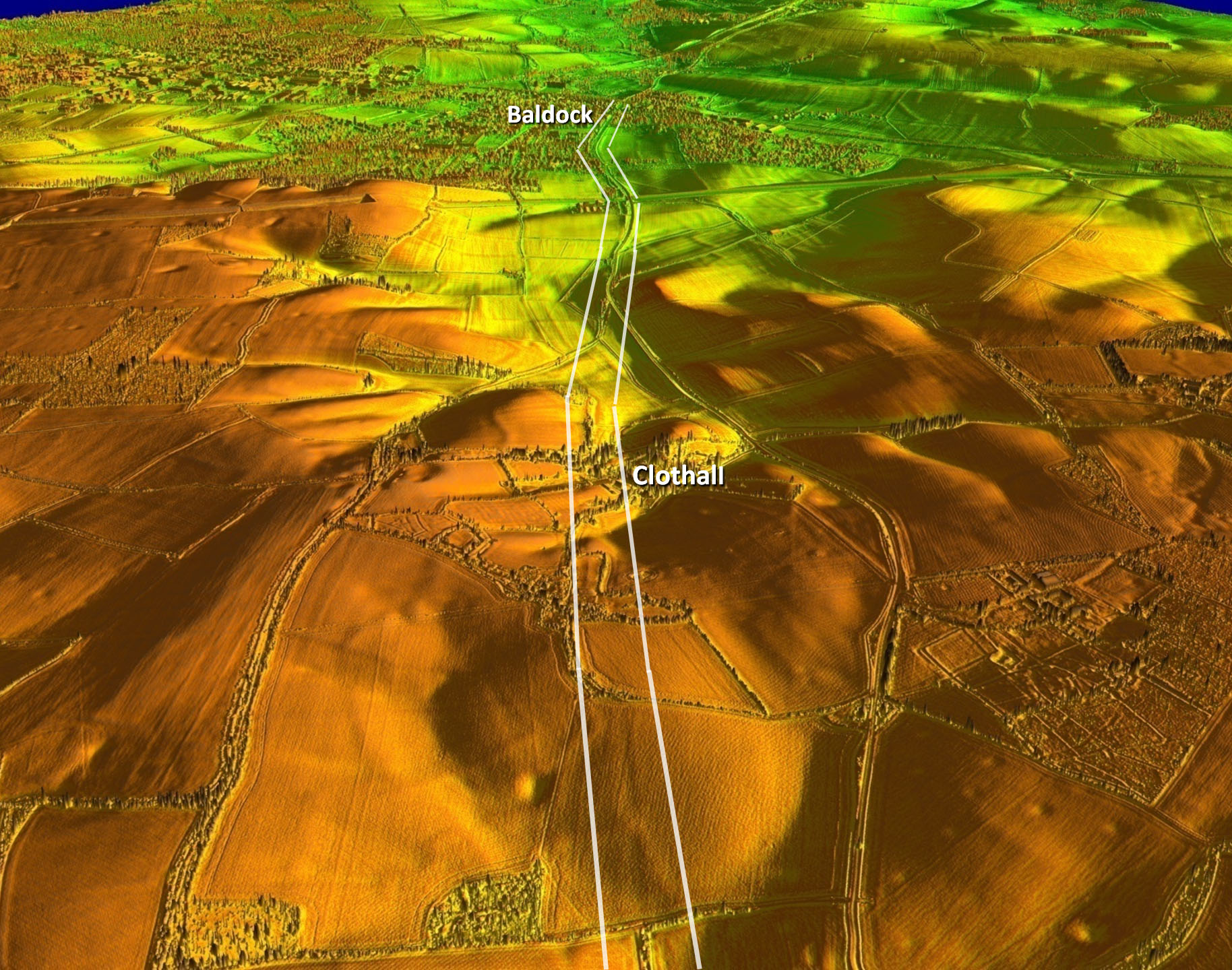
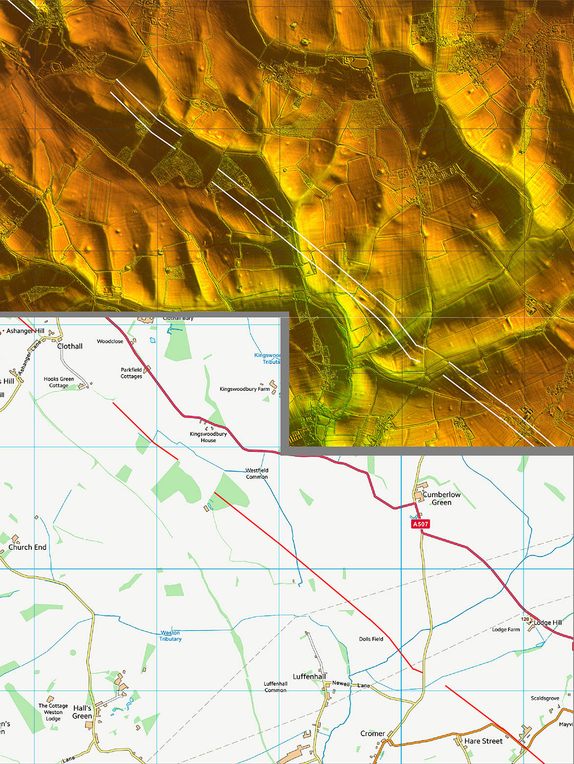
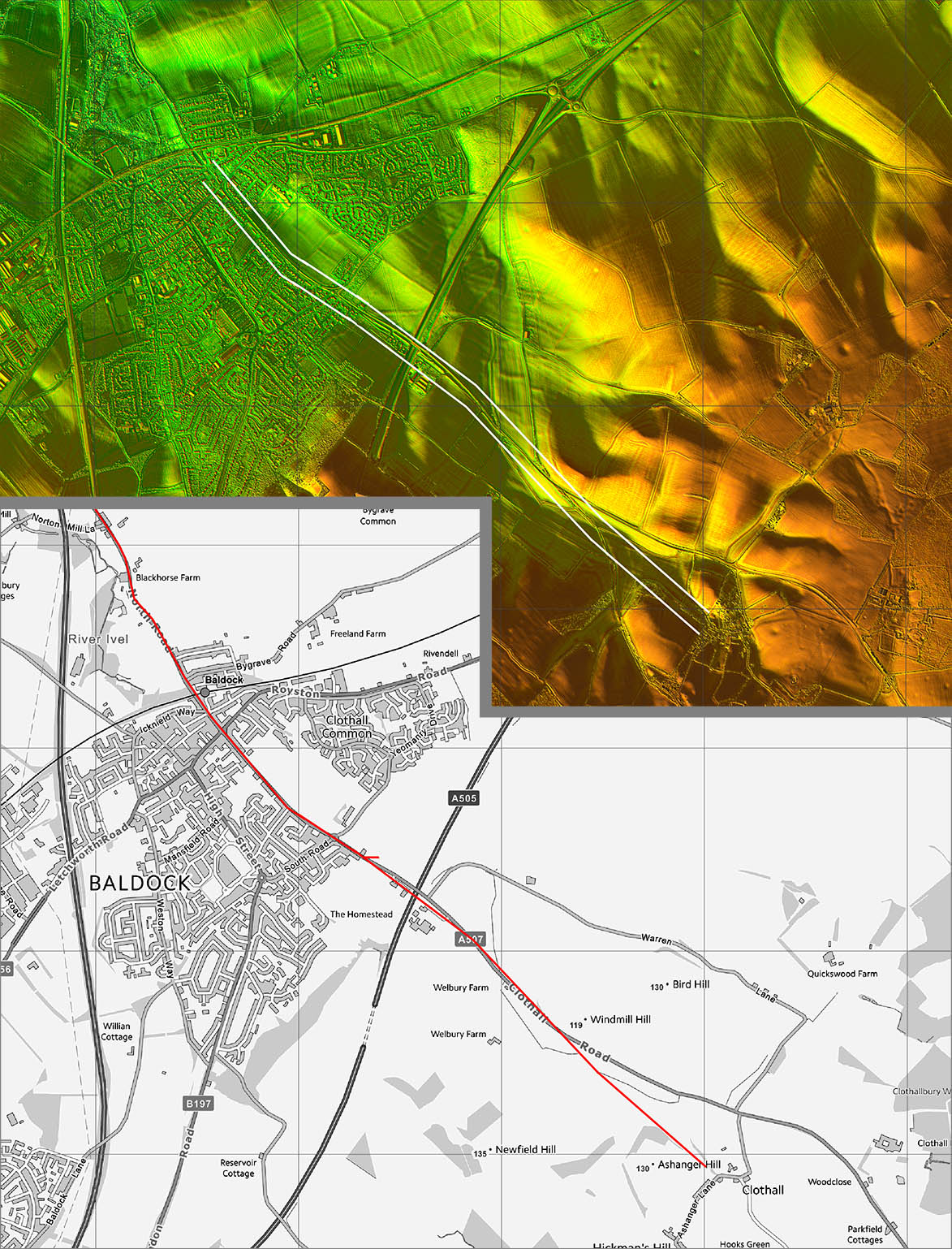
Final approach to Baldock is faint in places but not in doubt. |
Click for larger view |
 |
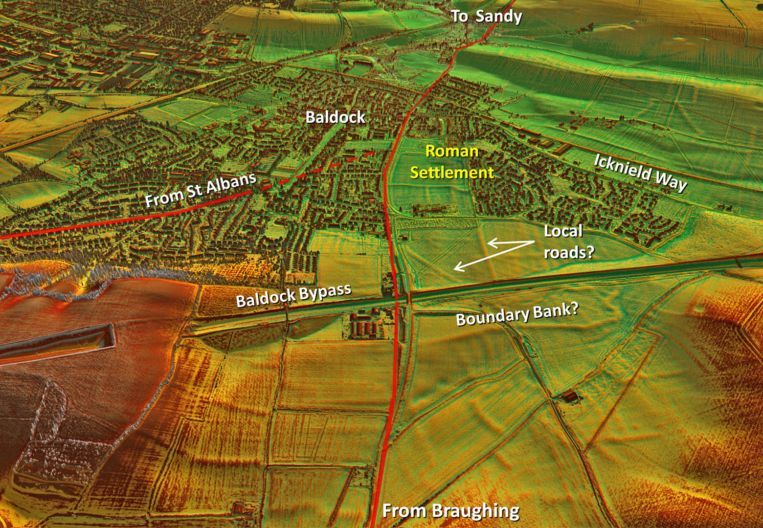
Oblique 3D Lidar Image - Baldock
Baldock was a small sized town located on the (pre-Roman) Icknield Way. There are no reports of it having town walls although the Lidar does show what could be boundary banks just to the north of the road coming in from Braughing. Stone buildings are recorded as is a temple. Alongside the road from Braughing, at Clothall Common (Baldock), was found a Roman curse written on a sheet of lead (RIB 221 - Curse upon Tacita).
The road continued on to Sandy in Befordshire. |
Click for larger view |
 |
Lidar Image and Route Map 1
|
Click for larger view |
 |
Lidar Image and Route Map 2
|
Click for larger view |
 |
Lidar Image and Route Map 3
|
Click for larger view |
 |
Lidar Image and Route Map 4
|
Click for larger view |
 |