title

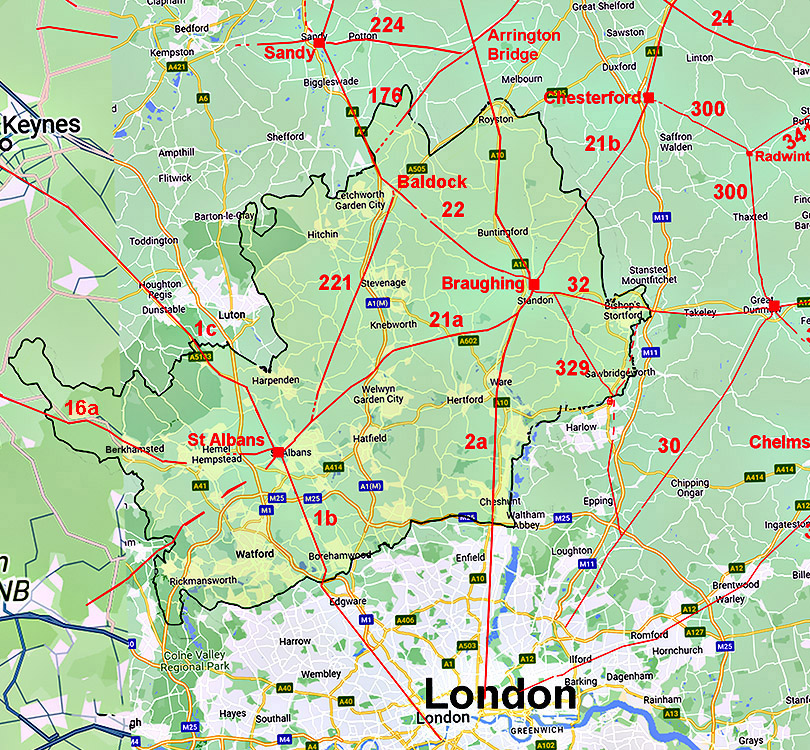
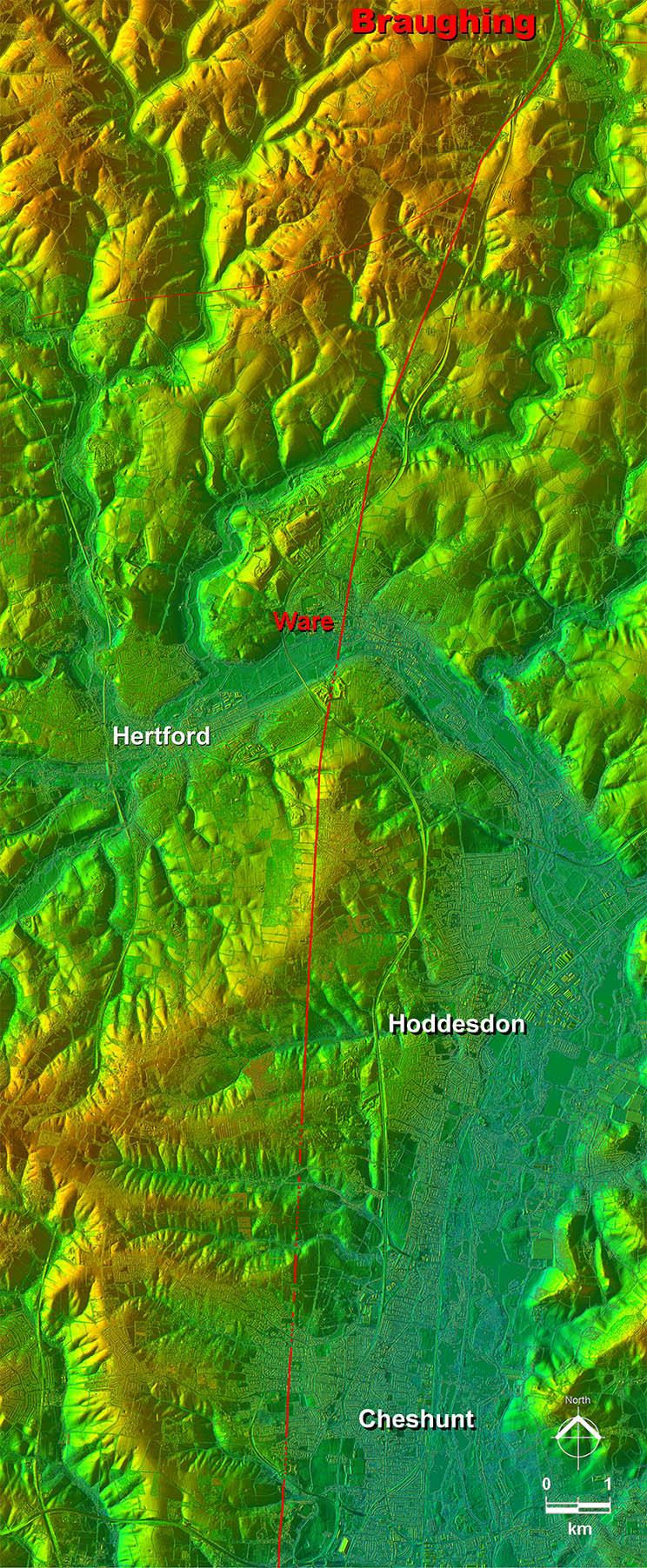
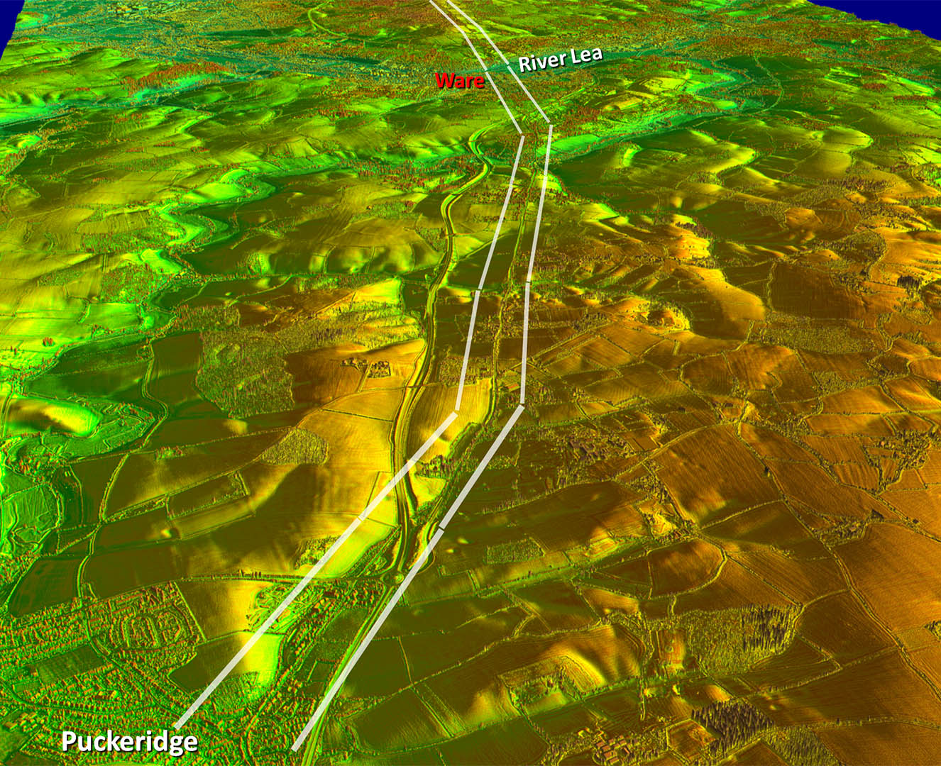
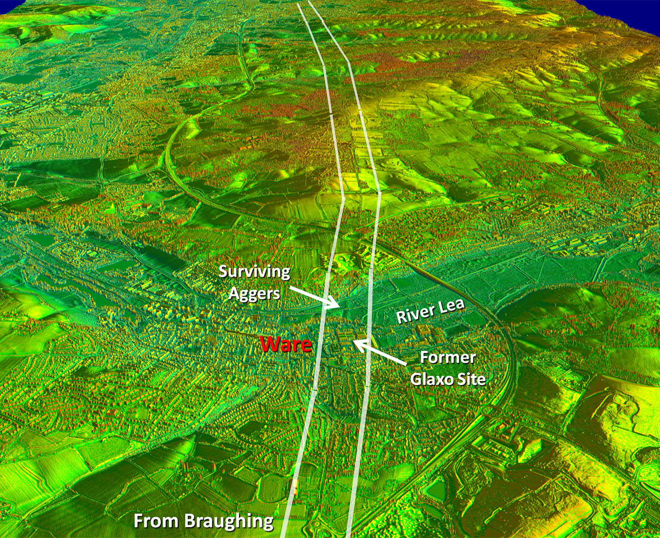
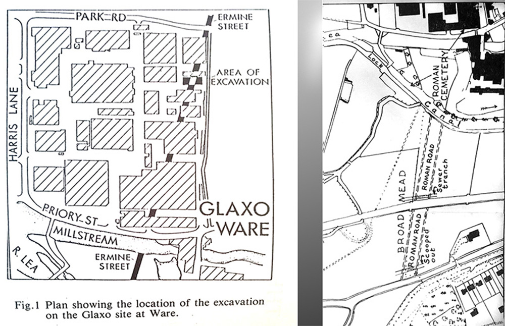
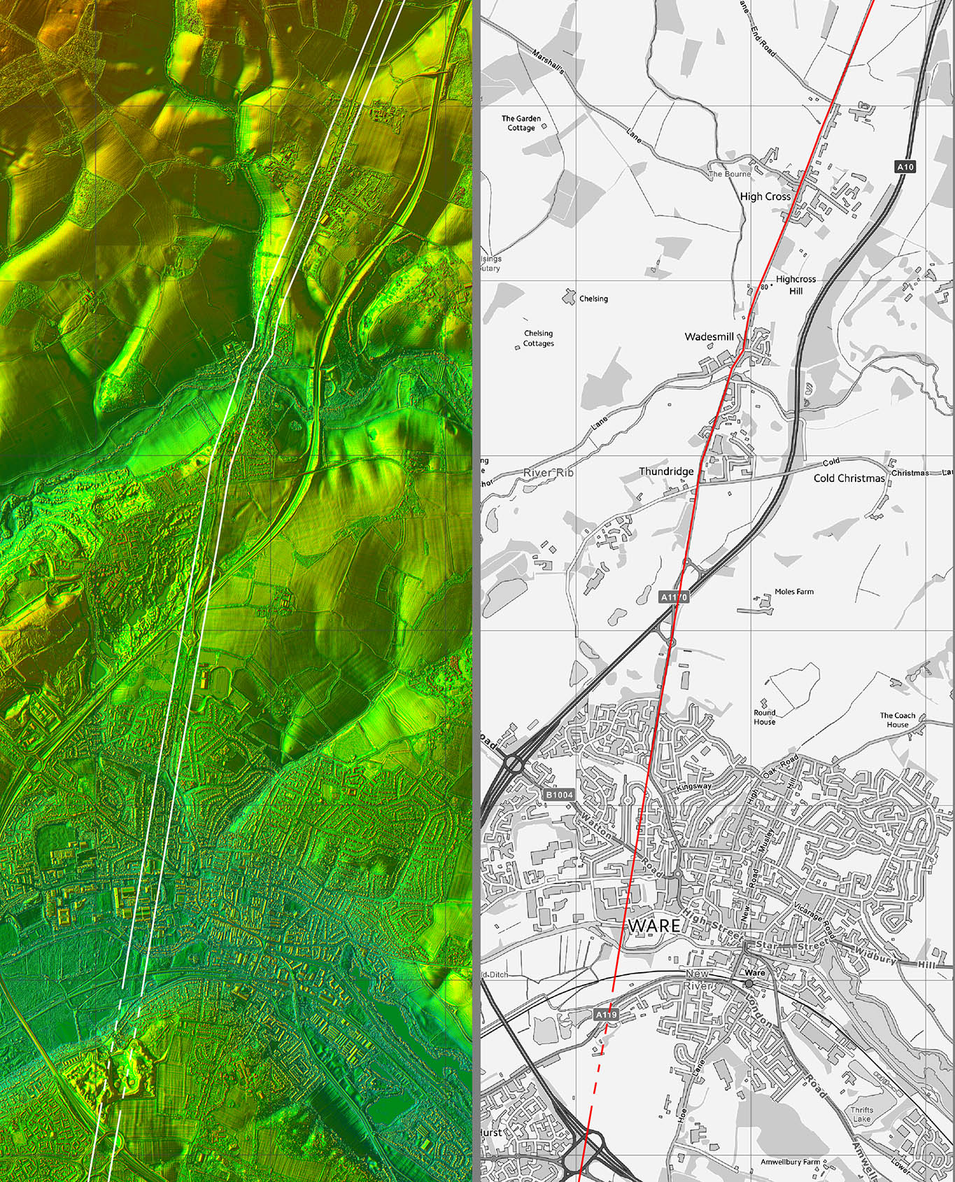
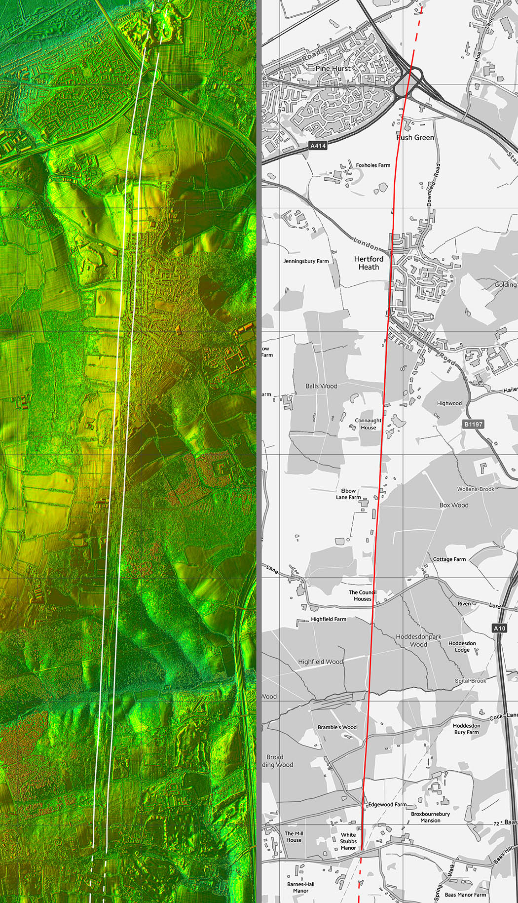
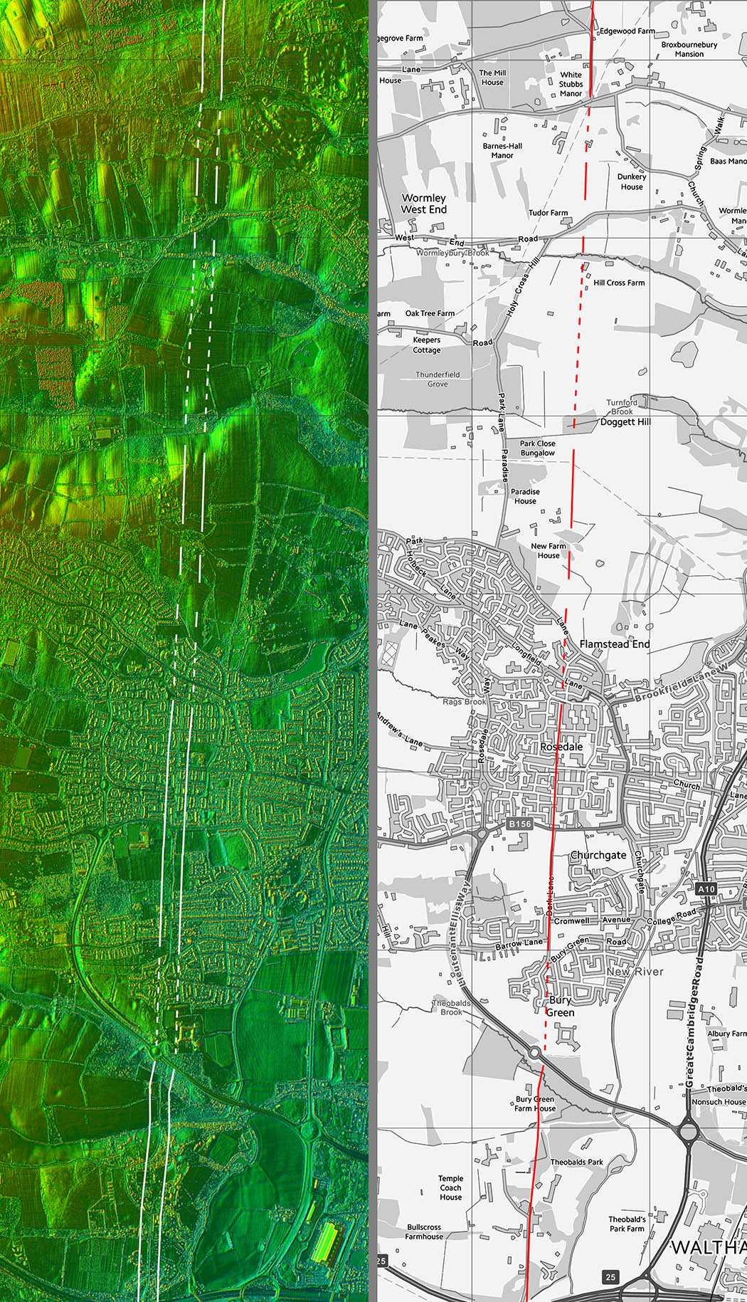
Ermine Street, Braughing South to London

Margary Number: 2a

Distance: 15 miles (to M25 Motorway)

Very direct road to London although the crossing of the River Lea at Ware was obviously a key point. This was a pre-Roman settlement so probably indicates Ermine Street was based on an earlier track way.

Ware became a substantial Roman town with many finds including several buildings including pottery kilns, a slave shackle, jewellry and ladies’ toilet implements, e.g. eyebrow tweezers. Around the settlement were many cemetery sites.


Historic Counties: Hertfordshire

Current Counties:Hertfordshire

HER: Hertfordshire


location


Lidar Image - Full Route from

Very direct and the River Lea crossing at Ware was probably a targeted alignment point.

Click for larger view


full route

Oblique 3D Lidar Image

This view exaggerates the direction changes but the route only deviates a little from a straight line.

Click for larger view
3D lidar

Oblique 3D Image - Ware

Ware settlement was on the north side of the River Ware. Across the river's floodplain the road agger survives well.

Click for larger view
ware-3D

Ware - Excavations

The road was found in excavations where it crosses the low ground by the River Lea (Holmes) and later at the former Glaxo site (Godwin). The construction of the road (causeway) as found by Holmes at Broad mead was:-

"The whole width of the road is here 65 feet between the inner edges of the ditches ; it consists of two side portions, each about 20 feet wide, with a central and thicker roadway about 24 feet wide. The central roadway has an almost flat hard surface but the side portions arc softer and that on the east side especially is very sandy. "

Right: John Holmes, Ermine Street at Ware (Broad Mead 1952-4), East Herts Archaeological Society transactions Vol XIII part II, p156-8, 1955.

Left: Nicola Godwin, The Ermine Street at Ware (Excavations at the Glaxo site 1989), Hertfordshire Past & Present, vol 31, p 21-24, 1991..

Click for larger view
excavations

Hertford Heath

South of the River Lea then Elbow Lane on Hertford Heath follows the line and there is even a sign to prove it.

Image: Stephen Craven licenced for reuse under the Creative Commons Attribution-ShareAlike 2.0 licence.

Click for larger view
ermine street sign

Alternative Route - Wormley

Further south passing Wormley the traditional/HER route dog-legs a little to the west. There does not seem any reason for this and there are a couple of Lidar clues strongly suggesting that the road carried straight-on.

Click for larger view
Wormley- ALternative Route

Lidar Image and Route Map 1


Click for larger view
map1

Lidar Image and Route Map 2


Click for larger view
map2

Lidar Image and Route Map 3


Click for larger view
map3

Lidar Image and Route Map 4


Click for larger view
map4

Back to Hertfordshire homepage

Last update: March 2025

© David Ratledge