
|
Watling Street - St Albans NorthMargary Number: 1cDistance: 13 miles (to Chalk Hill) Watling Street was one of the Roman's major roads running from Dover to London and on via St Albans to Wroxeter. Margary allocated it as his number 1 indicating how he viewed its importance. This section was part of Antonine Itinerary II which gives us the name of the small Roman settlement at Dunstable, known as Durocobrivis Watling Street is traditionally cited as having been the location of the Romans' defeat of Boudica, though precisely where on the route has never been determined. |
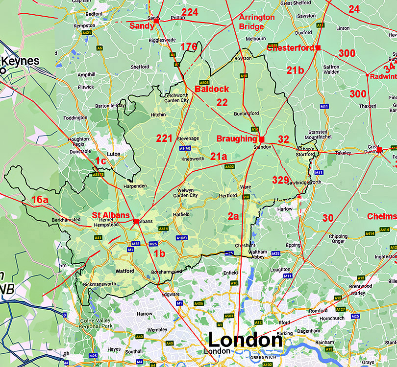
Historic Counties: Hertfordshire Current Counties:Hertfordshire HER: Hertfordshire
|
|
|
|
|
|
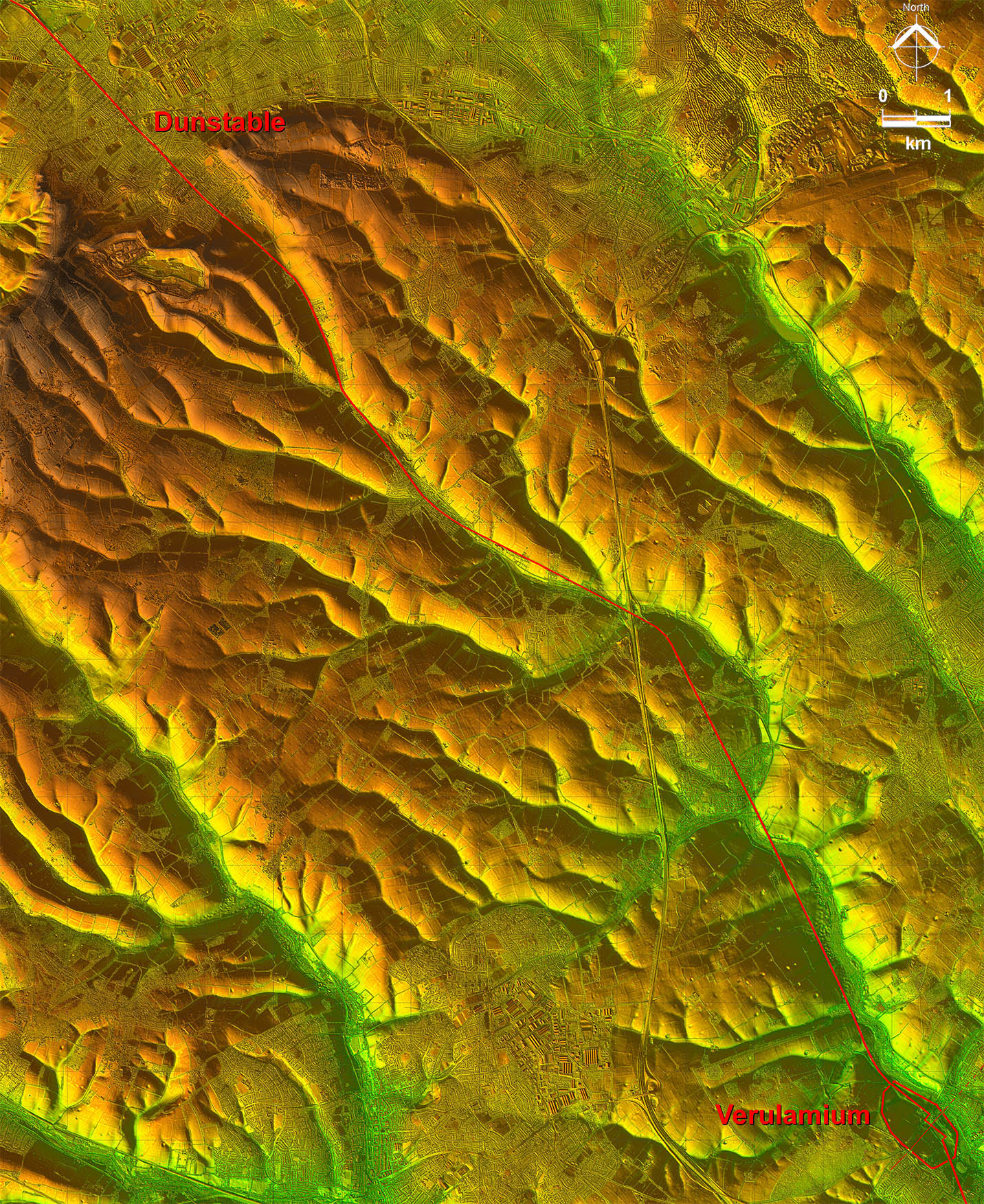
Lidar Image - Full Route from St Albans to Dunstable This Lidar image shows how cleverly the road was routed through several valleys to Dunstable. . It was at the latter where the ancient Icknield Way crossed Watling Street. |
Click for larger view
|
 |
Oblique 3D Lidar Image - Heading out of North-west Gate The first valley the road follows is that of the River Ver. Note the cutting where the Romans excavated down, no doubt to ease the gradient. |
Click for larger view |
 |
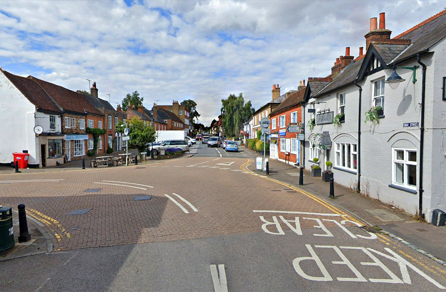
Watling Street - High Street, Redbourn Watling Street passing through the pretty village of Redbourn - looking north.
|
Click for larger view |
 |
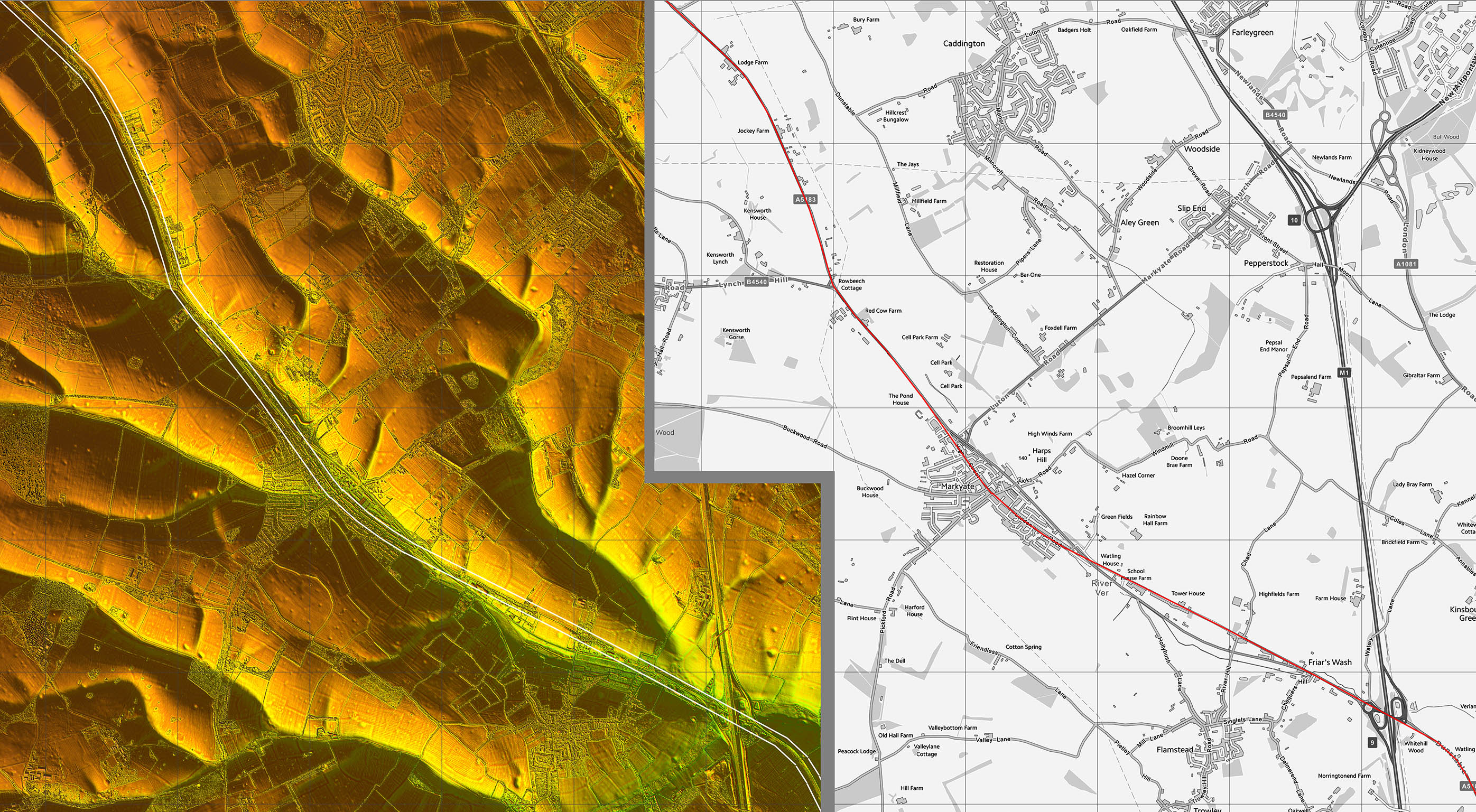
Oblique 3D Lidar Image - Approaching Dunstable Sensible route that would make the journey very easy for traffic rather than attempting a straight-line. |
Click for larger view |
 |
Lidar Image and Route Map 1 The route of Watling Street across Verulamium is by Kris Lockyear. |
Click for larger view |
 |
Lidar Image and Route Map 2
|
Click for larger view |
 |
Lidar Image and Route Map 3
|
Click for larger view |
 |
|
Last update: March 2025 |
© David Ratledge |