|
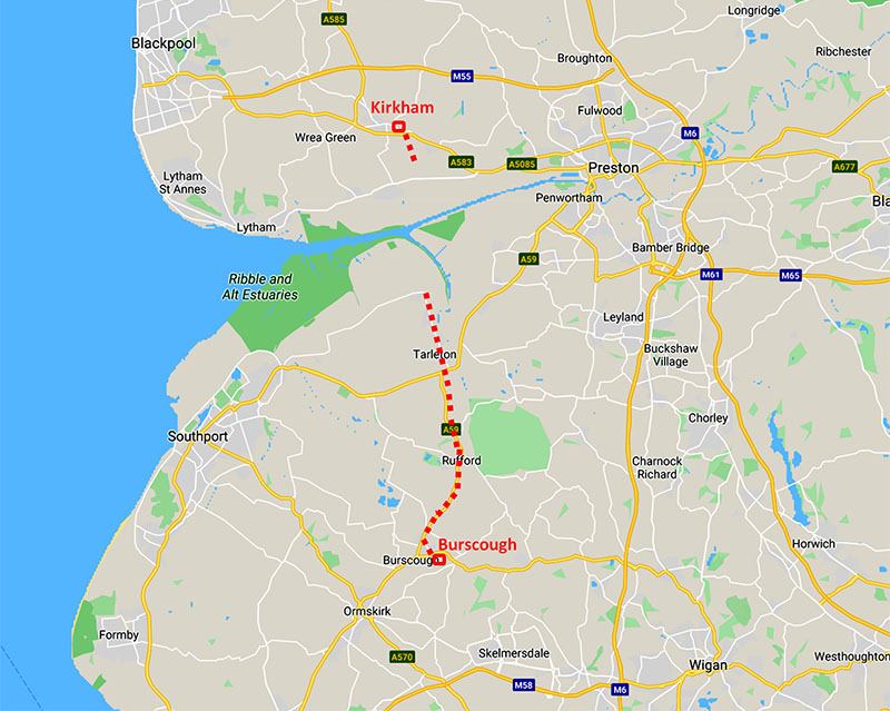
The Roman Road from Burscough to Hesketh Bank & Kirkham(?)Margary Number: NoneDistance: Burscough to Hesketh Bank 9 miles + Freckleton to Kirkham ?? miles The long suspected fort at Burscough has now been confirmed by excavation (Stephen Baldwin, CBA NW Conference 2018) and by geophys (Wigan AS, Bill Aldridge). It would undoubtedly have been connected to Wigan by a Roman road. However, the most logical explanation of Burscough Fort's location would be if it were part of an (early?) south to north road to Kirkham. There is some evidence for a road via Hesketh Bank although the Ribble Estuary would have needed fording or crossed using a ferry. This road is best regarded as a logical possibility rather than a certainty.
|
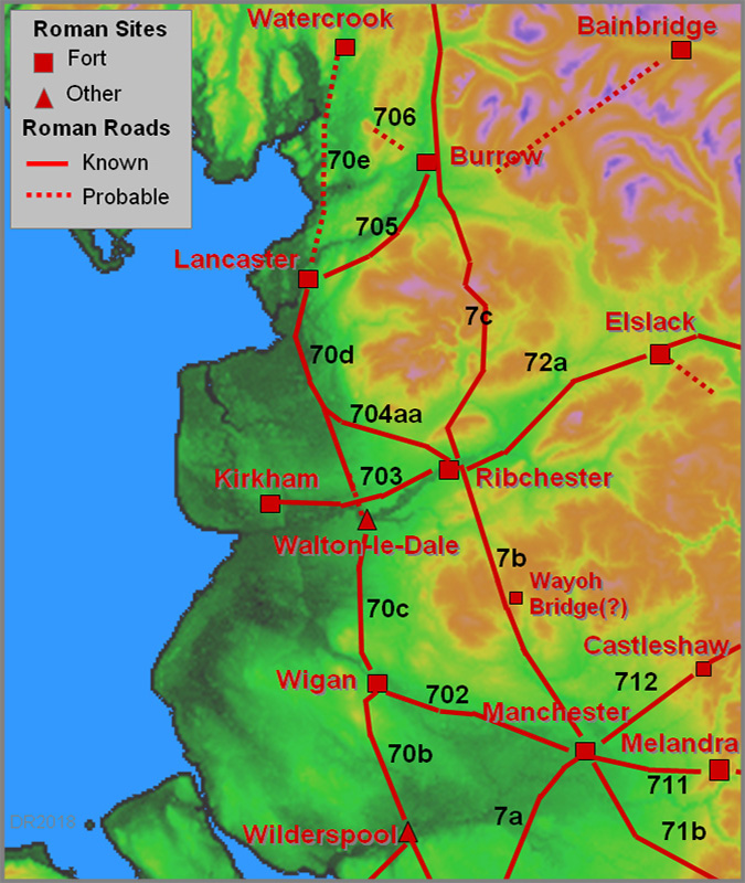
Historic County: Lancashire Current Counties: Lancashire & Greater Manchester HER: Lancashire & Greater Manchester
|
|
|
|
|
|
Lidar Image of Full Route There is some Lidar evidence that this was indeed a Roman road but perhaps not totally convincing as yet. |
Click for larger view |
|
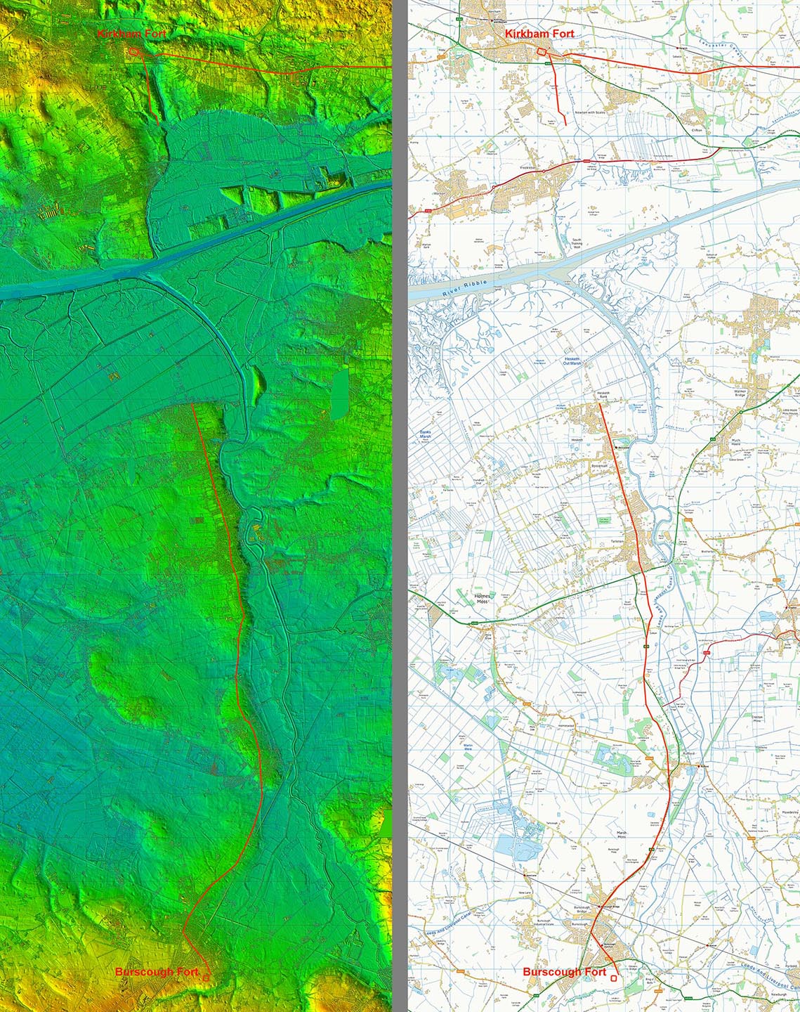
Oblique 3D Lidar View - Burscough to Hesketh Bank The location of a fort at Burscough now starts to make more sense. North of it today are the reclaimed lands formerly of the Ribble Estuary. Heading north is a narrow promontory of high ground going via Rufford and Tarleton to the old ford at Hesketh Bank. This forms the only dry route north and reaches the Ribble Estuary opposite Kirkham. So we have a logical location for both Burscough and Kirkham!
|
Click for larger view |
 |
Lidar Image & Route Map to Hesketh Bank The route follows the narrow promontory of high (and dry) ground. It is generally followed by modern roads but in two places, north of Rufford and south of Tarleton, it diverges so can be seen in the Lidar data. Note Causeway End Farm between Burscough and Rufford - perhaps a small clue that the A59 there could well represent the Roman line.
|
Click for larger view |
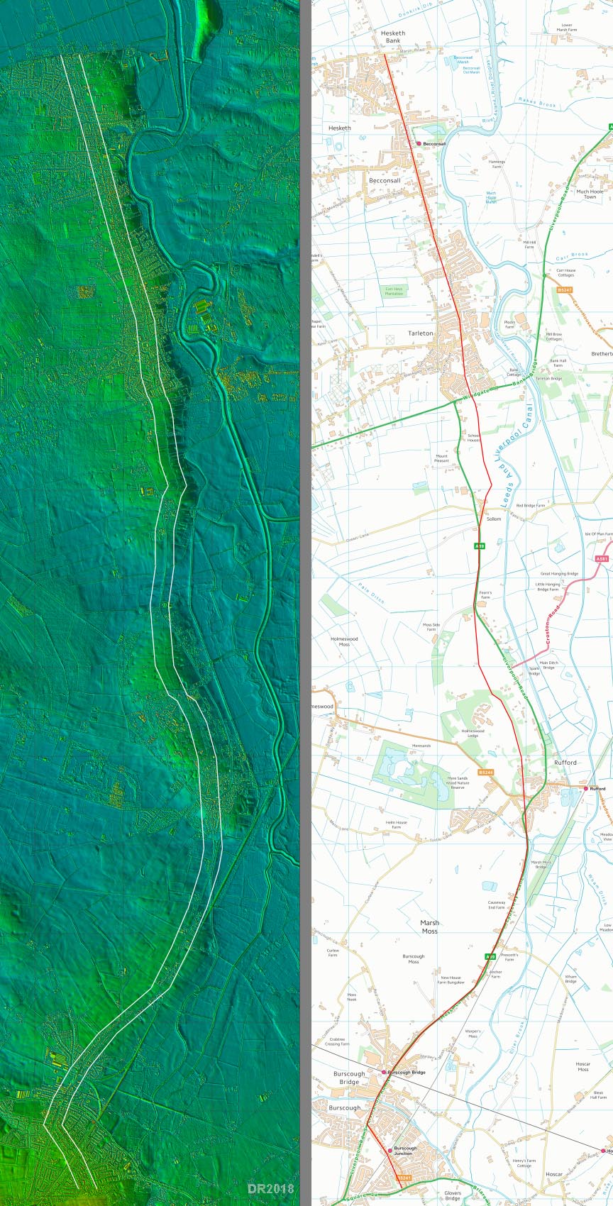 |
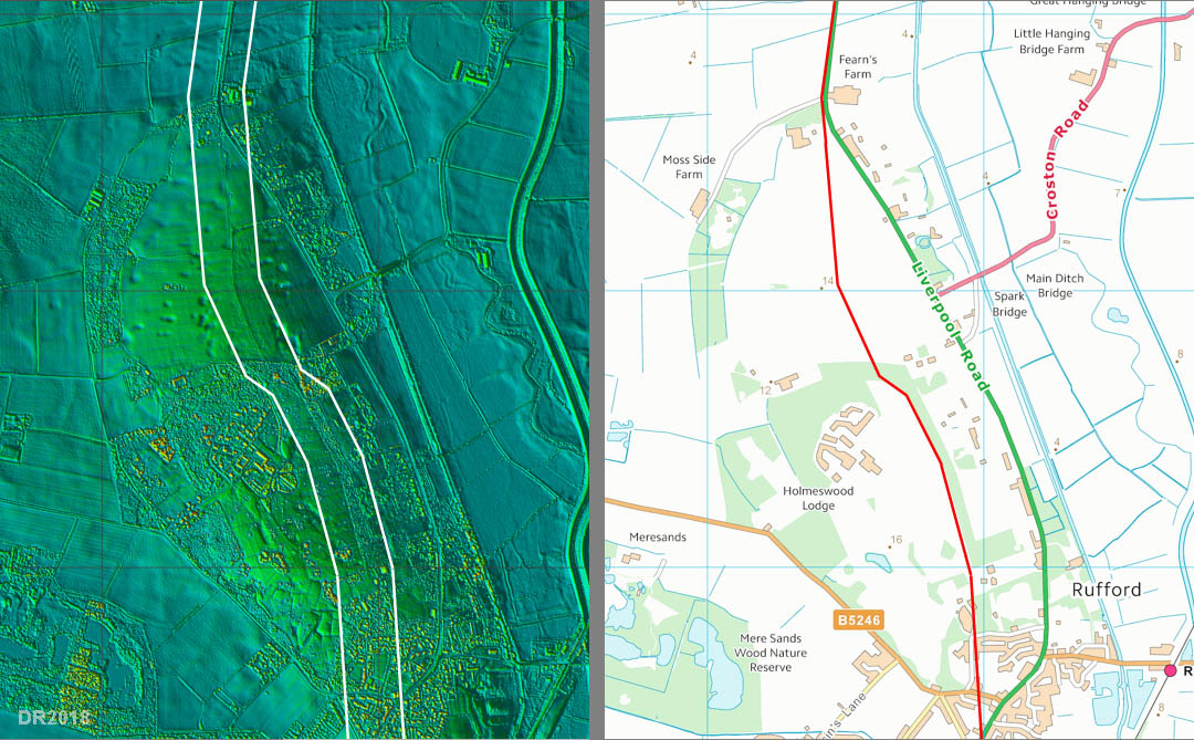
Lidar Image & Route Map - Rufford This is the first real evidence for the road as the modern A59 swings away off the probable Roman line. North of Rufford New Hall there appears to be a modern pipeline alongside the old road just to confuse the issue here but the road alignment is further west.
|
Click for larger view |
 |
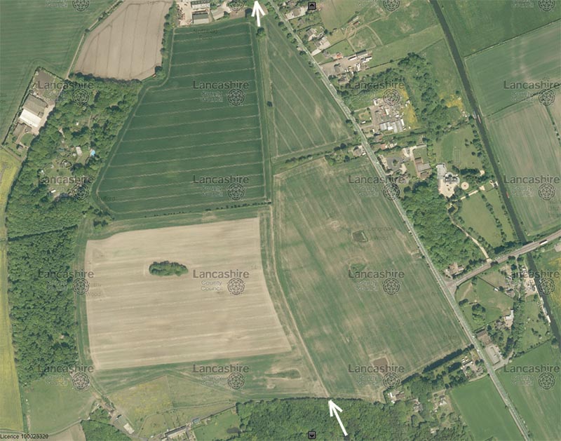
Aerial Photograph - Rufford This is the area north of Rufford New Hall. My guess is that this is the line of the original road with the modern A59 being a later turnpike bypassing Rufford New Hall. If so it could well be derived from the Roman road. See below for ground level view.
|
Click for larger view |
 |
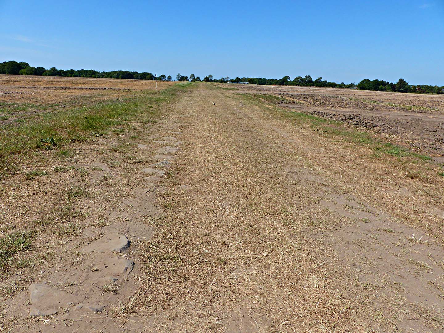
Track North of Croston Drive, Rufford During drainage works north of Rufford New Hall in 2020, Peter Cooke was able to visit and watch what was visible in the excavations. It certainly looks like an old road, has stones visible and looks far too wide for a farm track but it is not built up. Also, Peter reports that according to the drainage contractor no substantial road foundations were encountered. The assumption is a road from Burscough to Kirkham would most likely have been early and perhaps never upgraded to a typical full construction. The Wigan to Walton-le-Dale To Lancaster becoming the main stage 2 Roman road. Image: Peter Cooke
|
Click for larger view |
 |
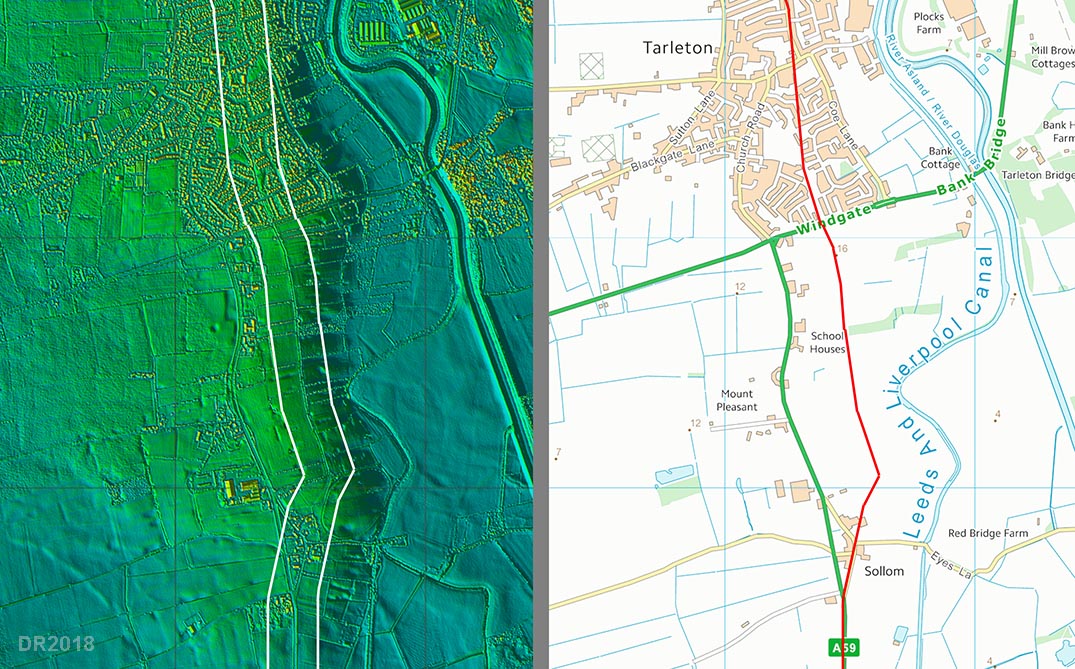
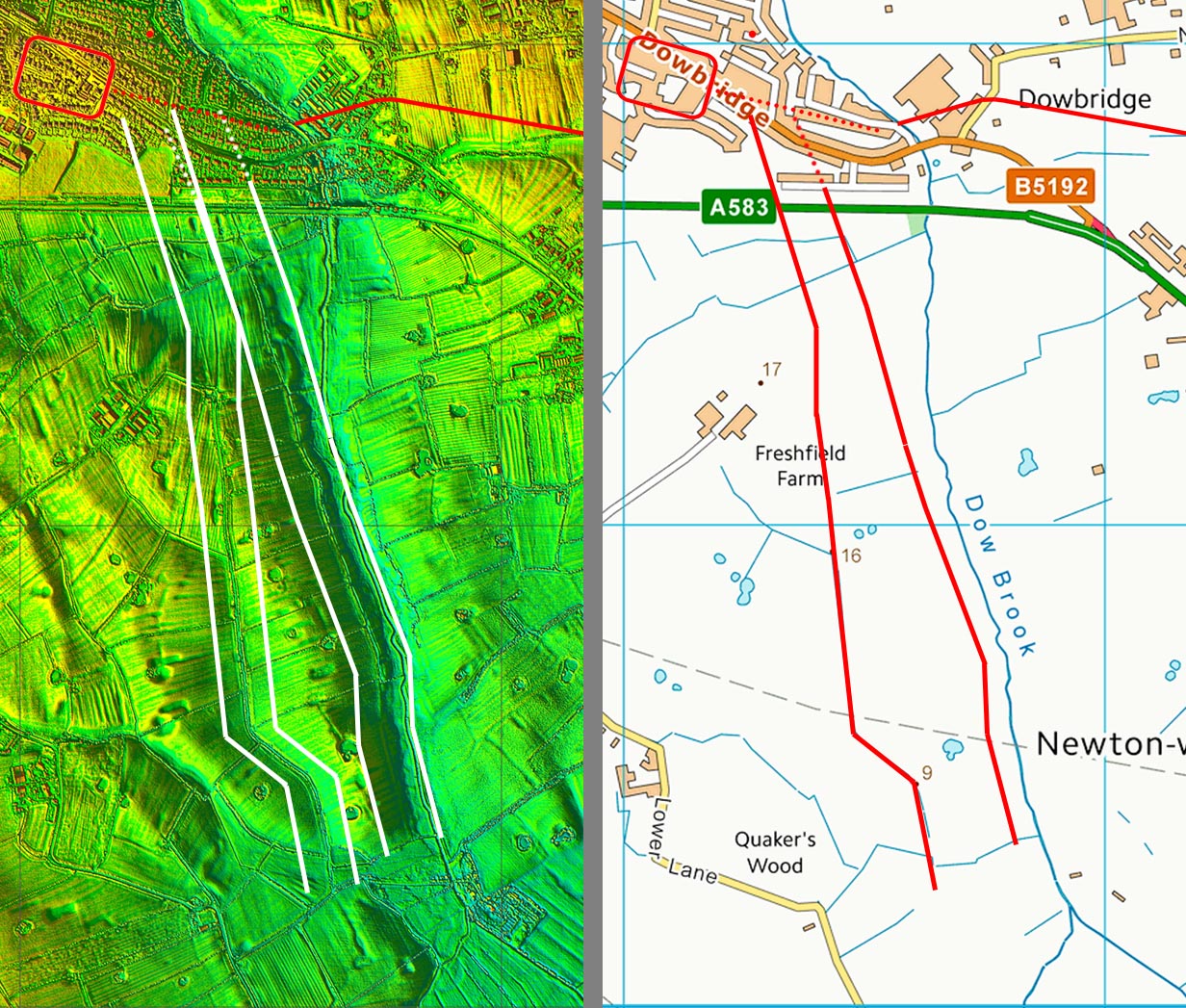
Lidar Image & Route Map - Tarleton Approaching Tarleton the modern A59 again swings off line. This stretch I would also suspect was replaced by the turnpike so almost certainly the old route and lines up perfectly with the straight road through Tarleton.
|
Click for larger view |
 |
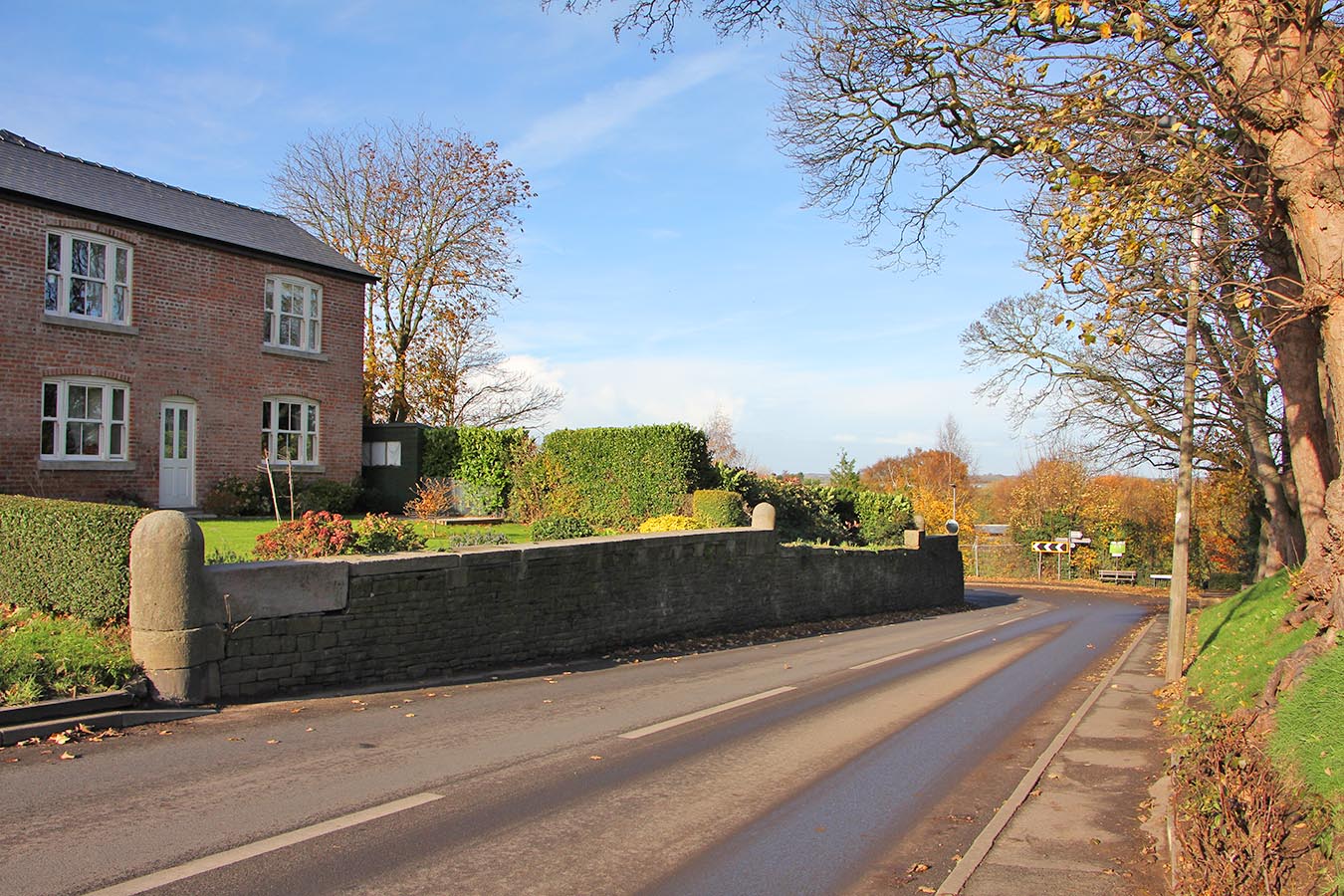
Hesketh Bank Through Tarleton the road is very direct and straight making a beeline for the old fording point. This is where the road suddenly drops down to the old shore which would have been where the T-junction is (big arrows). This point is opposite to Kirkham and was in the past the old fording point for the Ribble Estuary. There is a guide house hereabouts. Travelers would have needed a guide to cross the dangerous estuary. Note: what looks like a Roman milestone is a much later stone post. It fooled me until I took a closer look.
|
Click for larger view |
 |
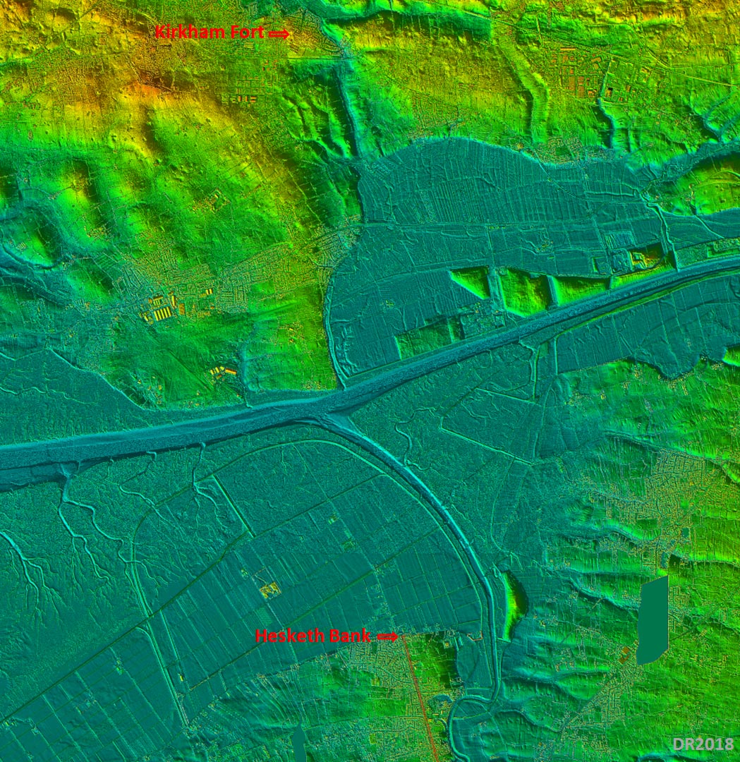
Lidar Image Ribble Estuary - Hesketh Bank & Kirkham The relationship of the road at Hesketh Bank and the fort at Kirkham becomes apparent in this lidar view of the Ribble Estuary. It is the shortest fording point for the Ribble Estuary. There is some evidence too that Kirkham may have been reduced to a later fortlet like Burscough although the results there are very confusing. They do though share a similar position west of the known road through Wigan-Walton-le-Dale-Lancaster. The latter route used lowest bridging points without the need for fording estuaries - perhaps a stage 2 route?
|
Click for larger view |
 |
Approaching Kirkham - Two Options There does appear in the Lidar imagery to be the possibility of a road south-south-east from Kirkham fort down to the former Ribble Estuary. This would probably have been the location of a harbour for Kirkham and perhaps also part of the route from Burscough.
|
Click for larger view |
 |
Oblique 3D Lidar Image - Approaching Kirkham 3D version of above withe the westerly option indicated. This is my slight preference but the easterly one could be valid. Either way is does show the relationship of the fort to Ribble Estuary and a possible harbour site.
|
Click for larger view |
 |
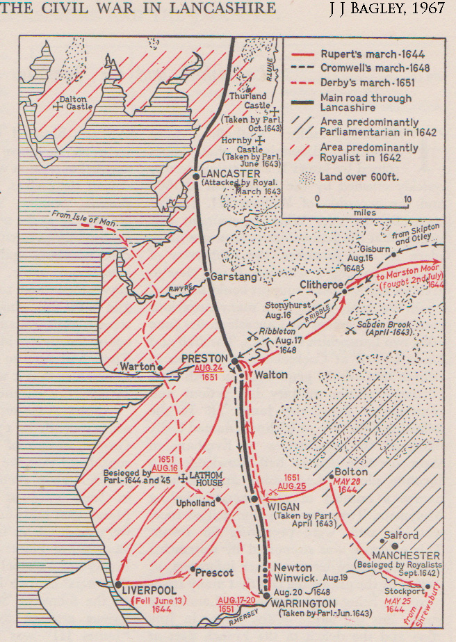
Bagley's Map & Derby's 1651 Route The relevance to this road is Derby’s 1651 invasion route depicted on Bagley's map. This appears to have been Knott End, Kirkham, The Naze, Hesketh Bank, Burscough, Up Holland and down to Warrington. Presumably he would have followed a road rather than ploughing across fields. At that date then Roman routes were still the only option. The section from Kirkham to Lathom matches the route suggested here.
|
Click for larger view |
|
|
|
|
Last update: March 2020 |
© David Ratledge |