|
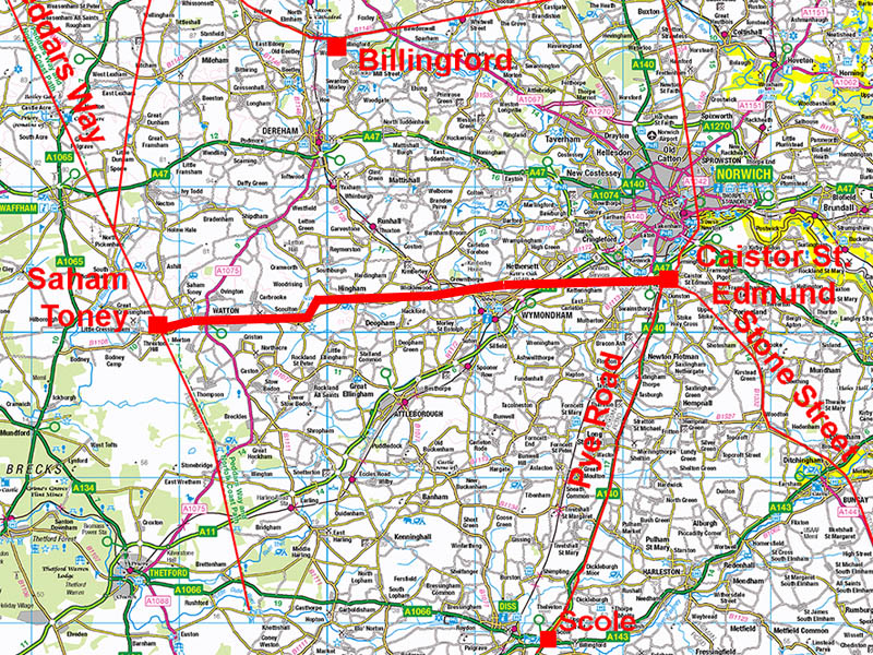
The Roman Road from Caistor to Saham ToneyMargary Number: noneDistance: 22 milesOne of the strangest roads I have ever come across! Scoulton Mere must have been of some special importance - perhaps of religious significance - as the course of this road, for seemingly no logical reason, makes a huge dog-leg around it. The Norfolk HER and James Albone plotted this road as two separate roads: one east from Saham Toney and one west from Caistor. The connection was missing and with the two roads miss-aligned it is easy to understand why they thought to be two separate ones. Finding the route at Scoulton Mere, with that huge dog-leg, solved the puzzle and created a single through route. Although it added a new puzzle as to why the Romans would do that. Saham Toney was clearly a major settlement with fort(s?) and a settlement so it was to be expected it would be connected directly to Caistor St Edmund. HER References: Road west from Caistor: 19725 NEW: Lidar Video Flyover from Caistor as far as Scoulton Mere - see below. |
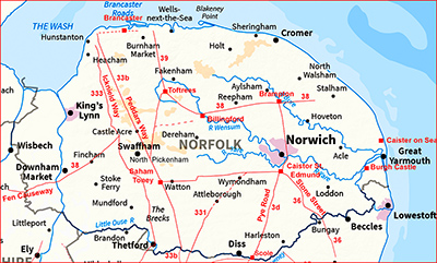
Historic Counties: Norfolk Current Counties: Norfolk HER: Norfolk
|
|
|
|
|
|
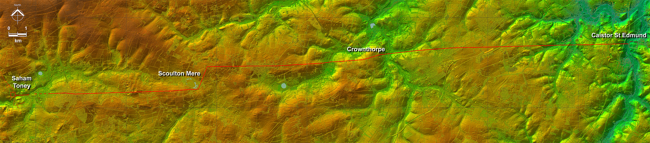
Lidar - Full Route As can seen from the topography there is nothing really to warrant that huge side step at Scoulton Mere - it had to be for some other (important) reason.
|
Click for larger view
|
 |
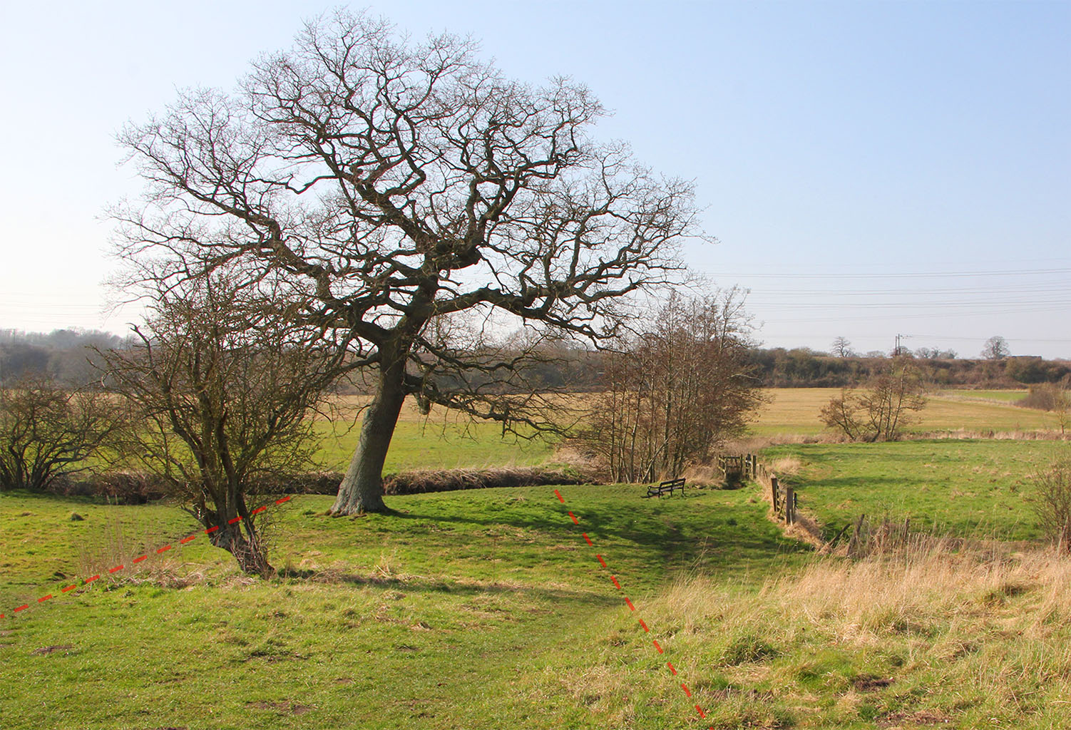
Caistor West Gate Exit Not a lot of evidence visible and the river has probably moved since Roman times. The line though was probably under the big tree. Image: DR |
Click for larger view |
 |
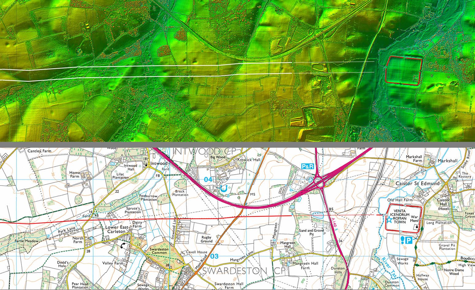
Oblique 3D Lidar - Venta Icenorum We are looking west over the Venta Icenorum Roman city. There would have been a bridge over the River Tas and there are a few remaining traces of the road to suggest that it almost certainly took a very direct course. |
Click for larger view |
 |
Lidar Image and Route Map 1 Generally this road is pretty obvious in the Lidar data but for some reason the first kilometer or so is very faint. The nearer we get to Wymondham then the better the road has survived. |
Click for larger view
|
 |
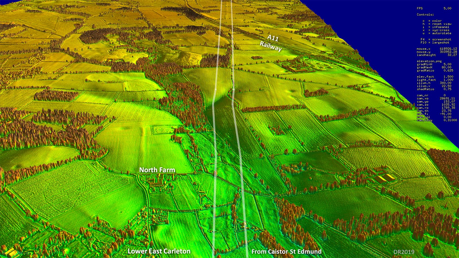
Oblique 3D Lidar - East Carleton A very slight kink to negotiate the valley at Lower East Carleton. |
Click for larger view |
 |
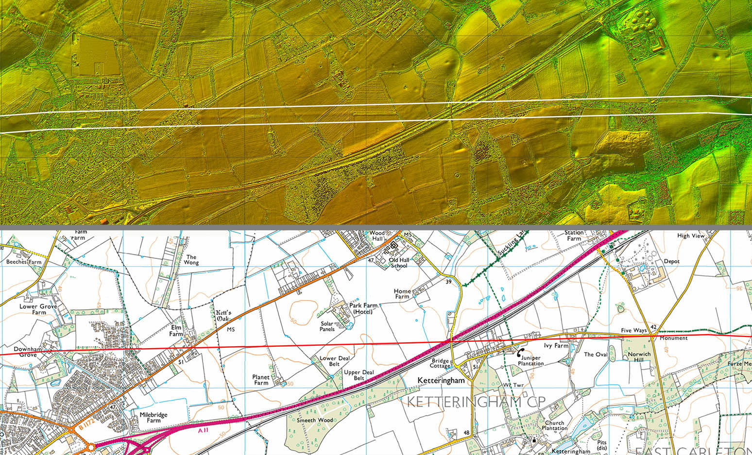
Lidar Image and Route Map 2 Once we have crossed the A11 the road agger is very clear and looks almost pristine. |
Click for larger view
|
 |
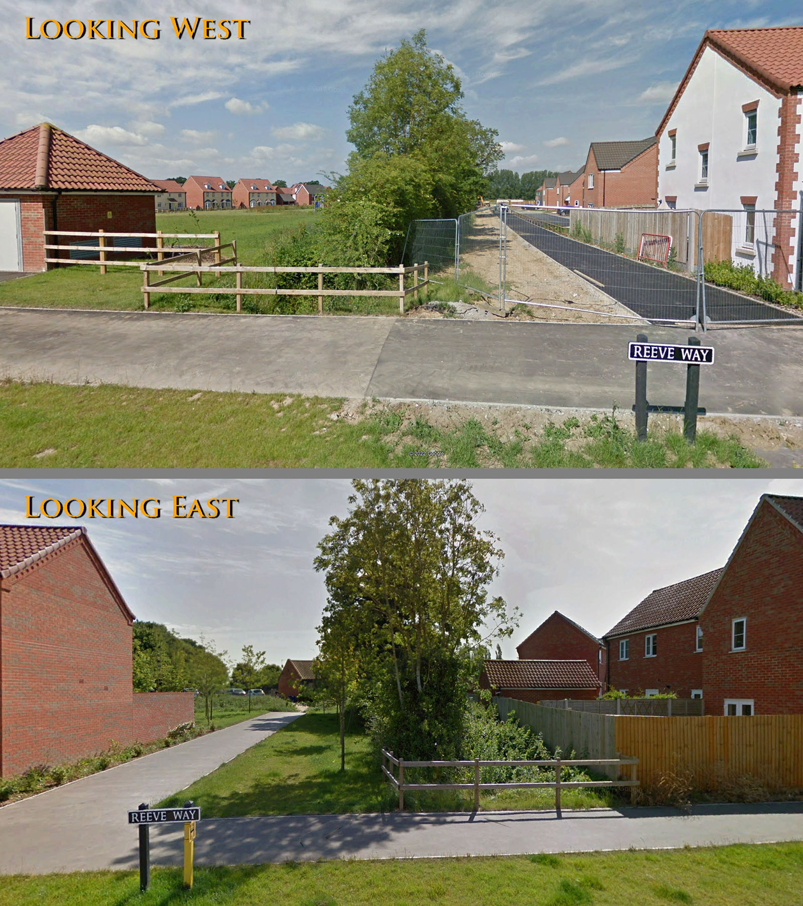
Reeve Way, Wymondham If you have visited Wymondham Rugby Club then you will have crossed the line of the Roman road. The hedgerow marks the line of the Roman road. |
Click for larger view |
 |
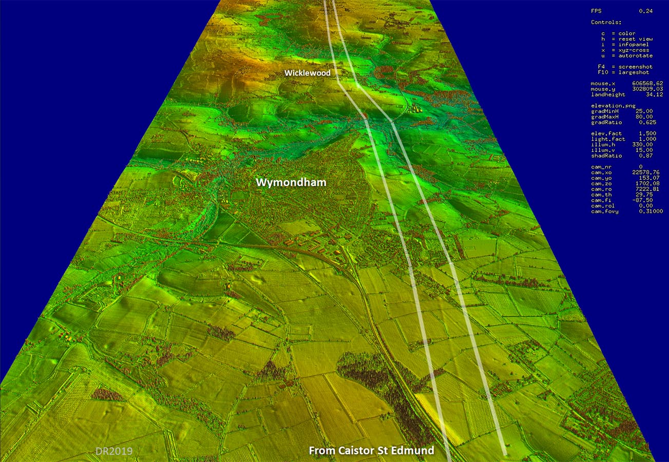
Oblique 3D Lidar - Wymondham There is a slight adjustment of alignment after Wymondham towards Wicklewood. Note for non-locals: Wymondham is pronounced Win-dum |
Click for larger view |
 |
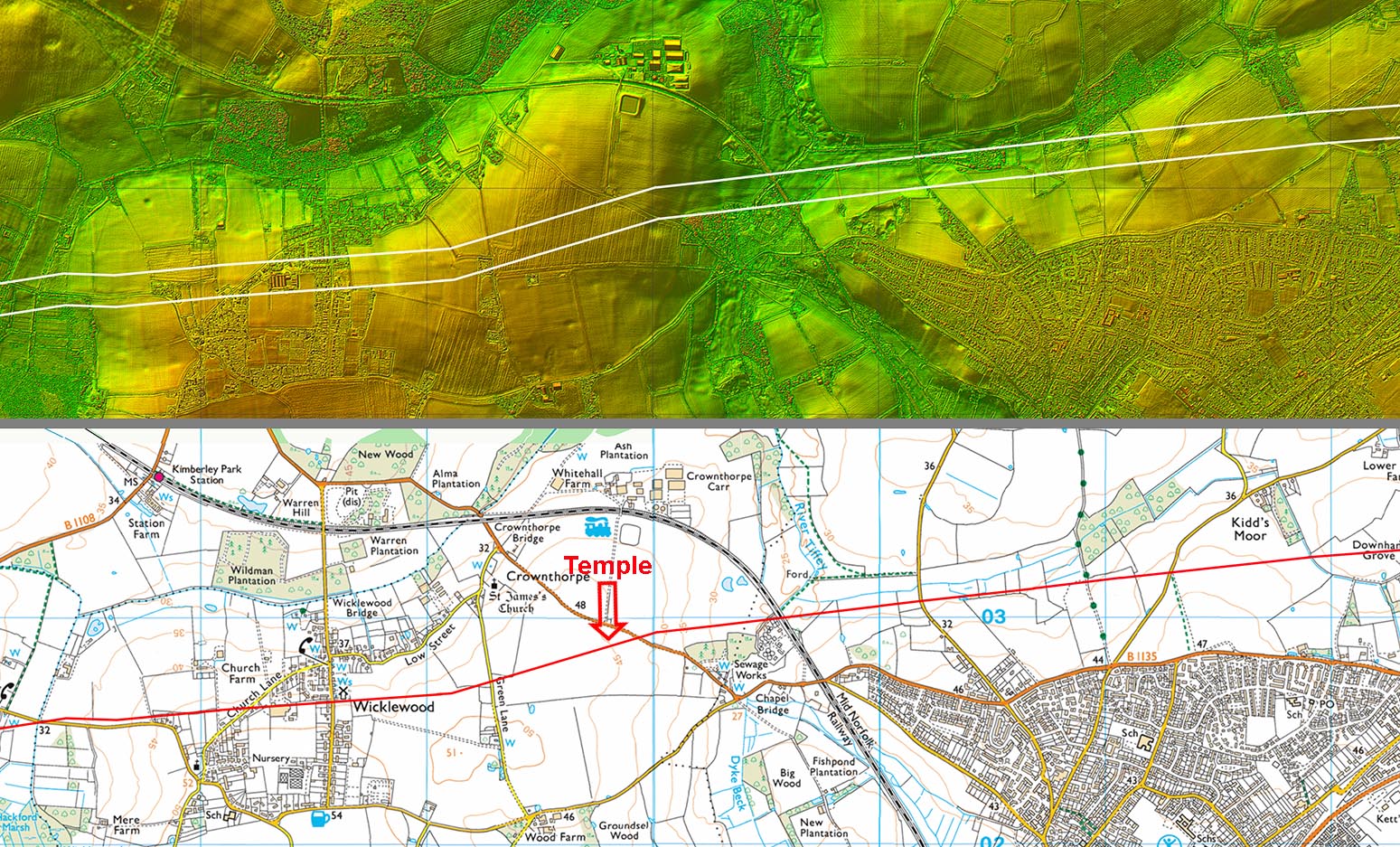
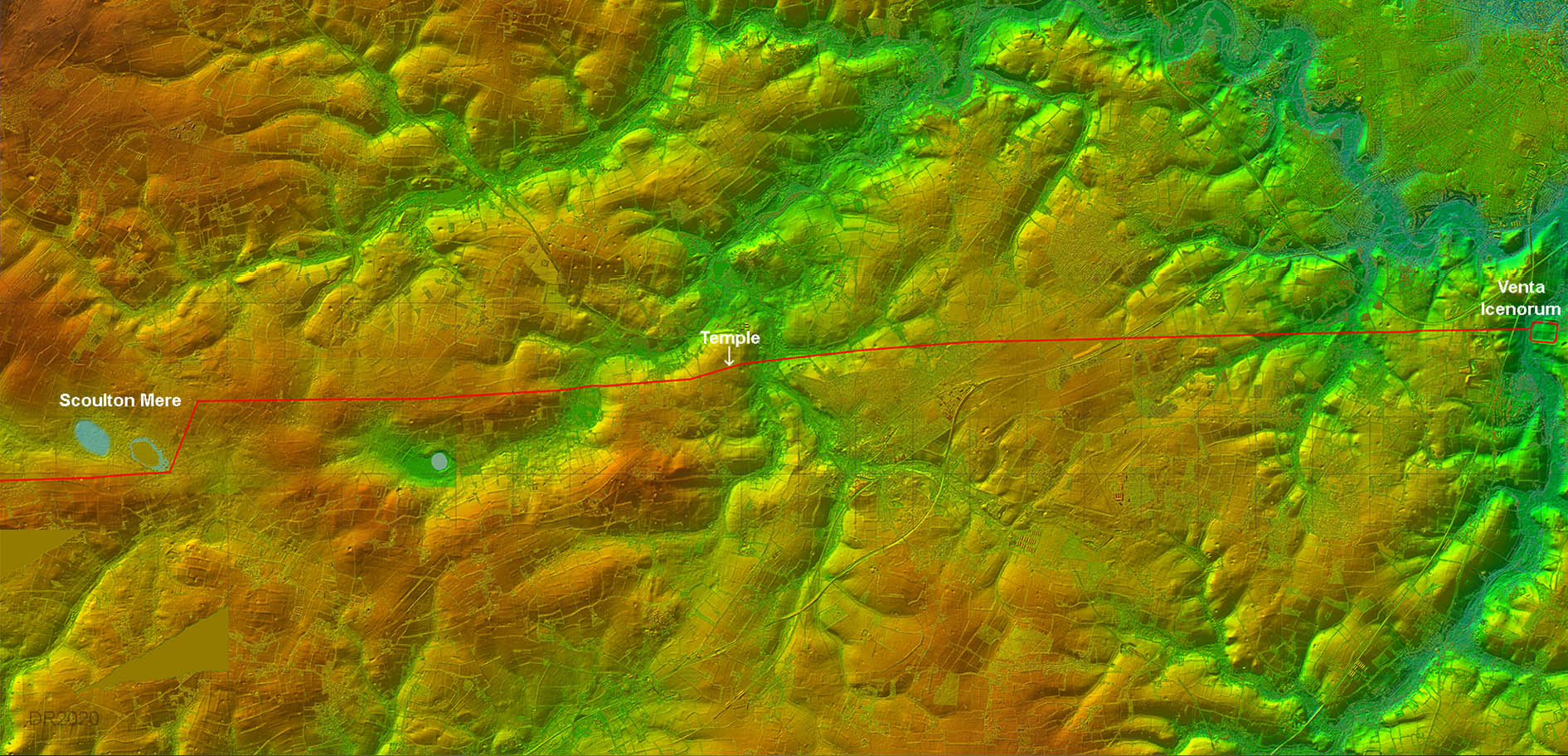
Lidar Image and Route Map 3 The slight dog-leg just west of Wymondham is where the Roman settlement of Crownthorpe is situated. There was certainly a roadside temple here (HER54693) and probably a small settlement as well. However, the field in which the settlement and temple are located appears to have been subject to deep ploughing so Lidar cannot add much if anything regarding this site. The significance of the temple might be explained by what occurs further along this road! |
Click for larger view
|
 |
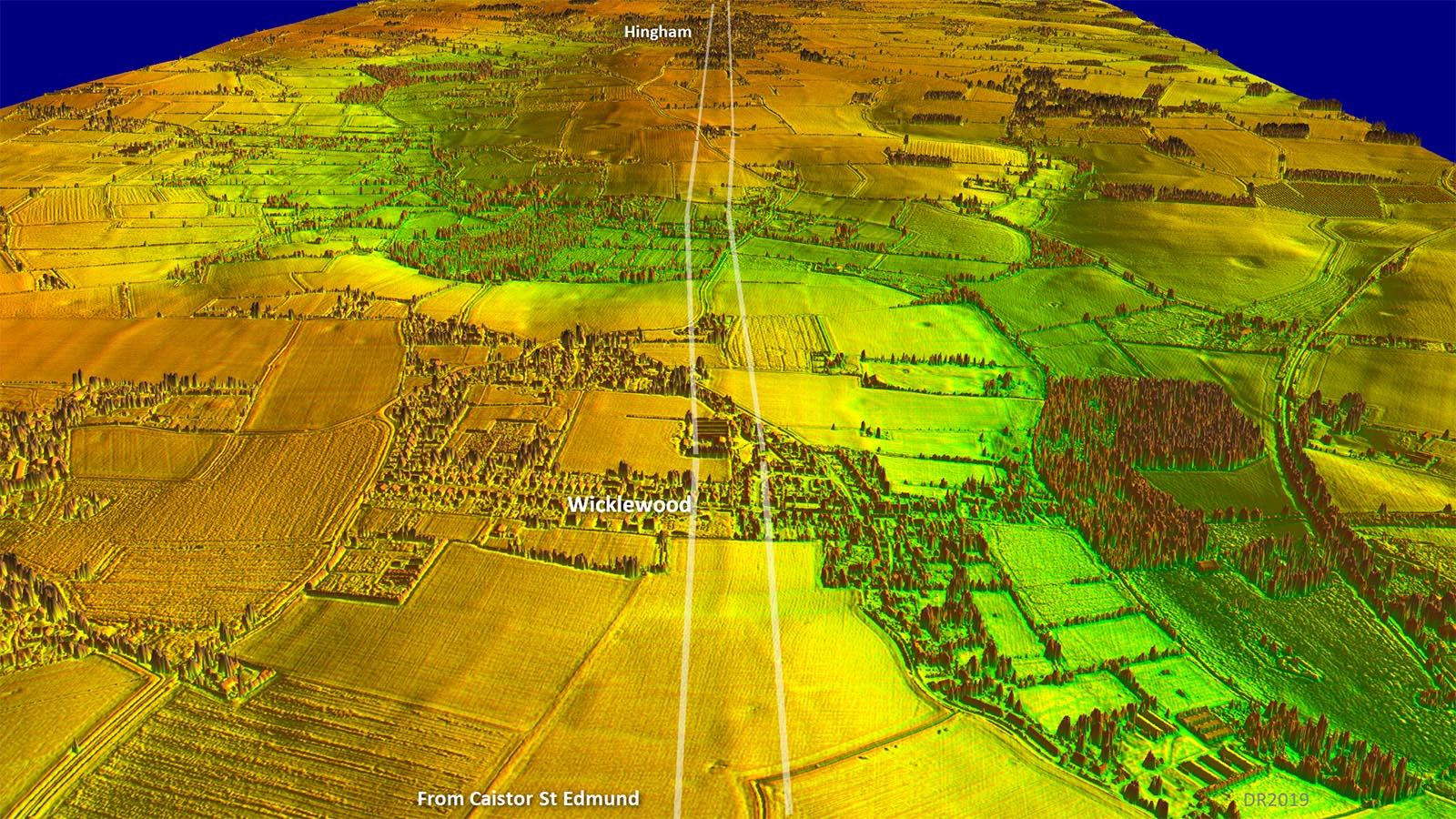
Oblique 3D Lidar - Wicklewood to Hingham We are now west of the temple site and the lidar evidence is getting fainter but still definite. |
Click for larger view |
 |
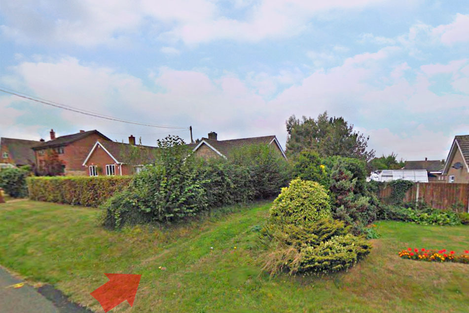
Wicklewood This grass track, opposite the famous windmill in Wicklewood, appears to mark the line of the road. Image: Google |
Click for larger view
|
 |
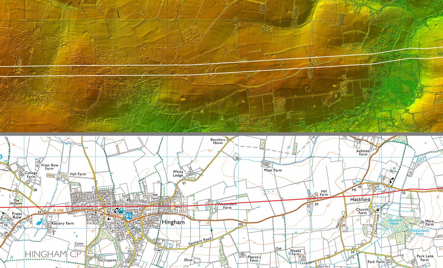
Lidar Image and Route Map 4 Between Hackford and Hingham the road agger is again clear. Across Hingham it is lost under developments but re-emerges on the same alignment when west of the village so we can be confident in its course here. |
Click for larger view
|
 |
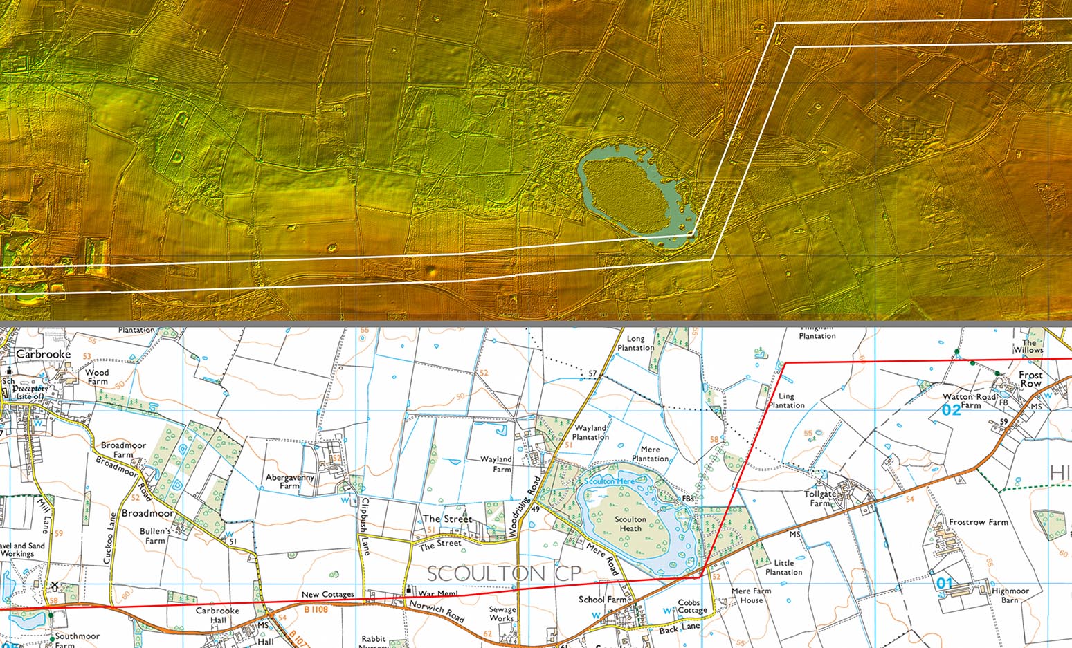
Lidar Image and Route Map 5 When tracing this road this is where I originally came to a dead end. The straight alignment all the way from Wicklewood seemed to end abruptly just north of Scoulton Mere. How could a road so obvious in the lidar disappear? It was only when I rotated the illumination angle (Sun position) in the Lidar that it became obvious that the road took a 70 degrees turn to the south followed by another at around 68 degrees on the south side of the Mere. Wow - I have never come across anything like this before and it was totally unexpected. |
Click for larger view
|
 |
Oblique 3D Lidar - Scoulton Mere The 70 degree turn seems far too extreme to be justified for finding the best route for the road. A shallower angle could have been used but for some reason it was not. |
Click for larger view |
 |
Lidar - Scoulton Mere Originally the Mere was about twice as big. The area to the west of the current mere has clearly been drained and looks to have been either a separate mere or perhaps one connected to the existing one. The west drained mere appears to have indications of a settlement within it reached by causeways - one from the north bank and one from the south bank. Norfolk's answer to Flag Fen? Note: Scoulton Mere is private. |
Click for larger view |
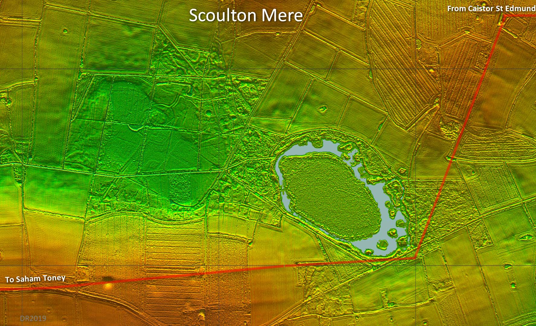 |
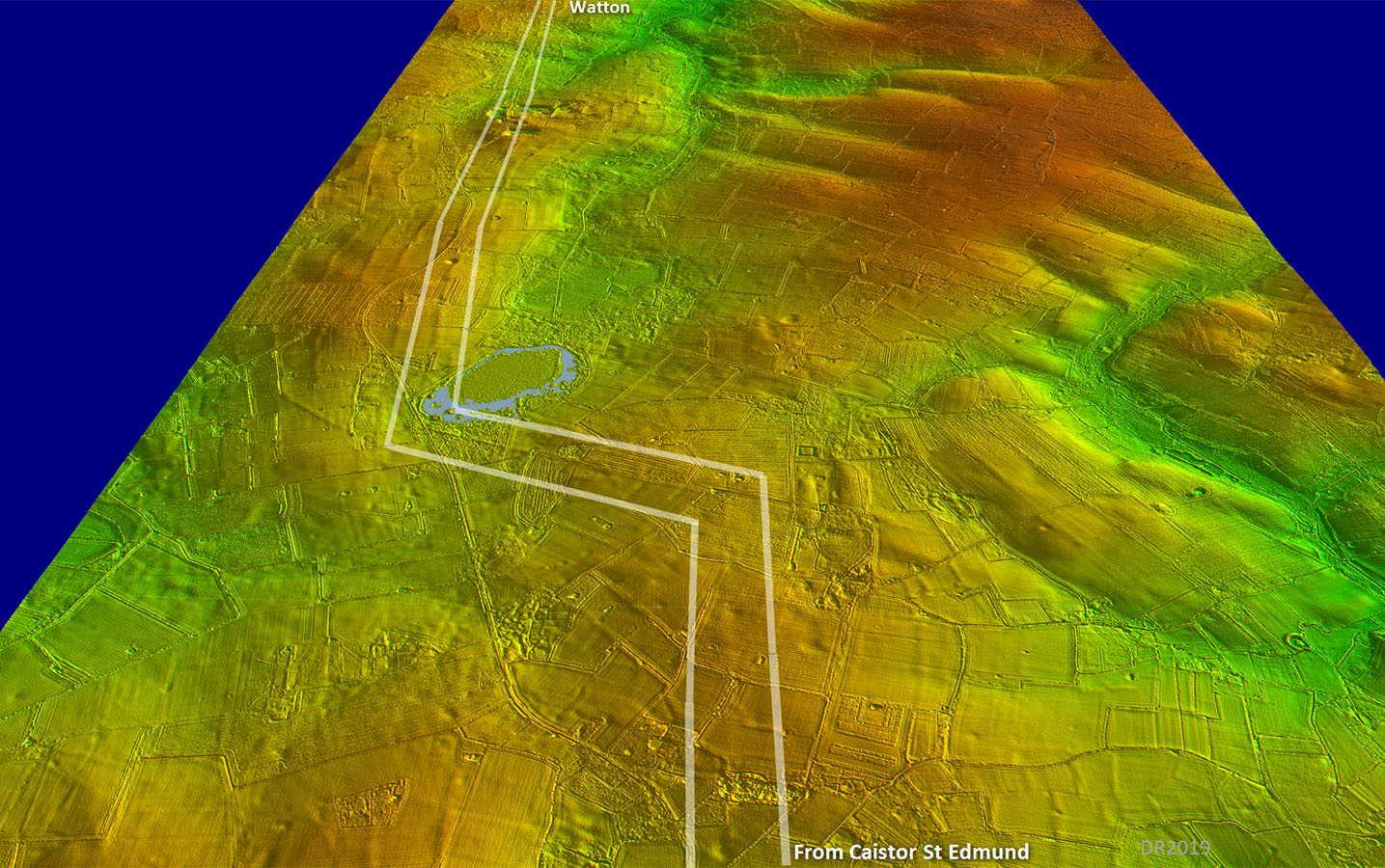
Lidar Plan - Caistor to Crownthorpe to Scoulton Mere Anyone familiar with Time Team will recall that when anything inexplicable cropped up then the standard answer was it must be a “ritual site”. Perhaps in this case that description could be true. James Albone in his thesis (see reference) suggested the road from Caistor and that from Saham Toney could have had a common destination of a religious site at Sea Mere (another mere located south of Hingham). His suggestion could well have been correct in principle but with the wrong mere – it was Scoulton Mere. The temple at Crownthorpe could now perhaps make sense. Was it a roadside temple on the route from Caistor to the ritual or religious site of Scoulton Mere? On this image I have coloured the western (drained) mere blue to give an impression of its former very impressive size. |
Click for larger view
|
 |
NEW - 3D Lidar video flyover along the road as far as Scoulton Mere
|
||
Lidar Image and Route Map 6 The straight road through Watton has always been assumed to Roman and with it now being connected up to the road from Caistor this can confidently be stated to be the case. |
Click for larger view
|
 |
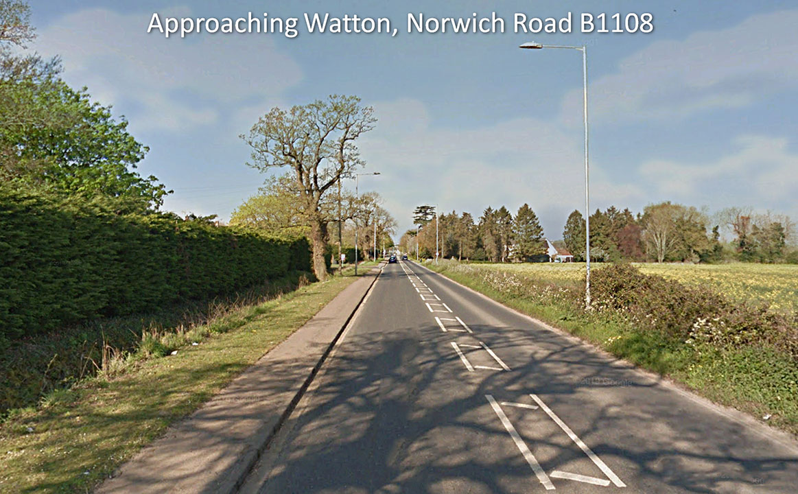
Approaching Watton It does look Roman - it is straight and aims directly for the Roman site at Saham Toney. Despite this it seems when ever the road is dug up no Roman foundations are spotted. Still that ditch on the left does give some credence to the belief that this really is Roman. Image: Google |
Click for larger view |
 |
Lidar Image and Route Map 7 The last section that joins up with Peddars Way is subtle and perhaps a bit subjective. I have shown it dashed from Watton as this is really interpolation with not much visible There was an important Roman settlement at the junction sometimes referred to as Threxton and/or Woodcock Hall. However, the complex is generally referred to as Saham Toney - see below. |
Click for larger view
|
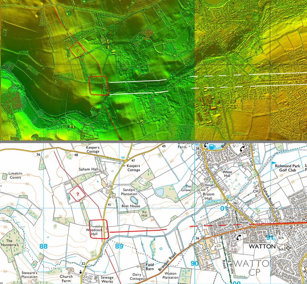 |
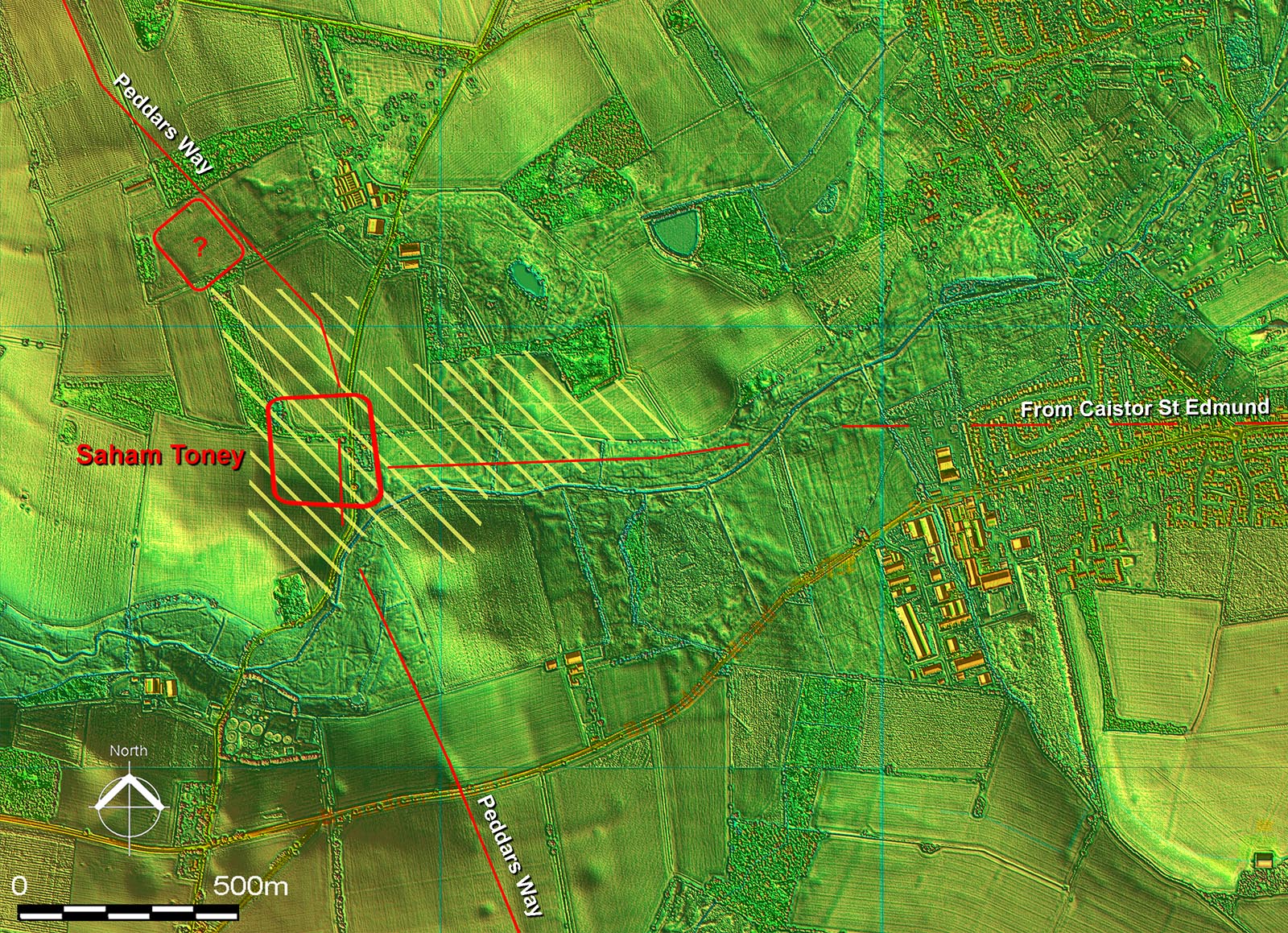
Lidar Image - Roman Roads and Forts at Saham Toney There are suggestions of an early Claudian Fort south of the river according to the HER, possibly located on Sand Hills. However, there is nothing visible in the Lidar or aerial photos that would support this. There have though been many Roman finds there - thanks to John Newton for bringing this to my attention - so something was certainly going on there in the Roman period The large central fort was located on aerial photos in 1996 and has 3 parallel ditches. See HER4697 for aerial photo. The fort is somewhat misshapen with sides not quite parallel not unlike Ixworth the next fort south on Peddars Way.. Dating could have been circa the Boudican revolt. It probably would have had a short life being replaced by a settlement - its extent is shown hatched in yellow (ref HER4697). The area either side of Peddars Way south of the river is a puzzle - it appears to overlie the agger of Peddars Way. The possible northern fort(?) is not recorded in the HER but appears to respect the alignment of Peddars Way. See the "Possible Roads" section for two probable local roads here. |
Click for larger view |
 |
|
Last update: January 2020 |
© David Ratledge |