
|
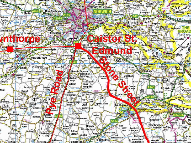
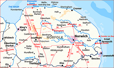
The Roman Road from Caistor St Edmund to Wainford (Stone Street)Margary Number: 36Distance: 12 miles (in Norfolk)The destination of this road as far as Norfolk is concerned is not in doubt - it crosses into Suffolk at Wainford Bridge. That cannot be said for its ultimate destination, which is unknown. This road is generally known as Stone Street. Norfolk HER: 10636
|
Historic Counties: Norfolk Current Counties: Norfolk HER: Norfolk
|
|
|
|
|
|
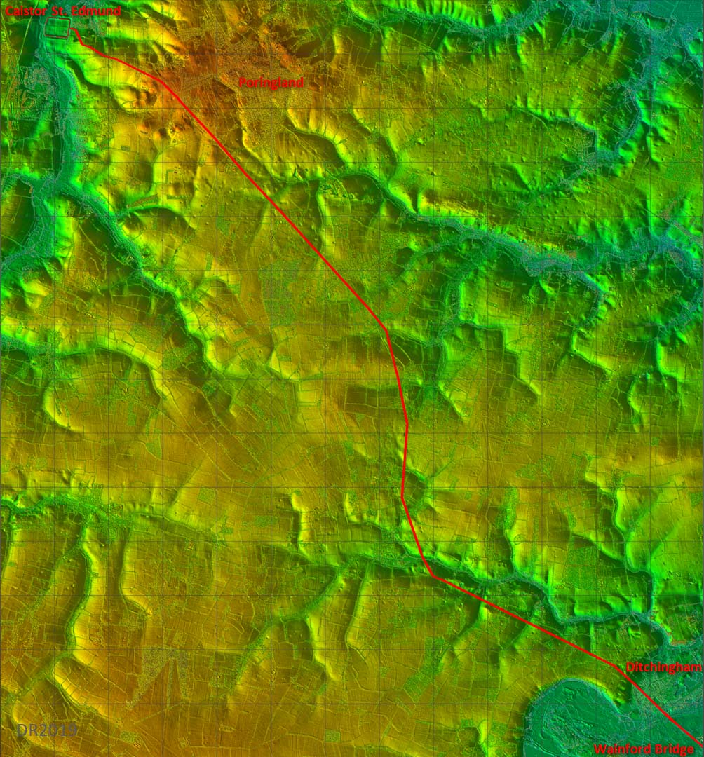
Lidar Image - full route in Norfolk I was hoping that a full Lidar image showing the topography would explain why this road did not follow a perfectly direct route. But there doesn't seem any reason for that big deviation, which begins at Kirkstead Green. |
Click for larger view |
 |
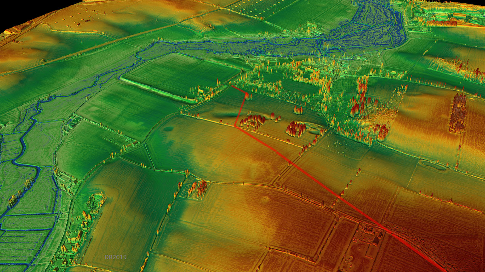
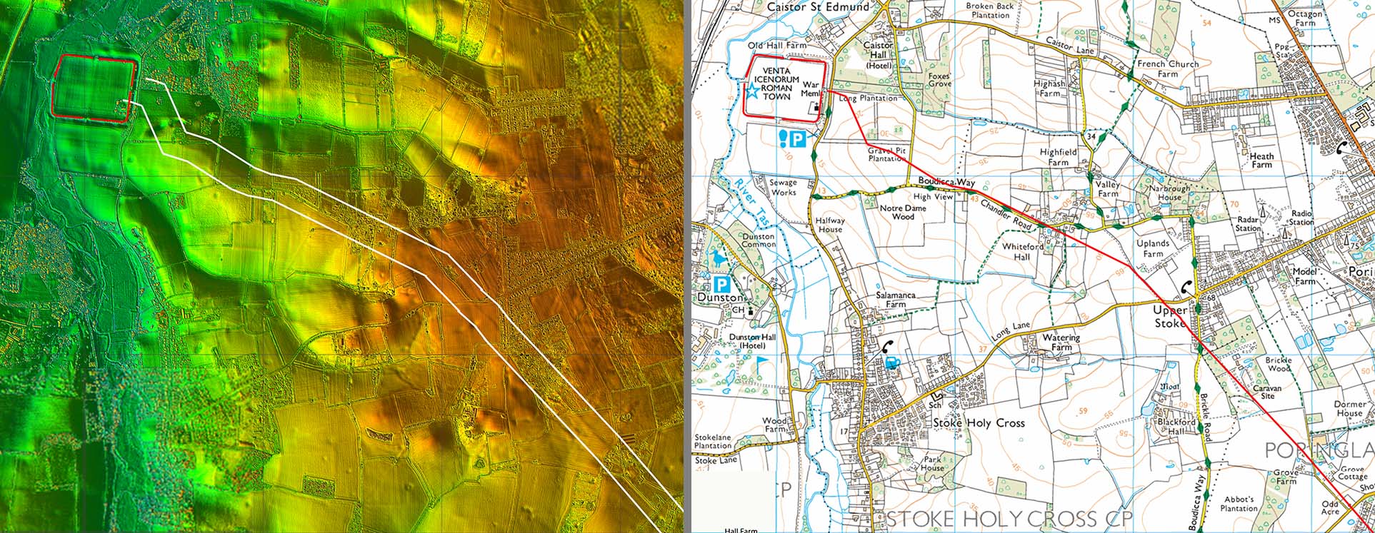
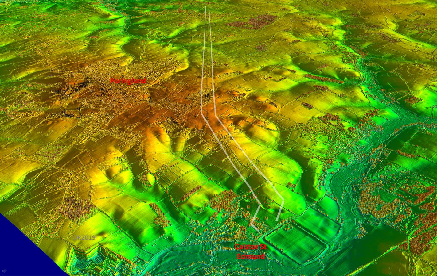
Oblique 3D Lidar Image - Caistor St Edmund The initial route out the fort seems to have had to negotiate buildings outside the town wall. The original Roman site at Caistor was much bigger than the later walled area so it is likely that the first alignment originated from an early period gate or entrance. |
Click for larger view
|
 |
Lidar Image and Route Map 1 The first main alignment starts on the high ground at the appropriately named Uplands Farm at Upper Stoke. |
Click for larger view |
 |
Oblique 3D Lidar Image In this view we are looking straight down the line of the main alignment. |
Click for larger view |
 |
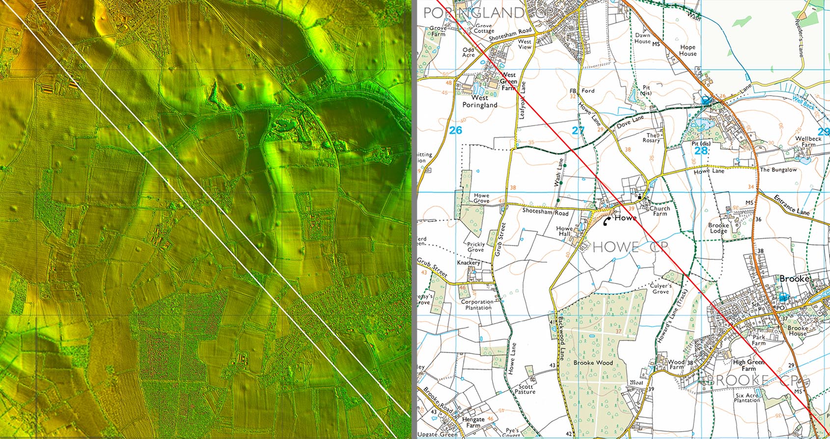
Lidar Image and Route Map 2 Dead straight passing West Poringland, Howe and Brooke. |
Click for larger view |
 |
Lidar Image and Route Map 3 That long first alignment changes direction at Kirkstead Green. Pinning down this point proved difficult. It would appear that Kirkstead Green has destroyed much of the Roman line - an old boundary on the OS first edition map corroborates to some extent what the faint lidar traces are showing. |
Click for larger view |
 |
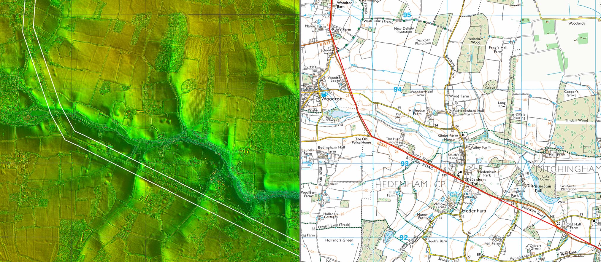
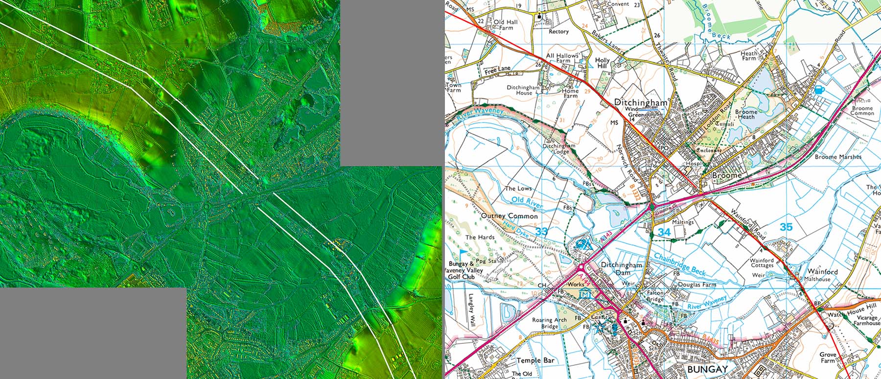
Lidar Image and Route Map 4 The Roman and modern roads coincide for much of this section but the Roman alignment is virtually dead straight whereas the modern road now wanders off course in several places - see below.. |
Click for larger view |
 |
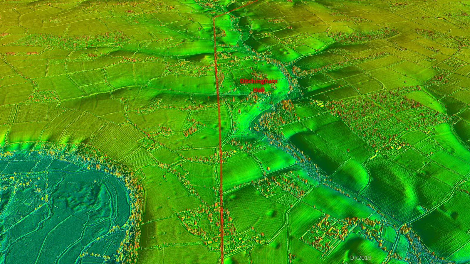
Oblique 3D Lidar Image - Ditchingham Hall The Roman road straight-lines the modern loops near Ditchingham Hall. |
Click for larger view |
 |
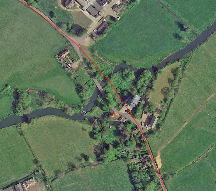
Wainford Bridge - Google Earth Aerial Photo The Roman crossing appears to have been downstream (east) of the modern bridge. |
Click for larger view |
 |
Lidar Image and Route Map 5 Wainford Bridge is the county boundary and we leave Stone Street as it heads into Suffolk |
Click for larger view |
 |
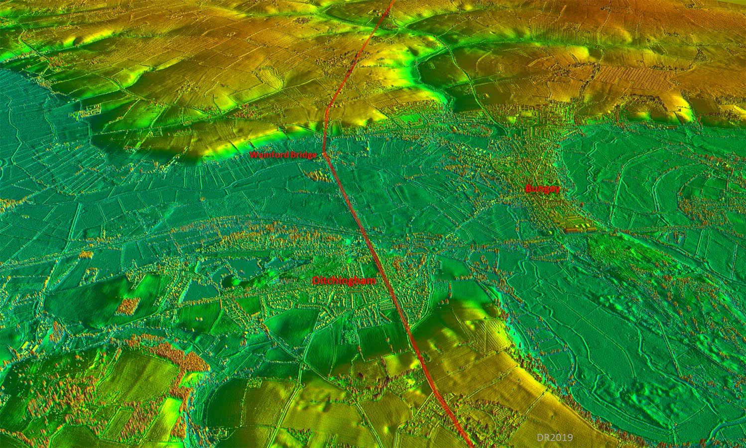
Oblique 3D Lidar Image - looking towards Suffolk Quite where this road was making for in Suffolk is one the great puzzles. There must be a lost Roman site there as this is not the only road heading for an unknown destination in east Suffolk. |
Click for larger view |
 |
|
|
|
Last update: January 2020 |
© David Ratledge |