|
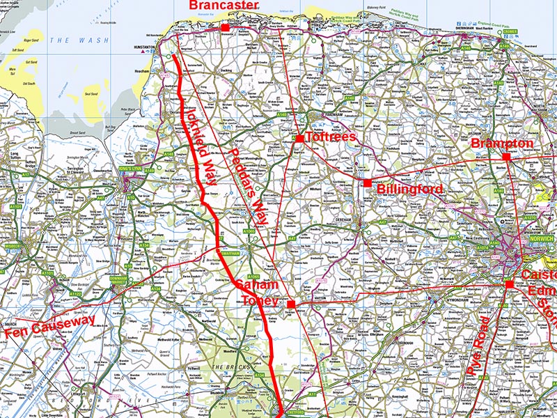
The Icknield Way Roman RoadRingstead to ThetfordMargary Number: 333Distance: 43 miles (total in Norfolk)Believed to be an Iron Age trackway predating the Roman period but adopted and improved by the Romans where they deemed necessary. That's the theory but is it really that old? Doubts have been cast on its authenticity. Much of its route is down to W.G. Clarke (EDP Oct 1923). Nevertheless it has been included here for completeness. Peddars Way, the Roman Road, appears to be a Roman replacement to the Icknield Way - they both seem to have the same or very similar destinations. This would tend to indicate that Icknield Way pre-dated it. Why would you create a parallel road to Peddars Way if a superbly engineered Roman road was already there? Surely it must have been there first. Note the mapping for this road is reproduced here at half the scale normally adopted on our Norfolk web pages. The actual route depicted in based on that recorded in the Norfolk HER with gaps filled in by what is visible in Lidar imagery. Norfolk HER reference: 1398 |
Historic Counties: Norfolk Current Counties: Norfolk HER: Norfolk
|
|
|
|
|
|
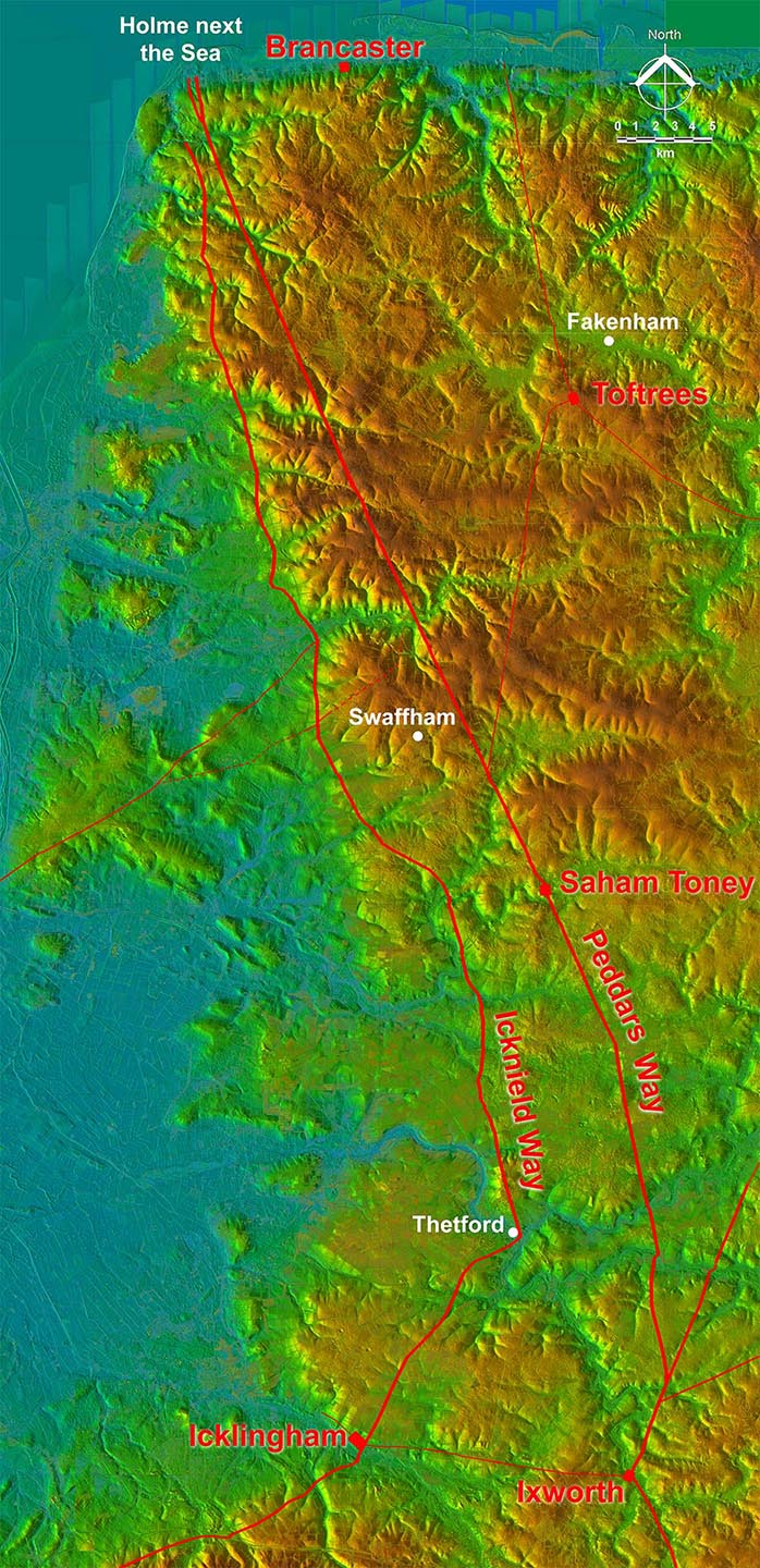
Lidar Image - Icknield Way and the Fens In this wide field image of the Icknield Way it immediately becomes obvious that road represented the most logical route around the edge of the Fens keeping to dry ground. You could not find a better route today. The Peddars Way on the other hand is so obviously a Roman road whose primary function was getting to the port at Holme, for a ferry onward to Lincoln, as directly as possible. Despite it being such a sensible route around the Fens doubts have been cast on the authenticity of the Icknield Way, at least in Norfolk. |
Click for larger view |
 |
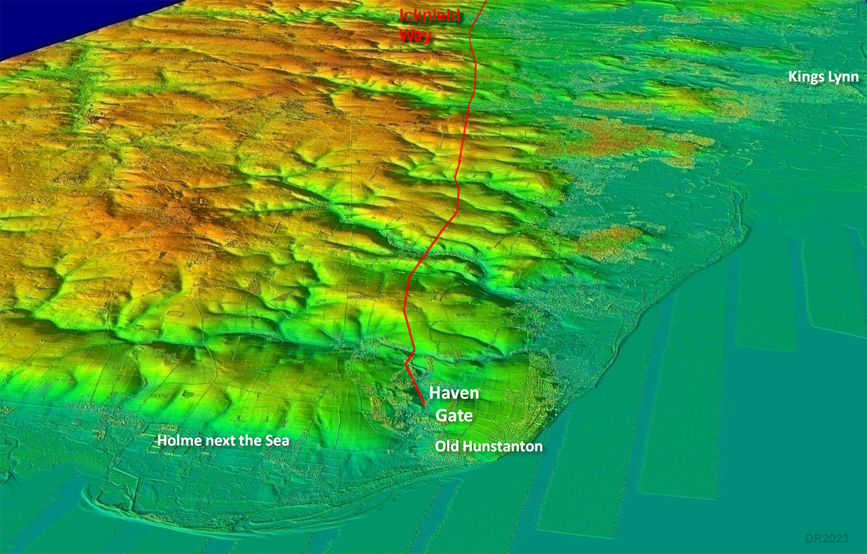
Oblique Lidar Image - Icknield Way, Old Hunstanton The start (or end?) of the Icknield Way is at Old Hunstanton. This spot was known as Haven Gate. Gate means road and haven a safe harbour or inlet. This would appear to be the case here although now long silted up. |
Click for larger view |
 |
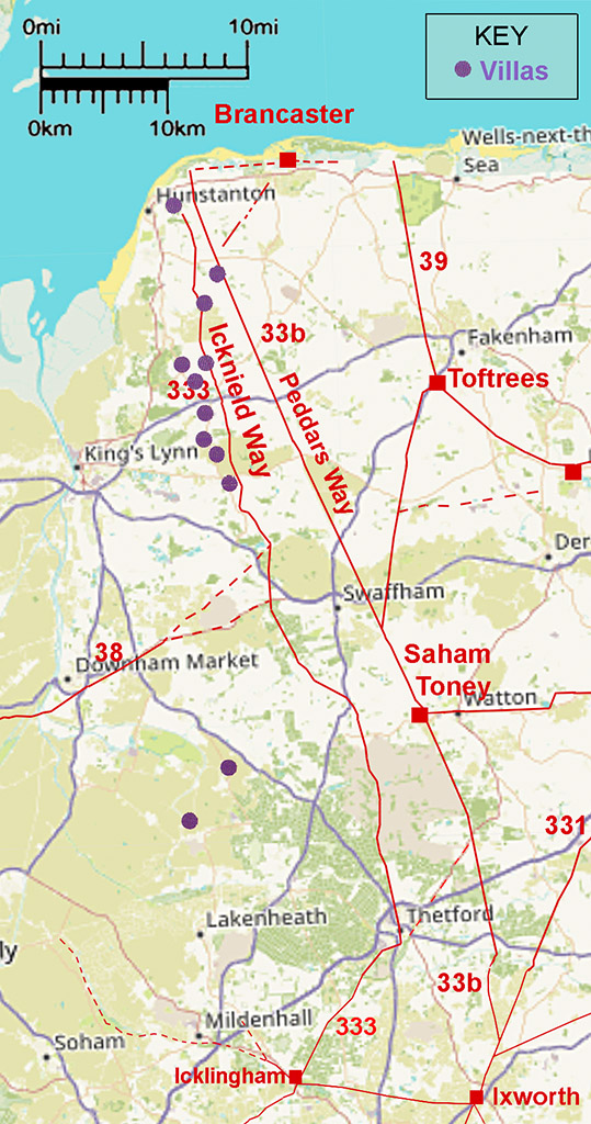
Icknield Way and the Roman Villas The biggest supporting evidence for the Icknield Way being ancient and adopted by the Romans are the ‘Icknield Way Roman Villas’ (Davies, 2008, p189-193). At least seven, perhaps 9, of these appear to be located along it There is also some supporting documentary evidence (Clarke, W.G., 1925, p109-122 & 1937, p62-7) for the Icknield Way route being ancient. At Dersingham, near Hunstanton, it was known as Ykenildestrethe and Ikelynge Street in the 13th Century. Also Margary (Margary, 1973, p262-4) refers to the route between Flitcham and Shernborne as having the name Streetford Road. |
Click for larger view |
 |
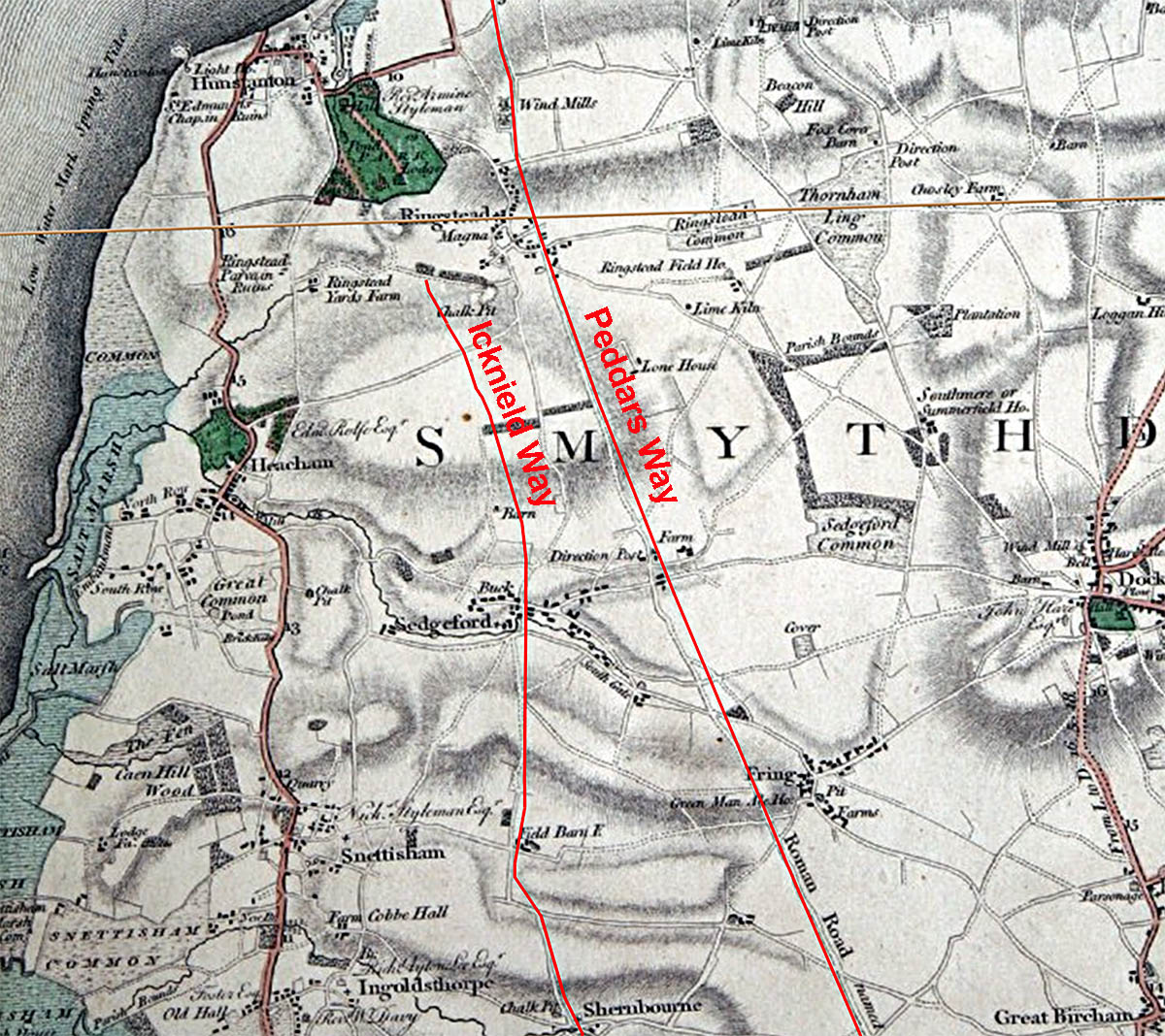
Hunstanton & Ringstead - Faden's Map The destination (or starting point) would appear to have been at or near Hunstanton but the Norfolk HER does not show a line further north than Ringstead. Hunstanton Park (coloured green) is a natural depression and perhaps was a harbour in Roman times but now long silted up. Margary refers to this as Haven Gate and this name is perhaps a clue - meaning road to the safe harbour (haven).. Faden’s Map of Norfolk, online version by Andrew Macnair. |
Click for larger view |
 |
Ringstead to King's Avenue - Route Map 1 From Ringstead the way heads south via the villages of Sedgeford, Shernbourne and Flitcham.
|
Click for larger view |
 |
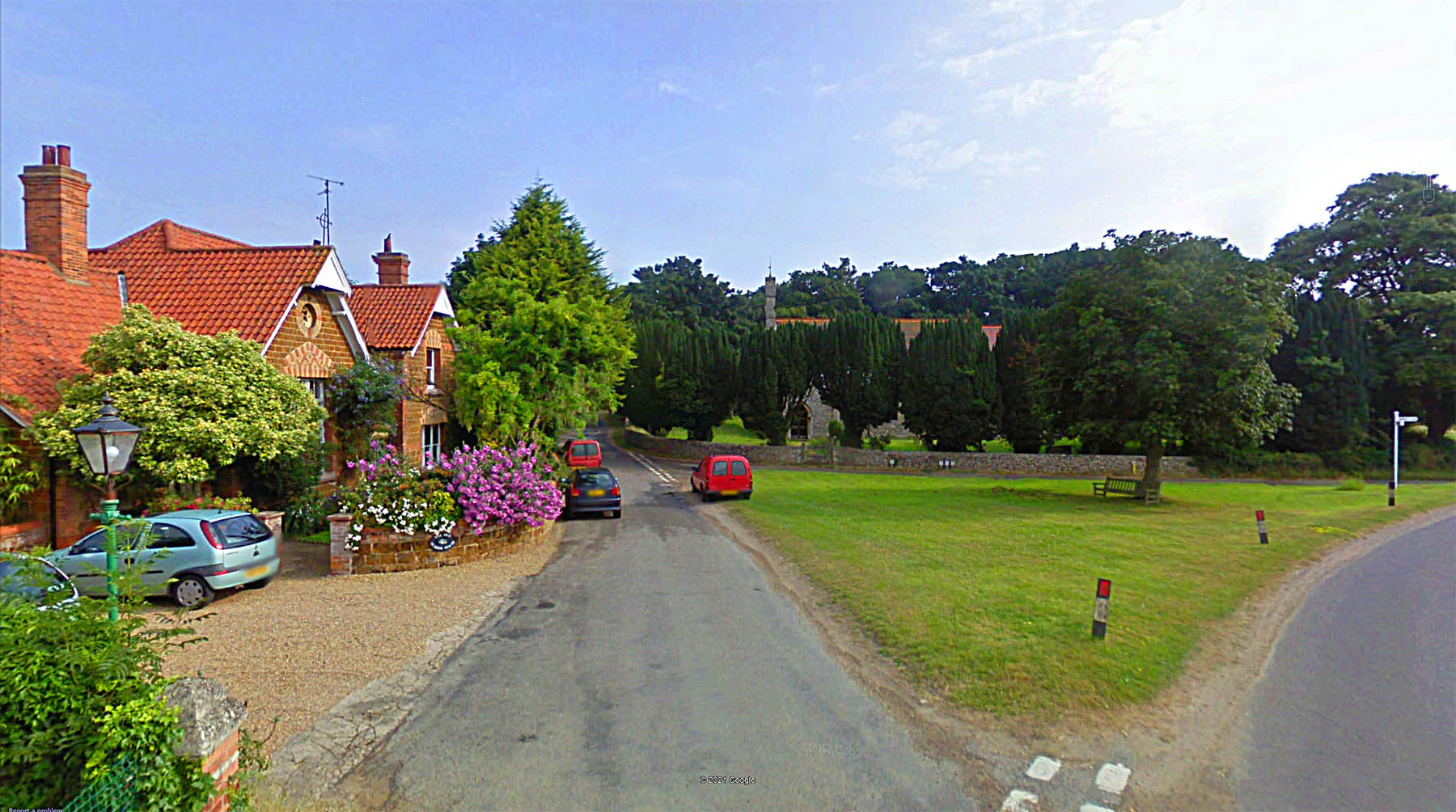
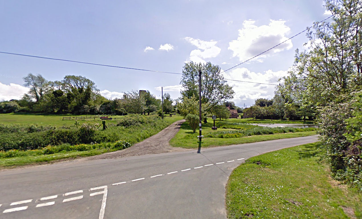
Shernborne - looking north The Icknield Way passes through the pretty village of Shernborne. The route is between the parked vehicles. Image: Google
|
Click for larger view |
 |
King's Avenue to East Walton- Route Map 2 The kink at East Walton is a little odd and without any apparent reason to justify it..
|
Click for larger view |
 |
Gayton Thorpe - looking south Our road heads down the track to the left of the village pond and to the right of the church in the distance. Image: Google
|
Click for larger view |
 |
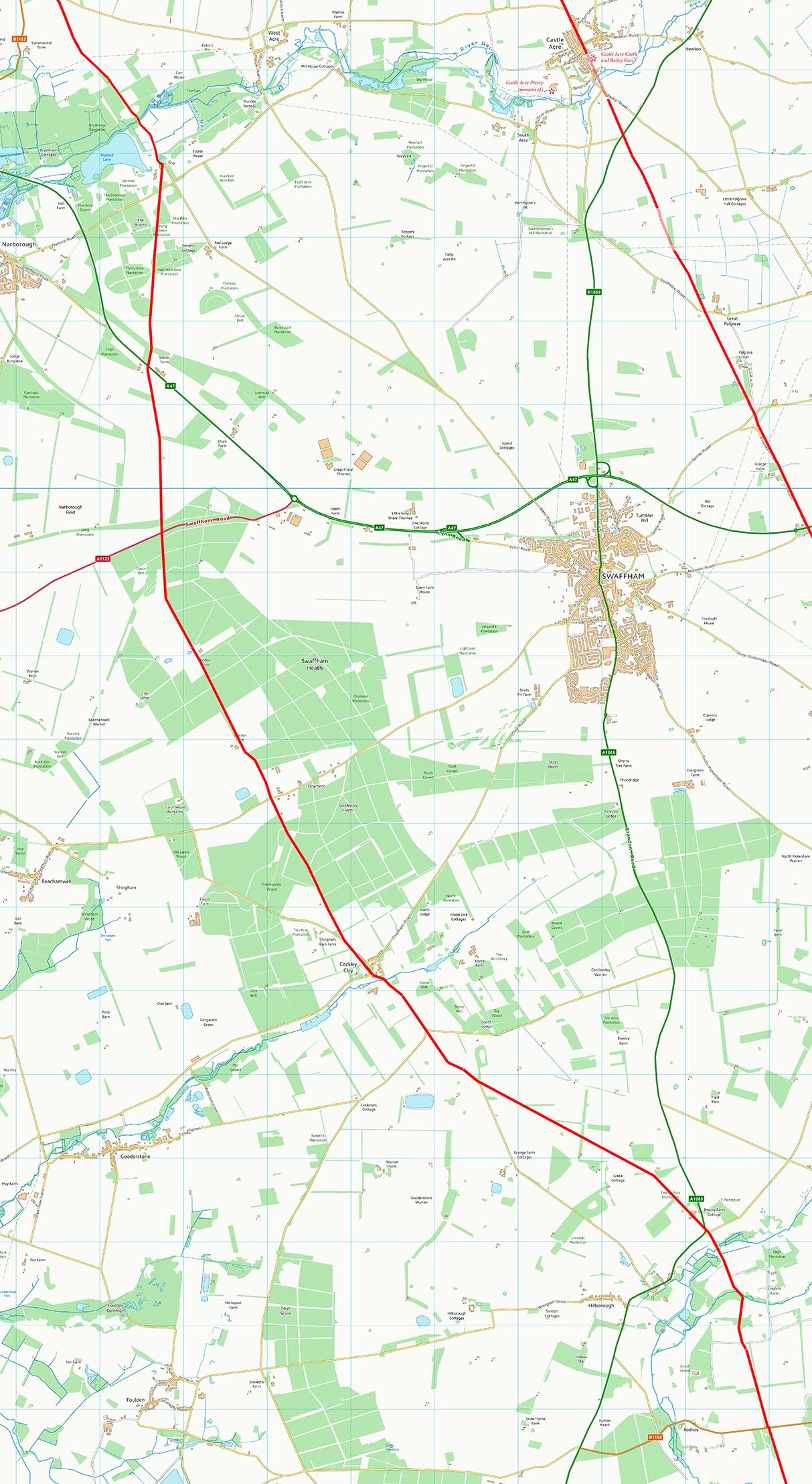
East Walton to Hilborough - Route Map 3 On this section, to the west of Swaffham, the Icknield Way probably formed a junction with the Fen Causeway coming in from Denver. The latter is labeled as "Roman Road" on OS mapping but the true Roman line was probably just to the south of this - see our Fen Causeway Road web page.. Just north of the possible junction with the Fen Causeway is the old road known as Fincham Drove heading for Castle Acre.
|
Click for larger view |
 |
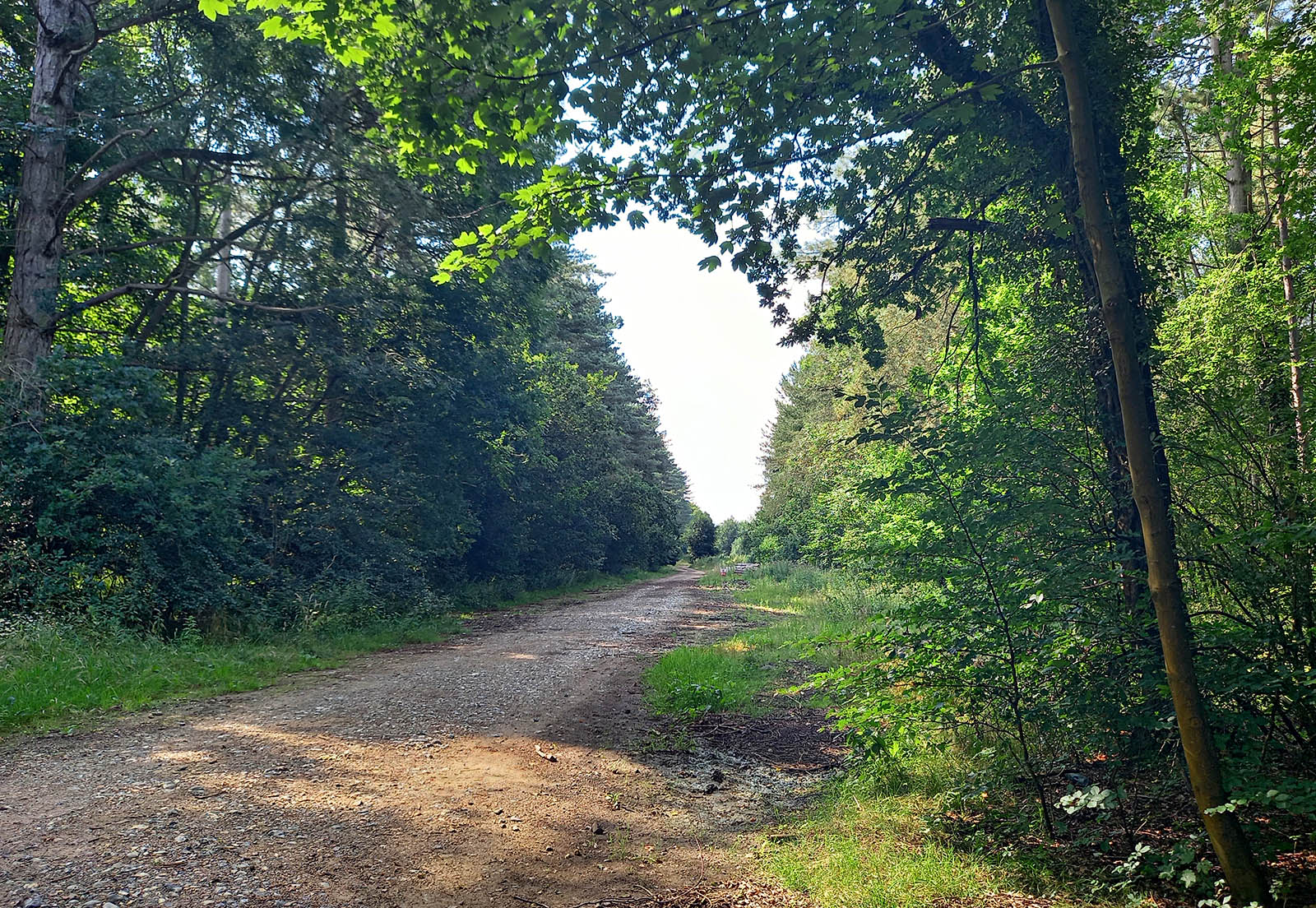
Icknield Way - A1122 North Looking north from the A1122 along the somewhat overgrown Icknield Way Image: DR
|
Click for larger view |
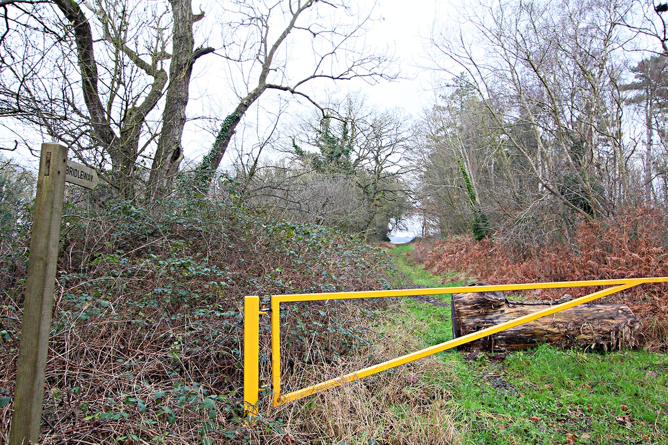 |
Icknield Way - A1122 South Across the the road from above, then the Icknield Way is still an impressive highway although it had recently been blocked off to vehicles when I visited (December 2019). The Fen Causeway possibly joined the Icknield Way here. Image: DR
|
Click for larger view |
 |
Oblique 3D Lidar Image - Hilborough There is not much Lidar coverage (currently) for the Icknield Way but there is for the stretch east of Hilborough.
|
Click for larger view |
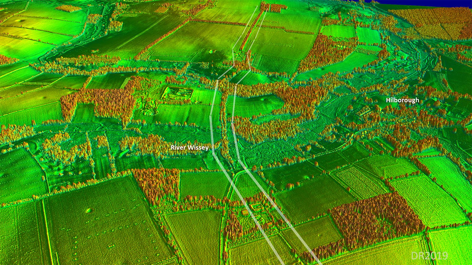 |
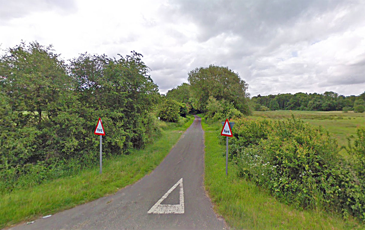
Icknield Way, Hilborough - Home Lane Ford Just east of Hilborough, then Home Lane marks the Icknield Way and it heads to a ford for its crossing of the River Wissey. Image: Google
|
Click for larger view |
 |
Hilborough to Thetford The route through Thetford is somewhat speculative. South of the town, Icknield Way changes alignment towards the south west in Suffolk. This goes by various names, Barnham Slip, Angles Way and St Edmund Way as well of course as Icknield Way.
|
Click for larger view |
 |
Icknield Way, Nuns Bridges, Thetford The route of the Icknield Way through Thetford is reported to be via Nuns Bridges. Here, in close proximity, the Rivers Thet and Little Ouse are crossed at a truly delightful spot. The bridges are relatively modern and presumably replaced the ford of Thetford..
|
Click for larger view |
 |
|
|
|
Last update: October 2023 |
© David Ratledge |