|
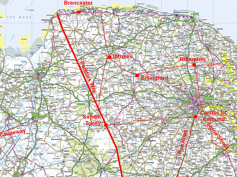
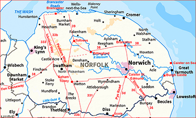
Peddars Way Roman RoadSection 2: Great Massingham to Saham ToneyMargary Number: 33bDistance: 42 miles (total in Norfolk)This section takes us from Great Massingham to Saham Toney passing North Pickenham where the Roman road from Toftrees joins. Saham Toney appears to have been one of Norfolk's most important Roman Settlements - perhaps second only in importance to Caistor St Edmund.
|
Historic Counties: Norfolk Current Counties: Norfolk HER: Norfolk
|
|
|
|
|
|
Lidar Image - Full Route Section 2 There is full Lidar coverage for this section. The Roman road is remarkably direct over this section - only when examined closely does it come off line occasionally, usually to negotiate a valley or river.
|
Click for larger view |
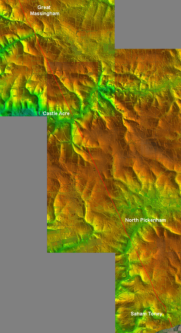 |
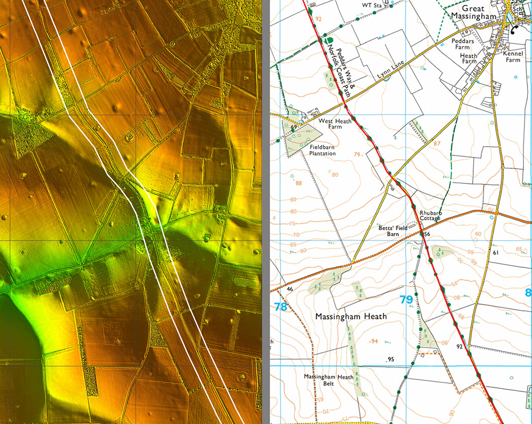
Lidar Image and Route Map 7 This is one of those instances where the route wobbles a touch from straight, just south-west of Great Massingham. This was obviously to negotiate the valley there so rather than fighting the contours it followed them.
|
Click for larger view |
 |
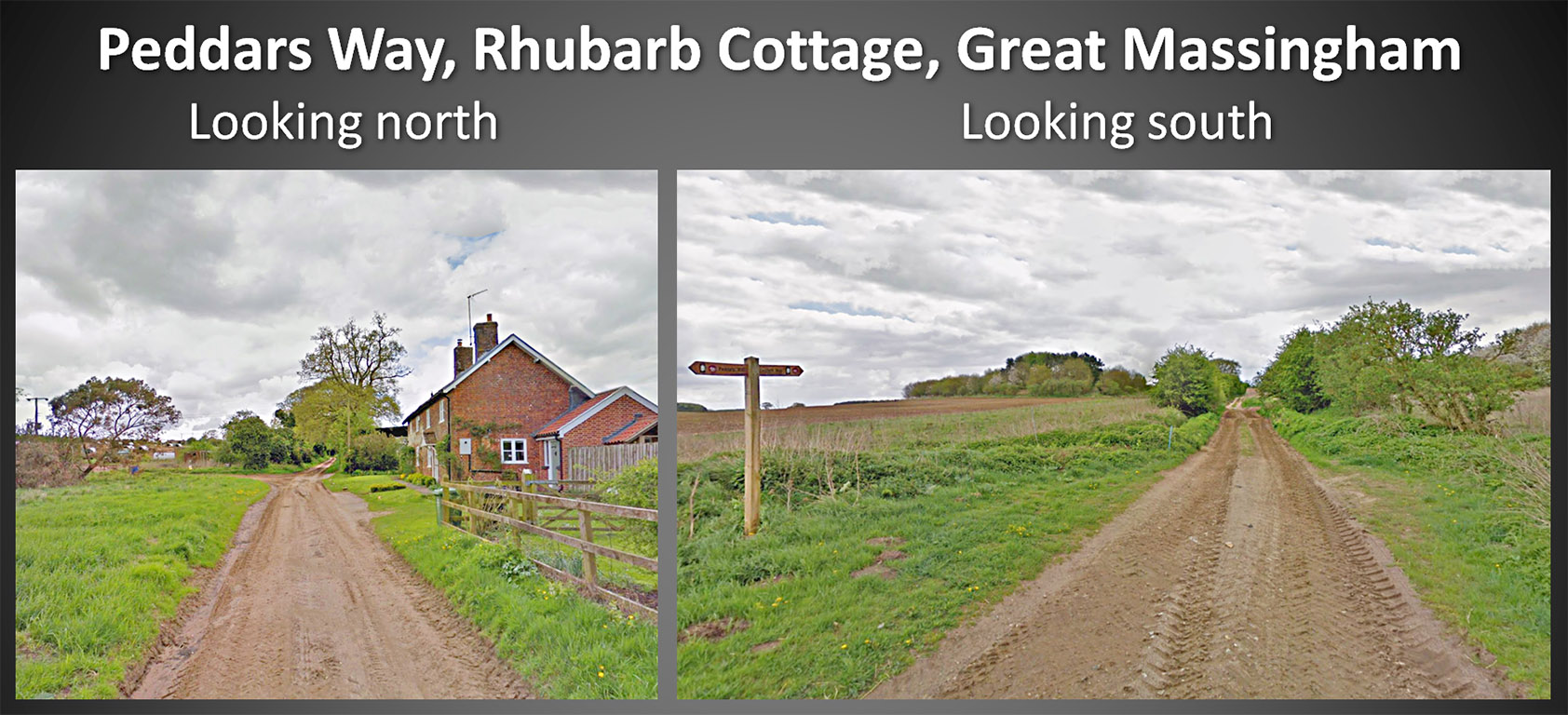
Peddars Way passing Rhubarb Cottage, B1145 I have passed this spot many times on the B1145. The Peddars Way here is obviously still in use as a farm track both south and north. I didn't notice any Rhubarb. Images: Google |
Click for larger view |
 |
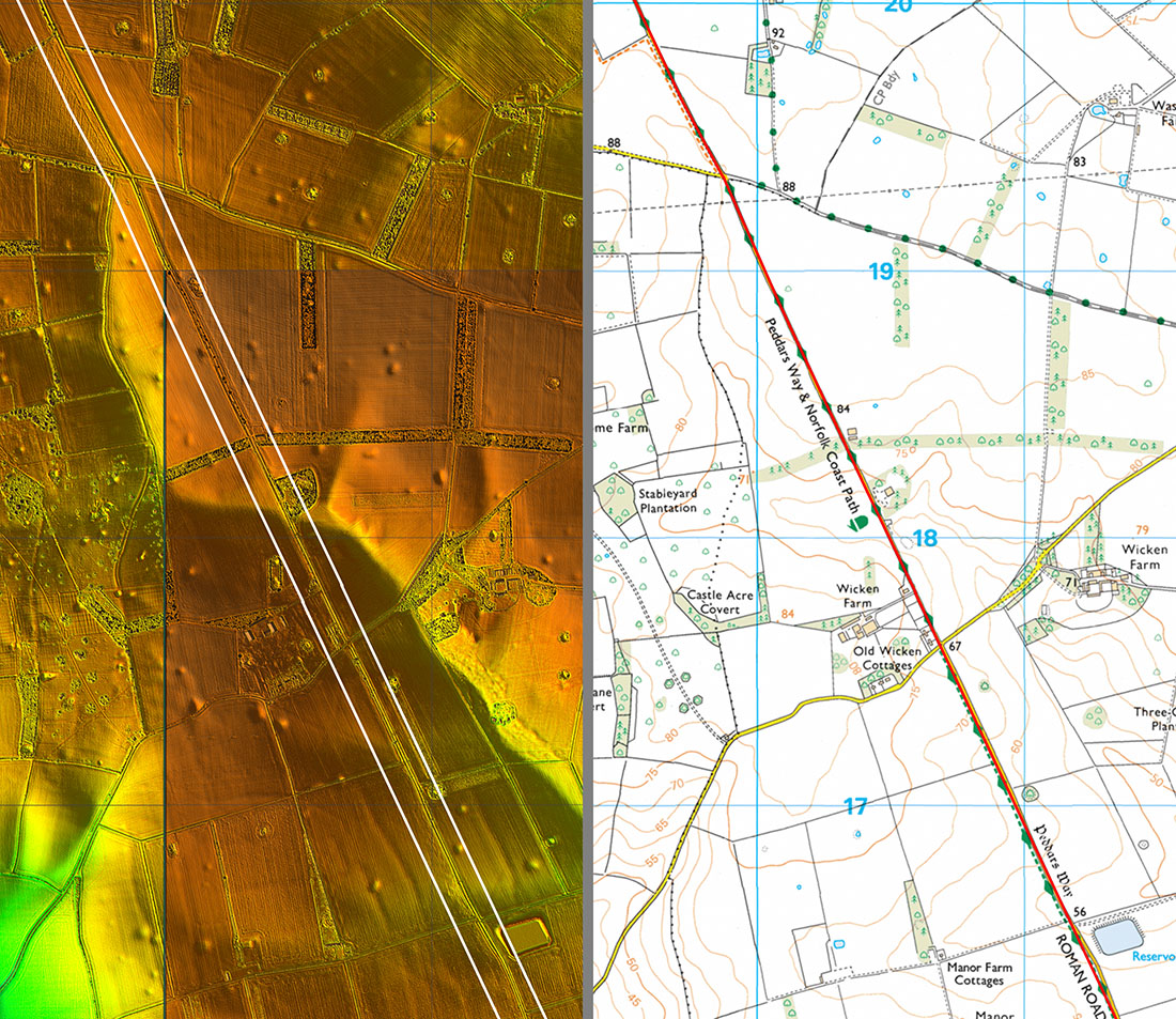
Lidar Image and Route Map 8 More of the same and almost dead straight on this stretch. |
Click for larger view |
 |
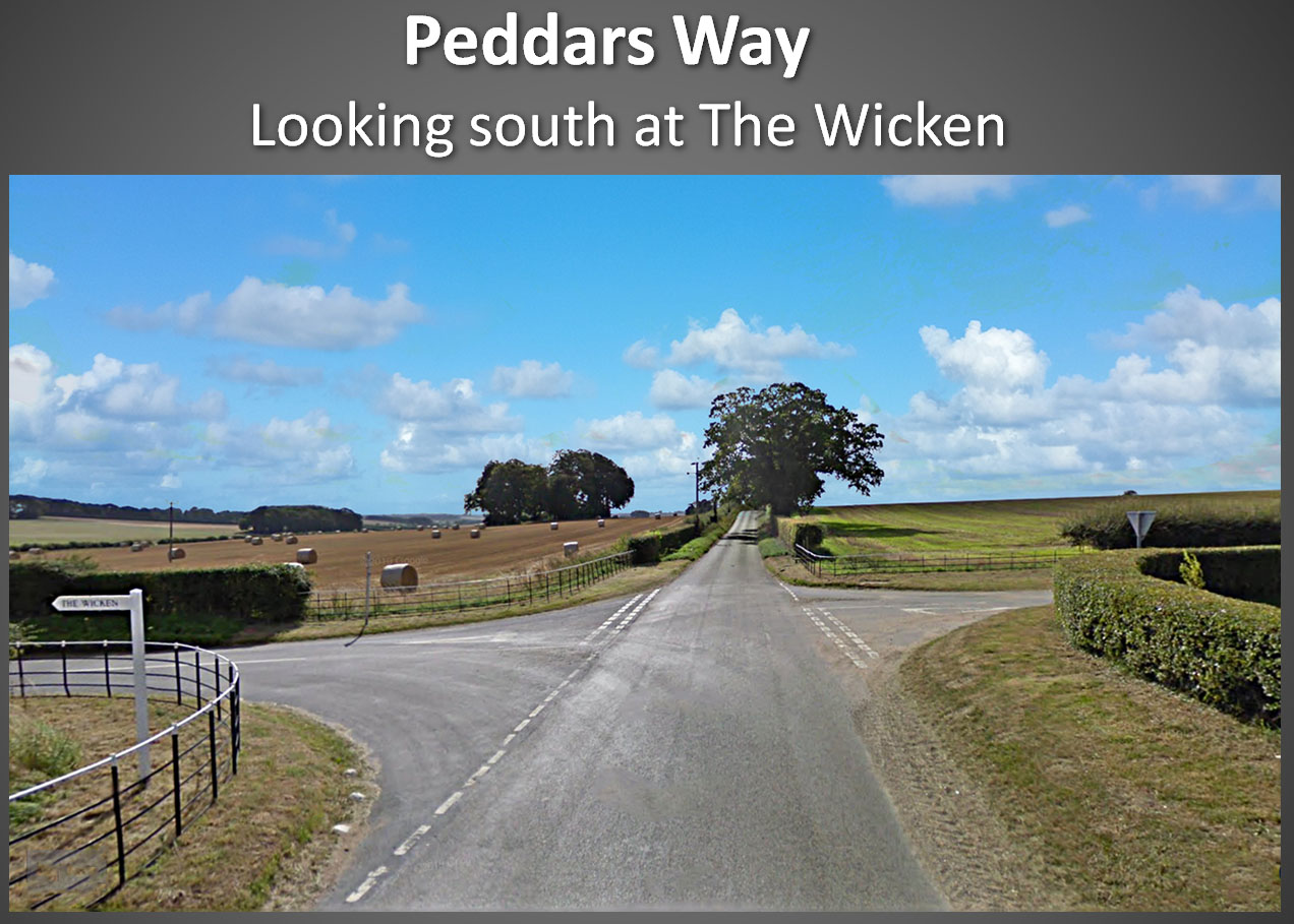
Peddars Way passing The Wicken Peddars Way is now surfaced so not quite as pleasant walking for a while. Image: Google |
Click for larger view |
 |
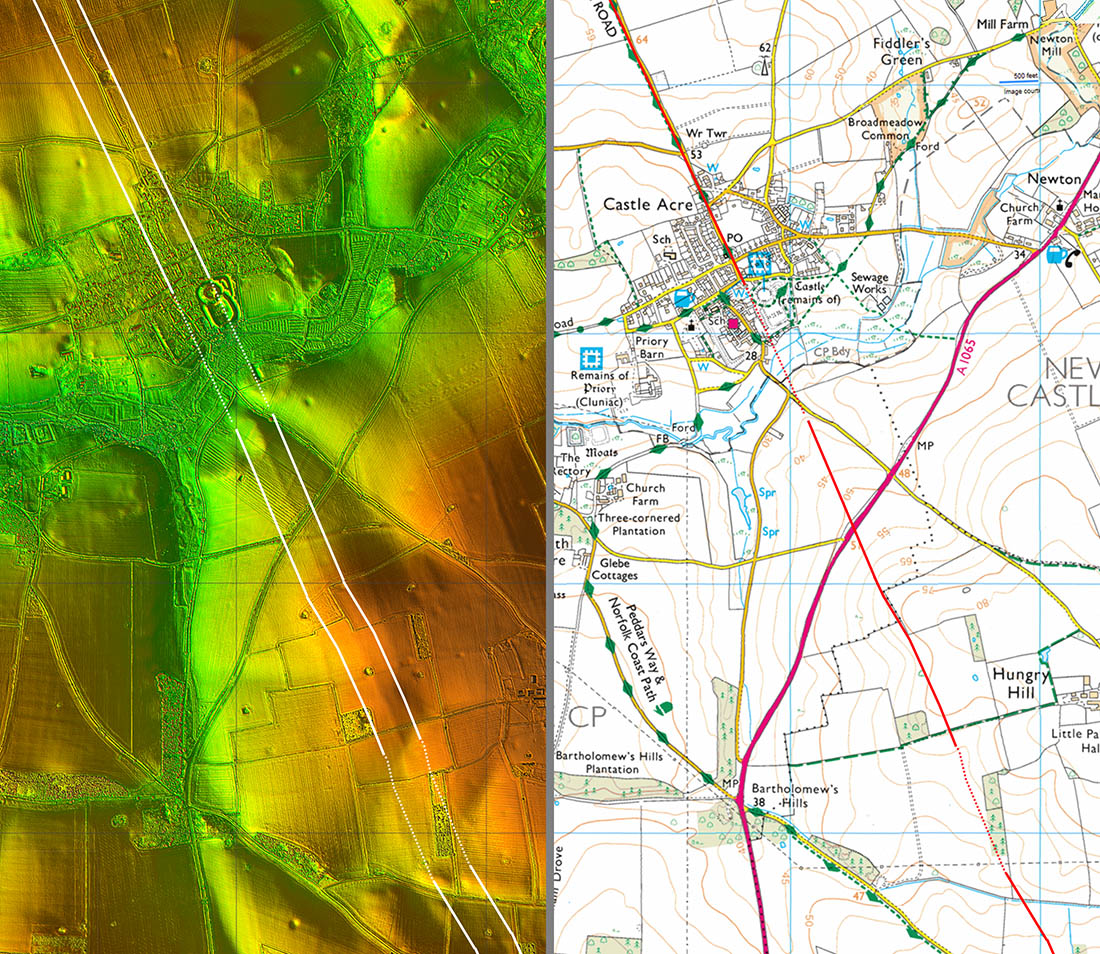
Lidar Image and Route Map 9 - Castle Acre The route clearly passes the Norman Motte and Bailey castle on its western side. The crossing point of the River Nar is not obvious - it could have been along the main alignment but there could well have been a dog-leg west to where the modern bridge is. Castle Acre is one of Norfolk's gems and is a must visit village. |
Click for larger view |
 |
Oblique 3D Lidar Image - Castle Acre We are looking south down the line of the Roman Road at Castle Acre. The Motte & Bailey was clearly built immediately alongside the road no doubt to control traffic along it and police the crossing of the River Nar so our road was still important in 1066, or just after.. |
Click for larger view |
 |
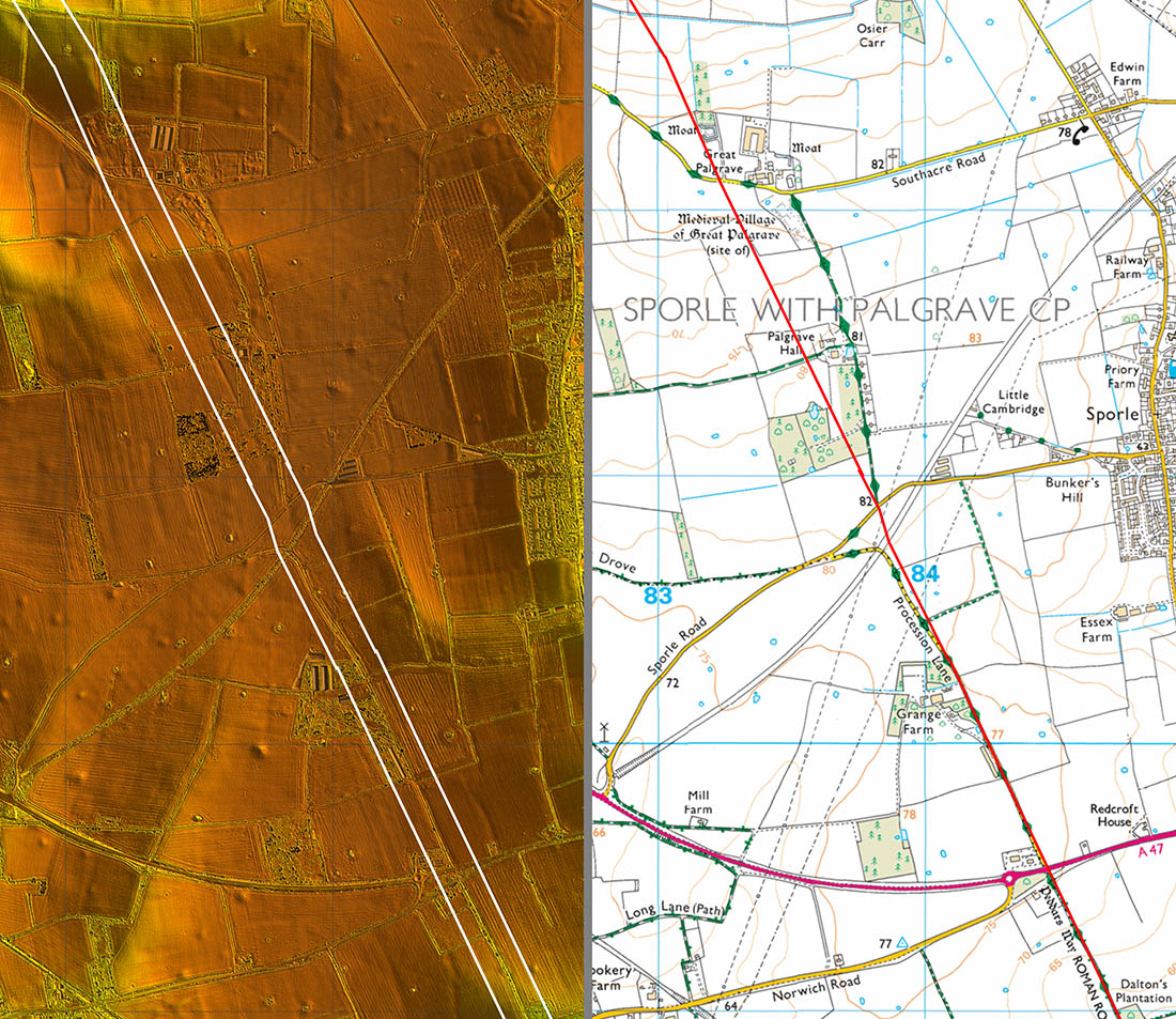
Lidar Image and Route Map 10 An interesting section where we pass the deserted medieval village of Great Palgrave, the old railway to Dereham and a McDonalds. Peddars Way here is called Procession Lane. I would guess this is down to pilgrims heading for the religious site of Walsingham? |
Click for larger view |
 |
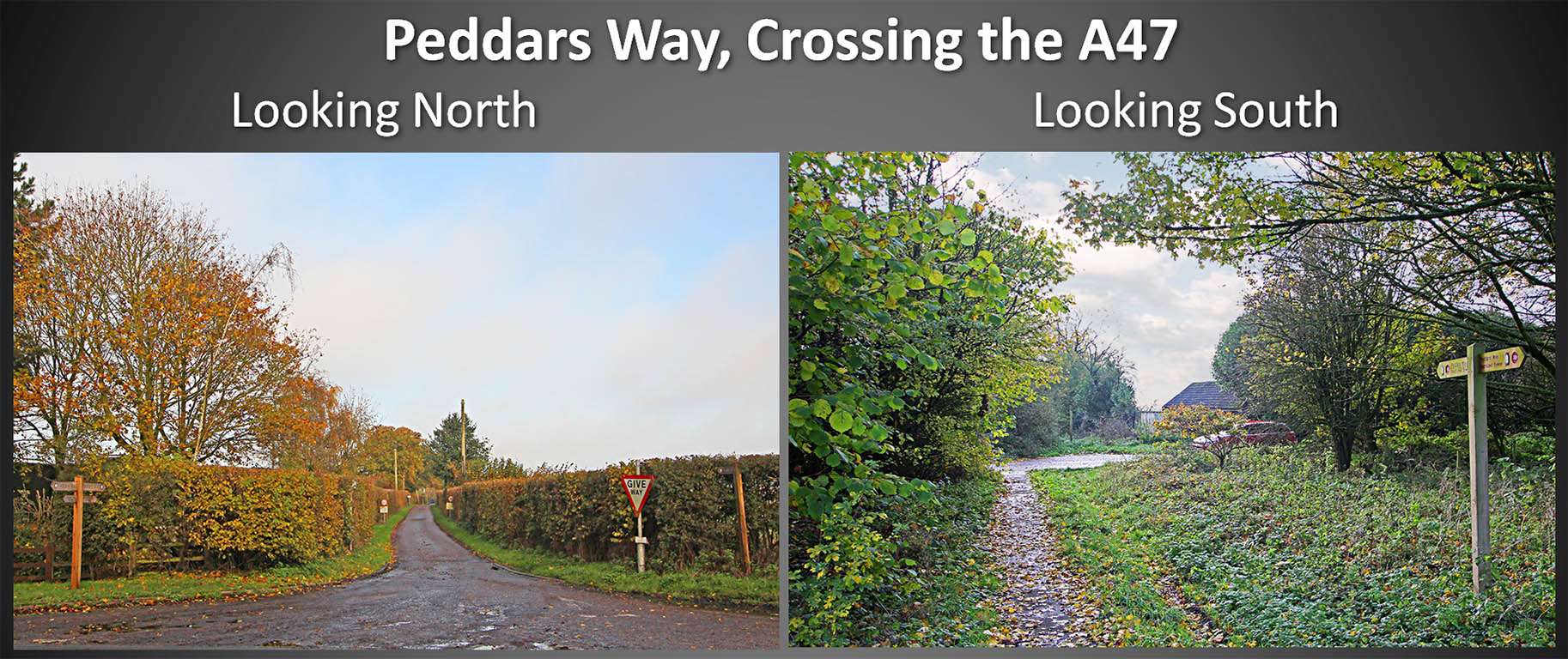
Peddars Way crossing the A47 Not the most attractive of locations by the racetrack of the A47. There is a McDonalds here but I wouldn't recommend crossing the road. Peddars Way surely warrants a footbridge here. Images: DR |
Click for larger view |
 |
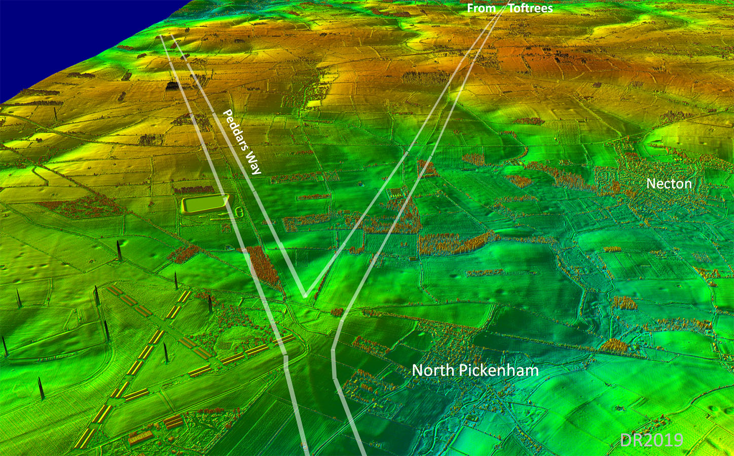
Lidar Image and Route Map 11 On this stretch we are joined by the Roman Road from Toftrees or perhaps more accurately, here the road for Toftrees branches off Peddars Way. |
Click for larger view |
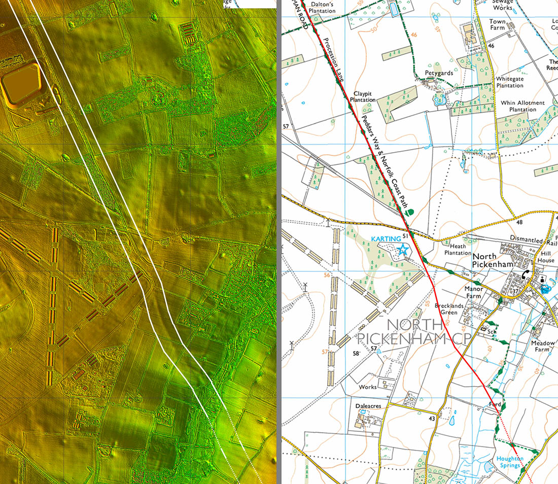 |
Oblique 3D Lidar Image - North Pickenham The two roads are obvious and the logical conclusion would be that Peddars Way was the earlier with the road to Toftrees branching off it at a later date. |
Click for larger view |
 |
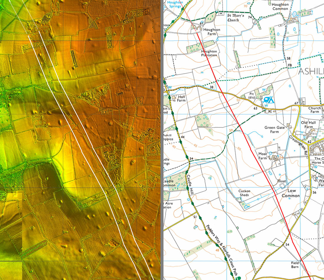
Lidar Image and Route Map 12 Peddars Way the footpath is around 1 kilometre west of the true line passing Cressingham. |
Click for larger view |
 |
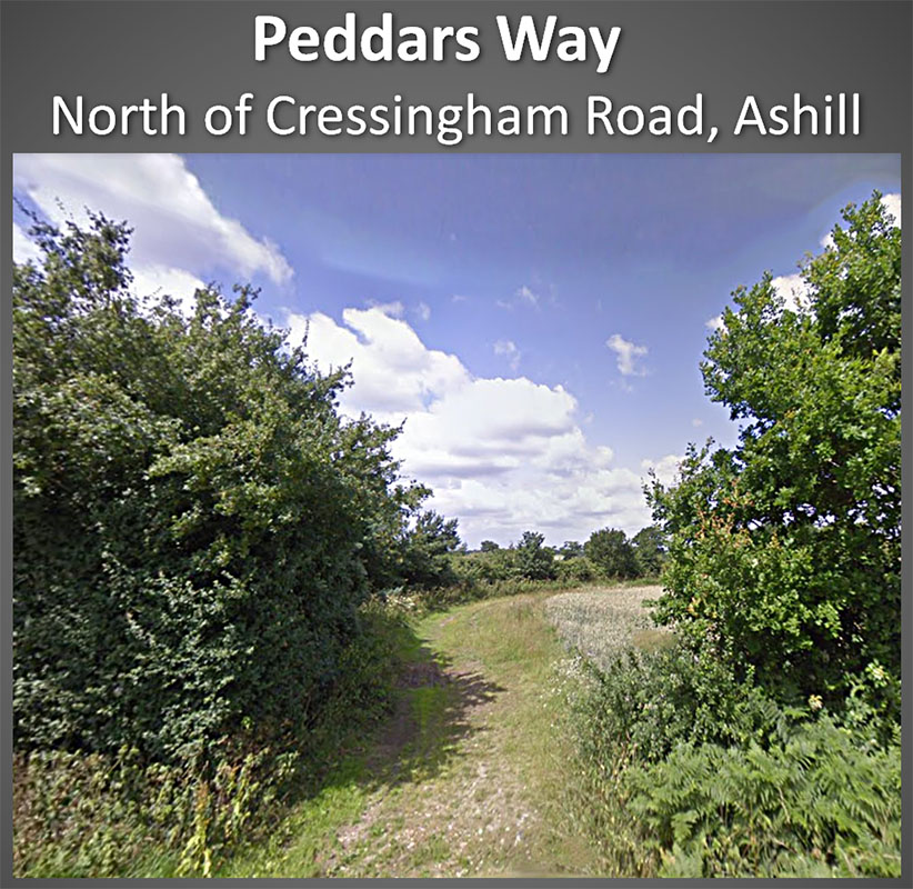
Peddars Way north of Cressingham Road Not a right of way here but it can be viewed from Cressingham Road. Image: Google |
Click for larger view |
 |
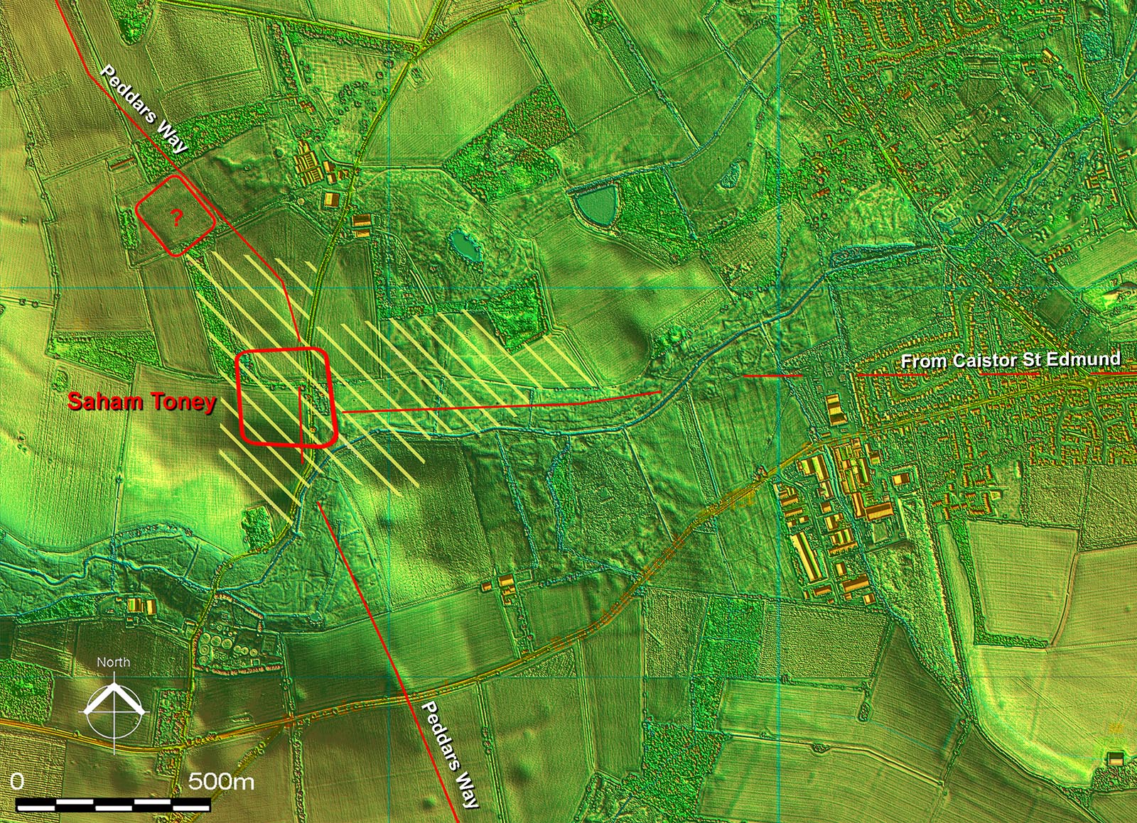
Lidar Image and Route Map 13 The Saham Toney Roman site is referred to as Woodcock Hall in the Norfolk HER (4697). It is an extremely complex site and appears to have gone through various stages. The Roman road from Caistor St Edmund meets Peddars Way at this spot. Peddars Way continues in Section 3
|
Click for larger view |
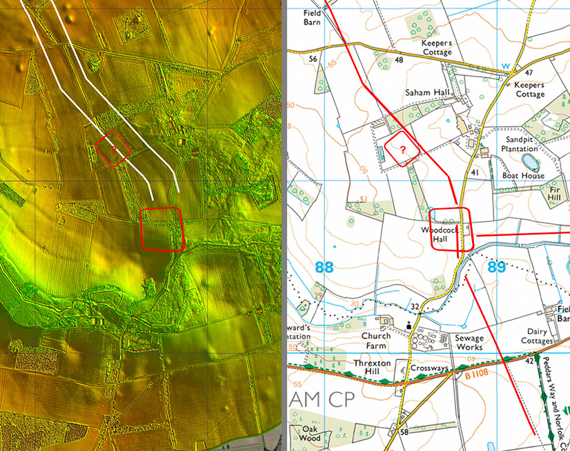 |
Saham Toney (Woodcock Hall) Roman Site - Enlarged Lidar Image There are suggestions of an early Claudian Fort south of the river according to the HER, possibly located on Sand Hills. However, there is nothing visible in the Lidar or aerial photos that would support this. There have though been many Roman finds there - thanks to John Newton for bringing this to my attention - so something was certainly going on there in the Roman period The large central fort was located on aerial photos in 1996 and has 3 parallel ditches. See HER4697 for aerial photo. The fort is somewhat misshapen with sides not quite parallel not unlike Ixworth the next fort south on Peddars Way.. Dating could have been circa the Boudican revolt. It probably would have had a short life being replaced by a settlement - its extent is shown hatched in yellow (ref HER4697). The area either side of Peddars Way south of the river is a puzzle - it appears to overlie the agger of Peddars Way. The possible northern fort(?) is not recorded in the HER but appears to respect the alignment of Peddars Way. |
Click for larger view |
 |
|
|
|
Last update: January 2020 |
© David Ratledge |