|
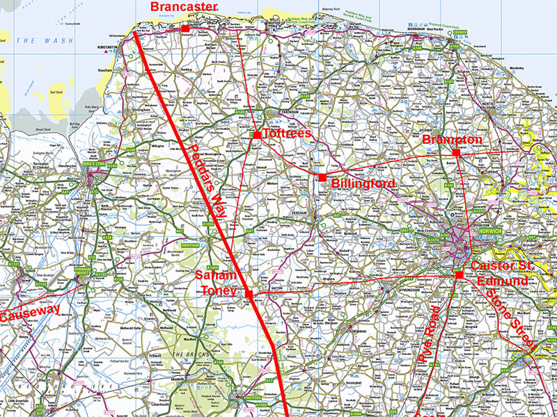
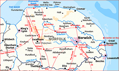
Peddars Way Roman RoadSection 2: Saham Toney to BrettenhamMargary Number: 33bDistance: 42 miles (total in Norfolk)This section takes us from Saham Toney to the County Boundary near Brettenham. If features the single change of direction for this road in Norfolk.
|
Historic Counties: Norfolk Current Counties: Norfolk HER: Norfolk
|
|
|
|
|
|
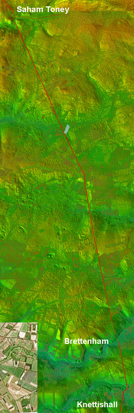
Aerial/Lidar Image - Full Route Section 3 Virtually 2 long straight alignments. The road makes its one major turn of 19 degrees near Hockham . Strangely, the long straight alignments, such a feature of this road, changes once we reach Knettishall in Suffolk.
|
Click for larger view |
 |
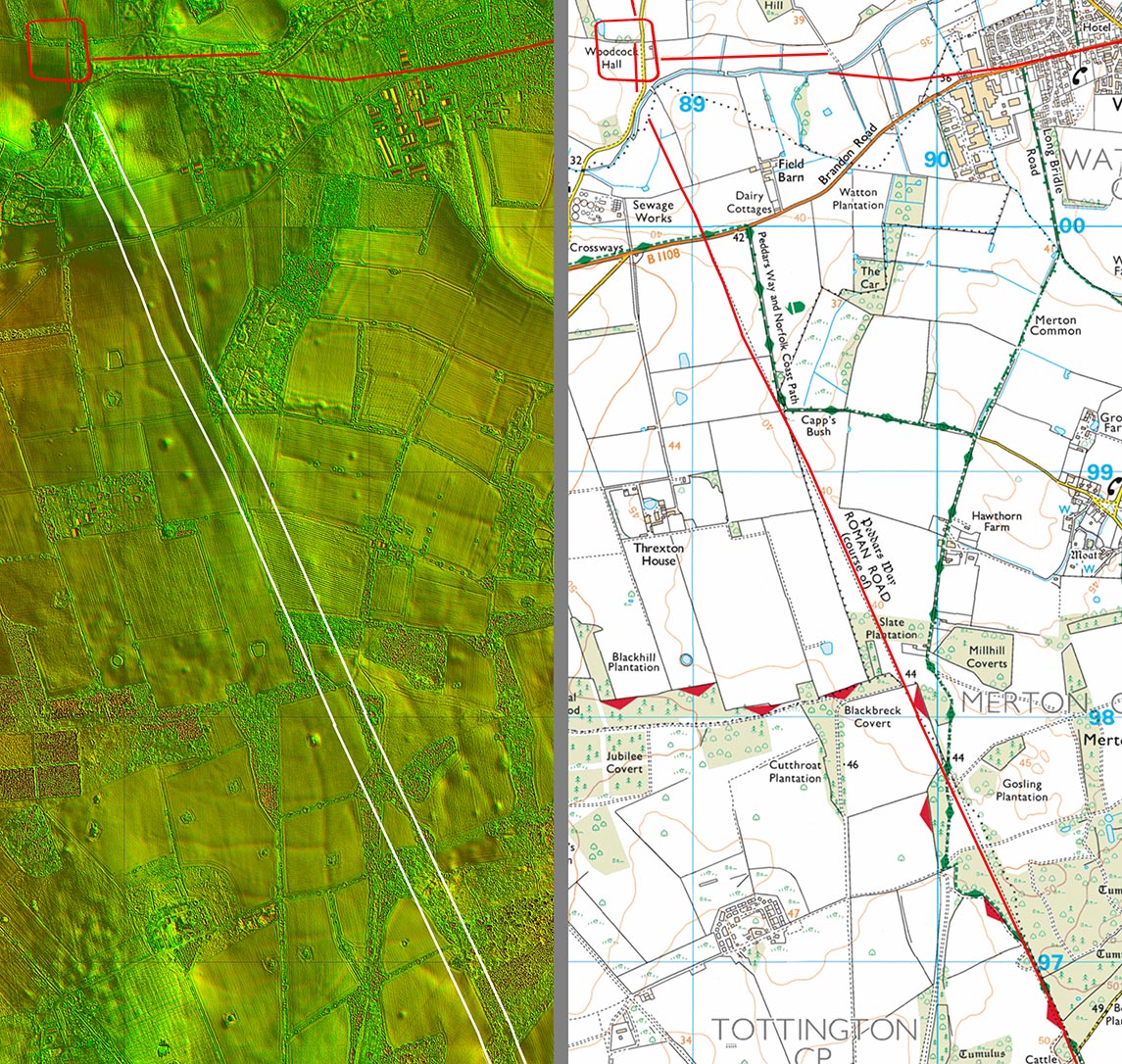
Lidar Image and Route Map 14 Lidar shows just a little wobble from straight about 1km from Saham Toney.
|
Click for larger view |
 |
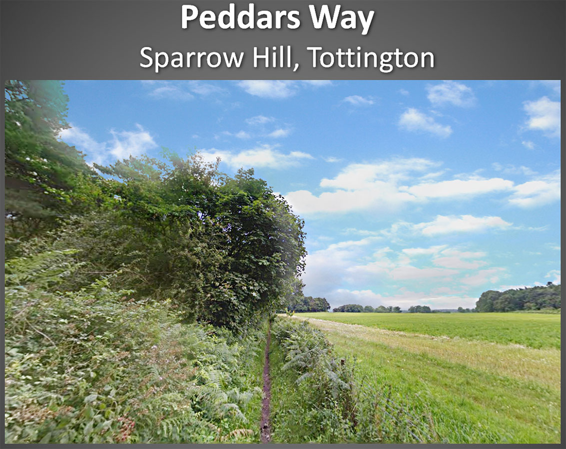
Peddars Way - Sparrow Hill, Tottington Peddars Way, the footpath, rejoins the Roman line at Sparrow Hill. There isn't much evidence of a Roman agger but my line would place it in the trees to the left of the footpath. Image: Google |
Click for larger view |
 |
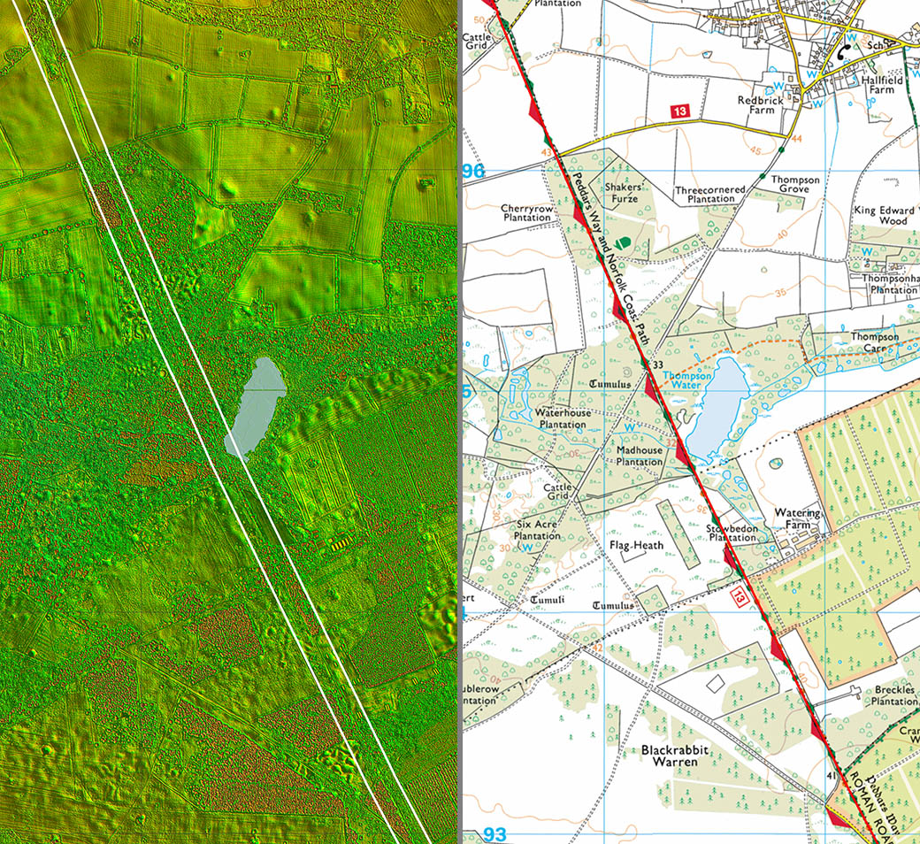
Lidar Image and Route Map 15 Did the alignment of the road target passing Thompson Water? There does appear to have been a very subtle change of direction to negotiate this pond. A feature of Roman sites in Norfolk and Suffolk is the proximity to water - often meres.
|
Click for larger view |
 |
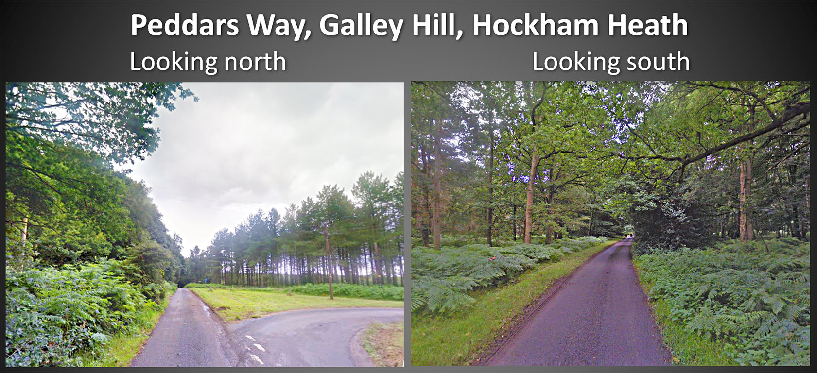
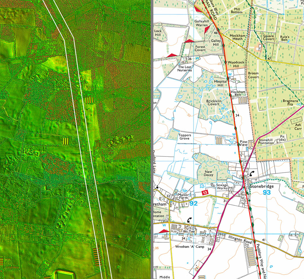
Peddars Way - Galley Hill, Hockham At last a change of direction from that we have been following all the way from Holme next the Sea! So we now turn through 19 degrees and take a more southerly course for our final alignment towards Suffolk. There is some indication on the left image that Galley Hill is actually a reasonable hill and was no doubt logically selected for setting out reasons. Images: Google |
Click for larger view |
 |
Lidar Image and Route Map 16 On this section is the alignment change of 19 degrees at Galley Hill before we head for Stonebridge..
|
Click for larger view |
 |
Peddars Way - A1075, Stonebridge The Dog and Partridge in Stonebridge is approximately on the line of the Roman road and for any long distance path walkers at last some rest and relaxation. Image: Google |
Click for larger view |
 |
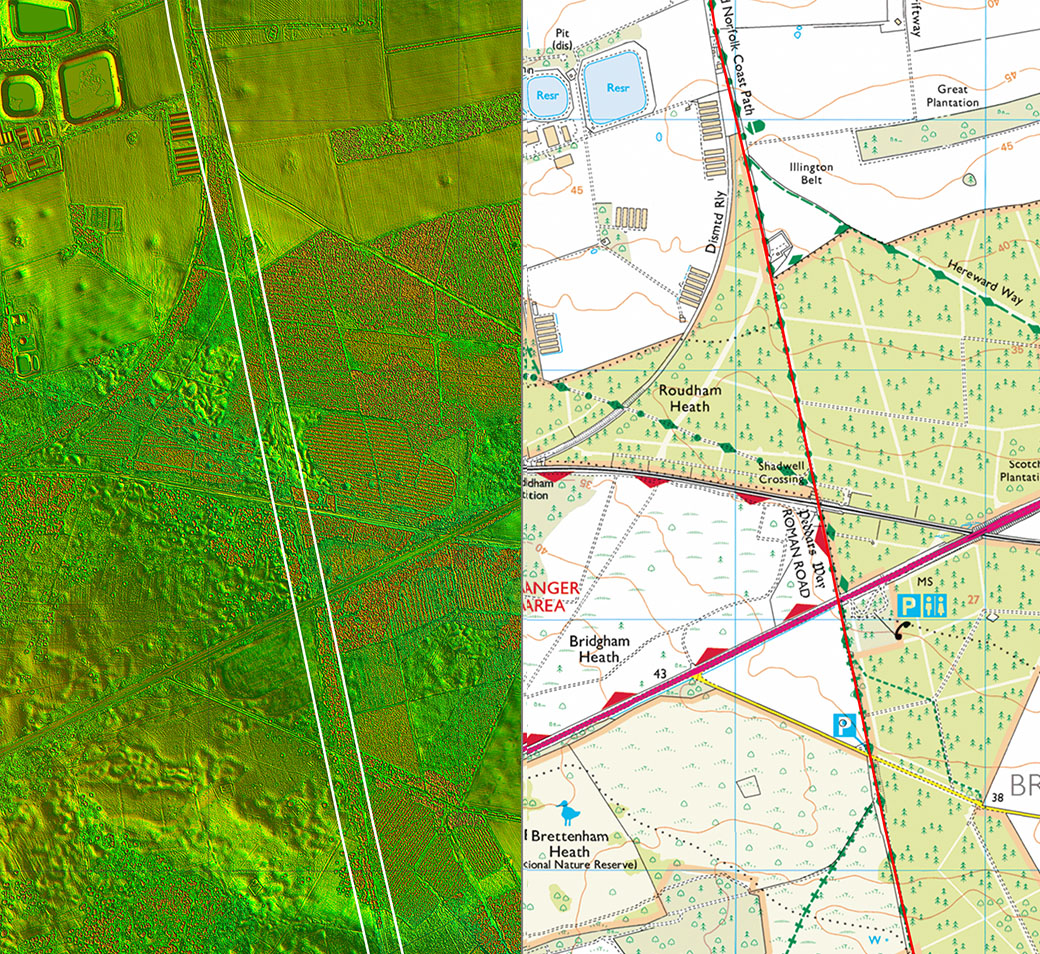
Lidar Image and Route Map 17 More of the same, the alignment continuing unerringly straight on. The A11 is an unrestricted dual carriageway and great care is needed here. Another case of a footbridge needed?.
|
Click for larger view |
 |
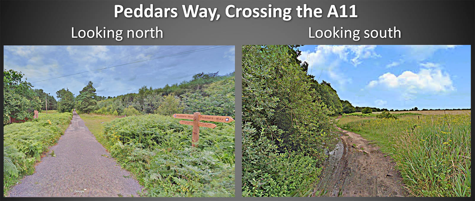
Peddars Way - Crossing the A11 There is a car park here for the forest but the A11 is hardly a safe road to attempt to cross. Images: Google |
Click for larger view |
 |
Lidar Image and Route Map 18 On the basis of the Lidar evidence the Roman alignment was probably more direct than the current Peddars Way Footpath. There is some evidence (agger?) south of the river but on the north bank nothing really to confirm this crossing point.
|
Click for larger view |
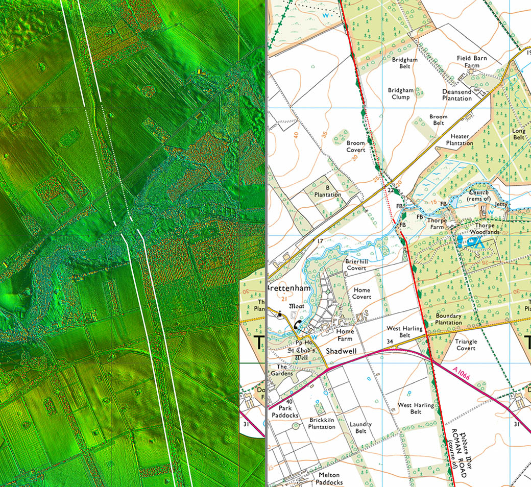 |
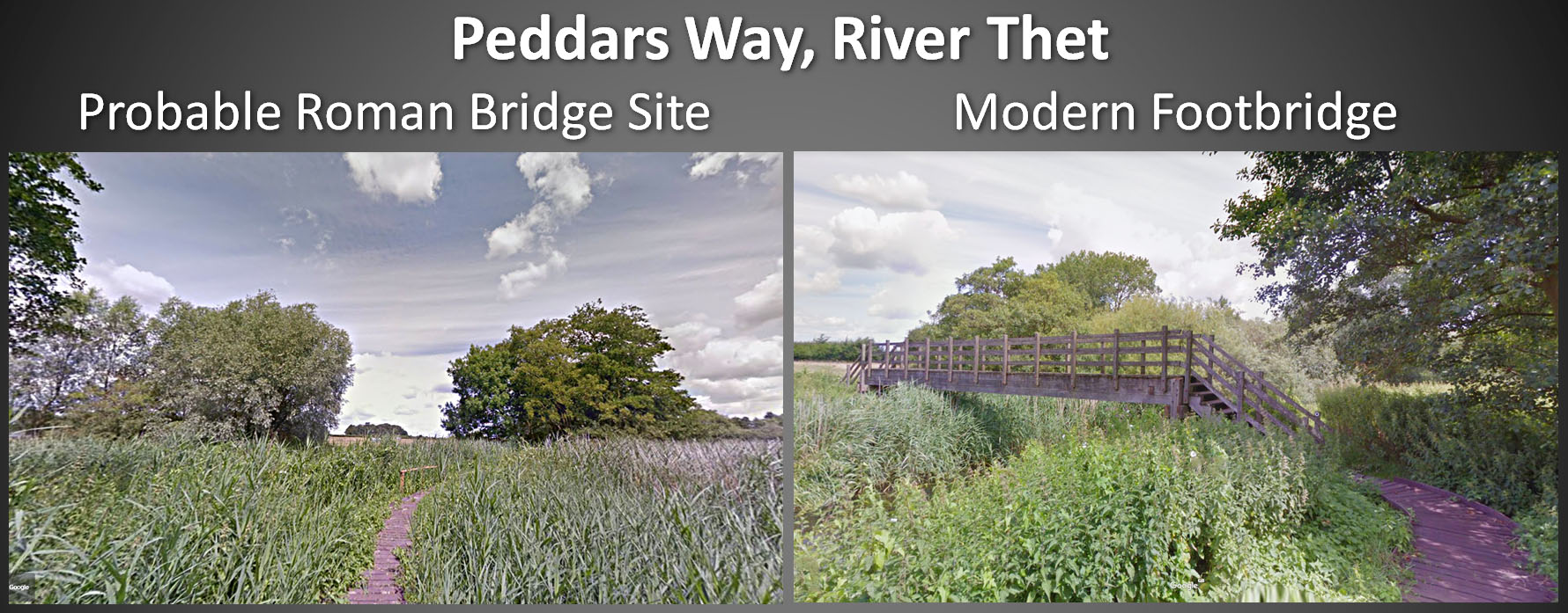
Peddars Way - River Thet At Brettenham, Peddars Way has to cross the River Thet. The indications are from the Lidar data that the Roman crossing point was more direct (see Map18) and west of the current footbridge. Brettenham means village of the Britons. Image: Google |
Click for larger view |
 |
Lidar Image and Route Map 19 The long alignment from Galley Hill comes to an end for the crossing of the Little Ouse River. The Roman road dog-legs to negotiate the river. Once into Suffolk a new alignment begins -see the Suffolk section for its continuation to Ixworth.
|
Click for larger view |
 |
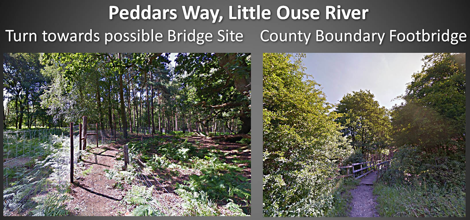
Peddars Way - Little Ouse River In the left image this is the end of the long alignment and we swing to the right for presumably the best bridging point in Roman times. In the right hand image we are on the Suffolk bank looking back to Norfolk. Images: Google |
Click for larger view |
 |
|
|
|
Last update: July 2020 |
© David Ratledge |