
|
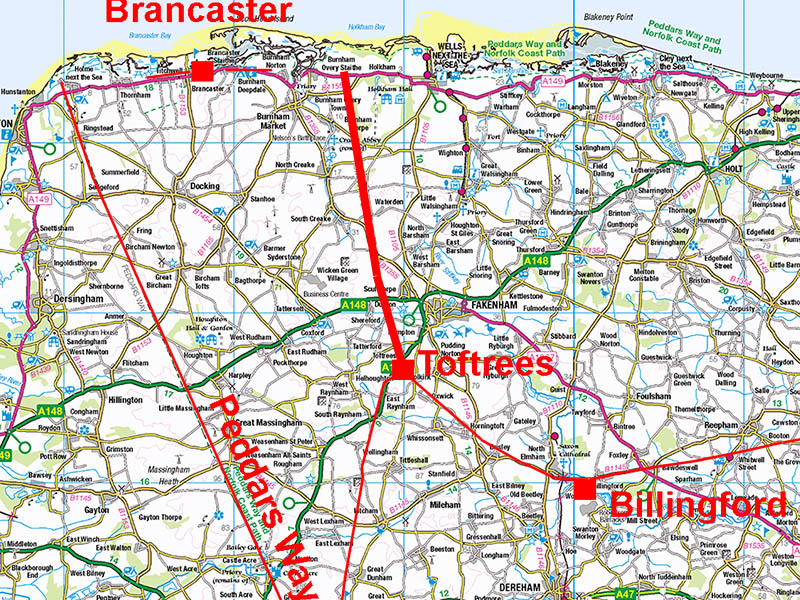
The Roman Road from Toftrees to Overy Marshes (North Coast)Margary Number: 39Distance: 11 milesThe destination of this road must surely have been to a north coast port/harbour. If is often described at having Holkham as its destination and it does indeed pass through Holkham but Lidar has shown its last visible section is towards Overy Marshes, in the parish of Burnham Overy. Unfortunately, Lidar data is currently (2019) only available for around half the length of this road. Nevertheless its directness and survival in the landscape has meant its course can be confidently plotted. Its final stretch towards a plantation at Marsh House Farm is covered by Lidar so this can be added to the known length. Note the HER doglegs the road here to follow the parish boundary but I could see no supporting Lidar evidence for this. Norfolk HER: 1791 |
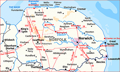
Historic Counties: Norfolk Current Counties: Norfolk HER: Norfolk
|
|
|
|
|
|
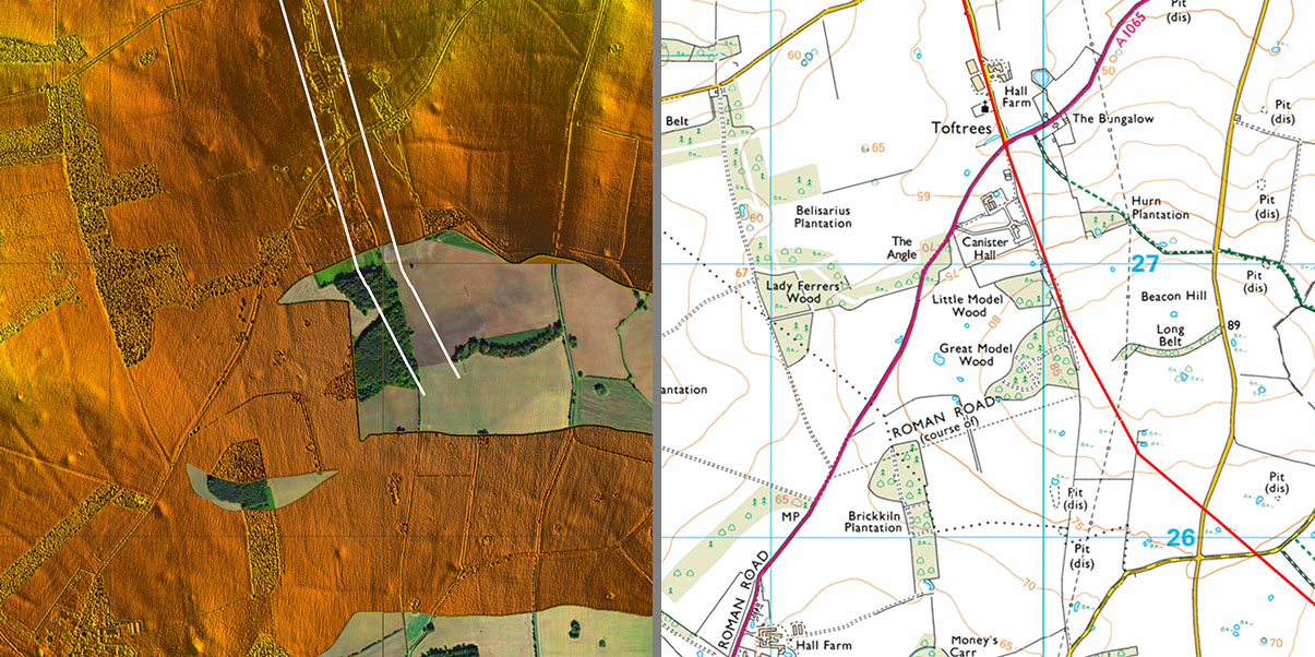
Toftrees - Aerial Photos Aerial Photo Plate 4 from East Anglian Archaeology Report No.5 Norfolk, Norfolk Archaeological Unit, 1977, has been overlaid on top a modern Google Earth aerial. The junction and Roman settlement of Toftrees is evident. |
Click for larger view
|
 |
Lidar/Aerial - Full Route A very simple straight alignment with fractional changes of direction - these could just be the limits of Roman surveying accuracy. |
Click for larger view |
 |
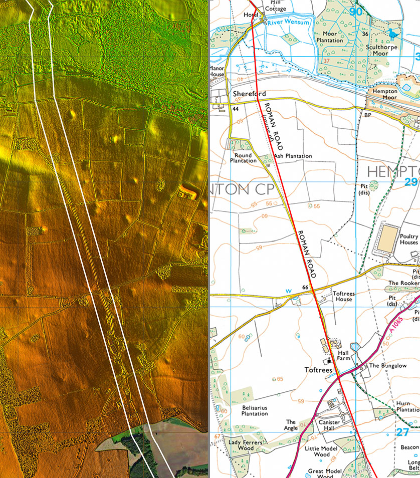
Lidar/Aerial & Route Map - 1 The road arrangement at Toftrees is a bit odd - perhaps there was a westerly shortcut as well, roughly along the line of the modern A1065. |
Click for larger view |
 |
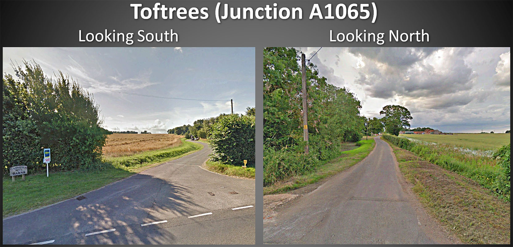
Toftrees (A1065) - Streetview Where the road crosses the A1065 the route south is not too obvious but northwards the modern road shows how it is built on top of a substantial agger. |
Click for larger view |
 |
Lidar/Aerial & Route Map - 2 The marshes of the River Wensum would have been a major obstacle and the indication is that the alignment swung to the west slightly for the crossing rather than the course OS mapping shows. |
Click for larger view |
 |
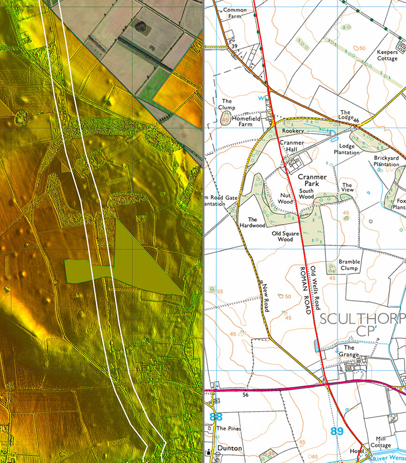
Lidar/Aerial & Route Map - 3 There was another slight wobble in the alignment at Cranmer Park. Note also the name "Old Wells Road". |
Click for larger view |
 |
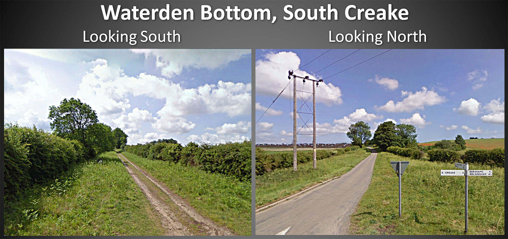
Waterden Bottom - Streetview At Waterden Bottom the modern farm track coming in from the south is dwarfed by the agger that it sits on top of. Heading north too the Roman agger is much wider than the modern road warrants. |
Click for larger view |
 |
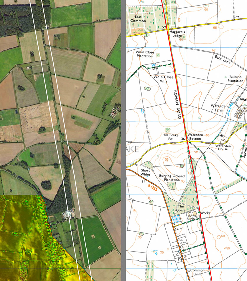
Lidar/Aerial & Route Map - 4 A clue often to the age of a road is if the field boundaries respect it i.e. they use it as a boundary rather than have been severed by it. This is the case here. |
Click for larger view |
 |
Lidar/Aerial & Route Map - 5 Holkham Hall used the road as it western boundary so we can be reasonably certain the road was still in use when the hall was established. |
Click for larger view |
 |
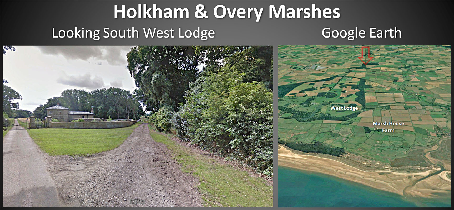
Holkham and Overy Marshes - Google Looking south at Holkham Hall's western gate the road survives as a track alongside the boundary wall. The sea-side of Marsh House Farm appears to be reclaimed land and presumably the sea or a navigable creek approached here making it a natural harbour worth running a road to.
|
Click for larger view |
 |
Oblique 3D Lidar Image - Overy Marshes-Holkham We are looking back down the line of the road. There can be little doubt that the road targetted what appears to be a promontory now perhaps partly washed away. This was located just west (right) of the Holkham Iron Age Fort or Camp. |
Click for larger view |
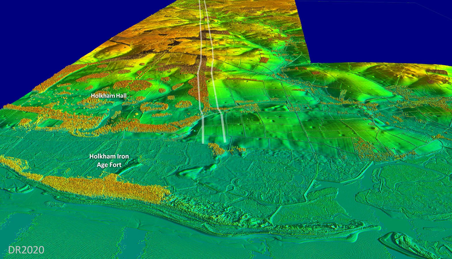 |
Lidar Image - Roman road and Holkam Camp The road does not target Holkam Camp but probably did target a safe harbour there but on its western side. Inset: close-up of the camp - a very low hillfort!!! |
Click for larger view |
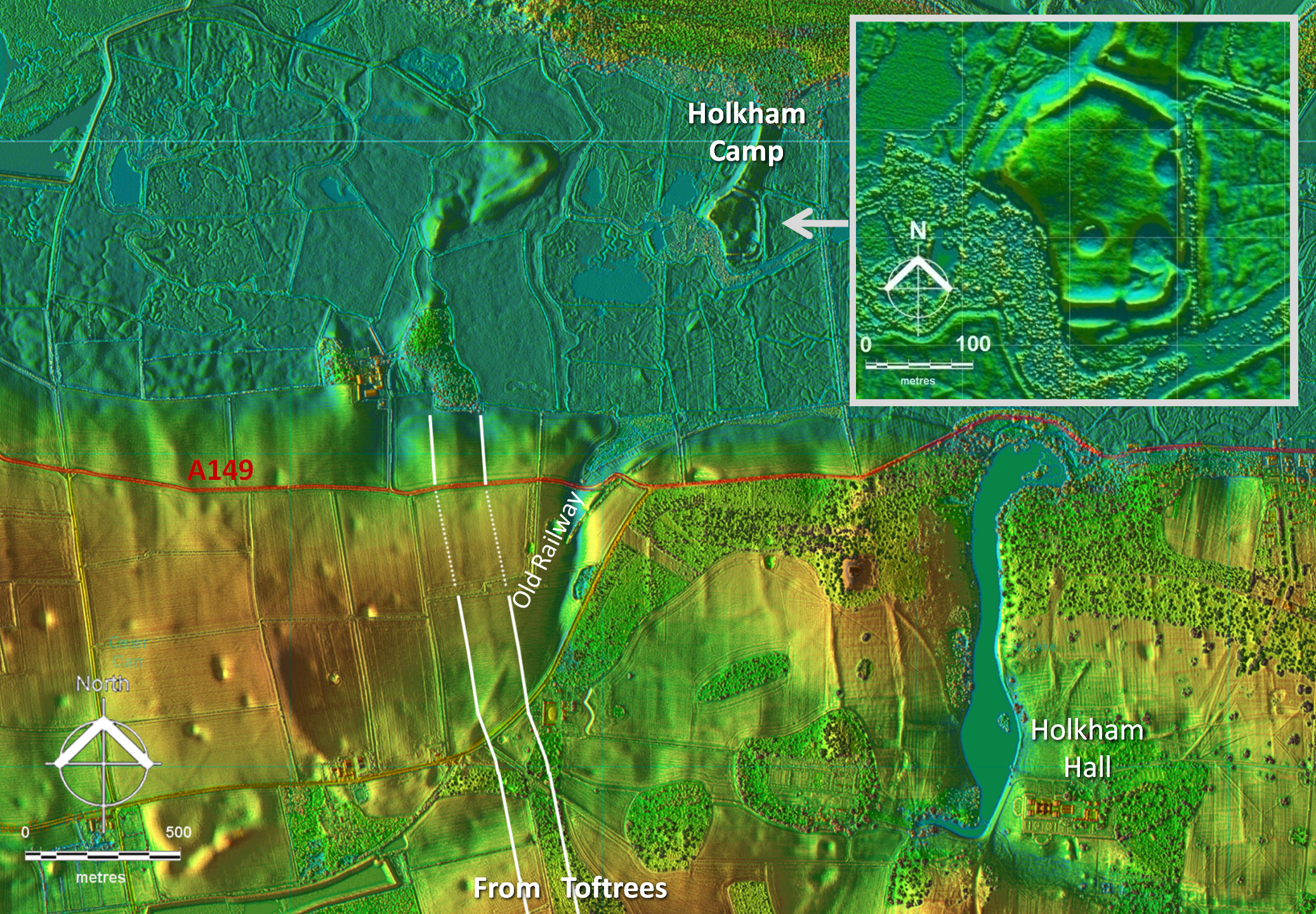 |
Lidar/Aerial & Route Map - 6 The destination of the road appears to have been a port or harbour near the knoll at Marsh House Farm - now a plantation. Obviously coastal changes over the centuries will have removed any traces of the harbour. One wonders why the Roman's needed two north coast roads to harbours (this and Peddars Way). Did one become silted up and a replacement was required? |
Click for larger view |
 |
|
|
|
Last update: January 2020 |
© David Ratledge |