|
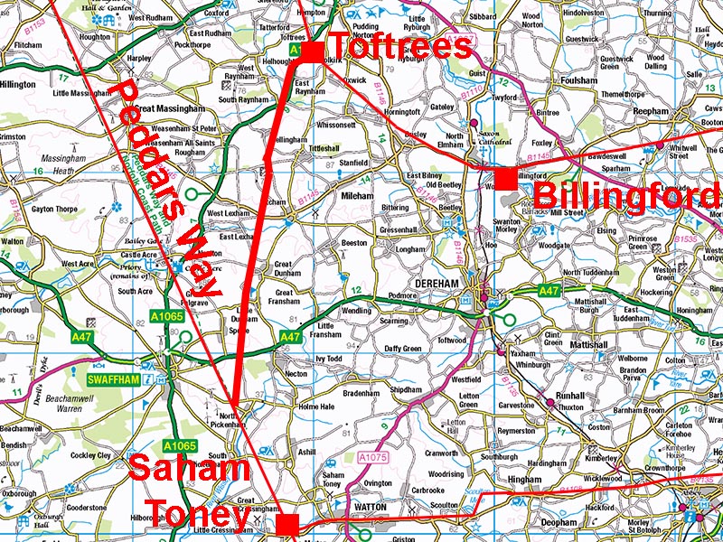
The Roman Road from Toftrees to North PickenhamMargary Number: NoneDistance: 13 milesA very direct road that at first glance would appear to be a branch off Peddars Way. However, without dating evidence this is somewhat speculative but the arrangement would tend to indicate that Peddars Way was the earlier road. This road is sometimes referred to Walsingham Way indicating it was still in use long after the Romans departed and was then the route to Walsingham. Today though only the first mile has a modern road utilizing it. From the A1065 onwards the road has survived well in the landscape and its course can be easily located - at least using Lidar. Norfolk HER: 3697 |
Historic Counties: Norfolk Current Counties: Norfolk HER: Norfolk
|
|
|
|
|
|
Lidar Image - Full Route The colour scheme I have used exaggerates the scale of the topography - it is hardly a mountain pass! |
Click for larger view
|
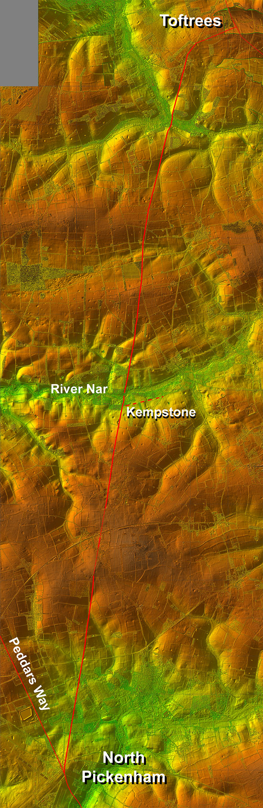 |
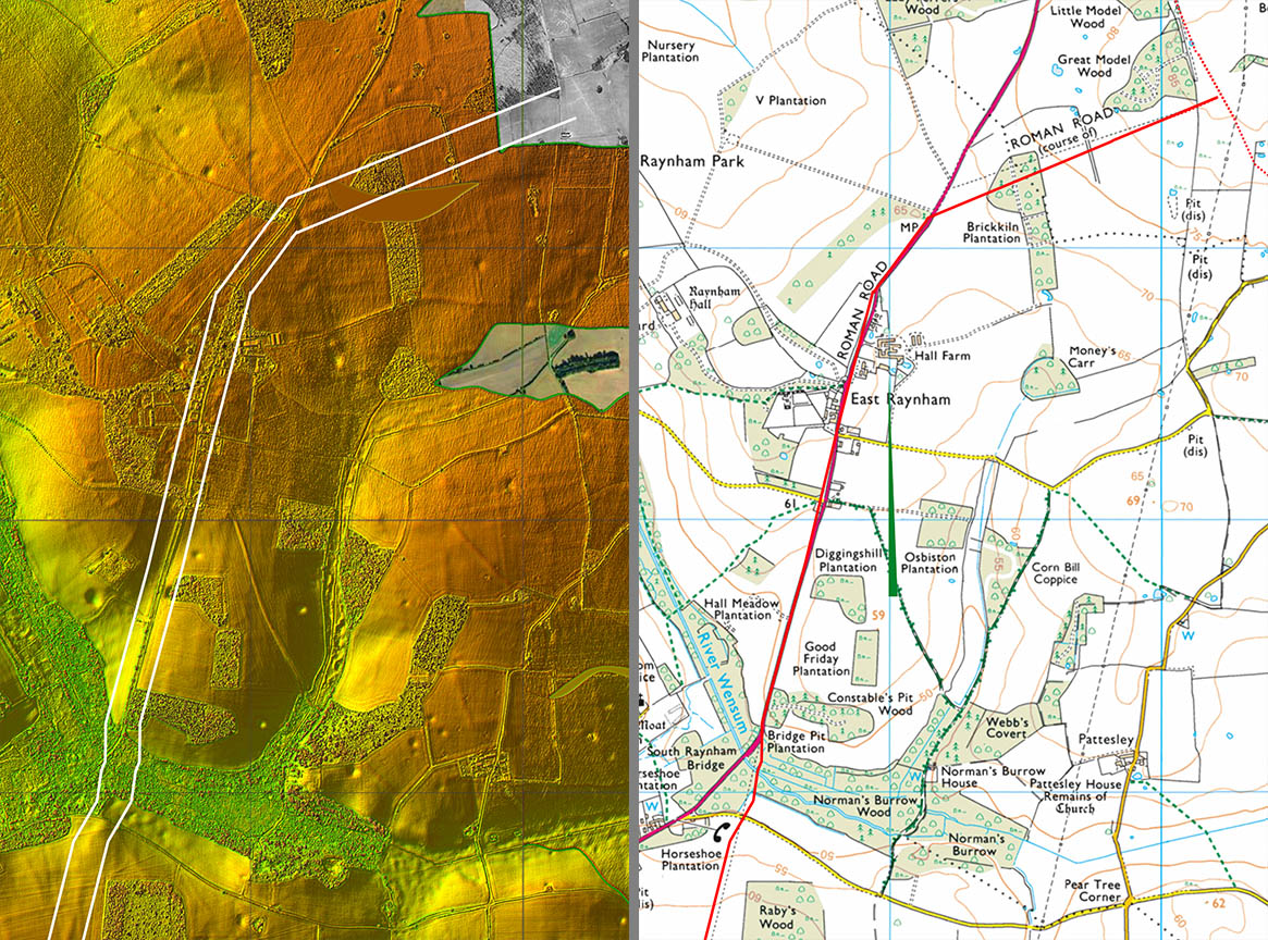
Lidar Image & Route Map 1 There is a link road across from the Toftrees Roman Settlement (plotted incorrectly on the OS map) to the main alignment for North Pickenham and Peddars Way. This is suggestive that there could well have been a direct bypass road following the A1065 and now masked by it. At Raynham Bridge the Roman line diverges from the modern road and is rarely utilised as a modern road again. |
Click for larger view |
 |
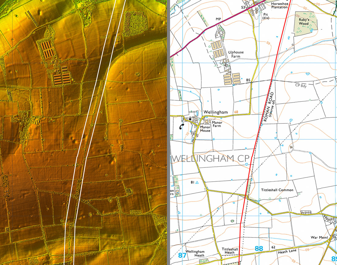
Lidar Image & Route Map 2 Puzzlingly on this stretch the parish boundary follows parallel to the Roman agger but not precisely on it. Did the parish boundary follow the outer 4th eastern ditch? |
Click for larger view |
 |
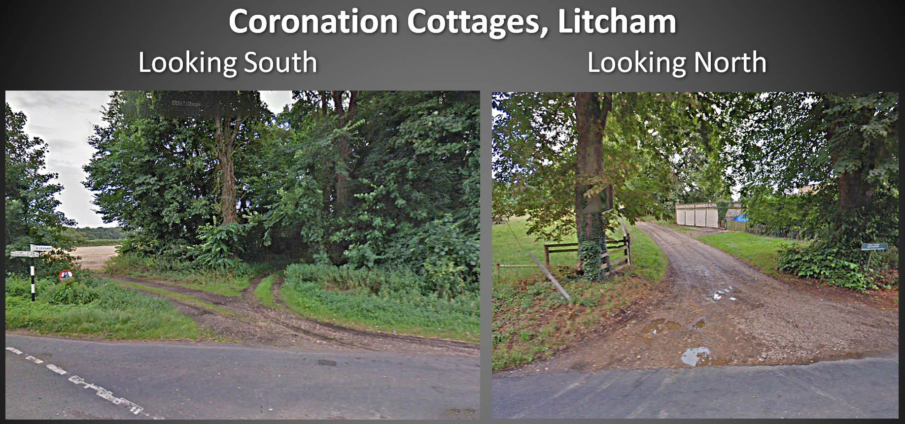
Coronation Cottages - Streetview I have driven past this point many times without realising the Roman alignment crossed here! Southwards is perhaps explicable as the route is through a dense copse. Northwards is more open but there is no sign of an agger. I have always thought at this junction that the road heading west looked Roman - more research required! |
Click for larger view |
 |
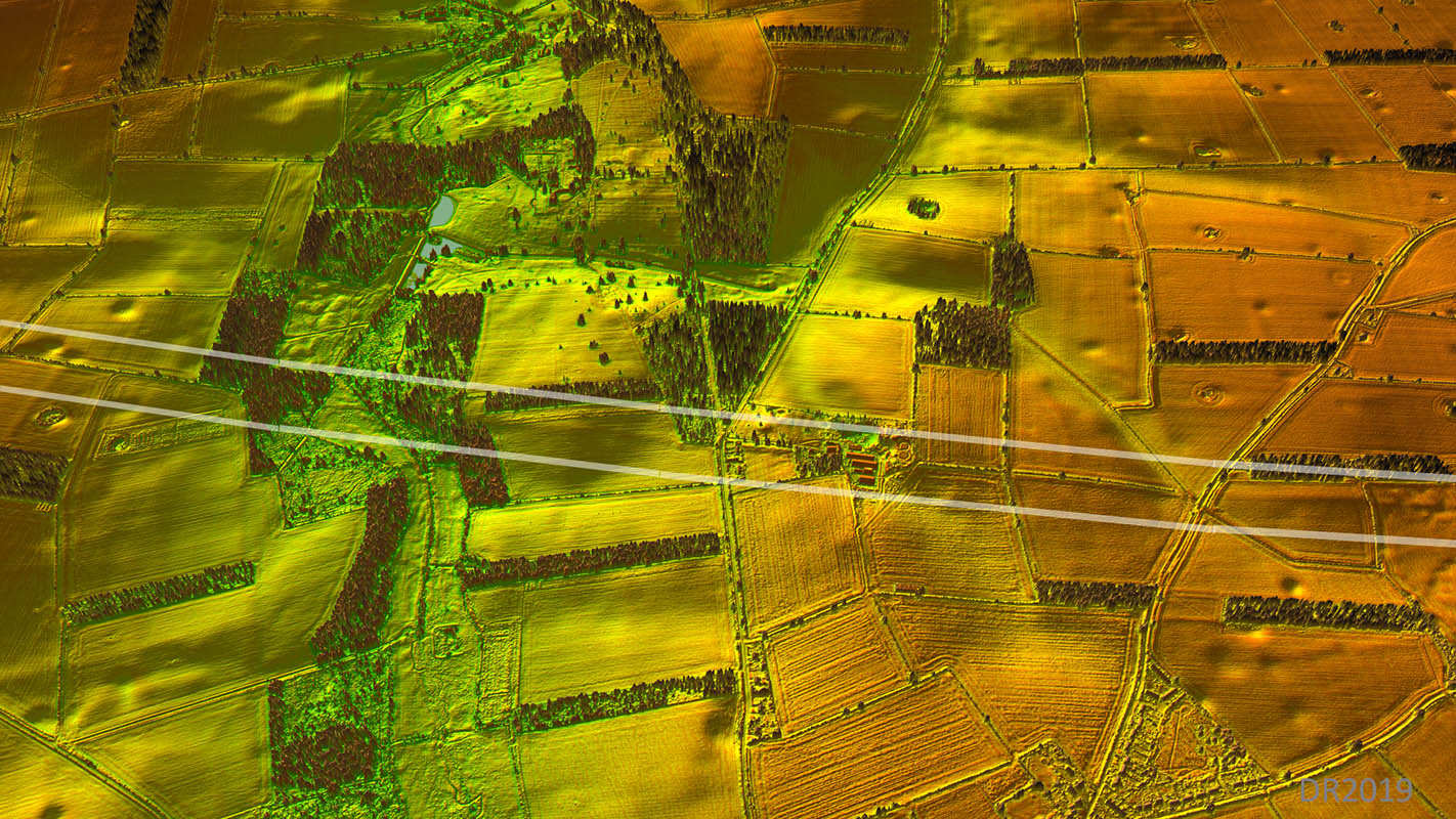
Oblique 3D Lidar Image Coronation Cottages In this view we are looking west with our road passing right to left rather than down the line of the road as is usual. The route is clear and there are obvious traces of the road agger on the south (left) side of the River Nar crossing. |
Click for larger view |
 |
Lidar Image & Route Map 3 This is the plan view of the approach to Litcham with Litcham and Coronation Cottages at the bottom.. |
Click for larger view |
 |
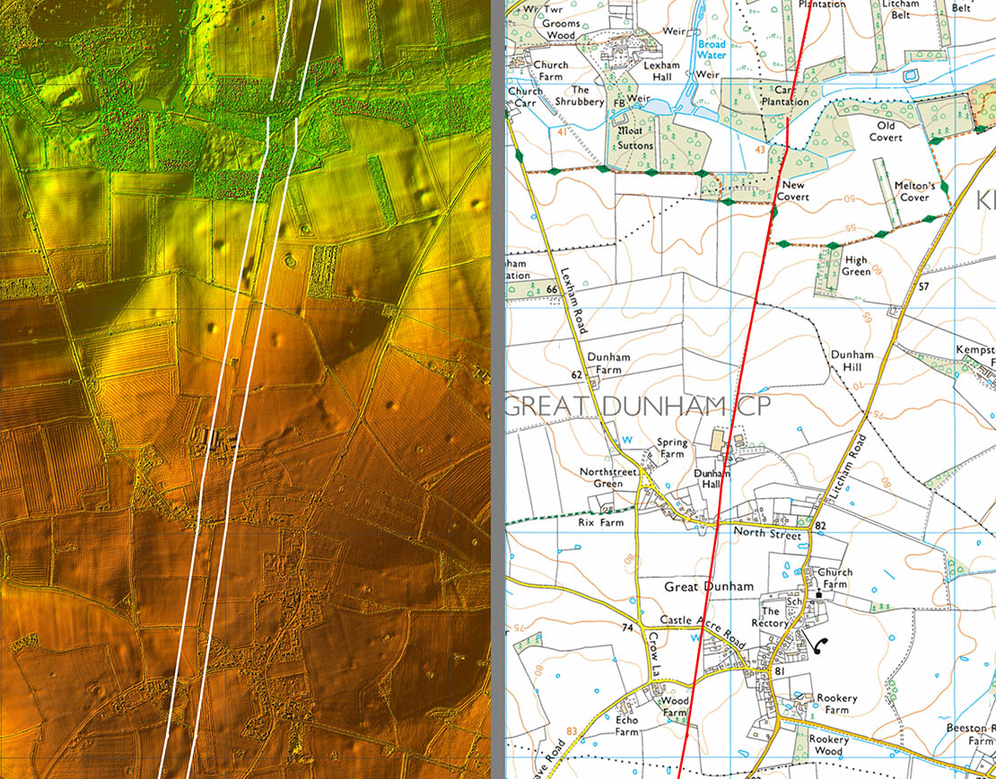
Lidar Image & Route Map 4 Passing Great Dunham the route is clear and Dunham Hall appears to have its entrance directly onto our road! |
Click for larger view |
 |
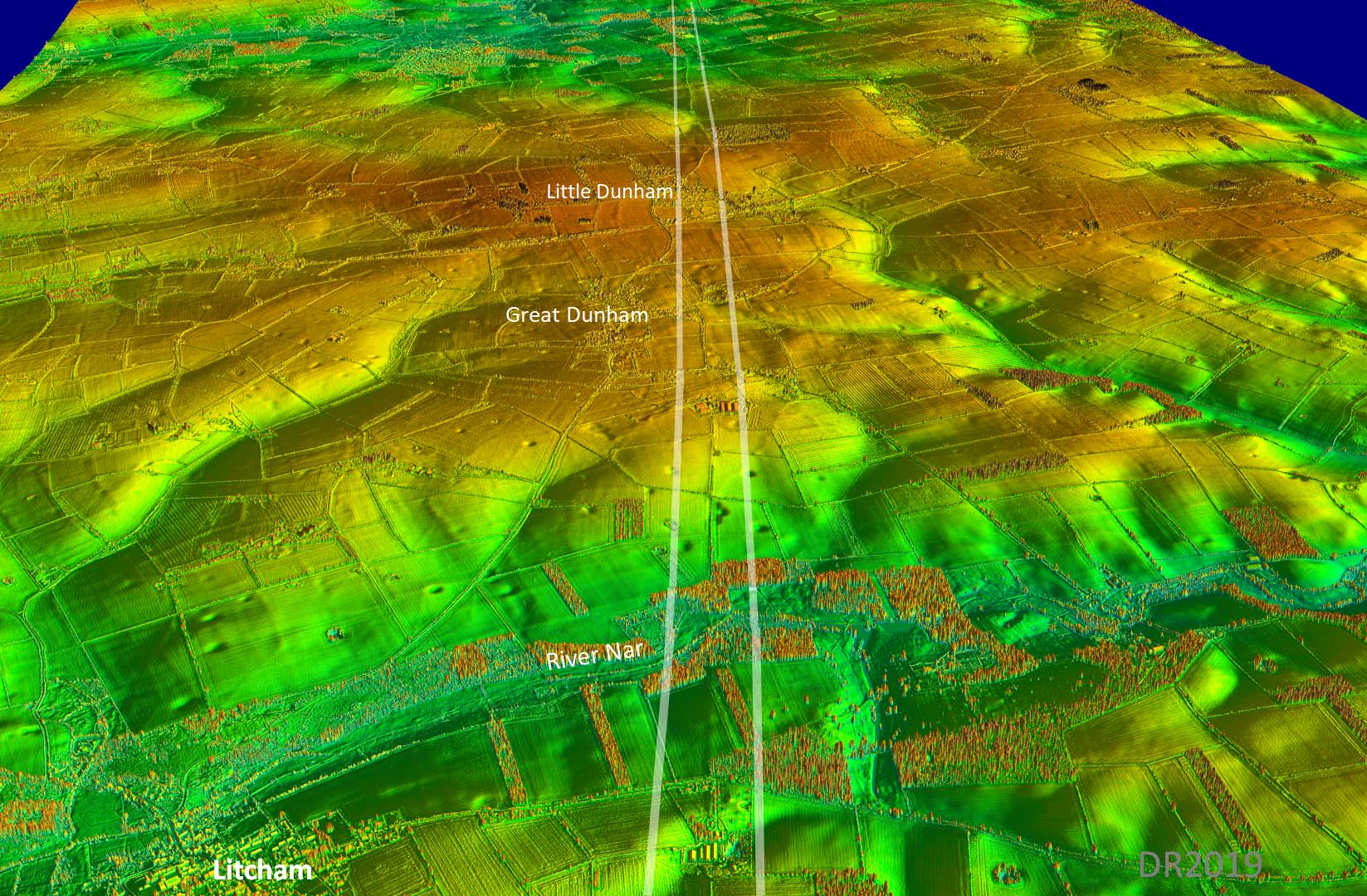
Oblique 3D Lidar Image - Great & Little Dunham The line across Little Dunham was lost but there is sufficient Lidar evidence to confirm it almost certainly continued its straight alignment just to the west of the village. |
Click for larger view |
 |
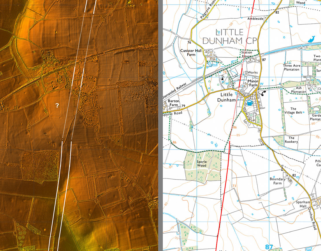
Lidar Image & Route Map 5 There is a suspicion of something just west of the road at Little Dunham - looks to have rounded corners. Nothing listed in the HER though. |
Click for larger view |
 |
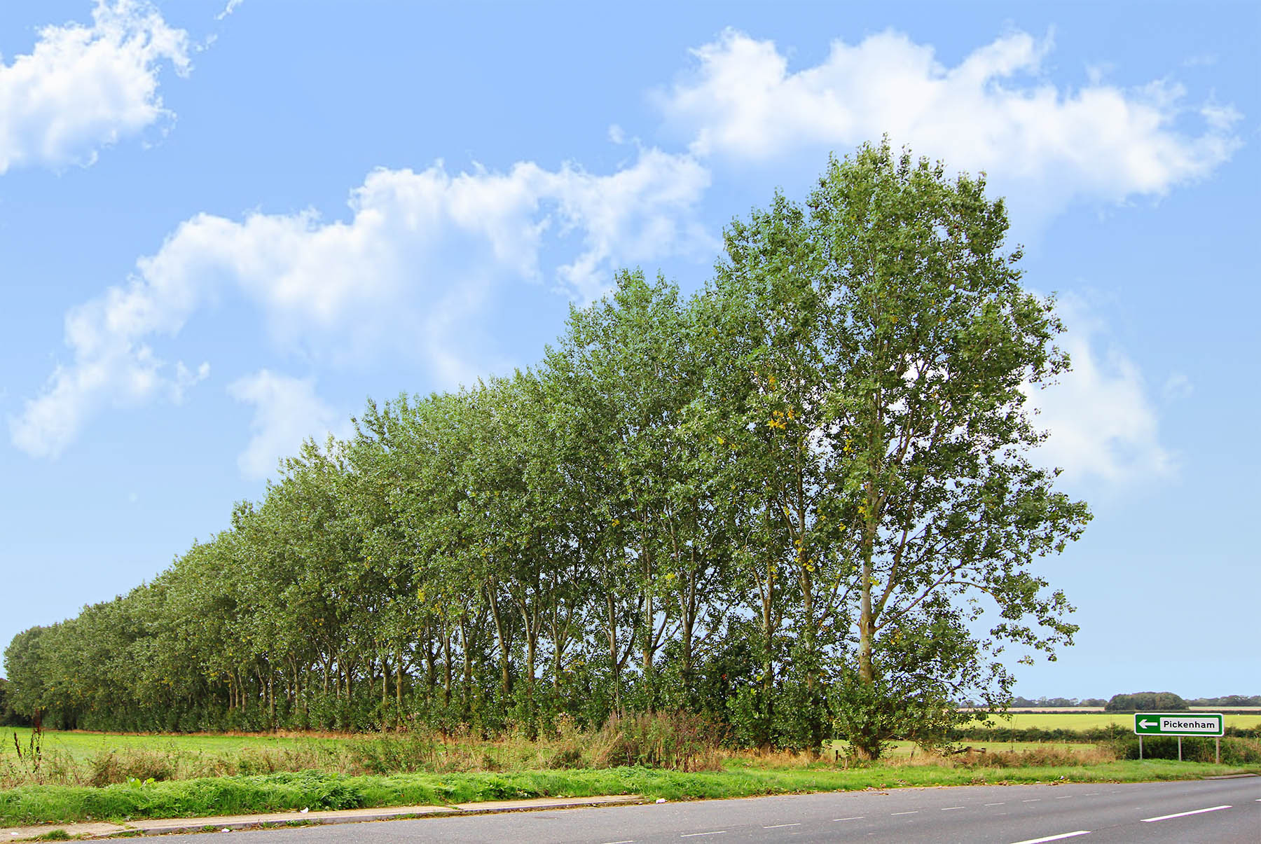
A47 - looking South The crossing point of the A47 is marked by this line of trees on top of the Roman agger. Very convenient that the modern sign points to Pickenham down the Roman alignment! Image: DR |
Click for larger view |
 |
Lidar Image & Route Map 6 Getting close to the Peddars Way now. The OS line appears to be slightly in error over parts of this section. |
Click for larger view |
 |
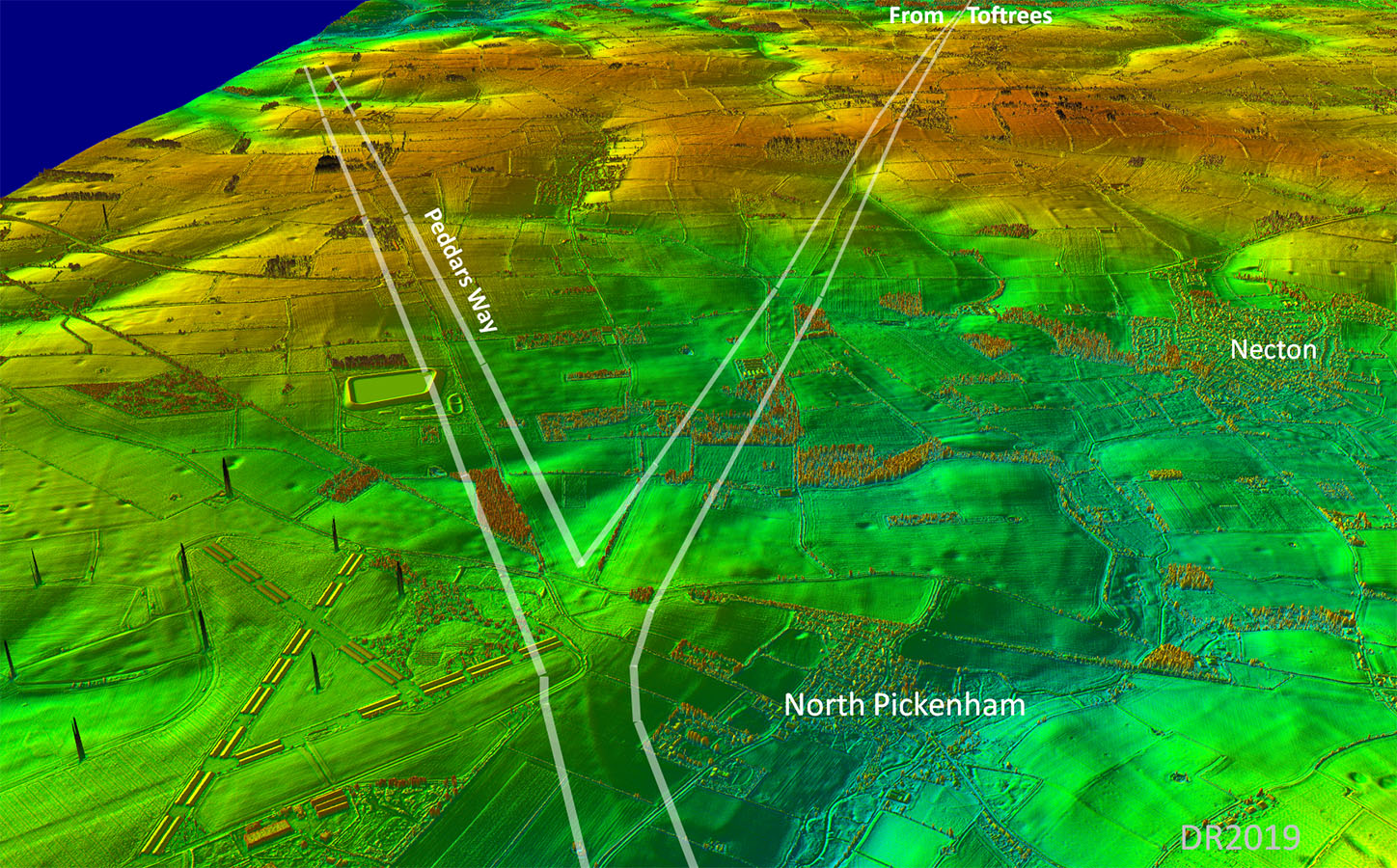
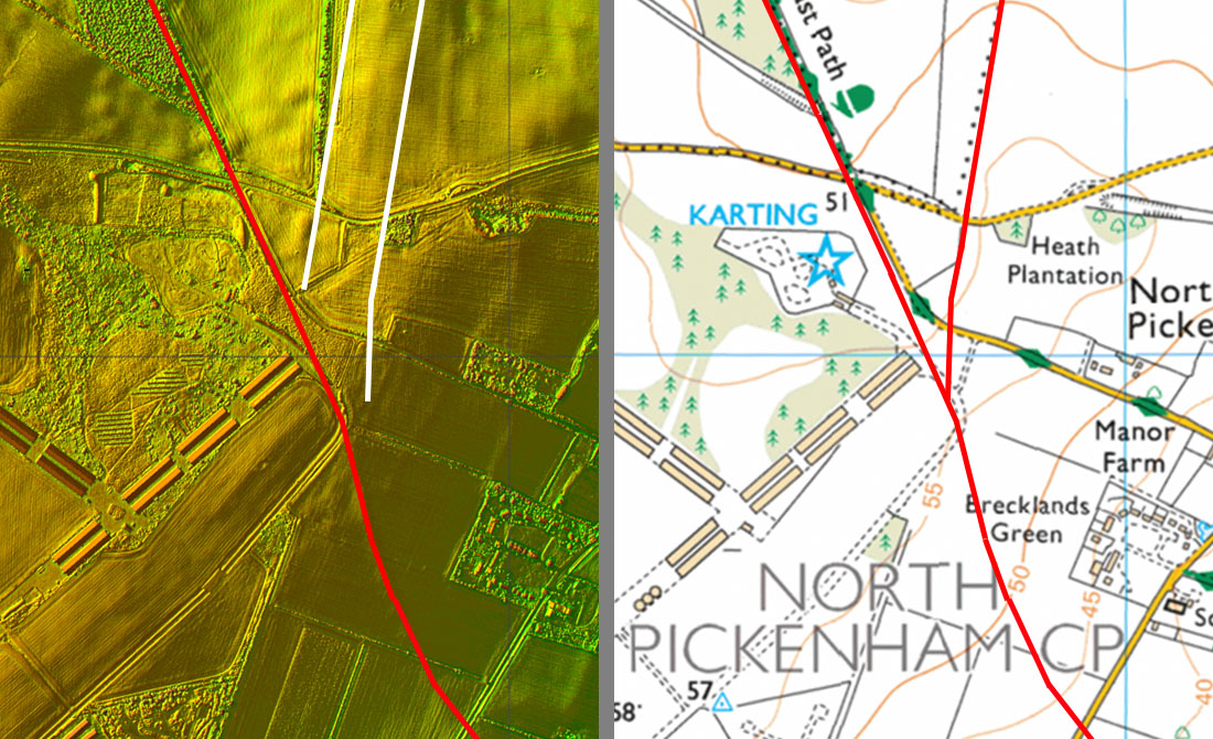
Oblique 3D Lidar Image - Junction with the Peddars Way It is pretty obvious where the junction with the Peddars Way must have been but it looks like the corner the old airfield has destroyed the actual merger point. |
Click for larger view |
 |
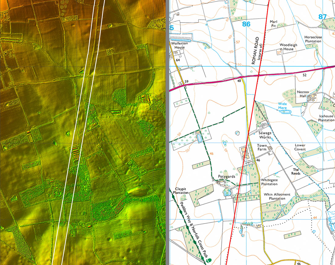
Lidar Image & Route Map 7 The arrangement is suggestive of Peddars Way being the earlier route. Both these roads ultimately lead to north coast ports - obviously important for the Romans. |
Click for larger view |
 |
|
|
|
Last update: January 2020 |
© David Ratledge |