|
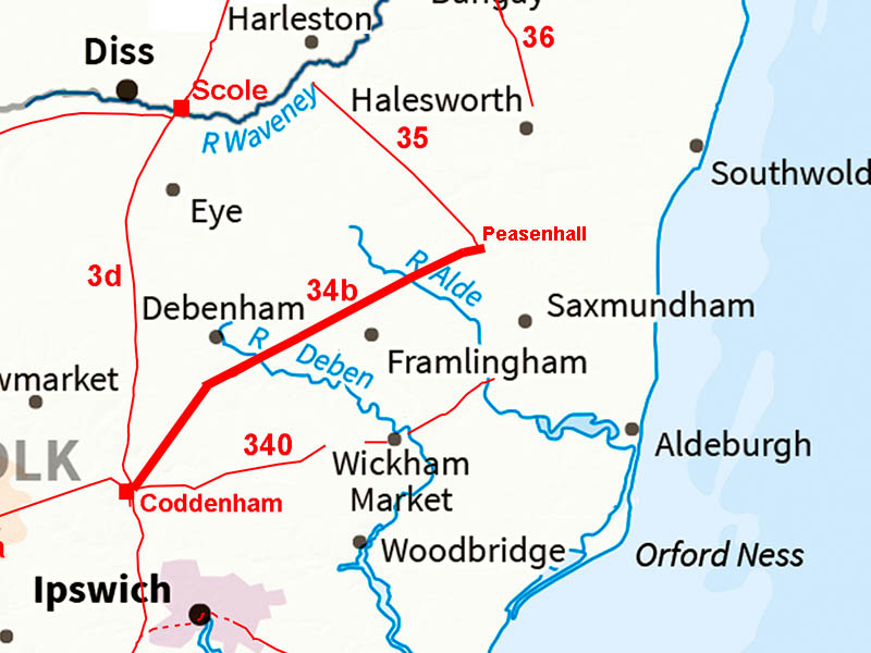
The Roman Road from Coddenham to PeasenhallMargary Number: 34bDistance: 19 milesA certain road to an uncertain destination. One of Suffolk's great puzzles. Where did this Roman road, and the others that head to east Suffolk, have as their destination?.We now know there not heading for site called Sitomagus! |
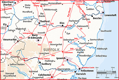
Historic Counties: Suffolk Current Counties: Suffolk HER: Suffolk
|
|
|
|
|
|
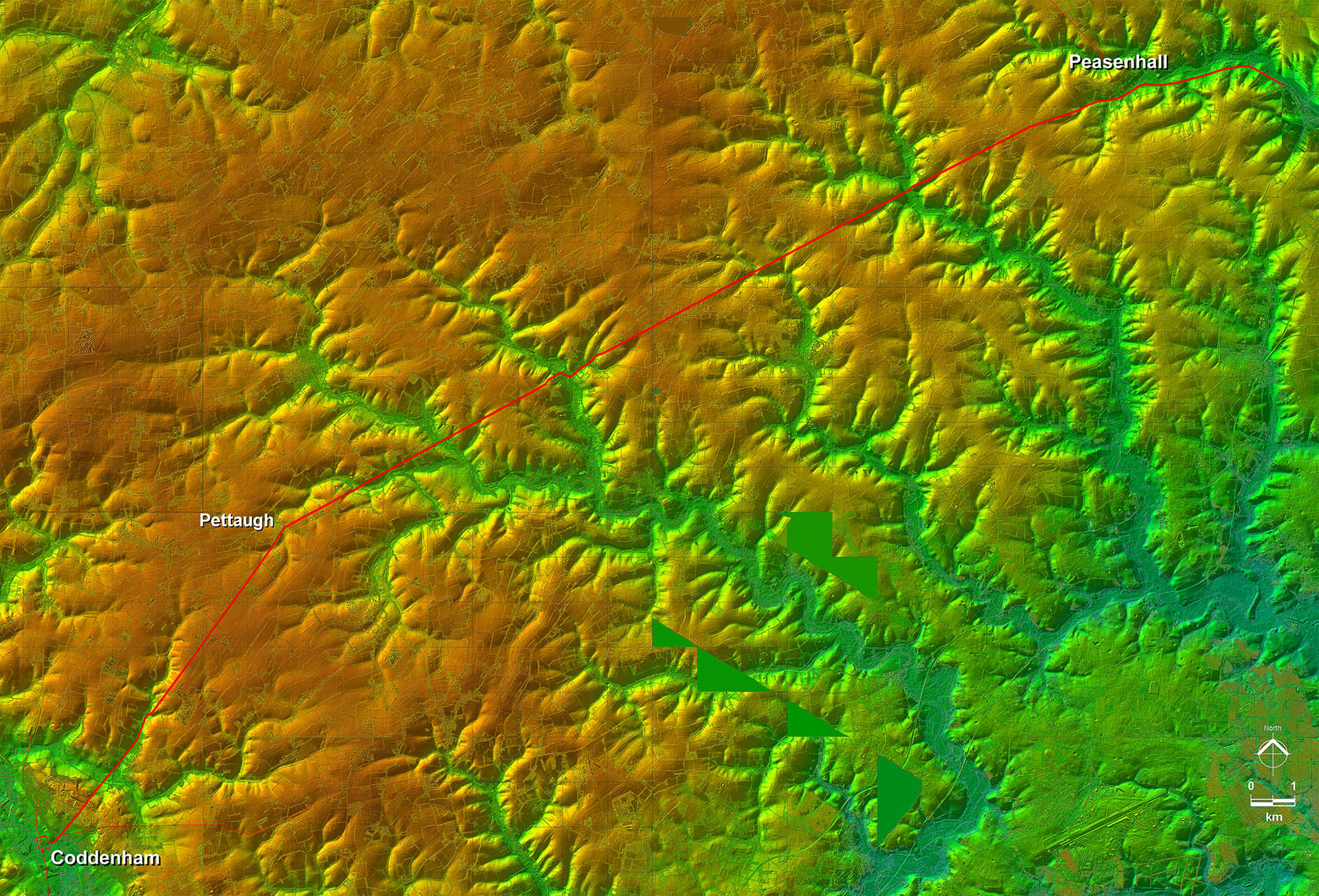
Lidar Image - Full Route The initial alignment is for Coddenham, the village, where there is a slight change of direction for Pettaugh. Here is the major alignment change for Peasenhall. |
Click for larger view
|
 |
Combretovium Site Plan A complicated and comprehensive road hub. There was also the possibility of river transport too! |
Click for larger view |
 |
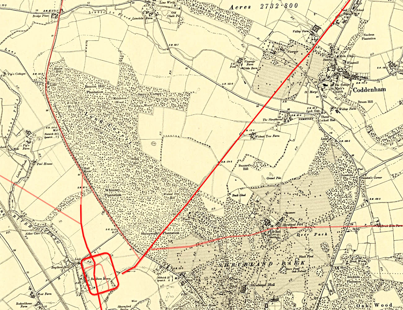
Coddenham - OS First Edition Map The Roman road appears to have had the fort's east gate as its starting point. The subsequent settlement or small town was south of the fort but it is most likely that the roads were set out early i.e. when it was a fort. |
Click for larger view |
 |
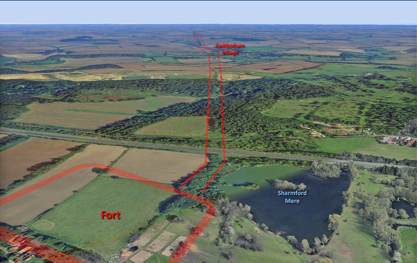
Road leaving Coddenham Fort That subtle change of direction at Coddenham is exaggerated in this Google Earth view. The later small town was to the right of the fort. Image: Google Earth |
Click for larger view |
 |
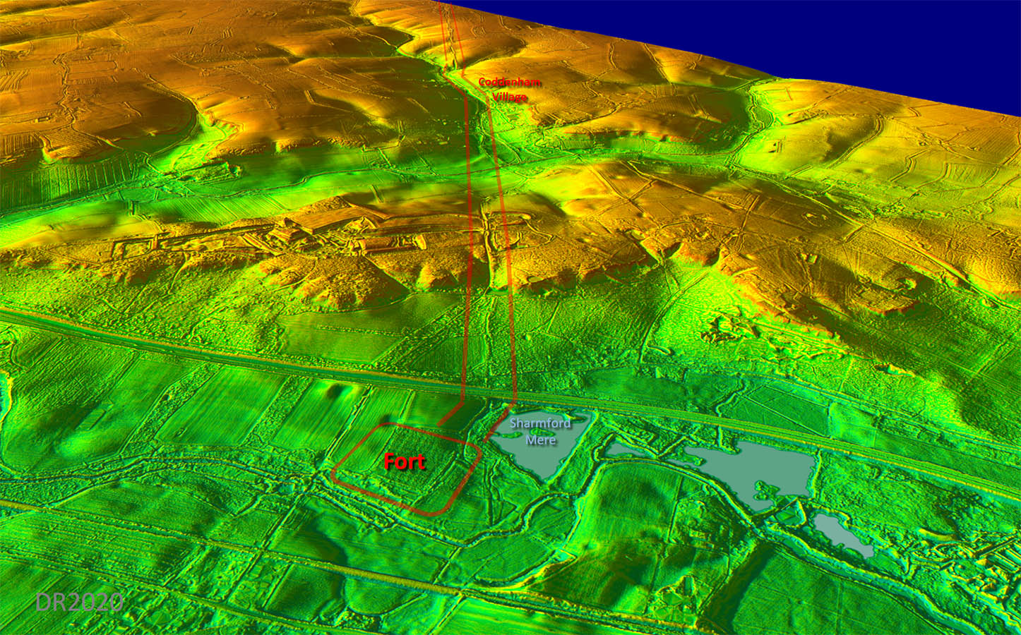
Oblique 3D Lidar Image - Coddenham This view is similar to the Google Earth one above but was derived from DTM lidar data i.e. all the buildings and trees are removed. The route of the road leaving the fort is much more obvious (and certain) in this format. |
Click for larger view |
 |
Lidar Image and Route Map 1 Although the Road initially aims for Pettaugh it needed a slight change of direction at Coddenham. |
Click for larger view |
 |
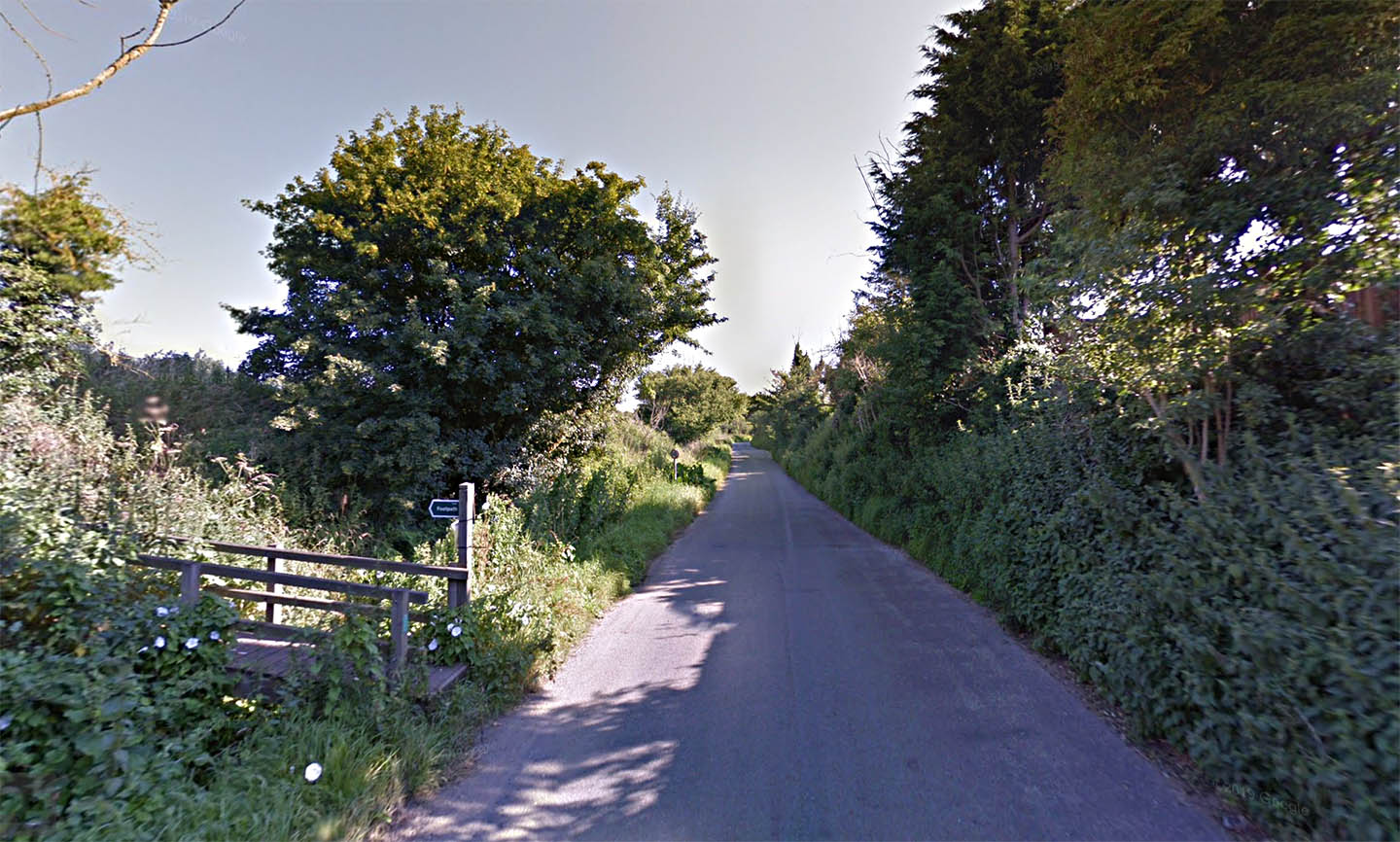
Lower Road, Coddenham Our road comes in from the left at a shallow angle and joins Lower Road, Coddenham, at about this point. Image: Google |
Click for larger view |
 |
Stone Street, Crowfield Appropriately named Stone Street indicates the stones of the Roman road still existed when it got its name. Image: Google |
Click for larger view |
 |
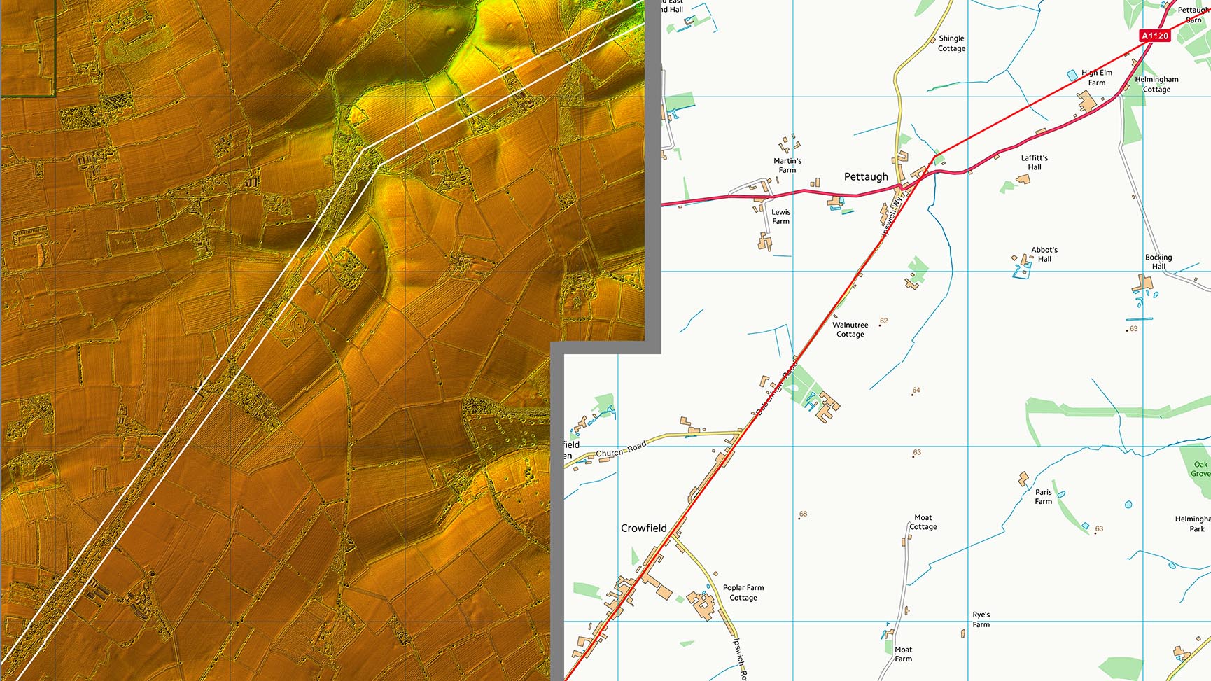
Lidar Image and Route Map 2 The first alignment from Coddenham comes an end at Pettaugh. The logic of this spot for the change of direction is hard to understand as it is far from being a high point and doesn't appear to have a good view in either direction. |
Click for larger view |
 |
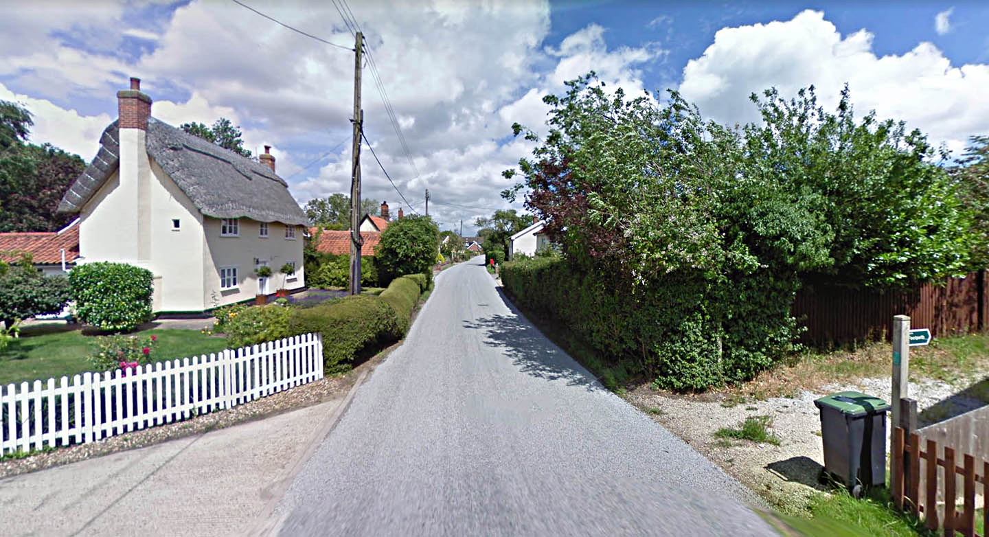
Pettaugh The road emerges from the trees, crosses Church Road and then off the image to the right will make a turn for Peasenhall. Image: Google |
Click for larger view |
 |
Lidar Image and Route Map 3 The route through Framsden, where it deviates off straight to negotiate the valley, is a little subjective. There are indications that the route shown is probably correct but not absolutely convincing. |
Click for larger view |
 |
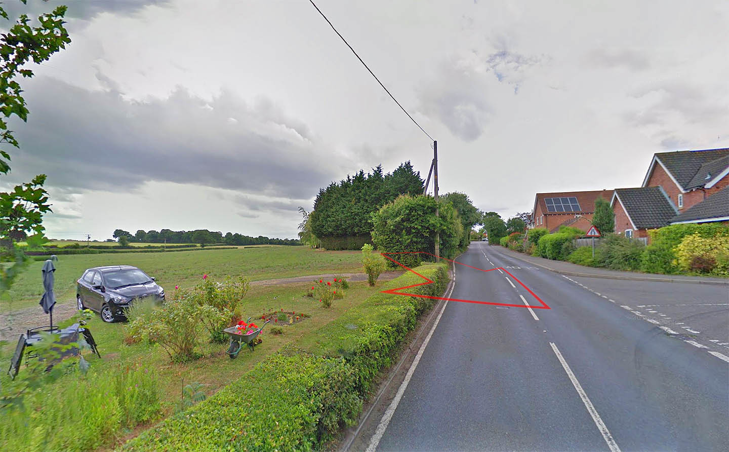
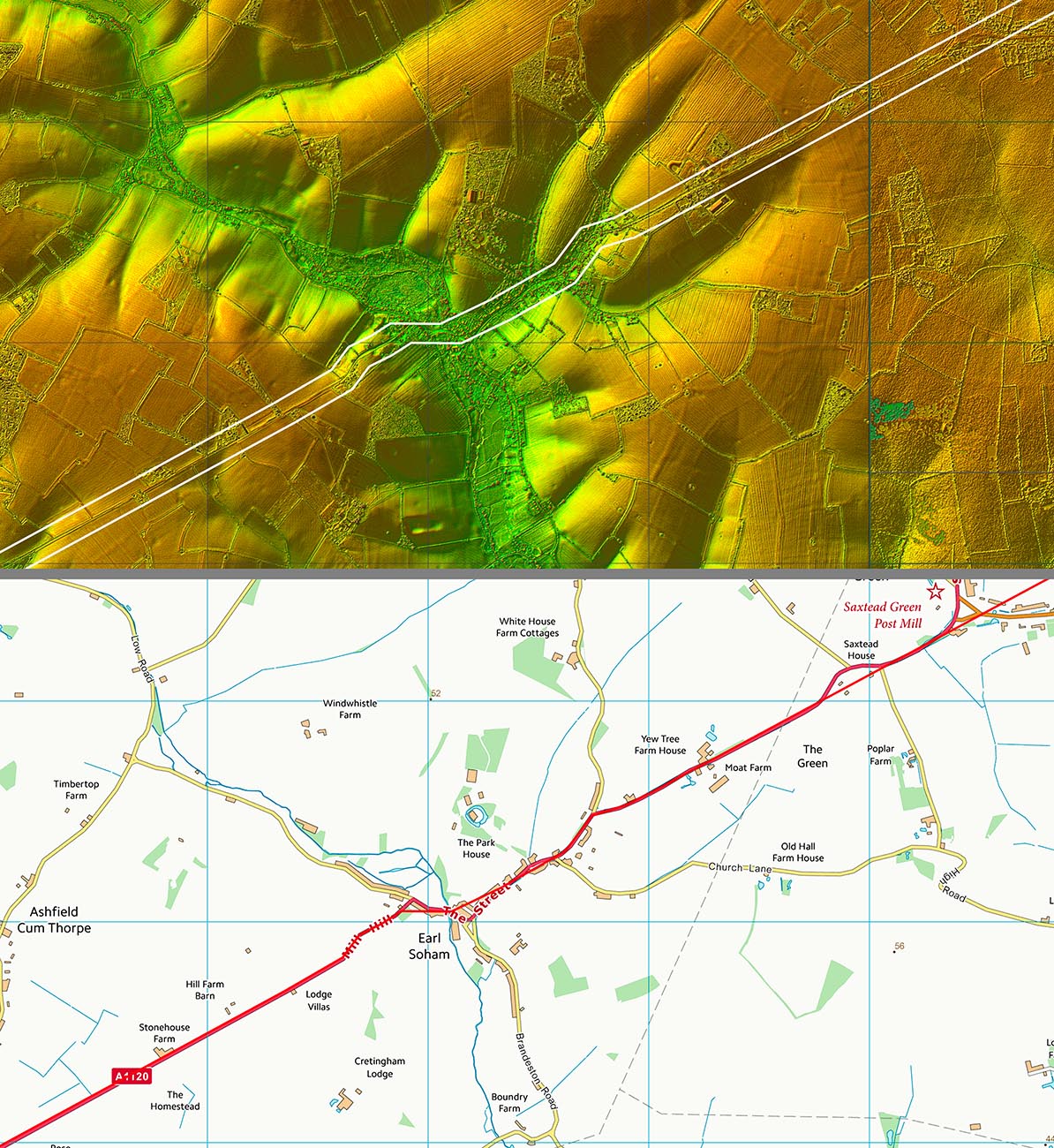
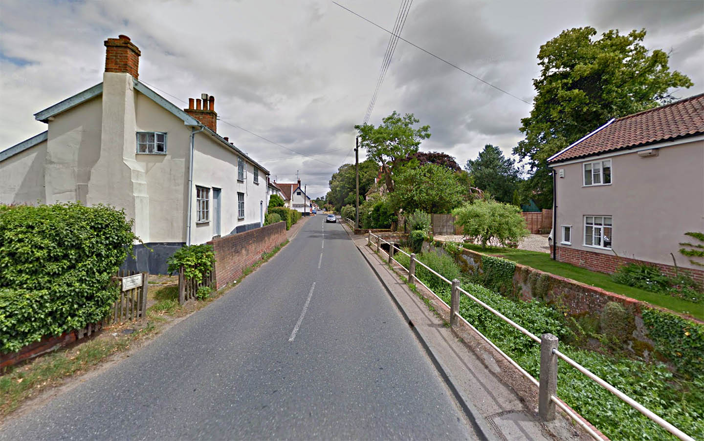
The Causeway, Earl Soham We are looking back to Coddenham and the Roman road almost certainly straight-lines the modern road here via what is known as the Causeway - that's the track beyond the red arrow. Image: Google |
Click for larger view |
 |
Lidar Image and Route Map 4 The straight alignment is maintained either side of Earl Soham but in the village itself then it adapts to the contours to negotiate the valley there. |
Click for larger view |
 |
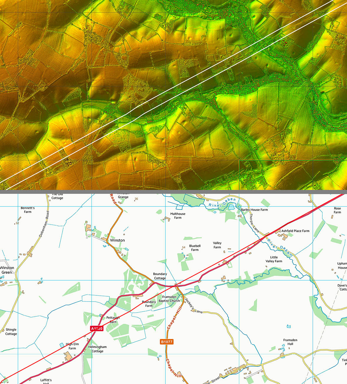
Lidar Image and Route Map 5 Unerringly straight passing Dennington where the road in known as Roman road - see below. |
Click for larger view |
 |
Roman Road, Dennington South of Dennington, there is a huge clue as to the route of the Roman Road. It is actually named Roman Road! Image: Google |
Click for larger view |
 |
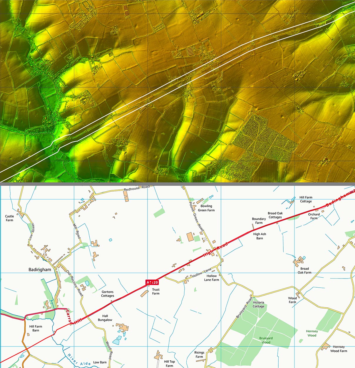
Lidar Image and Route Map 6 South of the village of Badington, then the modern A1120 road overlies the Roman line. The road is called High Road - again an appropriate name for a Roman road constructed on a built-up agger. |
Click for larger view |
 |
Peasenhall The attractive village of Peasenhall marks the junction of our Road from Coddenham and a second Roman road from Harleston. The junction was at the modern crossroads behind the car in the distance. Image: Google |
Click for larger view |
 |
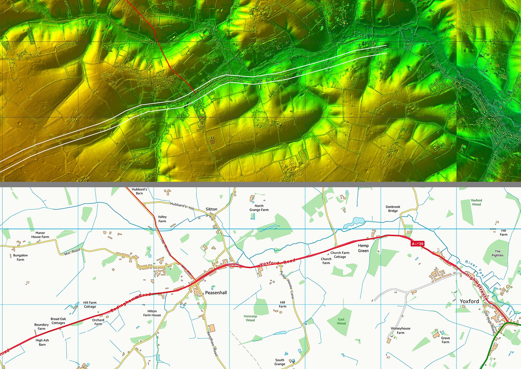
Lidar Image and Route Map 7 Modern roads represent the Roman line into, and probably beyond, Peasenhall. The destination is still a mystery. For a suggestion of where this road was heading see our East Suffolk Puzzles page. |
Click for larger view |
 |
|
|
|
Last update: March 2020 |
© David Ratledge |