|
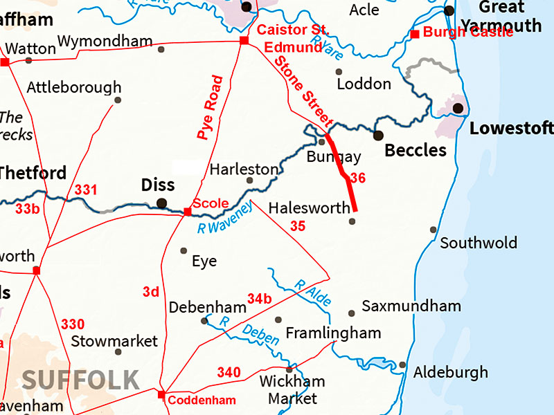
Stone Street Roman Road from Wainford to HalesworthMargary Number: 36Distance: 7.5 miles (Wainford to near Halesworth)We continue following Stone Street onwards from the Norfolk boundary - for the Norfolk length follow link. The route is clear all the way to north of Halesworth where the problems begin! This was a major road from the Iceni tribal capital of Venta Icenorum so surely must have been going to somewhere substantial. |
Historic Counties: Suffolk Current Counties: Suffolk HER: Suffolk
|
|
|
|
|
|
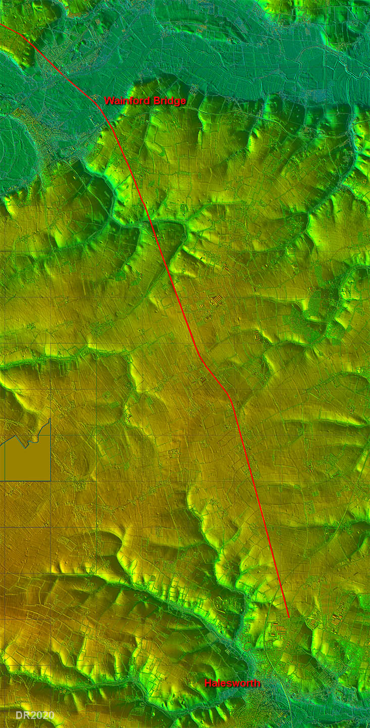
Lidar Image - Full Route The road was clearly targeting the Halesworth area and presumably a crossing of the River Byth there. Where it crossed the river and what direction it went in after is the puzzle.
|
Click for larger view
|
 |
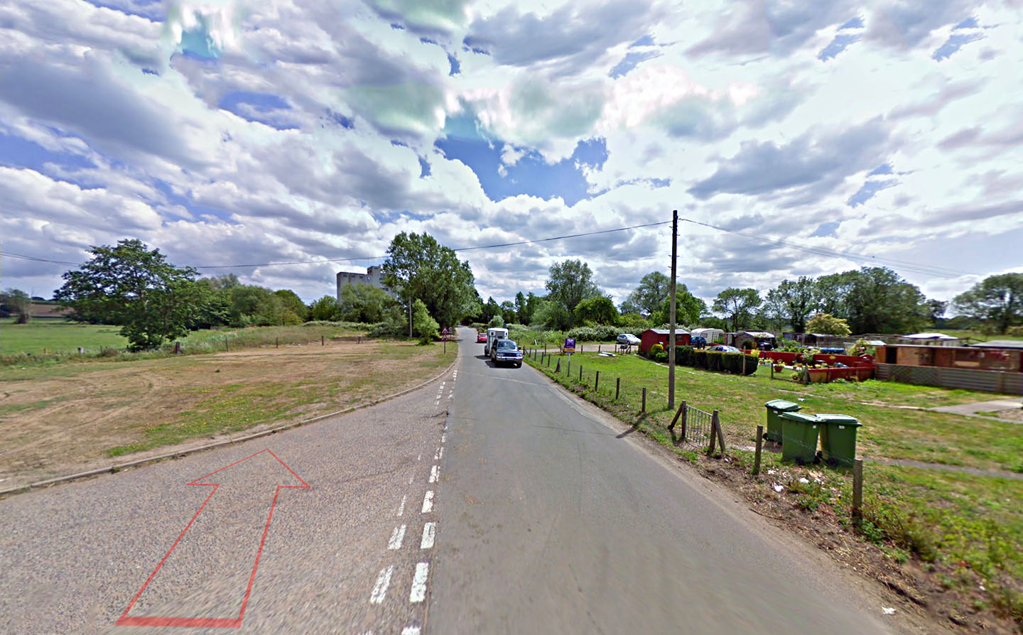
Wainford Bridge - looking South-East We are on the Norfolk side of the river here. The Roman line and crossing point was probably left (downstream) of the modern bridge based on the approach road's alignment. Image: Google |
Click for larger view |
 |
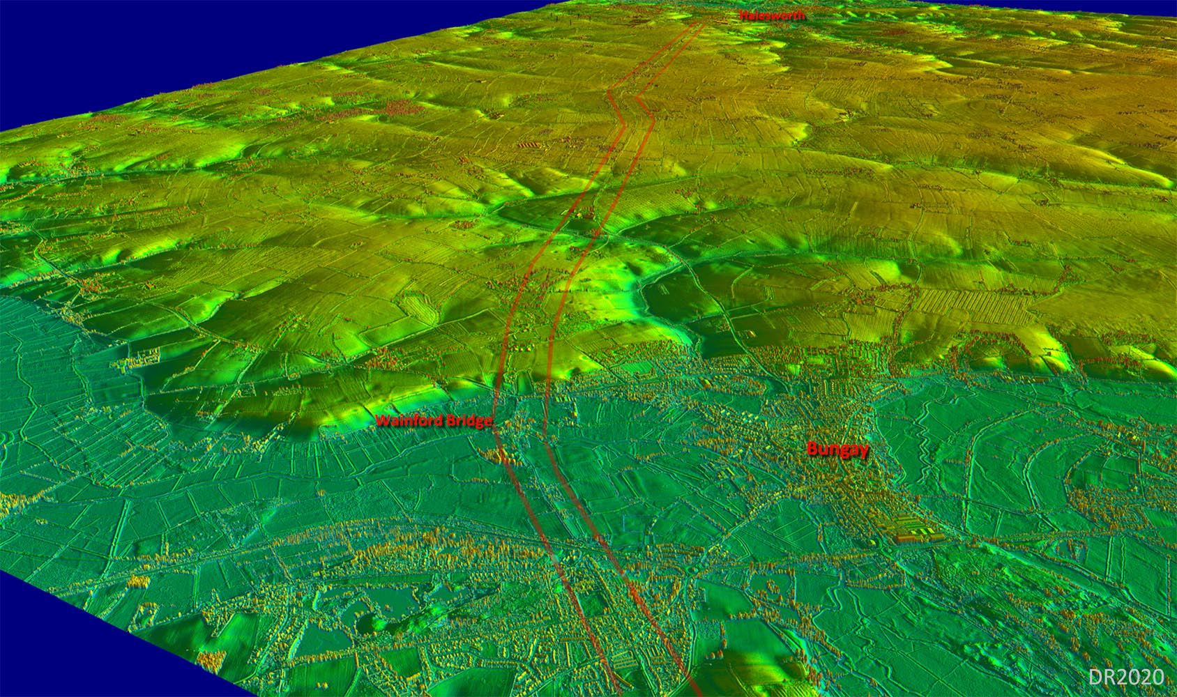
Oblique 3D Lidar Image - Wainford Bridge looking South-South-East The modern main road leaves our Roman line to go via Bungay but the Roman alignment was much more direct. Just that little chicane half way to Halesworth otherwise pretty straight. |
Click for larger view |
 |
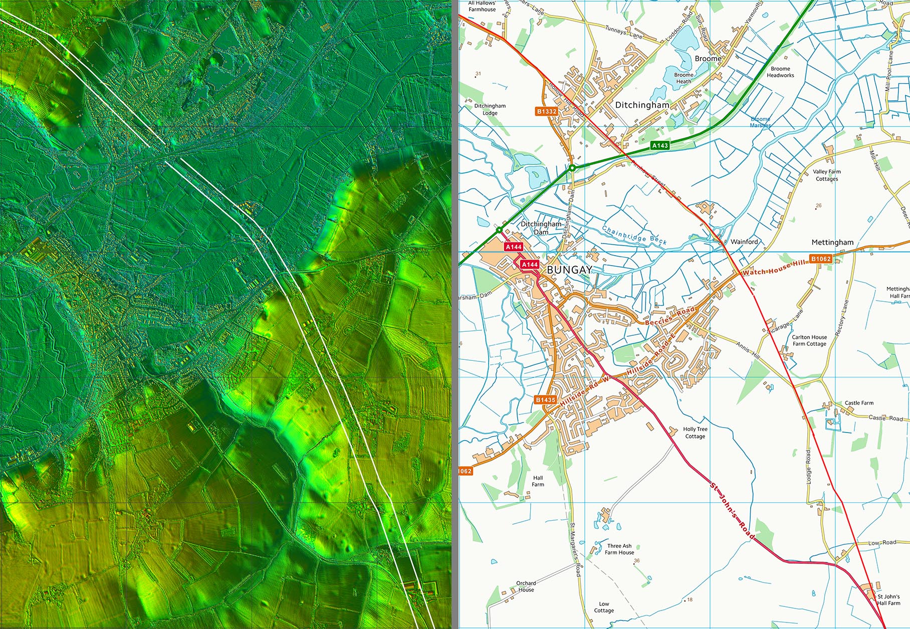
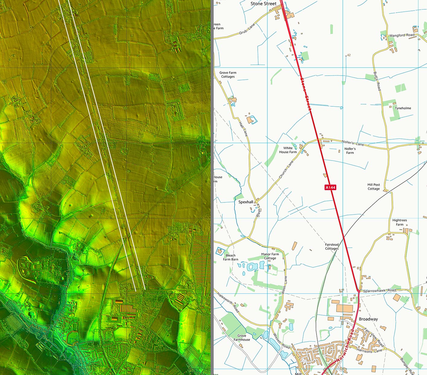
Lidar Image and Route Map 1 There are just about enough intermittent clues to fix the road's course passing Carlton House and Castle Farm before it will join the A144. |
Click for larger view |
 |
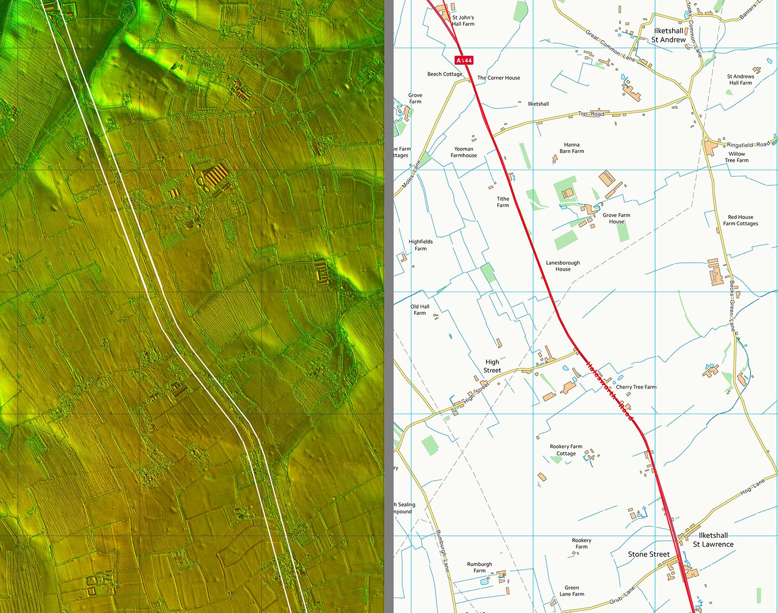
Lidar Image and Route Map 2 The chicane at Cherry Tree Farm was presumably to set the alignment to where the Roman engineers wanted to get down to the Byth valley. |
Click for larger view |
 |
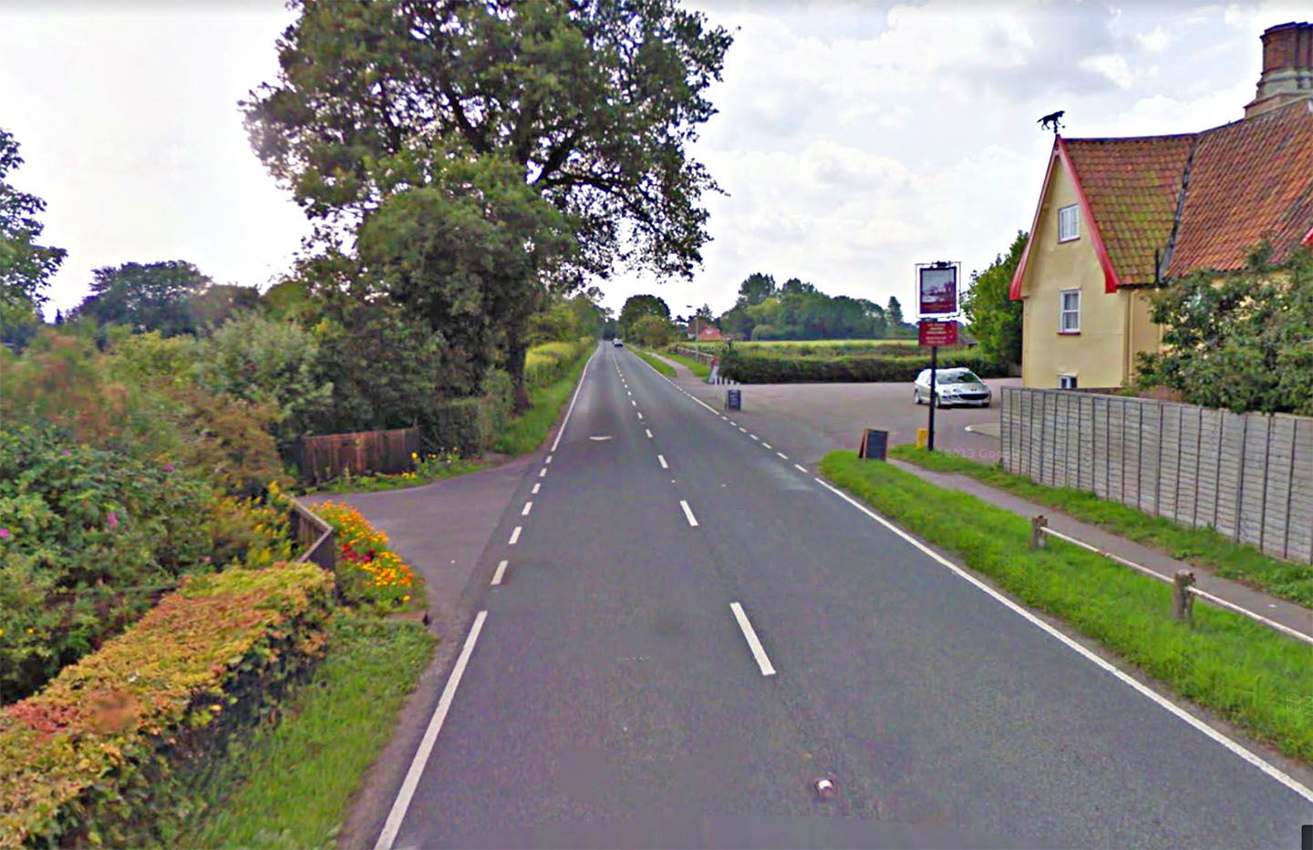
Stone Street How this road got its name - Stone Street the village and Stone Street the road. With generally a paucity of stone in East Anglia then a stone road would have been something worthy of this name. Image: Google |
Click for larger view |
 |
Lidar Image and Route Map 3 Did the road turn at the end of the long straight and pass through Halesworth or did it carry straight on? So far I haven't been able to resolve this for certain. Cases can be made out for both. |
Click for larger view |
 |
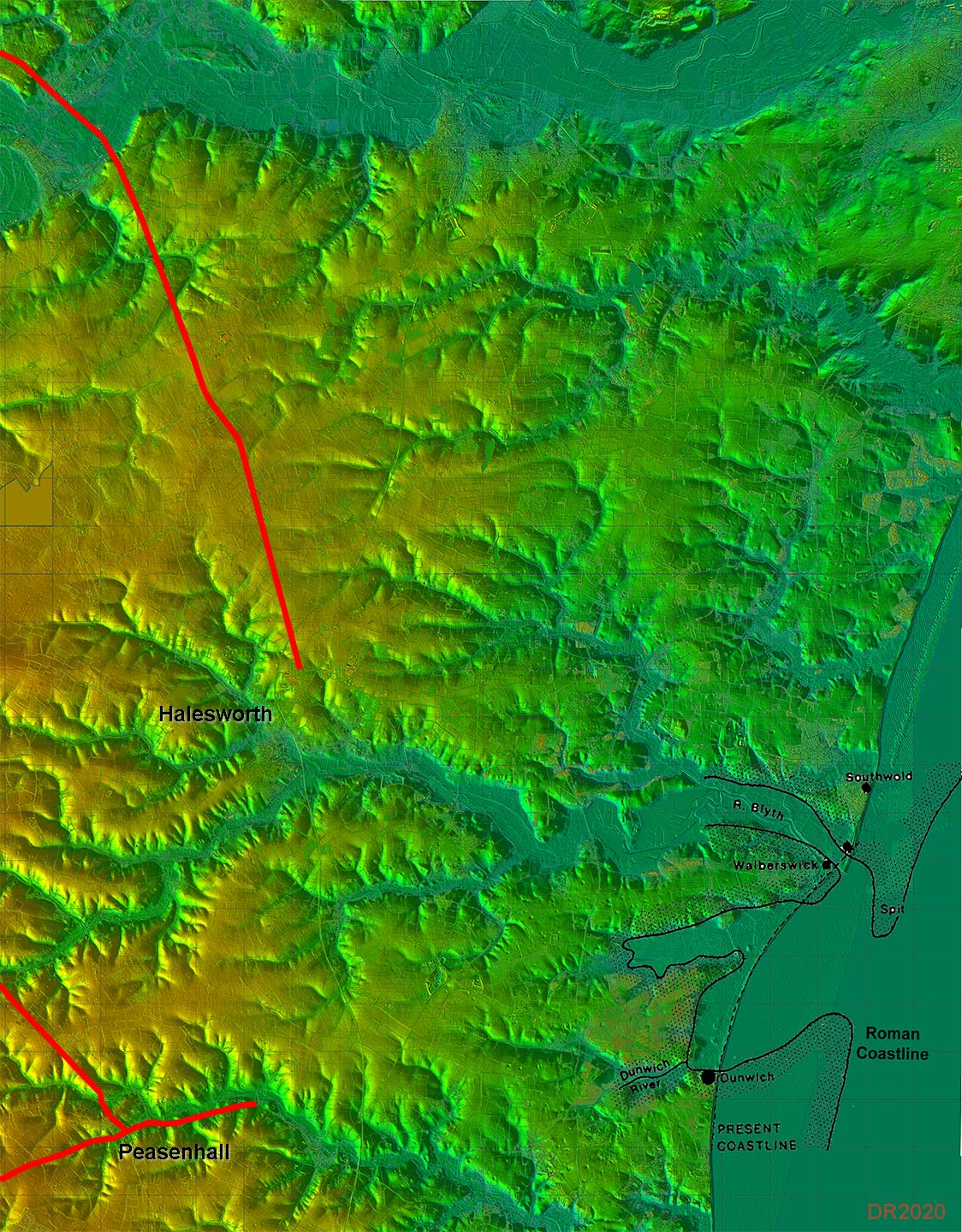
Destination? These are the known Roman roads to Peasenhall in addition to Stone Street. I have also shown the supposed Roman coastline. The obvious destination is the Dunwich peninsular...... For this area in detail and for possible routes - see our East Suffolk Puzzle for a suggestion or two.
|
Click for larger view |
 |
|
|
|
Last update: April 2020 |
© David Ratledge |