|
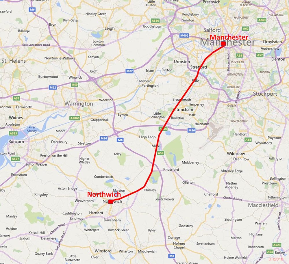
The Roman Road from Manchester to Northwich (for Chester)Margary Number: 7aDistance: 20 milesThis was part of a major inter-city highway for the Romans - Chester to York - and probably the most important road in northern England. The line today is preserved in a series of major roads often appropriately named Chester Road! The surprise is perhaps that it doesn't follow a direct route for Chester but heads further south to go via Northwich (Roman Condate). For a detailed route map see the bottom of this page. |
Historic Counties: Lancashire & Cheshire Current Counties: Greater Manchester & Cheshire HER: Greater Manchester & Cheshire
|
|
|
|
|
|
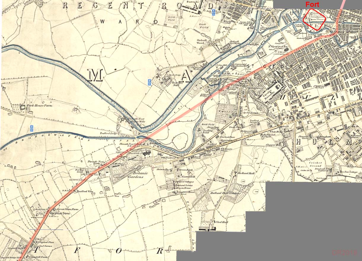
OS First Edition Map (c.1845) - Manchester to Stretford The old route of Deansgate crossing the River Medlock at Knott Mill Bridge would almost certainly will have been the Roman line and crossing point. Today Bridgewater Viaduct bypasses the original road. The first main alignment then begins and appears to make for the Great Stone (see later). Pomona docks has destroyed a considerable length but alignments of Chester Road on both sides show it must have headed fairly directly passing close to the old course of the River Irwell.
|
Click for larger view
|
 |
Modern Map - Manchester to Stretford The route chosen was close to old course of the River Irwell, perhaps for a reason now unknown. Having passed the Great Stone it turned heading for the important crossing of the River Mersey at Stretford. Note: The continuation of this Roman road beyond Manchester for Castleshaw (and York) does not share any of the alignments here indicating that the two sides of Manchester were independently set-out by the Roman engineers. |
Click for larger view |
 |
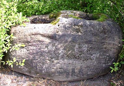
The Great Stone, Stretford Originally alongside the Roman road and it does appear the Roman engineers perhaps positioned their road to pass it. The stone has now been moved to Gorse Hill Park. This erratic boulder stone has therefore seen 2000 years of travelers pass it by. It has twin sockets and is believed to have been used as a plague stone. |
 |
|
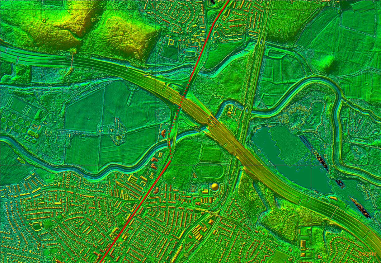
Stretford - "Street Ford" - Lidar Image No visible trace of our road remains. Road improvements from the turnpike era to the motorway age have taken their toll. Also evident are old courses of the River Mersey so working out where the Roman crossed is mostly guesswork. I would assume a bridge was built here for such an important Roman road so the "Street Ford" name would derive from when the Roman bridge had long gone. This was the former Lancashire-Cheshire boundary but today both sides are in Greater Manchester. |
Click for larger view |
 |
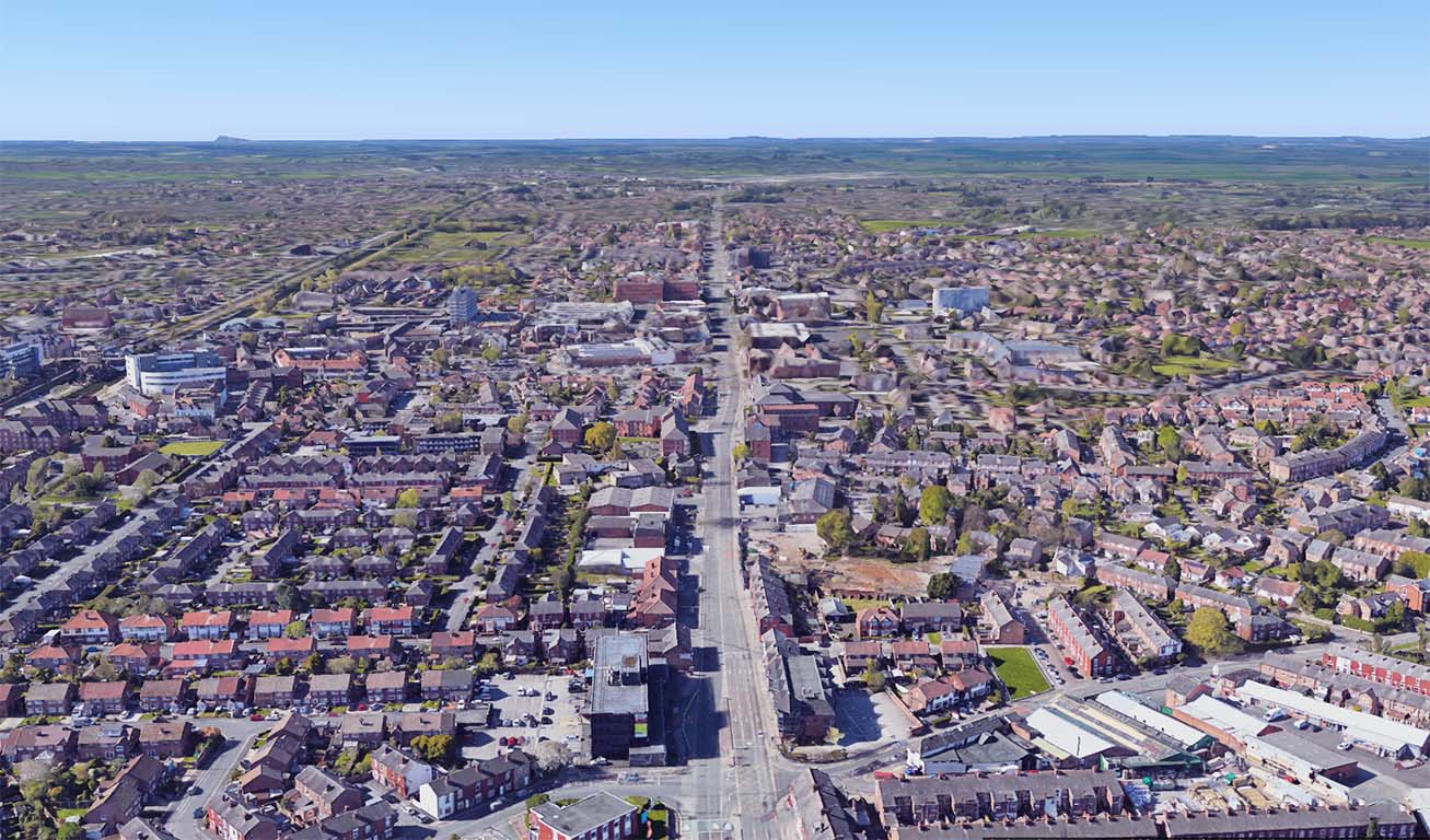
Washway Road, Sale This unmistakably Roman road is aligned on the high ground in the vicinity of the reservoir at Dunham Forest Golf Course. There it will make a very slight turn - see next image. |
Click for larger view |
 |
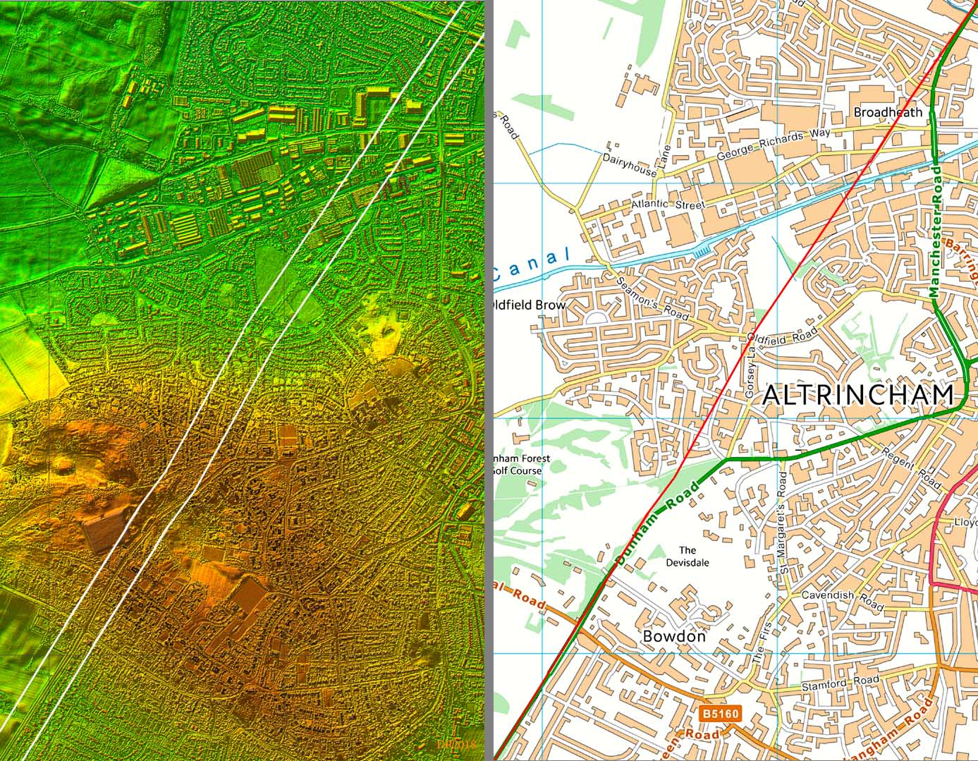
Lidar Image and Route Map - Altrincham The modern road swings off the Roman line toward Altrincham but rejoins it south of Dunham Forest Golf Course. Part of Davenport Road preserves the line as does the footpath across the open land at Oldfield Brow. There are traces too across Dunham New Park approaching the golf course near the top of the hill. |
Click for larger view |
 |
Dunham Forest Golf Course, Altrincham The new alignment is now heading for Rostherne where the new Mere bypass starts. There would have been in all certainty a bridge over the River Bollin - today the boundary for Cheshire. The modern road wobbles about the Roman line which of course would have been straight. This is fairly common as when part of the Roman road were worn away there would be diversions to the side and landowners were never slow to move they boundary forward if they could gain a bit of land. |
Click for larger view |
 |
OS First Edition Map - Mere The kink in the modern road seems unlikely to be based on the Roman line. There is some slight evidence of a direct line on the OS first edition in that perhaps the tree line follows the Roman road. There was originally a gap in the Lidar here but with full coverage this puzzle has been answered - see next image. |
Click for larger view |
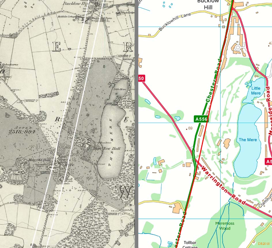 |
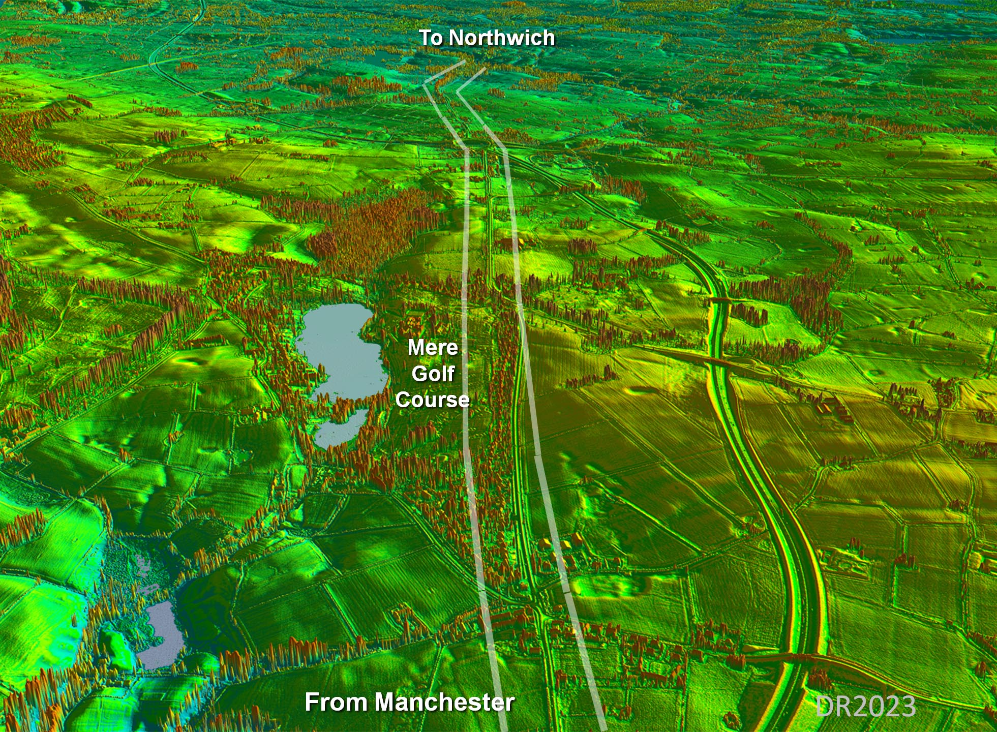
Oblique Lidar View - Mere Golf Course Lidar has confirmed our suggested route at Mere Golf Course was correct! |
Click for larger view |
 |
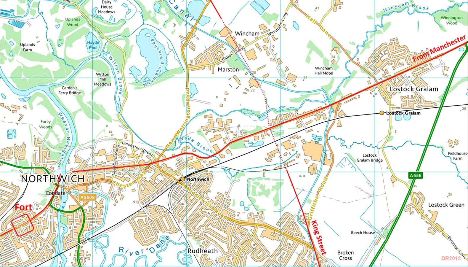
Detailed Route Map - Northwich Modern roads still adopt the Roman line but the River Weaver Bridge appears to have been further north, on the basis of road alignments, than the modern one |
Click for larger view |
 |
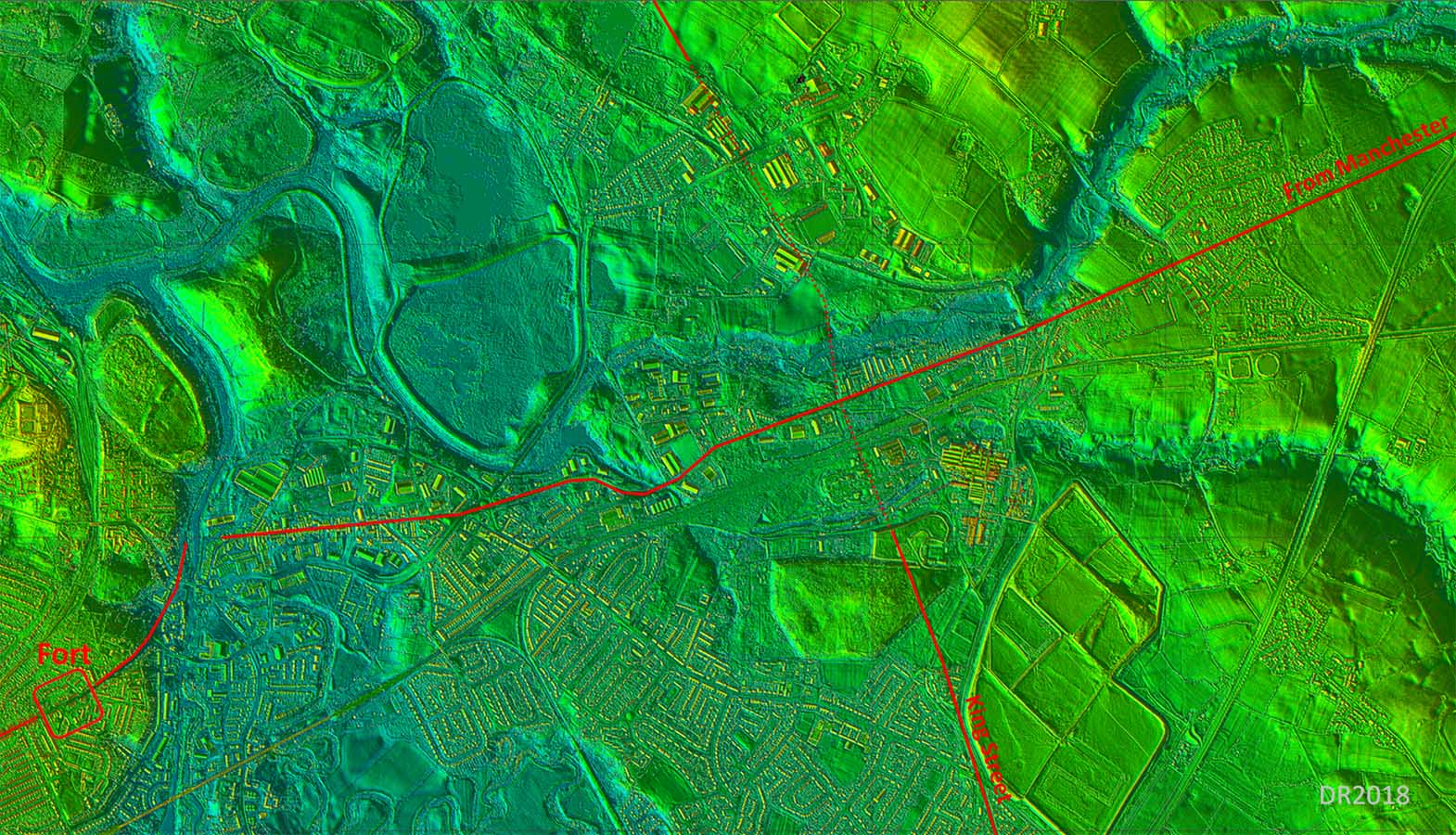
Lidar Image - Northwich The fort site was well chosen to be on higher dry ground. The puzzle in King Street which passes a good mile to the east of Northwich and almost ignores it. |
Click for larger view |
 |
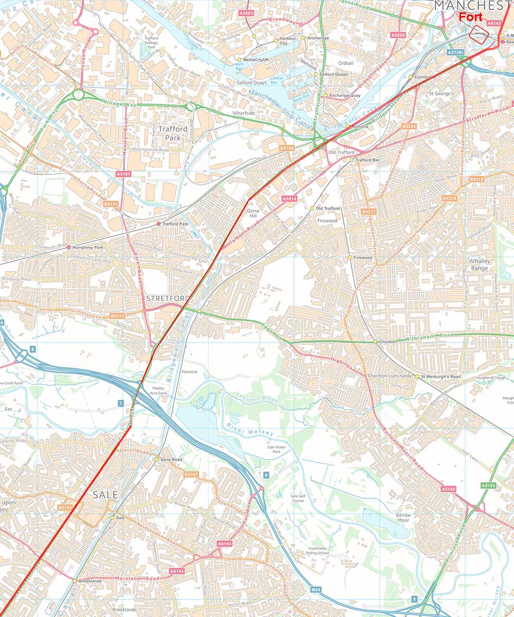
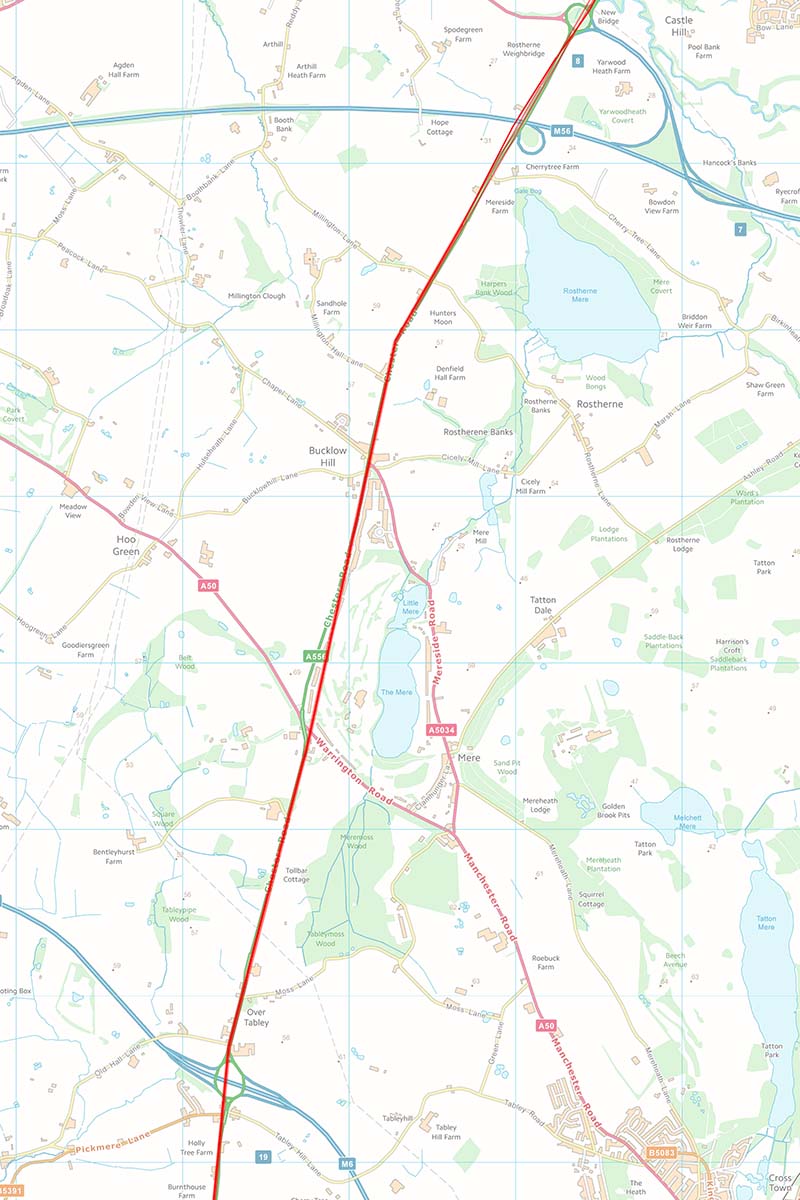
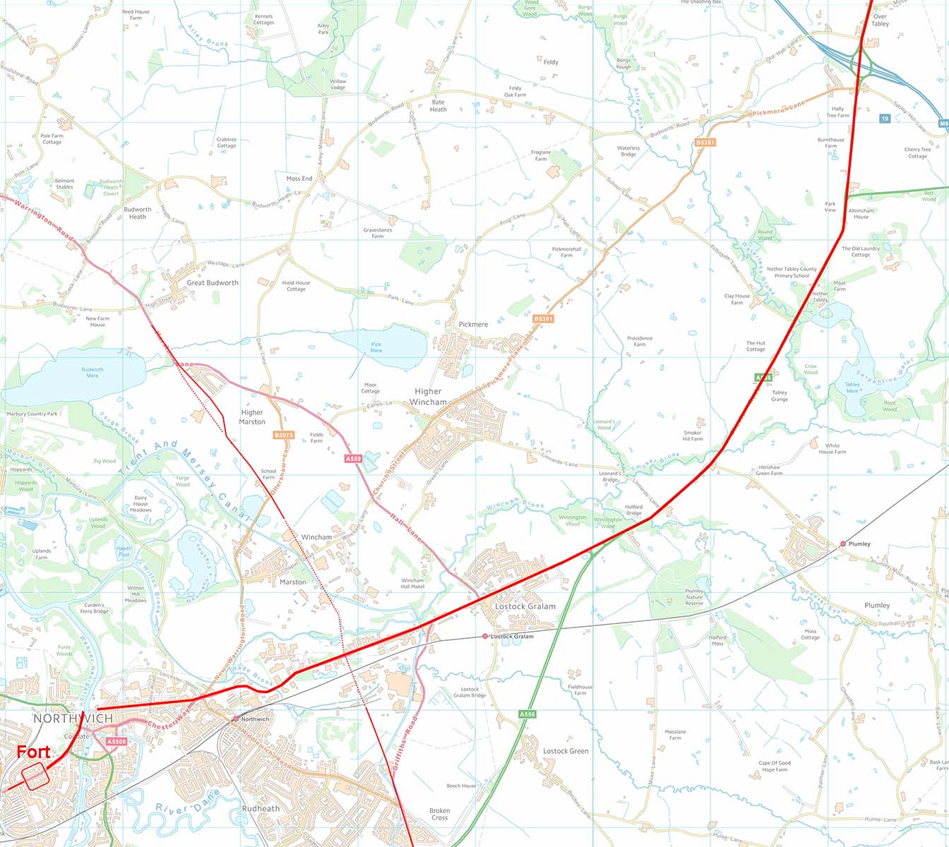
Route Maps Route Map 1 - Manchester to Sale Route Map 2 - Sale to M56 Route Map 3 - M56 to M6 Route Map 4 - M6 to Northwich (also includes King Street crossing this road) Note: because much of the route overlies modern roads the background maps have ben reduced in intensity. |
Click for larger view |
|

|
|
|
Last update: August 2023 |
© David Ratledge |